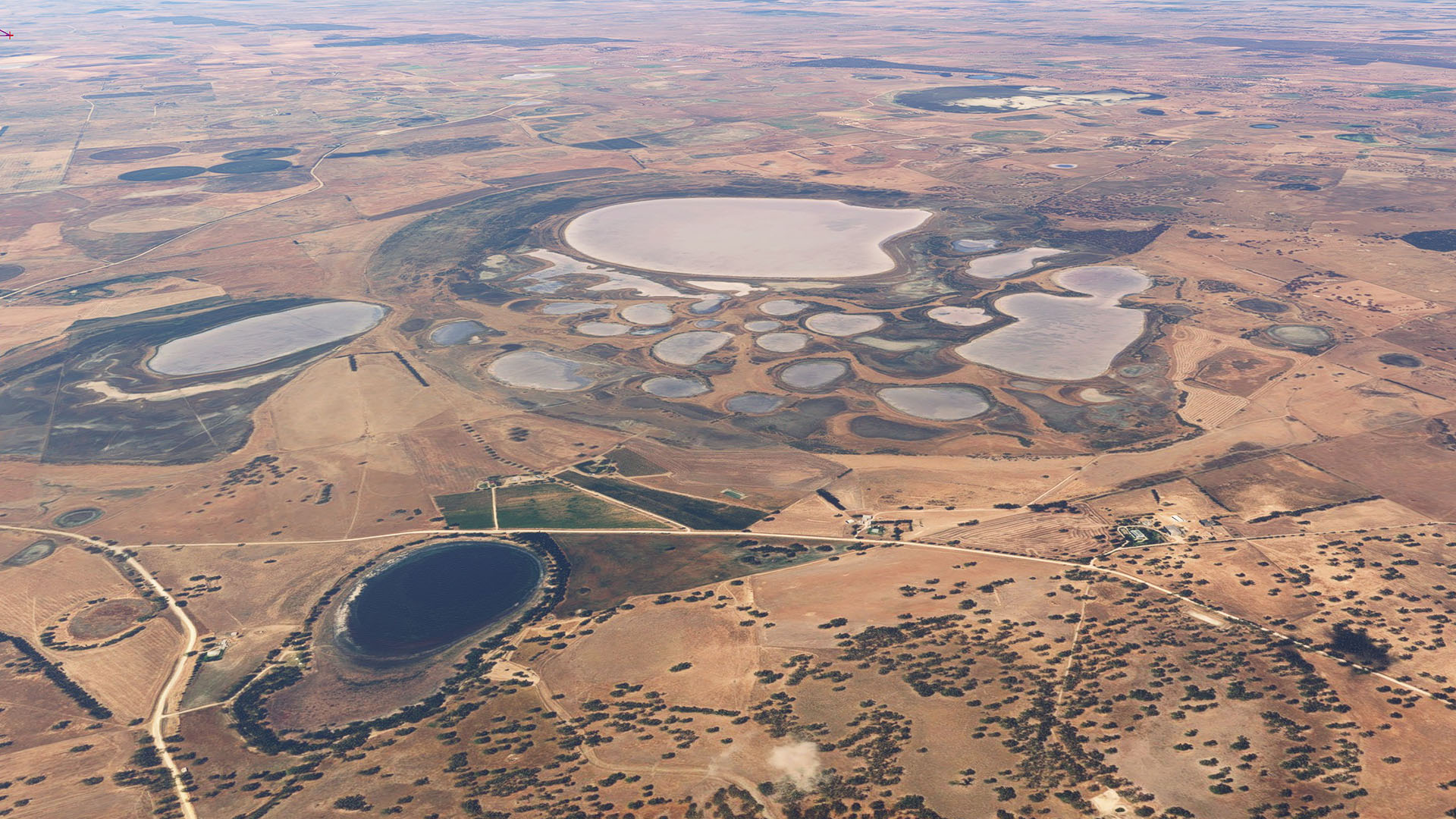
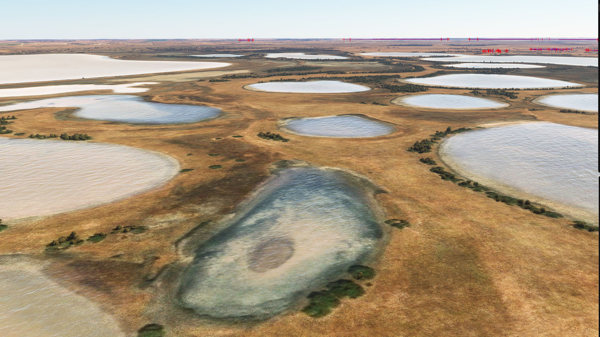
Description of the issue: Dry lakes (playas, salars, salt pans) around the MSFS world all (or at least a great many of them) have water in them, even if the underlying aerial imagery clearly indicates the absence of water
Coordinate or location of issue:
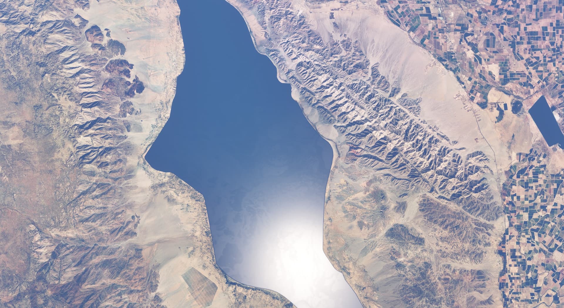
Example 1. Laguna Salada (Mexico) at 32.36, -115.65
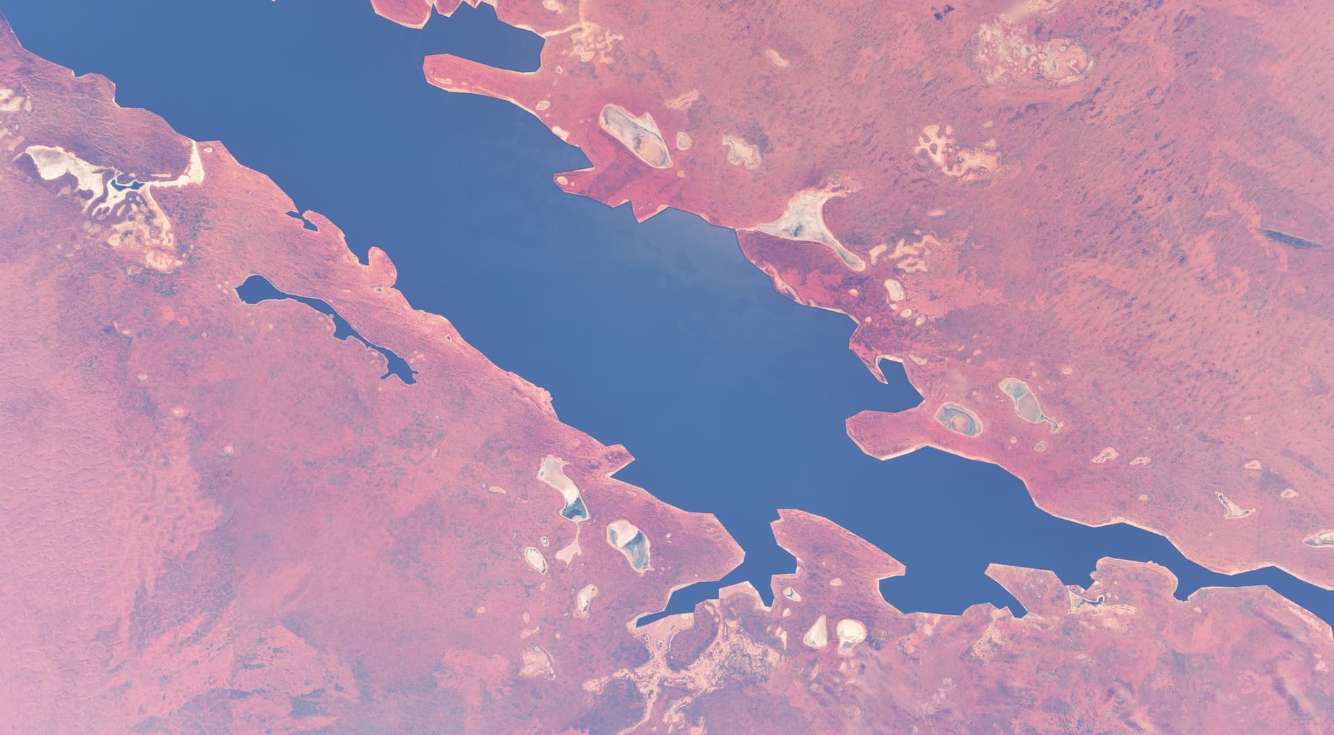
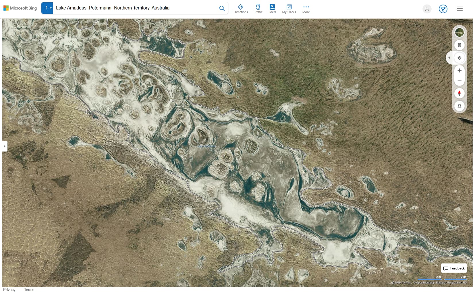
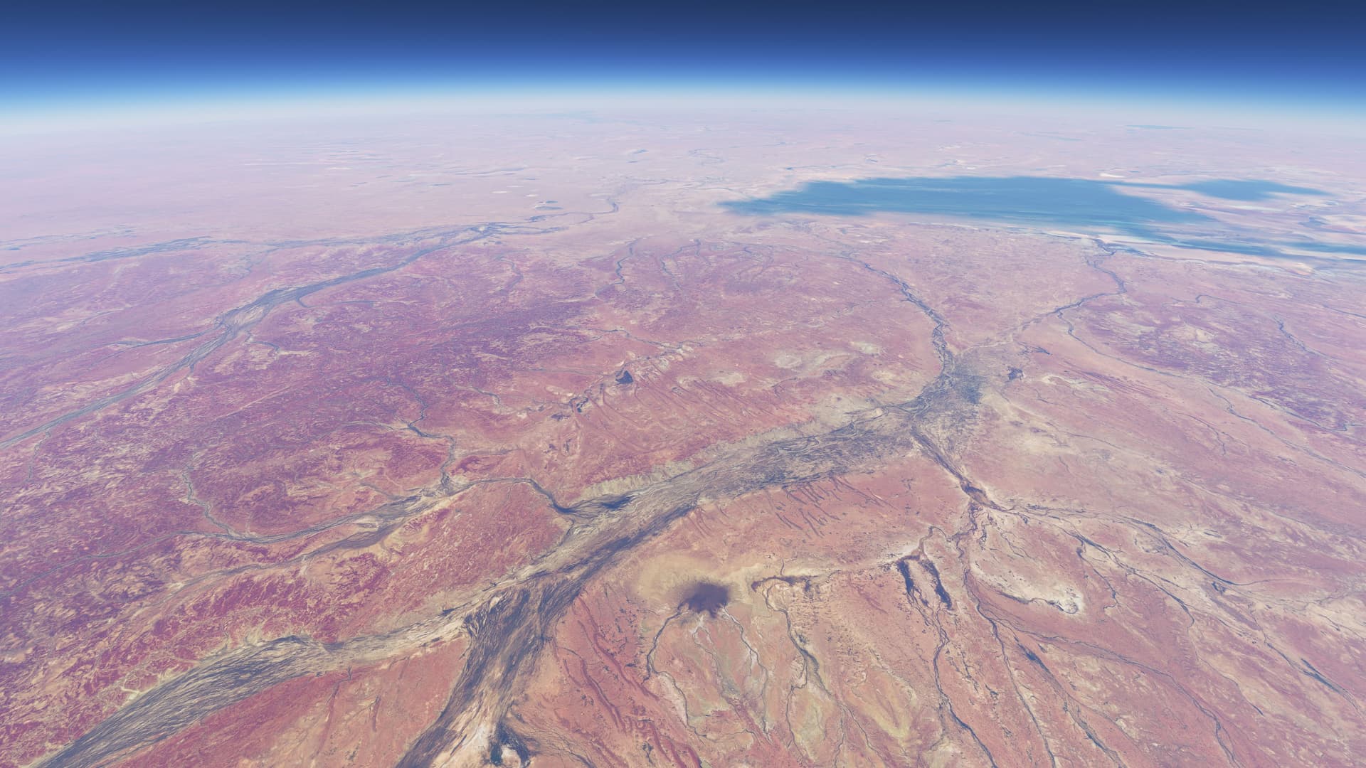
Example 2. Lake Amadeus (Australia) at -24.75, 130.9167
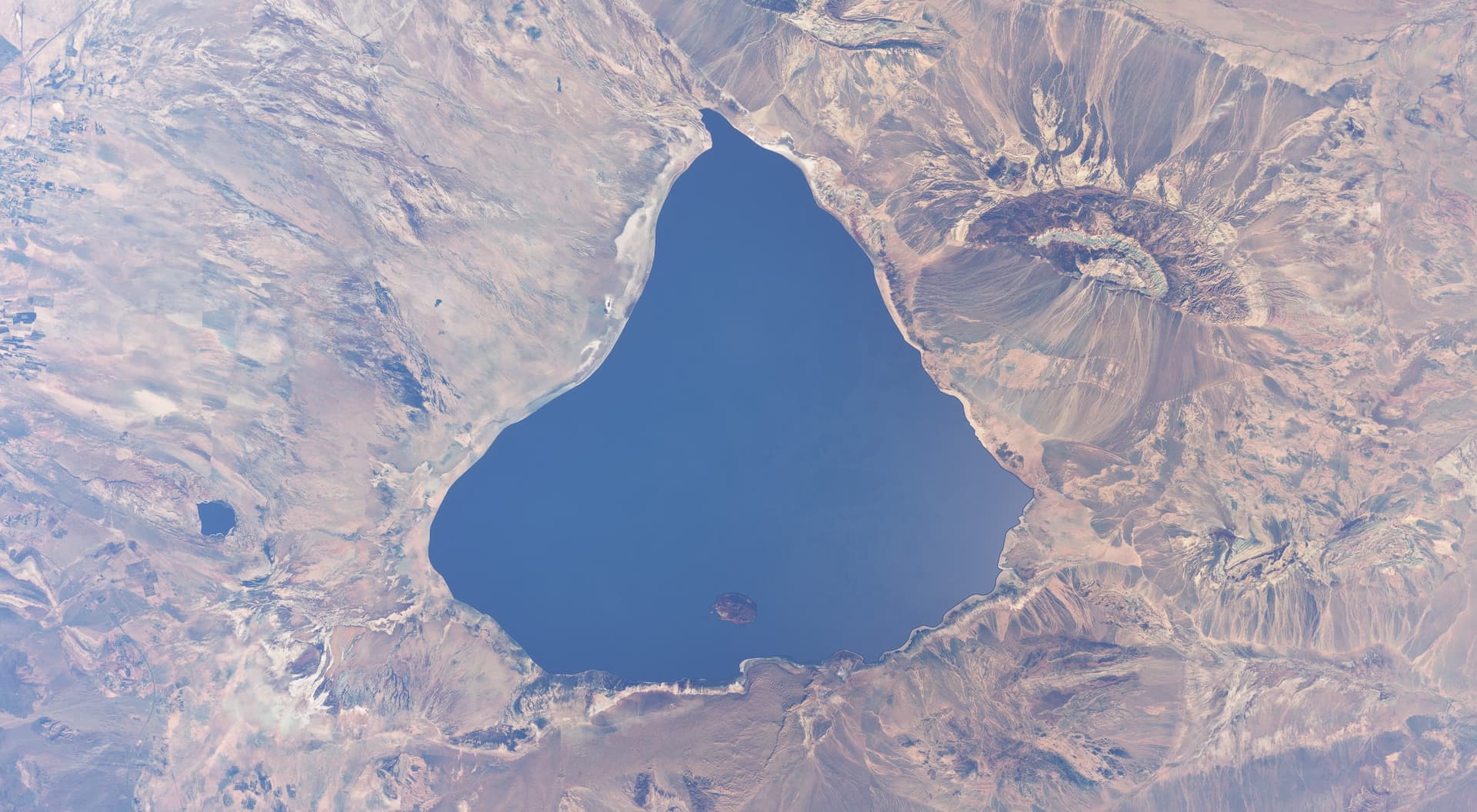
Example 3. Namak Lake (Iran) at 34.5, 51.866667
FREQUENCY OF ISSUE
How often does this occur for you (Example: Just once, every time on sim load, intermittently)? Every time
REPRODUCTION STEPS
Please list clear steps you took in order to help our test team reproduce the same issue:
I originally logged this as a bug within a week of MSFS release, because flying over Central Australia was just seriously off-putting, then again after the Australia WU. The original bug report was closed as “fixed”. I’ve since created several add-ons, available on flightsim.to, that seek to correct this issue for some locations, even if they are a long way from perfect.
SU16 has seemingly made this situation a LOT worse, and partially broken my previous fixes by changing the ‘type’ of ‘water’. eg. from ‘lake’ to ‘pond’ to ‘water’, more or less randomly.
Now, I think there’s actually a fairly simply solution. I believe the sim uses OSM data for hydrology (rivers and lakes etc). If not, they data looks suspiciously like it. In any case, the data will be tagged with attributes such as ‘dry’ and ‘intermittent’. When population the sim with these data, simply taking these tags into consideration should resolve a majority of the above outlines symptoms.
I had Bijan Habashi fix this for most of Iran’s lakes with his trees product. It would be nice if Asobo had a way to fix this on their end. The majority of lakes that have water in MSFS 2024, don’t have water and haven’t had water for years in real life.
This was when the bug reporting wasn’t using this form, but Zendesk (from memory). Is there a way of linking back to that? Provided I can even find it.
Hmmm, there’s no reference as such that I can see. FWIW, here are the emails I received. I recall there being a “closed” one as well, but maybe I misremember, or a least I can’t locate it. Given the “We have recorded the bug you have submitted in our internal bug and issue tracker.” it must be somewhere in the system. Not that it makes much of a difference, since the problem still exists in the sim.
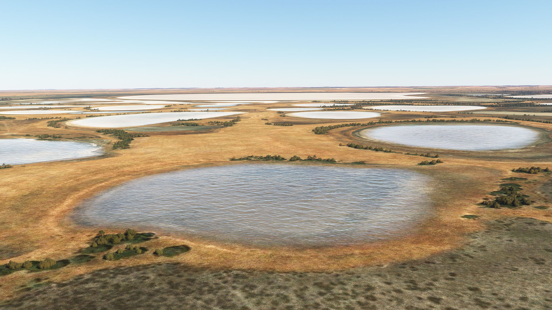
Now, here’s something intriguing. This place is called “Clay Lakes”, in South Australia’s Limestone Coast region, just north of Narracoorte. It’s the typical “intermittent” body of water you’ll find in semi-arid regions all around the world. They hold a bit of water after heavy rains but are generally dry. The intriguing bit is that they have a transparent water mask (this is 2020). I’ve come across a few of these … very, very few!
Now, while the depiction of these lakes with any water is technically incorrect (the Bing Maps imagery shows them as dry), at least they’re not that in-your-face deep-ocean-blue.
But the sim (even 2020) appears to be capable of showing them in a state much closer to reality. Which raises the question why this “transparent” water mask isn’t the default? I mean, even over a lake that’s shown as a deep blue in the imagery, a transparent mask will still depict it as deep blue.
Another question, why am I not able to create these transparent masks with the SDK?
And thirdly, just curious, but what makes these Clay Lakes so different that the sim gives them this fair treatment? Because they’re surrounded by deep-blue, red-headed, ugly stepsiblings!
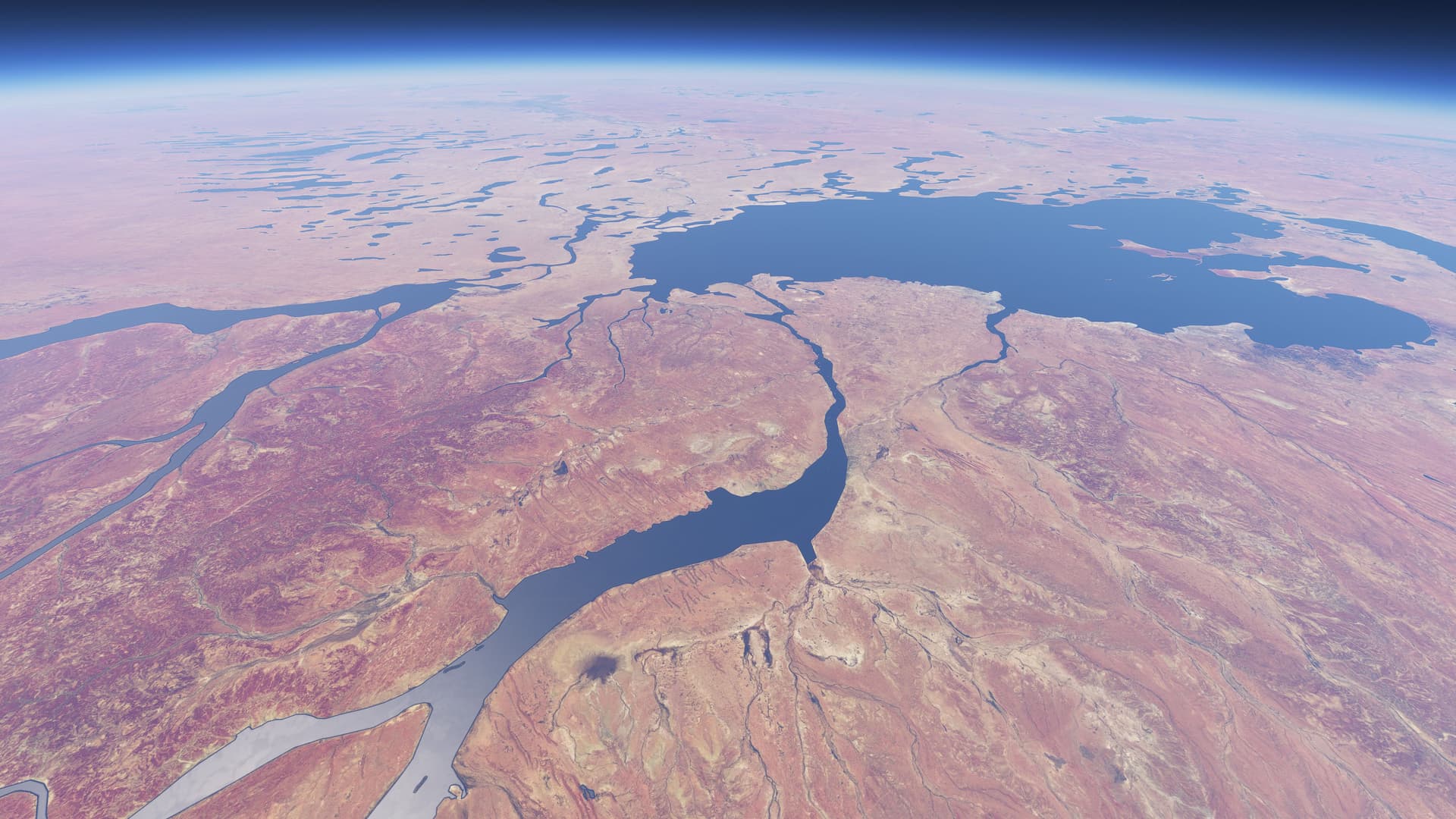
This is the bottom of the Simpson Desert in central Australia. The “river” below us is the Finke. I carries water to reach Lake Eyre once every decade or so, and even in full flood would be hard to distinguish from the surrounding land because of the sediment/mud it would carry.