Giiib watermaskkk on australia on Bora-Bora plss
1 Like
@tomlaut1980 , where is that location? I wanna fly over them tonight after work!
After work, early morning has never been more fun! 
It really is. I ncertain areas astounding
Even in page Arizona when I dida tour of the Navajo reservation for people on youtube, the water near the dam was astoundingly real and accurate. IT caught the light blue hue.
1 Like
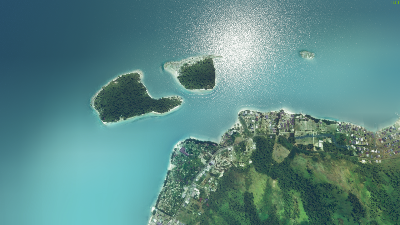
Hi its in the Bahamas . I flew over this spot: 25.025081, -76.528483
3 Likes
Yes! Help from The Huntsman has arrived!
TY!!
1 Like
posting some liveries in a bit as my email folder got filled up 
1 Like
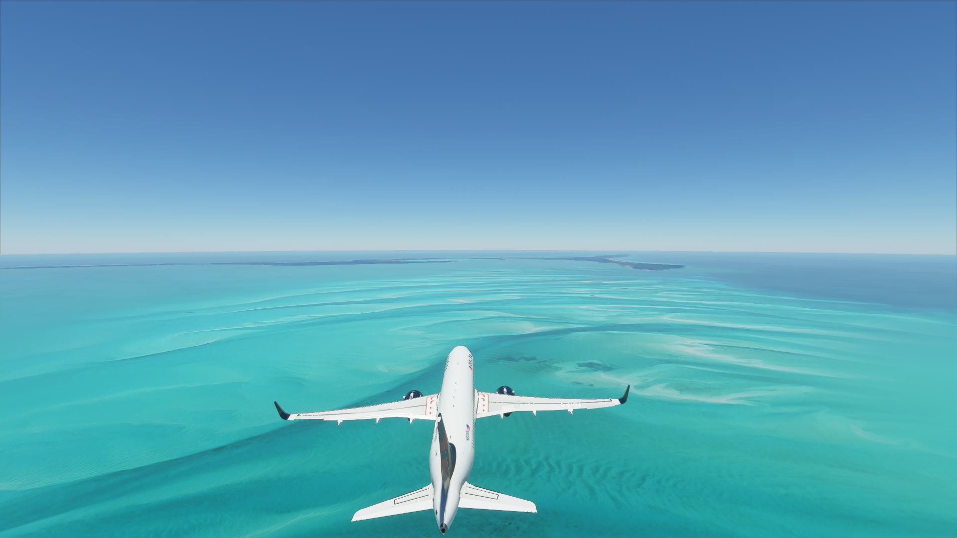
OH man… we love T&C and the water masking wasn’t happening yet when I visited in the Alpha…  Gotta go back I guess.
BTW what did you use to capture the vid? Quality is GREAT.
1 Like
Thx! Yes Water Masking really elevates the visuals.
I used Shadowplay to capture @2k.
2 Likes
whats up with that oceania video giving me a boner , please update dev literaly unplayable without bora bora watermask 
1 Like
And Moorea
And Tahiti
And Seychelles
And Maldives
And…
1 Like
and , the whole world
1 Like
Unfortunately at most of the places reefs and what is called water masking are missing. Moorea for example:
1 Like
Yes. True.
But we are beginning to see some appear in random places and what we do see is Gorgeous!
1 Like
Holy ■■■■, it looks absolutely beautiful
Could you please share the exactly settings, time, location???
guys please sent us ALL locations with mask water please ! it’s beautifull
1 Like
I agree I wanna see some more places like this, please people let us know of some more areas with nice water masks!
1 Like
Well done ! amazing work!
Out of curiosity which method used ? Working from high resolution sources (aerial imagery 0.5 m/p) or low resolution imagery (10 m/p) therefore rather satellites?
Because if the first solution offers a very precise rendering, it requires a lot of manual work with: among other things, clouds cleaning and therefore extrapolation of what it may be below, and a lot of colorimetry balancing between the different tiles.
Working from lower resolution satellite images (Sentinel 2 for example) does offer much less precise images on paper but will require much less manual work, don’t you think? it is easy to extrapolate what may be under the cloud layers of a shot by taking the same shot taken a few days later and the colorimetry is perfectly homogeneous over very large area.
In addition, the seabed may require much less precision than the emerged parts because there is the deformation linked to the layer of water above (blur) and the deformations linked to the swell generated magnificently by Asobo. And if necessary, if there is a need for more accurate imagery of the seabed, may be use a automatised workflow of those used with satellite panchromatic bands which allows a high-resolution band to be coupled with multispectral bands which will give an irreproachable colorimetry to your seabed…
In any case, well done again it’s really mind blowinf to fly over Bahamas shallow seabed. 
1 Like
absolutley incredible!! what clouds settings and time settings did you use for that sunset screenshot for the 3rd one? looks like a nuclear bomb just went off lol… bloody amazing
2 Likes
Thx. Kinda hard to take any bad shots in this wonder!
The Clouds were the Storm Preset with a few tweaks. Basically lowered them a bit and reduced the coverage so they didn’t block out all the light.
The time was pre-sunset.
This Sim is like flying around in a painting that we can change on the fly!
1 Like