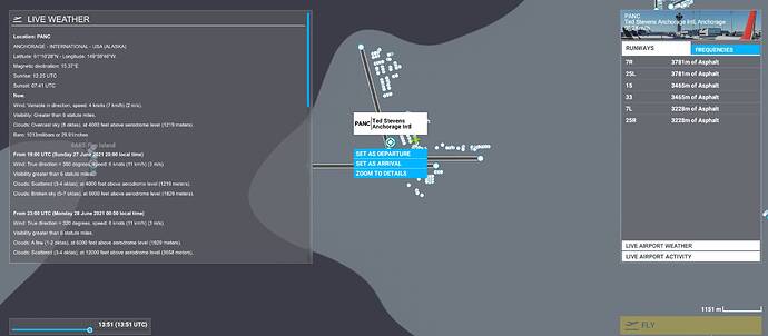
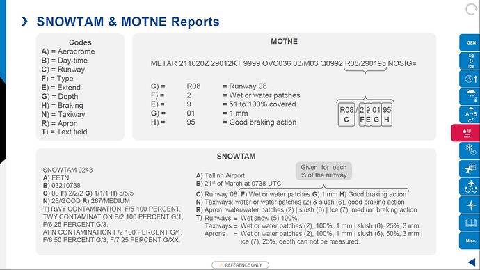
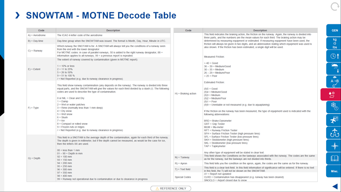
I like it! Did you intentionally omit the barometric pressure (useful below altitudes reverting to 29.92)?
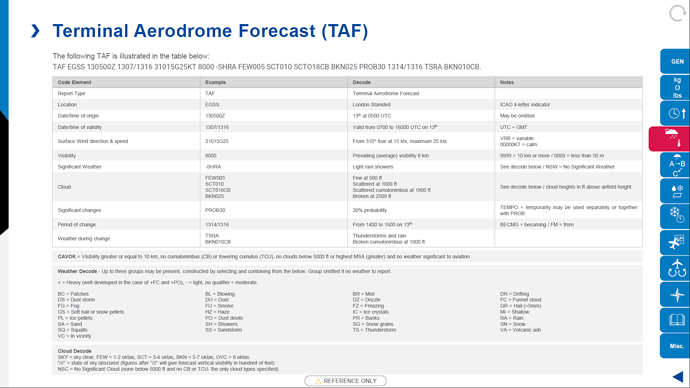
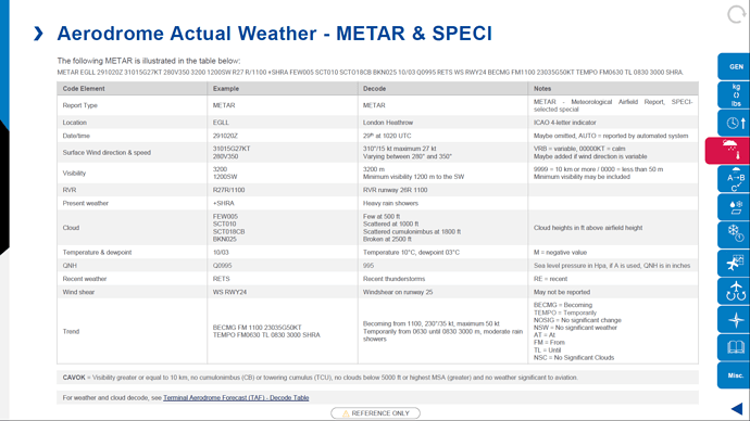
@trashmon49 no, a typo sadly! Copied the text from the metar/taf and must have missed it! I’m pretty sure the data is in-sim already so hopefully just about making the UI/UX work and displaying the information. It would be great to be able to click on any airport and get the info like the above.
If you haven’t already, would you be able to vote for it? If you have, thank you!!!
Yes, lack of reliable in-sim weather information is probably the single biggest obstacle to realistic flying in the sim right now. “Live” weather is a nice idea, but it often doesn’t match the real world. Right now I plan my flights using the Aviation Weather Center’s Standard Briefing page, but because “live” weather isn’t “real” weather, real world aviation weather is of limited value.
What we really need is a way to get accurate in-sim weather. While it would be nice to get in-sim weather as proposed, many of us don’t bother with the MSFS “flight planner.” In that vein, I would hope that the first thing developed would be to expose all of the necessary information via a SimConnect API so anybody could access it. That would enable third parties to develop all sorts of useful tools as well as remove the limitations that exist today. For example, third party ATC implementations struggle with doing something as basic as assigning a departure or arrival runway since they can only guess at what the winds are doing.
Ideally, I would like to be able to get the components of a standard briefing which consist of:
- Accurate METARs and TAFs (which implies accurate ATIS in the sim).
- Winds and Temperature Aloft forecasting. This is essential for fuel planning.
- AIRMET and SIGMET forecasts.
- Area forecasts (including surface analysis).
- Radar summaries.
The first two need to happen ASAP. The rest would be nice to haves.
Already upvoted, Matt. Should I do another?  I think might as well include Baro in the proposition, one-stop shopping. The real world and the sim are usually not in sync anyway. Never bothered to check, but perhaps the sim is using stale day old bread, i mean data.
Like everything in your post! I tried to see what simVars were available but couldn’t find many/any at all sadly. I suppose this is a two edged sword in that this could be a quick(ish) add to the map.
I use a mixture of Navigraph, Simbrief and LNM to plan flights at the moment, saving and loading them in sim. My thought being that you can use that screen to navigate fairly quickly and ensure that real data is near or the same as the sim data.
@trashmon49 Defo on the Barometric pressure, I copied the text when playing with the idea in photoshop, how’s this…
The weather API is part of SimConnect, but it has been deprecated (presumably since the weather engine was rewritten). The basic starting point would be for Asobo to implement SimConnect_WeatherRequestObservationAt[Nearest]Station and SimConnect_WeatherRequestInterpolatedObservation. Both of those provide METAR data. For TAFs, etc. the API would have to be expanded.
Just like that! You got a great idea, so with upvoting, we should see this needed improvement in 2023 or early 2024… LOL!
Hi
The Pimarc pms 50 GNS 550 Mod actually does have the facility to read metar information on the fly in the aircraft
A page selection allows you to read and decode the metar for the Departure and Destination airports in a flight pan, and via the gps dial you can enter a icao airport code and get the live metar info for any airport.
I use this in my Banderiante all the time when en route to give me an indication of wind direction at my destination and pre plan what Star I might use
Hope this is of help
Yes, but that information is being pulled from real world METARs so it likely will not be useful since “live” weather doesn’t tend to match “real” weather. This is the problem being discussed: because “live” weather isn’t “real” using real world sources for flight planning (or in flight weather updates) isn’t particularly useful because it isn’t going to match the actual in-sim weather.
Since there are a few requests about how weather analysis (it is much more than planning) is done IRL, the very first step is understanding weather and what it does to flying
There is a great book that is not too dry on theory and explains in very much detail what weather is and does to airplanes, how to analyse it, and how to fly it: “Weather Flying” by Robert Buck.
Written by 2 professional pilots but talks about all areas of flying (VFR to IFR, GA to Airlines)
There is also a very thorough how to guide in the relevant section of this forum, dedicated to the tools one can use against the sim, highly recommended also
@GrueDiademe81 Awesome, thanks! Love a good book!
Will check out the How-to as well.
Apologies, it is actually here in the community section! Part of a multi-series and very good for a low-and-slow VFR starting point
Agreed. Viewing weather data before a 3 hour flight certainly doesn’t guarantee what the weather will be when you arrive. This is where a little analysis and weather forecasting come in. Not sure you can do that in the sim.
In a way that is quite realistic… IRL all we can do is do the analysis, then a crucial part is monitoring the evolution of the actual weather and if the forecast is accurate… just like in the sim, very often conditions are different than forecast!
If the forecast had some indications of marginal weather, and the actual weather behaves differently, that means decision time, and I find it as frustrating in the sim as it is IRL 
In that way VFR requires a lot of understanding weather!
And also some sound advice as to when to divert to go around or secondary airport. So many accidents and near accidents when people take unnecessary risks and chew up the scenery…
The problem with the sim is that we lack some of the real-time reporting tools that we have (like radar and satelite views, metars etc). Some of it is available in the sim but not as much as IRL, hence it is quite hard to see what the real conditions are in the sim vs forecast, which is really the crucial bit. If the forecast is wrong we try to understand HOW it is wrong, and then possibly guess WHY it is wrong and how it is likely to evolve. That is what we base decisions on, and that piece of information is very hard to get from the sim
In real life we use the PPS - crewbriefing system to print the briefing package which includes:
- Operational Flight Plan including fuel, mass & balance, navlog etc.
- METARs, TAFs & SIGMETs for the departure, destination and alternates.
- NOTAMs for the departure, destination, alternates and FIRs.
- Upper Wind and Temperature charts (UWT).
- Significant Weather Charts (SWC).
- A vertical cross-section of the flight, showing winds and significant weather vertically.
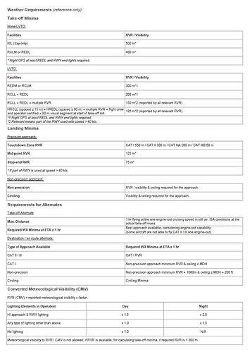
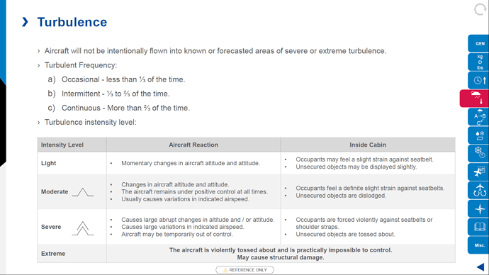
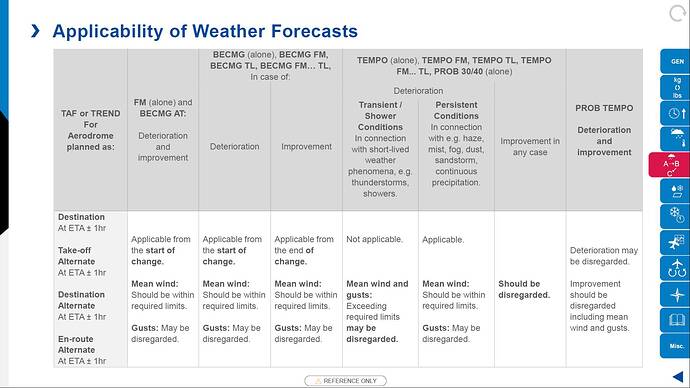
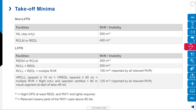
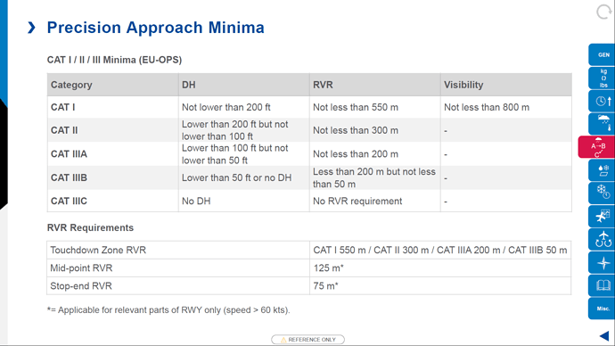
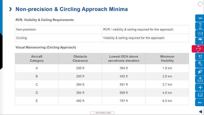
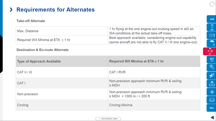
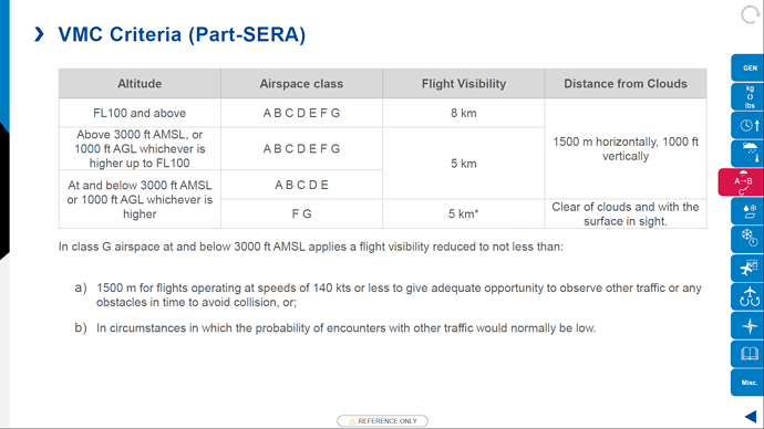
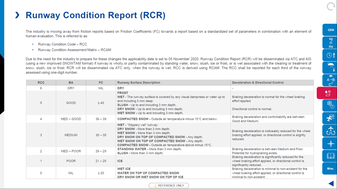
During flight I use the Aeroweather app to get an update on METARs and TAFs and I use Windy for weather radar. I made the following summary of weather requirements some time ago. Its based on EASA ORA.MPA, its what we use in commercial aviation for planning and its basically all there is to know!
And when differing conditions are met, the ability to make good decisions when you’re moving at 200+ knots. Things are happening quickly. The sim doesn’t portray this very well, if at all…
Let’s remember that not all users here use English as their first language, and, even those that do, well…
Anyway. I interpreted his post differently. I saw him using the word prediction instead of planning, but he meant basically planning. Not everyone here is a pilot, and even among pilots lingo varies… He also meant that we have more tools available for checking the weather, not for changing it. This is all about flight planning as pilots do.
I for one would love to get the same tools in game that I get at 1800wxbrief to plan a flight, using the ingame weather instead of real weather. We should be able to turn on a radar level to see rain in the world map, overlay wind at various levels, show loops of fronts and rain to help predict what’s going to happen. Get weather maps and sigmet maps.
That would require that all the pieces that Asobo is using be integrated into a whole better than they are, but I’m positive they are working on that.
And, yes, part of flight planning Does depend on prediction of what’s going to be there when you get there. And I think that’s possible on Asobo’s end, even if they were just to suck in the TAF’s from 800WXBrief.
