What about Tide effects?

Hi everyone =)

I wonder if tide variations will be, one day, update in MSFS ?

We can see from Google Earth lots of detail about tide variation and that’s pretty cool.

I loaded low tide in France but water become just photographyic and you lose water motion.

Next to tides, many lakes have seasonal changes in water levels, some are even dry most of the year. The same for rivers.

It’s probably too much data to track (river and lake levels are all recorded in public domain) however some simple logic would go a long way. The server would have to remember rain fall (record live weather) for river levels. Lake levels on recorded rainfall and seasonal variations.

Tides would be a very great visual add-on here on the east coast of Canada (Bay of Fundy) as well as the southwestern coast of England perhaps. The size of tides in these areas (and probably others) is quite a sight for those who are not familiar with them. This would greatly enhance MSFS 2020 VFR flying!

Tidal bores would be a nice effect, would be a while until this can be rendered

Mont Saint-Michel is at constant high tide in the game, nothing like this

And this whole area falls dry every day

And yep Bay of Fundy

Coast of England
image

I guess it’s always high tide as the aerial and sat images have all been taken at different times. There must be lots of seams along the coast.

1 Like

I’d prefer they worked on getting rivers looking good over anything else right now. Rivers seem to me to be the often over looked detail in the environment that would make a big improvement to the way things look.

Wasnt there a FSX mod for tides and waves?
Maybe something similar can be brought to FS2020

Thats would be amazing for Barra Airport!

this would add more realism, would be nice !

2 Likes

I recently gave a talk about past, present, future of MSFS at Nerd Nite Tokyo, titled “From Flight Sim to Digital Twin: The Evolution of MSFS”

There’s a lot of things that you could talk about when projecting the future of what MSFS could be, based on the progress made over 40+ years.

However, a lot of these things are already recognised, roadmapped, and already under development eg. Flight Modelling, AI content gen, weather (aerial only generally) , seasons, SDK, AI traffic, ATC, etc etc

I chose to focus on one aspect that currently doesn’t seem to be on the radar and/or roadmap - or discussed much at all except for occasional lonely threads like this.

That focus aspect was water simulation, which I think is a key element in taking MSFS to the next level out to 2030 and beyond.

Realistic water simulation is critical for lots of reasons, two in particular:

  • Modelling the full behavior of natural systems
  • Provide realistic environments for navigation

Here’s one good use case:
|475px;x285px;
ref: Queensland floods: Burketown residents warned of crocodile-infested waters ahead of expected peak | Queensland | The Guardian

What you can currently do in MSFS:
|464px;x261px;

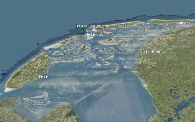
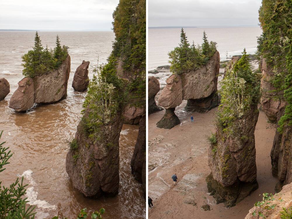
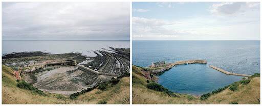
Ditto for the tides.

I gave two other use cases as examples which are even more critical.

I’ll post the video link if it gets posted.

It would be good to get more of a conversation going about the need for water simulation to get some more focus and visibility.

3 Likes

I would live to see tidal flows