What are these lines on the VFR map?

Can anyone explain to me what these lines are on FS2020’s VFR map? Presumably they denote different airspace categories, but I can’t find any sort of explanation or key on what is what. They also overlap in almost incomprehensible ways.

  1. Hashed blue lines

  1. Hashed maroon lines and dotted blue lines

  1. Solid maroon lines

Can anyone fill me in on what all of these are representing?

They are indeed airspace boundaries. I suggest using this https://www.openflightmaps.org/ or Navigraph charts.

So you don’t know what type of airspace the lines represent on the VFR map?

They don’t provide much info. You need to look elsewhere.

1 Like

There’s a lot of differing airspace to unpack - it mostly follows the scheme found on US VFR Sectional charts.

The blue-hatched airspace around Hohenfels AAF (ETIH) is restricted. It’s a military airbase, so that’s not unusual.

The thin blue dashes represent class delta (D) airspace, like around LSMD. The thicker magenta represents class Charlie (C), like around LSZH (which also has its own D area close to the airport).

Many of the C (and B in the US) areas are layered, like the proverbial “upside-down wedding cake” with the airspace getting lower and lower toward the primary airport. This protects departing and arriving traffic closer to the primary, but allows other traffic to fly under the airspace farther away, within airspace that is less restrictive.

I need a little help in locating the airspace in the second pic. Magenta hatching is usually indicative of some other military operating area or defense airspace that is less restrictive than the “restricted” airspace mentioned earlier. The former might have operations, air to air training, maybe alert or patrol areas. The latter is either protecting an asset or is where live-fire exercises routinely occur.

I can recite this a lot better for US airspace. ICAO is a little different and I’m not quite as familiar with the various permutations (especially with regard to military/defense airspace), so I’m being a little more general here.

2 Likes

That’s helpful, thanks. The airspace with the magenta hashed lines is in North Africa. The others, as you can probably tell, are in the vicinity of Germany and Switzerland.

I’m still confused by the areas of overlap. For example just here:

You’ve got bits like those little triangles from overlaps just south of LSPF. Is that because different regions demarcate at different altitudes or something?

And then bits like this:

How can any pilot understand the boundaries when they’re that tangled?

The color scheme and drawing style of those lines depicting airspaces may make sense in FAA regulated regions. When flying in Europe, the scheme feels extremely weird and unfamiliar. At the moment, the lines are kind of useless as many ICAO airspaces are not rendered at all. Airspace altitudes are not rendered either. Important airspaces appear only when zoomed in, etc.

In short, I always resort to Navigraph VFR maps for any serious flying. It would be nice to see some improvements in the integrated maps but I won’t hold my breath for it.

3 Likes

There are many free alternatives to navigraph. Such as Skyvector etc. Much easier for those on console.
Not everyone is on PC

1 Like

This YT channel is a fantastic resource for anyone new to simming and/or Aviation.
Easy to follow short videos for every level of pilot.

2 Likes

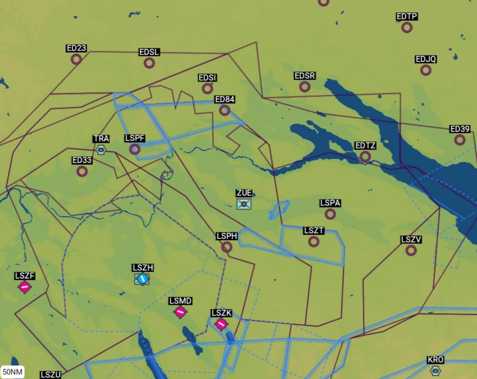
Yes, those magenta bits are different sectors of Zurich’s class C TMA (terminal maneuvering area), which occupy various blocks of altitude. Then there are a few layers of class E below that. Unfortunately class E and C are depicted with the same lines on that map, so it’s an absolute mess.

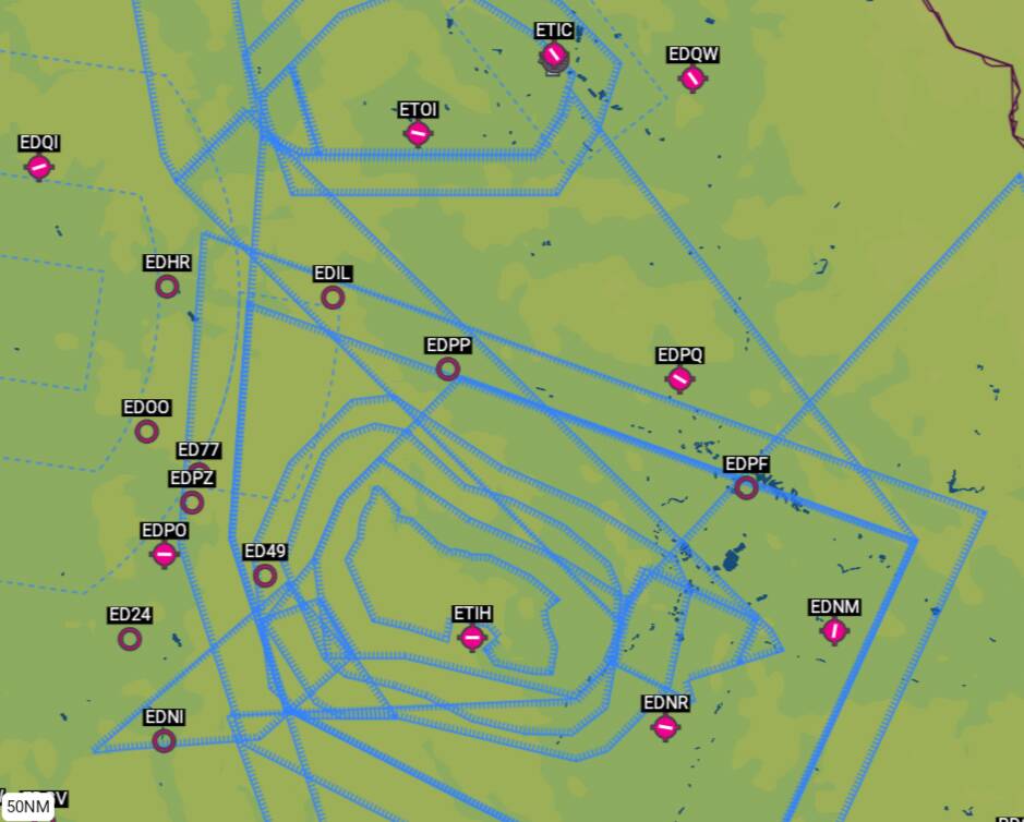
In that first pic, the blue hashed lines depict a glider area. So you’ve got a designated glider area within a class C. Those are also different blocks of altitude, but I assume, much like MOAs and restricted areas in the US, also might be activated in various configurations at different times, depending on need.

As others have said, you’d have to use another source.

One free resource to folks that have Microsoft accounts (all of us here) that hasn’t been mentioned in this thread is the increasingly excellent planner.flightsimulator.com

Within this, you can activate all layers of airspace and restricted areas, which will then be shown by designator and altitude on the map (when zoomed in appropriately).

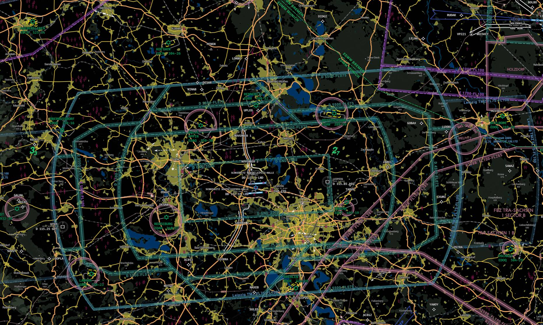
So here’s that restricted area in question around Hohenfels, zoomed in:

And if I do a long finger press, it will pop up details of all the airspace layers where the press occurred:

In short, the in-game VFR map is pretty worthless for meaningful airspace depiction. Sure, it’ll tell you something is ahead, but it’s not going to tell you what.

Keep in mind that VFR flying is either heavily regulated or not permitted in many countries. That’s not to say this is the case in your examples, but understanding how VFR works in various regions could be a factor. I know I’d have trouble navigating that under VFR in Europe without some major training. Whereas being under positive control from ATC, such as when you’re flying IFR, can obviate the need to be concerned about airspaces, in a navigational sense.

2 Likes

Thanks for the information everyone. This was triggered by Say Intentions telling me to make sure I didn’t fly through restricted airspace, and then on looking at the map, being unable to work out which area it was referring to!

1 Like