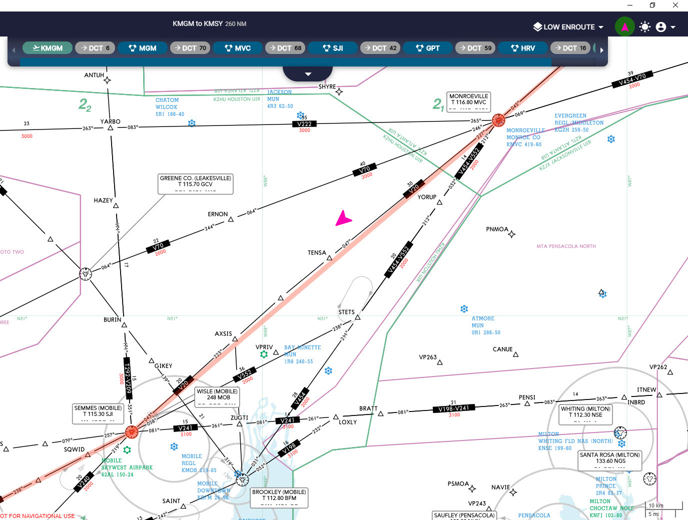
Flying a cessna 172s using VOR to VOR nav. I want to fly a route which involves passing (MVC) MONROEVILLE and then onto (SJI) SEMMES (MOBILE) using airway V20. On the navigraph low enroute chart it says to fly radial 227 near MVC, but 223 near SJI.
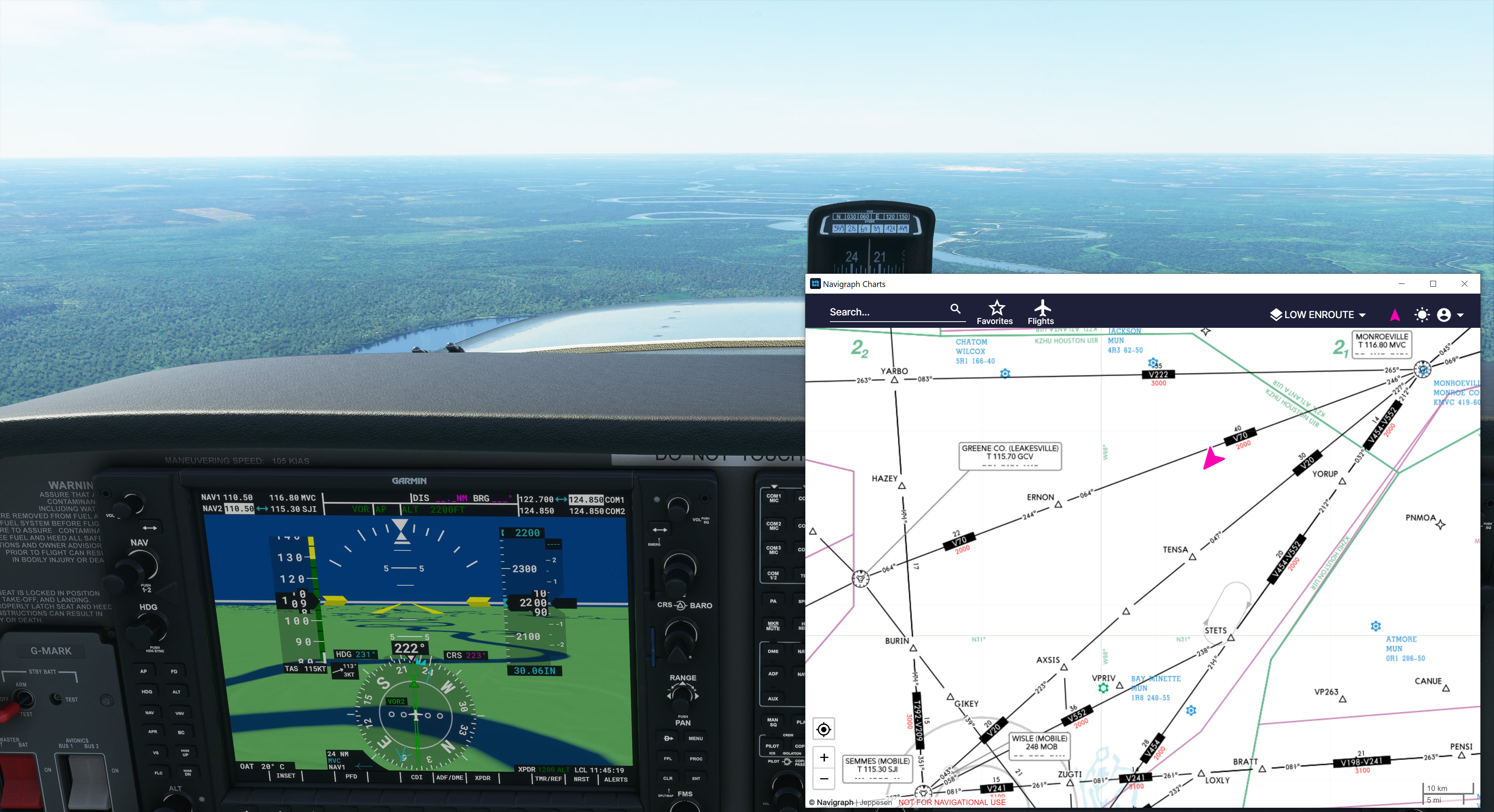
Something’s wrong because my plane is way out. What am I doing wrong? The map shows the plane flying CRS 227 with VOR 115.30 (SJI).
Several possibilities. If I’m understanding correctly the pink arrow there is your plane?
Are you certain that this map/add-on is accurate?
There’s drift in your gyro over time and needs to be adjusted back to magnetic, if you have that feature enabled. Though I think you’d see that error in the CDI
Wind will also push you off course, though that should also show up on the CDI
Also:
If you look at this on a VFR sectional you’ll see that V20 goes through the TENSA intersection so that’s specifically the changeover point, the intersection of those two radials.
The easy solution is to split the difference and set the CDI to 225°. Set Nav 2 to 115.30 and monitor. As soon as you’re in range, switch to Heading Hold for a moment, switch Nav 1 to the same freq., center up the CDI on the closest inbound radial, then switch back to Nav Hold.
If you want to fly the V20 airway one radial wont give you that. The radial you are flying inbound is 223° (which is 043° inbound) to SJI which will bring you through AXSIS, but wont follow the V20 airway, since TENSA is a waypoint which is on an outbound radial of 227° from MVC
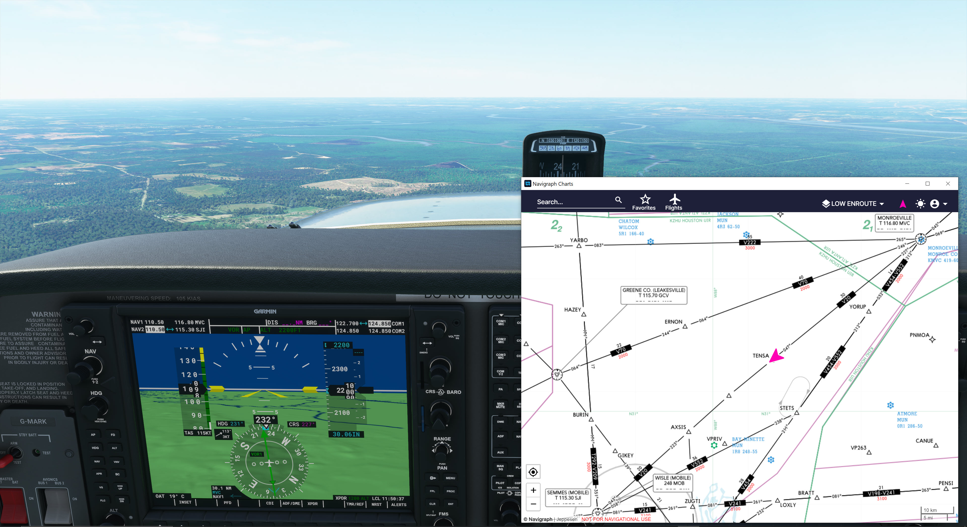
Your course is one thing, your track is another. You are going to have to adjust for wind to track the radial. Your CDI course should be on the radial, then adjust your heading to keep the CDI centered. That airway has a bend in it and there is no changeover point indicated so use the halfway point as your change over to track the inbound 043R (course 223) to SEMMES.
No my friend I tested and the DME is not there, but the strange thing is that it does not appear on my charts either, unless you really zoom all the way in. I’m not sure but that DME does not appear at all or the little airport UUBL does not appear either…