Yes, a spike in interest is happening again, after realizing that MS isn’t planning any serious improvements. However, a number of posts and votes should not be an indicator of a subject’s importance. Unfortunately, MSFS development trajectory is determined by public voice, not by professional judgment. That’s why the weather in X-Plane looks like done by people who know how weather works and looks like, while the weather in MSFS looks and works like the majority of people think it should.
11 Likes
We’re always waiting for something
5 Likes
With the line of Tornadoes that landed in Oklahoma yesterday and clear high altitude TCUs. I am wondering if any has experience of what the weather was being depicted like in the sim?
1 Like
At what time did it happen ? The sim does historical weather.
https://x.com/i/status/2047549736786317334
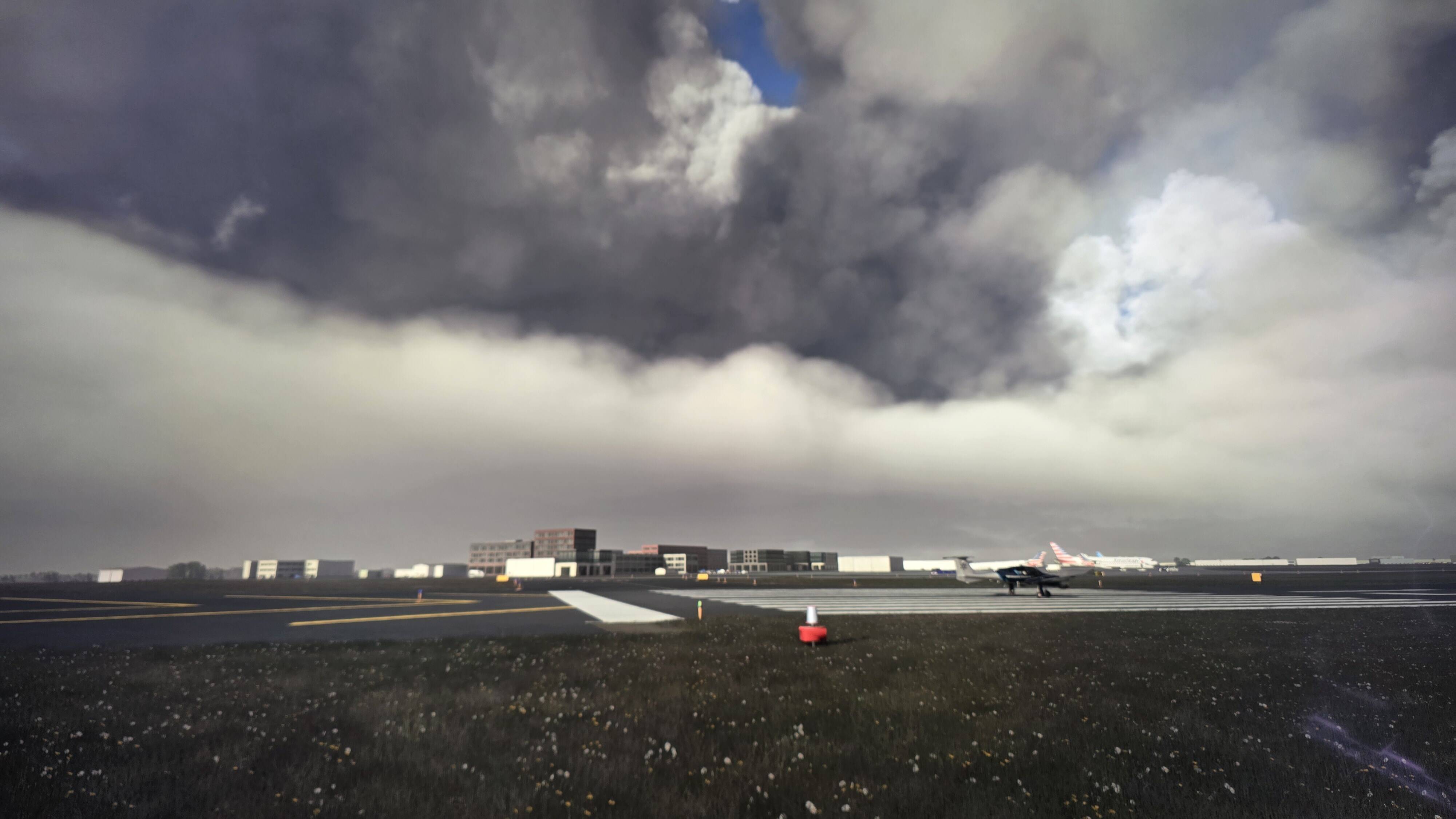
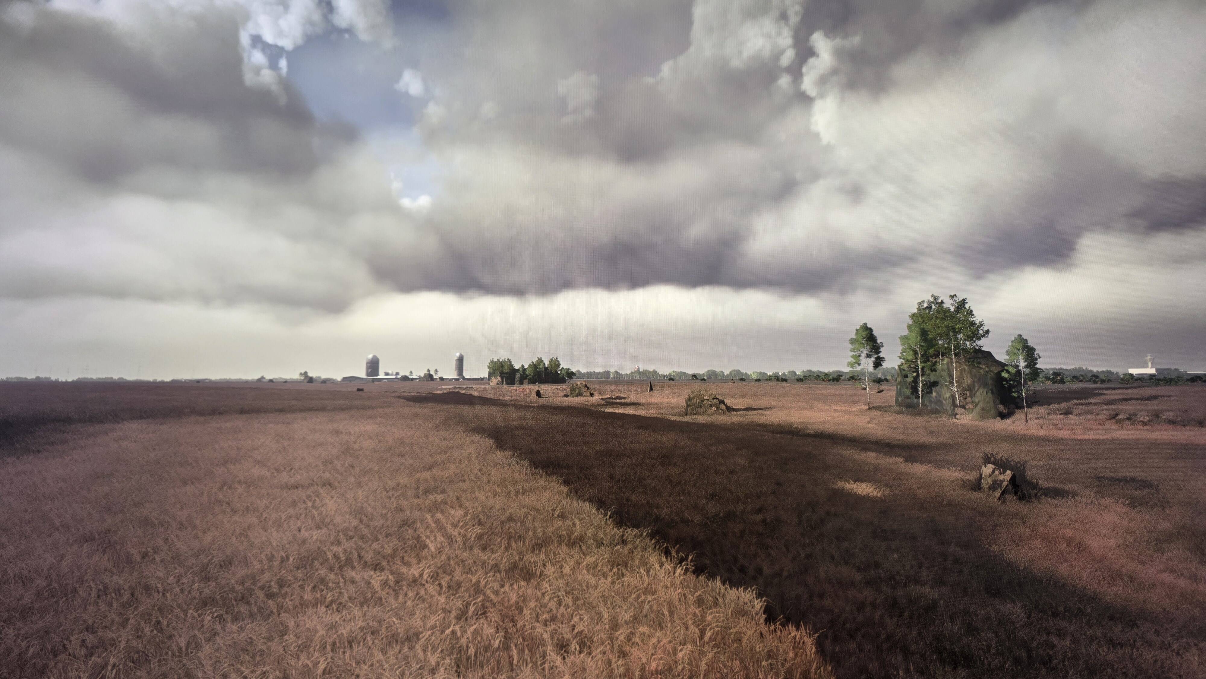
This is what it looked like from an airplane, it was around evening time. @GridRisen
2 Likes
2 Likes
Just out of curiosity. Where you able to see anything from the air?
Nothing of that sort as shown in the video you shared. As usual it was a mess of pieced together cumulus ash clouds. It looked horrible. From the ground it looks okayish. I also used historical weather and switched back to 23:00 the previous night which is around when that storm was wreaking havoc. There were just cumulus clouds in sim with low bases and there was no rain or lighting. Again, a very terrible representation.
6 Likes
Nice. For context, here are the METARs during the period KICT was affected by the storms last night:
METAR KICT 252253Z COR 12013KT 7SM TSRA BKN039CB BKN060 21/17 A2967 RMK AO2 RAB37 SLP039 OCNL LTGICCC DSNT E-SE TS OHD MOV E CB DSNT SE MOV E P0000 T02060172 $
SPECI KICT 252300Z COR 16013KT 9SM -TSRA BKN039 BKN050CB OVC060 21/17 A2968 RMK AO2 TSB2254 OCNL LTGICCC OHD AND DSNT SE TS OHD-N MOV E CB DSNT SE MOVE E P0001 T02060172 $
METAR KICT 252353Z 14010KT 8SM -TSRA SCT019 OVC035CB 19/17 A2972 RMK AO2 RAE03B24 TSB2254 SLP056 OCNL LTGICCCCG VC N-NE TS VC N-NE MOV E CB MOVD SE P0002 60002 T01940172 10261 20194 53002 $
SPECI KICT 260006Z 17012KT 9SM -TSRA SCT014 BKN019CB OVC033 19/18 A2972 RMK AO2 OCNL LTGICCCCG VC ALQDS TS VC ALQDS MOV E P0001 T01890178 $
SPECI KICT 260011Z 17012KT 1 3/4SM -TSRA BR SCT016 BKN022CB OVC027 19/18 A2972 RMK AO2 FRQ LTGICCCCG VC ALQDS TS VC ALQDS MOV E P0001 T01890178 $
SPECI KICT 260026Z 20013KT 10SM -TSRA SCT013 BKN019CB OVC025 19/18 A2973 RMK AO2 FRQ LTGICCCCG VC ALQDS TS VC ALQDS MOV SLW E P0002 T01890178 $
SPECI KICT 260041Z 20013KT 10SM TS SCT009 BKN013 OVC019CB 18/17 A2974 RMK AO2 RAE31 OCNL LTGICCCCG VC ALQDS TS VC N-E MOV SLW E P0002 T01830167 $
METAR KICT 260053Z 24008KT 10SM -TSRA SCT009 BKN013 OVC019CB 19/17 A2975 RMK AO2 RAE31B43 SLP065 OCNL LTGICCCCG VC ALQDS TS VC N-E MOV SLW E P0002 T01890167 $
SPECI KICT 260122Z 15008KT 10SM TS BKN015 BKN039CB 17/15 A2974 RMK AO2 RAE14 FRQ LTGICCC VC NE-SE TS VC E-SE MOV SE P0000 T01720150 $
Note that several of these are SPECI (non-routine) - the overall period in which there was some sort of TS present in the observation itself spanned from 2253z to 0122z, a span of about two and a half hours. On one hand, it was nice that the storms existed in the sim, but I question why they didn’t display any lightning.
As for the observations, I’m not sure if the sim ingests SPECIs as they come or if it’s set to a pre-determined ingest timeline, like hourly. More info is needed - that’s question #1 I’d ask the devs.
That said, as we’ve gone ‘round and ‘round about, a METAR observation only really tells you the presence and intensity of a storm within a few miles of the station, it doesn’t speak to size, movement, etc. Where it does indicate some of that, however, is in the remarks (RMK) section. As KICT is a human-augmented station, there are plenty of those to be found, along with the aforementioned SPECIs. The next question (#2) I would ask the devs is do remarks affect the weather engine at all - I assume due to the irregular nature of their entry (albeit fairly standardized), they do not. (See “MOV,” “MOVE,” and “MOVD” for an indication of the irregularity of which I’m speaking).
Either way, this was an irregular storm - not really part of an organized line, but stronger than a plain old airmass storm, very slow-moving and constantly recycling. In fact, it was imitated by the outflow boundary of an earlier storm that had dissipated to the southeast.
There is no way to depict it correctly using METAR alone. In fact, the only right way to depict how it affected the KICT and surrounding terminals would have been to use consecutive radar scans to synthesize an analogue for the precip and use satellite pics or even upper-air wind data to help generate a depiction of the anvil. That’d be recommendation (rather than question) #3.
Here’s the evolution on radar:
Initiation over KICT around 2250z
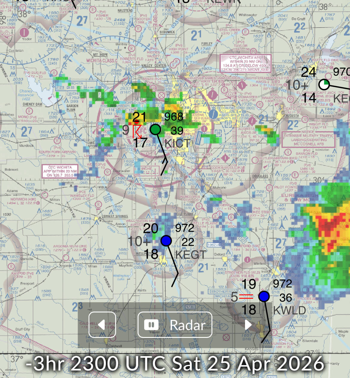
2350z scan (nearly coincident with 2353z METAR)
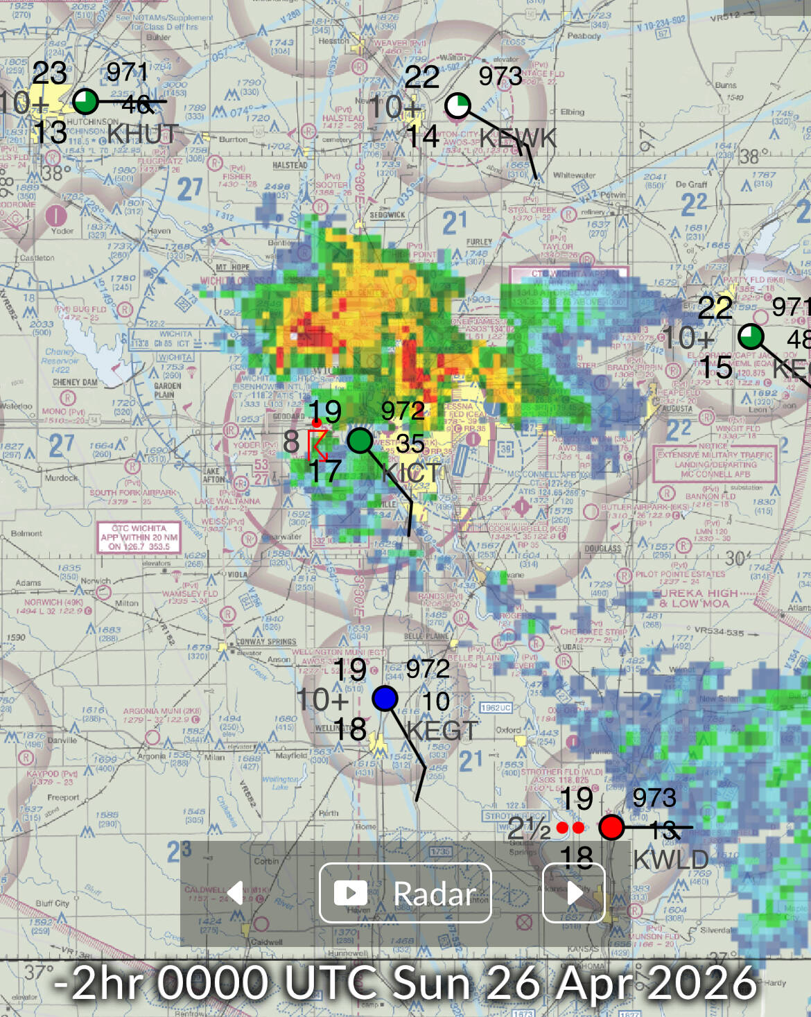
0120z scan near the SPECI issued at 0122z

0200z, near-total dissipation
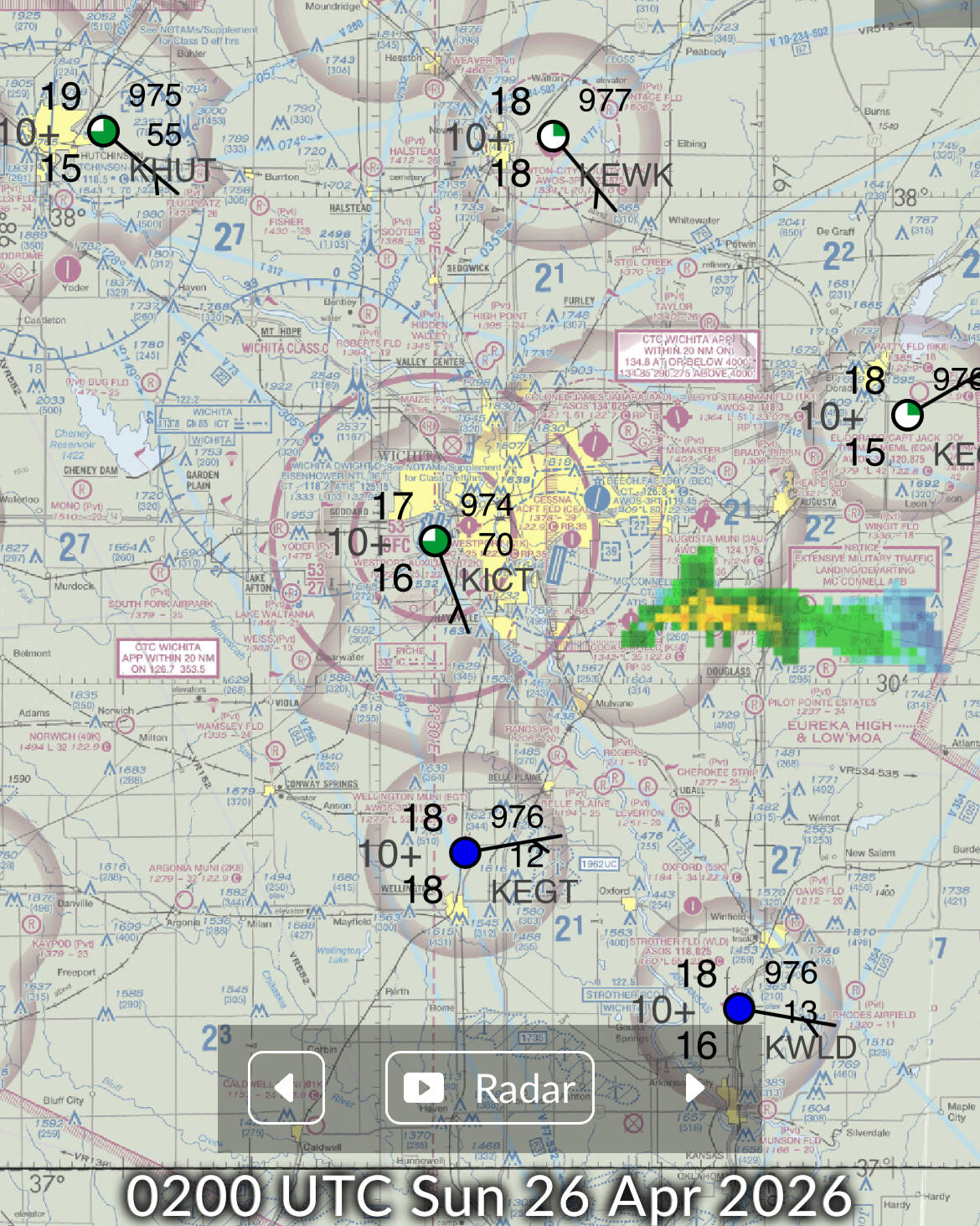
At the end of the day, thunderstorms like this are too erratic to generate with a forecast. And because they affected certain parts of the terminal area at different, prolonged times, it’s important to get that behavior in the ballpark, otherwise you might as well shut down the entirety of the region. I’m well aware of the current data limitations using gridded numerical forecast models, but they are augmenting it with observational data to an extent already. Main point - is it possible to get to the point where they can use more timely and accurate sensor-driven data other than METAR and divergent and low-resolution forecasts?
Note I have yet to see evidence that XP approximates the structure of thunderstorms correctly, either, especially close-in. However, I would be curious to know if their excellent distant weather representation moves and sizes correctly and holds water (pun intended) visually as it evolves and nears the user.
3 Likes
OP is spot on. On the last live stream Asobo and Jorg indicated or at least seemed to indicate that everything was just fine and dandy with the weather and the clouds. In fact, everybody outside of them think the exact opposite. In every other flight sim out there does it much better than what they’re able to do. Their contract with their weather provider has turned into an anchor holding back the main environment we operate in. They work on things such as missions and career mode yet the core environment is utterly broken, what a sad state of affairs.
15 Likes
You should really have put this in it’s own thread. Upvoting a 6 year old thread now won’t get it noticed by Asobo.
1 Like
Seb stated on one of the previous Q@A for live weather, it need rewrite from scratch, it’s on the backlog and are doing priority.
6 Likes
I did put it in its own thread. The mods merged it. I have also maintained that the practice of adding this to new topics is not practical. However I understand the counter argument that having 100 threads all about the same topic is counter intuitive. I have tried to get the word out in this topic to help bring the issue to the top again.
5 Likes
At 23:25 People need to vote more for wishlist

4 Likes
Please find that exact Q&A and post the timestamp, thanks
2 Likes
Link to the specific livestream with timestamp pls.
1 Like
If the weather system needed a “rewrite” it was advertised as a “new weather system” in the 2024 rollout. Now o question what exactly did they change in it?
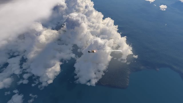
Here are additional examples of weather that the other simulator is depicting with a community” KSP” mod. Maybe something that the devs can use as inspiration.

4 Likes
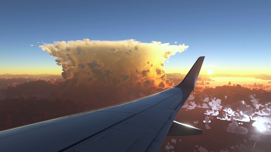
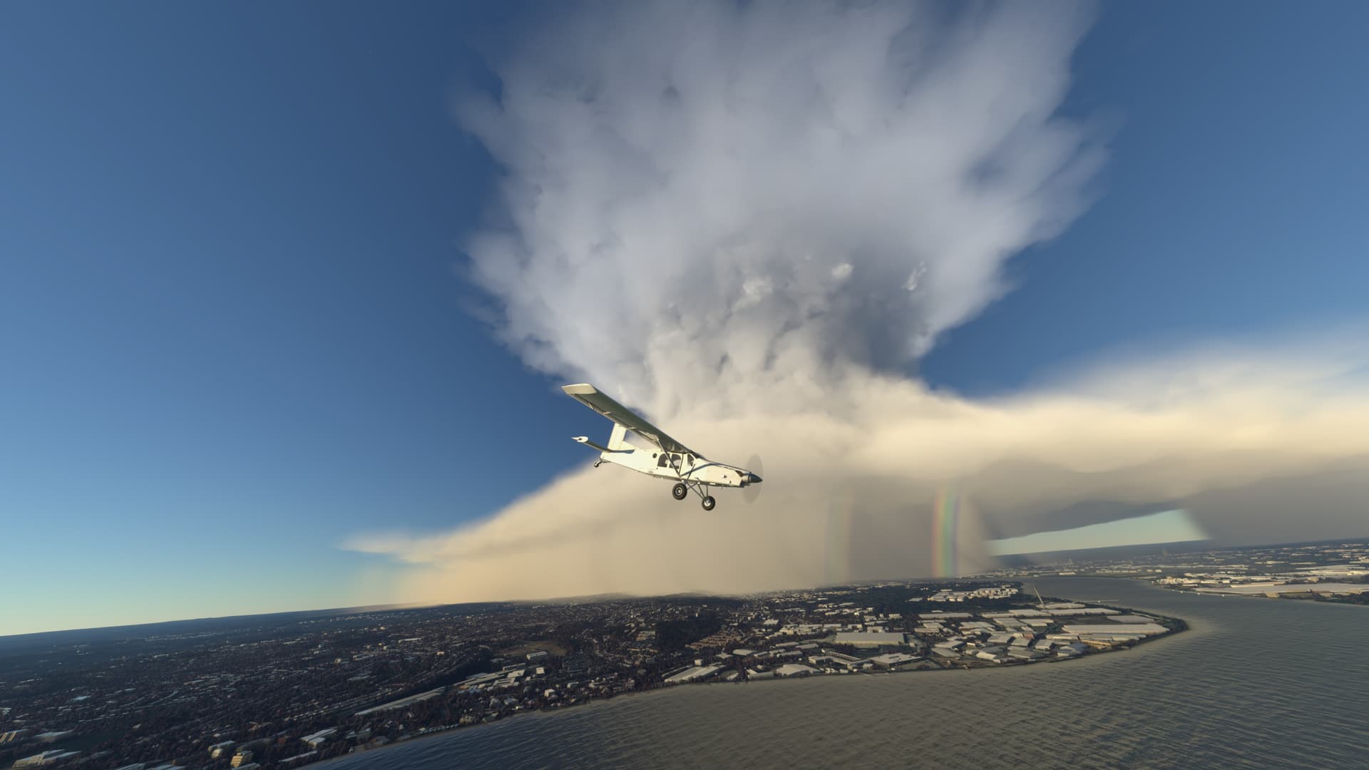
Asobo have all of it, current Msfs is capable to do this in manual and supercell option on preset, those 2 shots from Msfs 2020, I am trying to reproduce them in manual, these 2 shots don’t do justice, I could make all sort of anvil, CB, supercell, very convincing, I need to check how I did before, I did posted video but lost it. There was entry for specific location we could enter and storm was there. But they need to implement this on Live weather which is totally different.
4 Likes
The link is above with the timestamp.
At no point in the time stamp above did Seb say that, he said it needs a “bigger rework”. Stop spreading false information please.
3 Likes