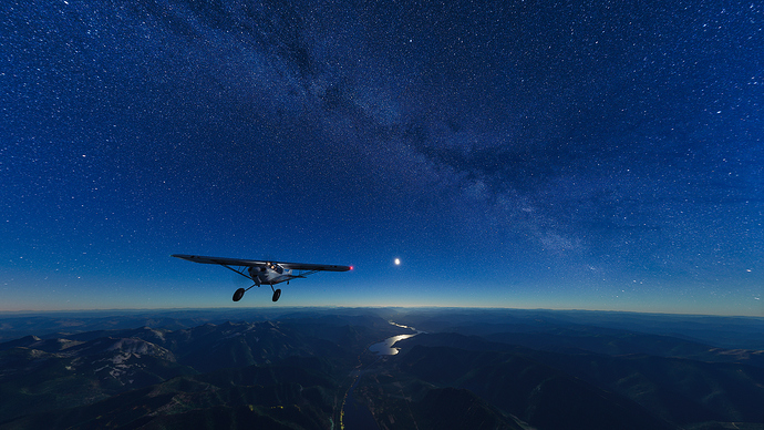
Photo taken on Leg 14 of my North Idaho Bush Trip while flying in the dead of night over the Clark Fork River en route to Lake Pend Oreille. Flight plan with the date and time below the photo!
Complete 18-Leg North Idaho Bush Trip Flight Plan on my website.
Leg 14: Craik (29MT) to Cx Ranch (ID01)
Set Date, Time and Weather to June 10th 2020 3:00AM.
Weather – Clear Skies
The afternoon storm has delayed your flight schedule, as you planned on watching the sunrise from the shores of Lake Pend Oreille. As the clouds clear as the night sets in, you decide a moonlit route up the Clark Fork river should be easy enough as the Cx Ranch landing strip is easy enough to find.
Take off from Craix and head east until you meet up with the Clark Fork River and head north until you reach Frampton airport, your half way mark to Lake Pend Oreille.
Continue northwest along the Clark Fork river. In the distance, the moon will be lighting up Lake Pend Oreille, easily making it visible. As you approach the wide opening of the lake, you will fly over the small town of Clark Fork on the east side of the river. Directly opposite, on the west bank of the Clark Fork River, you will see the Cx Ranch landing strip, illuminated by four lights, 3 of which lie on the west side of the runway
Heading Distance ETE
308 – Frampton Airport | 17.76 NM | 7’52”
284 – Cx Ranch (ID01) | 19.76 NM | 9’34”
