First of all, I really appreciate the commentary and I am hoping others can read this to gain an understanding of the magnitude of the issues involved.
The question of the “simulation” being “credible” is exactly what the Canadians are arguing about discussing in their thread, (referenced in the first post).
Here are three pictures of “my house” in Butovo, just south of the MCAD. (North is up.)
This one is by Yandex - they actually have a high resolution close-up image.

The building in the center that has a half-green and half-white roof is where I live. (We’re in the green part.)
Just below and to the right slightly is our (brick paved) driveway and you can even see our car in it.
This is the Google image for the same place.
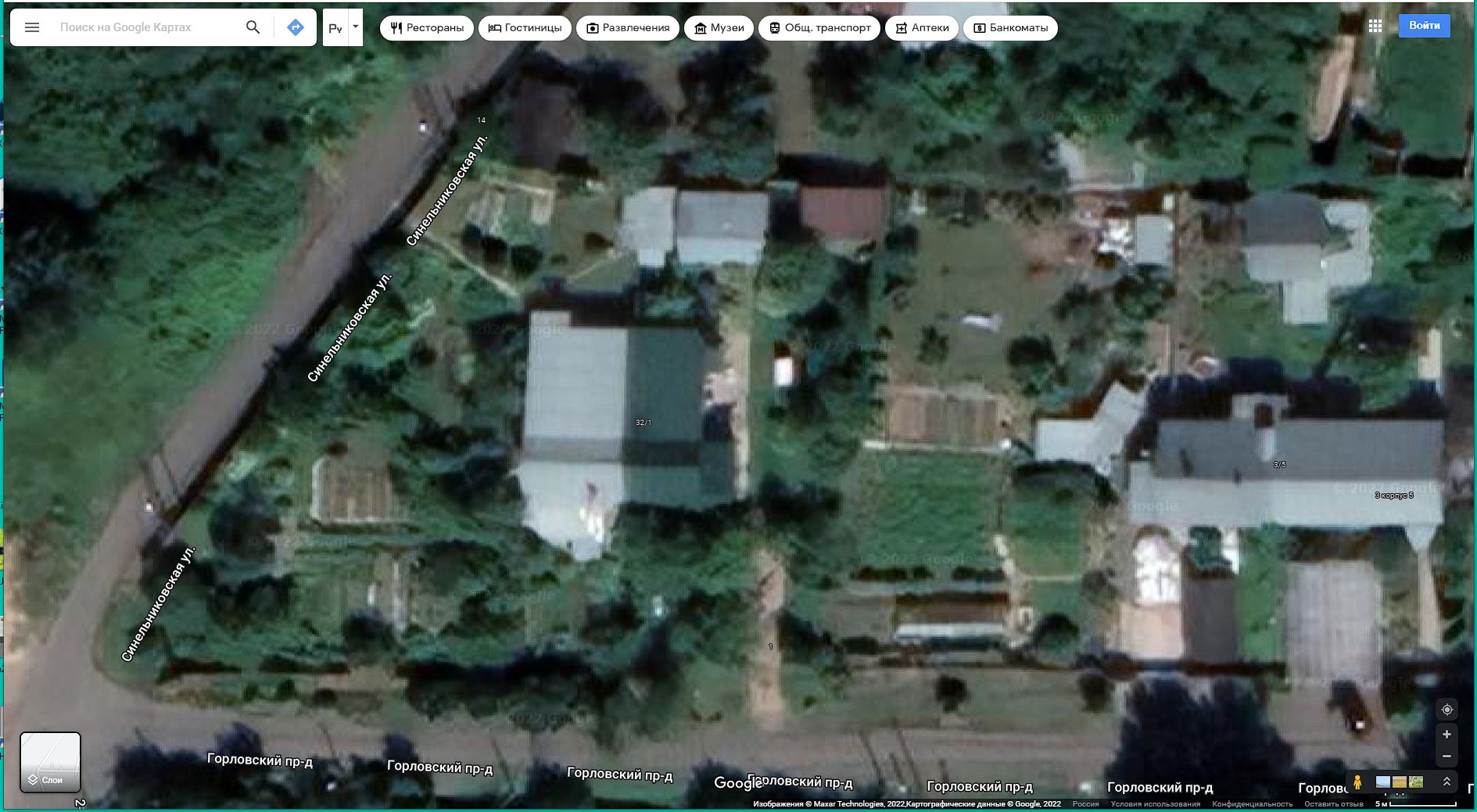
You can see that things are substantially similar except for the resolution.
You will notice that the car is not there and the small white rectangle just to the right of the green roof is my wife’s lawn swing.
Here’s the Bing version of the same place.
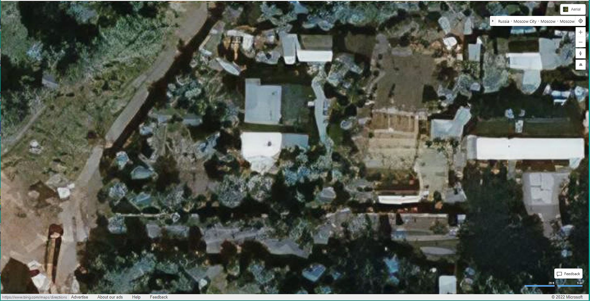
Several things you will notice:
- Gorlovsky Proyezd - the road in front of our house - is curved all around. In some places, it’s not even visible though it should be clearly visible - except maybe at night - and even then there are street-lights.
- It looks like we have a small road or a long paved driveway right next to the house. Again, all curved around.
- The thing that looks like a brown snake in the far lower left is construction where they were digging up the street to install gas mains. That was about seven-or-so years ago.
- You will notice considerable visual artifacts - as if the picture is a composite of several pictures, taken at different times of day and from different angles - all stitched together.
This is exactly what people are discussing in the Canadian forum and in other discussions all over the web - the Bing imagery is horrid and bears very little resemblance to reality.
This is one of the main reasons I asked about local storage of images - perhaps starting with a good map, correctly oriented with respect to everything else, (that’s the tough part!), with the correct scenery overlays, you’d have a pretty neat setup.