MSFS doesn’t stream live data from Bing maps. With the exception of stuff that was added with world updates, the data you see in MSFS is what Bing had available back when it was pulled to put into the sim. Depending on where you are in the world, that data can be as new as 2-ish years old, or as old as 10 or more. A snapshot was taken at some point in the development cycle, optimized for delivery, and what’s what we have. That’s what’s streamed to use from Asobo’s cloud servers. We don’t access Bing maps directly.
This is directly contradicted in the video right above your post.
The video says there’s a lag, because new aerial imagery requires processing - tree detection, water masking, etc, but they are always updating the aerial imagery in MSFS. This is not a static world screenshot.
It’s allmost impossible to update all the data in realtime all the time. It’s more efficient to take the data at a certain time then process that data for streaming and ones in a while update with new data.
That’s how it was explained in the past. Snapshots are taken from Bing, the optimization work is done, and it’s inserted into the sim, usually along with world updates. If it worked like Jorg explained it, we’d be seeing the same images in MSFS as we are in Bing, and this forum thread wouldn’t exist.
I can quite guarantee you that in my region (no PG data), the MSFS imagery is 5+ years old. I see areas that have since been built up as empty areas or ground just breaking. We have a bridge that opened 2 years ago that took them 3 years to build. In MSFS, all you see is the ground cleared, which happened about 6 years back. Yet if I check Bing, the imagery of the same areas is current and about a year old and shows the completed bridge.
True. The data is being updated all the time. Piece by piece. Area by area. Care to try to guess how long it will take to update every square mile of new data that is being added. And by the time you get half way through, there is new data available.
This is a continuous process that will never be done. The issue raised by many is that their favorite area has “much better imagery” available than what is being used in the sim. Who gets theirs done first? You bring up an example of a couple square miles of New York. I can show you 100s of thousands of square miles of reasonably hi res scenery in the browser that is brutal in the sim. It covers almost all of Canada from about 55 degrees and north. I would really like to see that fixed before they upgrade some little peninsula in New York.
Who’s complaint is more important? How do you decide?
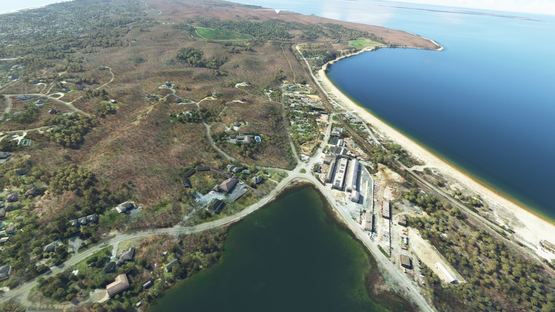
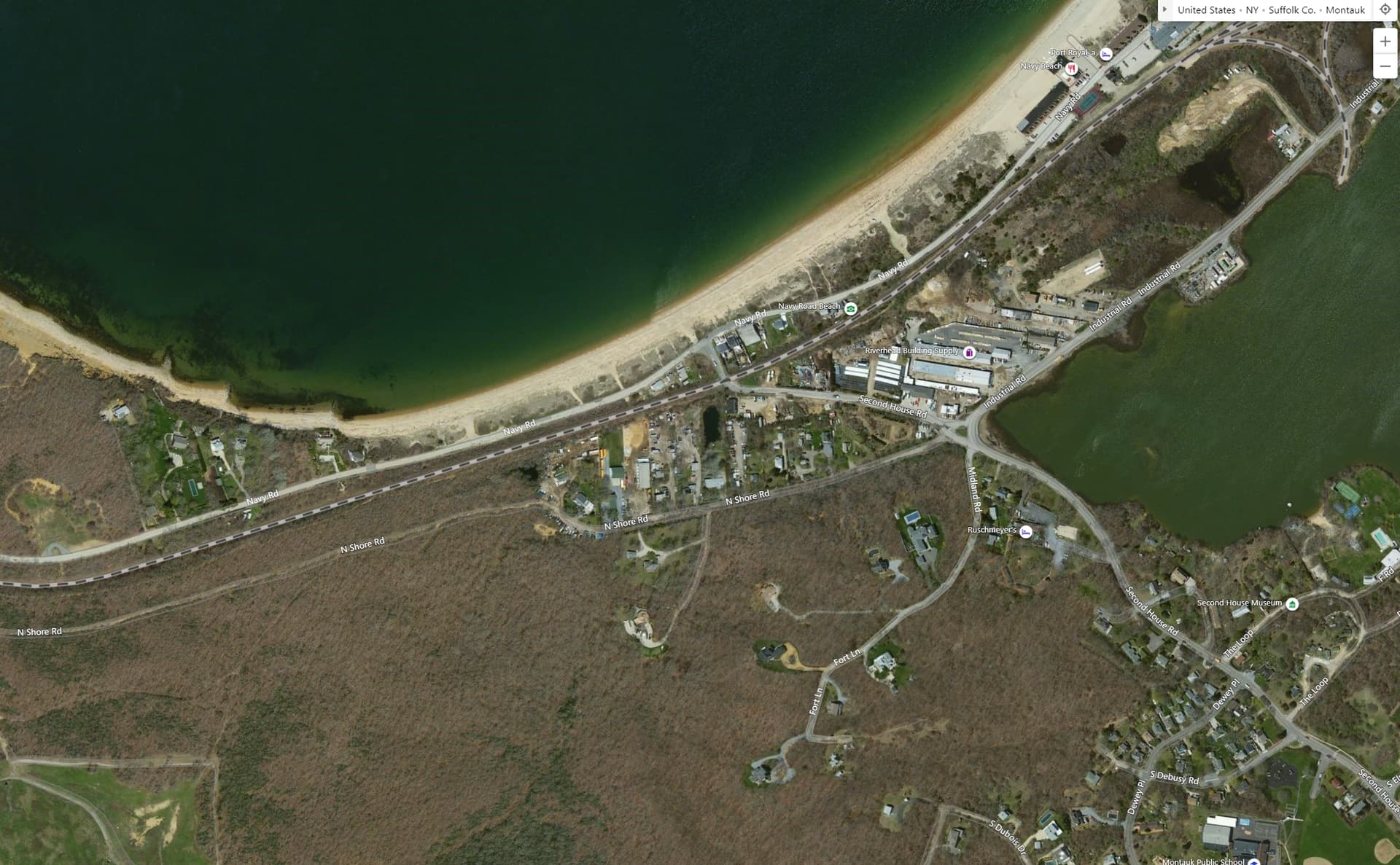
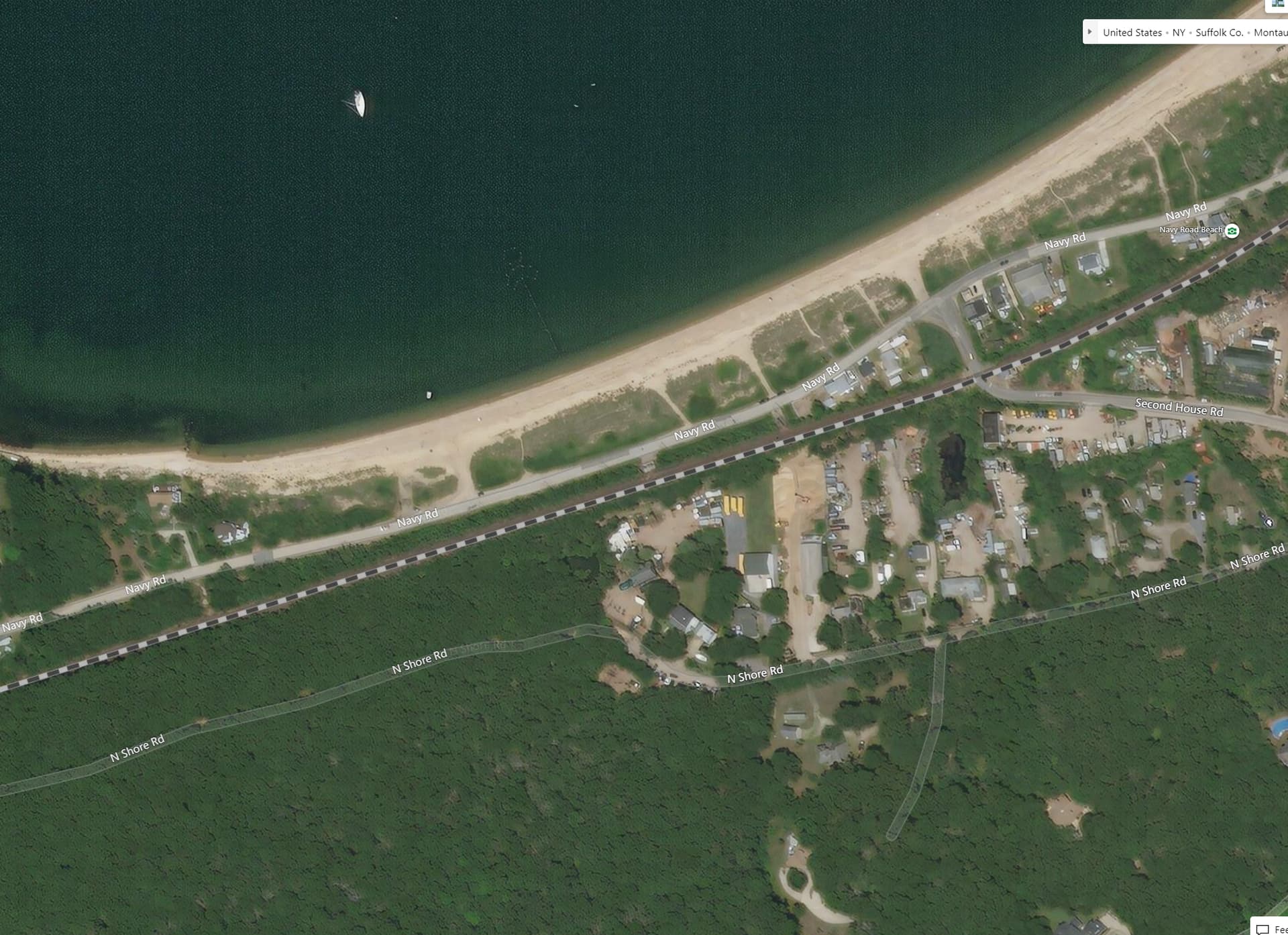
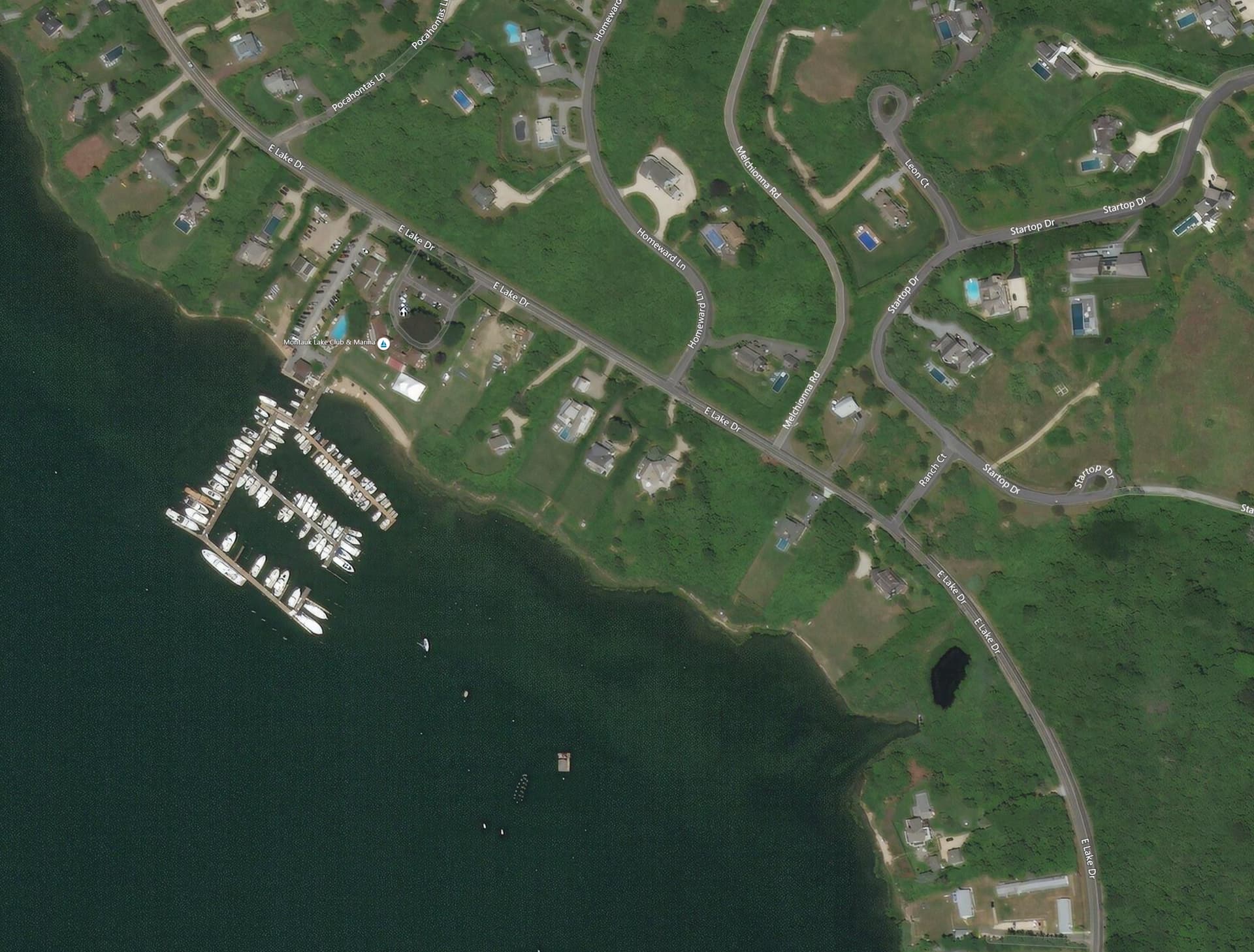
I certainly wasn’t advocating for my specific area - just pointing it out as a good example. It would be great if you could designate places you were interested in, and see a notification in-sim if they get imagery updates.
To me, that’s the main takeaway point here. In the Q&A, Jorg says the sim uses the same aerial / sat data as Bing and suggests it’s real time - that we should see the same data in MSFS that we see in Bing. That’s demonstrably not the case.
So either Jorg is mistaken about how it works, or something, somewhere isn’t working as intended and they’re oblivious to it.
Most irritatingly though they don’t generate the lower LODs from the available high quality data they use for the higher LODs. This leads to visible jumps at some LOD transitions.
This also concerns Bing Maps. And both ortho and DEM suffer from this.
If there is no licensing reason for this, we have to assume it’s just plain old sloppyness.
I have a feeling there’s some distinction in the bing datasets between the imagery you see when you are above the two max zooms (usually newer and higher res) and the middle (zooms 3-8) which is used by MSFS, and then 9+ which is their full global imagery. I bet MSFS excludes a lot of the max zoom levels for some reason - maybe they are smaller chunks and would be harder to make cohesive?
Well it depends: Yesterday I found the 2 new holiday complexes being built in my neighborhood (Germany) in FS - I’m not sure since when they’re there but I think it’s even post-WU6. The ortho image is showing the state of the (still ongoing) construction of maybe 2020, it’s so new that BlackShark AI doesn’t cover the new lodges yet.
The Google image still shows the empty field that the one site was before, and the farm that mysteriously burned down 2018 before the other investment project was started at that site.
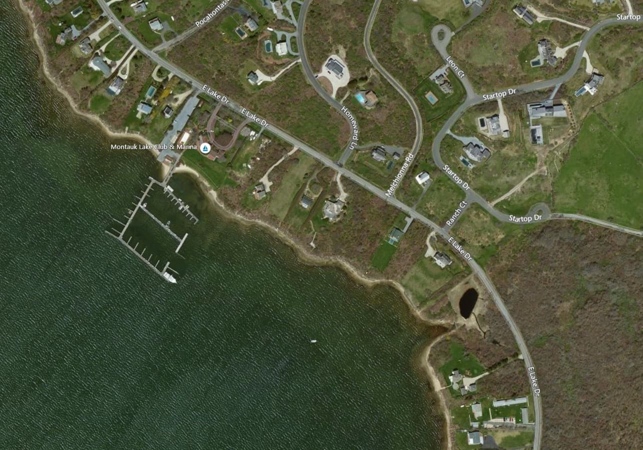
Like I said in my earlier post, I can quite confirm that images of 2 bridges in construction in this area not in the sim.
The first bridge, where initial ground breaking started 6 years ago, shows only that in the sim. Initial groundbreaking. At all LOD levels in Bing where you can actually make out ground detail, that bridge is complete as it opened over a year ago.
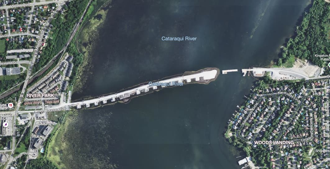
We have a second bridge going up spanning across a river and it being built at record speed, it seems. Initial groundbreaking on both shores for survey work started in 2016. In the sim, there’s no sign of any groundbreaking at all. Yet on Bing Maps, at all LODs, the imagery is from early spring 2021 and shows the bridge in a very advanced state of construction.
Bearing in mind, this isn’t a PG area, so this is standard Bing imagery here. If what Jorg said was correct and Blackshark was constantly updating the data, this wouldn’t be the case.
This is the highest level where it’s visible. In sim, ground data is much higher res than this.
In MSFS, there isn’t the slightest hint of any of this bridge, meaning the imagery in the sim is older than 2016, so 5+ years old, despite Bing having data that’s less than a year old.
In relation to this issue, about 2 months ago (when the bing servers failed) in my hometown in South America the most current bing maps (of excellent resolution) appeared for about 2 days. After they fixed the problem, the older, lower resolution images reappeared. So there is something strange with all this.