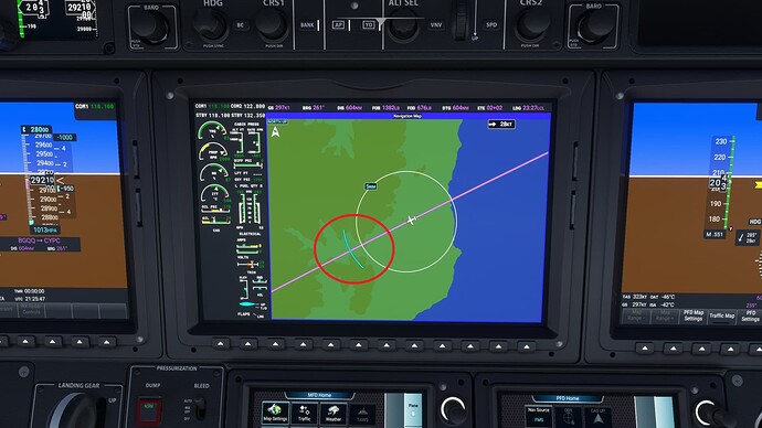
Hopefully this shows what @simmnut is saying about the blue arc line as he is spot on!
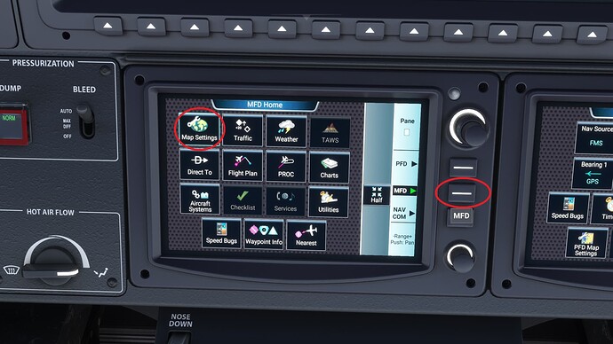
- Press ‘MFD’ to get to the MFD homepage, then press ‘Map Settings’.
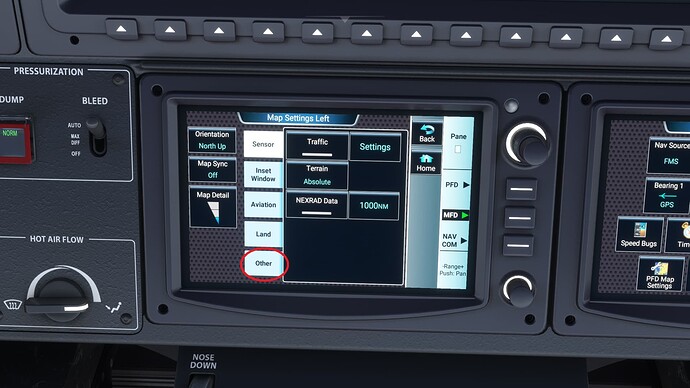
- Press ‘Other’
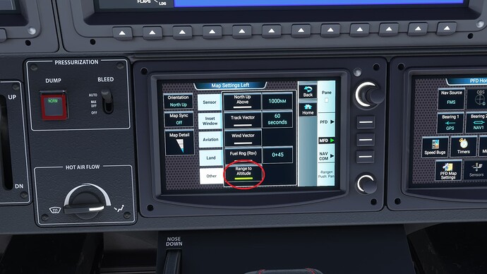
- Make sure ‘Range to Altitude’ is clicked and enabled.
- The MFD map will now show you where the ascent/descent will end with a blue ark. This will change live as your vertical speed and ground speed change.


