Asobo, can we prioritise ultra high res meshes for national parks?
1 Like
Hope they will add the currently missing EDGT Bottenhorn airfield and update the sat image of the marburg-biedenkopf area as it is still covered with snow. A rendition of the castles in marburg and biedenkopf as POI would be cool as well.
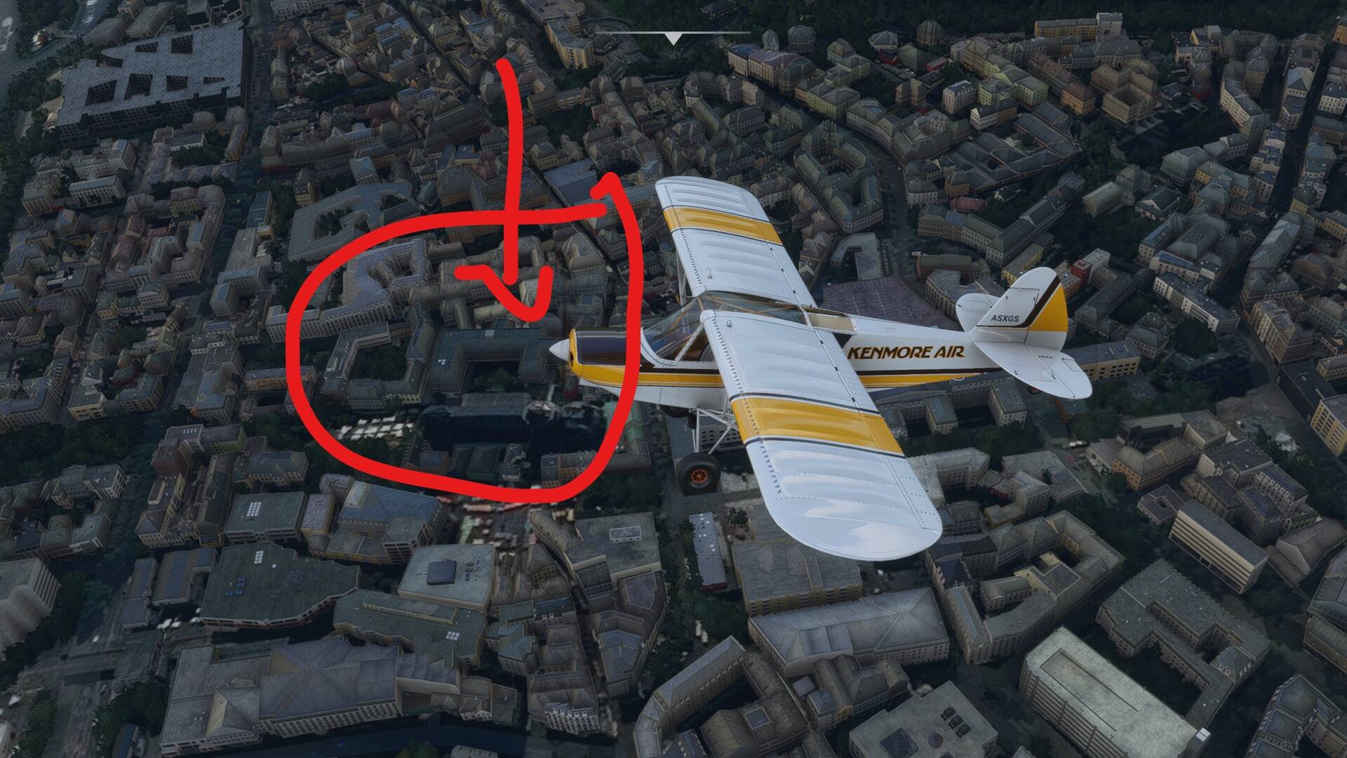
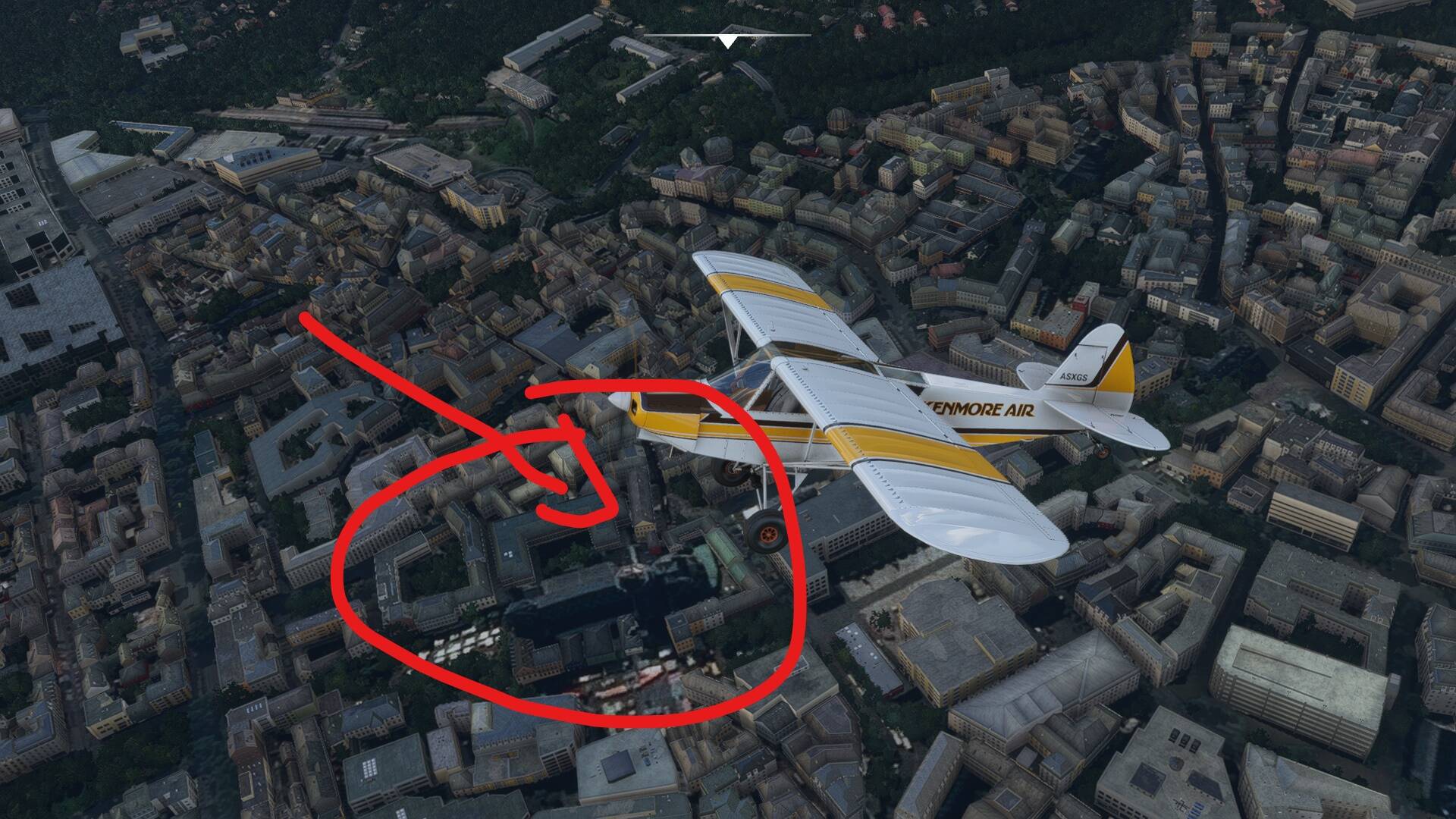
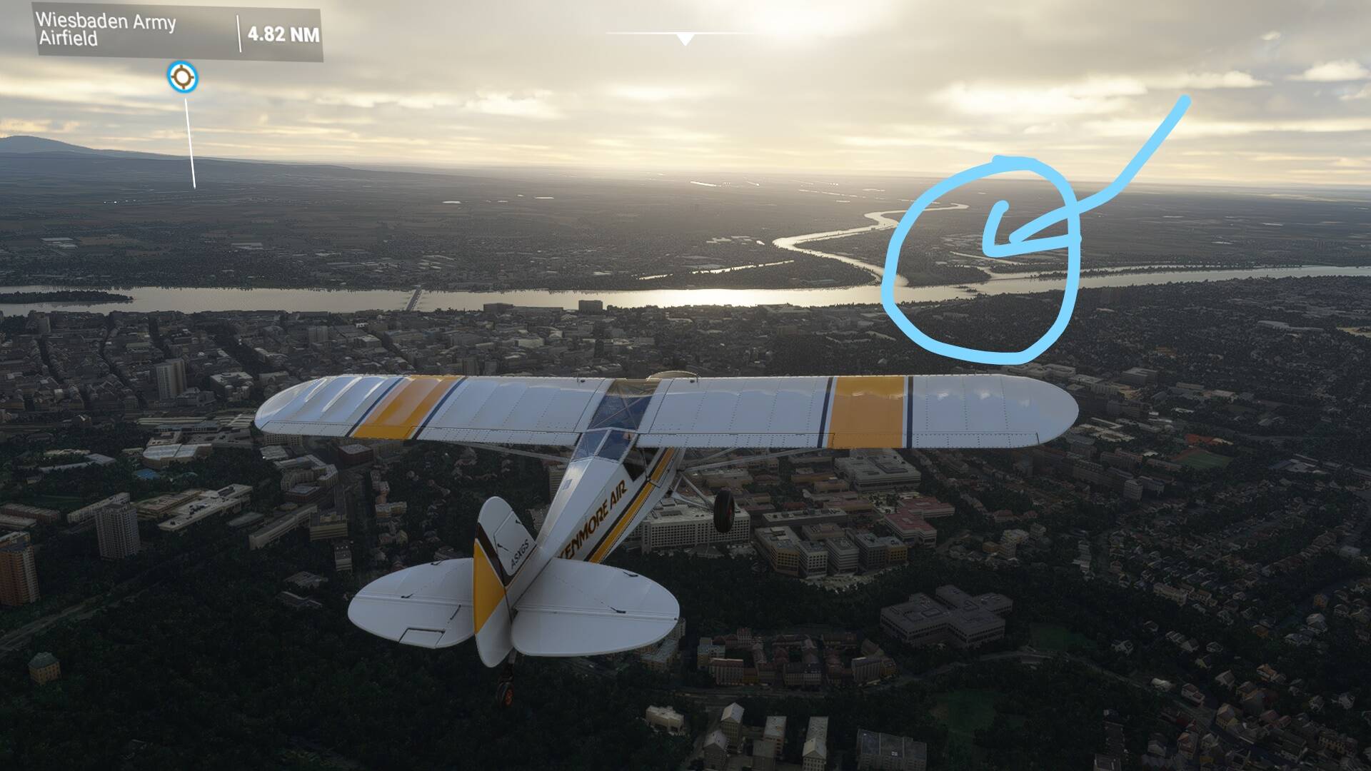
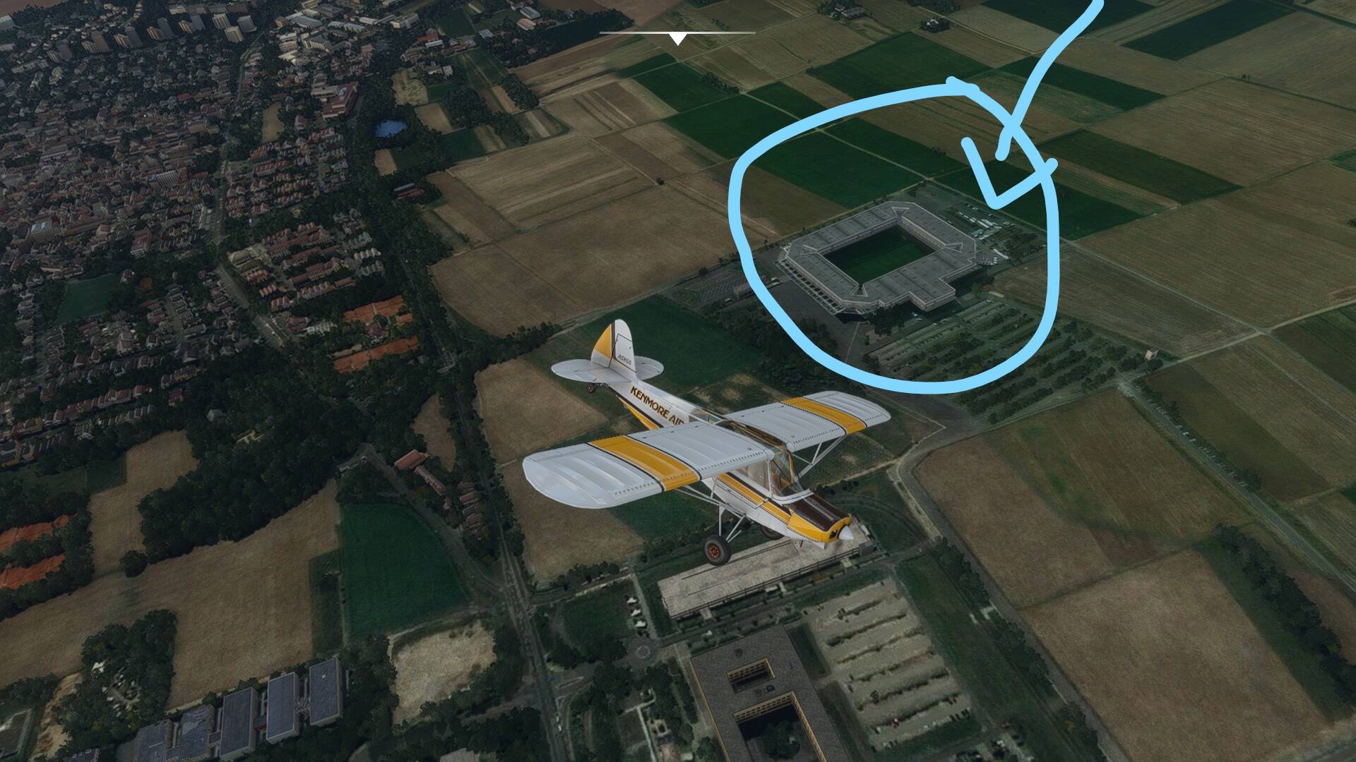
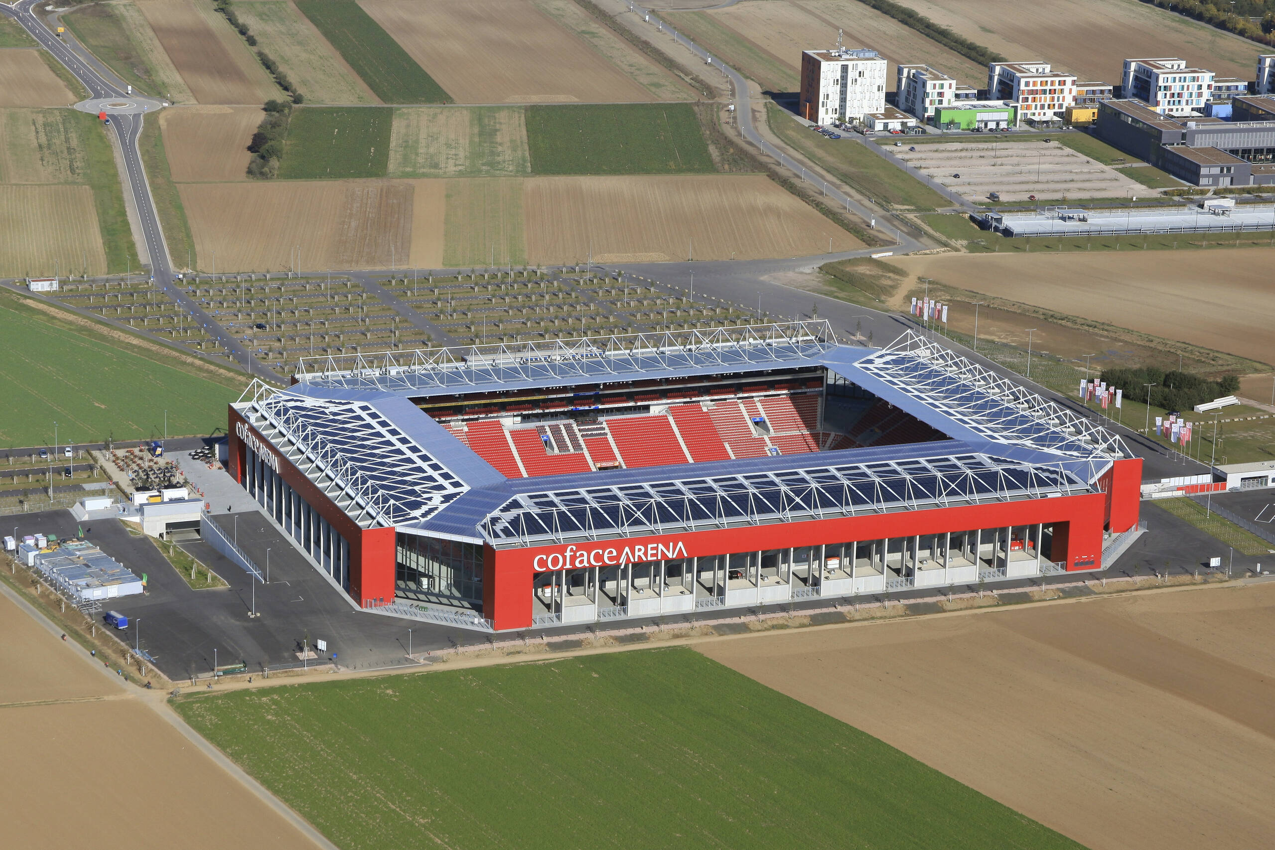
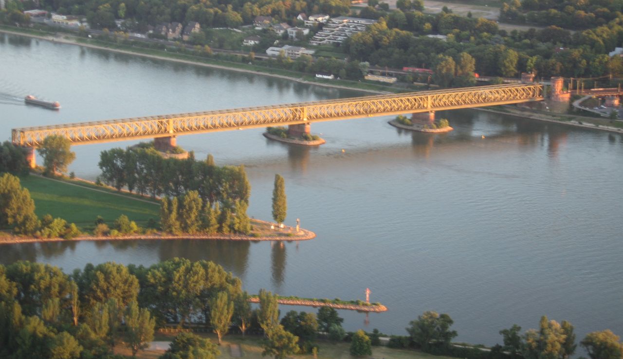
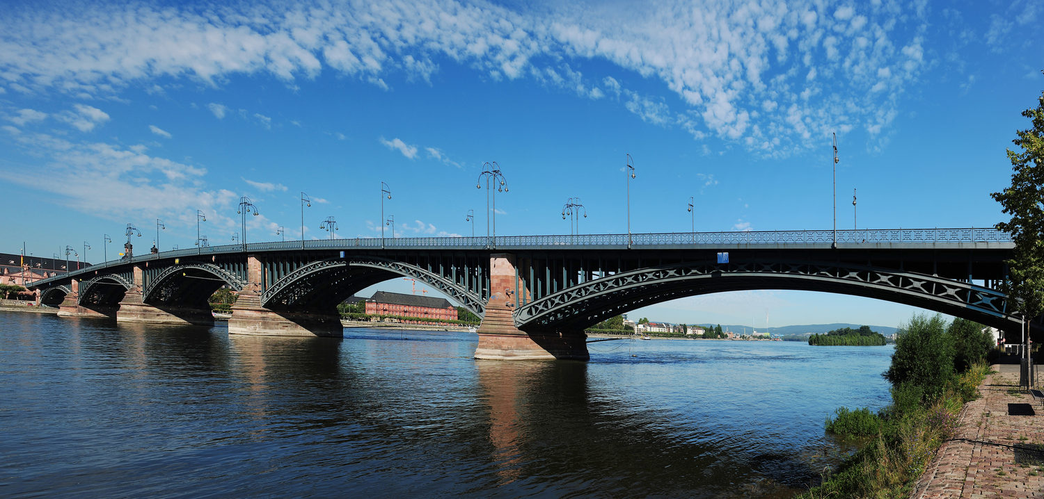
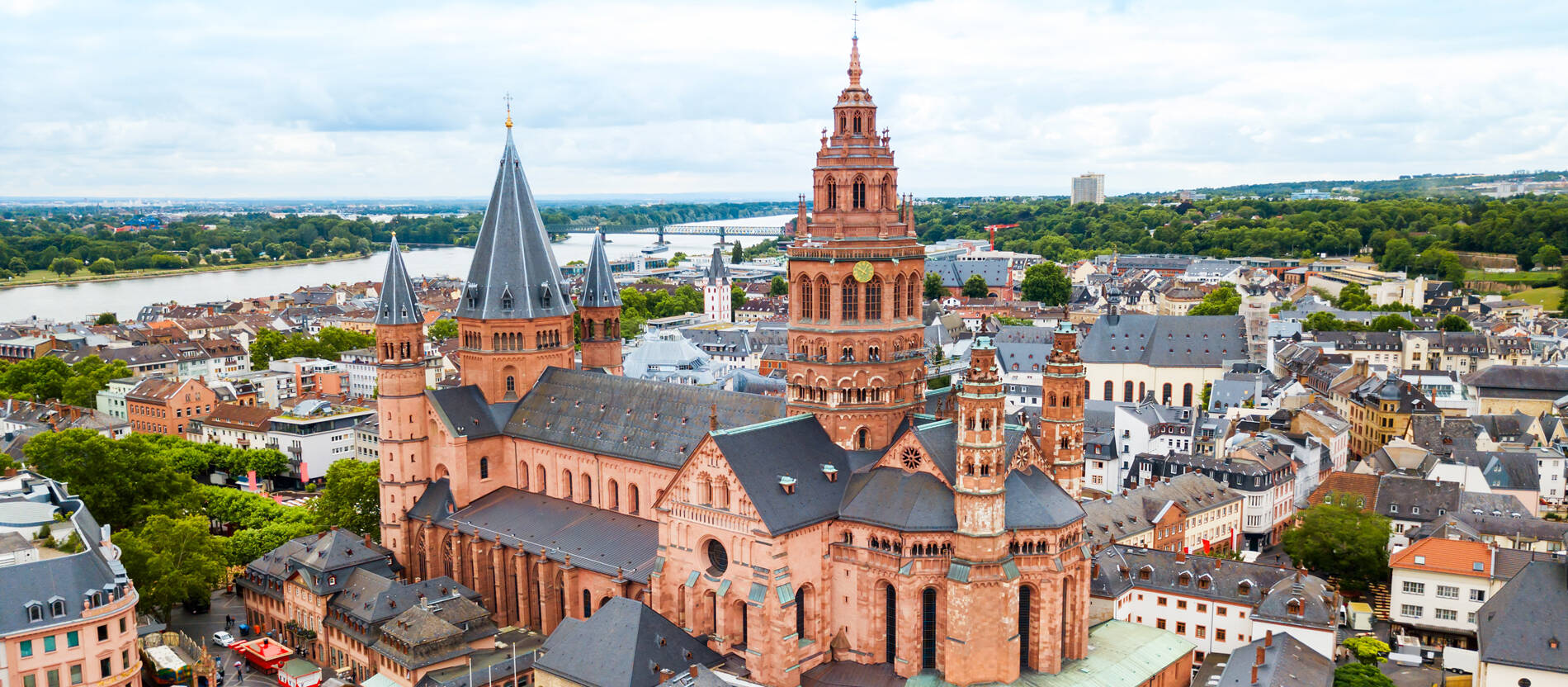
@IsakWold I don’t know where exactly to provide feedback, so I do it here and I hope you can maybe forward it. In my hometown Mainz, the capital city of German State Rhineland-Palatine in MSFS there is a train bridge over the Rhine missing, 49.99157163289568, 8.2937641070065 coordinates. And, which is more important, the Mainz Cathedral 49.999061995638236, 8.273902682921527 coordinates, which is 1000 years old, and also a big point of interest, is represented as a 2D texture and can’t be seen. The third is the beautiful Theodor-Heuss-Bridge, which connects two states Hessen and RLP and the cities Mainz and Wiesbaden over the Rhine is very ugly, coordinates 50.006727103481815, 8.276770388592395 in the sim. And last, the Mainz Bundesliga Coface Arena Soccer Stadium, 49.98410974710551, 8.224413784912029. Mainz is directly located under the approach lanes to the Frankfurt Airport and just 20 minutes away by highway, so it makes sense to make the important points like Bridges and the Cathedral. Maybe also the Biontech Building in Mainz ![]()
P.S See Screenshots! and the real ones for comparison.

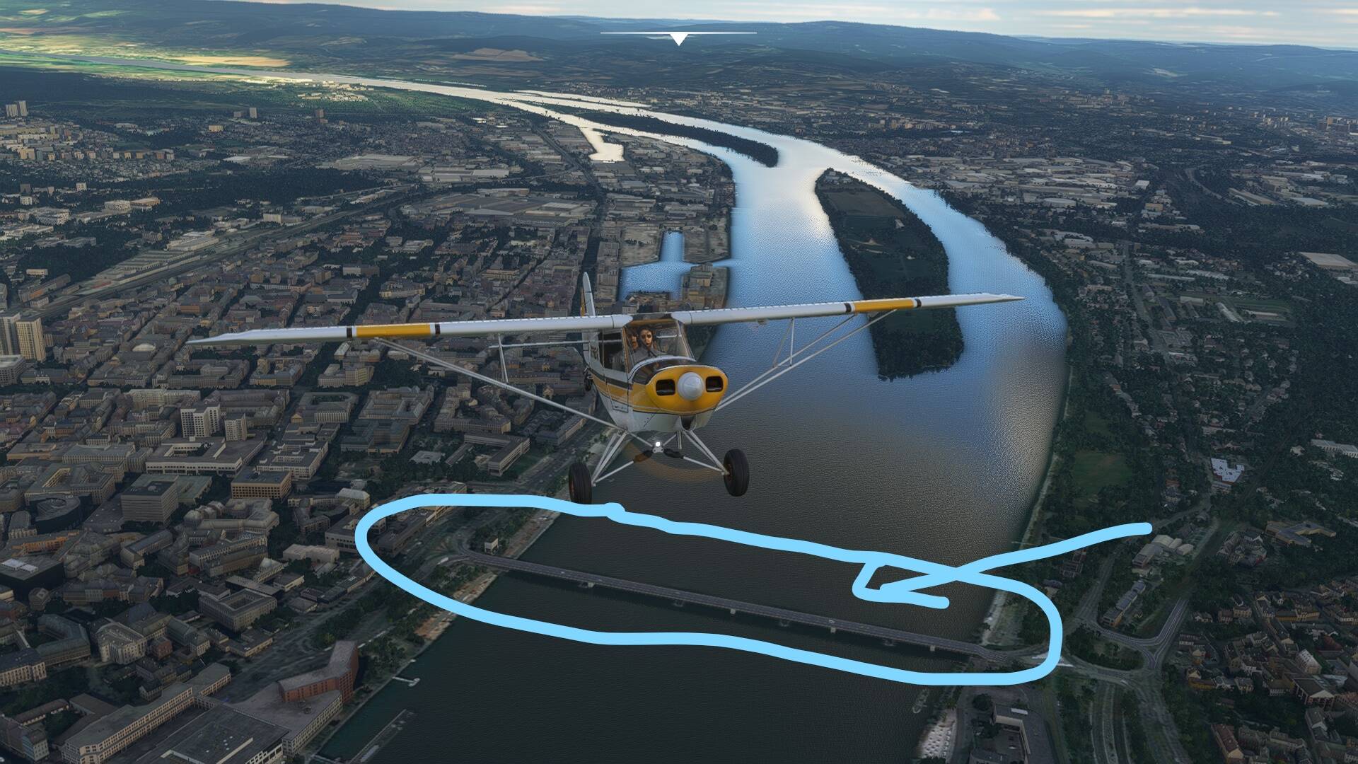
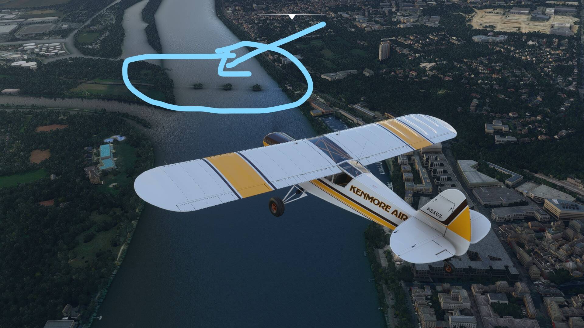
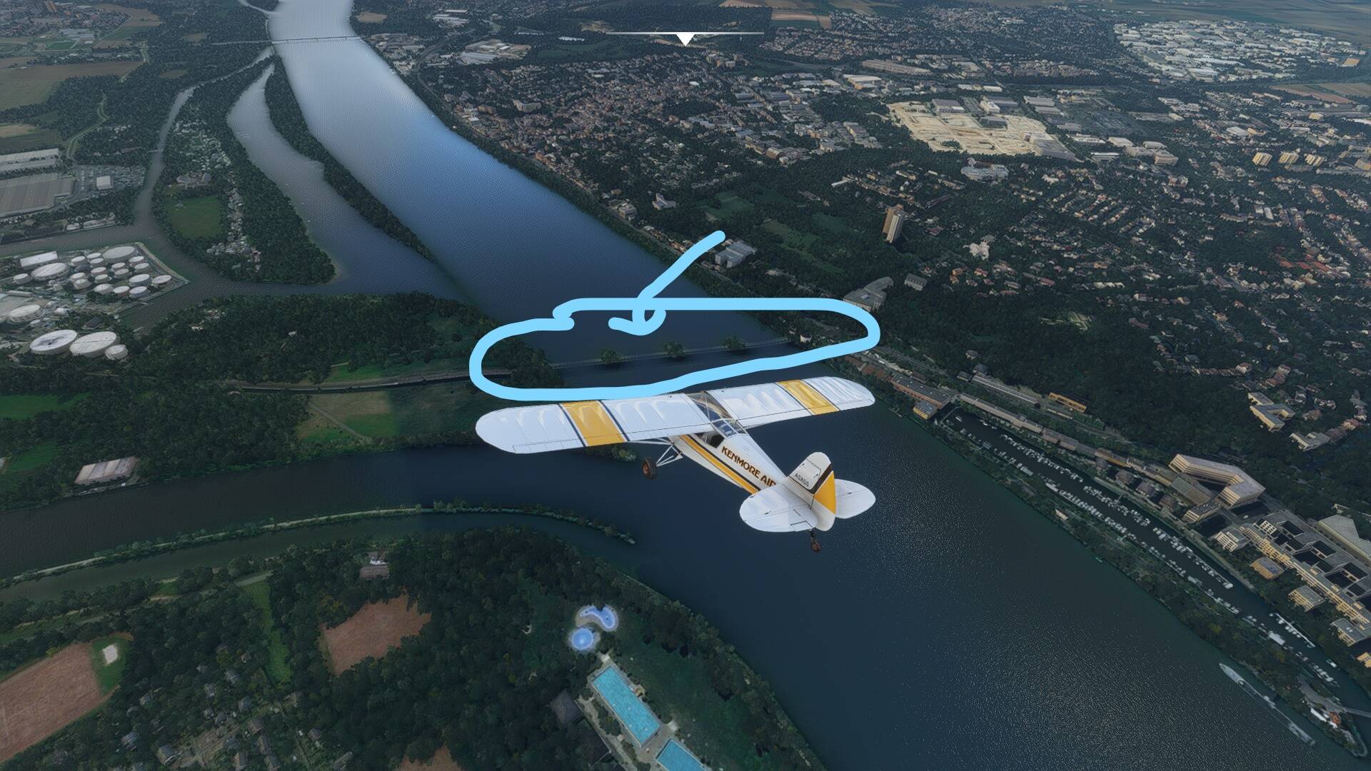

Those are not “bugs” per se: that’s just the current limitation of the “AI generated buildings/algorithm”.
Especially bridges are prone to go “underwater”. It pretty much all depends on the quality of the “input data”: satellite images, open street map data, other sources…
So unless a human manually interacts and corrects the generated data that’s just how we have to live (fly) with it. Only general AI generation / classification improvements will help sort those “glitches” out in the future…
On the other hand: we should all be very happy that our world is still a wee bit too complex for a simple AI algorithm to recreate everything perfectly ![]() We do live in an imperfect world with lots of “irregularities” - such is life
We do live in an imperfect world with lots of “irregularities” - such is life ![]() /philosophical_mode_stop
/philosophical_mode_stop
2 Likes
Whilst I love flying in Europe it will be good if they spread the updates around the world, south america, caribe, africa, asia or oceania would be great as well. Nordics and now Germany and neigbours (no offense here) are a bit the same to fly around for non eurpean based simmers.
We have the whole world to explore but there is probably a commercial reason as most simmers may be located in those areas.
2 Likes
yup - the auto gen seems to have a consistently bad time doing churches and train stations… also, it gets water treatment plants wrong as well, too ![]()
To be honest, I don’t think it’s (only) a “commercial reason” - as in “where are most of our clients located” - behind this. Or why else would they have started with Japan? (And I have absolutely no clue, it might as well be that Japan has the “highest density of flight simmers” - so no offense taken here ;))
It’s probably more a “low hanging fruits first”, as in "where do we get the (cheapest) highest quality digital data first. First off all, where is it available in the first place (Europe is known for a “high quality data coverage”) and second, how much do we have to pay for it. Given that the Swiss government decided just a year ago that digital geographic data is now “free to use” might (or might not) have played a factor in the decision of “what is next”.
But yes, I agree, there is a bit of a “geographic lockdown” right now ![]()
UPDATE: cheap - why is c-h-e-a-p on the index? And why geographic? g-e-o-g-r-a-p-h-i-c?!
3 Likes
I am “super happy” that my hometown Lübeck is onboard (Holstentor) together with the airport!
UNESCO World Heritage!
Thank you Asobo (Jörg!?)
If it is too long for you folks to wait:
https://de.flightsim.to/file/1479/lubeck-luebeck-landmarks-mini-pack
1 Like
Wait, what? That’s like saying flying in NY is the same as FL… I didn’t know the Nordics also had one of the biggest mountain ranges in the world
I live in Norway, and am I bit confused, there is no way you can’t see the difference of Nordics ![]()
![]() , and Germany
, and Germany ![]() . I can understand that Denmark is similar, but, Norway? Sweden? No no no
. I can understand that Denmark is similar, but, Norway? Sweden? No no no ![]()
![]()
Its funny but the closer you live the more differences people live there see. This happens all over the world, even counties will say that they are totally different, my point is that is a very close proximity area, UK, BeneLux, Nordics, now Germany, austria… too close (kind of 80 minutes flight radius)
My point was that I would love to see something really different, Africa, south america, India, Australia… thats the real point. For the non local eye the countries, styles, architecture is sort of the same. I remember travelling from belgium to holland and then denmark and it was hard to notice the difference, but I understand that for locals is a whole world apart ![]() again, no offense here!
again, no offense here!
Well, Germany update will be, lets hope the next one moves a bit further.
Happy flying!
This censorship of normal non-vulgar words is ridiculous. I had words such as scrolling mouse censored the other day, but now it works just fine. It is random.
This will be my comment when Australia gets some love. Hopefully I’m not waiting until 2025 to post my comment.
Lübeck is my home town, and essential for the MSFS ![]()
Well, at least we got good coverage then. As someone who primarily flies in Austria, Switzerland, Germany I appreciate it. ![]()
Too close? Just 80 minutes flying time? Tell a resident here that the area around Innsbruck (I live near LOWI) is similar to the area around Hamburg, and you may be in trouble. ![]()
There is already at least a couple of free DEMs for the Swiss alps. I think one of them goes up to about 1m resolution in some areas. The Matterhorn and the area round it looks spectacular, completely realistic. What really lets down the look of the sim more than anything now is the low quality of the satellite imagery coming off Bing maps. Its truly terrible for some of the swiss alps.
Bing really is the weakest link in the chain for the look of the world of FS now. If Bing had the quality of satellite imagery that Google Earth does the sim would look utterly spectacular. I know Asobo have said there are big improvements planned from the Bing side of things but I’d be interested to know a bit more about that, like when its coming.
4 Likes
It depends on the region. At some parts Bing is way better than Google and vice versa. Google has very bad areas aswell. Also Jorg mentioned the goal is to have 7cm res images over the whole world somewhen down the road when better data is available.
2 Likes
With the DC-6, the coming Ju-52 and the hopefully coming DC-3 having a more detailed Tempelhof airport in Berlin would be nice…
3 Likes