That’s very helpful, thanks for resharing this! As I was happily enjoying 2020 up until su16, and only joined the forum when it so drastically lessened the experience, I had not seen this personally.
So if I’m correct in my understanding it does give some clarity as to cliffs having such an impact from su16, being only one of the many areas downgraded with su16’s release but a very obvious one. Am I correct then that Asobo aligned aerials and elevation data, but “cliff mapping“ not being updated as it noted here is the reason why we now have the aerials smeared down cliffs?
But thank goodness the didn’t port over crop fields, they look atrocious in 2024! Small mercies I guess!
Genuinely hilarious. Choosing to stay an iteration behind and then being upset when the latest updates don’t come to you is one thing, but to claim it’s ruined America’s 250th anniversary is so over the top it has to be an attempt at comedy… right?
I’m actually a bit skeptical about this theory, as most of the latest City Updates and latest World Update Australia, which are available for both fs20 and fs24, already cover an extensive bunch of countryside having a diverse range of DEM variation as the latest fs24-only World Update US. Accordingly, the developer also started to officially call them Areas of Interest as opposed to previous term of Points of Interest.
I believe they’ve always made a distinction here. POIs are specific things like, for example, a visitors center for a national park which is handcrafted. AOIs are typically more photogrammetry based and are large areas, like the national park itself.
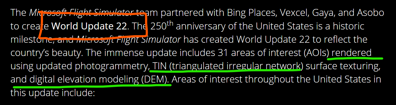
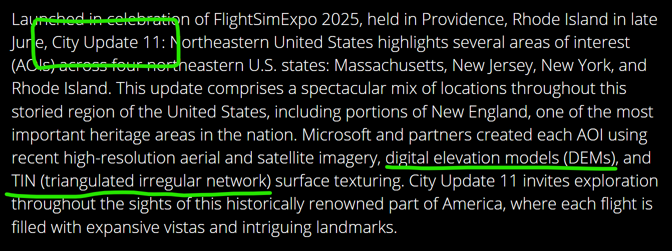
DEM (Digital Elevation Model) was used in in MSFS 2020, and I believe this is also compatible with MSFS 2024. However MSFS 2024 uses a new elevation model called TIN (Triangulated Irregular Network) that is much better at representing cliffs, edges, and other sharp elevation changes. Because many of the "areas of interest’ in WU22 center around mountainous areas, this update (for the first time, apparently.) consists of many upgrades to TIN areas. This apparently means that it is impossible (or maybe labour-intensive) to produce a version of the update that is compatible with MSFS 2020, so we miss out.
This update also contains many separate handcrafted Points of Interests (POIs) which are typically buildings or landmarks that ARE compatible with MSFS 2020. The POIs incude include visitor centers, resort buildings, historical forts and castles, observation areas, springs etc. that could also easily be included on top of the MSFS 2020 DEM-based terrain if the effort was made, but it wasn’t. So we miss out this time, and worry that we may miss out on more updates and POIs in the future.
yes, AOIs are meant for vast areas covered in TIN, especially countryside regions outside of specific urban areas, while POIs are rather handcrafted pieces of 3D-modeled landmarks.
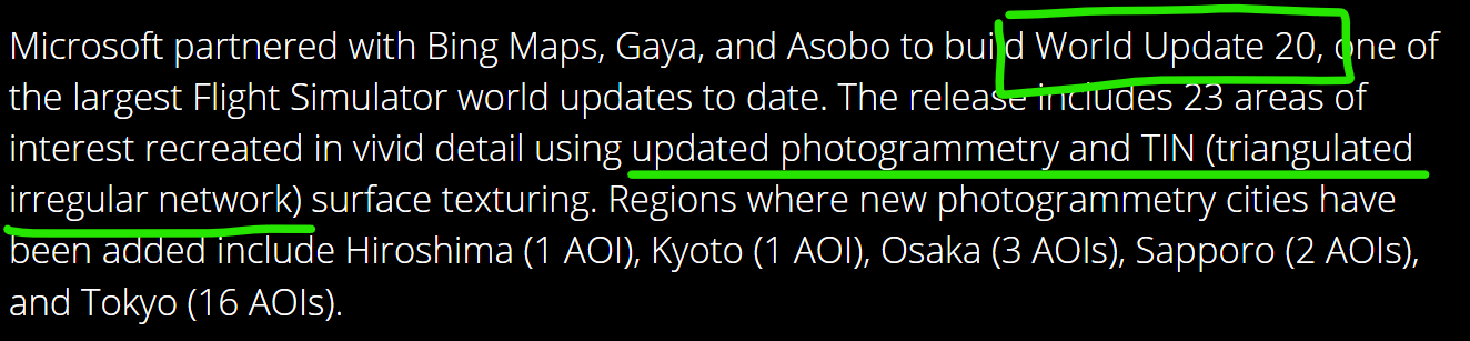
Well, TIN has always been in the sim since day one with MSFS2020, specifically for urban areas while also having some extension towards the outskirts of towns or city centers. The dev started to use it extensively for countryside in MSFS2024 with Grand Canyon showcased on launch, that lacked a presence in MSFS2020. We also had the chance to experience similar use of countryside TIN, for instance, with TIN coverage for greater metropolitan Tokyo in World Update 20: Japan for MSFS2020, too. Therefore, I reckon it’s more of a marketing thing rather than a technical handicap of MSFS2020 to not cover the latest countryside-TIN-abundant World Update 22: USA for MSFS2020.
Well, that has been the (unofficial) response in these forums, that the use of TIN in WU22 was incompatible with MSFS 2020. I’ve been asking for an ‘official’ response for why MSFS 2020 is excluded from WU22, but so far nothing.
Microsoft Flight Simulator 2020 is excluded from World Update 22 (United States National Parks) because the update relies on highly detailed TIN (Triangulated Irregular Network) photogrammetry. This advanced terrain-scanning technology is only available in MSFS 2024 and cannot be supported by the MSFS 2020 engine.
MSFS 2020 does not have the technical baseline to render this data
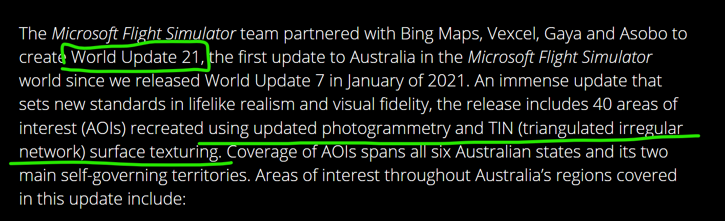
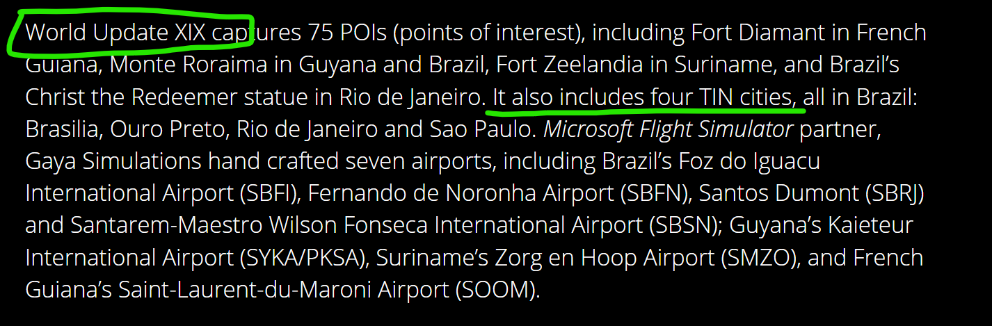
@Pilotfirst9999, first, I’m curious where this detail is officially documented. I was beginning to accept it at face value until @aloofPilot5634’s comment above. Now I’m doing some digging of my own, and the previous WU21 ALSO mentions that it contains “…updated photogrammetry and TIN (triangulated irregular network) surface texturing” and that update IS available in both MSFS 2020 and 2024, and was released in May of this year. The same with world update 20 (Japan - released September 2025) and world update XIX (Brazil - released March 2025) all of which were released and available for both MSFS 2024 and MSFS 2020.
So obviously the fact that a World Update package contains upgraded TIN areas is NOT by itself a reason to exclude it from MSFS 2020, or WU19, WU20 and WU21 would ALSO have been excluded from MSFS 2020. So the question remains, why is WU22 not being offered in MSFS 2020?
At this stage, I’ll only accept a response that comes from a moderator and/or links to a Microsoft or Asobo statement about why this update is not compatible and/or not offered for the MSFS 2020 platform, since the techincal aspects included in the description for WU22 are not any different from the previous three demonstrated above.