I love this game! I bought a brand new gaming machine specifically for Fs2020. But I feel flight simulator is as much a flying simulation as it is a world simulation. It is meant to give you the feel that you are exploring the world whilst riding in super sweet aircraft. So when I fly over a lake or ocean where the coast lines are straight lines and in some cases nearly a mile away from the actual coastline in the sat imagery, it just completely destroys immersion. I mean, I can not even tell if Asobo is working to fix it. I have found these errors globally, and a huge amount just right here in Oklahoma with area lakes and rivers. And this was even after two updates ago when it said watermask was updated to the latest data. That must be some really terrible data. It doesn’t match with the image of the body of water at all in so many areas. I would just love to know that fixes are in the works. I am only getting a run around with zendesk… I can’t even find a link to submit a ticket anymore. I would fix it myself and release it for download if I could find the files for water bodies and ground imagery and also watermasks
If you do want to submit a ticket, look at the top of the page, and click “support”, then click, “submit a request” in the upper right of that page. Then just follow instructions and fill in the blanks.
Regards
Hi there!
There are some topics on this.
(228 votes):
https://forums.flightsimulator.com/t/water-image-quality-has-degraded-since-1st-release/301380
Or a search on “water” in Bugs & Issues:
Search results for ‘water category:200’ - Microsoft Flight Simulator Forums
The forum uses votes to bring issues up. When a duplicate topic is created, it splits those votes and we can not move/merge votes between topics. Could you have a look at any of the existing topics that has the same issue you describe and let me know?
Thank you!
The problem is with the source of the water data, the set of polygons FS2020 uses to draw water. They are very low detail in many places and sometimes just a single line for rivers.
For example
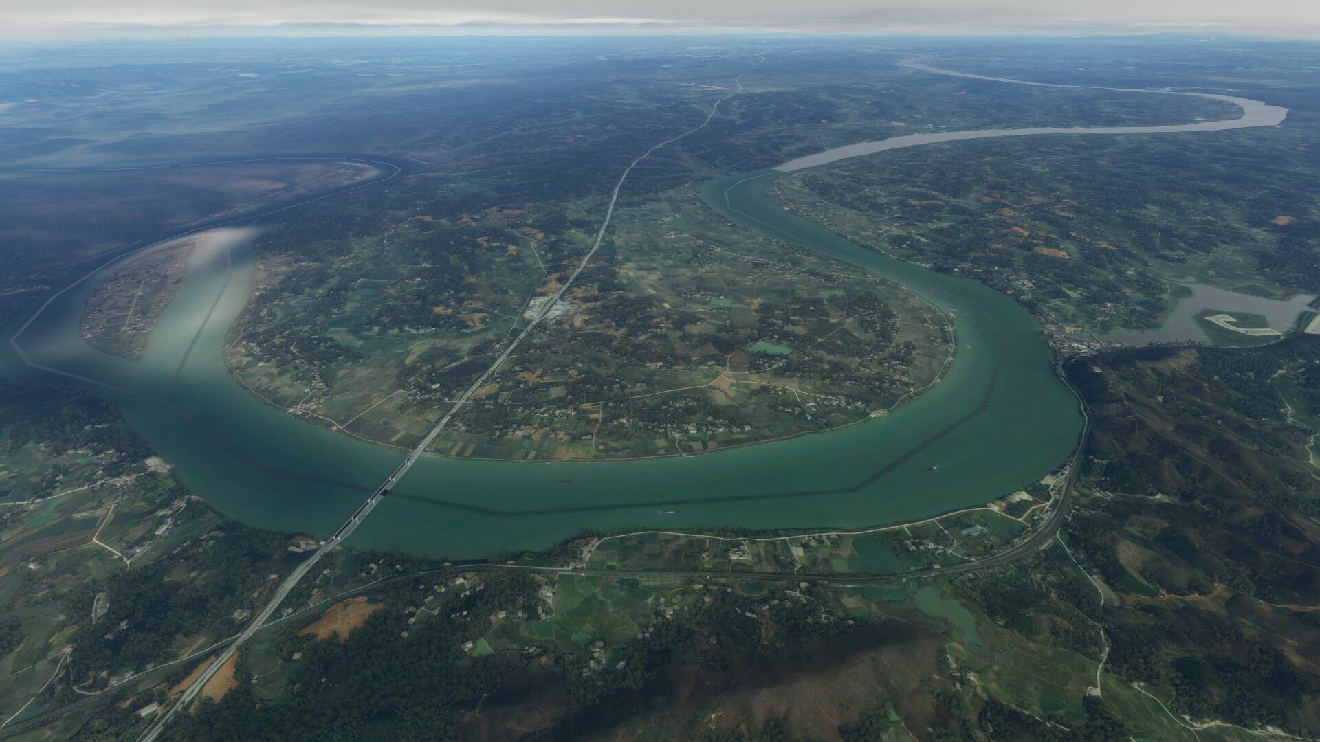
The polygon data set is from a different time than the aerial data as well. Rivers shift and swell, seasonal lakes are only around for a short period per year and tidal regions change every hour. The current polygon dataset will not work, at most the AI could use it as a hint where water is and trace the outlines on the map data to create a set that actually fits.
The closest related topic I could find is this
I can’t find anything about the actual polygon data, which sometimes is just better if turned off. (So it doesn’t cover the colorful dry lakes in Australia or draw a blue line through the middle of a perfectly fine looking river on the aerial data)
It’s a fundamental design issue. The water polygon set is meant for abstract maps, the one you see in the G1000 an vfr map.
Totally understand. I feel like they need to implement a completely new data set and rework the algorithm to recognize shore lines and coast lines more correctly. I believe it can be done. I just hope Asobo is on it for the next or upcoming updates… Because looks horrible in a lot of places and worse Tha FsX in some cases
Hi… No these aren’t the issues I am talking about. I am talking about the water polygons matching up with the satellite data… The water mask. Not the quality of it… On my end waves and reflections look amazing… Just irritating in the places where the reflections stop and you have a bare line near the shoreline. It is a major detractor and they made it worse with previous updates than it was in the beginning
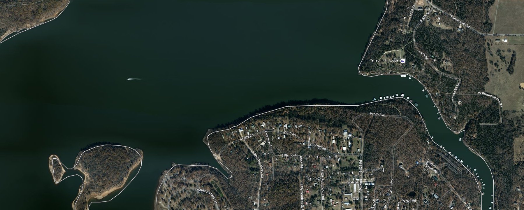
Posting an image of what @Woden1976 is posting about. 
@Woden1976 when you get some pictures, could also post yours?

With a different light - appears to be sandbars.

Bing Maps do show some black along the edges due to shadows from banks and trees.
I’ve also modified your topic title.
I highly recommend you review the Developer Q&A’s.
There are many issues around this topic, from watermasking, improper placement of water up hills, rivers 300 ft above the terrain, depth of water at shores, ability to allow planes to travel across from the shore to the water and back, ability of planes to not crash with their gear down in the water prior to driving up on the shore, and many other issues.
Asobo is working hard to address all this, and they discuss it often in the Developer Q&A’s.