In the new update, when contacting ATC, Instead of hearing Ronald Reagan International, I hear the same but in NATO alphabet, which is both funny and long.
Probably more realistic since no controller would dare call it “Reagan” 
2 Likes
LOL Especially some EX-Controllers !!!
Thats an Edit for the ATC Language file
or calling KBWI " Baltimore/Washington International Thurgood Marshall Airport*" !!!
Yeah, that’s been like that since Patch 2 when they introduced the new voices + extra brain damage to the already retarded ATC. It happens to a lot of airports. It’s really painful for when it’s spelling out airports like MACDONALD-CARTIER INTL AIRPORT or PIERRE ELLIOTT TRUDEAU INTL AIRPORT
I think its the ALL CAPS that does that
Medway = Medway
MEDWAY = MikeEchoDeltaWhiskeyAlphaYankee" all in one word !!!
and the infamous “Foxtrot Tango Worth” & “Sierra Tango Lukes”
We have all jokes about this since the day MSFS was released – all it would take is an Intern, a morning to go through and fix" !!!
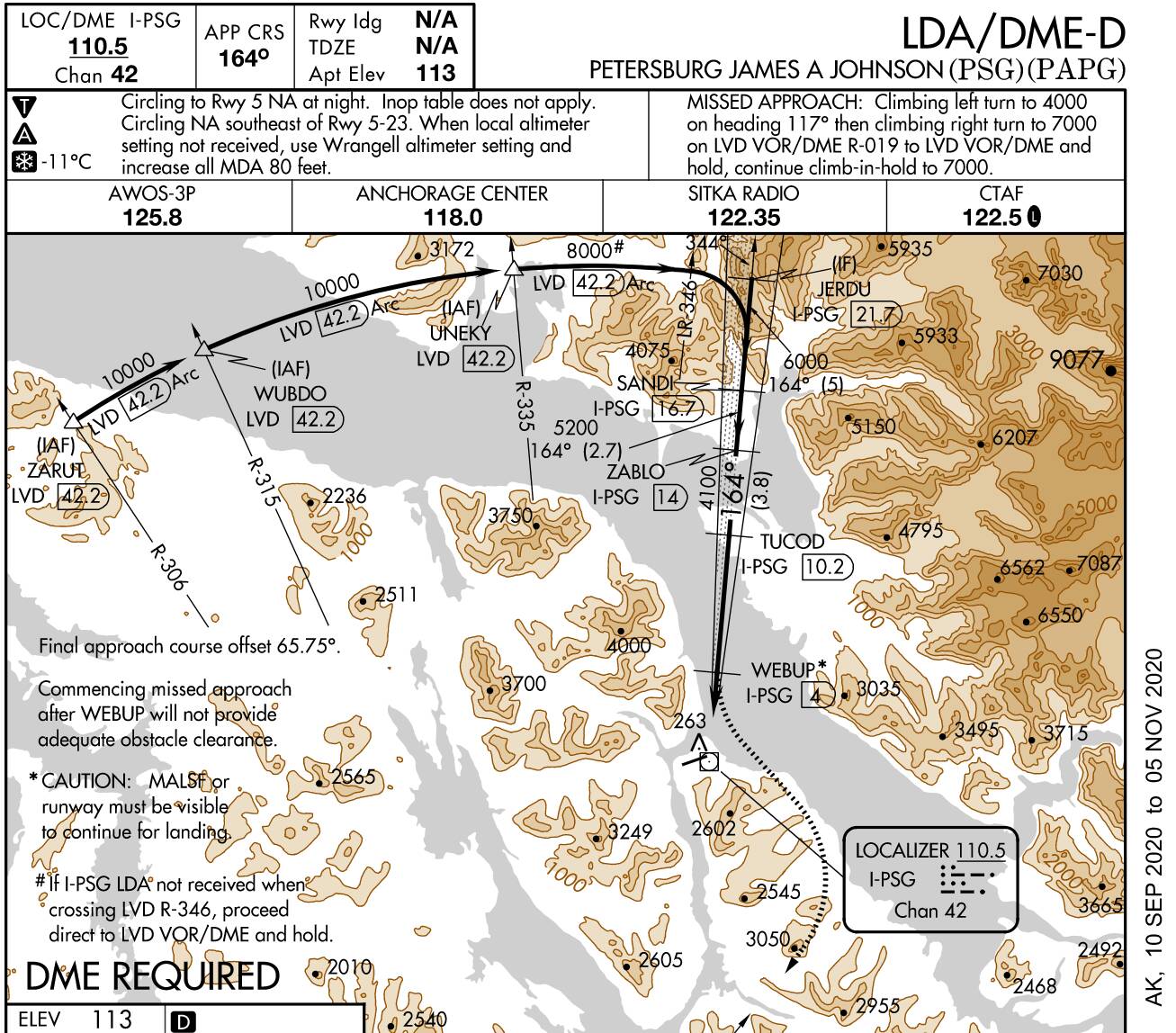
More importantly, if this airport is now a detailed, hand crafted airport, have they fixed the alignment issues with LDA approaches?
No, you are still going to get BUSTED for flying over the White House !!
(The Rnav for 19 is, and always has been correct)
Now, if you want to GO FOR BROKE, and guarantee to loose your Pilots License, try the LDA Z 19
That take you over BOTH the Washington Monument as well as the White House !!!

All joking aside, you would have though that while creating the KDCA airport, it would have been the ideal time to fix these ridiculous LDA approaches …
Its not as if there have been no ZenDesk tickets filed, or it has not been discussed at some length here on the forum.
That’s too bad. I’m definitely getting fed up with the focus on visuals & scenery. Especially when there is still so many more important things that are wrong or broken. Oh well…
Well, you can still fly it “Old School” with the Approach Plates !!!
Thats much more fun and challenging in any case… especially down to minumums, on a dark and windy night !!!
No you cant! That’s the problem. The actual ILS/LDA signal is wrong by 40 odd degrees. It should not be runway aligned!
Its not … maybe you are flying the back course for runway 1 ??
The LDA localizer is correct … does not have a Glideslope. you have to let down at the fixes.
So what you are saying is Asosb have fixed the sim wide bug that means every ILS/LDA signal is runway aligned? I hope you’re right, but from earlier comments and the screenshots above, I doubt it.
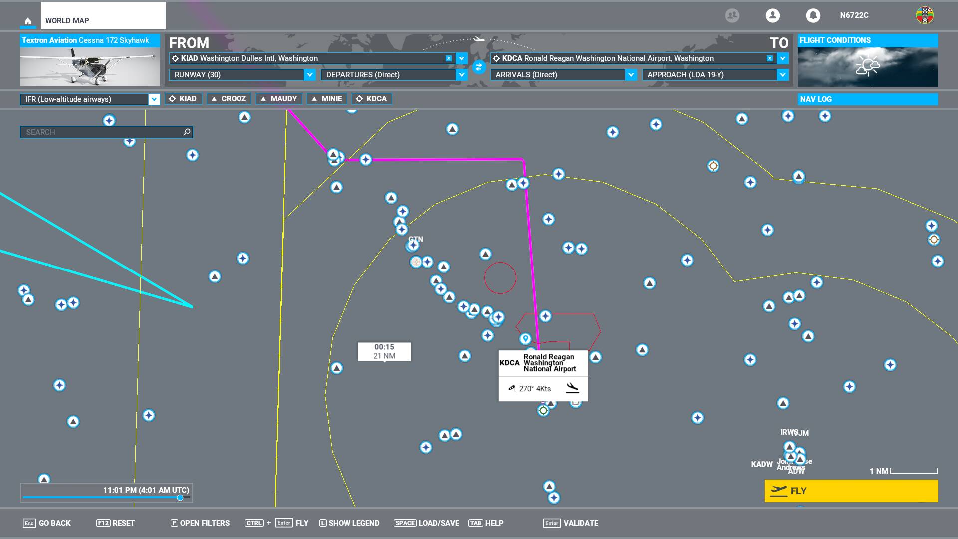
The screen shot shown the Flight plan, which is basically a GPS flight plan,
That flight plan goes off track, turns east, and then south to runway heading. (CRAZY Stuff)
But if you are flying, even GPS at the start of the approach, and have the nav radio tuned to the LDA 18 localizer, and switch to NAV / Approch, it will keep on the localizer, and take you in as if towards 15 . Then at 4 DME ? you circle to land on 19
It always been like this from release, they have changed nothing.
That’s interesting, because there have been a lot of posts indicating otherwise.
https://forums.flightsimulator.com/t/all-lda-approaches-in-msfs-do-have-wrong-loc-headings/311184
Even Navigraph have said there is nothing they can currently do to fix the problem. Yet you say the problem have never existed?
The problem exist in the MSFS GPS Flight Plan generator, and the MAP.
The Nav items, VOR, ILS, Localizer dme, are all Correct.
To be blunt, its 99% not understanding what a LDA is, and expecting the GPS to fly the plane for you, all the way diown to the ground.
1 Like
There may be thing wrong in the sim, in MSFS, or the Airport database, that is causing the MSFS Flight Planner t o plot that strange, straight in approach, but if you fly the LDA Localizer, using the nav radio, it is all correct…
If you have LittleNavMap, look at it, when it is getting its data from the MSFS database, Its all CORRECT.
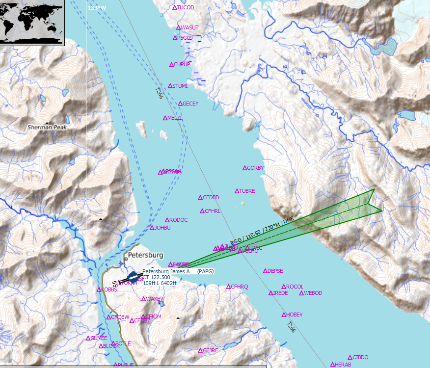
How it looks in reality:
How the Sim data is presented:
Different example I know, I can’t check DCA at this moment. I hope you’re right.
I am VERY familair with DCA and the LDAs here !!!
Flown them literally 100’s of time.
I am right…
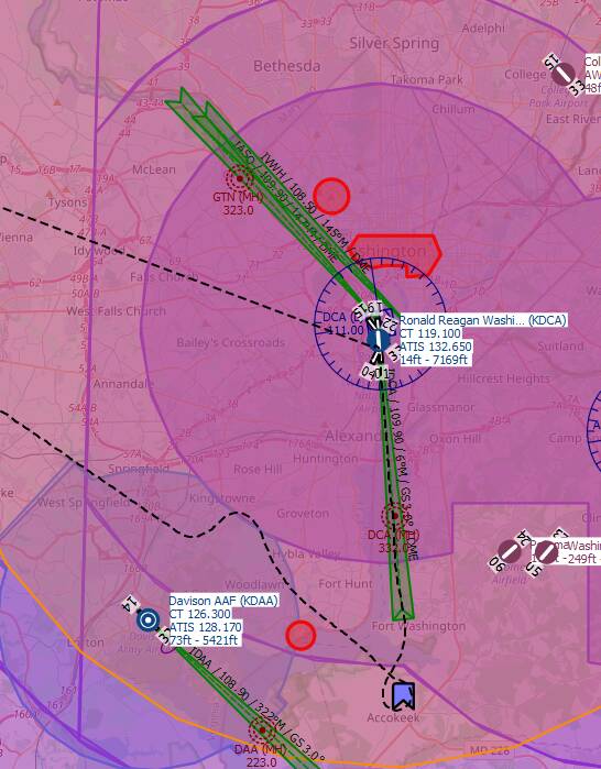
Little NAV map using data from MSFS’s airport database
Those are the two LDA 19s : LDA 19Y and LDA 19Z
