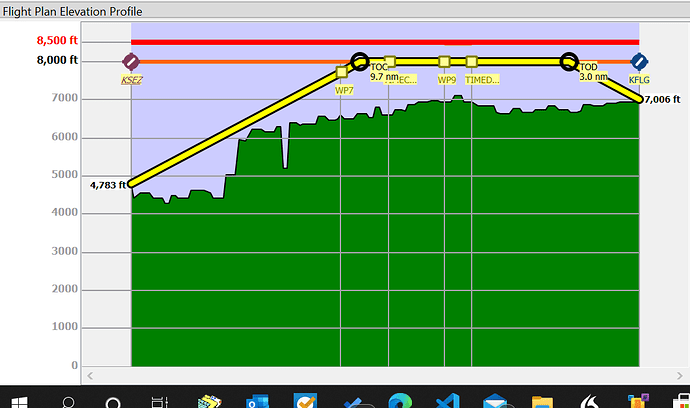
Just to illustrate what Little Navmap can add to one’s understanding of a flight, here’s the elevation profile of a flight similar to that in tutorial #7 from Sedona, AZ to Flagstaff-Pulliam, AZ using the default aircraft performance profile supplied for Little Navmap and importing MSFS 2020 scenery, airport data but using the built-in Navigraph for procedures, offline Globe data for base elevations. TOC is top of climb, TOD is top of descent. Perhaps if I actually flew the route, I wouldn’t come as close to the ground on my climb as I did from just picking a route on the map ~the same as tutorial #7.
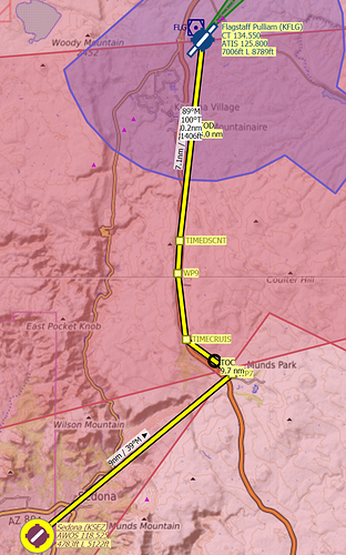
Here is the route corresponding to the elevation profile and ~the same as advised in tutorial #7. One can zoom in on the map in Little Navmap and see elevation contour lines at a high level of detail.

