Hello Pilots,
“Carte VFR” or “VFR Map” is a small mobile navigation tool for French Pilots.
https://play.google.com/store/apps/details?id=org.ssandon.viewer
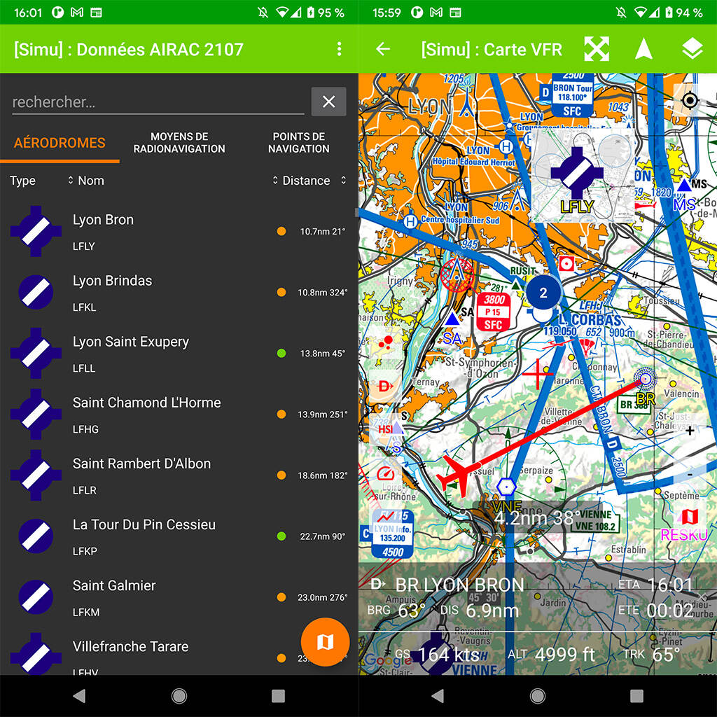
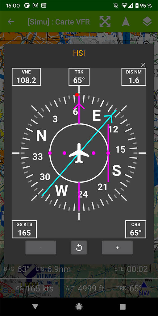
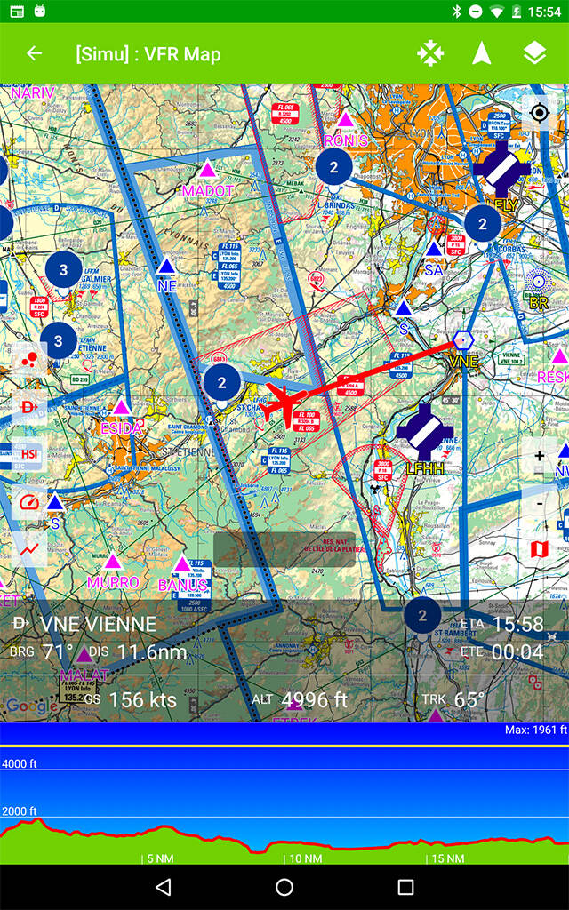
2 main screens : data and map
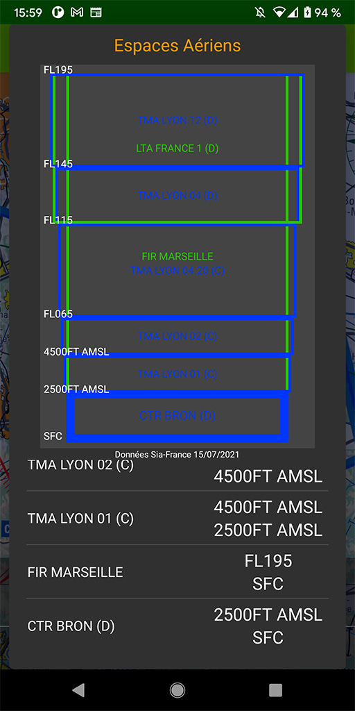
The application use French SIA data like Maps (1M & 250K), Approach & Landing charts and follow AIRAC Cycle.
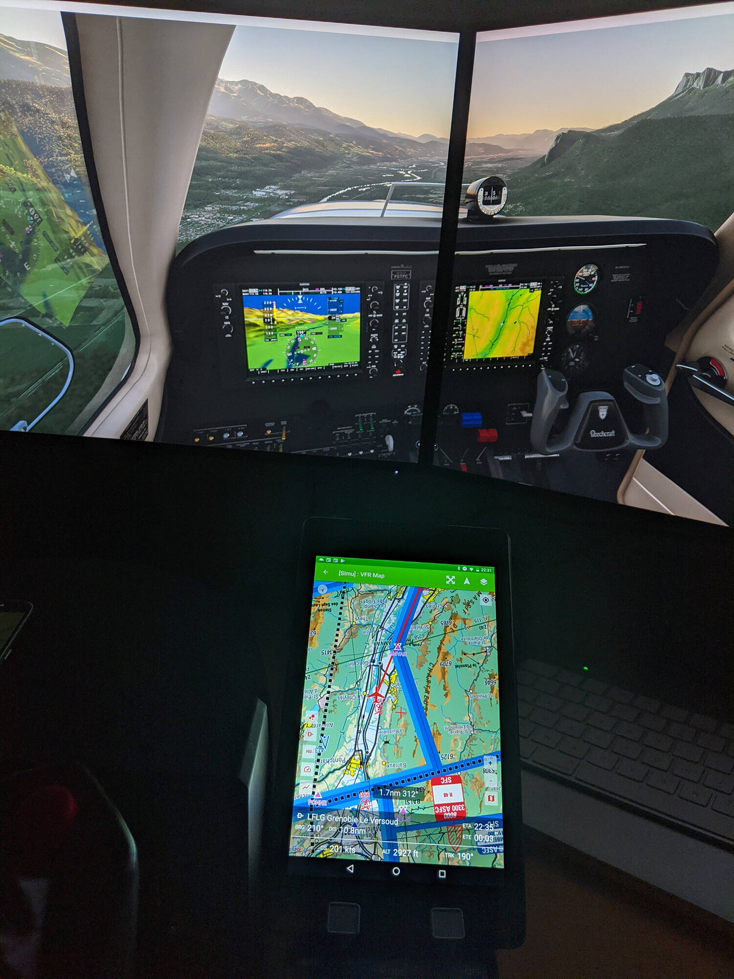
In normal mode the application works with the GPS and could work offline, but it is possible to link the application with MSFS_MCA and use it as if you were in the plane.
Regards
Stéphane