This has been very well documented, actually from the very beginning. The issue is listed in the developer road map but there seems to be a misunderstanding as the developer comments note continuous updates with world updates. It appears the issue is the LOD textures streamed from Bing Data are lower than what is currently available and then a step degradation is further implemented with an increase in altitude.
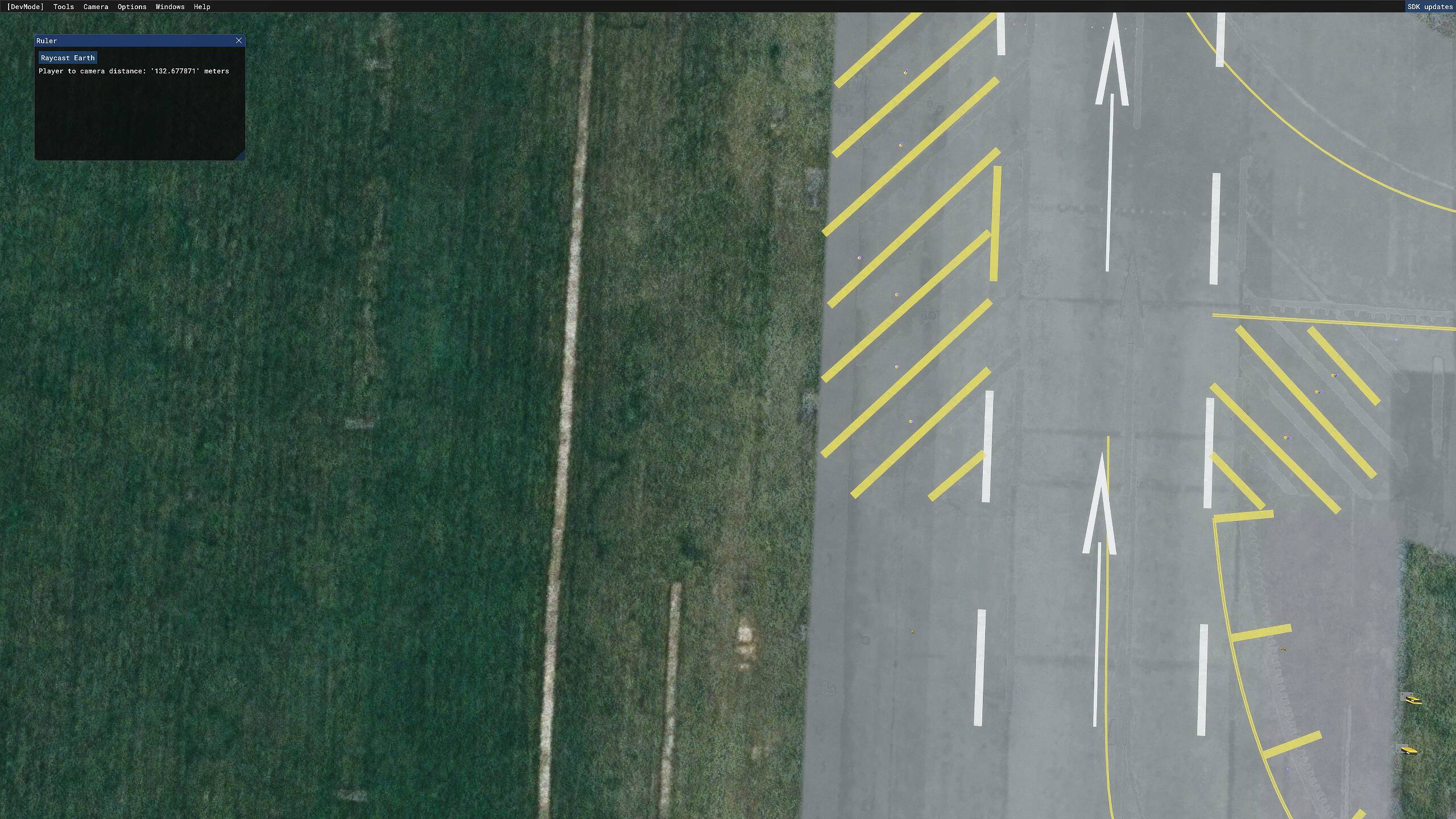
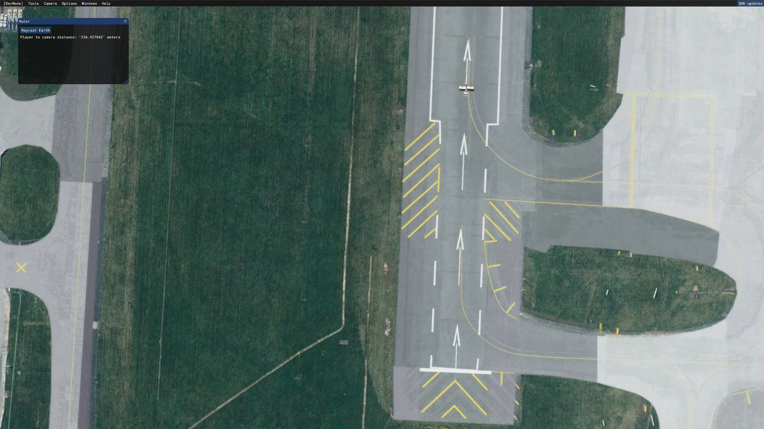
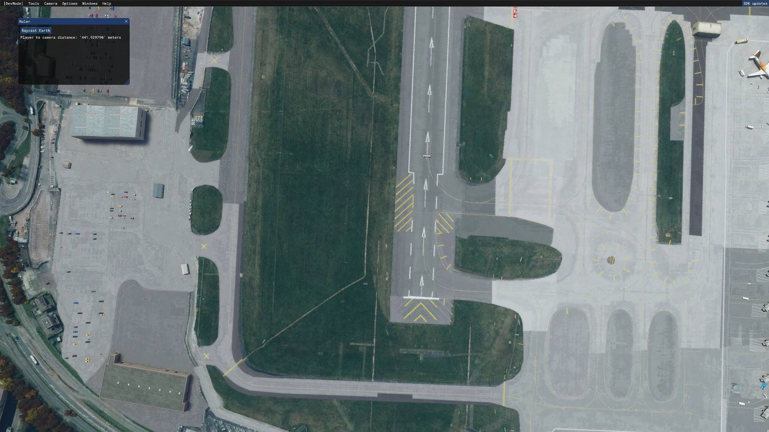
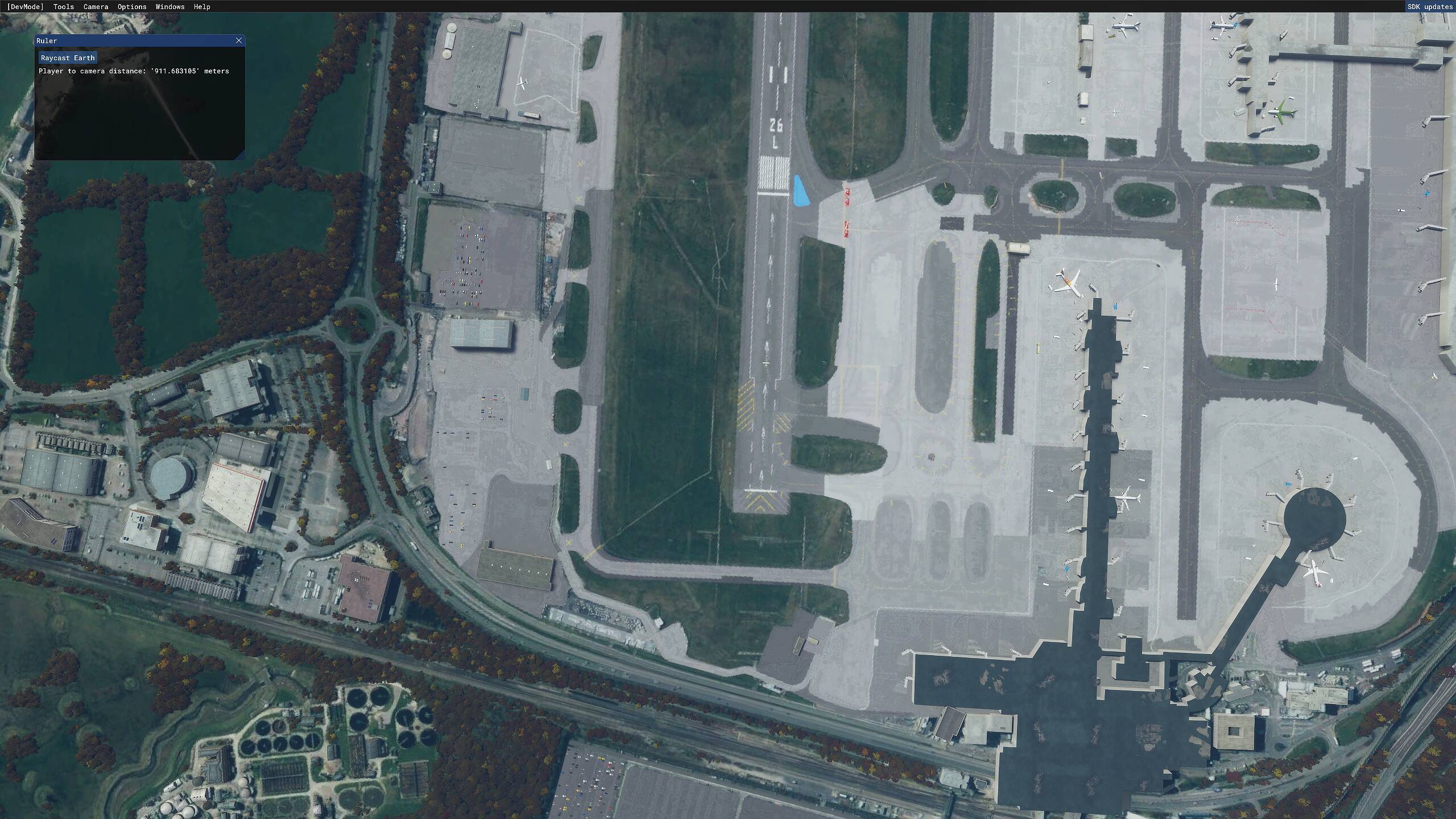
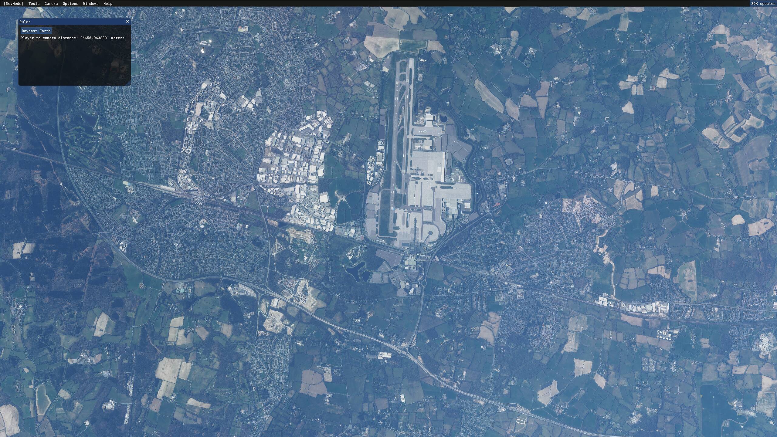
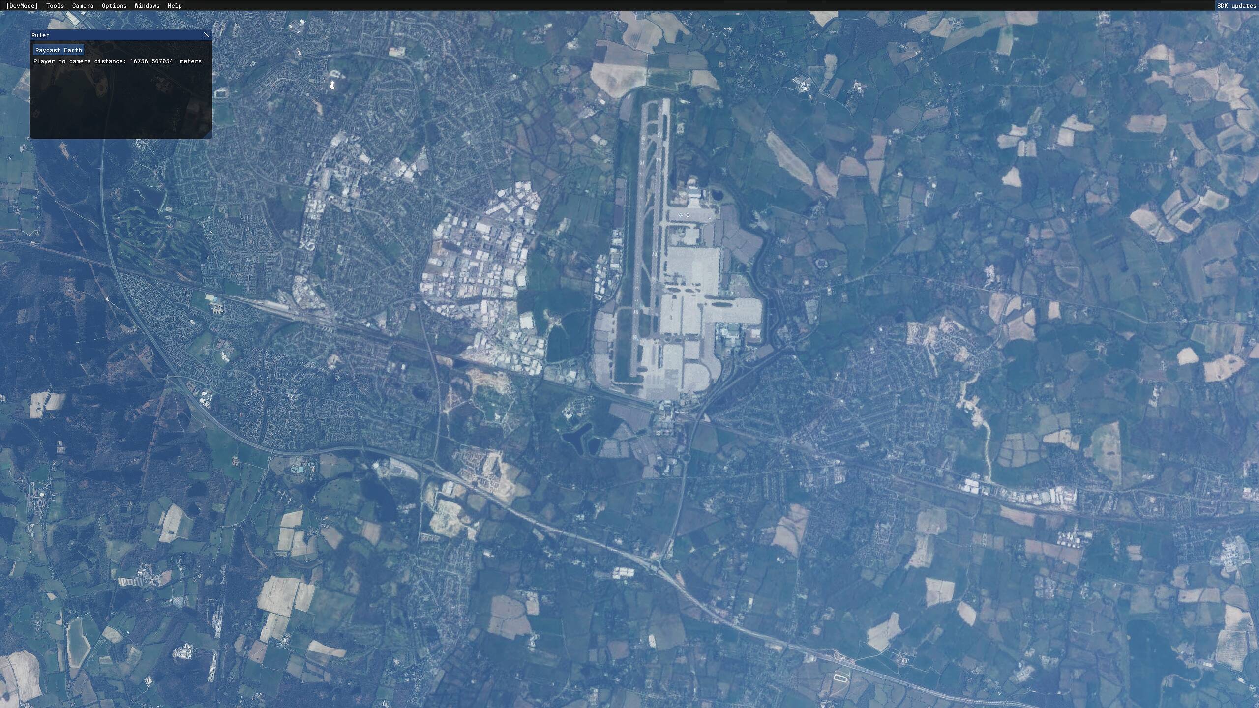
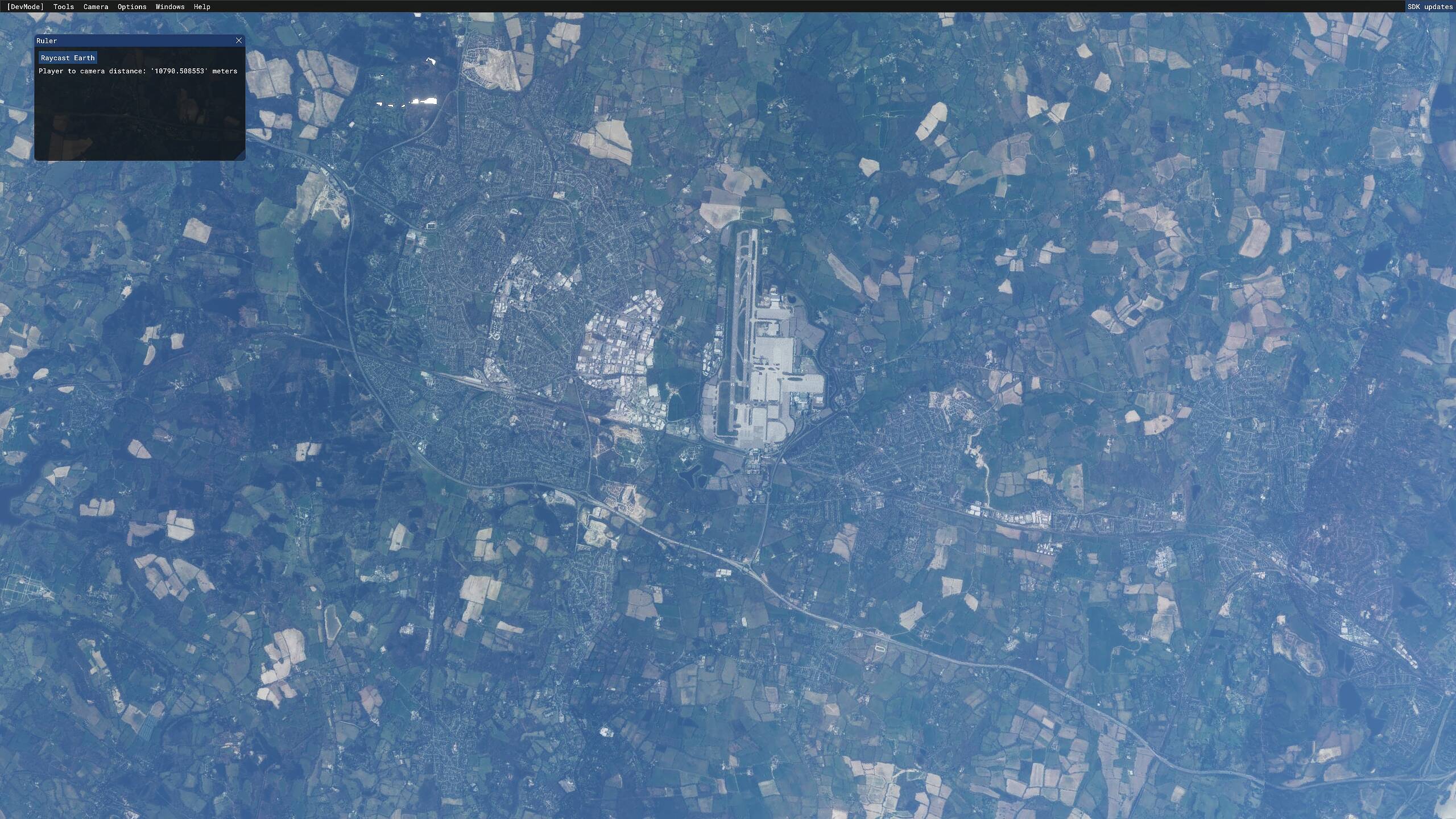
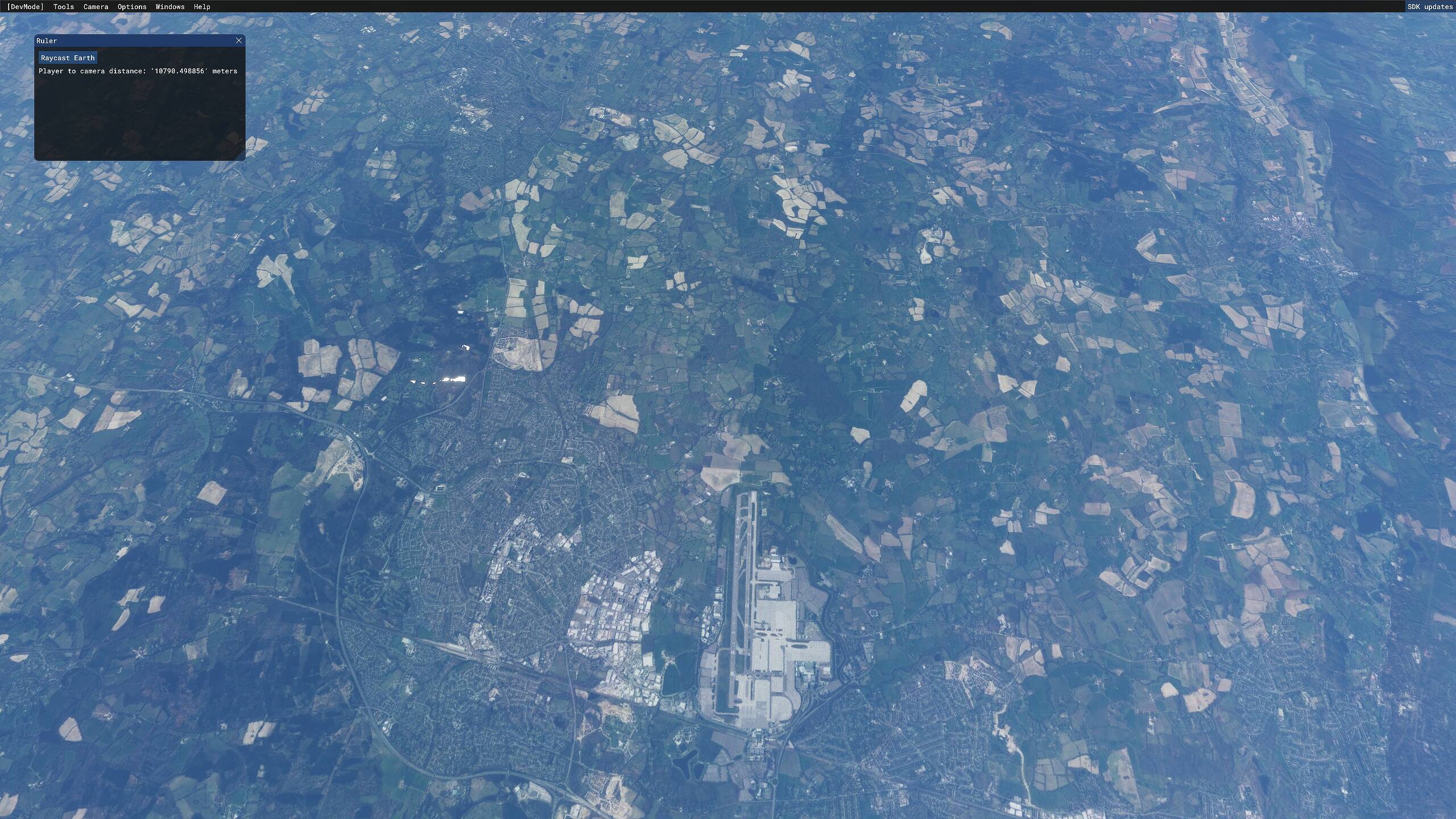
Fire up a flight and enter drone camera mode and set a top down view. Start zooming out/increasing altitude, there is a ruler function in dev mode that shows your altitude in meters. You’ll notice a step degrading of textures as you increase altitude (through very distinct altitudes), once you reach an altitude of about 8300 meters the textures go completely pixelated (perhaps LOD 12). The problem is that the LOD radius around the aircraft is affected, the outer ring radius still remains pretty sharp (this was fixed in an earlier update).
Two issue for me personally
initial LOD is too low (Perhaps LOD16 or maybe LOD17)
Strange formula used to calculate LOD degradation with altitude
Perhaps someone could find a fix in future for the degradation/altitude problem, maybe when we have access to those specific config edits. Unfortunately the initial LOD problem is something we will have to accept as this can only be implemented from the developer side.
In most parts of the sim world, (at least in most of the US and Europe) there are two separate layers of imagery: High resolution aerial photography that was taken from airplanes flying at relatively low altitude, and satellite imagery taken from orbit, which by its nature is has a lower native resolution because it covers a much larger geographic area, and was taken looking down through 100+ miles of intervening atmosphere. The transition you see when zooming straight up is the switch from aerial to satellite imagery.
Shortly after the sim was released, I did an edit to my home airport to change the alignment of the main taxiway to correspond to changes that were made in 2018. The unmodified airport has the old alignment since the Bing imagery (both aerial and satellite) was from 2014 before the new construction. When I zoom straight up in the drone at this airport, I know that the imagery I see is from the satellite at the transition point (which for me is around 22,000 feet) because the taxiway alignment can be seen to switch back to the old 2014 version.
I have done this test with every sim version since release, and the aerial-to-satellite transition actually takes place at a much higher altitude now (in May 2021) than it did with the first two release versions in August /September of 2020. Back then, the transition to the base satellite imagery took place at 12,000 feet.
Strictly my own opinion, but to me, the scenery viewed from high altitude does not look excessively pixelated (viewed on a 4K monitor) unless I zoom way in when looking straight down in external view which is not something that one could do when flying at high altitude in real life, since human eyes do not have built-in zoom lenses. When viewed at a standard zoom level, it looks fine.
There is no way to increase the LOD of an image that is natively lower resolution to start with. Now you can take a high LOD image and shrink it to cover a larger (horizontal) geographic area by downscaling, while still preserving the LOD (with individual elements looking smaller of course).
If you import an image into photoshop that was natively 1280 x 720 and blow it up to 4K (3840 x 2160) it is going to look horribly pixelated - there is no “magic” that would prevent that from happening. On the other hand you can import a native 4K image and downscale it to 1280 x 720 and it will still look good (with individual parts of the image being smaller of course).
This is not the same issue as horizontal LOD degradation seen when viewing distant objects at low altitude where the base imagery is still from aerial photographs rather than satellite. The infamous “tree draw distance” problem.
Could MSFS continue to use high-res aerial imagery at higher altitude by downscaling to cover more horizontal area? Yes, I’m sure it could, but at what cost in terms of CPU/GPU performance VRAM and frame rates?
I think some users expect to be able to look straight down from 30,000 feet and zoom in to put their eyepoint at the equivalent of 4,000 feet, and see the terrain with the same LOD as if the airplane actually was at 4,000 feet, but that strikes me as being an unreasonable and unrealistic expectation. Unless you have a pair of binoculars, you cannot do that in a real airplane when flying at high altitude.
One thing I did discover. Some MSFS users made an edit of the “sharpen” parameter contained in the UserConfig.opt file in an attempt to reduce pixelation of clouds by changing the parameter from “1” to “0”. Although doing so does reduce cloud pixelation, it definitely has a substantial negative impact on the appearance of terrain when viewed from high altitude.
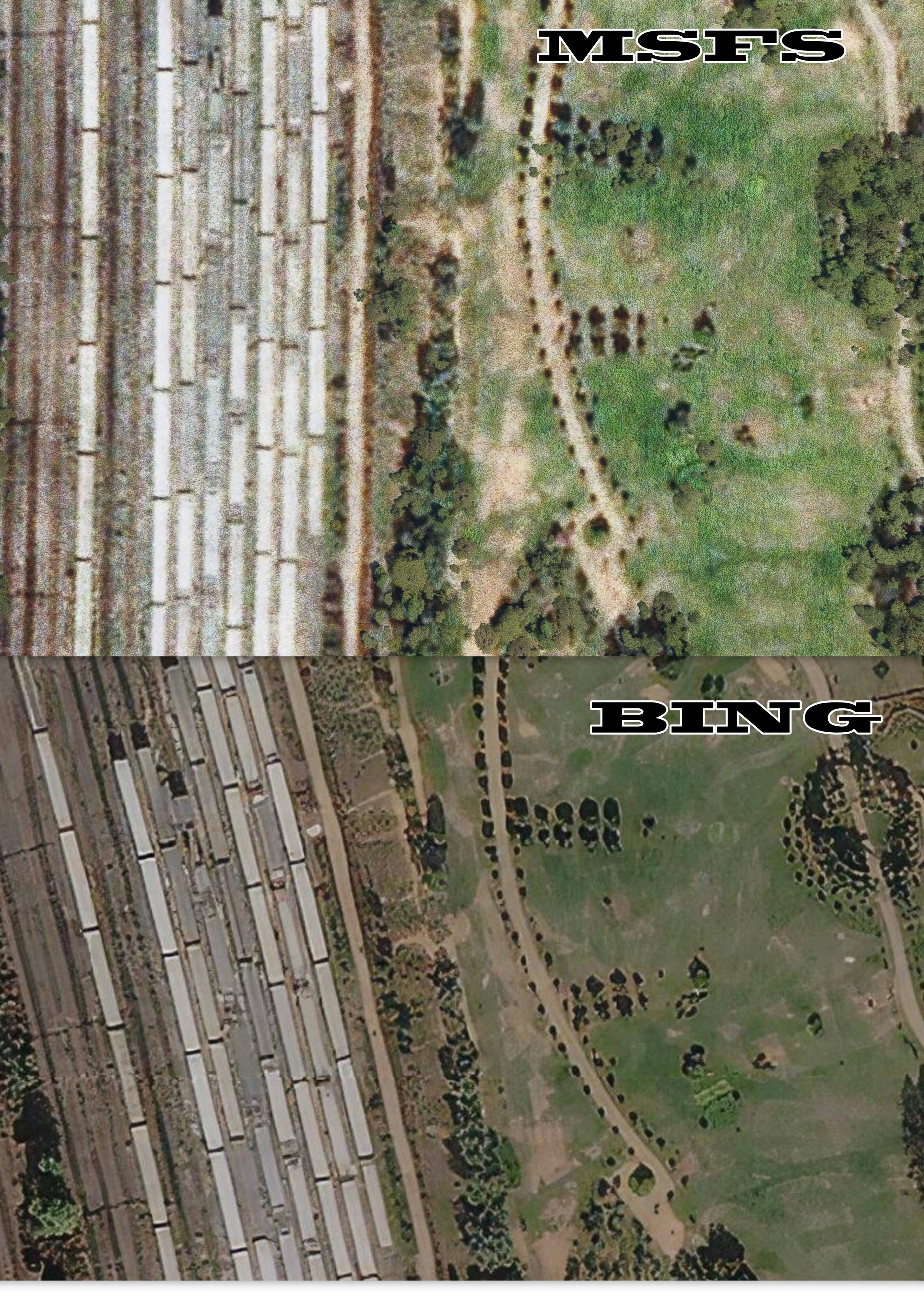
All the pictures are taken from LOW level ,There is a crystal clear difference, try out yourselves.
Cannot be optimistic on things that are clearly evident , I suppose
Thanks for the in-depth reply, much appreciated. Perhaps I didn’t explain the issue properly. I will post shortly, with examples demonstrating how the LOD is far more a problem than many here imagine, the degradation is a real thing and it’s very evident, this of course will be different for players using custom LODFactor settings higher than the default 2.000000 as the code used to calculate the scenery quality is based on the LOD Factor (when calculating altitude). Two sets of imagery are being used as you mentioned and the implementation of these low res images can be avoided when setting higher LOD Factors, albeit with a performance cost which is not recommended.
Notice the scenery on the outer perimeter of the LOD radius, it’s sharp, unaffected and clear. There is a major step degradation which is a miscalculation in the code using the LOD Factor, increasing the LOD factor will only increase the altitude transition steps but because the 1st deg happens only at a few 100 feet, there is unfortunately no hope for us maintaining the initial LOD.
Maybe but I can tell you the first few months of this year (Jan/Feb) the sim on Xbox was stellar. Now it is really not good. So if the degradation is due to Xbox why has Xbox degraded too when it was functioning fine before. I think it’s just a convenient excuse.