Hi everyone, I’ve read a bunch of threads here about the live weather issues so I know what the problems are and I’m not trying to start another debate.
I am trying to figure out a way to do pre-flight weather planning given the current constraints. I found that Meteoblue has a web based weather map and before I dig into it, I wanted to ask if anyone has figured out if that map matches to the weather data that is injected into MSFS? METARs would be nice but short of that, I’m wondering if I can scope out my destinations and routes using this map as it gives cloud cover, wind speeds aloft, etc.
Ideally “live weather” will match real live weather but short of that, I’m ok with something that lets me see what MSFS thinks “live weather” is. If MSFS says winds at an airport are 12 kts from the W, I don’t really care at the moment if that’s truly real world accurate but I need something to plan for those conditions during my pre-flight planning.
I found its lagging behind. Not that problematic enroute, but when you fly online and rely on METAR and ATC weather reports for landing, it’s just not accurate.
METAR injection would be absolutely great.
Normally I want to rely on METAR. However, in order to make use of the the current situation and also to understand the way the weather injection works I started comparing to meteoblue.com maps. Right now I can say it goes into the right direction, but it’s to early for me to make a concrete statement. Also note that there have been statements that the system would be a mixture of METAR and weather modelling data, which adds to complexity.
There’s a lot of discussion and asumptions in this forum about how the MSFS weather system works. In the end only Asobo and Meteoblue can tell us what they did and why.
@Jummivana
I don’t know if I can reach you on this channel. However I personally believe the community would highly appreciate an explanation of how the Meteoblue datamodel works and how it’s injected to MSFS. Once we know the background, it is much easier for everyone to report on potential deviations in the weather during MSFS flight (right now there are just too many variables).
Maybe this can be done by a separate feature discovery video - I know there has been one on weather, however we would need to go into some more detail here.
100% agree. It is too much of a black box right now. It has left the door open for REX to come in and take advantage of perceived weaknesses.
I for one want to see this uniquely new weather system succeed and reach its potential… it is truly something we’ve never had in a flight simulation before.
Thanks for the comments and ideas. I’m going to start working MB maps into my planning as using Foreflight METAR weather is too different. I’m guessing that lots of time and money have been spent already doing the weather integration so I doubt we’ll see massive changes to the engine. The next best solution would be to have more tools in the game showing us MS generated “live” weather at all the listed airports. i.e. maps, etc.
I wonder if they can create simulation METARS based on the in game engine that would only be accurate for sim flying. They’d be somewhat close to live but really spot on and useful for the sim weather.
The short answer is no, you can’t, because it doesn’t always match - and often by a huge amount.
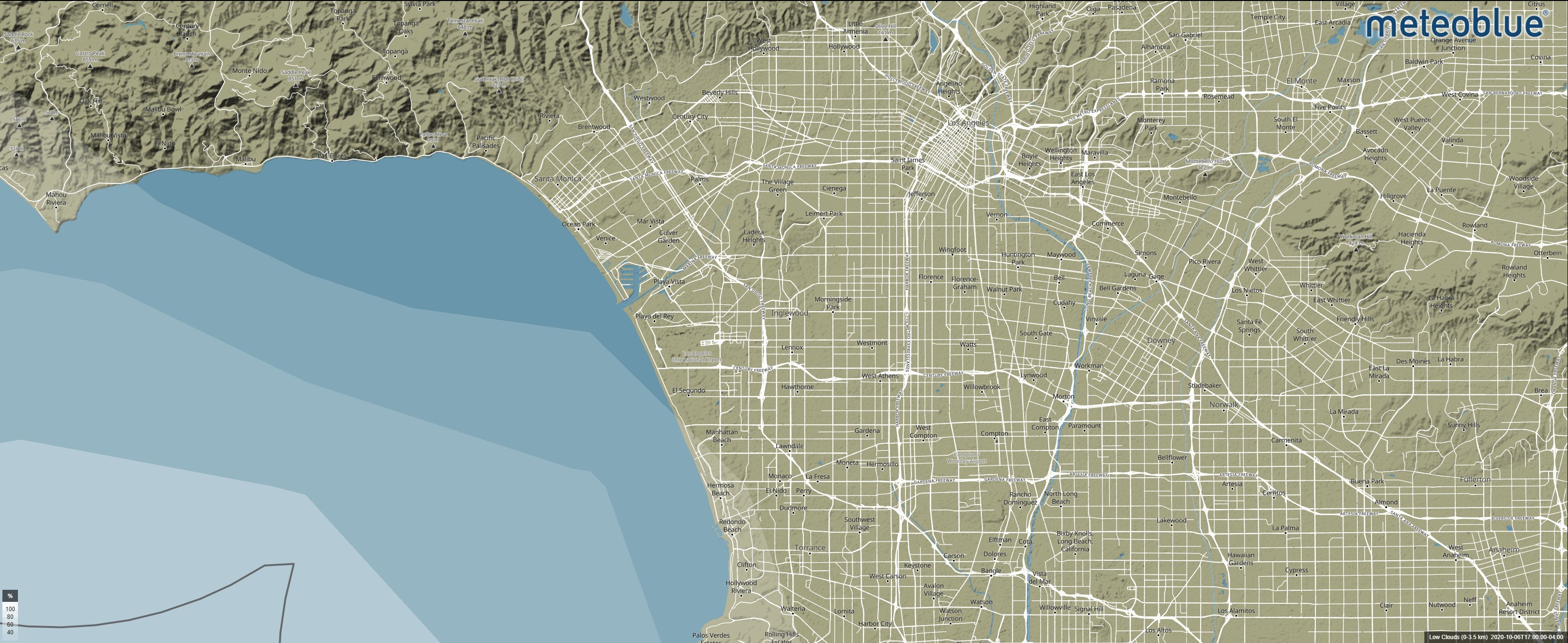
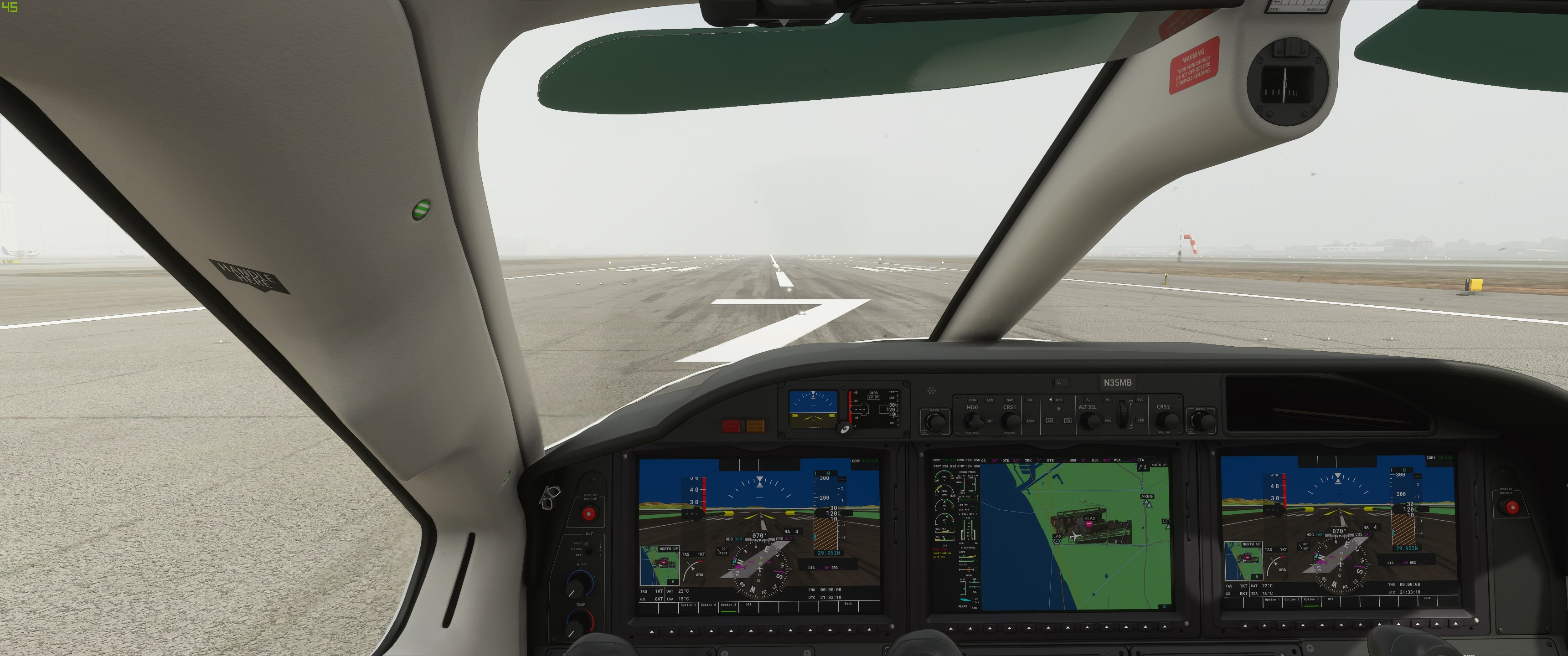
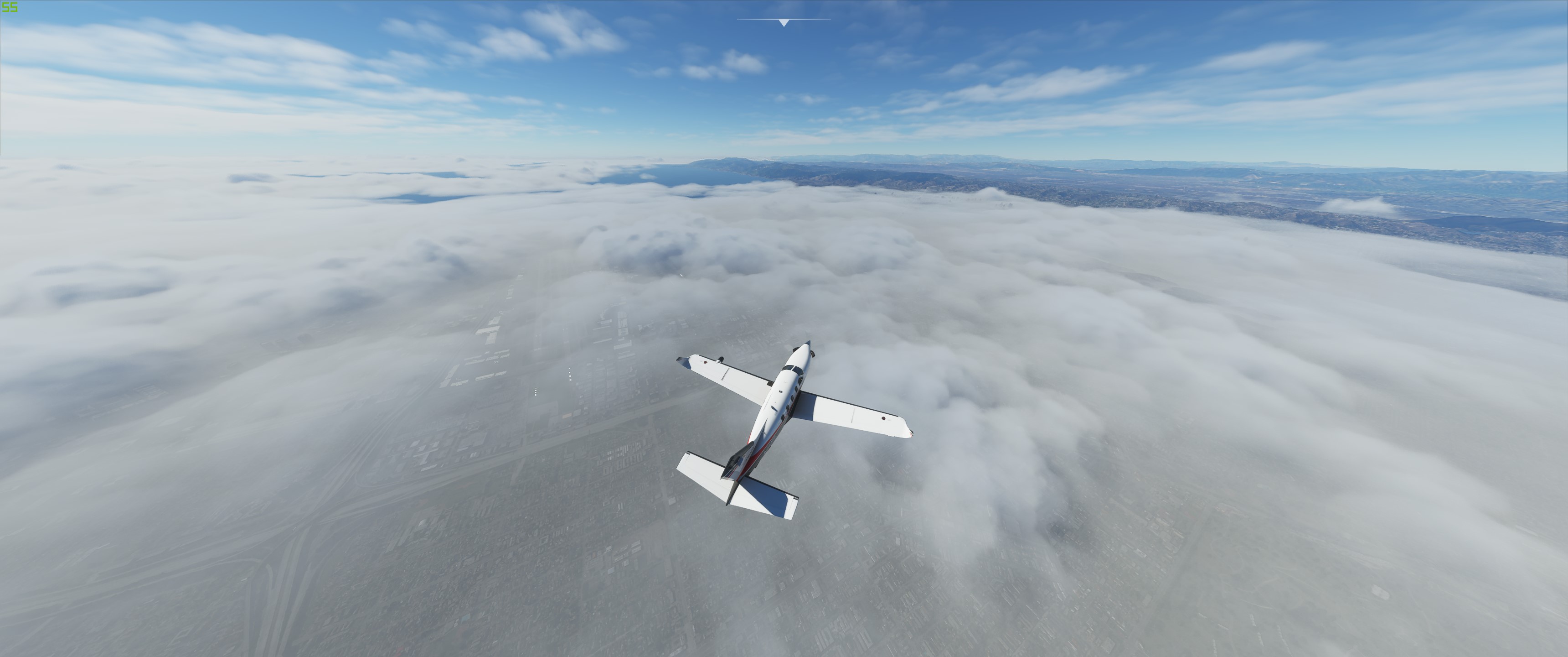
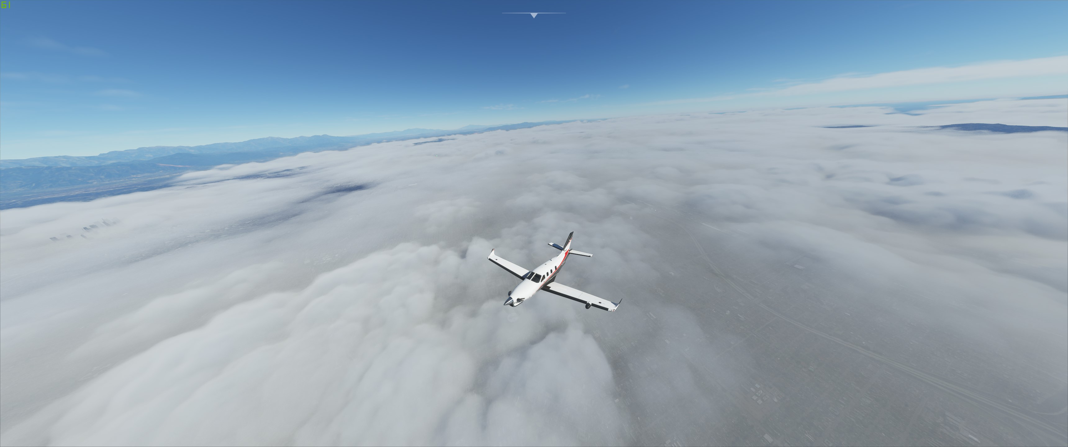
California in particular always seems to be the furthest off from the forecast out of anywhere I have flown. I just put these screenshots together of what meteoblue and MSFS Live Weather are showing at KLAX right now. Note this is from a fresh start of the sim.
Here’s what meteoblue is predicting for low level clouds: nothing. Some spotty coverage off the coast but nothing over land.
This is what is so frustrating - it’s one thing to have to plan using meteoblue due to the decision to use the forecast instead of METARs… that’s fine, I can work with that, but then if the in-sim conditions don’t even match meteoblue, then you can’t plan with any level of confidence.
I checked the meteoblue.com and satellite images for the situation described by you. Here’s a theory (!) of mine:
In real world we see low level clouds on the ocean being moved by WSW winds where they partially vaporize upon reaching land mass. This effect is not constant, because three hours after your post the METAR already reads worse conditions:
The Meteoblue data model is refreshed every 1-3 hours. This means there is no real time data that could be injected to MSFS.
At the same time I recall a video where MSFS simulates the wind flow and its impact to movement of clouds.
If you now inject the potentially outdated Meteoblue data with the offshore clouds and WSW winds, MSFS will move the clouds into LA basin, resulting in the in-flight screenshots you posted (the vaporization
effect I would disregard since it’s a rather advanced meteorological event to simulate).
Long story short: Meteoblue injects a slightly outdated snapshot of weather conditions, and MSFS uses its own model to depict weather over time.
Does that make sense?
Of course this is nothing we want to have in sense of accurate local conditions, but it could be an explanation of how MSFS works and, to some extend, it would be predictable system behavior for flight planning.
Again, just a theory. Only Asobo/Meteoblue can tell us their secrets.
I believe that’s the case for most of us, especially those who fly online, the lack of consistency.
Every external tool or website I’ve tried can’t be used for planning purposes.
ATIS is too unreliable – not to call it broken. Many airports don’t have it, others can only be tuned if you’re practically on the apron, and still some can be tuned but not received even on the ground. I just need some way to receive basic weather information, but unfortunately MSFS is severely lacking in that area.
The only issue with that addon is there are no winds aloft as of yet. Winds decrease as you get higher. Great mod for low alt and vfr but anything above 15000ft is inaccurate.
It is a tradeoff, accurate metar weather but no upper level winds. Developer said he is working on it but it won’t be realistic depiction, just a simple scaling of surface winds with some variation.
I’ve read a lot of weather related comments in the past few days. This thread has been the most civil so far. But back to the topic at hand. I think a few comments already has iterated what I think should be the path forward for MSFS.
If we are not using METAR, which I am fine with, give us a way to plan ahead. Either make meteoblue.com match up to the sim or vice versa. I don’t the viability of this but it sure would be nice for planning purposes.
I don’t mind the METAR injected add-ons, but they’ll have to prove themselves that they can flow smoothly between what’s models in MSFS and What’s ‘current’. I put current in quotes because METAR is often 1 hour intervals (sometimes 15 min interval at bigger airports). So far, if you are between METAR stations, you are SOL because weather won’t be anymore, if not way less, consistent than what meteoblue provides for MSFS. I.e. I can’t have a wall of cloud and cold front suddenly draw in just because it wasn’t an hour ago on METAR. So, until developers can get that to work, METAR based flying will be limited, at least for me, to local (<50 nm) flights.
MSFS needs to re-iterate their definition of ‘live’ weather to everyone to reset expectations and definitions. People expected they’ll see in sim what they see looking out the window. Sorry to say this but that technology does not exist on this planet yet. We get forecasts i.e. guesses at what the weather will be. Sorry if I broke your bubble. I too wish I could stick my finger in the air, say what the weather is going to be for 100% certainty for the next hour but no one on this planet can. Weather is extremely uncertain and that’s real life pilots are equipped with the skills and tools to deal with that. (i.e. onboard radar, flight planning, atc, etc.)
Tldr for your question. I wish and so do a lot of other people.
You can’t call it broken even if you wanted to, because it could be working perfectly as intended. That logic extends to the larger question of weather. It could be working just fine in the eyes of the developer. They (Asobo) need to weigh in with a post somewhere and explain exactly how it is intended to function like some of the other posters and I have indicated.
What is clear, aside from visibility in the game, is that we were forecasted to have “live weather” in MSFS2020, and that forecast has proven to be highly unreliable so far.
Agree with the above post. They probably should have called it “dynamic weather from prediction 12 hours ago” to have been accurate. They marketed it as “Live Weather”, so no one but themselves to blame…