SOQA Airport Moving Map
An airport moving map for Microsoft Flight Simulator 2024. It draws the airport you are on and puts your aircraft on it, in the EFB and in a toolbar panel.
Everything on the chart comes from the simulator’s own airport database: runways, taxiways with their real widths and names, stands, and hold short bars. It matches the scenery you have installed, including third party airports, so there is nothing to download per airport and no chart subscription.
Taxi Routes
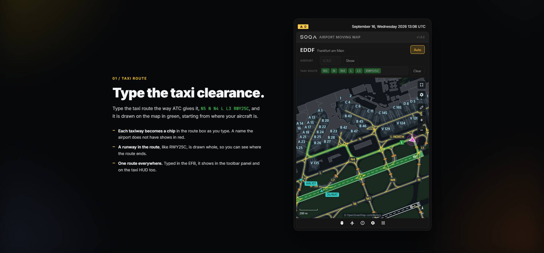
Type the route as ATC gives it, for example N5 N N4 L L3 RWY25C, and it is drawn on the chart in green from where your aircraft is. Each taxiway becomes a chip as you type, a name the airport does not have shows in red, and a runway in the route is drawn whole so you can see where the route ends. The route is shared between views: type it in the EFB and it appears in the toolbar panel and on the taxi HUD.
Taxi HUD (Experimental)
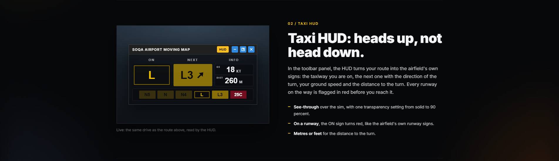
This feature is experimental, and it depends on the scenery. The route is read from the taxiways in that airport’s own data, so where a scenery leaves gaps between taxiways that should meet, the route will not join up across them and the HUD will not read the whole way through.
Also Included
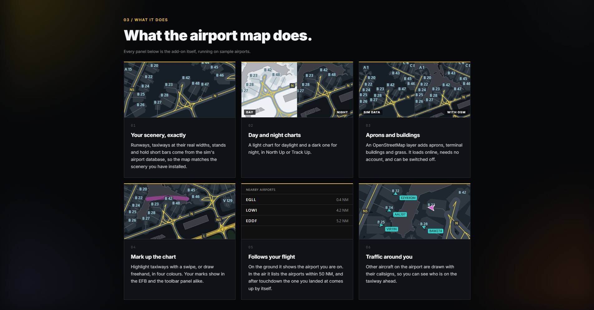
- Day and night charts, North Up or Track Up.
- Aprons, terminal buildings and grass from OpenStreetMap, optional and switchable.
- Highlight taxiways or draw freehand in four colours; your marks appear in both views.
- In the air, a list of the airports within 50 NM; after landing, the airport you are at comes up by itself.
- Other aircraft on the field, shown with their callsigns.
Installation
Download, unzip, and drop the folder into your Community folder, then restart MSFS.
Links
Product page: https://soqa.app/airport-moving-map.html
Discord: SOQA
Support: support@soqa.app
For flight simulation use only. Not for real world navigation. SOQA is not affiliated with any chart publisher, and no publisher’s charts or data are used. Aprons and buildings (c) OpenStreetMap contributors, ODbL.