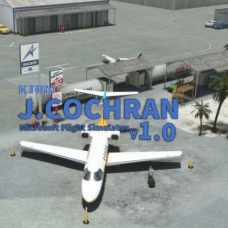
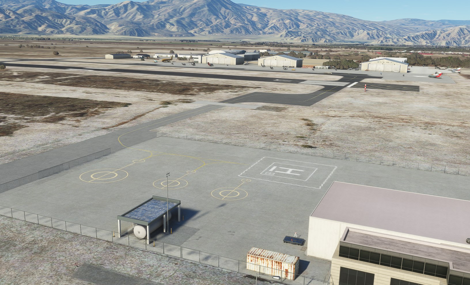
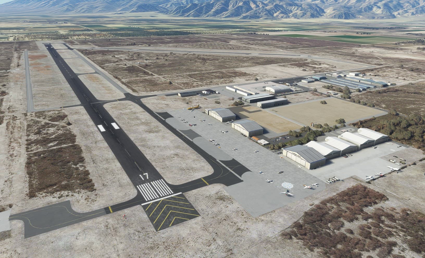
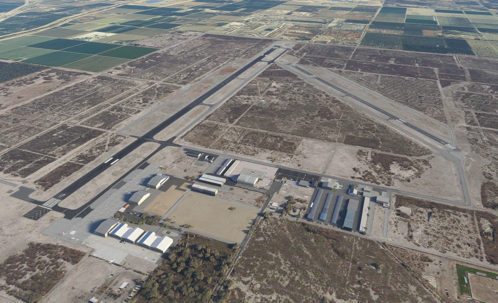
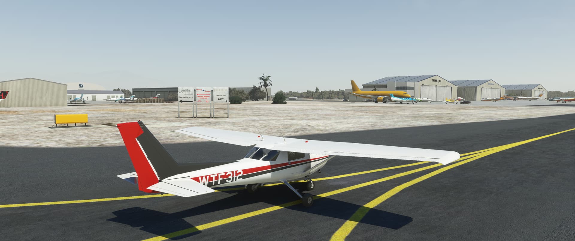
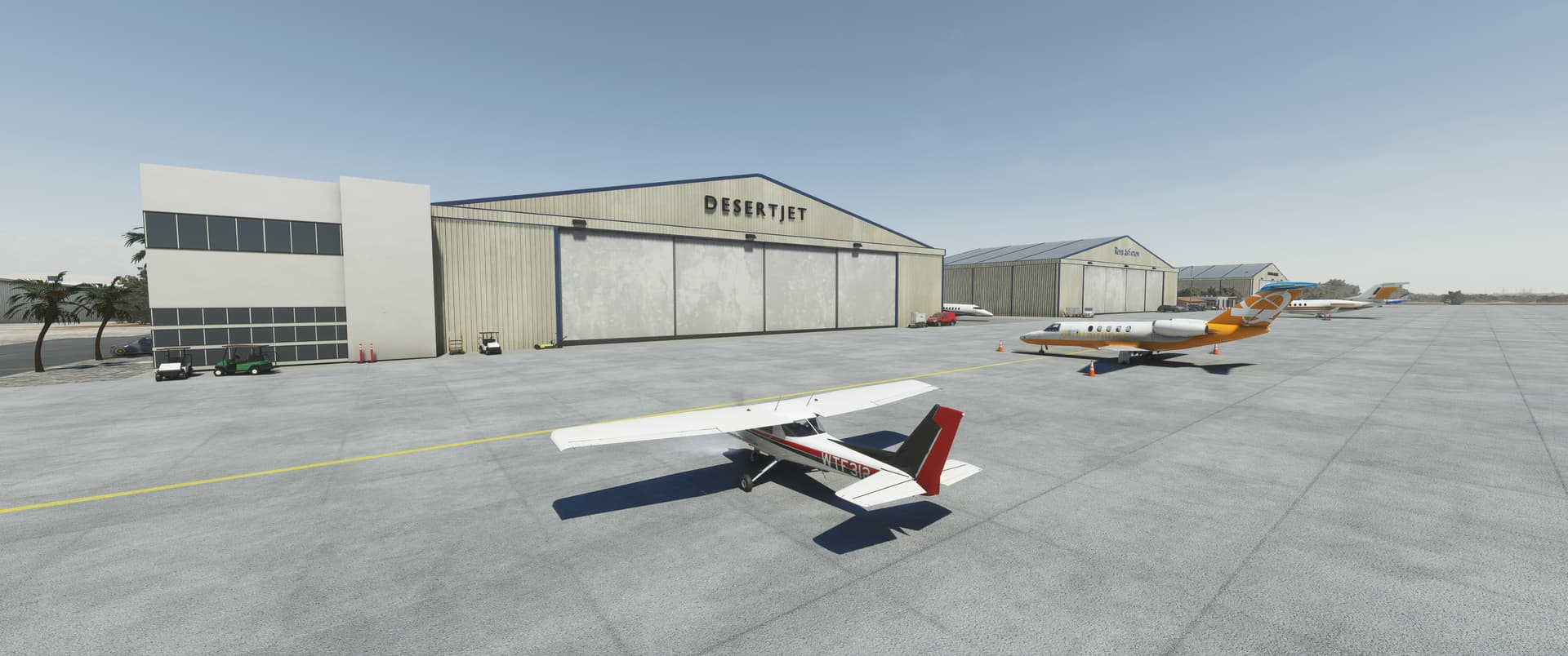
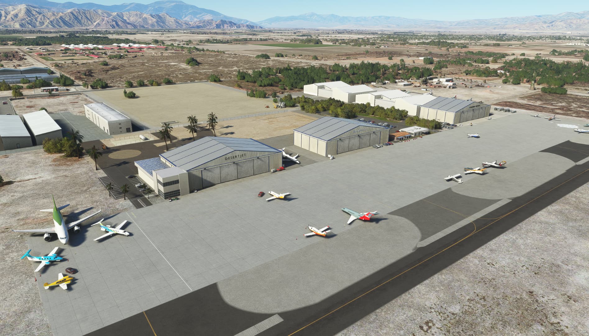
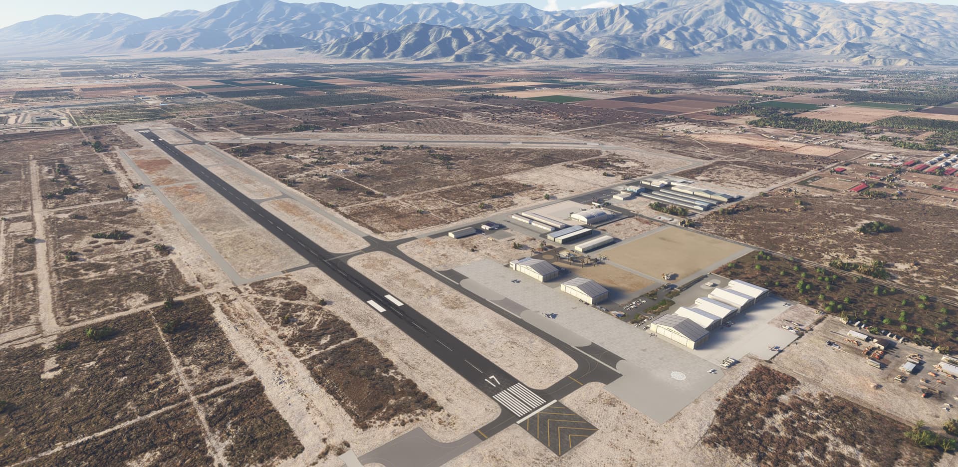
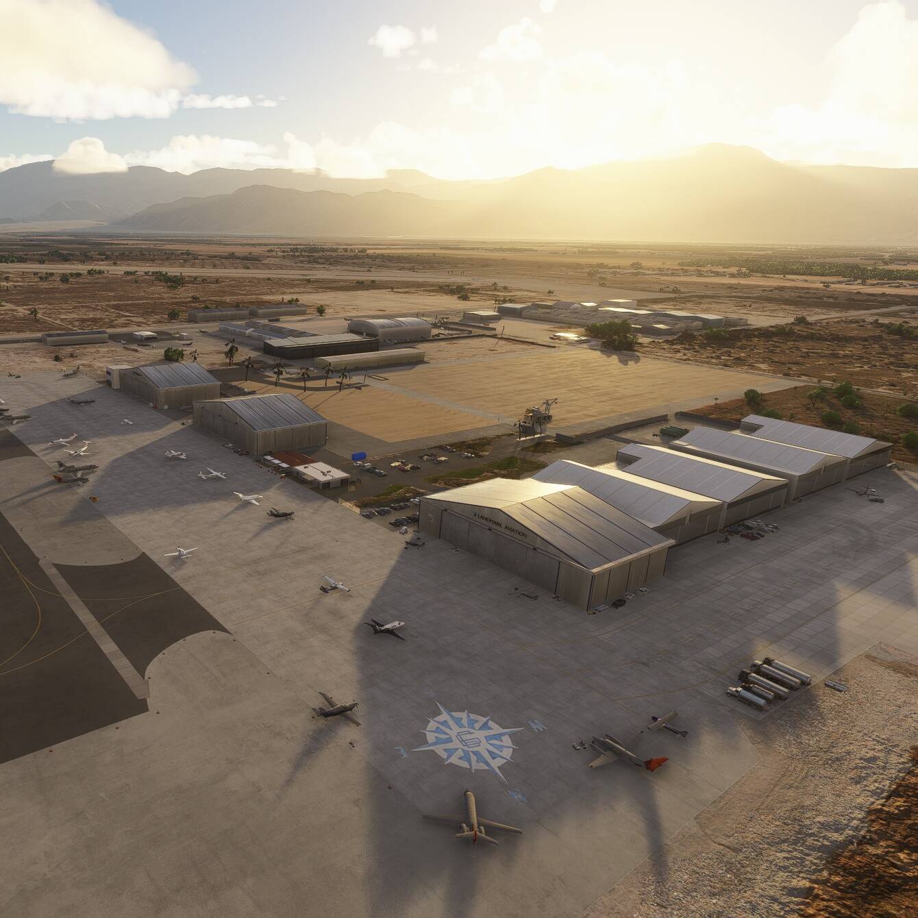
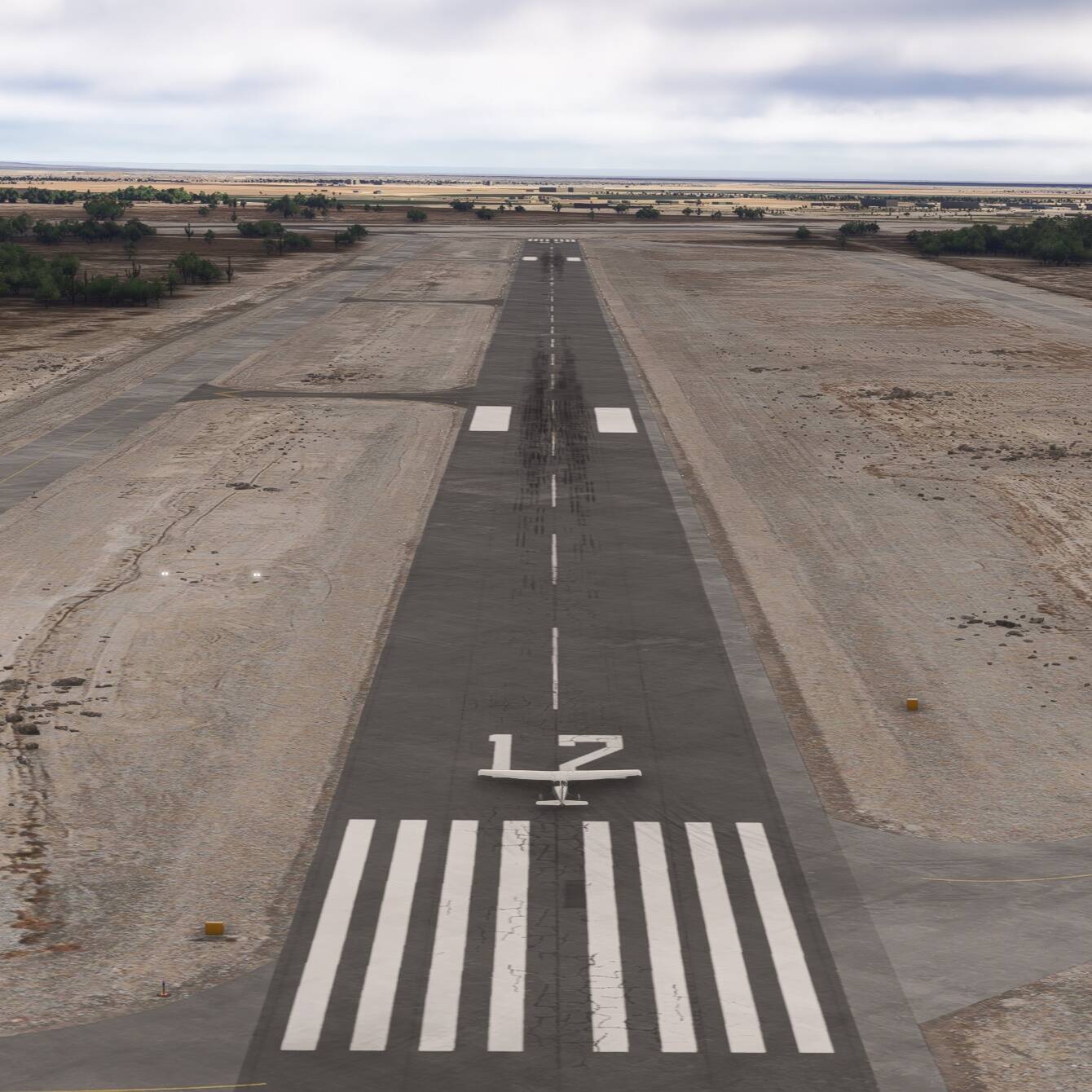
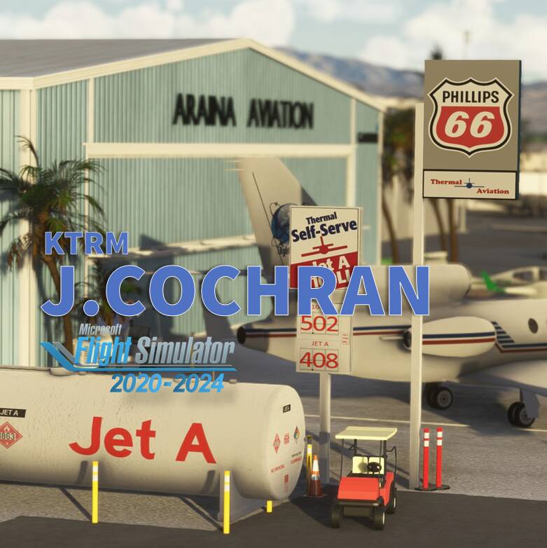
The Jacqueline Cochran Regional Airport (ICAO: KTRM) is located in the Coachella Valley—known as the Desert Resorts Region, the City of Palm Springs. 70nm up north San Diego and 115 nm east from Los Angeles LAX. KTRM is 115 feet (35 m) BELOW mean sea level. It has two asphalt paved runways: 17/35 is 8,500 by 150 feet (2,591 x 46 m) and 12/30 is 4,995 by 100 feet (1,522 x 30 m). You’ll also find FBO’s, Civil Air Patrol (CAP),Riverside County Sheriff Thermal Heliport (ICAO: 1CA2), flight school and of course avionics and mechanics shop.
Author’s note
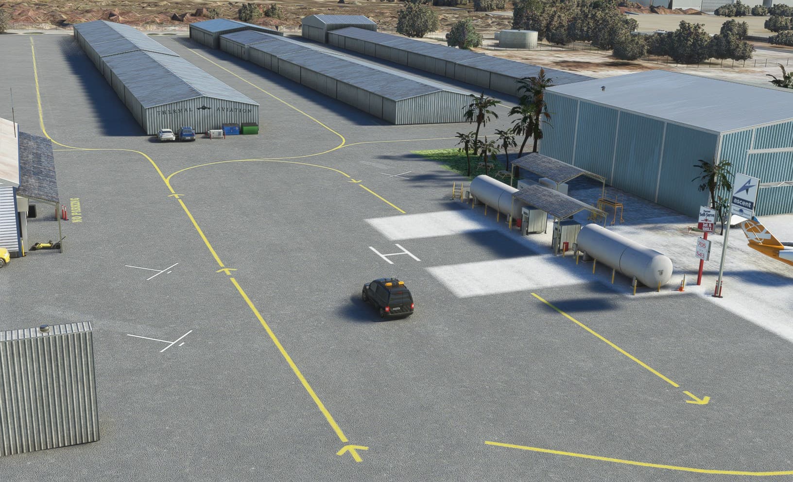
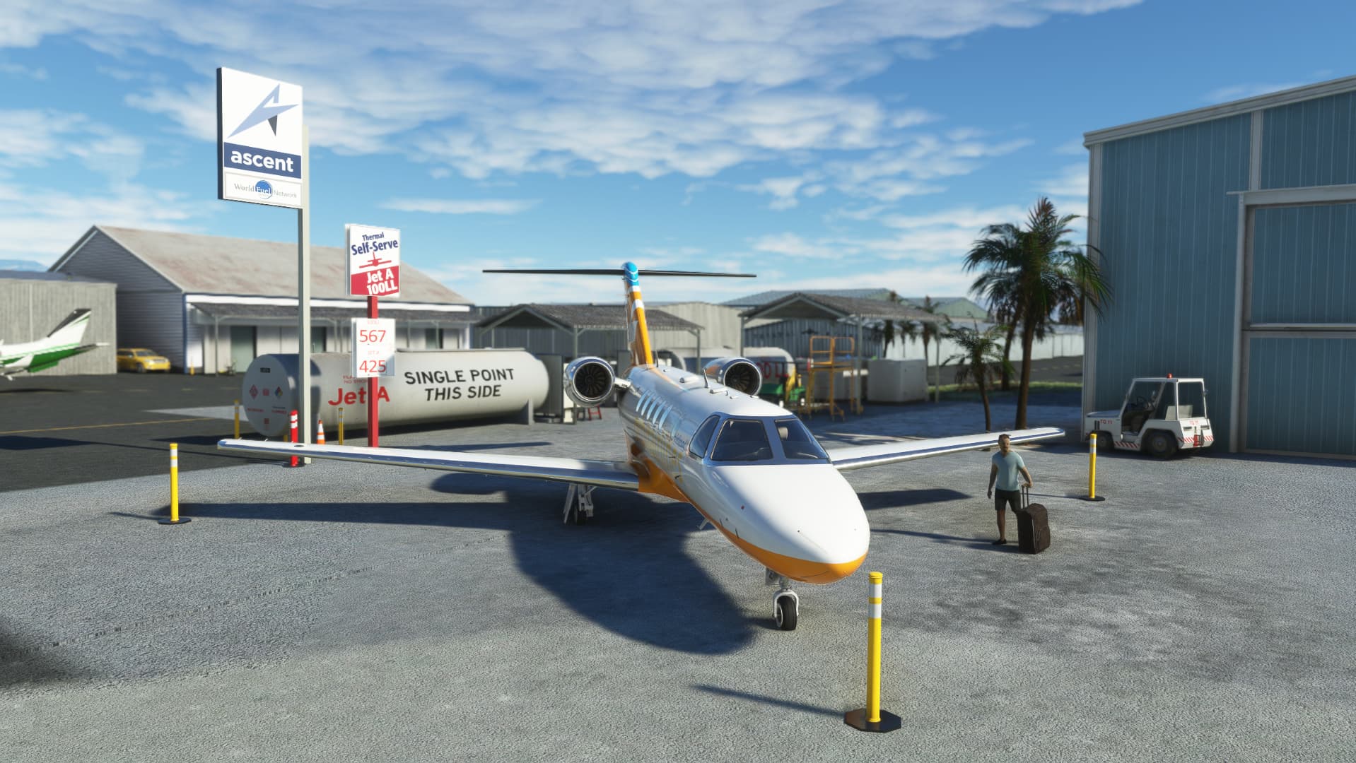
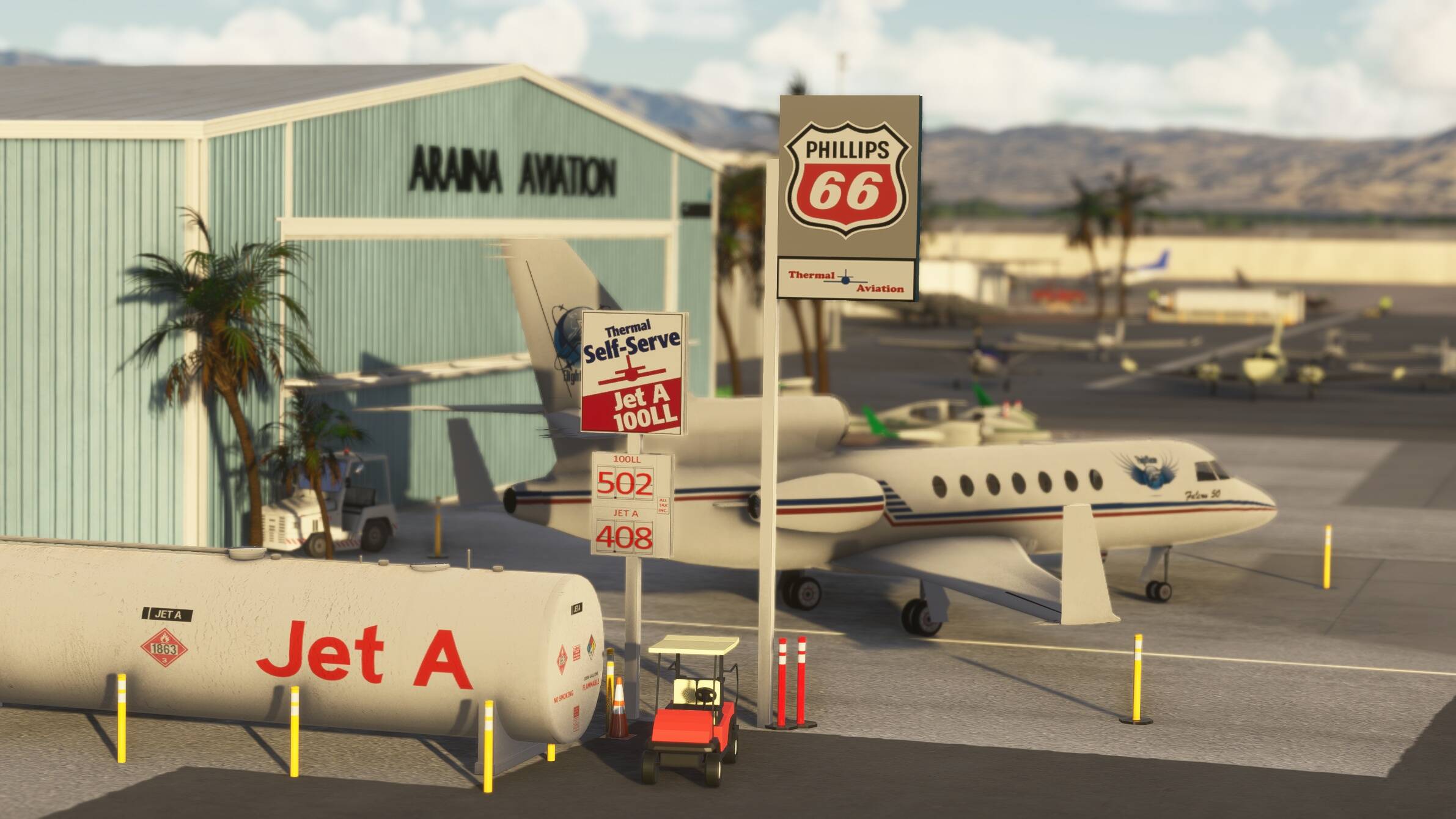
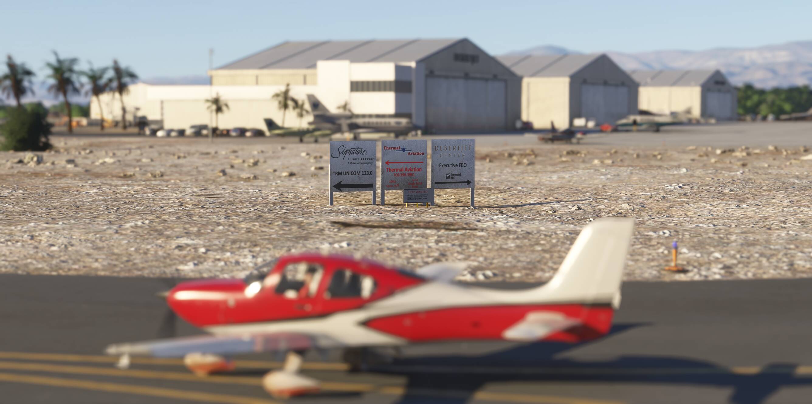
As for all of my MSFS mod, this small scenery is made from a pilot-eyes perspective. FBO’s has changed a lot this last years at Thermal: Desert Jet Center Landmark, Ross Aviation, Thermal Aviation Self-serve, Signature… and I wanted to keep all these names although it’s not anymore as real as it get, today Sept’22. Let me know what you think.
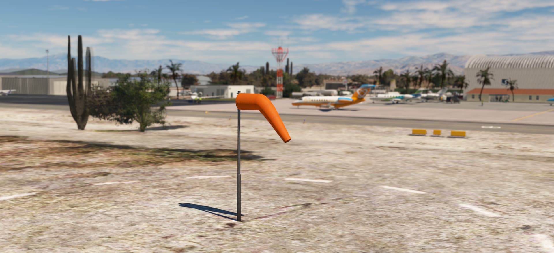
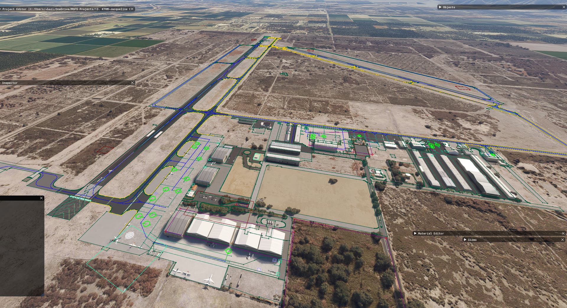
This mod is made with 99% of MSFS default objects library and feature massive number of details. The scenery is inspired by aerial views from Bing and Google maps. It’s a mix between the satellite imagery displayed from MSFS and more accurate data found on Internet. I did my best based on online video and online pictures.
900+ objects have been added to the default scenery to make in more live and bring a touch of an active area. If you have local pictures to help being more accurate, let me know!
Awesome thank you so much for this free download. For anyone who does not know Jacqueline Cochran was an important aviation figure, pilot , and good friend of Chuck Yeager
Putting my amateur work in the Market Place would required to create a customer - merchant relationship and a quality of support than I can’t afford. It’s a different mindset. I’m doing this for the pleasure of doing it and share as a give back to the huge flightsim community. Not to mention that my amateur work is really (really) amateur in some technical and performance-wise aspect.
This update focuses on aligning the scenery with the latest SU16 / MSFS2024 Bing Maps data and current airport layout, so what you see in the sim is much closer to what is on the ground today.
Main changes in v3:
Full realignment to SU16 / MSFS2024 Bing data: repositioned all objects, ground textures, markings and taxiway lines for a better fit with the new base imagery.
Enhanced runway texture for the MSFS2024 rendition.
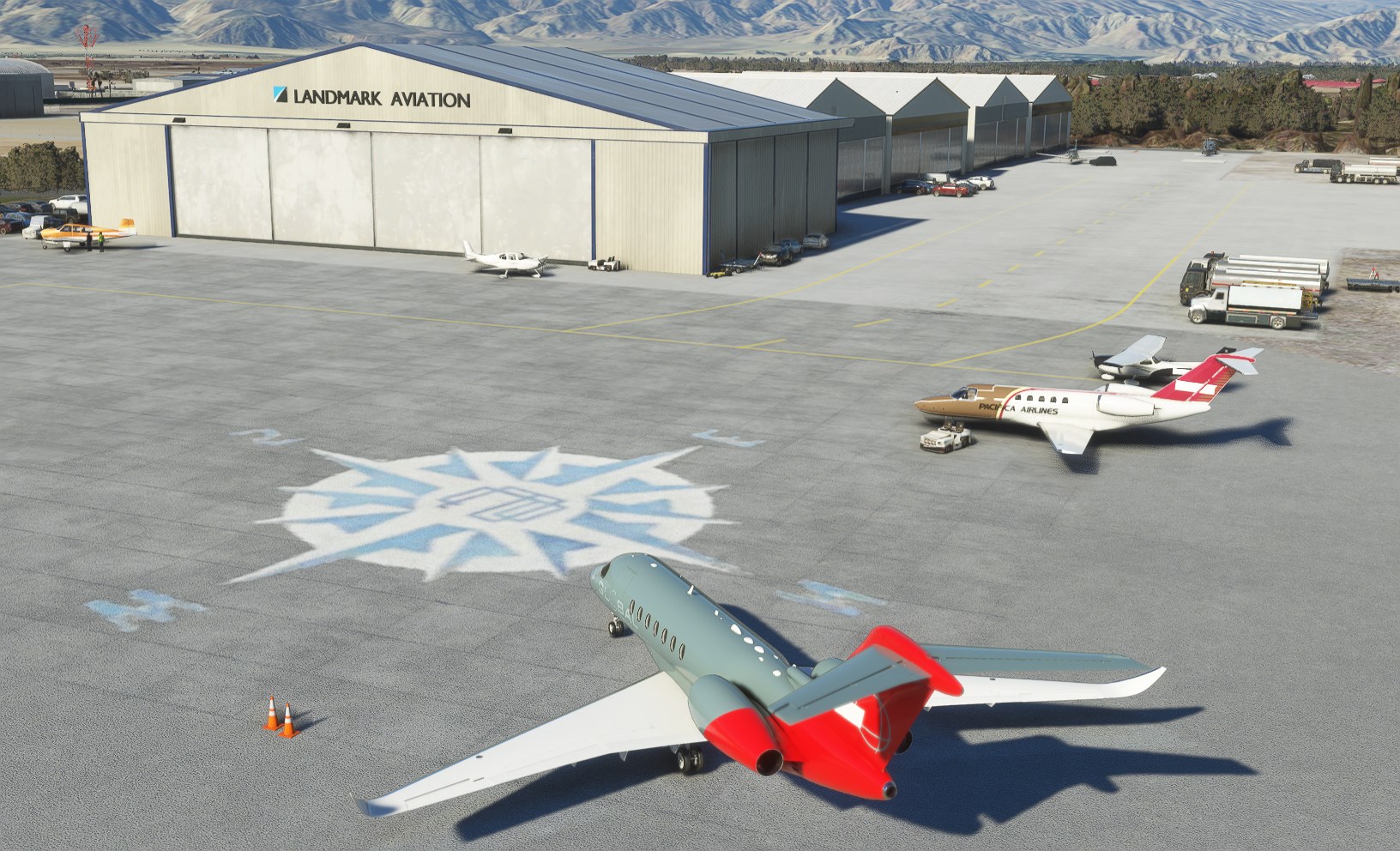
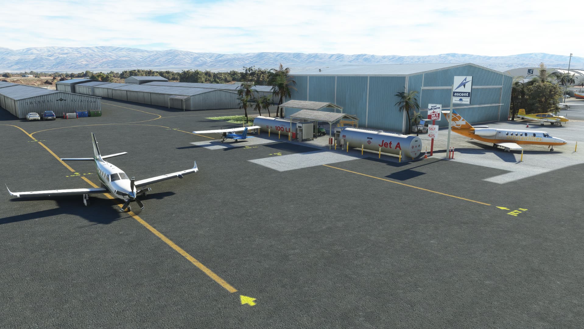
New fuel tank cistern at the California Highway Patrol (CHP) Air Base on the west side, with a refreshed surrounding area.
Added ARAINA Aviation hangar sign, including the Garmin logo signage.
Removed several hangars that have been demolished in real life.
Removed static SimObject aircraft to better match live / AI traffic usage.
Replaced missing objects and buildings for MSFS2024 so the field feels complete again.
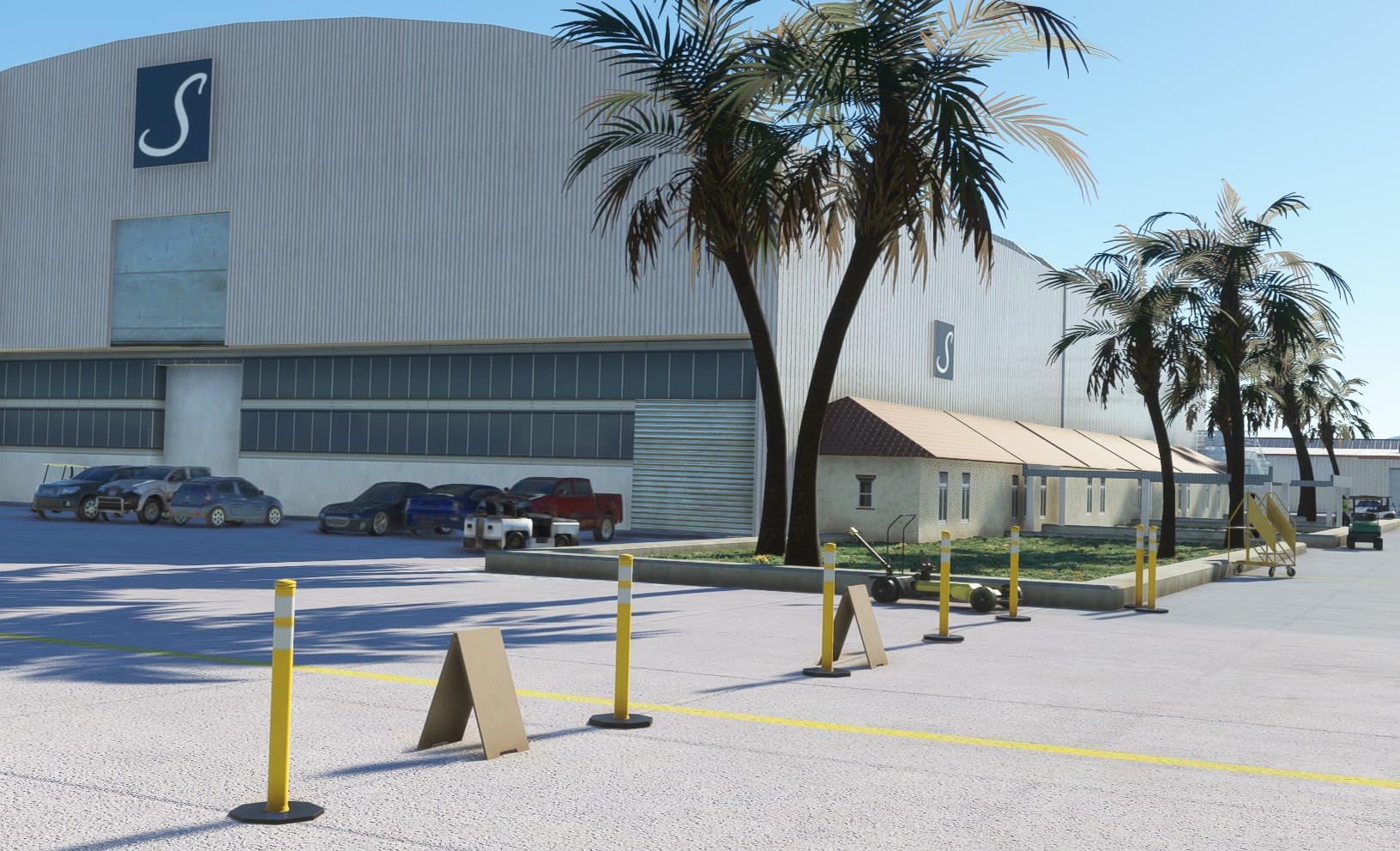
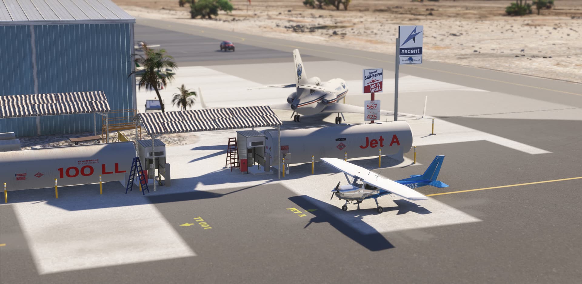
Updated Thermal Aviation fuel provider branding from Ascent to Phillips66.
Kept the Signature FBO hangar in place even though Signature left and Coulson Aviation uses the area now, same for Ross Aviation and Landmark signage which remain on their hangars for now.
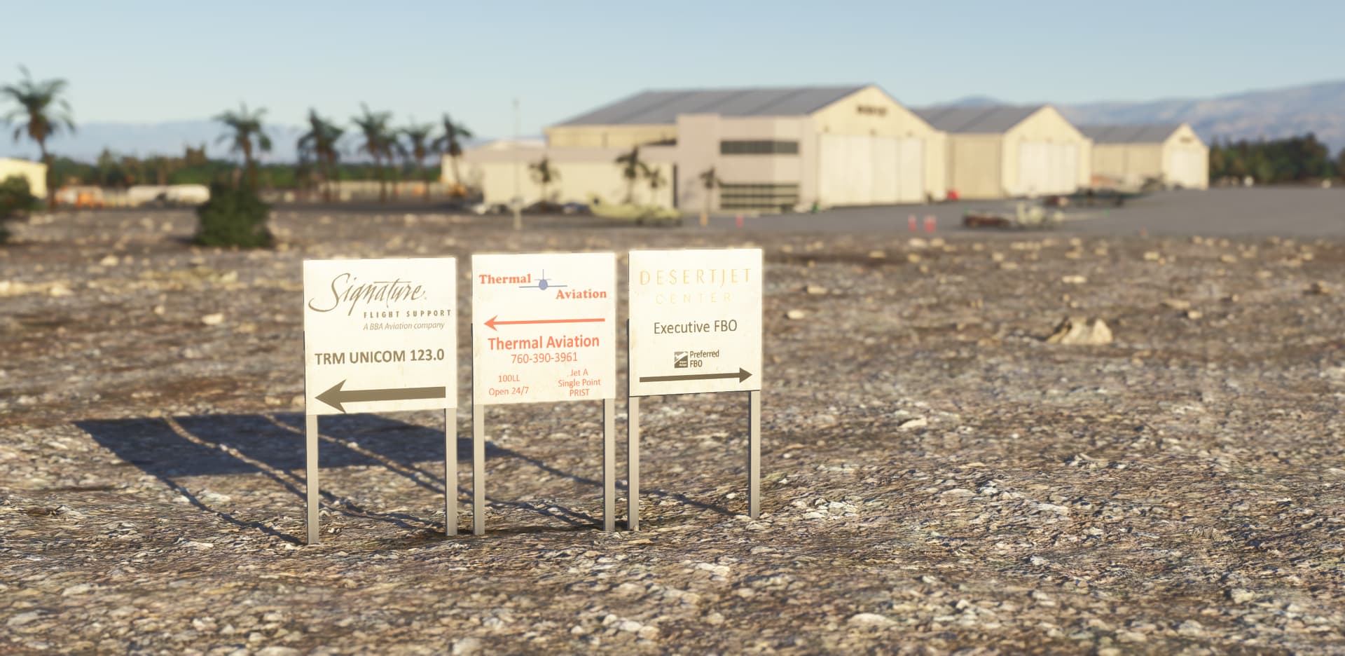
Still pending: the four big signs on taxiway Alpha pointing to the FBOs. Real-life reference photos are missing, so any local input is very welcome.
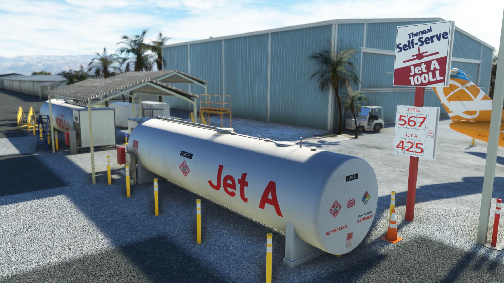
And yes, the most important part: updated fuel prices at Thermal Aviation.
Ive recently moved over to pc, your work is far superior to many many payware developers.
MS should give you a storefront so you are properly compensated for your efforts. Spectacular work
Update v3.0.1 for Jacqueline Cochran Regional Airport (KTRM) addresses several key improvements for accuracy and functionality in Microsoft Flight Simulator. Thanks to users for raising issues although some were tricky
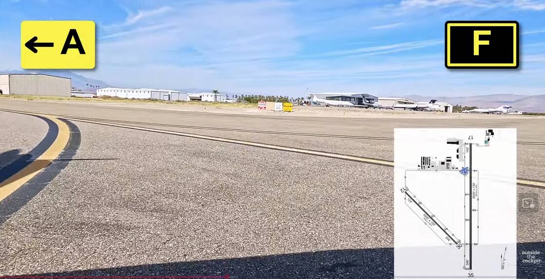
Taxiway Signage: Added missing signs for runway 17-35 exits and corrected mislabeled signs (B→A, C→F, A→B at B4).
Static Aircraft: Fixed pink/missing textures on C172 and PC24 models.
Ground Layout: Removed bump on taxiway A (heading to runway 12) and adjusted ramp direction sign.
Visual Corrections: Relocated PAPI-2 for runway 12 and added the missing second ARAINA AVIATION sign.
ChangeLog
Add missing taxiway signs vaccating runway 17-35
Add missing second ARAINA AVIATION sign
Fix taxiway signs displaying:
B instead of A at A runway 17
C instead of F at A runway 17
A instead of B at B4
Fix PAPI-2 position runway 12
Fix C172 and PC24 static aircraft pink/missing textures
Fix bump on taxiway A (heading to runway 12)
Fix ramp direction sign
By the way… I’m still looking for (high resolution) picture of this group of FBO signs. I know my scenery is not up to date but I can’t find a recent photos anywhere: