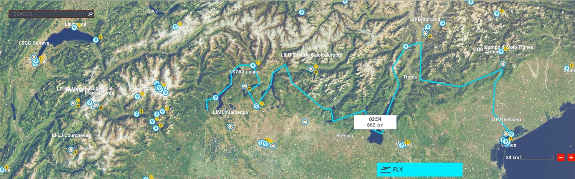
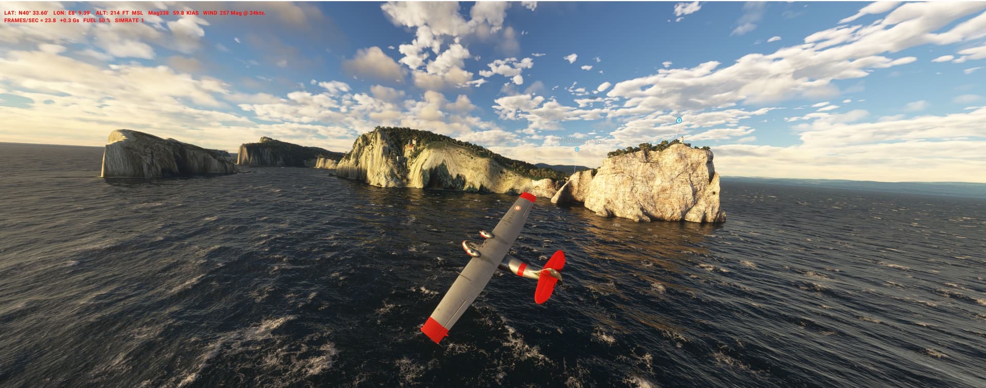
In the 1930s fascist Italy was in an aviation craze. While visiting the USA, Aviator and Generallissimo Italo Balbo was watching the National Air Races and decided to have one in his country.
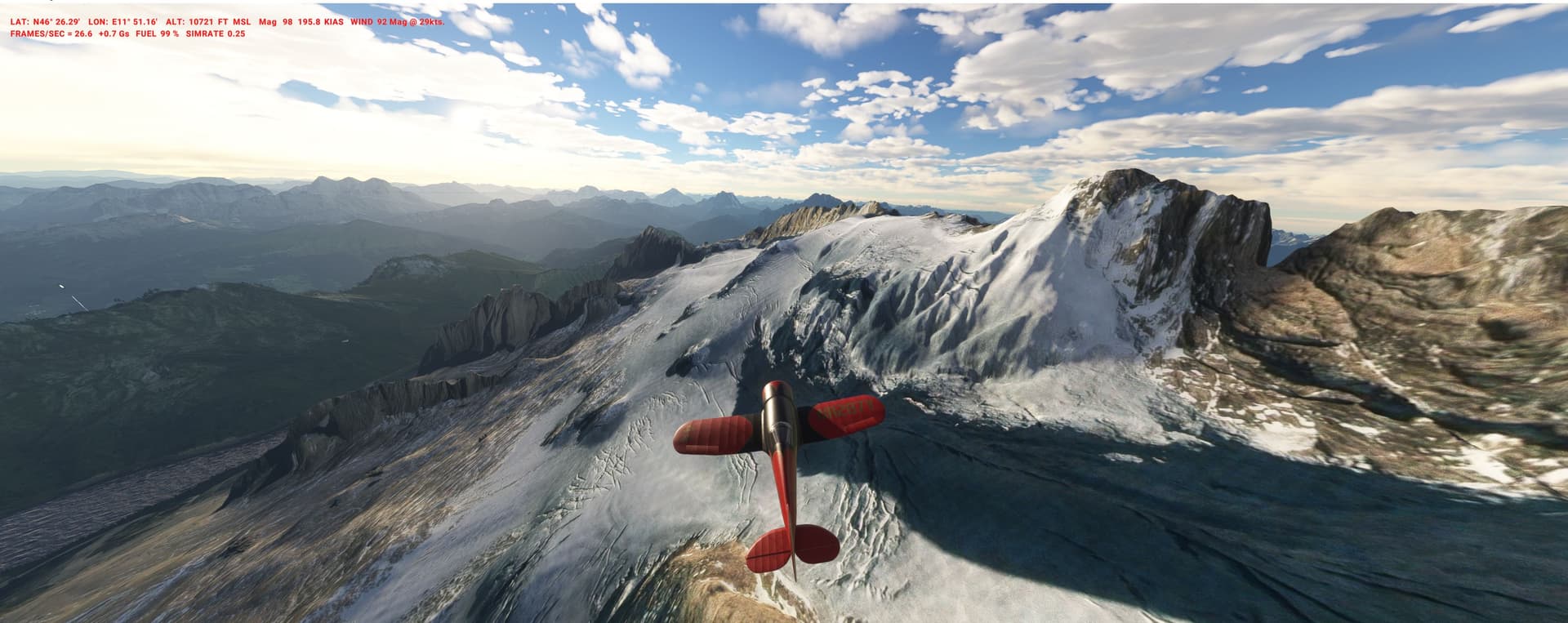
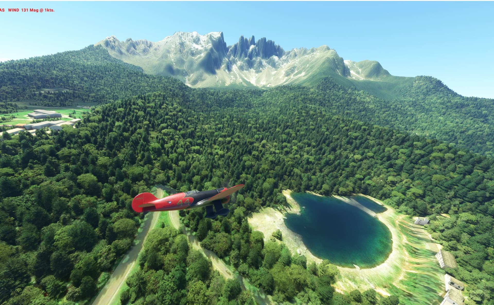
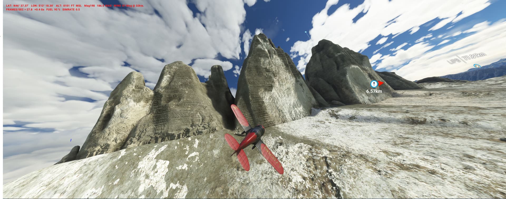
He choose some of the most spectacular mountains on earth - the Dolomites (its DEM has become reasonable finally!).
Start and finish is LIPB Bolzano, its perfect for contemporary racers (free Wedell 44, Asobo Gee Bee, or Spitfire/Mustang as an avatar for the Schneider Trophy Macchis/Fiats) but fun with any other plane.
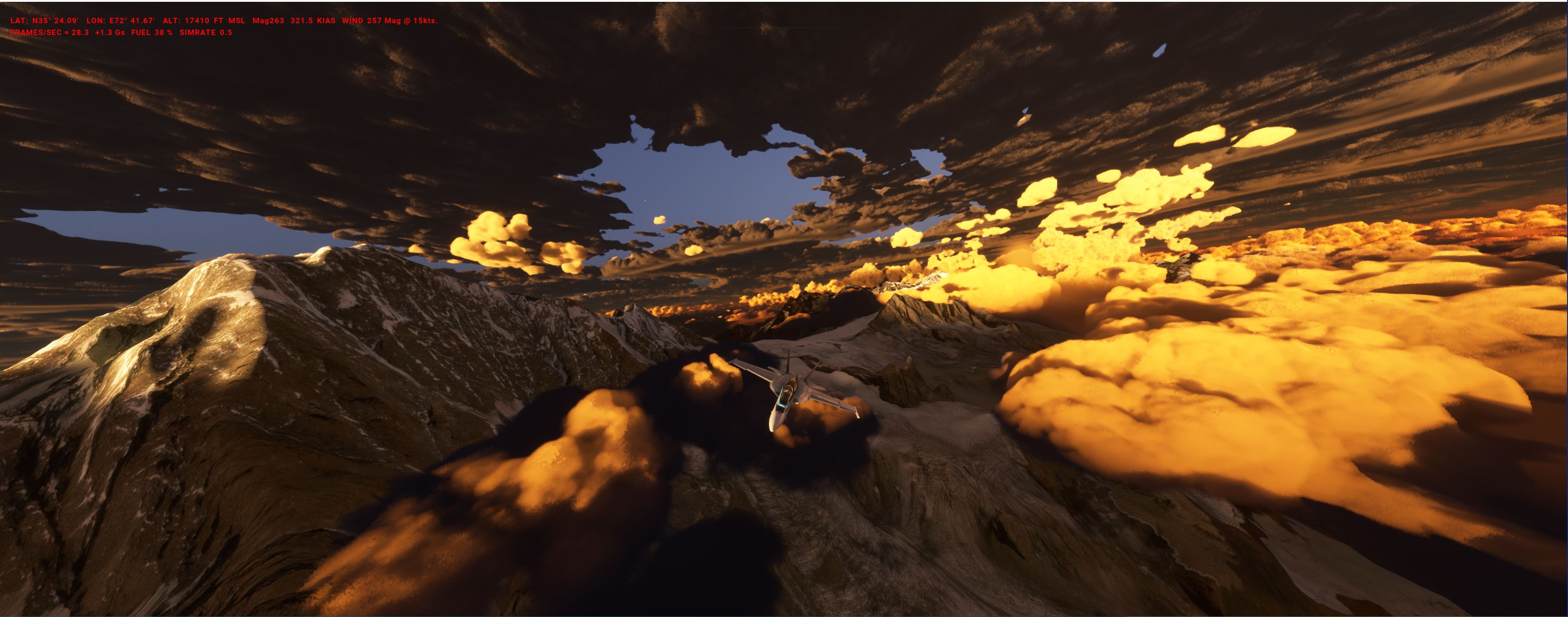
2011: Top Gun Pilot Pete “Maverick” Mitchell is in F-18 sim-training. Its all about a Navy alternative for a planned SEAL/JSOC action from bases in Afghanistan.
For plausible deniability stay invisible - the PLN PAKI_maverick.PLN (6.1 KB)
is a rough outline only and requires you to do nap-of-the-earth flying and terrain masking at your discretion from WPs 1-23.
After going over the target (WP labelled, Osama bin Laden's compound in Abbottabad - Wikipedia ) expect strip-alert PAF F-16s being launched - so for the egress hide in the high mountains and deep valleys up north.
Land @ MGRD or finish @ an unmarked strip on the coast near Livingston.
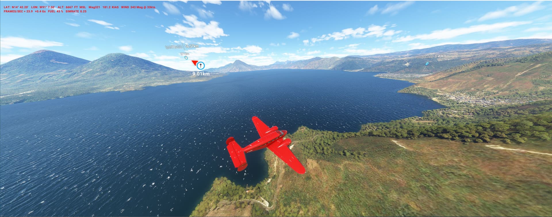
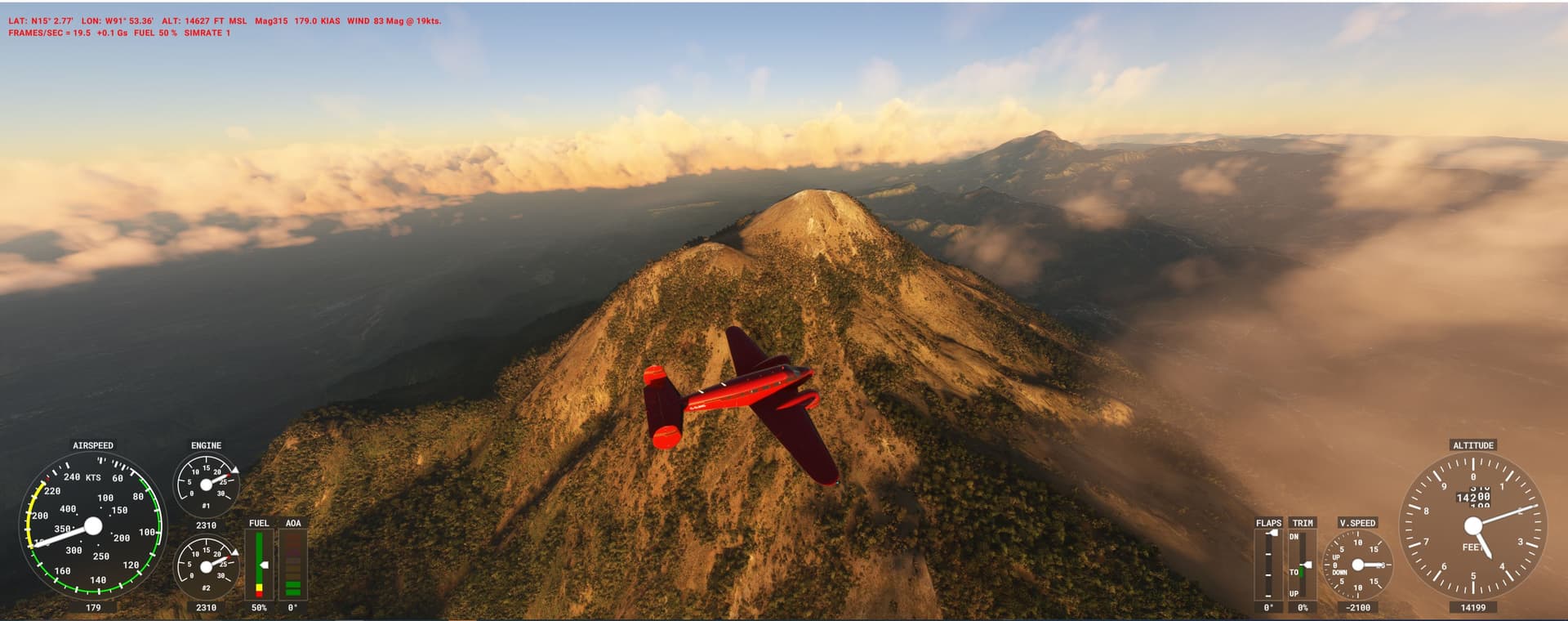
WP Huehuetenango: the AP is not in the sim (strange..) but clearly visible/doable - albeit a bit bumpy. Some strips are tight for the Beech, check, try, deny or take the Caravan…
DEM has improved a lot over time, the spikes are gone, thx Jörg.
There is some amazing locations in this thread, writing several down.
Planes of my choice as long as it isn’t very high altitude are the Quest Kodiak and Trent Palmers Freedomfox / Fox2.
Both payware but incredible detail, good bush planes with low stall speed and great flight models, you can even loose the door on the later if you open it up at speed.
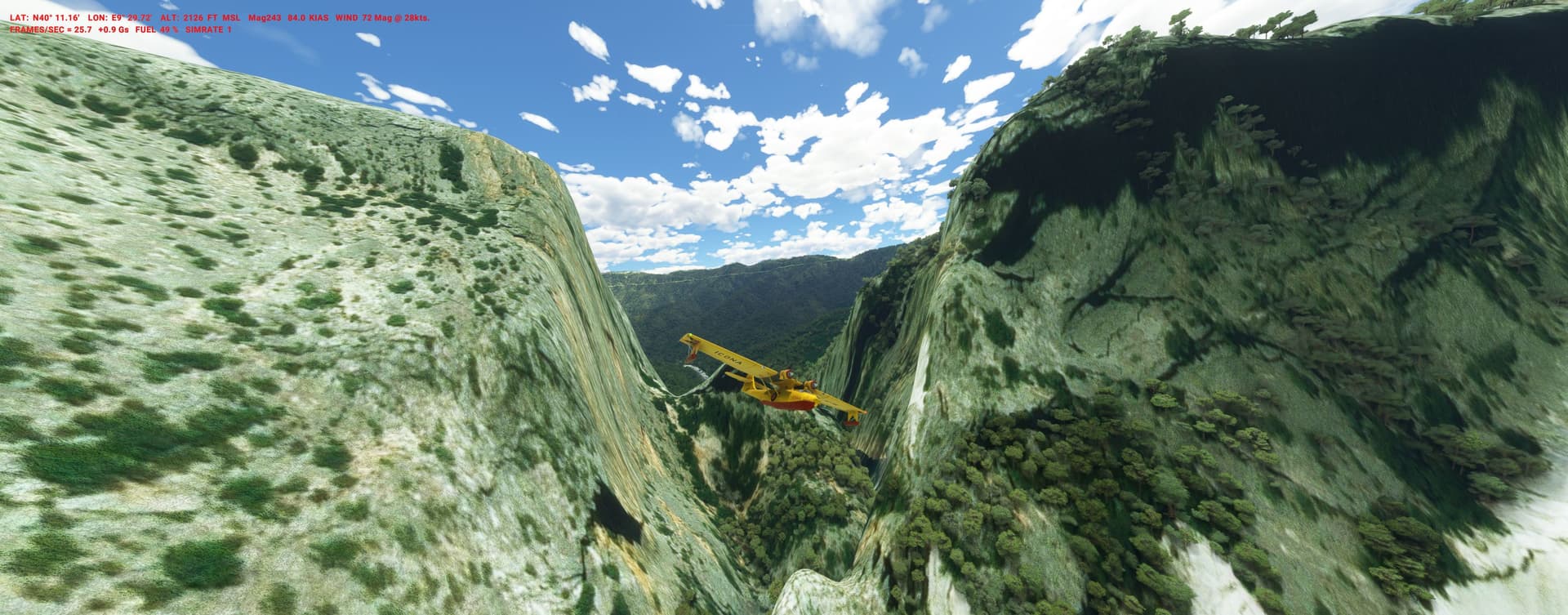
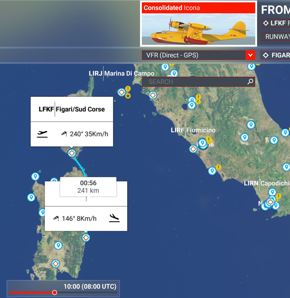
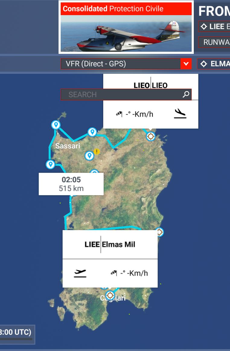
Water-bombers are currently active in the Mediterranean, fighting unprecedented wildfires. Unfortunately this activity is still in its infancy in MSFS (listen modders!), so we just do practice dry-runs without flames.
Italy has a squadron of Canadair flying boats for this:
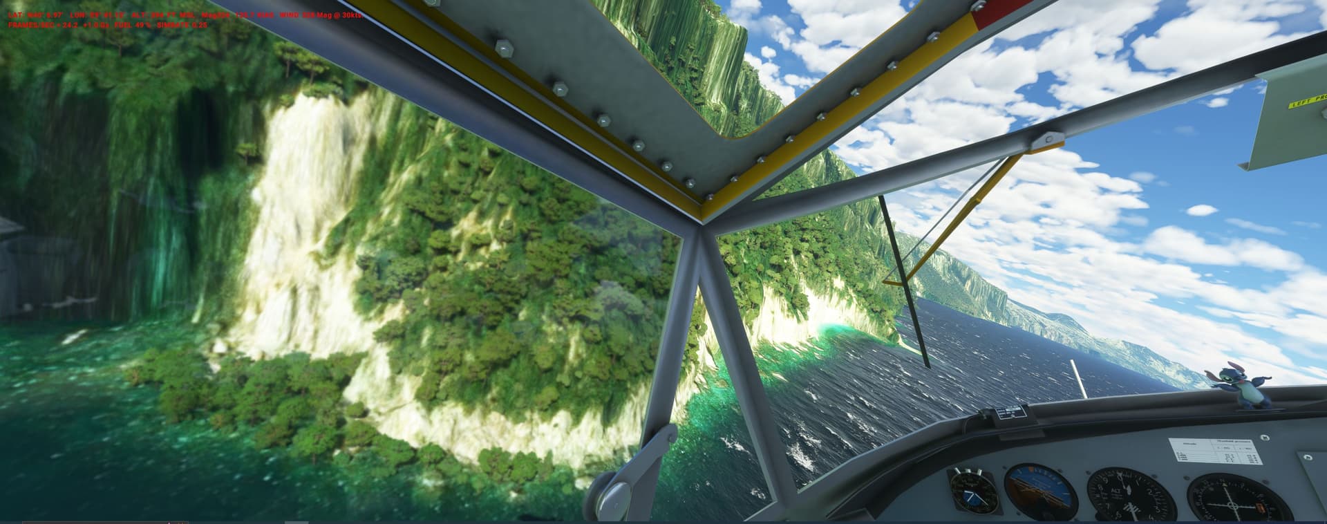
There are Sim-CL-215s, but we use one of my favs - the free PBY-5 (new beta-upgrade!) - the Cat was used in that role by France, English-VFR - Downloads (free.fr)
We will take her from Corsica for missions in Sardinia.
MISSION 1
Wildfires, fueled by the Maestrale (local west wind) rage in the coastal mountains along the east coast: watch for turbulence during the 5 water drops lo-level in the canyons.
MISSION 2
Fire patrol first in the south, then up the west coast to the north. Scoops at inland lakes are challenging, you will drop on some of the highest mountains of the island.
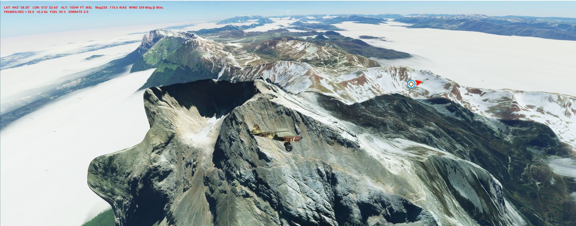
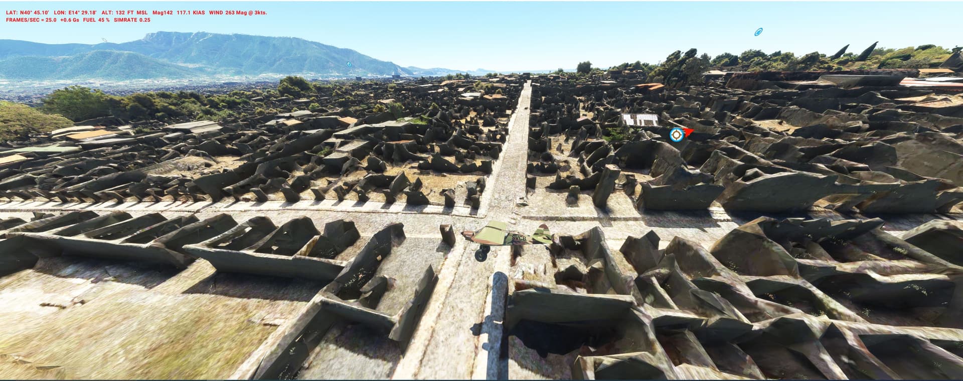
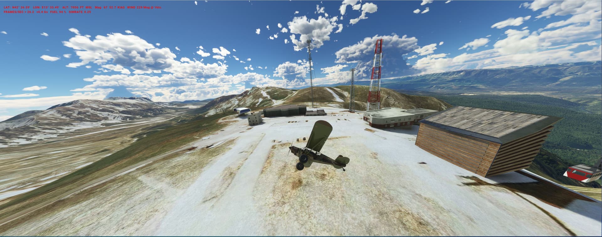
Sep 1943: Italian “Duce” Mussolini has been ousted and is held captive in an unknown location. His German allies have signal intelligence that he is located in some old castle in central Italy or a mountain retreat in the wild Gran Sasso massif.
Take a “Storch” STOL Luftwaffe plane (avatar) on a recon mission: ITAL_gran_sasso.PLN (10.4 KB)
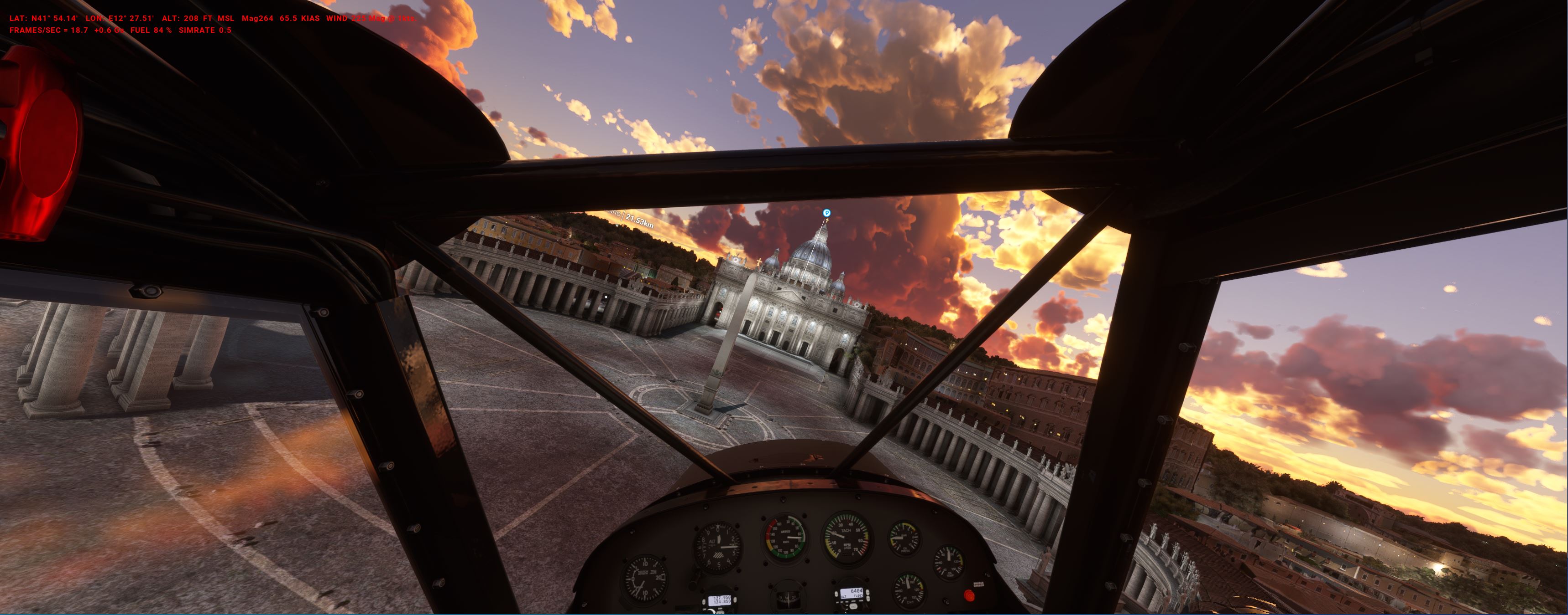
Start in Naples (lo-level inspection flight - as the city is slipping out of control in anticipation of the allied landings…), then head inland: Check POIs and land on remote pastures to check alpine huts & sheperd cabins before finally landing in Rome HQ for a report.
Pretty outlandish project - but first they need an excellent bush pilot to bring in hi-alt food caches and to check emergency landing zones (LZ) for an evac in case of emergency or bad weather.
Il Guerra de Chaco was a totally senseless war in the 1930s. The Ju-52 was the mainstay of the Bolivian transport wing, evacuating more than 40.000 wounded.
Thats a surprising number - higher than the Junkers evacs during the German Stalingrad airlift in 1942 !
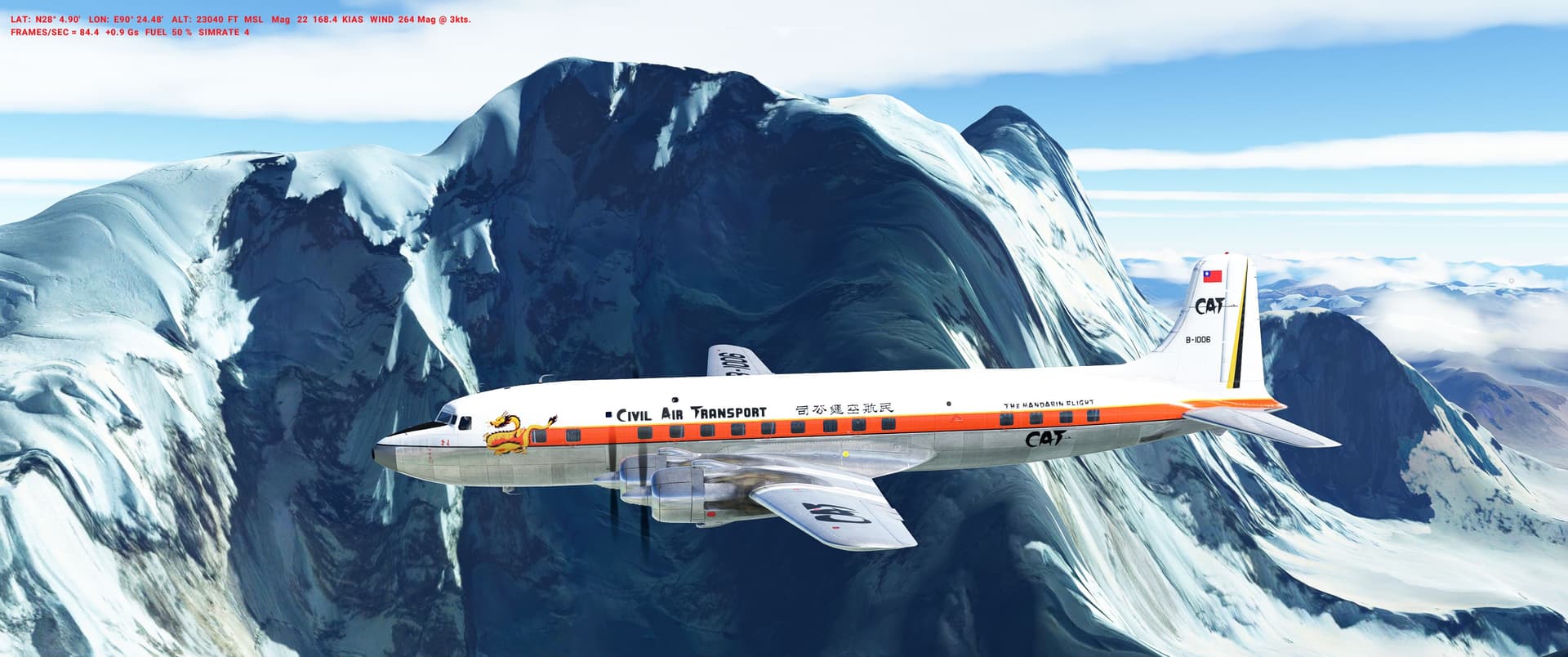
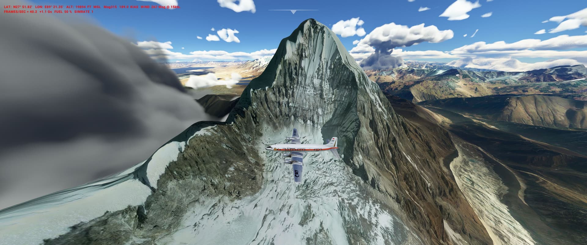
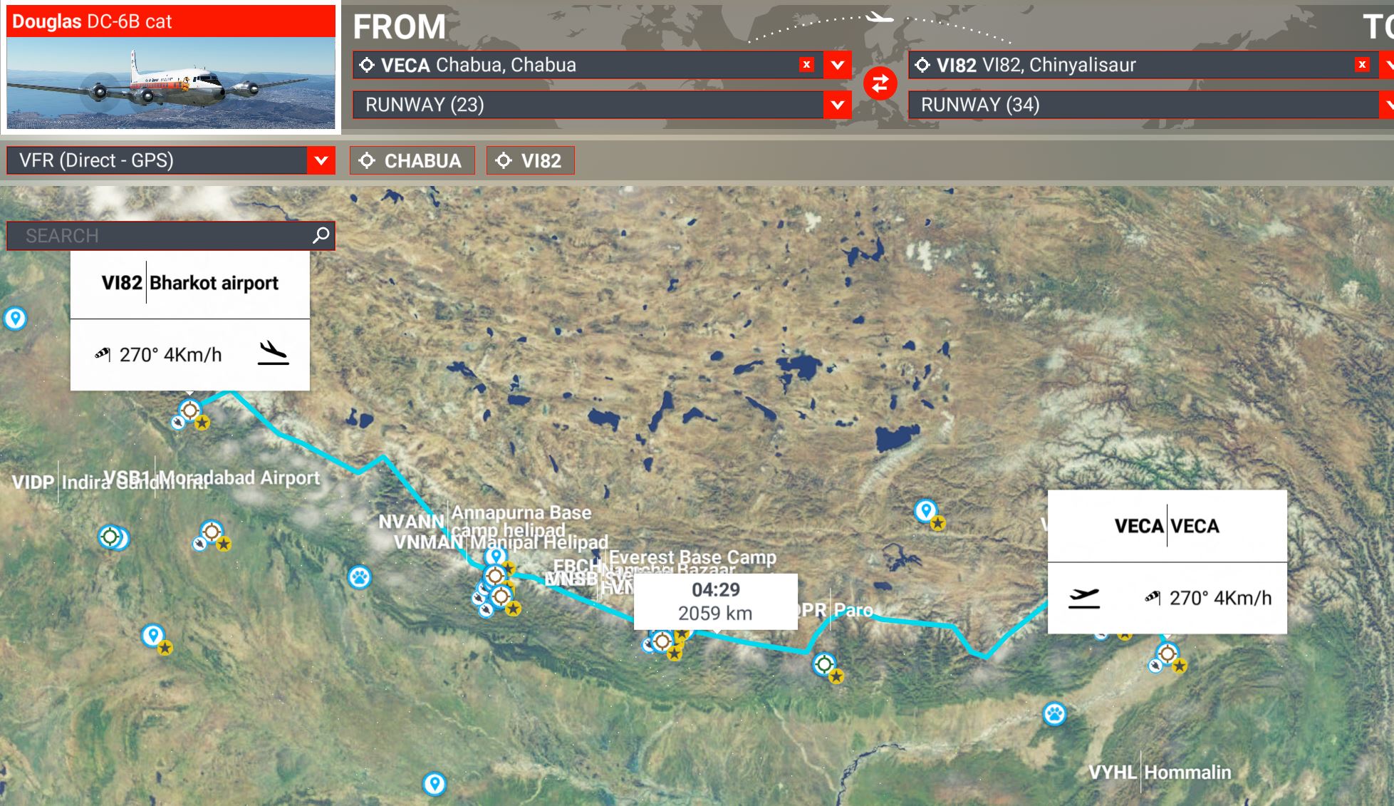
just coming back from some IRL trekking tours in the Indian Himalayas - absolutely beautiful mountains, will post some PLNs from the region over time (hoping for a DEM update soon ).
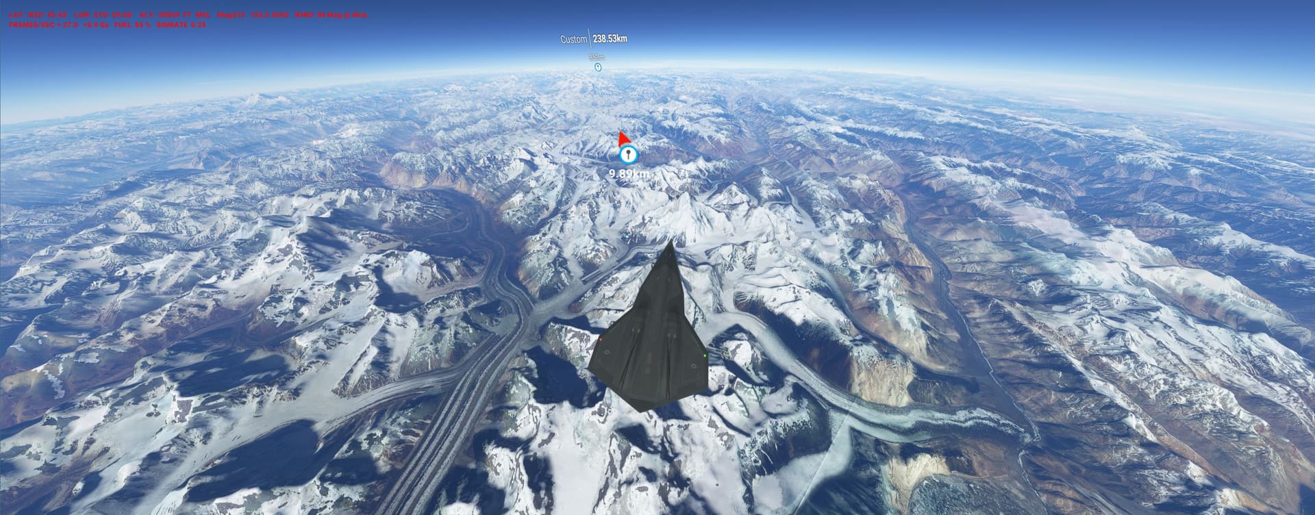
Each morning IAF fighters were flying over our tents, so an idea for the otherwise quite useless Darkstar posing as a real plane came to mind:
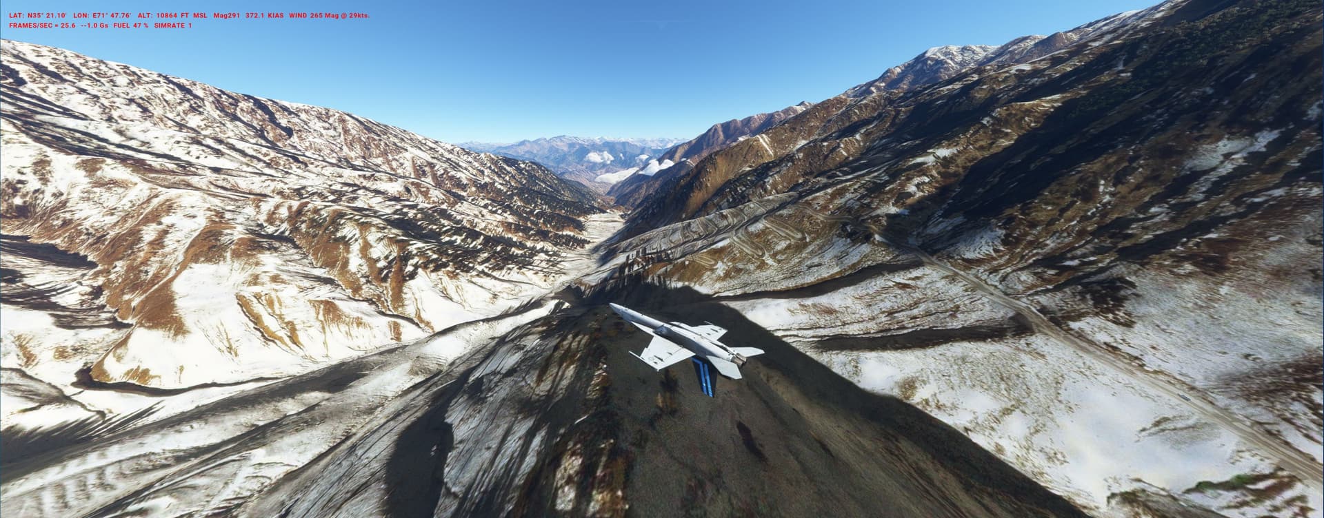
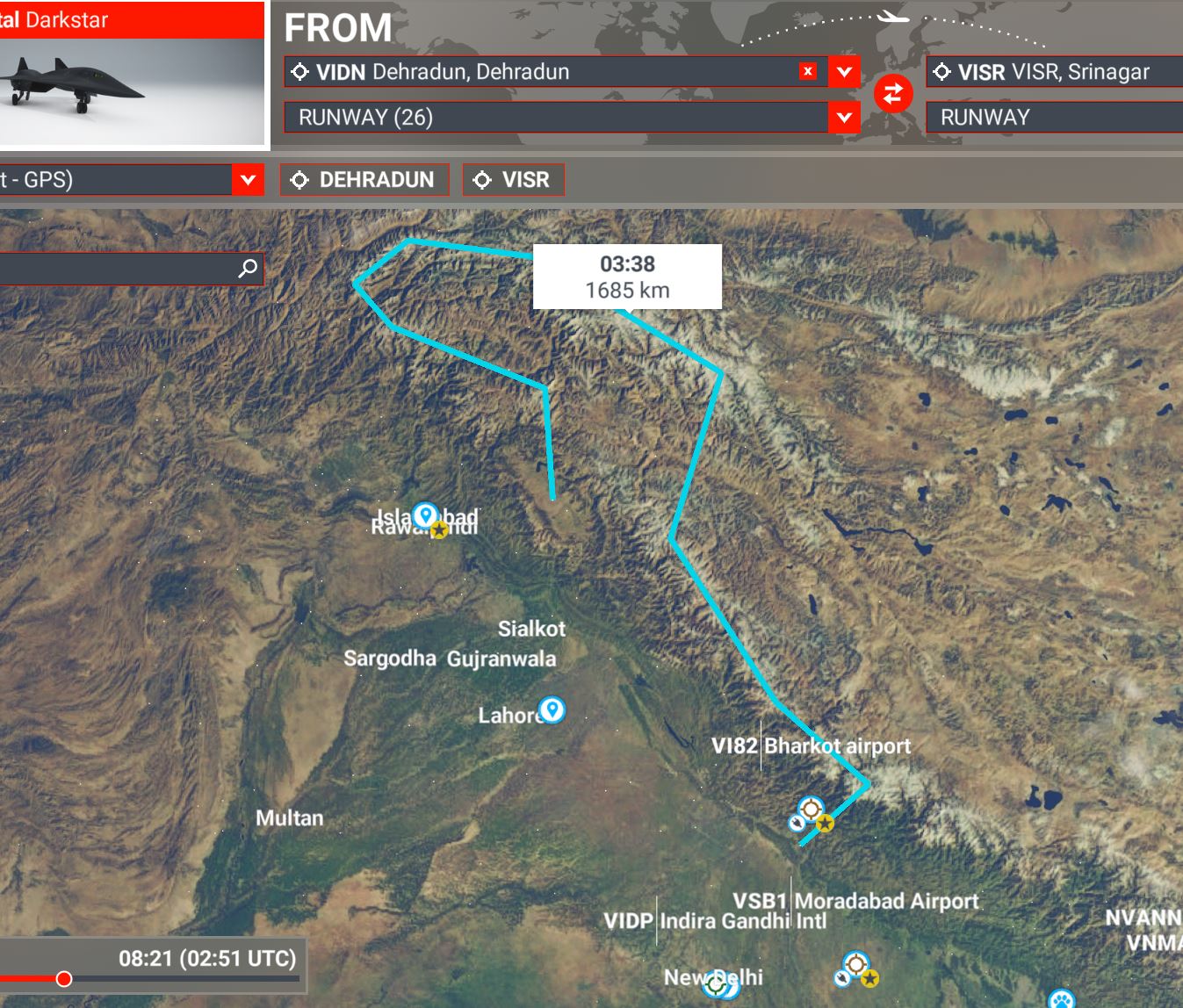
India and Pakistan have disputed borders/provinces and the IAF used Recce MiG-25 “Foxbats” for frequent incursions into the latters airspace. The Mach-3 MiG could operate up to 75.000ft, making interception impossible, much to the chagrin of the PAF.
Dark Foxbat @ 60.000ft over the 8000ms K2, Broad & Hidden Peak, Gasherbrum:
Start leisurely along the western Indian Himalaya before accelerating for a loop over enemy territory: adjust speed and altitude according to the situation, before landing in Kashmir. INDIA_Foxbat_over_Pakistan.PLN (3.3 KB)
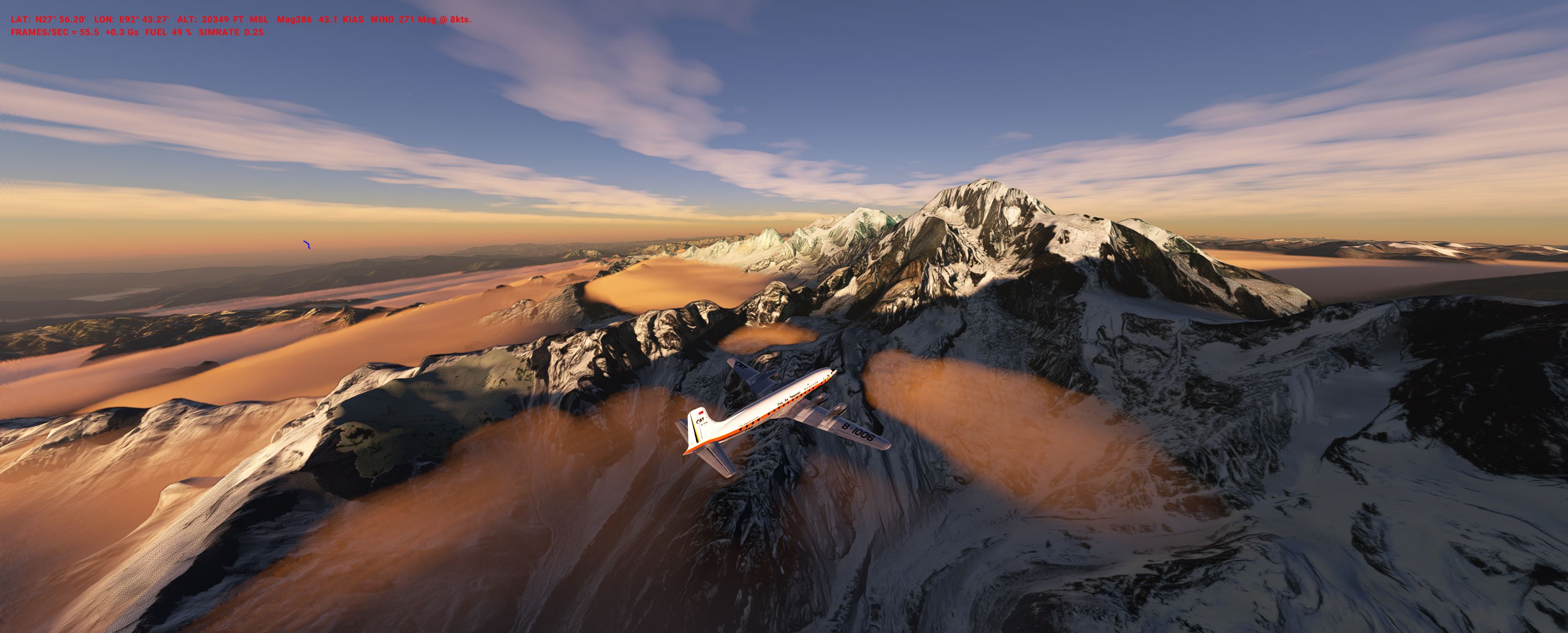
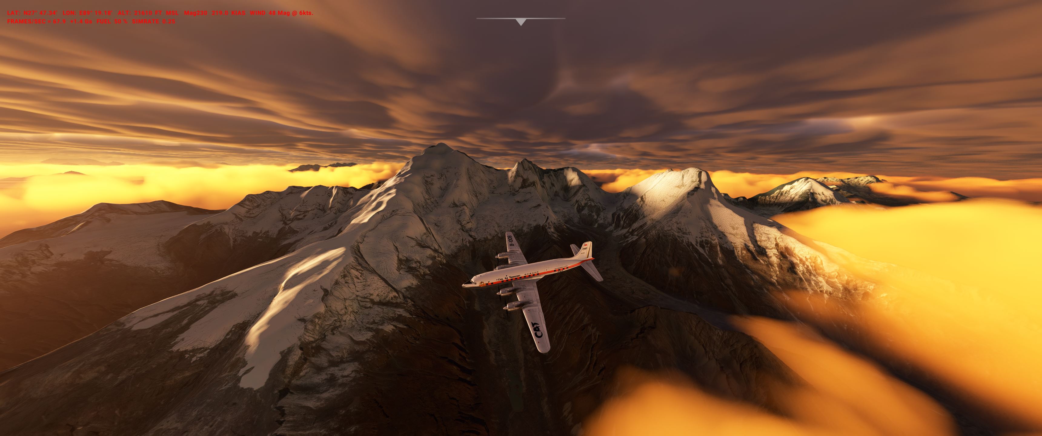
1959 - fearing for his life the Dalai Lama fled chinese-occupied Tibet to India (together with 80.000 of his followers) where they were granted asylum and support.
To keep up at least a spiritual bond with their homeland, exiled Buddhist lamas, yogis and abbots decided to fly along the India-China border and its sacred mountains. Performing the old rituals in the plane within visual range of the vandalized monasteries and stupas up North.
even after the last WU the Arctic is still a tropical ocean, so ice lovers have to go antipodal:
In 1946 the US Navy went to the South Pole big time:
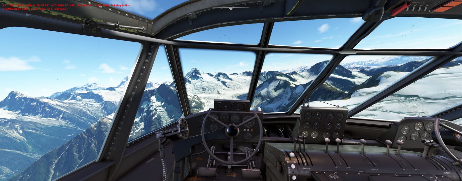
They used C-47 (JATO-assist launchs from the carrier!) and Martin Mariner flying boats to recon the continents mountains from all sides.
Map of the flights (a C-47 made it to the pole):
We have to do a bit of what-if as we have no carrier, no JATO (yet) and no Mariner.
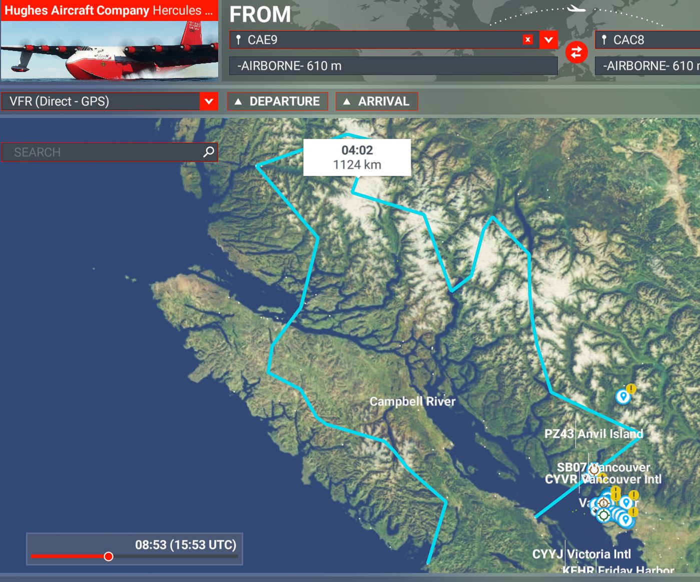
Put the Dakota on floats, bring in the Catalina and - drum roll please- a blue Hughes H-4 (all great freeware).
Then the Big One preps for the Transantarctic Mountains and Mt. Erebus (at the turning point Bing gives up and everything goes white-out…): ANTARCT_HighJ_Hughes.PLN (3.5 KB)
For effect, pics have been taken near Aerosofts Rothera station (highly recommended)
Lots of opportunities for modders (Little America etc.)
Next one will be the German Neuschwabenland expedition of 1938…
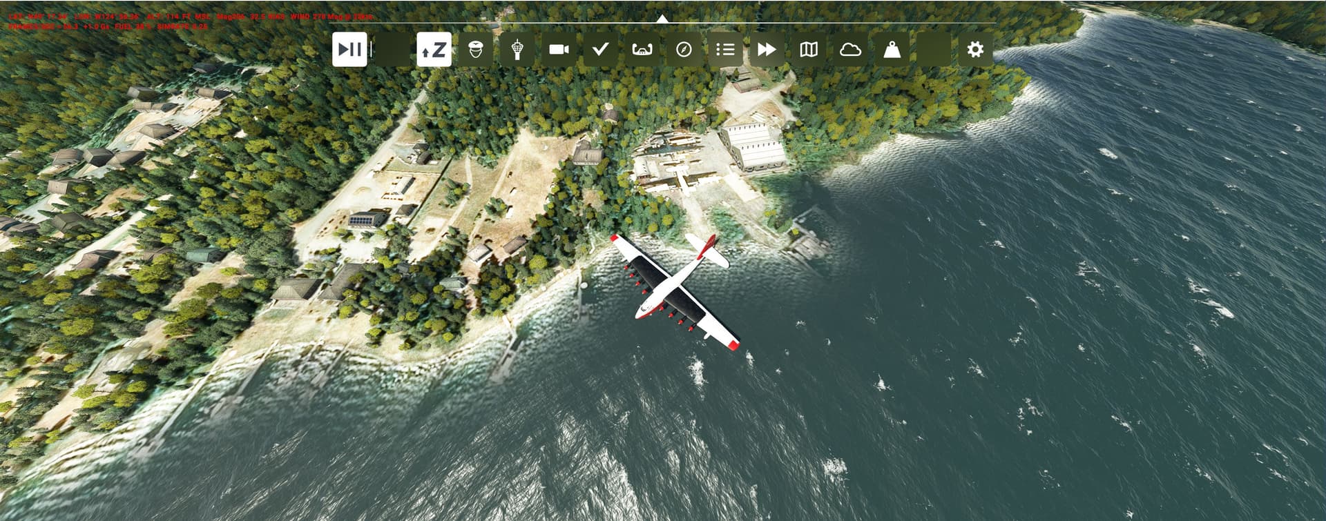
IRL many years ago Wayne Coulson allowed me to sit in the cockpit of one of his Martin Mars waterbombers on Sproat lake, a lasting memory:
Lets imagine that instead of the Mars some H-4s would have been equipped as firefighters. I estimate she could hold 80.000l of water/retardant - more than the fabled 747-Supertanker.
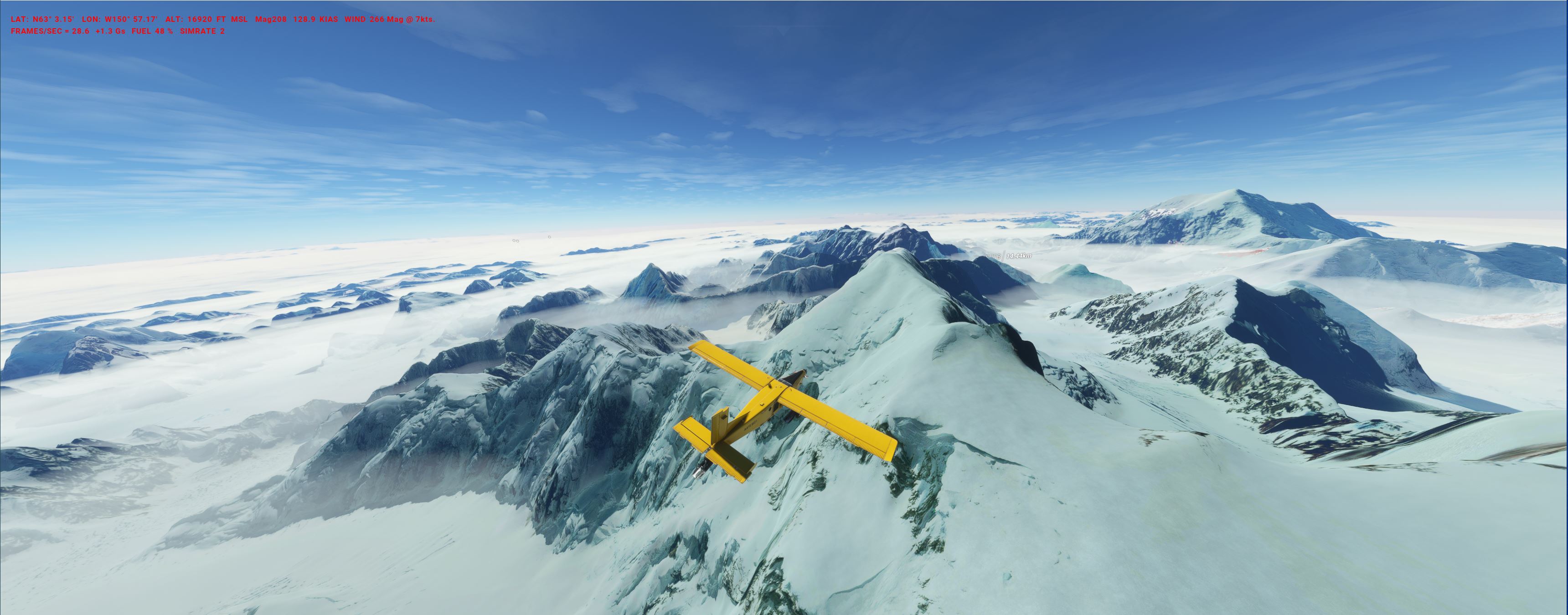
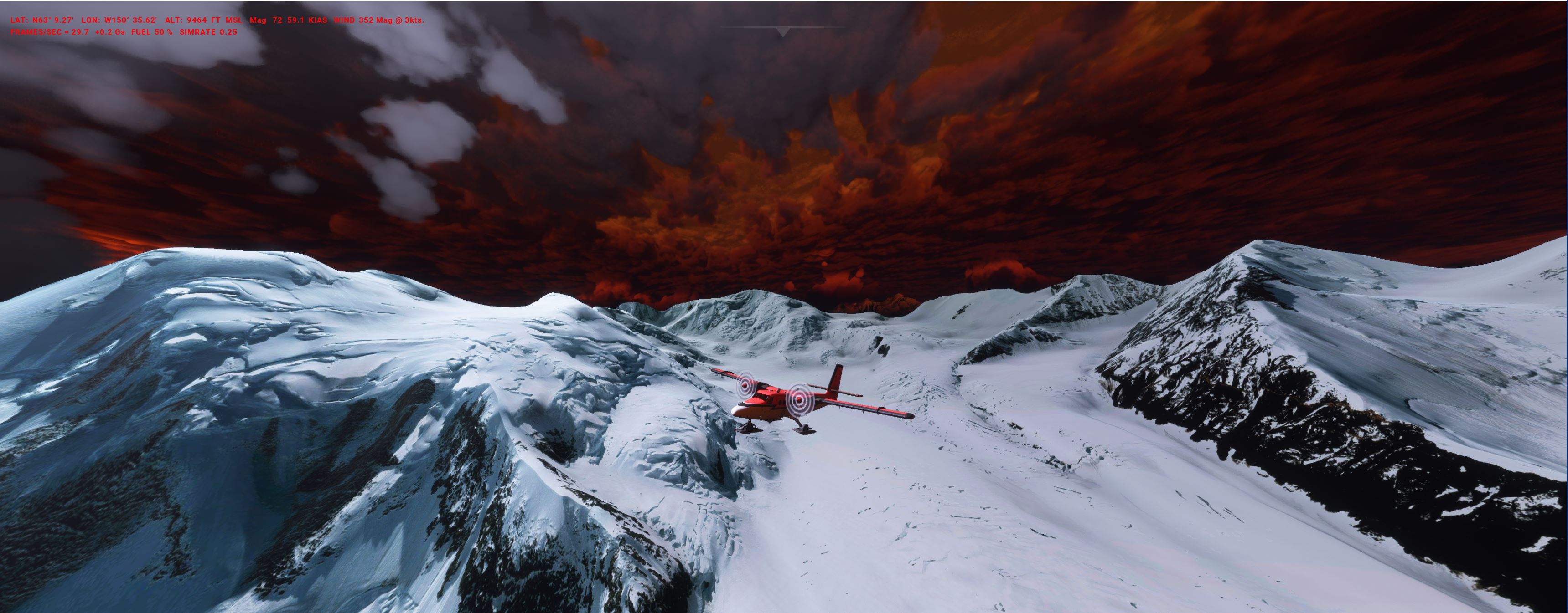
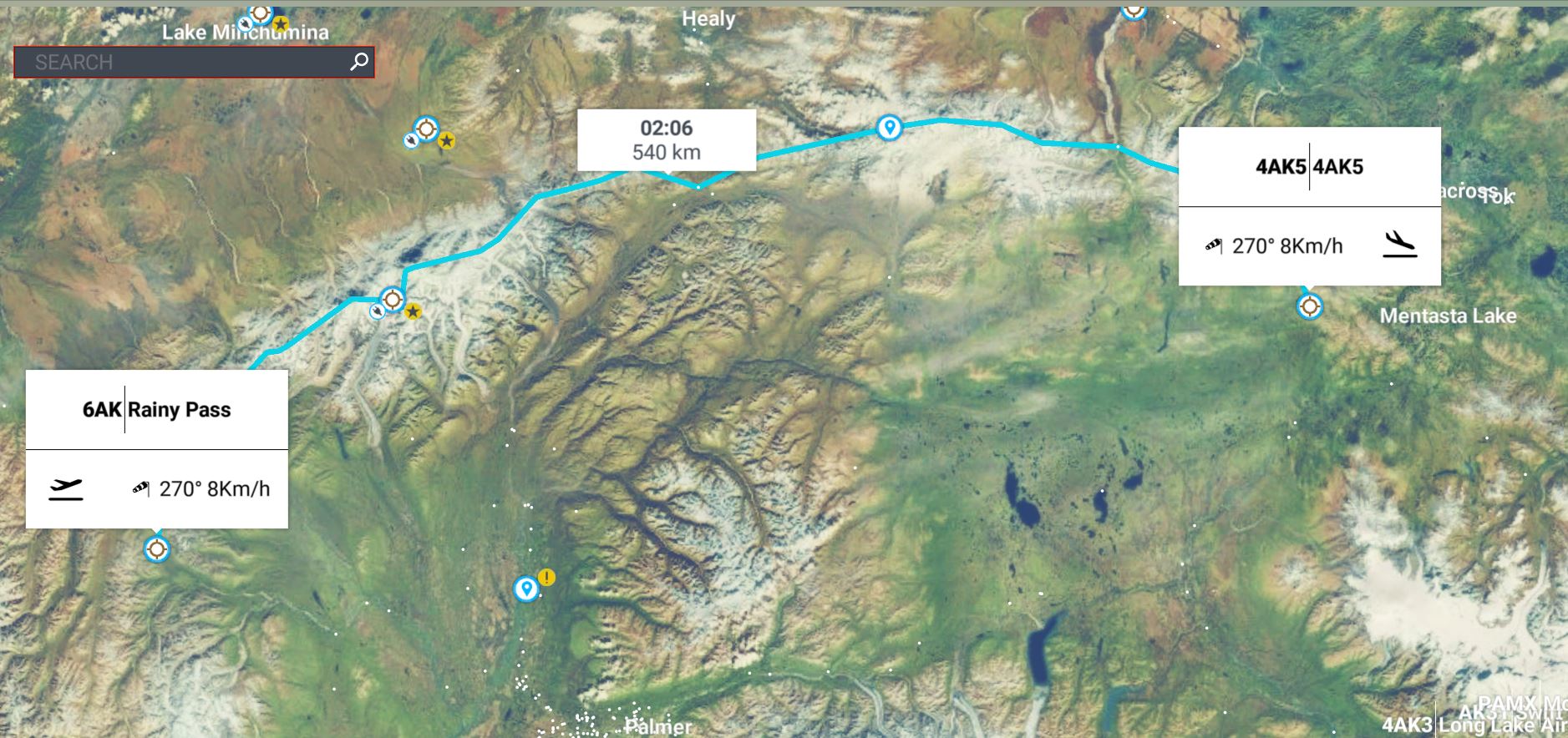
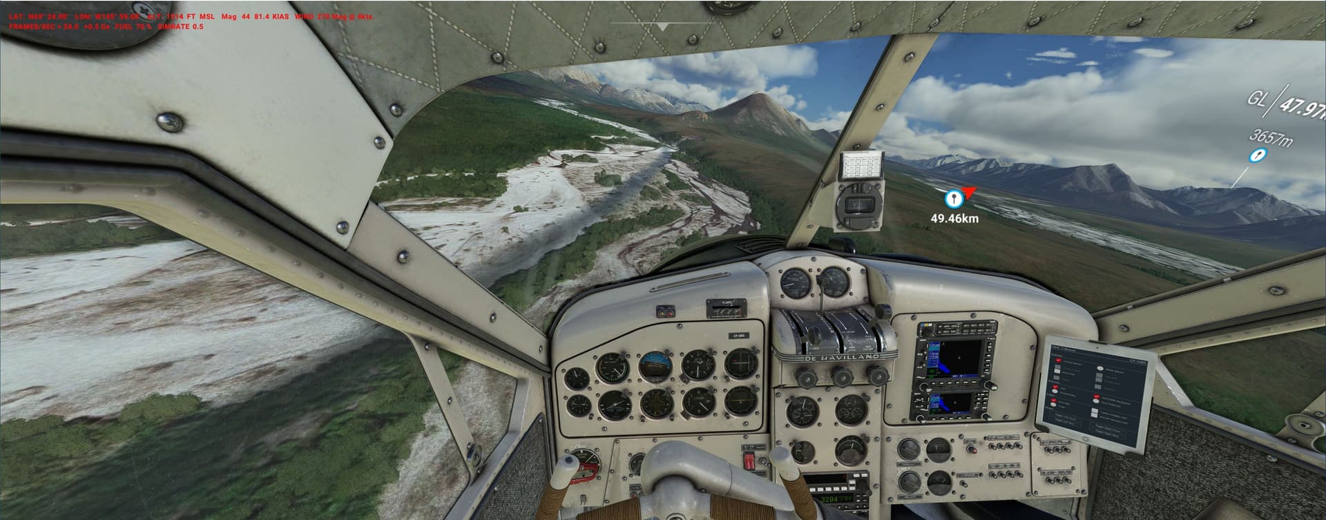
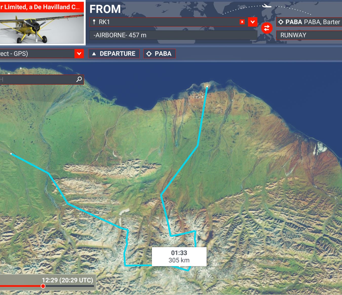
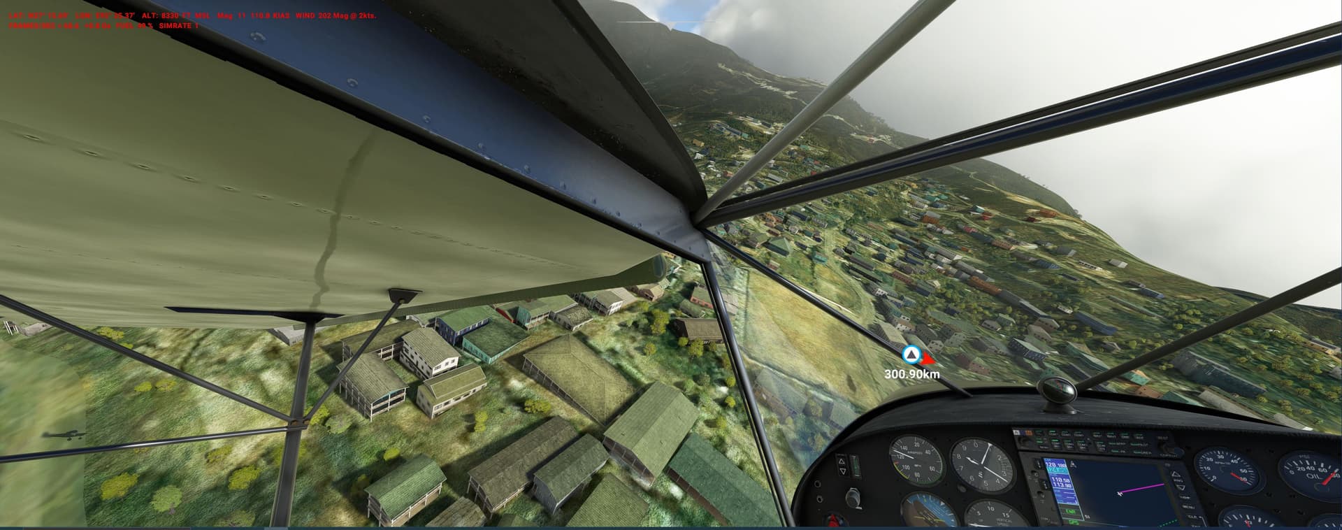
You fly from Kavik_RK1 to Barter_PABA: customer itinary requires you to land often - on deep-gravel river banks (Waypoints RL), glaciers (GL) and peaks (PL - if possible…).
The Indian National Cadet Corps operates more than 100 Zeniths:
Disaster control:
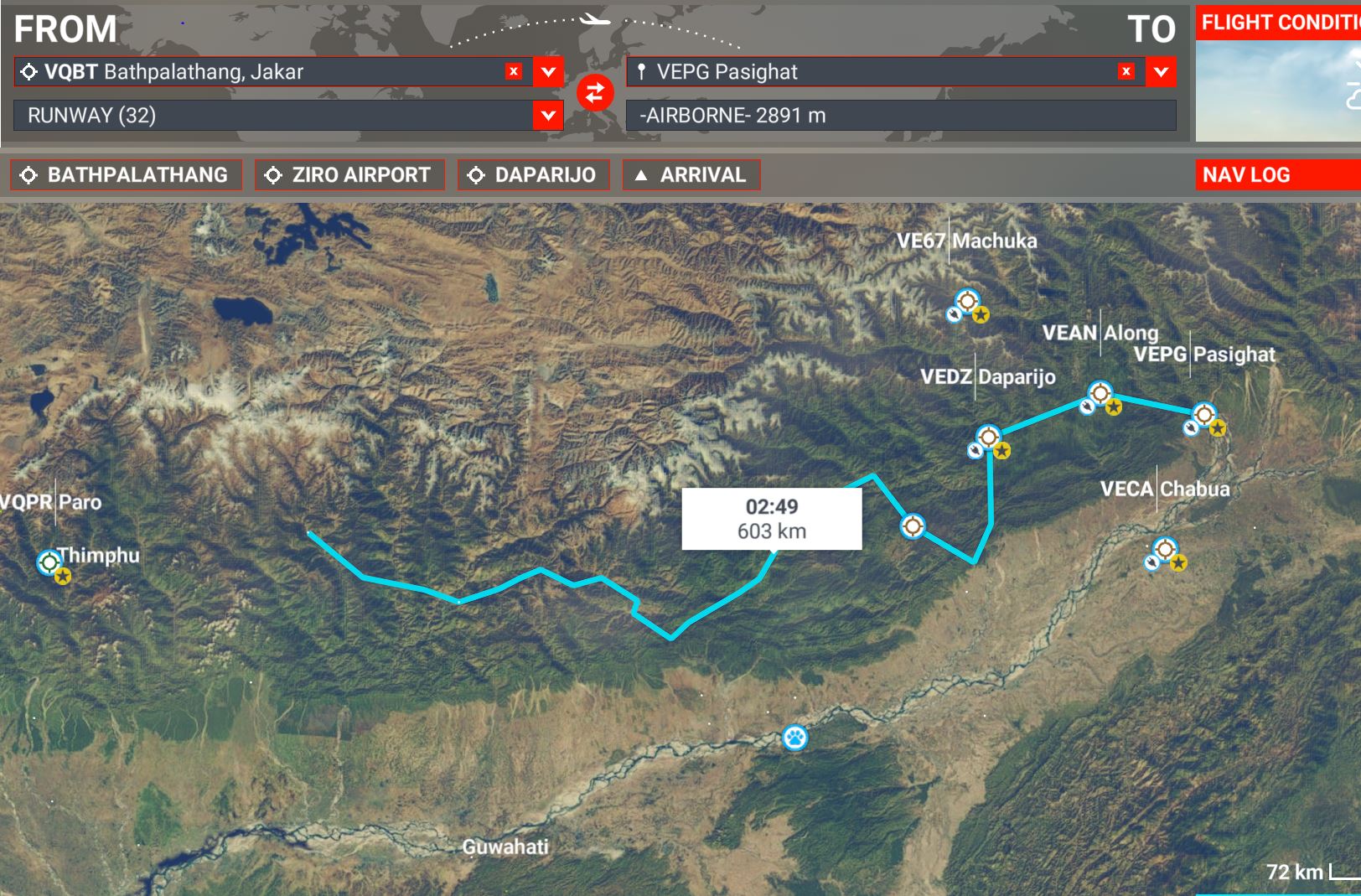
the state of Arunachal Pradesh (and Butan) has been hit hard by the monsoon.
Now the weather has cleared but all choppers are busy with SAR, so you are to fly a CH701 along the promontories of the Himalayas to check for landslides and flood damage in cut-off regions.
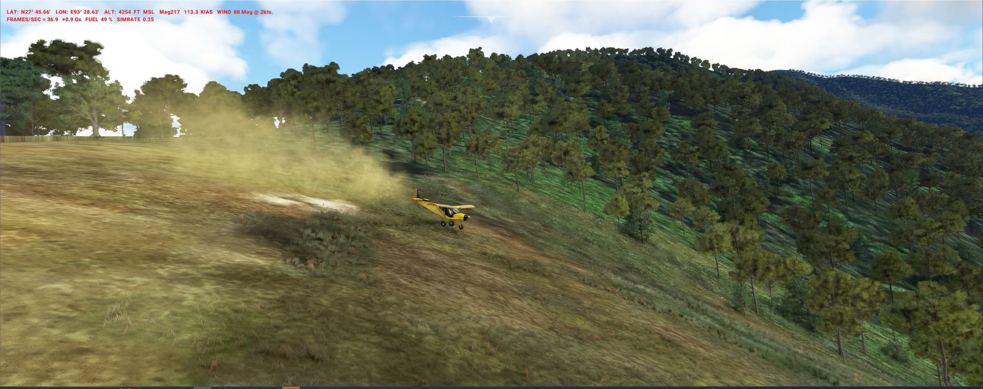
Something only the Zenith can do: land on meadows, river banks, village roads, soccer fields etc. - definitively tough going (Pipu-Dipu and other jungle clearings 30° slope, see pics)