… can be translated as “life air gunnery” by the Eidgenössische Flugwaffe (i.e. Swiss Air Force).
An annual event on the Axalp Hill - maybe the ultimate airshow in Europe, planes zip by 100ft from visitors.
There is a nice addon: https://flightsim.to/file/32933/fliegerschiessen-axalp
You show off the Pilatus PC-21 (2 pay options) there with a full aerobatic program, the location is great because you can come in at three sides from below (!) the spectators:
(many more Axalp YTs: F-18, F-35, F-5, Porters, Choppers in evidence)
But this year there is a hidden agenda:
your guy-in-back is a military attachee of a country interested in acquiring the 21 - competition on the trainer market is fierce, so the man has to be overwhelmed by superb action.
So somebody pulled strings and you got permission for a gut-wrenching, xlow-level, contour-following, tree-hugging, swiss-army-knife-edge ride (including a never done viaduct fly-thru…) along swiss peaks, from LSMM to posh St. Moritz LSZS where the fellow will be wined & dined…
You might take the US Forest Service infra-red scanning King Air N149Z (see the .to) to detect pockets of embers on the whole route or fly it in three stages with different planes:
A. from the Mexican Border to Sequoia NF US_PCT_S.PLN (5.6 KB)
Its spring, with snow patches still in the high Sierra. The PCT Association (https://www.pcta.org/) has hired a Cessna from CAL FIRE to spot damage to the path during winter.
Fly slow at tree top height, you have some landmarks & airstrips marked as WPs, the passengers will give you precise directions.
a memorial flight with vintage aircraft for the pilot who crashed on Forester Pass (13.200ft) in Sep. 1930 on a medical supply run for a trail contruction crew injured by a dynamite blast.
Can you make that highest spot of the PCT (pic) with your Stearman? Wave from the open cockpit to the first thru-hikers of the season!
a DC-3 of the USFS is on an inspection flight with a mixed team of environmentalists, logging company managers and politicians to check the clear-cut situation along trail and mountains.
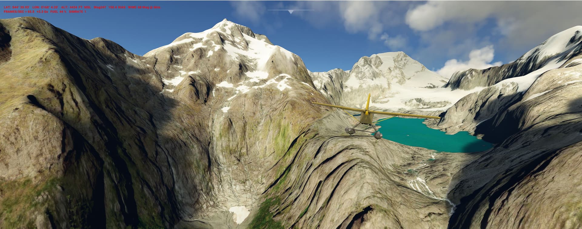
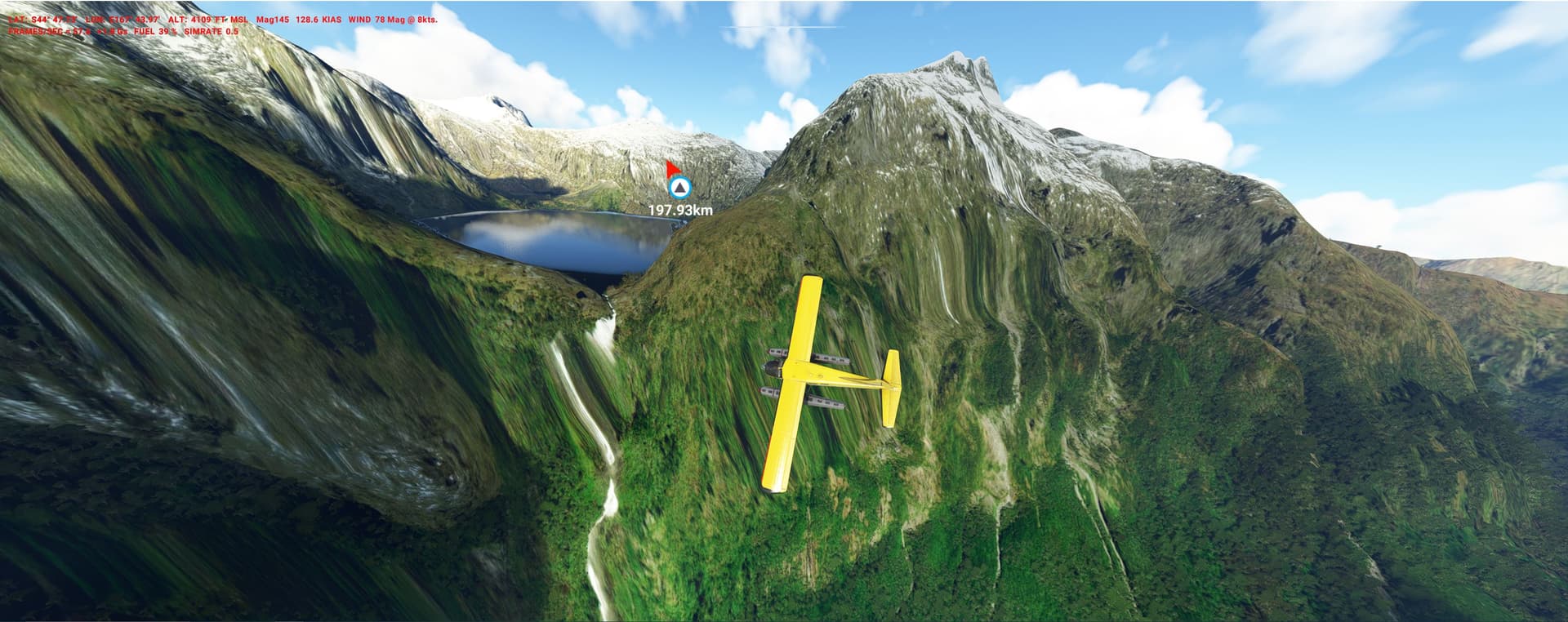
NEW ZEALAND - the bird that came back from the dead
1948: South Island
This T-Bird was considered extinct for a century - until it was rediscovered:
The find created quite a stir and biologists tried to find more survivors in its impassable Fjordland habitat.
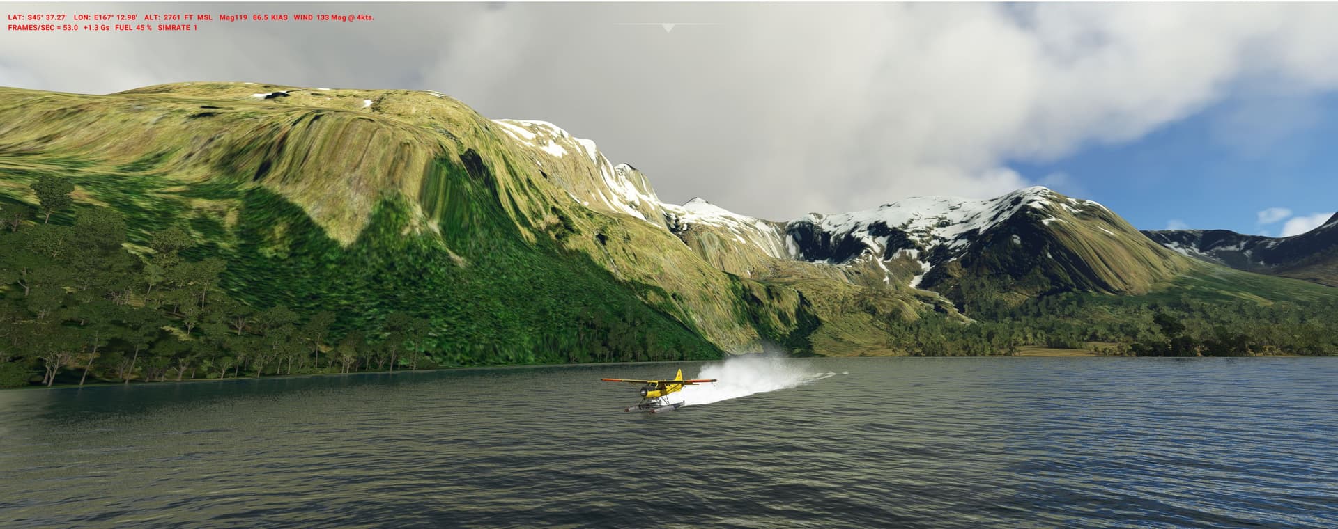
The only way at the time was to land with a Float-Beaver or Cub on never-visited alpine lakes and hidden inlets (WPs labelled WL = water landing).
The Takahe survived up to this day only because the rampant deer were later culled by chopper (in the beginning shot, later netted) - a golden opportunity for modders to create adrenaline-kicking heli missions in that wild region:
you might use the YTs (enter e.g. “new zealand deer hunting helicopter”) or contact this living legend:
Crop dusting & “top dressing” is big business in NZ (Aerial topdressing - Wikipedia) - with hundreds of aircraft, dozens of companies and 2550 “farm strips” littering North Island alone (none exists in the sim of course , map from Grafton 2010):
MAP
They are just a short patch of dirt/grass, often sloped and with a chemicals-reload truck waiting on top.
Its super-cool xlow-flying, beaucoup teaser YTs available, start with this guy: 100 flights in one day - Cropdusting - YouTube
he’s actually comparing his real thing to MSFS (diverting to Lukla of all places…):
Today you are a rookie ag-pilot on a qualification trip with the P-750 (ORBX on sale, unfortunately no dust animation yet…) thru some rugged parts of North Island. Your instructor asks you to do lotsa mock drops and landings in hilly training areas (WPs = TA), take your pick.
Great idea! I’ve done some ag flying just north of Lake Taupo inspired by Jimbo’s YouTube vids before. Jimbo used to be an instructor/check pilot for Lukla IRL so he knows it very well and it’s not surprising he ended up there for fun.
Easter has arrived, winter is coming - the free-riding season is about to begin. Before everything is covered by fresh snow, you are to check ice and crevasse conditions at 13 drop-off spots in the Mt.Aspiring NP with your Ski-Porter.
25 years ago one of my best IRL flying experiences ever were two “Adventure Flights” with this outfit, at the time much smaller and based in Wanaka (South Island):
An instructor in the rear, but me on the controls part-time: first a full aerobatic programm in the Pitts (he flew each figure first, then it was my turn), after that a ride over lakes and mountains in a T-6 (the P-51 being tooo expensive, but I regret not booking it to this day…).
1949-75 New South Wales
To air-support the construction of the gigantic Snowy-Mountain-Hydro-Electric Authority a dozen bush-strips and a Flying Unit were created. The latter operated Beavers, Porters, Islanders, Skymasters and more for a variety of missions.
You go out on patrol to check snow/mud conditions on those strips. @ YCUR you get the news to look for a missing kayaker in the Tumut Gorge, so skim the whitewater low & slow.
The Royal Australian Airforce and private operators flew Caribous in PNG for many years.
Here you go on a relief mission in the Highlands, 20 dirt strips (shortest 1034ft, max atitude 6350ft). With a good load it can be challenging, not to mention the weather…
I see from your great screenshots that you vary your sim rate a lot. May I ask why? (Only because the only use case I’ve ever envisioned was to speed up a crosscountry autopilot flight.)
I speed it up (with AP on) for bland legs of the PLNs. In the case of the dusk-unload pic I cheated by rotating the plane in warp-mode to bring it closer to the waiting folks. Shame on me…
Slow-mo is for gettin better angles of the screen-shots.
To have full time-control is one of the advantages of Sim- over RL-flying…
The Himalaya is prone to frequent and deadly earthquakes. Therefore the Indian Geological Survey (https://www.gsi.gov.in/) has set up monitoring stations on glaciers, riverbeds and prominent peaks.
After a big quake in Ladakh and Kashmir Provinces connection to them is lost. You are to go for a recon flight from Kargil - and on the way will also give assistance to cut-off villages.
Land (L) on pre-mapped, somewhat groomed but still rough (and x-short!) spots. Numbers at WPs are altitude in hundred feet. Sometimes only an air-drop is possible, at the peaks just do a visual inspection of the tripods.
Altitude changes can be dramatic so plan ahead:
on order to make pass height with the underpowered DHC you have to spiral up before the valleys close in…
Its a wild and rarely visited mountain range with spectacular peaks higher than 22.000ft. DEM is reasonable, Bing often quite good - everything set for a terrific experience off the beaten track.
1967: the PRCh is heading for its first H-Bomb.
Since years the CIA/Taiwan U-2s are doing regular high overflights (for photos, sigint, isotope sampling, sensor drops), but now several were shot down by new SAMs and MiGs.
Planners have to change to low-level operations, so activate the Bat pilots (Black Bat Squadron - Wikipedia) and start “Operation Heavy Tea”.
Your C-118 (or future Milviz C-130 ) uses two old airfields in northern Burma. Fly over the Tibetan Plateau, coming closer to the nuclear processing plants in Sichuan and the Lop Nor bomb test site (@ 40.7809, 89.2705). Its 4850km total, along many of Chinas highest mountains, used as nav-aids and radar-shaders.
(I like them pods disguised as boulders @ 48:20min, some CIA guys clearly were on shrooms …)
Less is known about “Operation Heavy Chai” - 3300km from India:
Drop a pod into the sand just 100miles from the Test Site. The legs over the empty Taklamakan desert have to be done at dune height (spectacular!) to avoid detection.
This is a 700km trip from Versoud (France) to Nikolsdorf (Austria) - along 27 main peaks of Europe (Hauptkamm can be translated as “Great Divide”).
In order to win the glider competition (or sim multi-player event ) … Looking back to the future: The OLC has revolutionized gliding (onlinecontest.org)
… you have to approach all Peaks/WPs stored in the GPS within 1500ft.
Set up a warm sunny day with a wind (5-10 kmh) from WNW (a standard summer situation), the Cessna should take you up in the morning real high.
Judging from my own IRL experience in the Alps (limited to a docile Scheibe Falke motor glider, taking the motorized Sim-DG-1001 calmed my nerves here…), I’m impressed how close you have to fly to the rocks to gain altitude and how Seb improved on ridge-turbulence and lee-rotors that can shake you pretty well.
You are a biologist doing research on the ecology of the springtail Hypogastrura sp., commonly called the snow flea.
The plan is to collect them in their habitat, glaciers and snow fields of Olympic NP (8000ft max).
Unfortunately grant money for field work is limited - so a chopper is out.
But a crazy bushpilot will do the 13 projected landings (WPs = GL) with you for a fraction of the costs. He operates tiny Zenith and CubCrafter skiplanes.
HIGH TATRAS & JULIAN ALPS - the first eye in the sky
WU14 has improved two mountain ranges which 110 years ago were part of the Habsburg Empire.
The Bleriot XI was the first operational warplane, used by more than 24 airforces - here come two historic WW 1 flights:
1914:
the Tsar tried to make a breakthrough to the south in Galicia. With the Imperial Russian Air Service Bleriot you are to reconnoiter the Kaisers HQ in Orava castle and Austrian fortifications on the crest of the Tatras. CZECH_bleriot_tatra.PLN (4.4 KB)
1915:
the frontline was the river Soca (Isonzo), famous today for its blue colours.
Fly an Italian Corpo Aeronautico Militare XI upriver and then over some of the highest peaks of the Julian Alps to spot Austrian mountain artillery dug in on the hilltops. Land uphill on grass to report to the Generals on Mt. Lussari.
With the flimsy Bleriot it needs finesse to reach and hold the 8700/9500ft needed - watch out for turbulence.
If you have no XI: re-hash it peacefully with a modern UL and muse over the human casualties:
Galicia 700.000; Soca: 1.1 Million, 7000 remains enshrined here:
Just came back from Bolivia, where you can still see old props, not necessarily in flying condition (C-46, C-47, C-131, DC-4, DC-6, Electra etc) at SLLP/La Paz/El Alto (Bing map, Azure kills them off unfortunately):