Omarama is a center for glider pilots from all over the world. https://www.omarama.com/
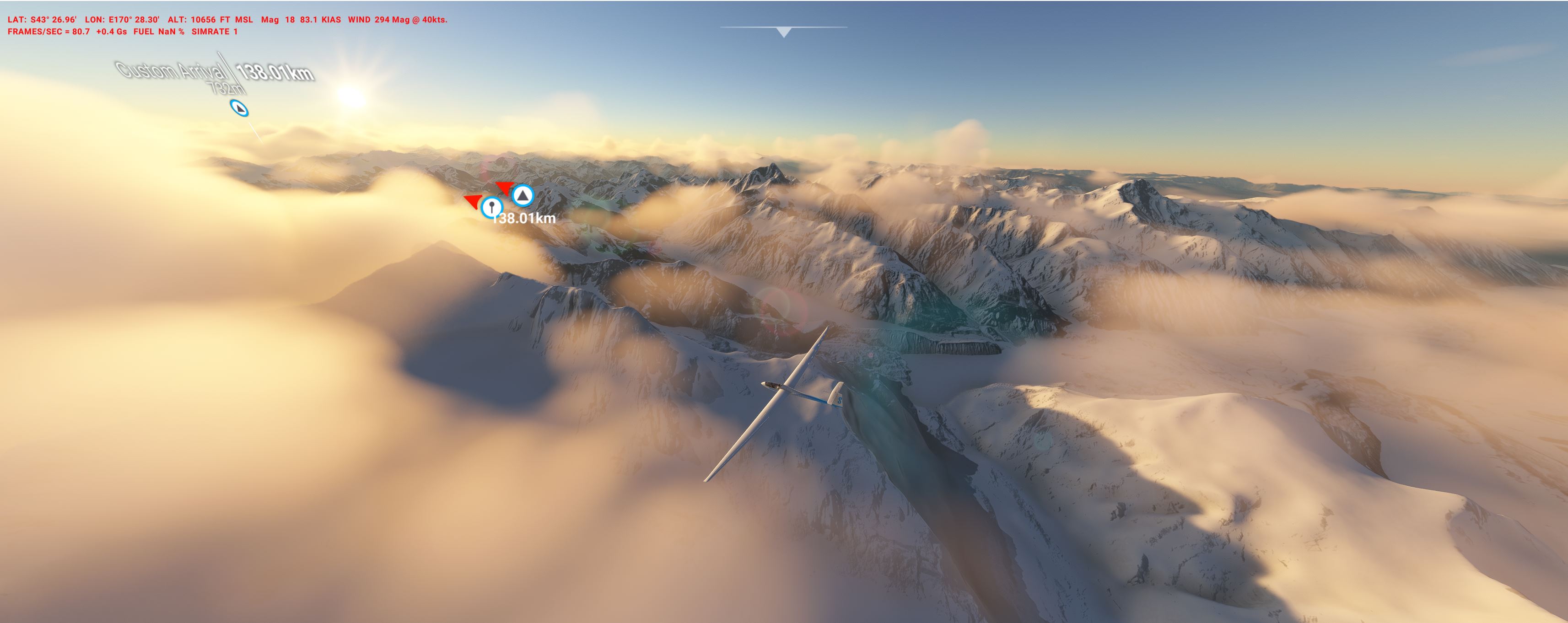
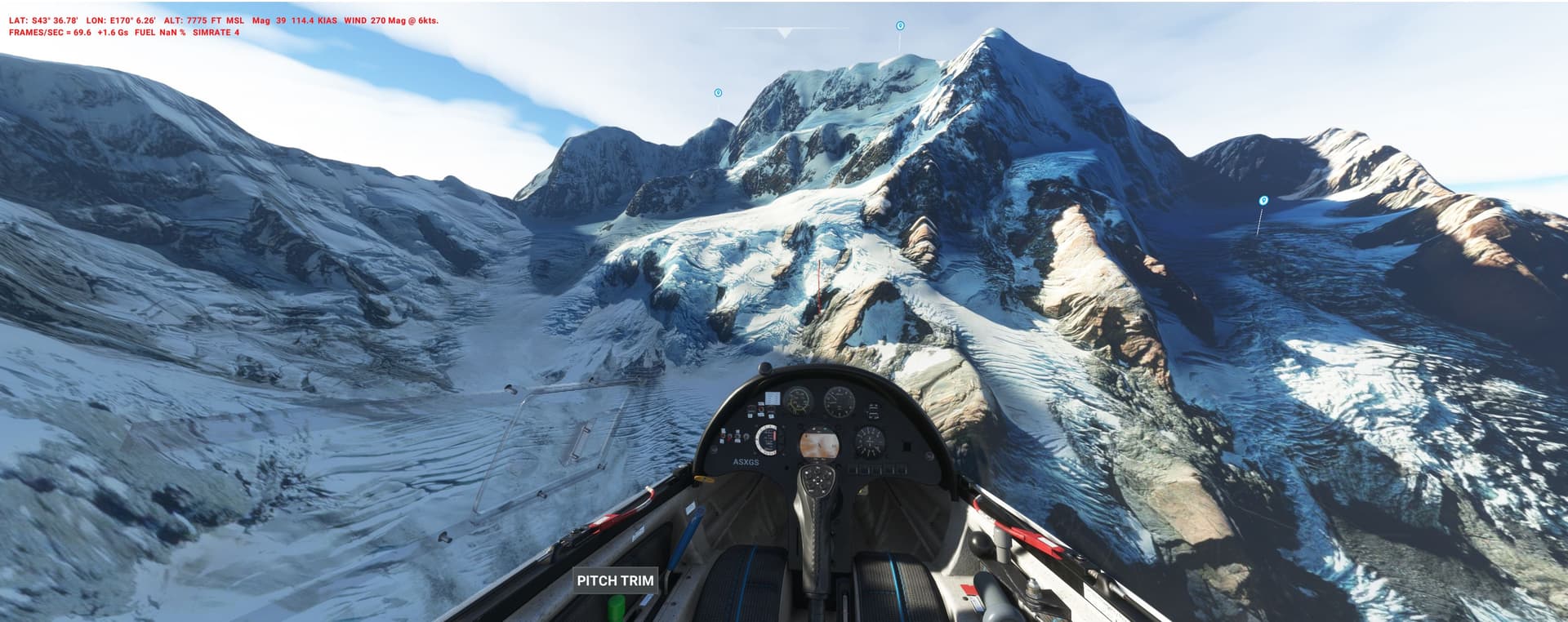
After separating from the Cessna we fly the DG over Mt. Cook (12.200ft) 280km up north over a dozen snow peaks until the Alps slowly peter out.
Experiment with different weather (“Live”, “Thermals” to prevailing “Western winds”) in order to make it - or try to force Metar for a “Wave” to go really high:
1955: USAF Generals planning for the Cheyenne Mountain Complex have nightmares about the USSRs nuclear bombers striking deep into the US south-west on one-way-tickets and by applying terrain masking to avoid radars.
They order a test exercise in which you are acting as bait with your Douglas EC-118A equipped with the latest ECM gear.
Interceptors (F-89, F-86D, F-94) are stacked up against you - at the time they were all sub-sonic and without guided missiles or look-down-radars - Mark-One-Eyeball only for the gun camera kill.
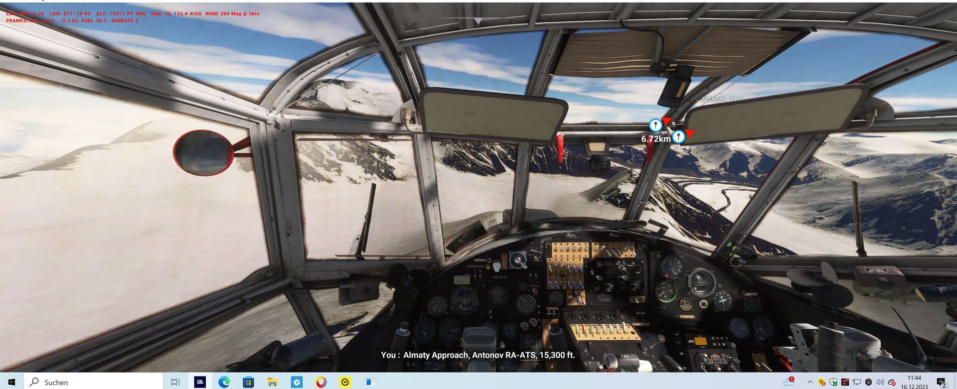
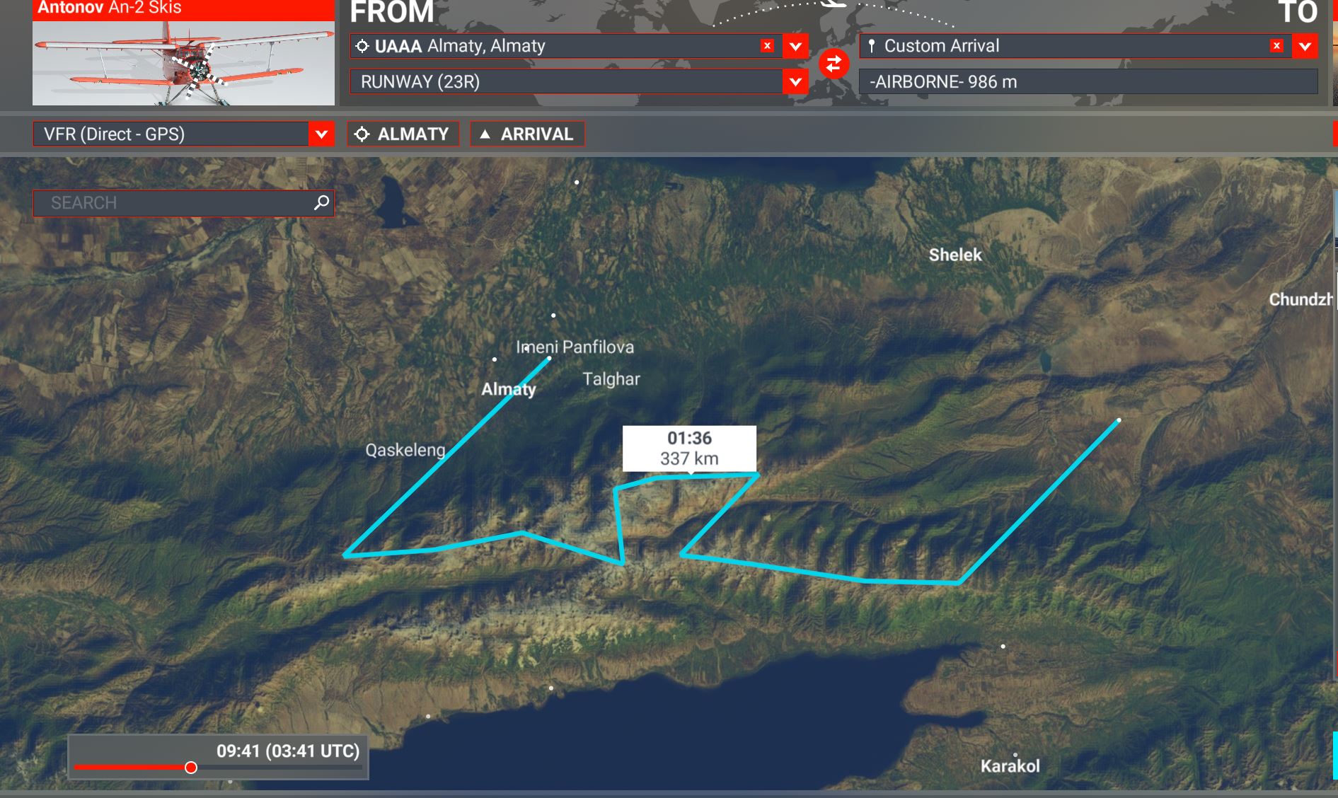
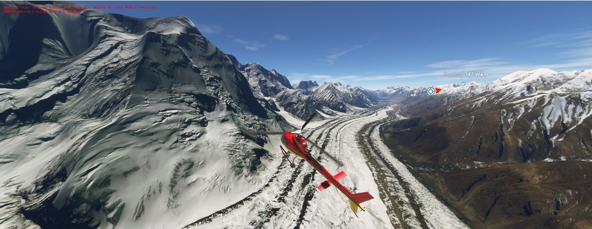
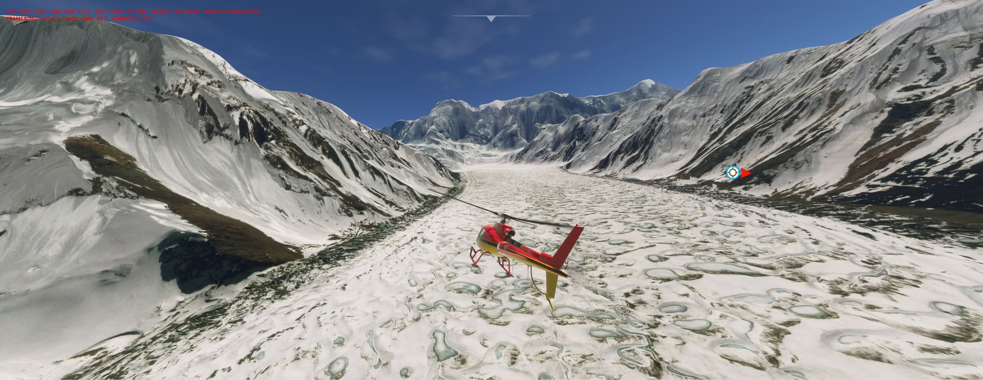
You are a volunteer setting up cam traps: a seasoned AN-2-ski pilot will drop you on many stops - from Almaty via the Trans-Ili-Alatau glaciers to mysterious Kaindy Lake
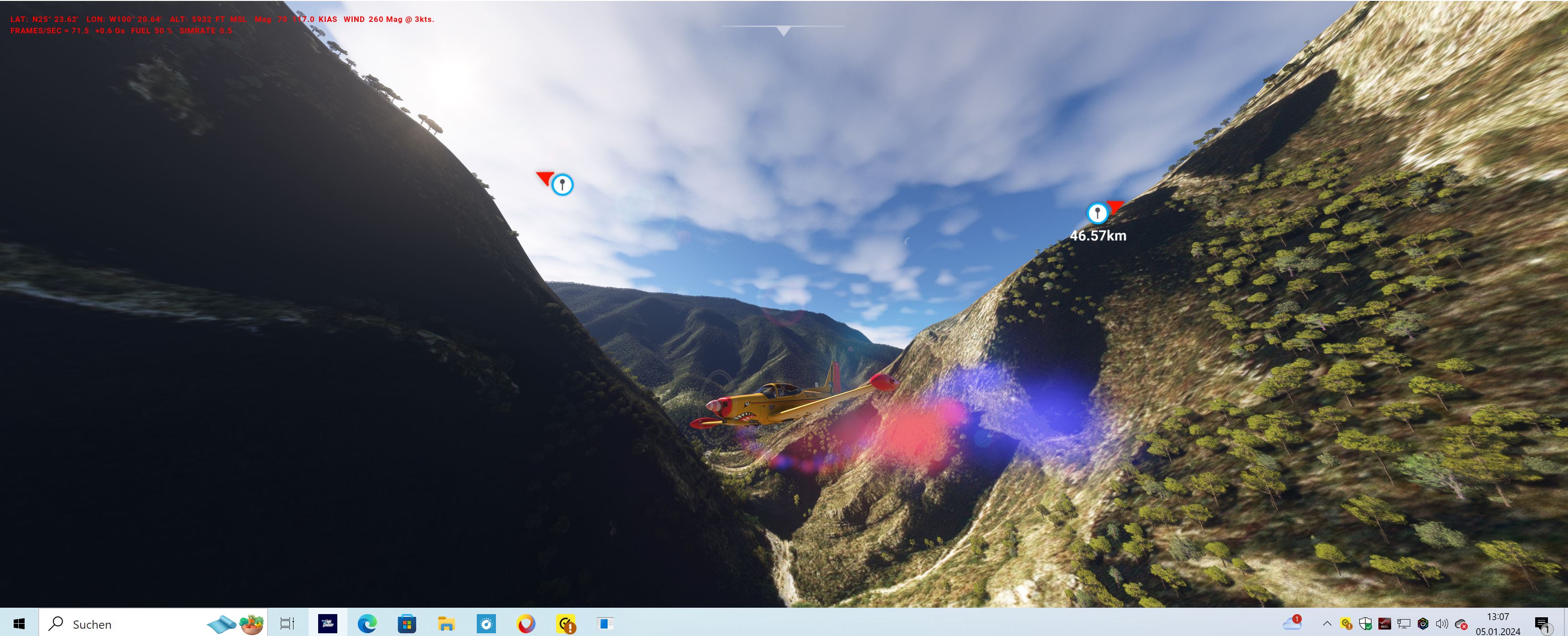
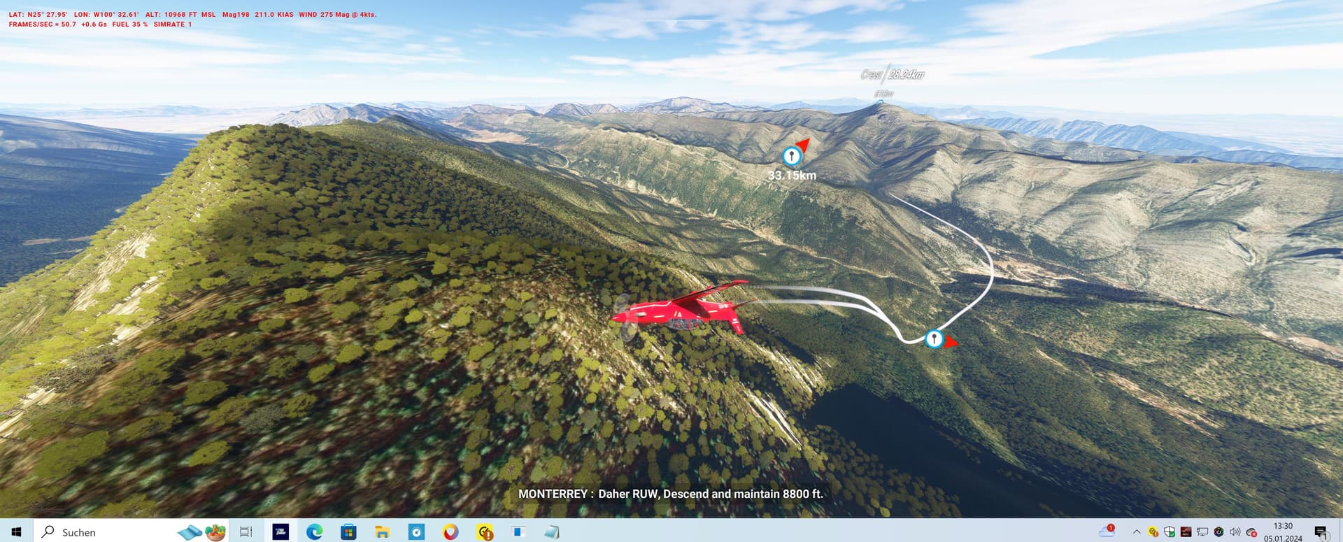
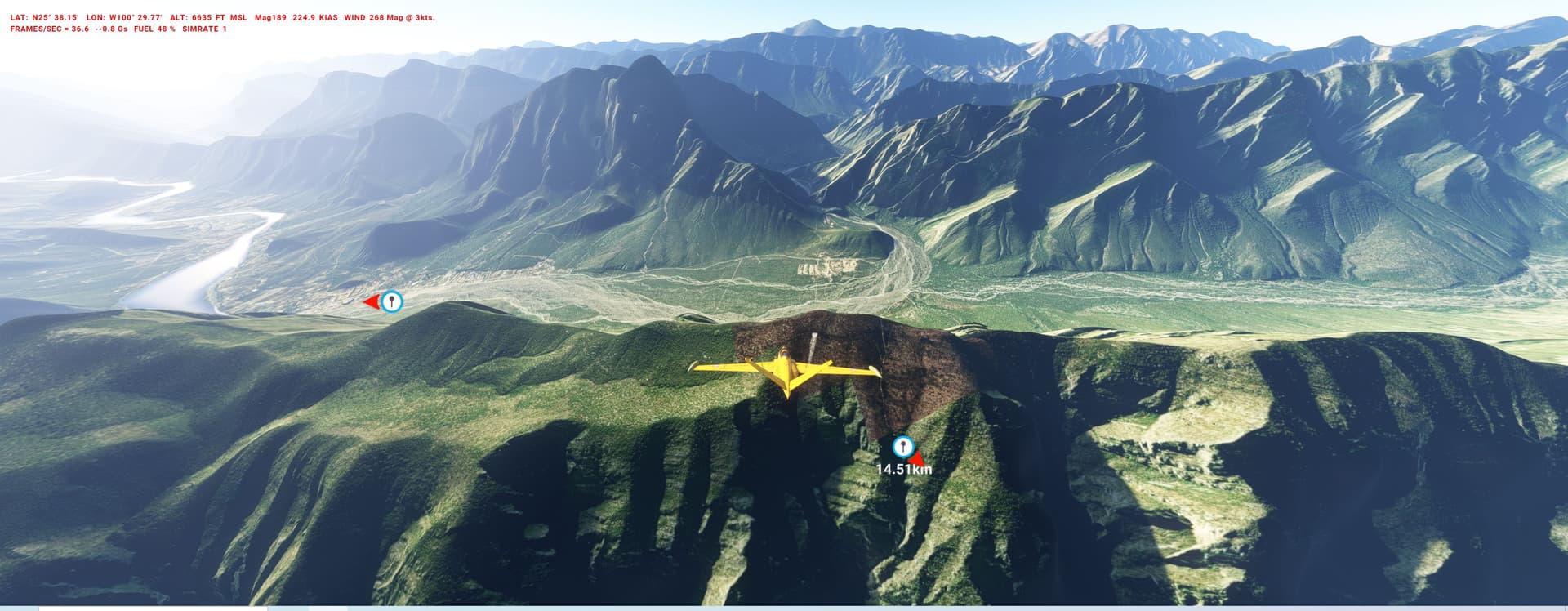
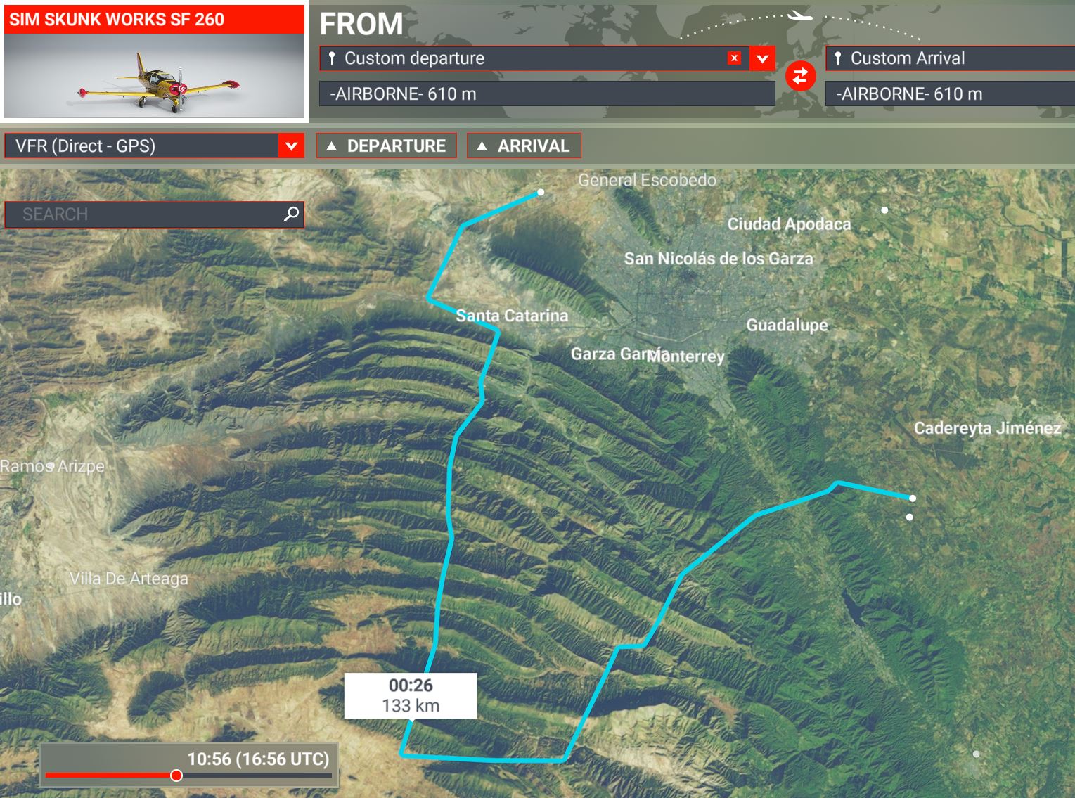
The Mountains around Monterey are the setting of the new private “Mexican Air Combat Training Company” (MACT) offering their services at very competitive prices.
You are gearing up for the qualification flight of lo-level operations in a hostile environment.
The PLN takes you on a gut-wrenching, tree-level roller- coaster over a dozen-plus ridges and thru canyons.
The trick is to clear the ridges inverted, do Hi-G pullouts in the valleys (WP = PO) and barrel-roll thru the canyons.
I advice to progress four times with ever more powerful trainer planes:
Prop-to-Turbo-to-Jet-to-Fighters. MEX_roller_coaster.PLN (6.8 KB)
Because of its legendary high-altitude performance you take the H 125 (AS 350) on a test ride: can you land on the highest peaks Jengish Chokusu (aka Pik Pobeda, 24.400ft) and the matterhorn-type Khan Tengri (23.000ft)?
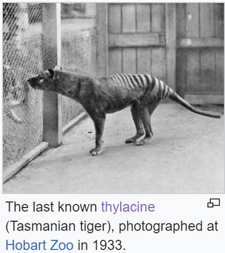
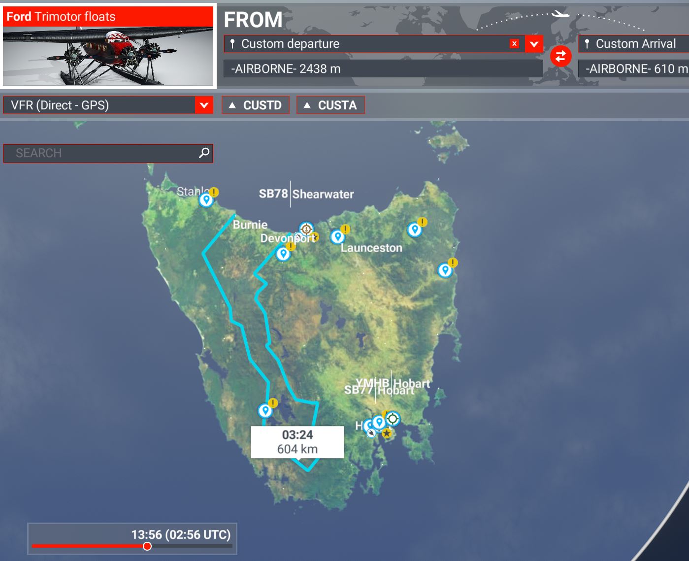
American pharma industrialist and famous trophy hunter Dr. R.E. Leaf was convinced that some specimens would still live in the mountains of Tasmania and decided to find and kill one.
The island interior was largely uninhabited at the time - todays big lakes are the result of post-war hydro-electric dams.
He chartered experienced hunting guide Martin Davis and a Ford-Trimotor Floatplane - stuffed with safari gear and provisions for several weeks. The plan was to land on mountain lakes and make hunting expeditions from there.
You are the bush pilot: fly low & slow along the peaks of the central highlands (Mt. Ossa 5300ft, in sim almost 7000ft, see pic below) to spot possible stalking grounds and decide on which of the ponds you dare to moor (WPs = WL for water landing).
Beware, the Tin-Lizzy can be temperamentfull in the waves (better with contemporary Ju F-13, Fokker VII ? - or a modern floatplane).
Reports differ about the outcome of the trip, there was some cover up…
The landing place in 1960 was indeed at the Northeastcol.
I made a video, which documents the entire journey of Yeti based on the book of the expeditionleader Max Eiselin and also shows the exact landing places near the Dhaulagiri (you require explanations in another language than German, you need to switch on the subtitles and select the language to English):
I am the author of that addon
With the video, I did not primarily want to highlight that addon but use MSFS to document some almost forgotten but all the more fascinating moments of aviation history.
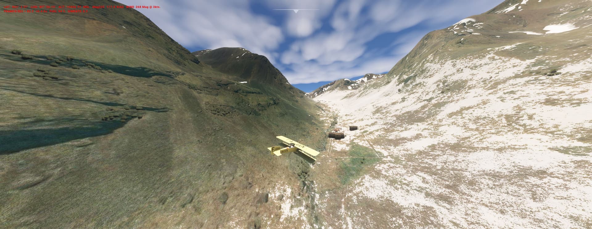
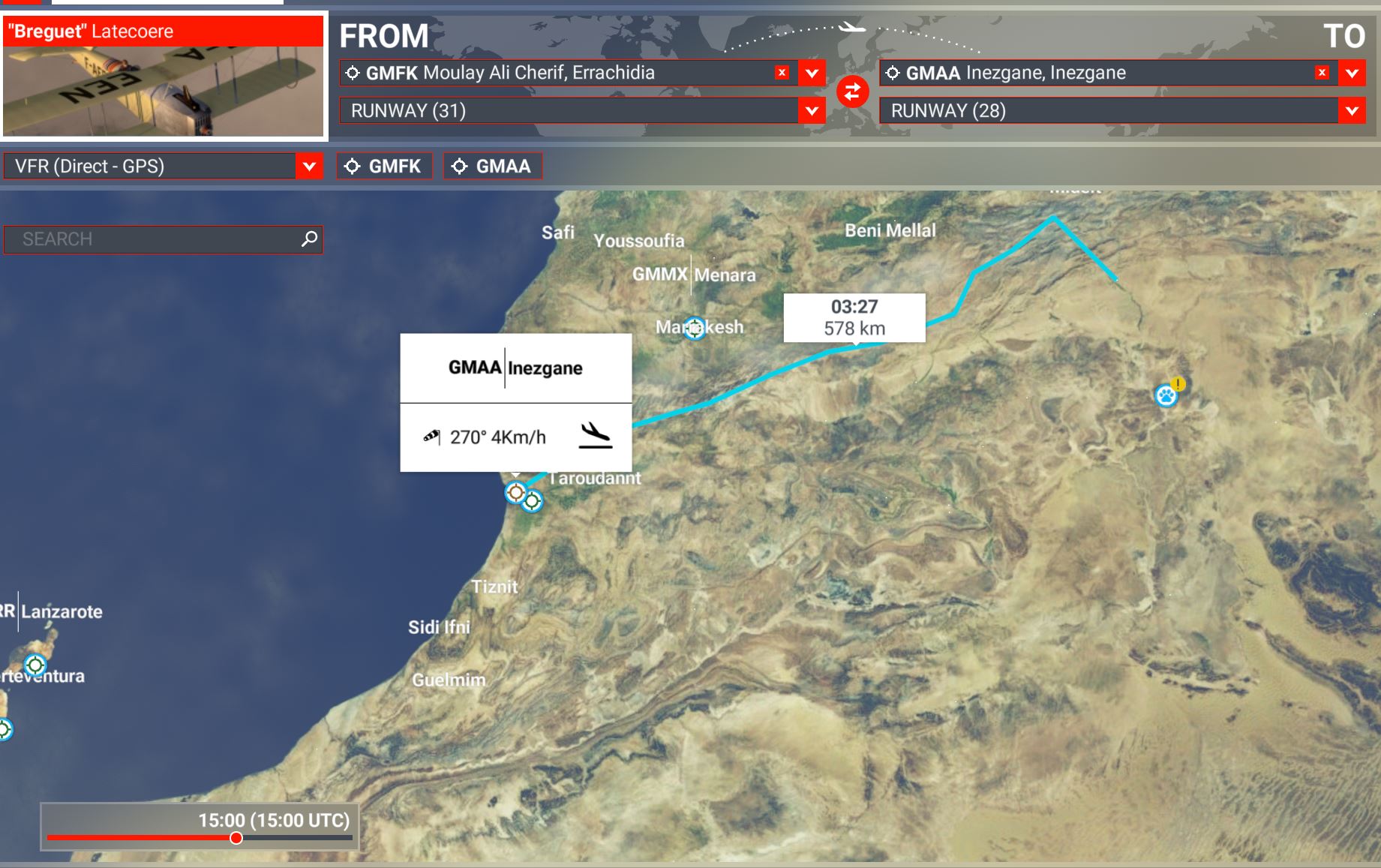
this PLN takes us back to the 1920s when Berber freedom fighters were battling French colonial troops in Morocco. Zaian War - Wikipedia
Your free Brequet XIV (MS Flight Simulator – RESTAURAVIA)) is assigned to bring mail to isolated outposts of the Foreign Legion in the Atlas Mountains (14.000ft).
Land the plane or just drop the envelopes at the WPs as you see fit.
March 1945:
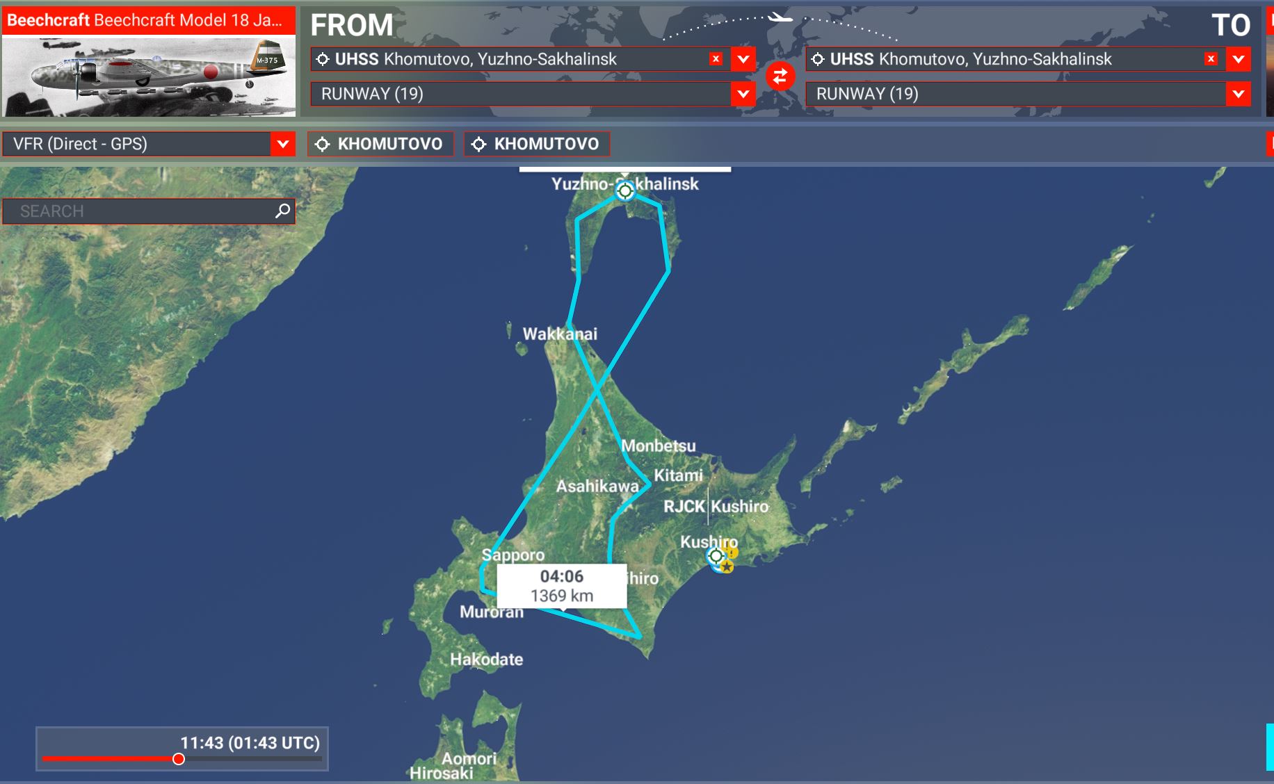
Japan and the USSR are not at war with each other but J.Stalin starts preparations for a northern invasion in summer. For this, you fly a lend-lease C-45 on a “maskirovka” recce-mission low over the mountains. Its a short hop from the russian Sakhalin peninsula - use the morning fog over the straits to your advantage. The airplane is painted as a JAF Kawasaki Ki-56 (BTW: a perfect snow-camo pattern, isn’t it?) and has cameras and listening devices on board.
(IRL the Sowjets did not land on Hokkaido but the adjacent Kuriles islands).
August 1945:
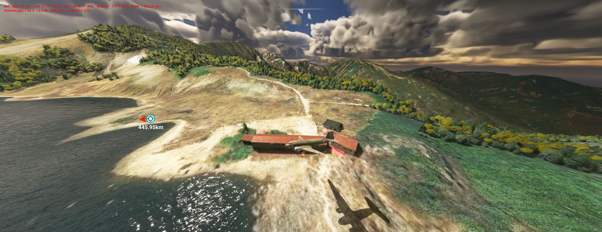
Its the day after the Tenno’s capitulation: US-signal intelligence proofs that american POW-pilots are dispersed in remote alpine huts and hotels (visible in the sim). The men are undernourished, cut off from the outside world and need immediate help.
You fly a C-47 out of Iwo to the mountains behind Tokyo. Fly low along the peaks to find the premises and then drop parcels with food and newsletters. Show the prisoners that they are not forgotten and will be free soon. Use mighty Mt. Fuji as a final Nav-beacon for the flight home.
This flight is a tribute to the folks who create and constantly improve the free C-17: C-17 Globemaster for Microsoft Flight Simulator | MSFS
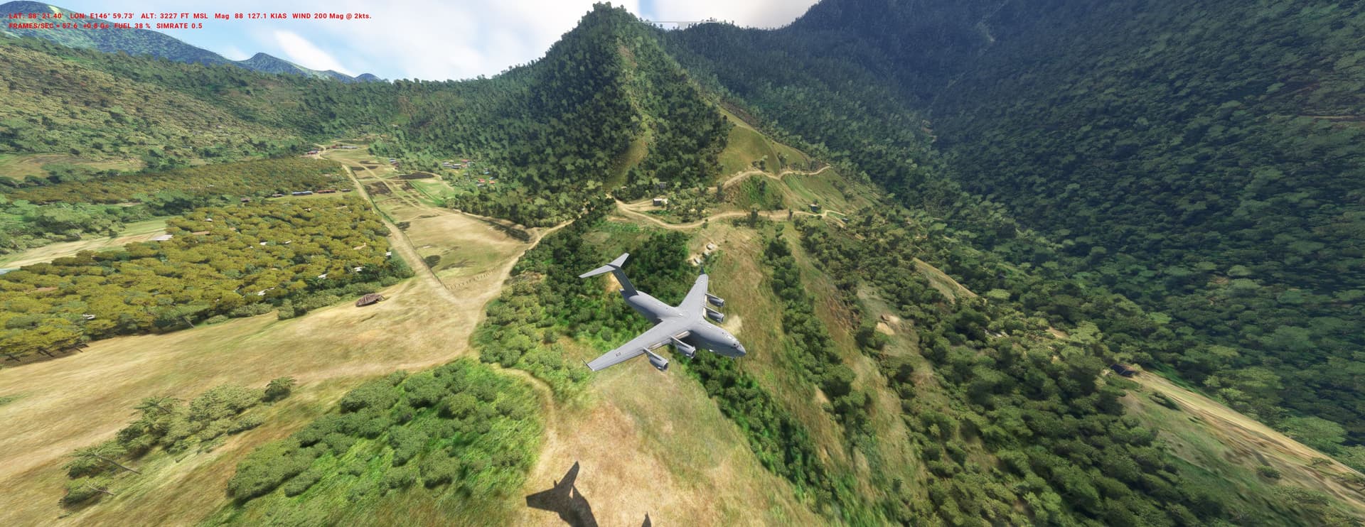
The highland of Papua has been struck by a major earthquake, severing access by road.
The Royal Australian Air force comes in for immediate help. You fly a C-17, loaded with 11 x 1 ton palettes of aid goods. Your job is to land on soft-surface airfields across the island, each time unloading one palette.
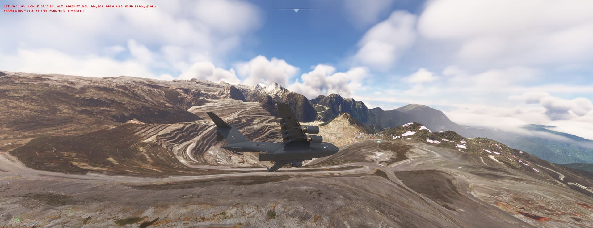
Some strips are very narrow and shorter than the recommended 3000ft - so require excellent brake/power/flaps management. Over Puncak Mines you have to do a LAPES paradrop, no trivial task at 14.000ft (pic).
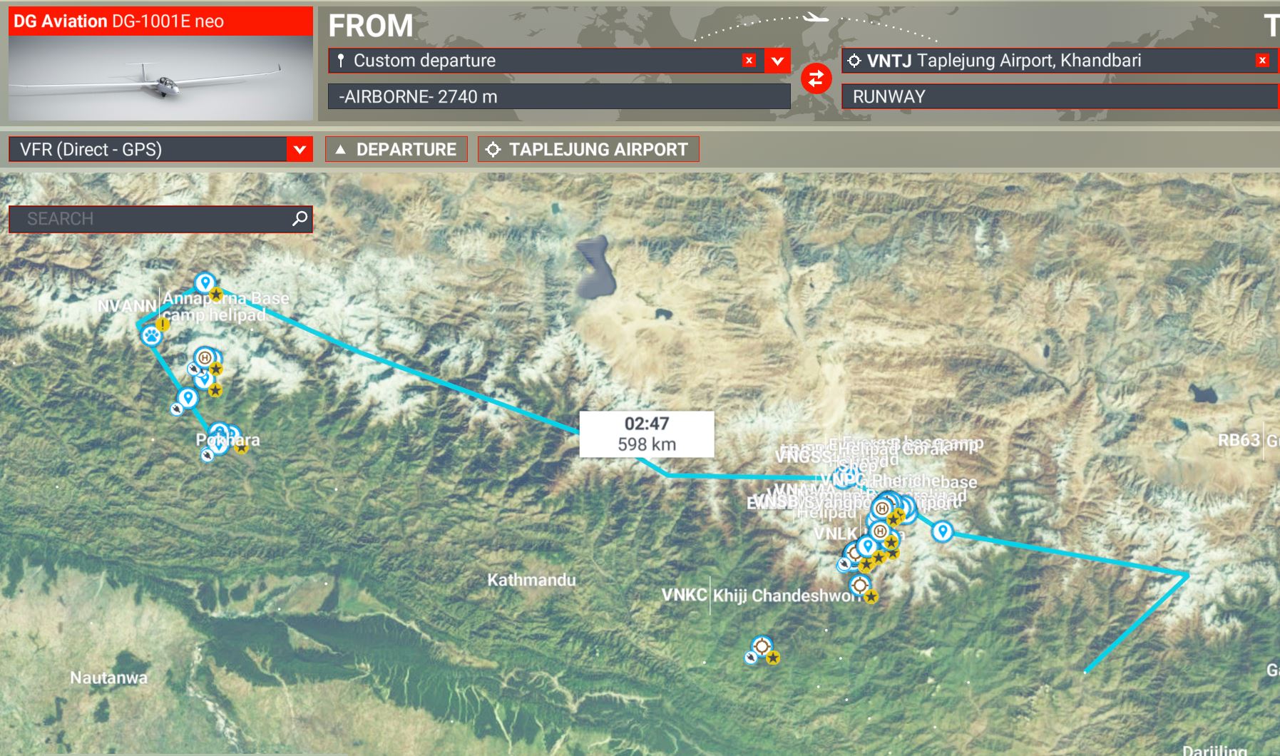
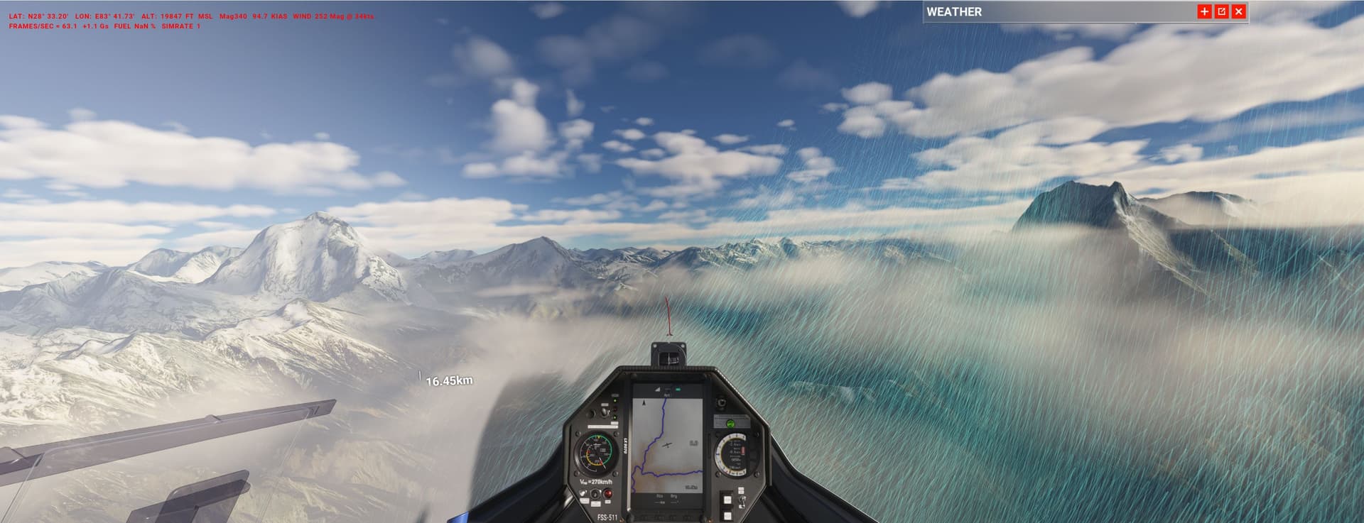
Load a “WPP_Jetstream” weather theme (from the .to), climb in the early morning from Pokhara (Cessna tow fails often…) and use the motor to reach 18000ft over the deepest gorge on earth, close to Dhaulagiri (26.800ft).
Turning point is Kangchendjunga (28.200ft): depending on the daytime left (the DG is not as fast as the Stemme) make your own decision for a landing strip on the way back west.
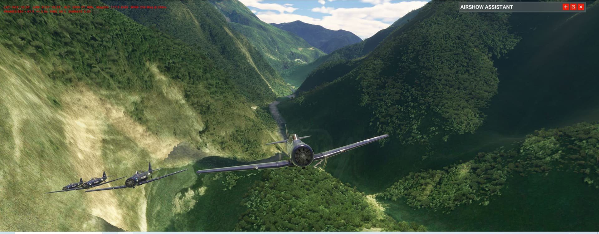
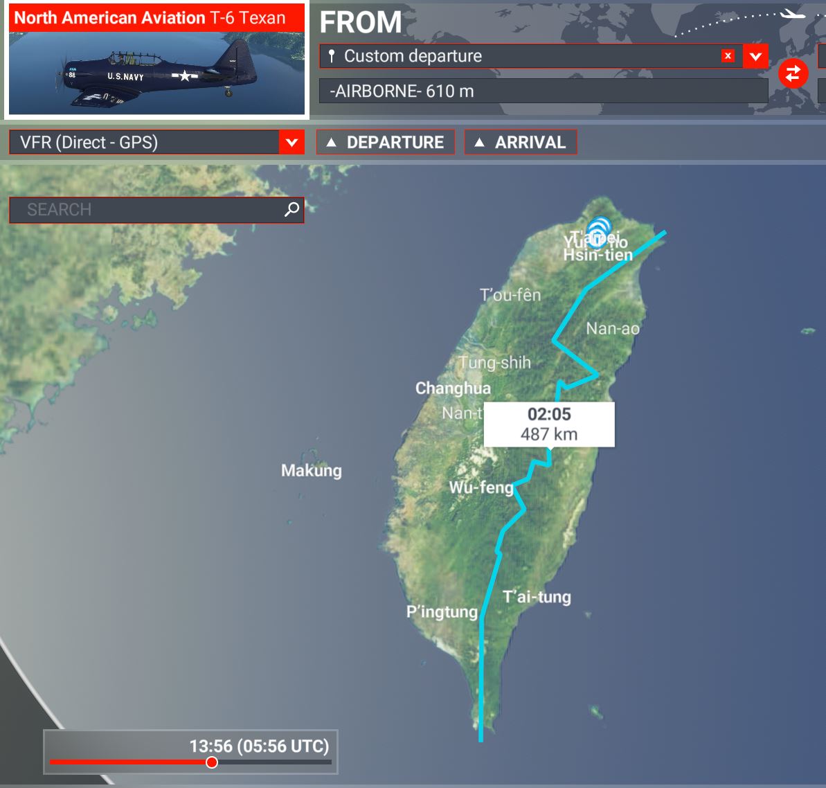
You fly a scout plane from an Essex Class carrier along the main ridges to look for enemy early warning installations build on peaks. Stay low and use the many gorges as cover to impede an intercept. Taiwan_mountains.PLN (5.2 KB)
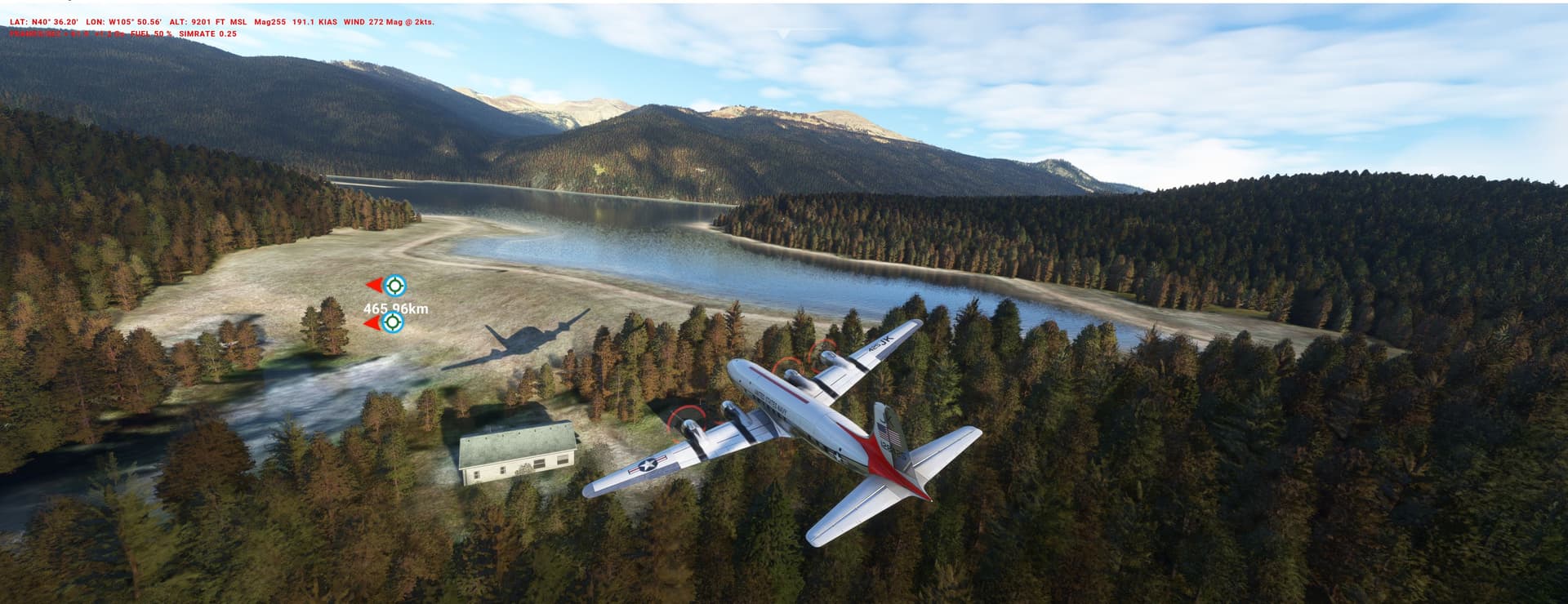
They want to acquire smaller air tankers - with the tight budget there are three options:
new P-750s, second-hand AN-2s with SEATmods, army-surplus Caribous.
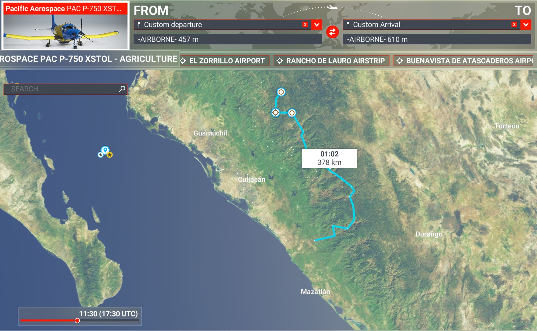
You come in from the north, fill-er-up (fuel & water) on MMGX and end near the coast.
Check all places with the three candidates and deliver your report: who is the winner (and can you find the recently crashed drug-runner )? MEX_wildfires.PLN (7.7 KB)
UGANDA: The Rwenzori mountains of the Moon (17.000ft)
The Rwenzori Circuit is an extremely challenging trekking tour. It takes you through one of the most diverse landscapes of the planet: rainforests, bottomless bogs, outlandish vegetation, tropical glaciers and rocky peaks. A number of basic alpine huts are used to stay overnight.
Unfortunately the region is probably the worst DEM/TIN/Bing in the Sim ever. To some extend Asobo is excused as the massive is covered in clouds 360/365 days. But Bing is not sooo bad (see below) and it doesn’t explain the persistent LIDAR pyramids. The huts themselves (all visible, somehow surprising) come most likely from an OSM overlay.
Via the GTFP:
Here we go:
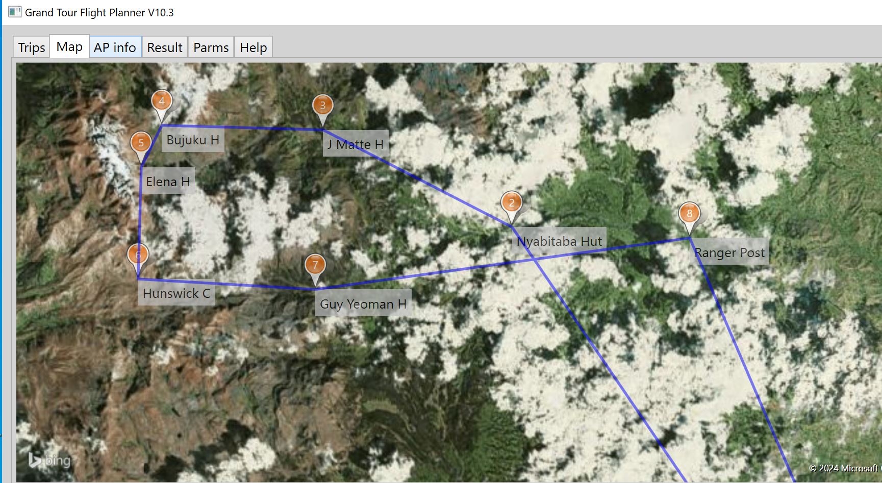
Trekkers have been gone missing on the circuit (there is no cellphone net) for a week due to abysmal weather. Now it clears up and your helicopter flies out of HUKS Kasese for a SAR-mission - look at each hut for the situation and bring people home if needed.
First hut, Nyabitaba, last trees in evidence:
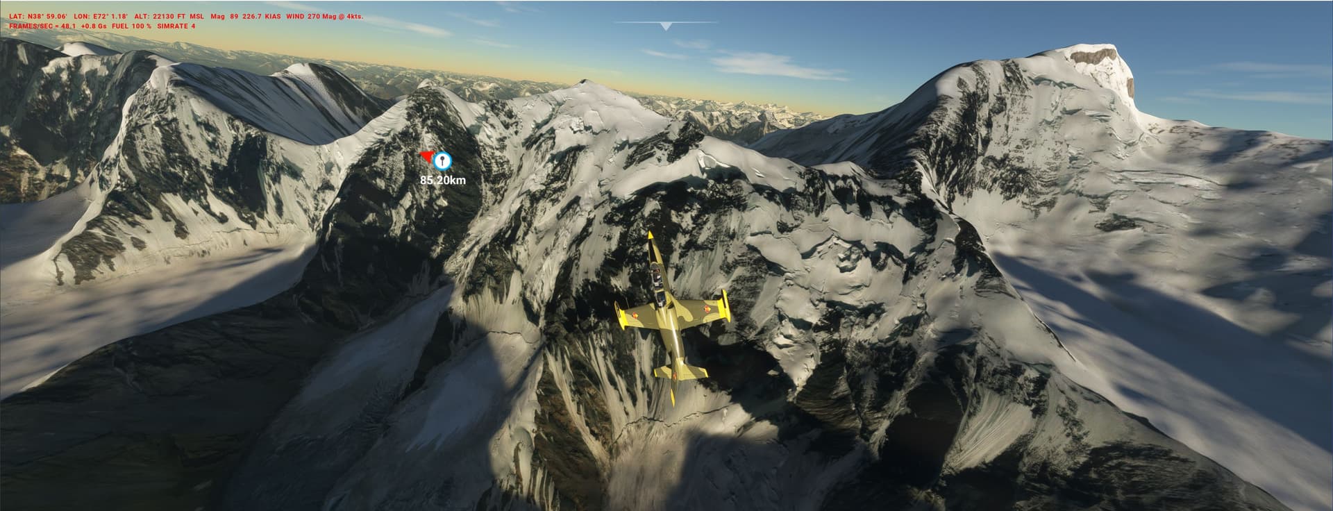
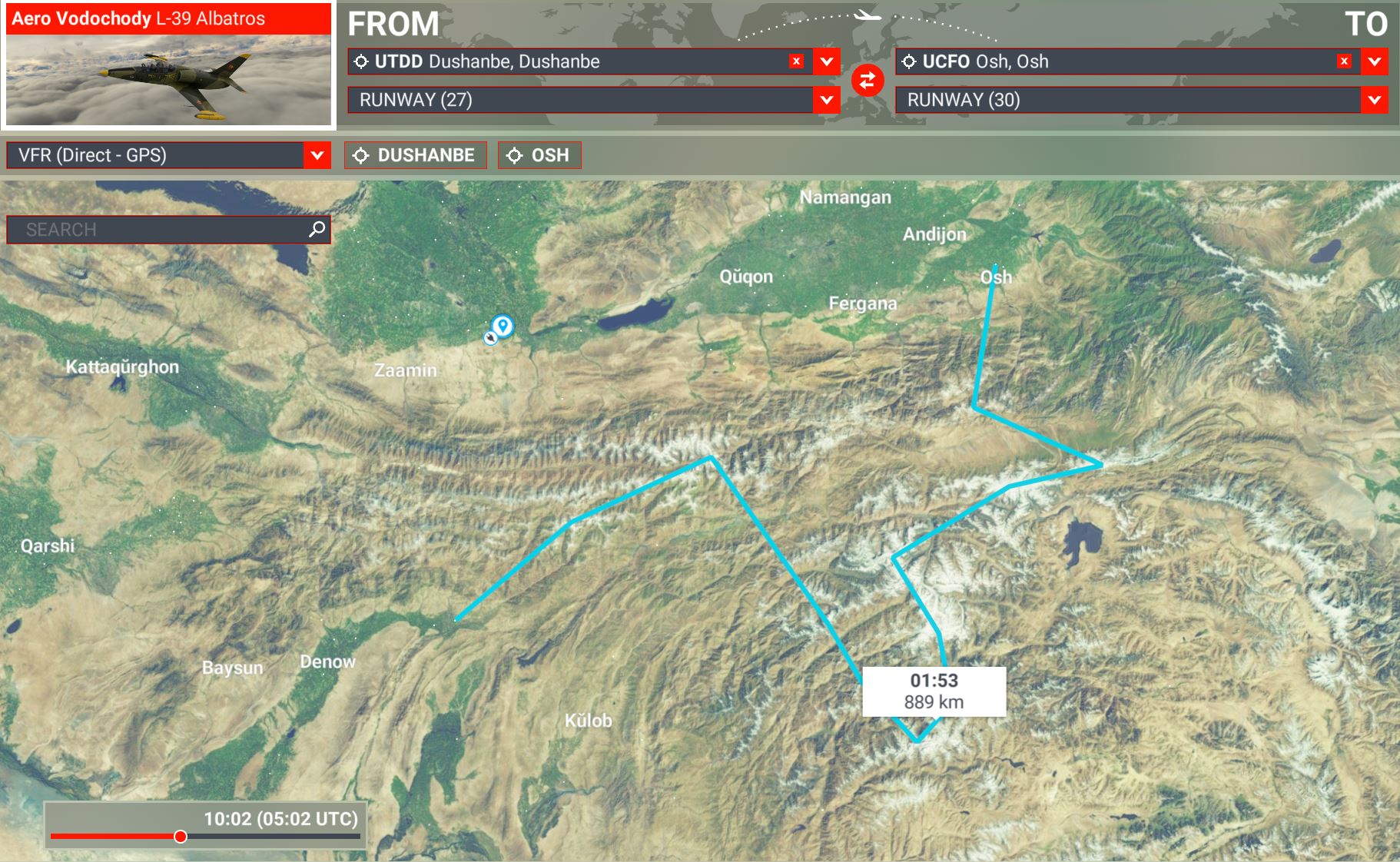
In preparation for the big jump you fly a jet trainer out of Dushanbe over some of the highest mountains of Tajikistan’s Pamir (e.g. Pik Communismus 24.600ft, pic) to check alternatives and approaches.
Azurpoly Transall customers might actually simulate the drop, pics/videos of the action are appreciated (as is an english translation of the film). ussr_tajik_pam_haho.PLN (3.8 KB)