Good day MSFS team,
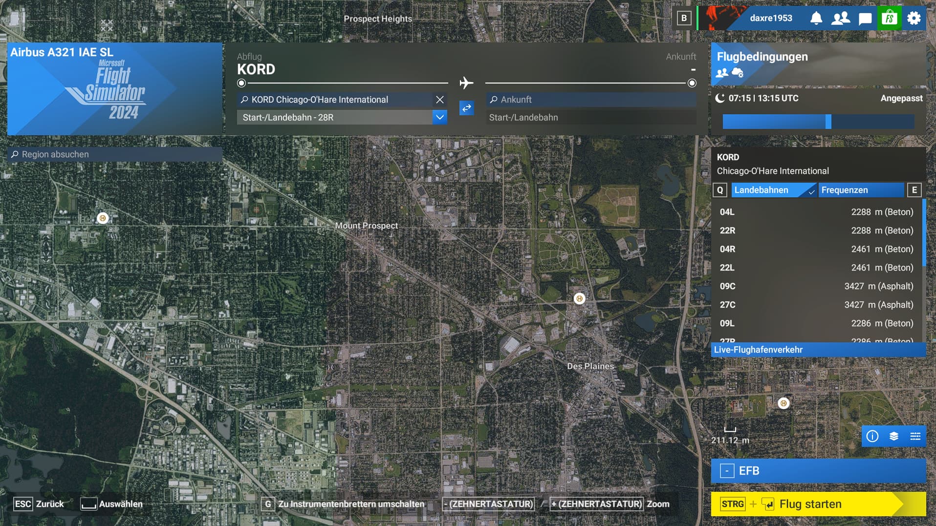
on your MSFS 2024 pre release agenda you didn´t miss out on emphasizing the new satellite imagery, especially for the US. One reason to make the switch from 2020 to 2024, right? Now… I just wanted to look at Chicago area cause I know in 2020 there was some quite noticable borderline between two completely different satellite images so I wanted to see how the new Chicago area looks like. I´ll attach a screenshot of it from the world map, it´s the exact same when the scenario has loaded. There is literally NO difference at all. And given that this happens at the first US airport I tried (and this issue was extremely popular in 2020, especially around the US), it´s hard to believe that it´s any different to 2020 at all. So pretty much every US or Canada flight will still see major changes in satellite imagery no matter if during cruise or during approach/departure. You´ll always notice and therefore my question remains clear: Where is the new satellite data which was promised for 2024?
Creating a selling point but leaving out that point in the end is a little unfair tbh…