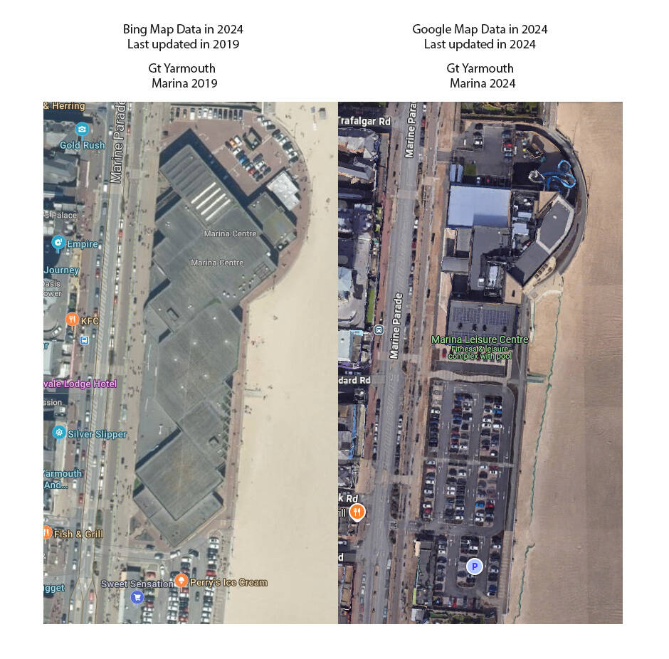
So i was going to buy MSFS 2024 , because i like flying over my local area, and the Map data in 2020 , was so so old and out of date , I thought they would have newer Bing maps 5 years later, so i bought it on xbox pass to test, and here are my results.
There have been many, many posts like yours questioning and commenting on comparisons between various map providers and MSFS 2020. Now MSFS 2024 can be added to the discussion. There are four major mapmakers using satellite images: Bing, Apple, Google, and Google Earth, each having strengths and weaknesses. Since Bing is owned by Microsoft, Bing satellite data is used as one of the sources for MSFS. When Asobo receives Bing data, there is a significant amount of processing needed before being added to MSFS.
I looked at Google Maps for your location and it is identical to the true photo you posted. Then I looked at Bing Maps and it looked almost identical to Google Maps. Then I compared those to MSFS 2020/2024. The photo on the left is similar to what is in MSFS today.
MSFS has distributed many City and World Updates that are highly detailed and breathtakingly beautiful. However, the entire world does not have the same level of detail. In order to deliver some detail around the globe, MSFS uses photogrammetry to approximate or simulate existing buildings using Bing Maps and other sources.
It is difficult for me to determine if the photo on the left is an older Bing map or photogrammetry. I think it is the latter based on the buildings and streets in the surrounding area. They are much different than the current Bing and Google Maps.
I understand your frustration and your desire to view your neighborhood in MSFS in high detail. My home and street look like an ugly blob mess. I think many other users feel the same. The most recent user survey when asked about their number one place to fly to, the top answer was their home. Informally when users were asked about the first place they are flying to when MSFS 2024 is released, many answered “their home”.
Asobo has said they are upgrading scenery that was missed or done poorly in previous updates. You may wish to inquire when your area will be “refurbished” so to speak.
The issue is not the Bing maps in many situations.
For instance, in the Northeast U.S., the Bing map data is pretty accurate, within the last 2 to 6 years.
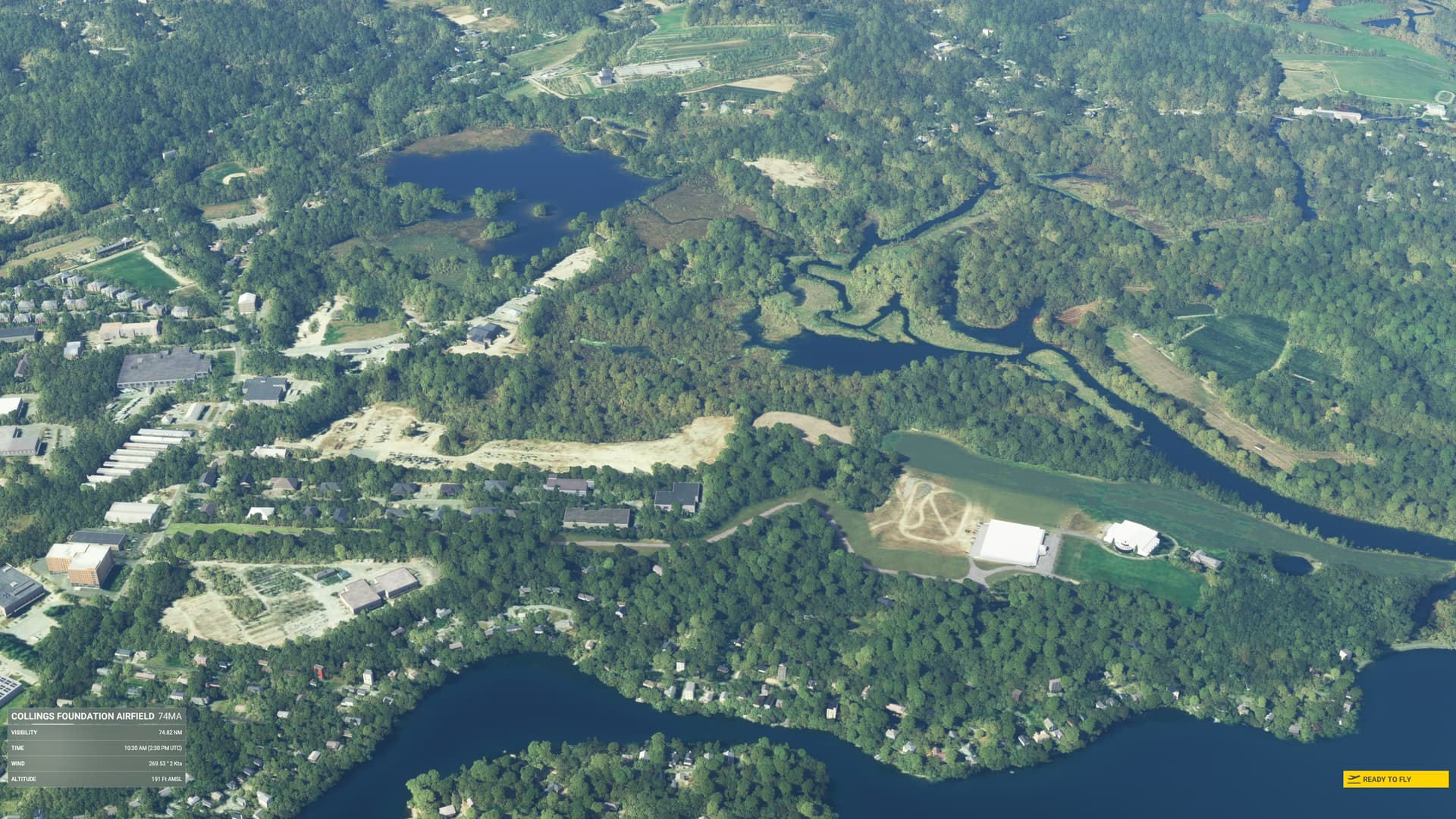
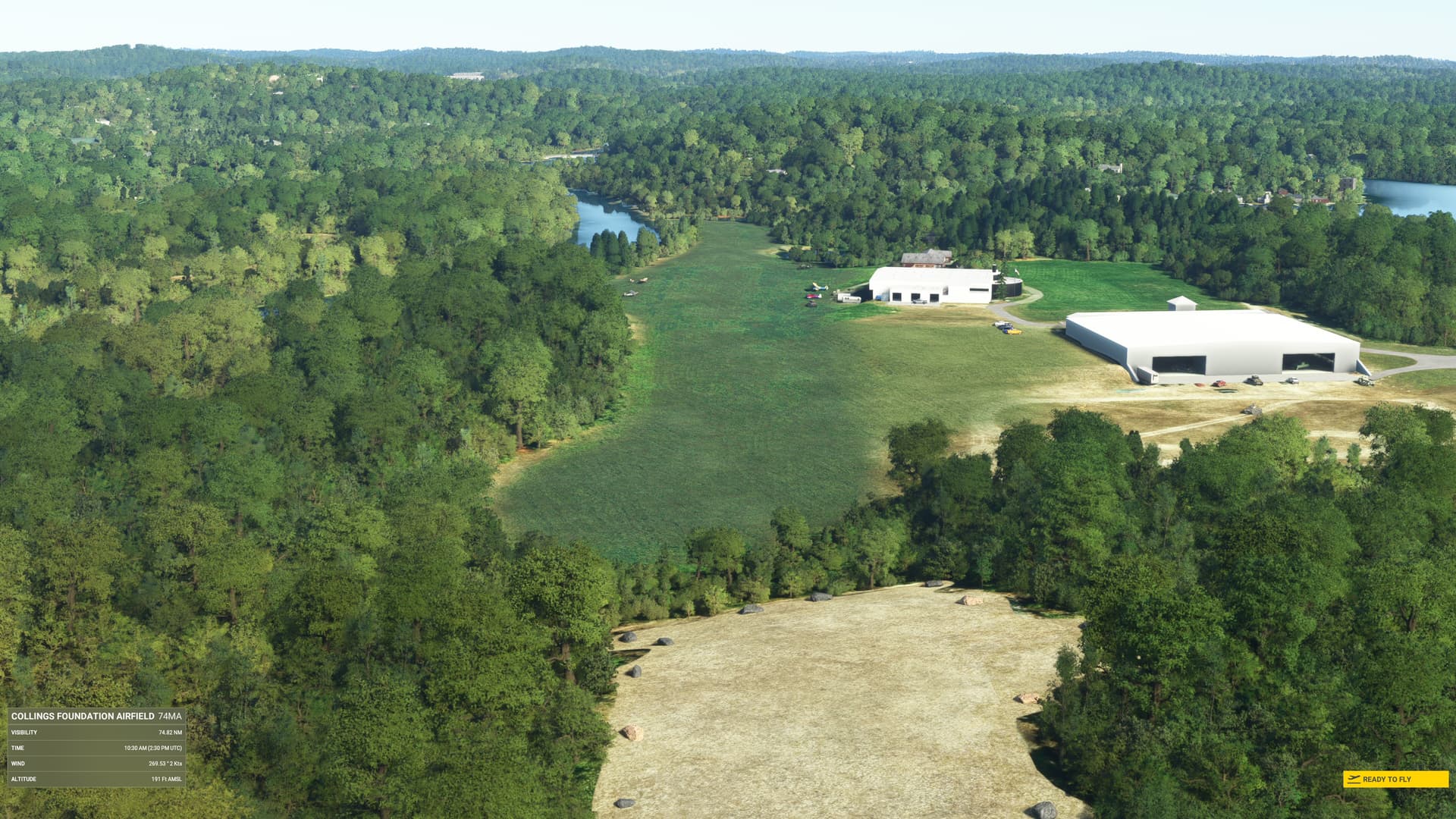
The problem in the Northeast U.S, at least in the Metrowest Boston area and up into New Hampshire and down through Connecticut, is the age of the TIN (PG Data), which overrides the Bing Map data.
I still have to test 2024, but, in 2020 you can see the actual Bing data in the sim in the World Map. The World Map shows the underlying Bing Map data, and if you turn off PG, you’ll see the latest Bing Map data. The TIN (PG) map data is pretty old, 2015 or so.
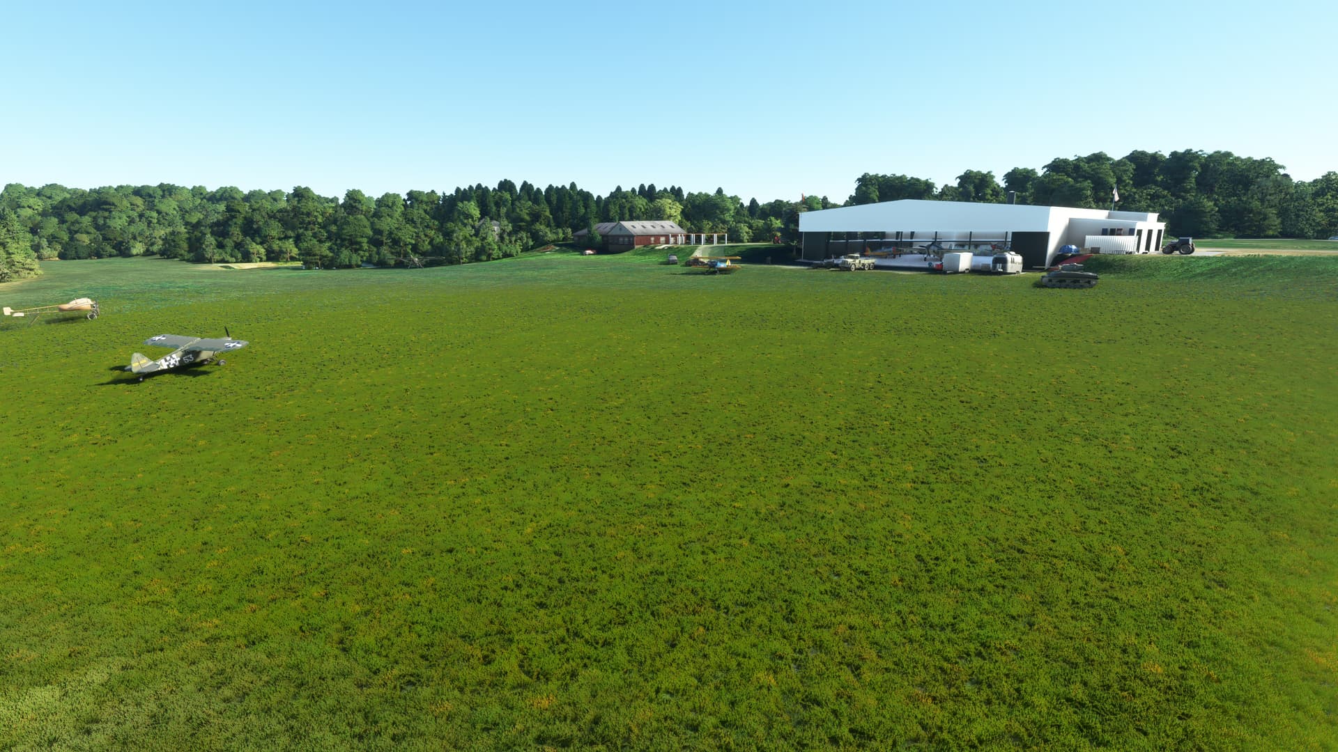
A few examples in 2020 are KCON, KFIT, and the American Heritage Museum in Stow by Boone Lake. With PG on, all three locations are at about 2015, KCON is missing one of its taxiways, KFIT still has 2/20 which was removed between 2020 and 2023, and the AHM does not show its museum, only the hangar. In the World Map, you can see the updated KFIT. With PG off, AHM at least shows the construction of the museum, which was finished in late 2018.
It would be awesome if some experienced NE airport developer could throw together a quick and dirty version of the AHM grass strip… Just sayin’. ![]()
At least map data exists over there.
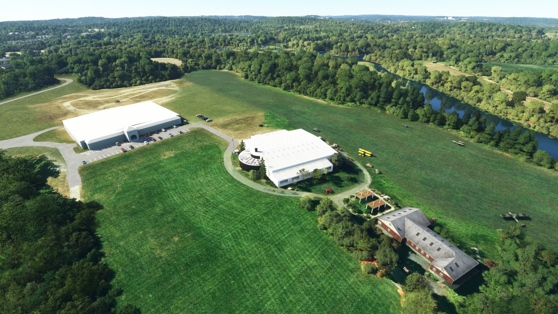


That is quite the expansive expansion. I’m going to need to go renew my membership, methinks… (Yes, I am aware that it will be several years before this is completed… I think the fundraising is just starting, right?)
Yes, we’ve been floating it out looking for interest, but official fundraising hasn’t quite started. Very soon though. They already own 95% or more of the aircraft shown, and are still looking for more.
Cheers for the Reply ![]() ,but im not getting an similar satellite data from bing maps. these 2 photos i posted were from within a hour of each host, IE : Bing , then Google.
,but im not getting an similar satellite data from bing maps. these 2 photos i posted were from within a hour of each host, IE : Bing , then Google.
here is bing maps link, it looks nothing like google on my pc, and it is the same map as used in FS 2020 and FS 2024 .Bing Maps - Directions, trip planning, traffic cameras & more
15 Years ago these maps had Hi resolution, you could zoom in and see somebody sitting in a chair, now you can just make out a car.
You are 100% correct. Bing is different than Google. I wish these maps had the date of the image.
When I replied earlier, I was using the Bing for iPad app, not accessing Bing maps through a web browser. The Bing fo iPad app image is different than the Bing maps web browser. It does look similar (current) to the Google Maps image.
Clearly Bing has two different images for the same place which I’ve never seen before, the older imagery used for FS2020/2024.
This is crazy-making!