My tour around Europe

So I’ve decided to fly around Europe visiting, if not all, then close to all European countries. It will probably be a long time before I’ll finish this but it will never the less be pretty interesting to see how the different parts of Europe look in MSFS. Though right now I’m limited by the one cheap month of Xbox game pass as I’m pretty low on money :confused:

Leg 1 - Scroll further down this post.
Leg 2 - Click here
Leg 3 - Click here
Leg 4 - Click here
Leg 5 - Click here
Leg 6 - Click here
Leg 7 - Click here
Leg 8 - Click here
Leg 9 - Click here
Leg 10 - Click here

The route (As it looks right now) I’ll fly look like this:


I’m starting in my hometown of Copenhagen, Denmark and flying counter-clockwise around Europe.
You can also see the route on google maps.

Well lets get going!


This lovely Cessna 172 is going the be the aircraft that is taking me across Denmark in this first leg of the tour.

We are starting from Copenhagen Airport, the biggest/bussiest airport in not only Denmark but all the Nordic countries, well at least in a normal year without a pandemic… It was inaugurated 20 April 1925 and was one of the first civil airports in the world.


Up in the air, taking a quick tour over downtown Copenhagen. The city is thought to have been founded around year 1150. But recent findings have shown that it is probably at least a couple of hundred years older than that. It is home to the 2nd oldest amusement park in the world called Tivoli. The oldest one “Bakken” is located a mere 10 km north of the city.


One the way out of Copenhagen you’ll find yourself flying over a very long straight road, at least by European standards, the road is heading straight to the town of Roskilde, we are going to follow it until we reach Roskilde.


A quick look back at Copenhagen. It is home to about 2,000,000 people.
The green line you can see cutting through the city is the remnants of a massive defensive fortification constructed between 1885-1892. As soon as it was finished it was basically almost already outdated, and now it is just a big long green space used for walking etc.


Enough of Copenhagen, now we are already above Roskilde which even back in the viking times were a major town and of great importance, it is also in the fjord that the wreck of the longest viking longboat in the world has been found. Today Roskilde is mainly known for its viking ship museum and the largest music festival in Northern Europe, simply called Roskilde Festival.


A little closeup of the town. Down by the water you can see the viking ship museums buildings. And some what up and a little bit to the right of that is where the Roskilde Cathedral is supposed to be, it sadly isn’t represented in the sim, but i’m sure some add-on developers are going to fix that.


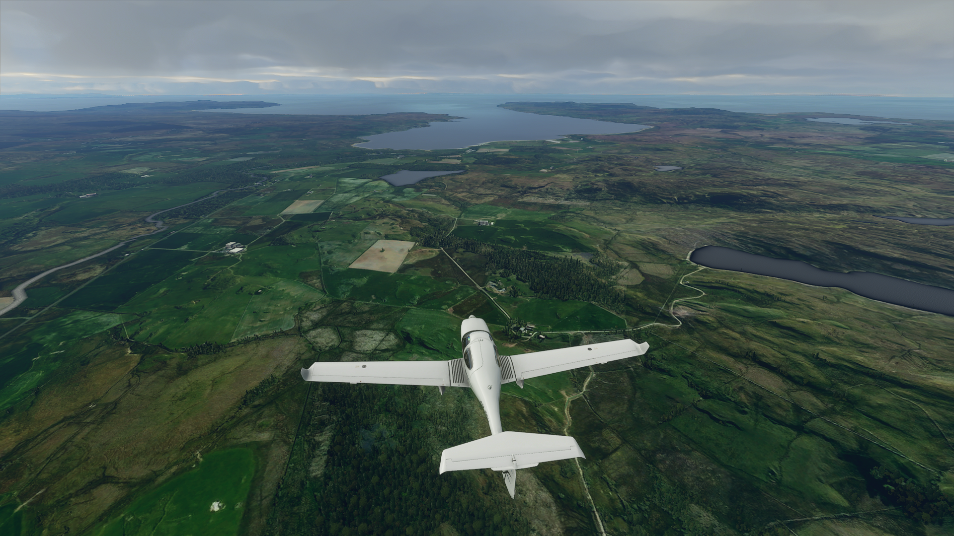
This is what most of Denmark looks like, endless fields and very flat. The highest point in Denmark is a whooping 170.86 m and yes the centimeters do matter!


This might look like a pretty boring circle, but it is in fact the remains of a viking ring castle called Trelleborg. There are 6 more in Denmark and one in southern Sweden weirdly enough also called Trelleborg. Why they where constructed is still a thing up for debate, but they are generally though to have been build by Harald Bluetooth in his quest to unify Denmark. Of course there are also people with uhm alternative theories, one being that they were build by ancient aviators as a navigation point.


This is the town of Korsør and the big inlet called Korsør Nor, it used to have a ferry harbor back in the day, but when the Great Belt Bridge opened in 1998 the ferries stopped sailing.


This is where the Great Belt Bridge is, in real life it’s a massive suspenion bridge, but in the sim it’s just represented by a low loooong ordinary bridge.


Close up of Korsør, not much happens in this tiny town, but it is home to one of two naval bases in Denmark, the other being in Frederikshavn all the way up in north Jutland. This also marks the point of leaving Zealand (No relations to New Zealand)


Sprogø connecting the suspension bridge with a more traditional bridge for the final stretch to Funen Island.


This is Nyborg, the first town you’ll reach when driving from Zealand to Funen. Fun fact in english it would translate to Newcastle, so we got one as well Brits!


Coming up on the third largest city in Denmark called Odense, but first…


This lovely face I just happened to spot as i changed to the exterior view.


Over Odense, the city is mostly famous for a writer you might have heard of, or at least heard of his fairy tales, Hans Christian Andersen who wrote tales such as The Little Mermaid, The Ugly Duckling and The Emperor’s New Clothes.


And they don’t miss a chance to use his name in promoting the city, very recently they renamed their airport to Hans Christian Andersen Airport instead of the more telling Odense Airport.


Suddenly this beauty appeared to my right side! Pretty amazing that you can get that in the sim! If you look hard enough you can see it’s actually a double rainbow, though not all the way.


Nearing the other end of Funen, and the town that can make any native english speaker laugh. Namely Middelfart. The etymology behind the name isn’t really that fun, it’s just “The waters you travel between” or “The narrowing”


This is where the suspension bridge “The New Little Belt Bridge” should be, but again it’s just a more regular bridge, I really hope some add-on people will do some magic on these bridges.


More endless fields. We are 5,5 million people in Denmark but we produce enough food for 15 million and it is no wonder with all these fields.


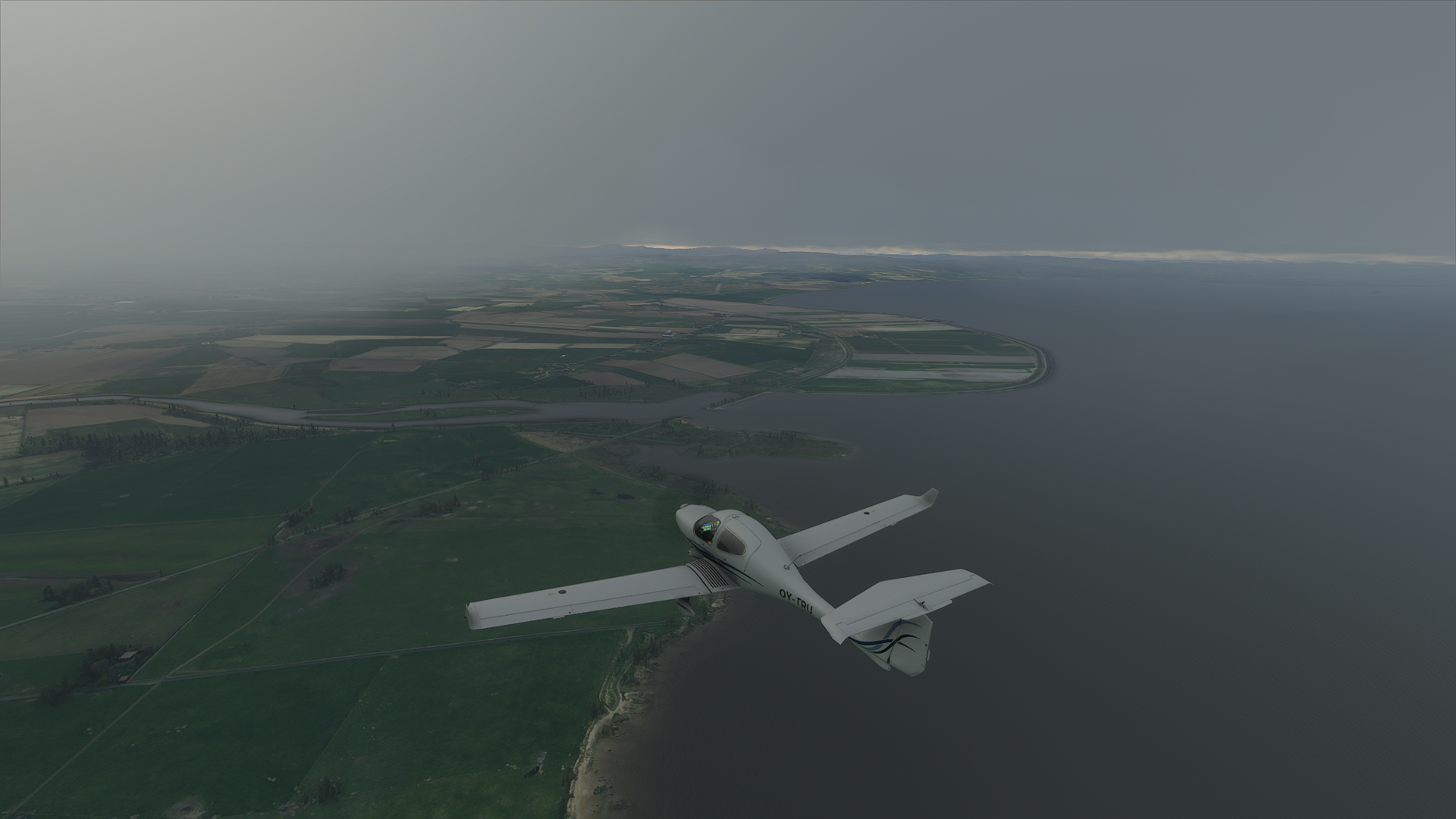
Nearing our destination of Esbjerg Airport! But first…


A quick detour over Esbjerg town! It was for a long time a tiny forgotten village until after the war of 1864 where we lost Schleswig-Holstein and desperately needed a new big harbor in the North Sea after losing Altona near Hamburg in Germany.


Today the harbor mainly serves as a service point for the oil rigs in the North Sea as well as a staging point for big sea wind turbines.


Just opposite the town lies Fanø which is famous for it’s wide beach perfect for flying giant kites. So of course they have an annual kite festival, where thousands of people go to the island to fly their own kites or just watch the spectacular sight.


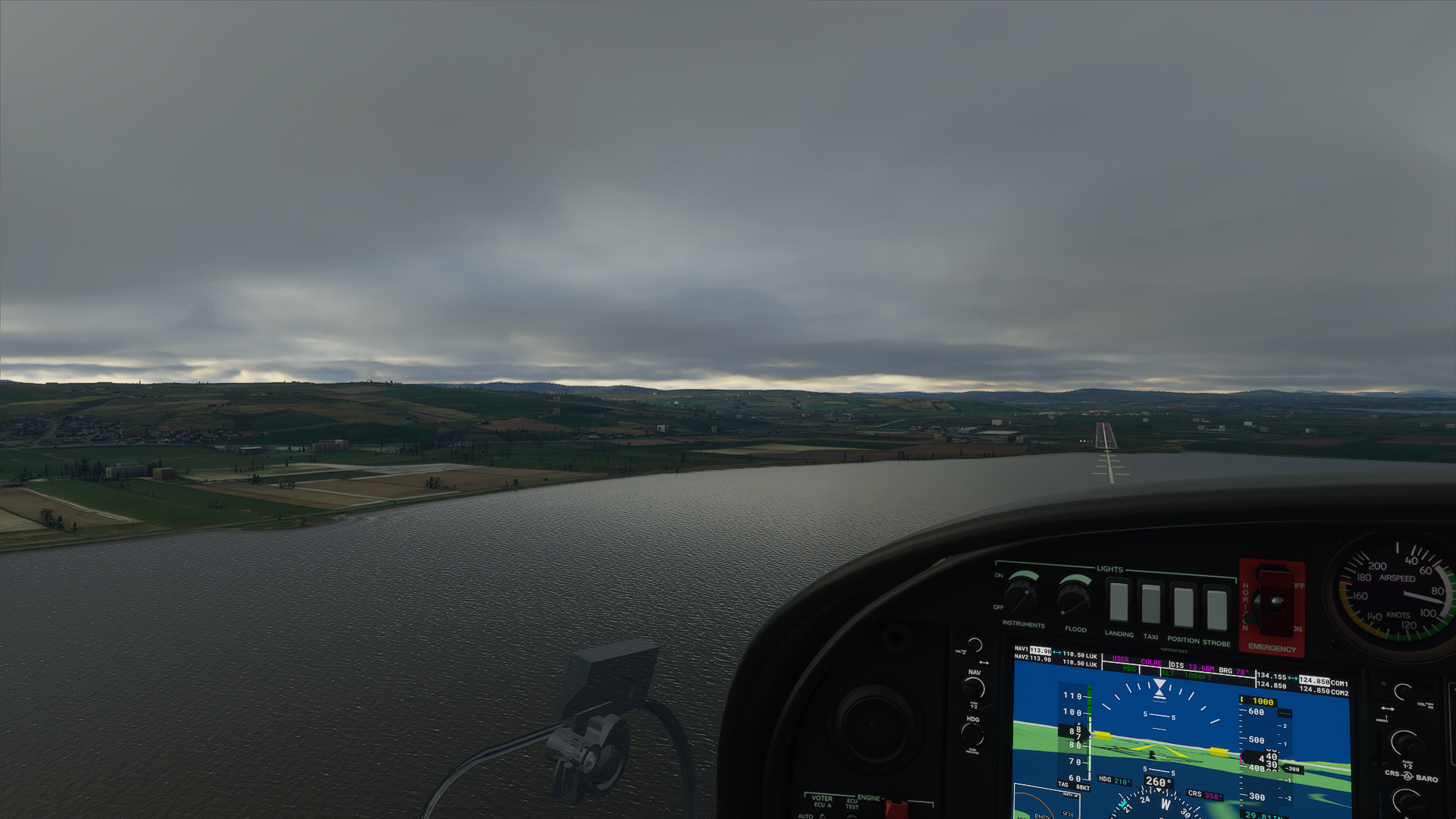
Enough chit-chat, now it’s time to land! I came in a little bit close to the runway but…


I managed to make a safe landing! This marks the end of the first leg of my tour around Europe! Only *looks on google maps* 94 more airports to visit :sweat_smile: Though now I’m heading to foreign lands I probably won’t be able to hit you up with just as many facts.

I hope you enjoyed it and want to follow me on my journey around Europe!

38 Likes

Good read, thank you for the extra information. Looking forward to see more of the tour!

2 Likes

looking forward to next 94 legs and commentaries

2 Likes

Thanks for the tour. Loving it.

Josh

1 Like

If MS FS 2020 is really realistic , you’ll get in trouble in northern Scandinavia: there’s no AVGAS to be had in real life. :slight_smile: Better to fly a DA40 with diesel engine; JET fuel is available.

Good luck!

1 Like

Excellent thread. Keep it coming. I have a tour of Australia planned so may do something like this and post

1 Like

Great post! Looking forward to reading more. Brought back some memories of when I visited Copenhagen and the Roskilde Festival a long time ago.

1 Like

Nice effort, and shows the potential of this sim.

If the scenery was a little bit more accurate this sim would have so many applications beyond that of being a flight sim alone. The educational possibilities are limitless - but the accuracy needs to be there. You could tell ‘history from the air’, recount entire battles and campaigns from the air or retell tales of great exploration (Livingstone and the Search for the source of the Nile…?), etc. 'Flights Into History’™ So many possibilities.

1 Like

Well I’ll have to carry extra gas in the back then :grin:
And thank you.

1 Like

Leg 2 from Esbjerg EKEB to Edinburgh EGPH. For some reason the weather didn’t show how it was in real life even though I choose live weather, so you’ll have to live with perfect sunshine :grin:


This Cessna Citation CJ4 is my plane of choice for this leg, mainly because the leg is mostly over the North Sea, so there is no real reason to fly low and slow. And holy smokes does it accelerate and climb quickly when you’ve just flown a Cessna 172 :sweat_smile:


Already pretty high up and a last glimpse of south Jutland, you can just see Esbjerg and Fanø in the background.


Looking north the big lake you can see isn’t actually a lake but a giant fjord called Ringkøbing Fjord.


Goodbye Denmark…


And hallo big nothingness. In real life there is quite a lot of activity in the North sea with both Britain, Denmark and Norway having a sizeable amount of oil rigs. Norways share alone accounts for 54% of the oil thought to be below the sea. It’s also because of this that Norway have the worlds largest pension fund, known as the Oil fund. The fund holds 1.4% of all stocks and shares in the world and is worth about $1,150,000,000,000 that is about $211685 for every Norwegian!


But other than that there is nothing to see in any direction.


It might be hard to spot, but i could see an aircraft nearing me, and before I knew it, it blew past right above me, with about 1000 ft separation I would guess. It really gave a good sense of the speed you fly with in this type of aircraft.


A quick artsy picture, because why not :smile:


Does my eyes deceive me or is that land out there in the horizon!?


Nope that’s definitely land!


Already at the coast you can see that it is a completely different landscape compared to flat Denmark.


It’s much more ‘curvy’ than the landscape in Denmark. But still lots of fields.


That is the town of Dunbar, it might not look like much, but apparently has a rich history dating at least back to the roman times. And it has been in a constant back and forth between England and Scotland back in medieval times because of the castle in the town.


This is East Fortune Airfield. But back in WWII it was known as RAF East Fortune and today is the best preserved WWII Airfield in the UK. It is home to the scottish National Museum of Flight which houses a lot of interesting aircraft. So if you ever happen to be nearby it could be an interesting visit for sure!


Looks like a nice beach, google tells me the town is called Gullane, and the beach is apparently award winning!


There we have Edinburgh and the destination for this leg of the trip. The island in the foreground is called Inchkeith. Back in the 1400’s it was used as a quarantine island, not for any pandemic like we have now, but for people infected with syphilis! It has a surprisingly large amount of history, considering it’s basically just some rock in the Firth of Forth.


Nearing Edinburgh. The city was founded around the 7th century, but people have lived in the area for 10000 years! Today it’s the capital of Scotland and home to about 500,000 people making it the 2nd largest city in Scotland behind Glasgow. In the town there is a statue of a dog called Greyfriars Bobby which became famous because it sat by the grave of its owner until it died 14 years later! And apparently serveral books and films have been made about the story of the dog. The graveyard where the dog stood guard by the owners grave is incidentally also known as the most haunted graveyard in the world! So maybe the dog was protecting the owner from the ghosts? :laughing:


Last picture from this leg as I forgot to take pictures from the landing and after… But you didn’t miss much, there was a lot of beeping and a voice going “stall” “stall” But I got it down, and as you know any landing you can walk away from is a good landing! :sweat_smile:

Next up heading up to Inverness!

12 Likes

Best thread ever my friend, please keep updating.

1 Like

Leg 3 from Edinburgh EGPH to Inverness EGPE. I flew this right after the previous leg, so the weather was still buggy for some reason, even a restart didn’t fix it. So you’ll have to live with perfect sunshine again.


I forgot to take a picture pre-takeoff, but this time i’ll be flying the Bonanza G36. It’s Edinburgh in the background.


In real life there should be 3 bridges here and each of them a different type of bridge, one suspension bridge, one cable-stayed bridge and finally a cantilever bridge, the Forth Bridge, which also happens to be a UNESCO World Heritage Site. It was build between 1882 and 1889, and was for many years the worlds longest bridge of its type until the Canadians build a longer one in 1919. But to this day it is still the second longest cantilever bridge in the world!


The pit right beside the plane is a former opencast coal mine, and currently is up for sale as a theme park/resort… So if any of you got a roller coaster tycoon in you now is the time to act!


For now still lots of fields, but we are approaching the Scottish Highlands!


Who said there aren’t seasons in MSFS? Here we got two right beside each other :sweat_smile:


I wonder if I’m flying high enough to clear the mountains…


I did, but only just, my guess is there is a 100 feet or less down to the peaks.


It’s looking real gorgeous up here, no wonder it’s so famous and an important part of the Scottish soul, if such a thing exists.


Even got a bit of ice up here.


Suddenly this came into view, looking pretty spectacular with a lake in valley just showing up almost instantly.


About 2 thirds of the way there


That is the town of Aviemore, which apparently is popular for skiing and other wintersports.


Out there, right after the mountain and by the water is Inverness and our destination. The Inverness Airport is about 10 km east of the town, so we wont get to fly over the town in this leg, but the next one goes straight over the town!


There we have it, Inverness Airport


Like so many other airports in Europe, if not the world, it got its start in WWII back then known as RAF Dalcross, last year it had almost 1 million passengers passing through. It is also neighbor to the Highland Aviation Museum, which on google maps looks more like a tiny salvage yard than a museum, but I’m sure its worth a visit if you happen to be at the airport.


Out there on the point is a fort called Fort George.


It was constructed 1748 to keep control of the Scottish Highlands after the Jacobite uprising of 1745, and remains in use by the British military to this day.


Back to the flying! On final approach to Inverness Airport.


Just before touchdown and the last picture from this leg. Next time we are going to Oban Airport, flying over Inverness and Loch Ness! Maybe we’ll be lucky and able to spot Nessie! :grin: We’ll also fly past the highest point in not only Scotland but the entire UK! So stay tuned for a hopefully exciting flight!

10 Likes

Leg 4 from Inverness EGPE to Oban EGEO, this time with working live weather!


This Cessna 152 is my plane of choice for this leg.


This is Inverness


It is the largest town in the Scottish Highlands and the administrative center for the Highland Council.
It was one of the main strongholds of the Picts and have existed for at least 1500 years, so it is rich in history.


That is Loch Ness, I don’t think much further introduction is needed really.


Fog incomming!


Better get nice and low, so I can find my way through the fog, but also keep a better eye out for Nessie!


The visibility isn’t to great, but still manageable though.


The fog didn’t last for long and we’re already almost past Loch Ness… Didn’t manage to spot Nessie, so I’ll leave that for somebody else!


It is pretty straight forward flying this leg, even without fancy glass cockpit instruments. You just have to follow the valley all the way to the Scottish west coast basically.
The lake in front of the plane is Loch Oich.


Next up it’s Loch Lochy, and yes that is its actual name!
Right under where the plane is a battle called The Battle of the Shirts were fought in 1544 between Clan Donald and Clan Fraser, the battle got its name because it apparently was so hot they had to take of their chainmail and only fight in their shirts.


Flying just below the cloud layer, pretty cool flying along this long valley or glen as they are called in Scotland, this one is called the Great Glen and is the result of a fault running from south west to north east.


Done with the lochs (For now), heading over some relative flat farm land.


Looking east, the river is called Spean and has its origin in Loch Laggan.


Out there Ben Nevis the highest point in the UK should be, but sadly there isn’t much to see because of the low clouds. Ben Nevis is the remains of a volcano that collapsed around 350 million years ago. Today it’s a popular climbing destination with about 100,000 people ascending each year.


Flying over Fort William, the second most populous town in the Highlands. Because of its proximity to Ben Nevis its a popular tourists center for climbers and other visitors. This is also the start of Loch Eil, which is actually not a lake, but more like a fjord.


Nearing Oban airport, can you spot it?`


Flying over the airport to get an idea of the layout. It seems that landing on runway 19 has quite the interesting approach as there is a mountain a mere 1.5 km from the runway requiring you to either come in very step or turning around the mountain on final.


Turning around to line up with the runway.


Coming in a bit low, barely clearing the treetops :sweat_smile:


Aaaand touchdown! Probably the best landing on my tour so far. The Cessna 152 is amazing to fly, very stable and almost just fly itself. Dont know if that is true to life, but it was pretty nice and made the flight a lot easier considering it doesn’t have any fancy autopilot, at least not one I know how to use :laughing:


Parked up, and ready to drive to the nearest hotel!

That was it for this leg! Next time we are going to Ireland (the island) and the City of Derry airport EGAE.

5 Likes

Leg 5 From Oban EGEO to City of Derry Airport EGAE


This time I’m flying the leg in this Diamond DA40NG


Shortly after take-off, flying above Dunbeg. Just over the right wing there should be a castle called Dunstaffnage Castle build in the 13th century by Clan MacDougall. Today it is partially ruined and open to the public. Like any proper castle it is said to be haunted!


It’s a pretty spectacular landscape with lots of fjords.


That island out there is called Colonsay and is the ancestral home of Clan Macfie. Today only 124 people live on the island.


These 3 mountains are known as the Paps of Jura, pap is a old norse word meaning breast, so in modern english it would be the breasts of Jura :laughing: Even though they are some 75 km away from the nearest Irish coast they can be seen from Ireland on a sunny day.


Flying over the island of Islay, if you are a whisky drinker you no doubt know of the island or at least the name Islay. There are about 3200 people living on the island but a mighty 8 whisky active distilleries on the island, so there is probably enough whisky for everybody on the island :tumbler_glass:


You can just about spot Islay Airport in this screenshot. It is, as so many other airports, also a former WWII RAF airfield constructed in 1940 to protect the scottish mainland from German assaults and as a base for reconnaissance planes flying out into the Atlantic ocean.


The representation of the weather in MSFS never ceases to amaze me, even with my settings mostly on medium it looks absolutely stunning! Also that is the island of Ireland out there in the distance.


Just beautiful!


That’s a lot of fog, hopefully I’ll be able to find my way through it.


Nearing the airport.


I was quite surprised that I was suddenly above the airport, but quickly spotted some big fat yellow crosses, so it wasn’t the correct airport… And here I was cutting the throttle and putting down full flaps to make a late landing, oh well. In reality it was a former RAF base called Ballykelly.


This time I was 100% sure I had the correct airport ahead of me.


It’s a very nice approach over the water with the hills to the left slowly rising above the aircraft as you descend.


Safely down with only just a slight jump on the runway :shushing_face:


And parked, for some reason the air marshaller wanted me to park in the middle of the taxiway, and who am I to discuss with somebody who know the airport better than me :laughing:

That’s it for this leg, hope you enjoyed it! Comments and feedback is more than welcome :slight_smile:

Next time we are flying to Galway EICM!

6 Likes

Loving following along with your trip… And the “tour guide” aspects are the icing on the cake
:slight_smile:

1 Like

Leg 6 From City of Derry Airport EGAE to Galway EICM. This one is very, very foggy so it’ll be a bit short.


This time we are flying the Robin DR400-100 Cadet… Probably not the best choice for a foggy flight, but we’ll see how we fare.

The fog isn’t to bad right now. Right ahead is Londonderry/Derry. there is a bit of a dispute of what the correct name for the city is, so much so that the dispute got its own separate wikipedia page!


Its history stretches at least back to the 6th century where a monastery was founded by St. Columba.


Anyway, on we go into the fog!


Now and again the fog clears up for a bit allowing you to actually see the ground. The big brown fields are peat fields, which there are a lot of in Ireland!


And then again a minute later no visibility at all! Makes for some exciting flying!


And then again, more peat fields.


Did I mention there are a lot of them? Peat has been used for heating for thousands of years, and is still to this day used in Ireland, but they are starting to phase it out as it is a very bad pollutant.


The weather cleared up just before I arrived at Galway, which was very lucky for me, because I’m not sure how I would have landed if it was foggy.


Nearing Galway and the airport.


A quick flyby of the airport to get an idea of the layout.


Flying of the City of Galway. The city grew around Galway Castle which was build in 1124 by the king of Connacht Tairrdelbach Ua Conchobair anglicised.


Today it is known as Ireland’s Cultural Heart and is home to numerous festivals and cultural activities, at least when there isn’t a pandemic about. It is also the European Capital of Culture this year together with the Croatian city of Rijeka.


On approach for the airport. Something tells me that the wind turbine probably isn’t there in real life as it is inside the city and right in the middle of the approach to the airport… It makes for some exciting flying though :sweat_smile:


On final


And touch down!


Parked and with a bus waiting… I wonder how many passengers they think I could fit in that aircraft!?

Next time we are flying to the capital of Ireland Dublin!

3 Likes

Don’t forget to take some time for some Guinness :slight_smile:

1 Like

Leg 7, finally! This time from Galway EICM to Dublin EIDW


Today we’ll be flying the Diamond DA62!


Shortly after take-off, this time we’ll actually be able to see where we are flying!


Just like last time, we get to see lots and lots of peat fields.


Flying over Ireland really shows how important peat has been to the country.


It is everywhere!


Flying over the town of Kilbeggan, which of course is home the the whiskey distillery Kilbeggan, which has been producing whiskey since 1757! (Except for some small periodes in the 1900’s)


Will you look at that, something you could call a forest… And more peat fields, of course.


Out there in the distance we got the Wicklow Mountains, it is the biggest continuous area of mountainous area in Ireland covering an area of 500 km2


Nearing Dublin.


They seem to have a lot of industrial buildings in the outskirts of the city.


And a fancy motorway interchange.


This park is Phoenix Park, and it is one of the largest enclosed recreational spaces in Europe! It was created in 1662 and today is also home to the Dublin Zoo and the American ambassadors residency.


Flying over downtown Dublin. The city is traditionally said to be founded by the vikings in 841, though today it is thought that there already was a small settlement before the vikings arrived.


Turning in to the approach to Dublin airport, which you should be able to just spot in the distance.


On final.


And touch down!

Hmm. Seems a little over the top with 2 control towers! :sweat_smile:

That was it for this leg. Next time we are flying to the Isle of Mann!

4 Likes

Leg 8, from Dublin EIDW to Isle of Man Airport EGNS


We’ll be flying in the JMB VL-3 this time.


Shortly after take-off


Goodbye Ireland…


And hallo Irish Sea


You can actually already see the Isle from here.


After a shortish flight, we are already flying over the Isle of Man


I had a weird texture bug I’ve only encountered here, with the terrain changing to these vivid orange, purple and green colors.


Already at the airport… But I decided to take a tour around the island instead of just landing immediately.


The Island is probably best known for the insane motorcycle race they have, where racers fly across the Island on the normal roads at incredible speeds. Just look up ‘Isle of Man TT’ on youtube and you’ll see some both amazing and terrifying driving


One thing they also like to boast about is that they claim to have the oldest continuous parliamentary body in the world, called the Tynwald founded by vikings in the late 900’s though the earliest written sources mentioning it are from around 14th century.


This is the town of Douglas the Isles capital and largest town with a mighty 28000 inhabitants.


Next up is Laxey, the name comes from old norse ‘Laxa’ which means Salmon river, in the local Manx language it is ‘Laksaa’ by comparison in modern Danish that would be ‘Lakså’ and ‘å’ can also be written as ‘aa’ making it identical to the Manx spelling, pretty cool to still see Norse influence this far away from Scandinavia.


On we go, this time flying over Ramsey which is the second largest town on the Isle, and again another Norse name still surviving after a thousand years.


Turning around and heading south towards the airport again, we come upon the town of Peel the third largest town on the Island, and is home to a castle out on the little rock you can see in the sea.


Time for some low flying through this little valley :grin:


Though I’m quickly out back over the sea, and the weird coloring bug has returned.


Turning in to land at the airport.


On final.


And down and parked!

Next time we are flying to Leeds Bradford Airport (EGNM) in England, so stay tuned for that!

3 Likes