It’s the summer solstice, and time to burn some virtual fuel to see if there is any sign of a polar ice cap at the MSFS 2024 North Pole (I have low expections). And, it’s also an opportunity to see how the PMDG 777-300ER handles navdata north of the 85th parallel.
My route is from PANC Anchorage, following the 160W Longitude due north crossing the pole at 90N160W and straight on to the 20E Longitude to ENSB Longyear. This way the plane doesn’t need to turn at the pole, and can just continue in a straight line if I need to disengage automation.
PANC/33 DCT 75N160W 80N160W 85N160W 90N160W 85N020E 80N020E DCT NESAS DCT ENSB/09
It’s nice to see Simbrief can draw maps for the polar crossing:
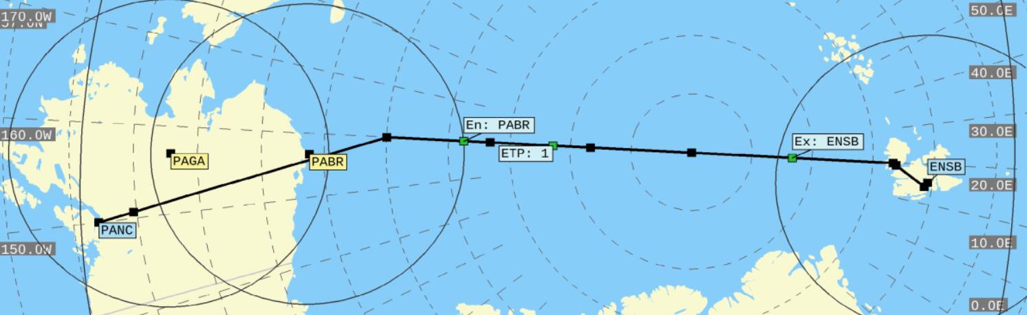
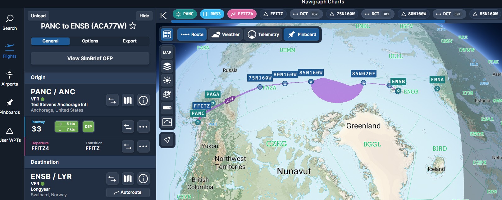
Navigraph still seems unable to draw anything beyond 85 degrees:
When I preview the flight plan and Step to the North Pole waypoint, even though my flight path is a straight line over the pole, the path on the ND is showing a 90 degree turn. This differs from how the G3000 (Longitude) shows it, which in my last north pole flight drew a 180 degree turn, sort of, really it was just a disconnected line.
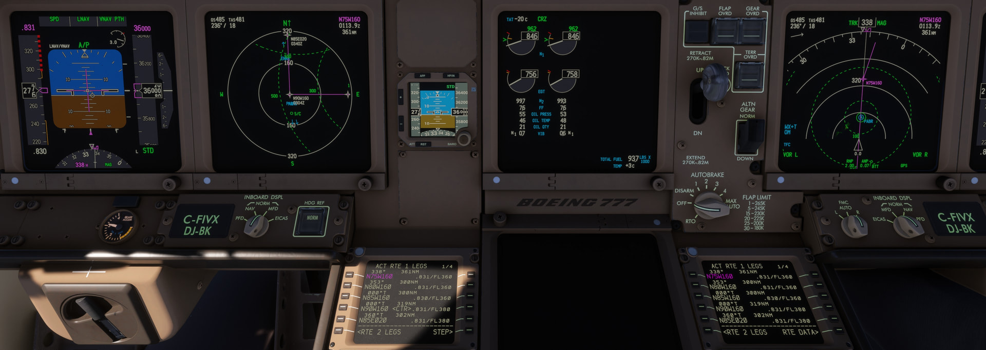
I thought the PMDG had a manual switch to change from Magnetic to True, but Google indicates the plane automatically switches to True once you pass north of the 85th Parallel. I will find out shortly and update this post.
I found the HDG REF button right under the ND, to manually change from NORM (Magnetic) to TRUE heading. I’m going to wait to see if it changes automatically crossing the 85th Parallel.
Update: passing north of the 82nd Parallel, the Aircraft automatically switched HDG REF to TRUE, and interestingly, lost the SATCOM DATALINK (I have BeyondATC set up for CPDLC to get ATIS). And now the flight path on the ND seems intact over the 90N160W waypoint for the pole, ahead
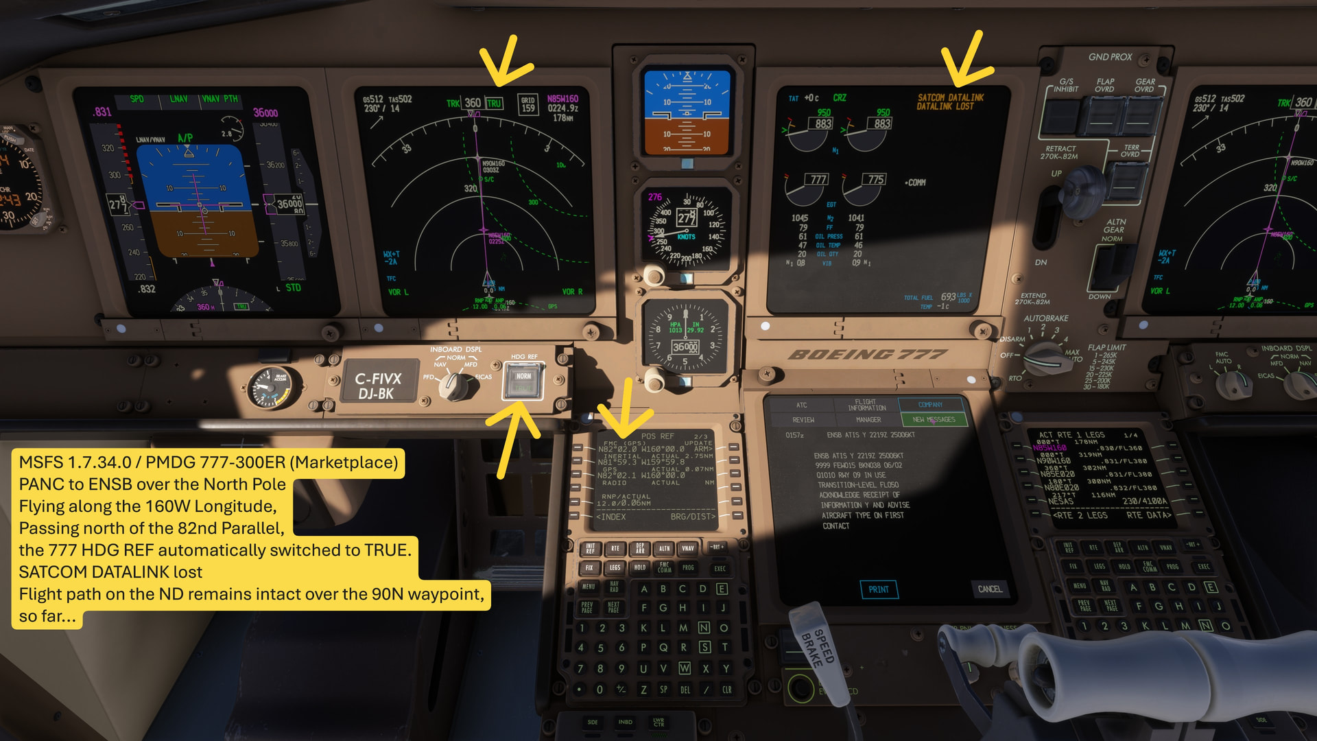
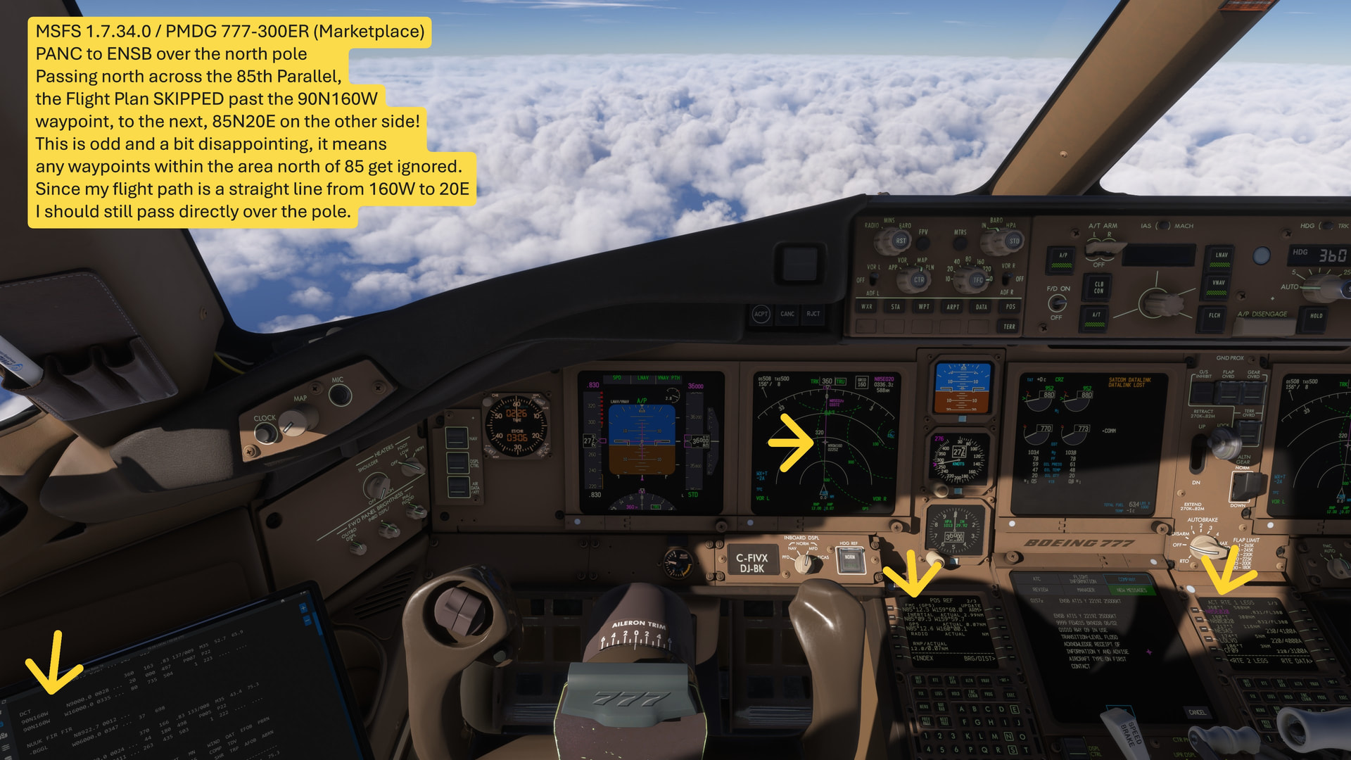
SO strange! Passing north of the 85th parallel, the Flight Plan essentially skipped the 90N160W waypoint, to the next waypoint at 85N20E … which I think means that it would ignore any waypoints north of 85 degrees, and just drop you to whatever waypoint you had next below 85 degrees.
Since my flight path is a straight line (160W over the pole to 20E) I should still pass the pole, but had I not done that, I think it would have put me off course. Disappointing, but this must be PMDG’s way of avoiding navigation issues from a Mercator flat map at the poles.
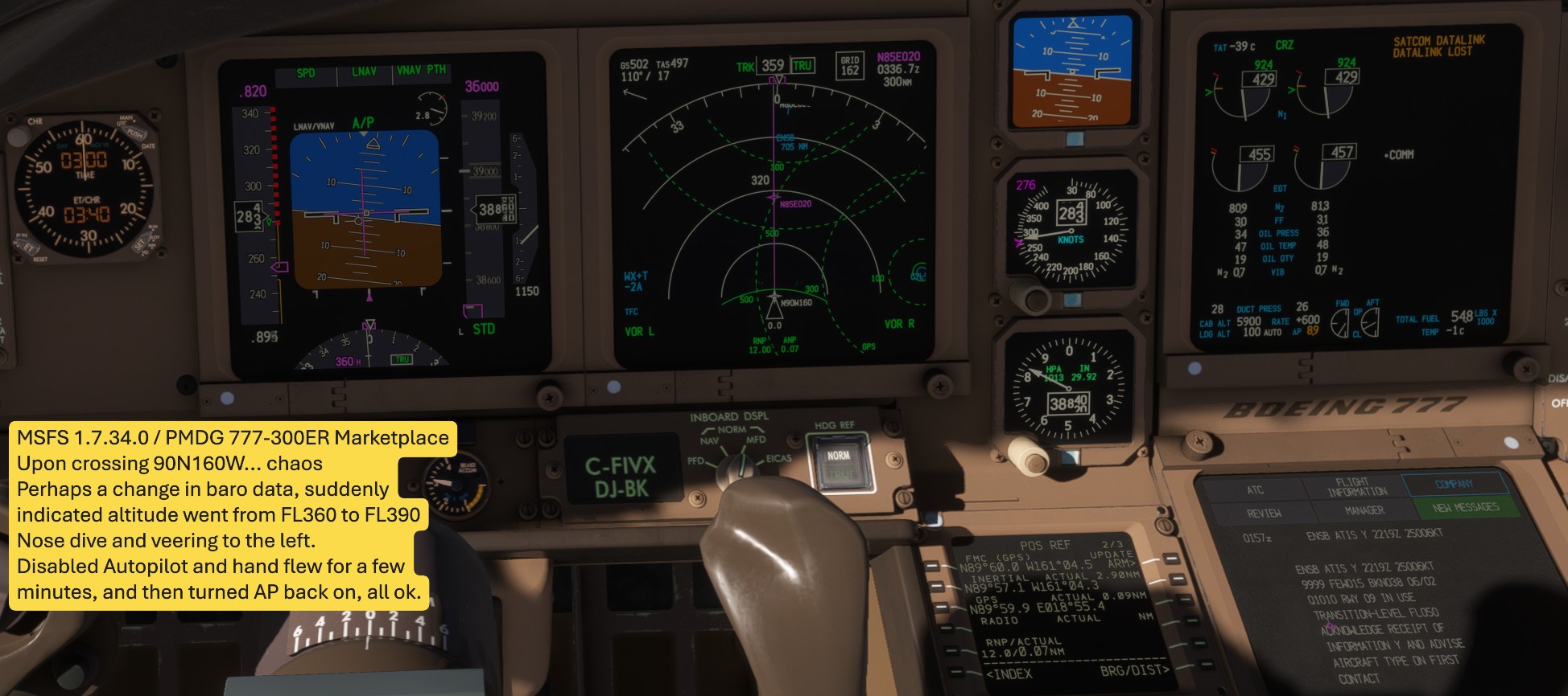
Upon crossing the pole, chaos. I think it must be a sudden change in barometric data, because the indicated altitude jumped from FL360 to FL390, the plane veered left and started diving, over speeding. I simply disengaged Autopilot, and hand flew straight and level until past the pole, then turned AP back on, all ok.
Even though Satcom is down, somehow BeyondATC immediately chimed in:
[Instruction] Air Canada 77W Heavy, you were assigned FL360. I show you at FL370. Descend and maintain FL360.
And the North Pole itself… extremely disappointing to see NO ICE at all. And, the water is of course Asobo “troplical blue” with zero waves. The pole itself is just a scenery tile with either flat clouds or something.


Upon crossing the pole, Navigraph crashed with “INOP”, and actually signed itself out! I had to re-authenticate and reload the flight plan.
