I think the airport you took a screenshot of just doesn’t exist in MSFS other than in the navdata. That looks like a rough satellite image with nothing planted on top, no runways, taxiways, aprons or buildings.
Yep. It’s just a satellite image with ILS planted on it 
You can even see a sad little airplane glued to the runway somewhere at the end.
Very confusing in low visibility…
The annoying thing is that when I go over these Chinese airports, I think I could fix it in a few hours. Just get the ILS shifted a bit… at least for a few of these bigger airports. But it’s these annoying BGL files, with changing format…
No doubt this would be a minor exercise for Asobo with all their tools, but I suspect it’s gonna be a long wait. They probably rely on their data supplier and do not fancy the manual labor.
I’ll consider getting Navigraph. At least they got it right.
Is it actually just the ILS that is misplaced? Most ILS approaches have a number of waypoints on the final approach path too. Has anyone checked whether these are lined up correctly with the ILS signal, or with the physical runway centreline?
Fixings these issues could well involve a lot more than just a simple ILS shift. All the corresponding approach waypoints may need adjusting too. And what about other approaches, they may be ever so slightly out of alignment too, only less noticeable.
My guess is the scenery itself is slightly misplaced. MSFS is the first version that uses satellite/aerial imagery as the basis for airport scenery creation. Maybe this produces slight position errors.
The navdata however, comes from an accurate database, much like it has for every other MS/P3D/XP simulator without issue, and is therefore probably correctly positioned.
That might indeed be the case too… but my guess is that for practical purpose, a correct aligned ILS signal would at least make ILS landings a lot easier… most of the deviation seems to be within meters… so if a waypoint further out is slightly off, the plane has enough time to correct on the ILS.
But after having a look at BGL files and possible tools to turn them into XML and back, I’m already tired 
It’s a lot easier to spend 40 dollars or so on a year’s worth of Navigraph data and let them do all the hard work.
But… I do feel Asobo is breaking some kind of promise here. This is not okay and if they know about all these faulty airports, it’s high time they fix them. I’m usually not a demanding customer, but a whole country and a big chunk of that continent?
I also don’t understand their marketing. It’s not like the Chinese market isn’t a market. That they don’t give it a makeover like Japan, okay… but don’t just let it hang there with all these faulty airports. Put a day or two into fixing this problem, before you start talking about smoke and contrails (yes, I know that’s probably different teams, but someone is making resource decisions…)
2 Likes
Noticed YSSY runway 7 localizer is off to the left by several runway widths (longitude).
Also KATL 26R is offset, seems like it lines up with the left side of the runway.
Ladies & Gentlemen,
just a short note - we have now found a way, how we can fix the approach offset issues. Offset (LDA) and normal ILS which were also be offset a little bit. We are preparing revision 3 which includes this major fix now. All ILS approaches are now 100% aligned (prepare for auto-land) with the centerline + the offset-approaches which were working before also as expected (at least with our data).
Here are a few example from this topic (using AIRAC 2106):
ILS LFMN 04R is offset - stock data:

… Navigraph revision 3 - also 04R offset, but correct one:
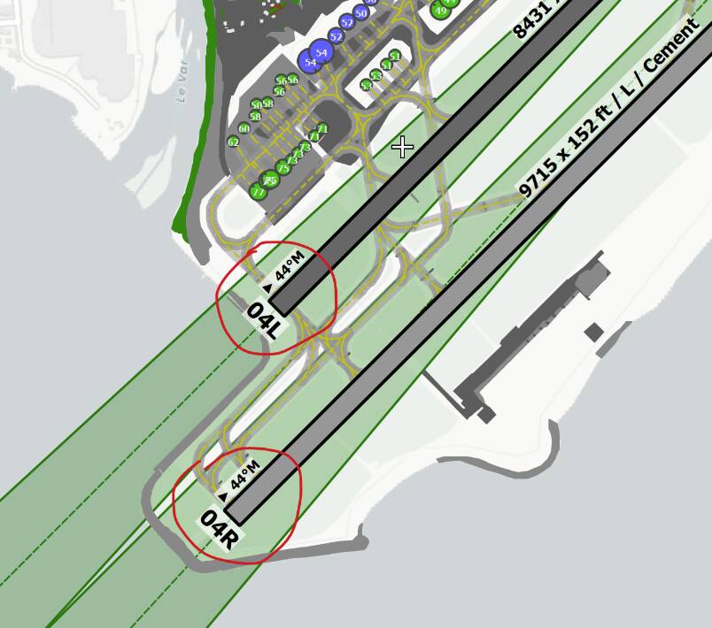
ILS ZUCK all runways - stock data:
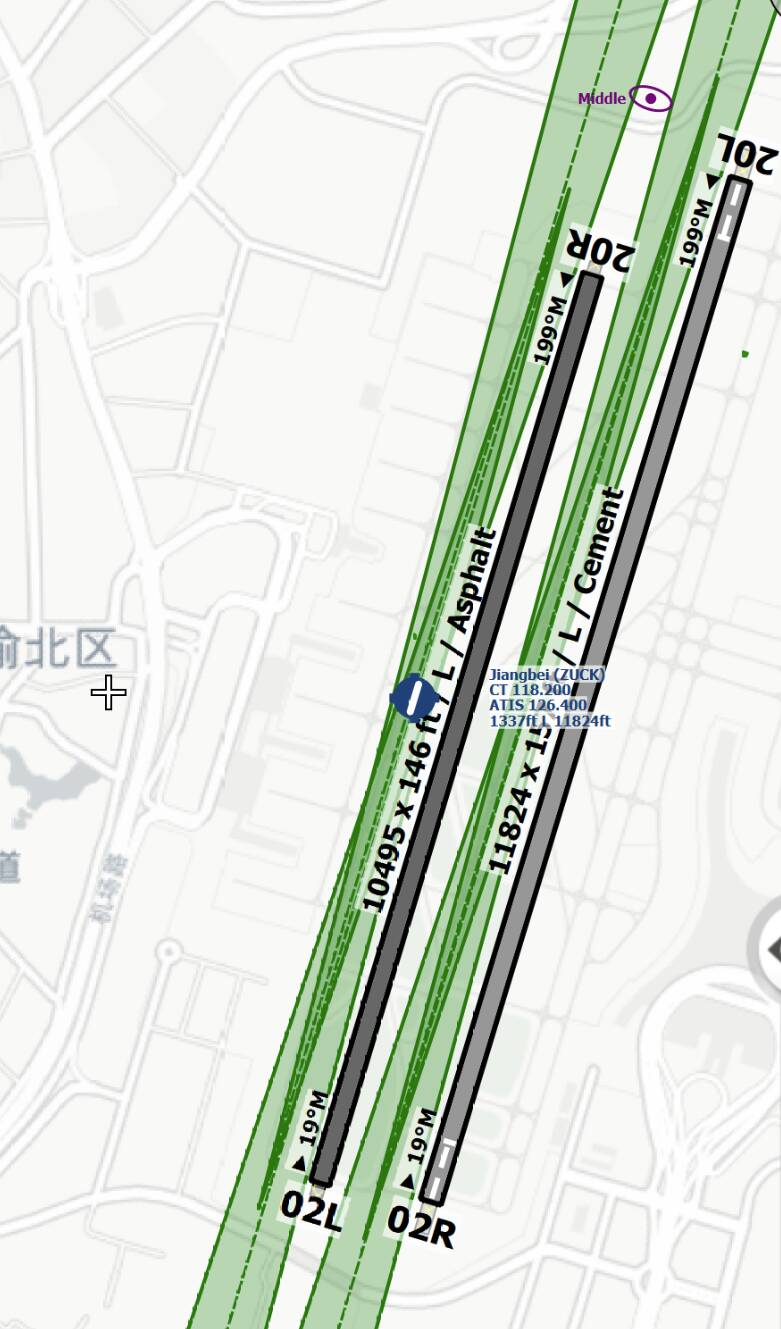
… Navigraph revision 3 - also all runways but now all completely aligned with the centerline:

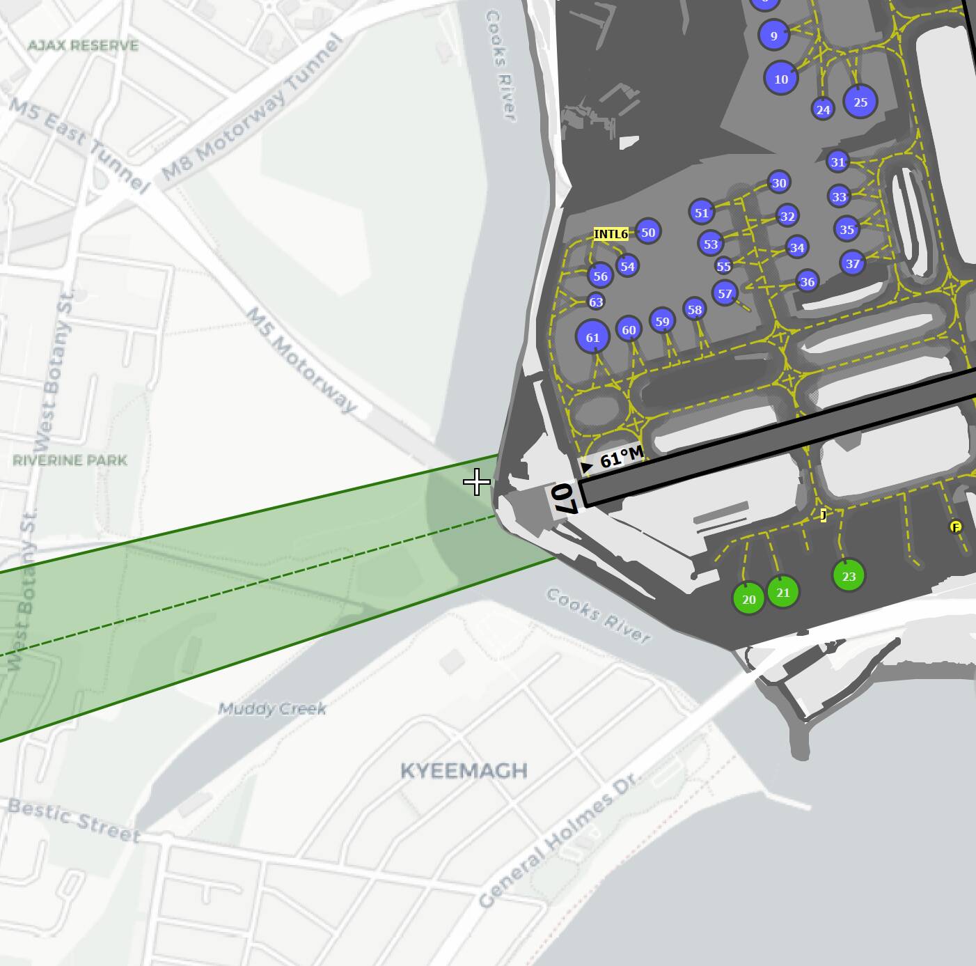
YSSY ILS 07 with Navigraph revision 3:
ZGKL all runways with Navigraph revision 3:

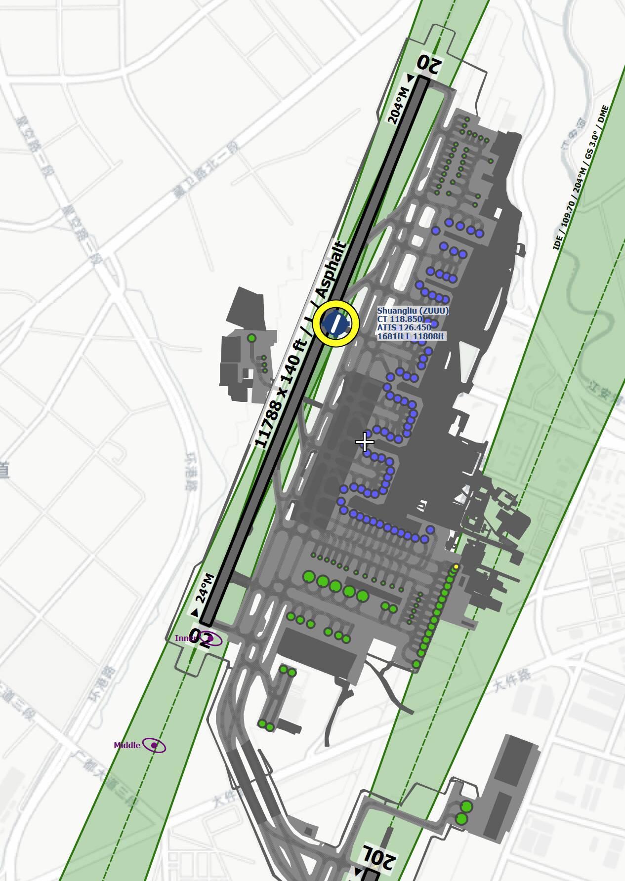
ZUUU all runways with Navigraph revision 3:
Again, we are on the final testing and we will release revision 3 in the next couple of hours. From that point on, you can expect absolutely correct localizer approaches, according the loc-courses on the charts with the Jeppesen data.
Hope that helps now to fly all approaches correctly, without to be left or right the centerline 
Cheers,
Richard
2 Likes
That’s awesome news! This stuff makes me keep my subscription
Navigraph AIRAC Revision 3 is out now …
Enjoy all absolutely correct worldwide ILSs now. All ILS… approach courses are now perfect aligned with the centerline. No shifting any longer - good for bad weather conditions
The ILS issue (not only LDA) is now fixed - also from now on, all localizer courses are exactly what you see on the charts (ILS and LDA/IGS approaches).
Have fun,
Richard
7 Likes
Just to confirm Richard – we appreciate that your Navdata is correct, so are you saying that if we use that data, MSFS now will NOT over-ride it, and all will be good ??
Confrm, we don’t overwrite, change or move any stock data files. All bgl files from the sim will be untouched.
That means, when you uninstall our data thru the new Navigraph Navdata Center, it will bring back the sim in the original state.
On the other side, MFSF will not “overwrite” it, yes (at least with the current version, we don’t know anything about the internal development plans from ASOBO).
Hope that helps
Richard
Is this with the Navdata client beta software?
Yes
Richard
1 Like
Fantastic works guys.
Heneda here I come 
This seems to occur with multiple addon airports all of a sudden… ILS approaches seem to be lining you up a few hundred meters to the right of the runway.
Having Navigraph installed or not makes no difference, the thing that seems to help is to disable the 3rd part scenery. It just seems weird that the same issue seems to happen over multiple addons sceneries. I’ve had tickets open with all the devs for the differenct sceneries but they seem just as clueless.
Anyone else have similar experiences?
Yes. I’m amazed that this is going undetected. Can’t use MSFS on VATSIM in this state. The mind boggles…surely the ILS should work at EVERY airport in a flight sim ?
1 Like
Which specific airports are not working? I fly ILS approaches all the time at multiple airports, (using Navigraph replacement MSFS nav data), and all work exactly as depicted on current approach charts.
Using the default MSFS NavBlue nav data is another matter. The default data does have known ILS alignment problems at several airports - especially in Asia. I have no expectation that is ever going to be fixed, which is why I use Navigraph.
I understand that some third-party add-on airports have ILS problems, but that is something that only the scenery developer(s) can correct. I have only two commercial add-on airport sceneries at the moment, and both work correctly.
But that’s kinda sad right?
I bought into MSFS on their promise it would all be in one program. Finally get rid of all these surrounding mods, adaptations, extra programs. Just start it up and there it all is. And they did try - sort of. I do expect them to fix it. How can they have a 3rd party contract (NavBlue) and have them deliver all this faulty data and not say: fix it… this is not what we are paying you for.
I agree though… it might take 10 years.
What puzzles me is that NavBlue has a number of products for airlines and anyone purchasing a subscription. I wonder if somehow MSFS mangles the data to make it work inside MSFS.
Just my 2cents … it should be easy for ASOBO (and I guess, they will fix it soon) to calculate the correct courses. The “normal” ILSs/LOCs are very easy and the LDA, SDF, … are a little bit tricky but there is a correct solution and I guess, they will find it also in the near future.
Cheers,
Richard
PS: that doesn´t mean, that all is correct than because you need of course the data and the NavBlue data are not complete and not very accurate (confirmed by ASOBO due the FAA data mix now … and possible other public-freeware datasets in the future).