We need proper blending of satelite data and PG etc
EDIT: this is rotterdam from the City Update of today.
We need proper blending of satelite data and PG etc
EDIT: this is rotterdam from the City Update of today.
Proper blending techniques should be employed, agreed.

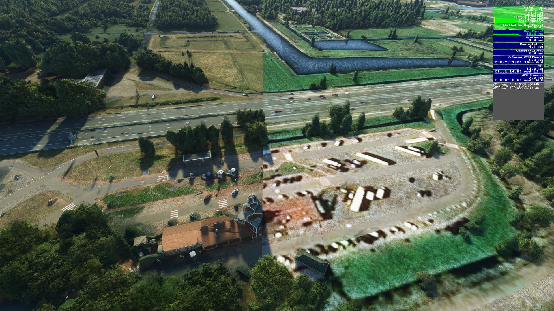
Köln has literally 3 differently colored and quality tile sets…
I won’t even bother checking out the rest, i’ll uninstall this update.
It’s incredibly immersion killing.
I am flying not driving a corvette C8 addon on the ground.
Perfect separation of Rotter and Dam, I see no issue there.
Maybe it’s related to this?
If so, it’s apparently resolved now, so try again?
Aside from the coloration blending issues, I’d also like to see them be more strategic with where the photogrammetry ends. They could definitely benefit from using roadways or natural features to help disguise the line. I’ve noticed many times photogrammetry ends near highways and interstates, and I’ve always wondered why they didn’t just end it along the edge of the highway to help mask it.
Nope that’s not it unfortunately
Have you tried deleting rolling cache if it’s on?
I’ve never seen it that bad. I thought it was a side by side shot!
I never use rolling cache, just go into the city update regions and world update regions and drone around. This lazy implentation that they do is literally everywhere and it’s incredibly immersion breaking to the point it made me uninstall all of them.
In this specific location, what does it look like in the Bing maps app/website? I know one doesn’t equate the other, just wondering whether this is an artefact of the ingestion process or the “raw” data is like this also.
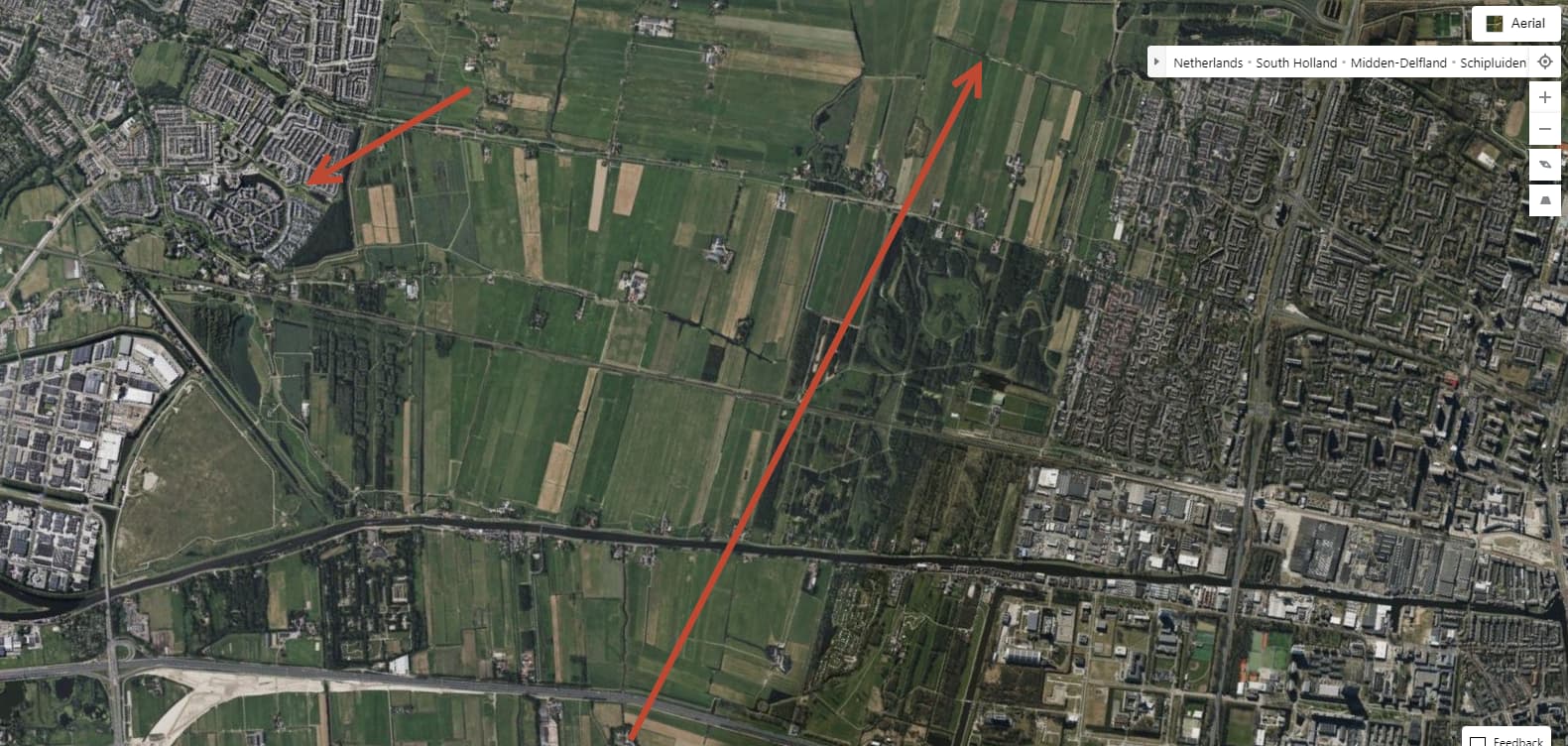
I found the location of the first image, and it does appear Bing maps shows this diagonal stripe.
But its no where near as bad, and in a different location. Focusing on this building below:

The line is just to the right of it here, going up to the top right. That line does not exist in Bing maps, but there is a kind of counterpart too it further to the left, at roughly the same angle.
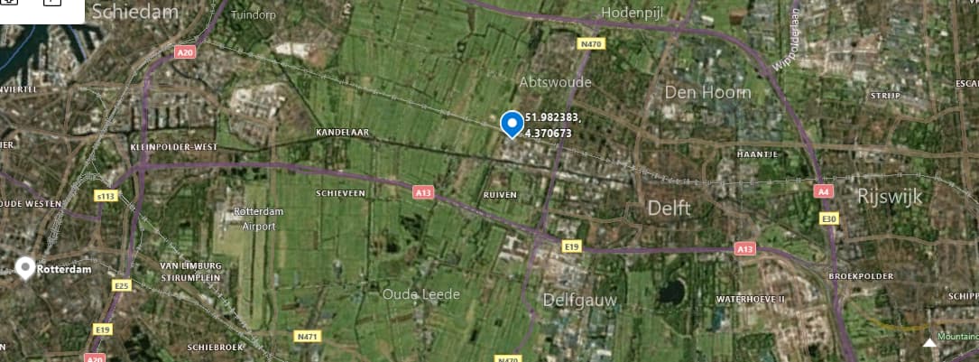
For reference that building I point to is located at:
51.982383, 4.370673
So that looks like this line has been created as part of the ingestion process into the data that is delivered to the sim.
No luck with the location of the second image. It’s like looking for a canal in a haystack.
To assist Asobo it would be really useful to list co-ordinate’s so they can find exactly where these anomalies are located.
To be fair Asobo or the team providings these satelite data could do the color corrections to match at least.
Heck if it is too much work (which is a nonsense excuse imo)
You can still use AI tools these days to do this work.
From my personal experience hand editing ortho tiles it doesn’t require that much effort to get it right.
Minor blending issues i don’t mind honestly, like slightly darker patch here and there.
but in case of these updates it can get ridiculously bad like in my examples above.
Or in worst cases even like this :

mind that the image above was showcased as a part of the italian world update for the city Naples.
Which is an absolutely stunning PG area but things like this ruin it for me.
I am planning on creating a full list soon.
There are actually many of these, i’m sure Asobo is aware of them all but decided it’s not worth the effort somehow.
I’m pretty sure no one at Asobo is ever looking at these “anomalies” - which are quality issues in the first place. There’s probably a group of people at MS/Bing tasked to gather actual aerials, and they do. Then there’s probably an automated process to implement these data into the server architecture of the sim.
That’s how these astonishing numbers of 200/500 (FS20/FS24) people working on the sims make sense: count the employees at each branch to which you have outsourced a task, and there you are.
And as many of those 200/500 don’t have any relation to the final product, this is how the quality issues in the sim may be explainable.
That’s why I was suggesting that all terrain anomaly reports should have a lat/long included as well. The world is a big place, and its a tall order to expect someone at Asobo to look at an image and know exactly where on Earth that location is. The only reason I found the first one was because there were roads, and buildings shown, which made it somewhat easy. The second image I gave up on.
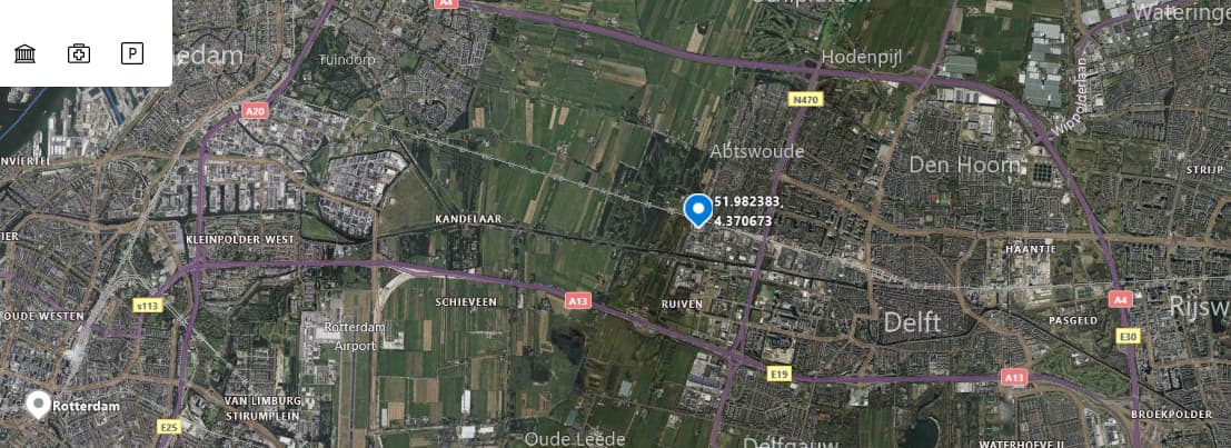
Here is what I see at one zoom level, fixated on that building I highlighted above. This is in the Windows 10 Maps tool.
Then one zoom level in.
You can make out further changes as you zoom in, but they are almost imperceptible.
Hmm, yes, it would be nice to see that being improved but I don’t think it’s within control of Asobo/XBGS at all.
MSFS uses a dedicated Bing server to pull data, it’s not a server they actually own and also they don’t seem to own the data. It’s a server to which the Bing team can upload a new snapshot of certain regions and some updated photogrammetry, also they seem to do some pretty minor color correction.
So basically what has to be improved is how Bing globally handles raw data which would also improve Bing Maps as a service.
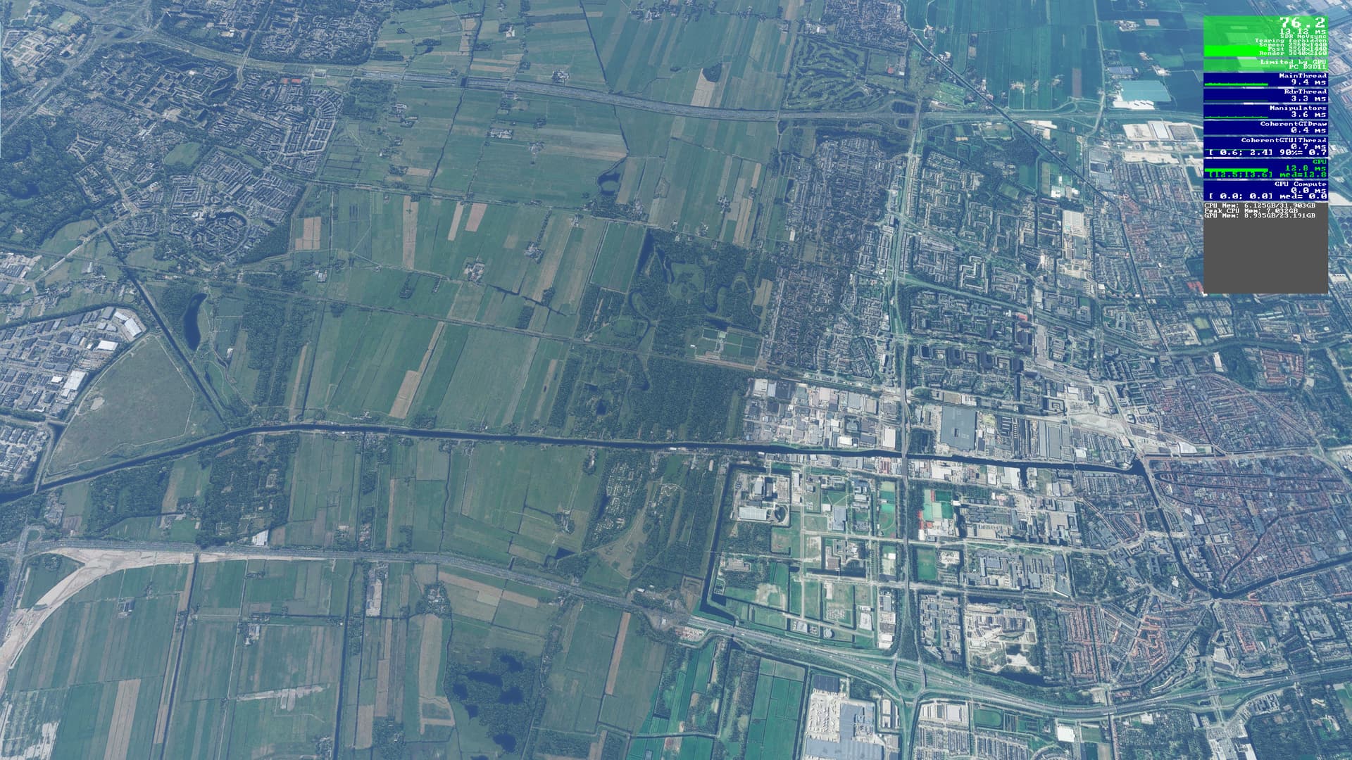
The original MSFS image above has photogrammetry on the left and satilite image on the right. I’m not sure what you are hoping to find on Bing Maps? I think the Microsoft Flight Simulator team has more control over the PG, so I would think ideally the colour correction could be done in-engine prior to releasing the World Updates.
PG is used to create buildings, and other structures. I don’t believe it is used to change terrain tiles.
I was illustrating that the hard line in the top image is not there in the Bing Maps tool, or the Bing website data. That would indicate this line was created when the data was brought in to MSFS.
There is an analogue to it further to the left, and at roughly the same angle as the original image. I can’t help thinking this is related in some way.
It takes what, 30 seconds to fly over that line in a C172?
10 seconds in the Vertigo.
It appears to be service station Ruyven (north)
51,98510° N, 4,39511° E