I wanted to share an example of how Career mode flights can be made your own, especially those that are strictly A-to-B flights (Cargo, Charter, Passenger Transport, etc.) and even turn into pseudo-Bush Trips as we currently lack those in 2024 natively.
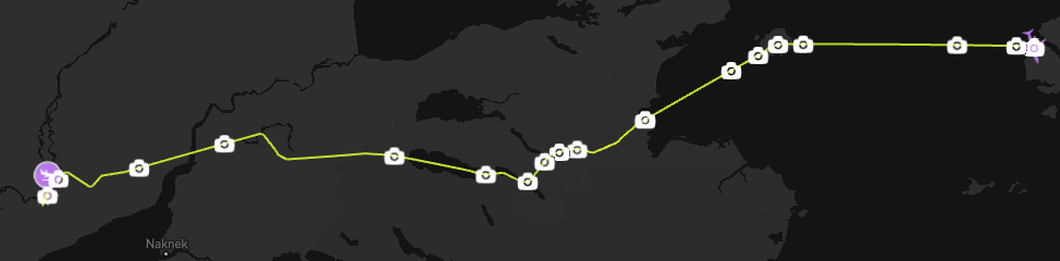
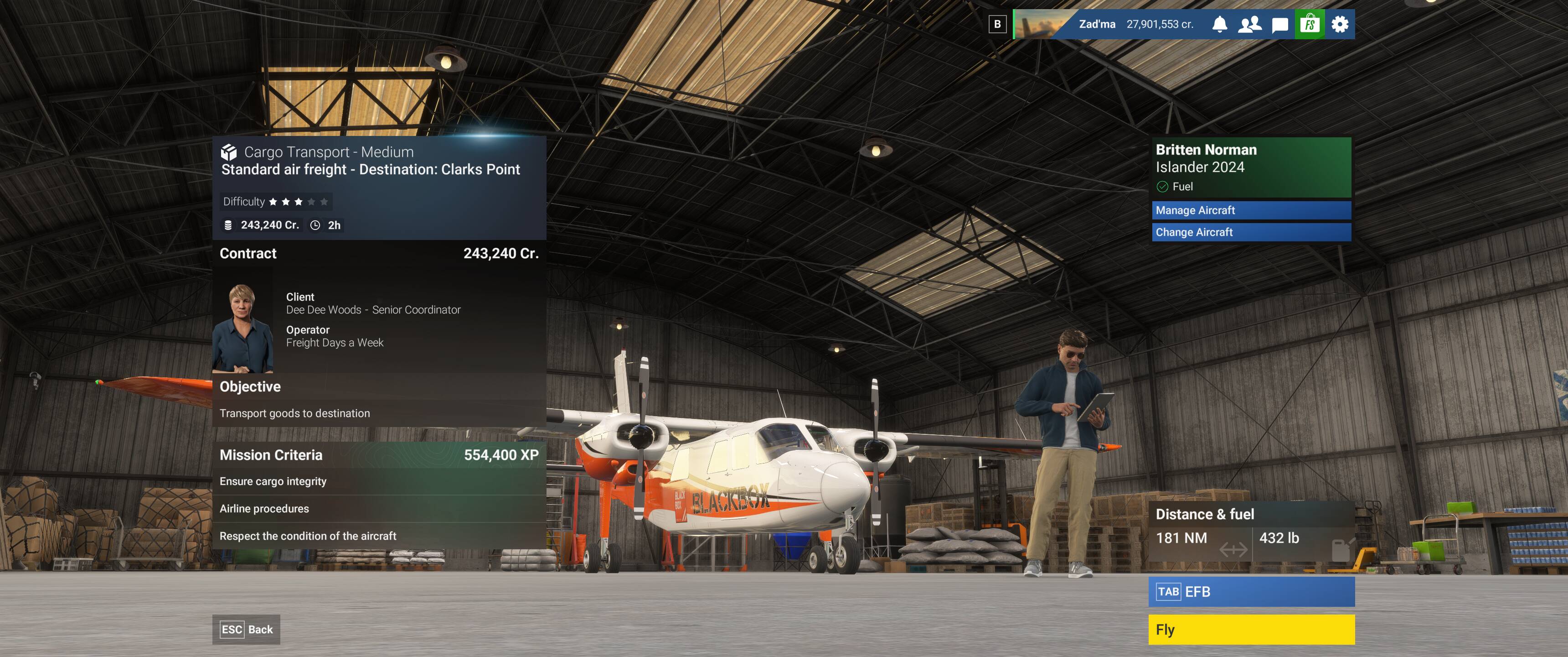
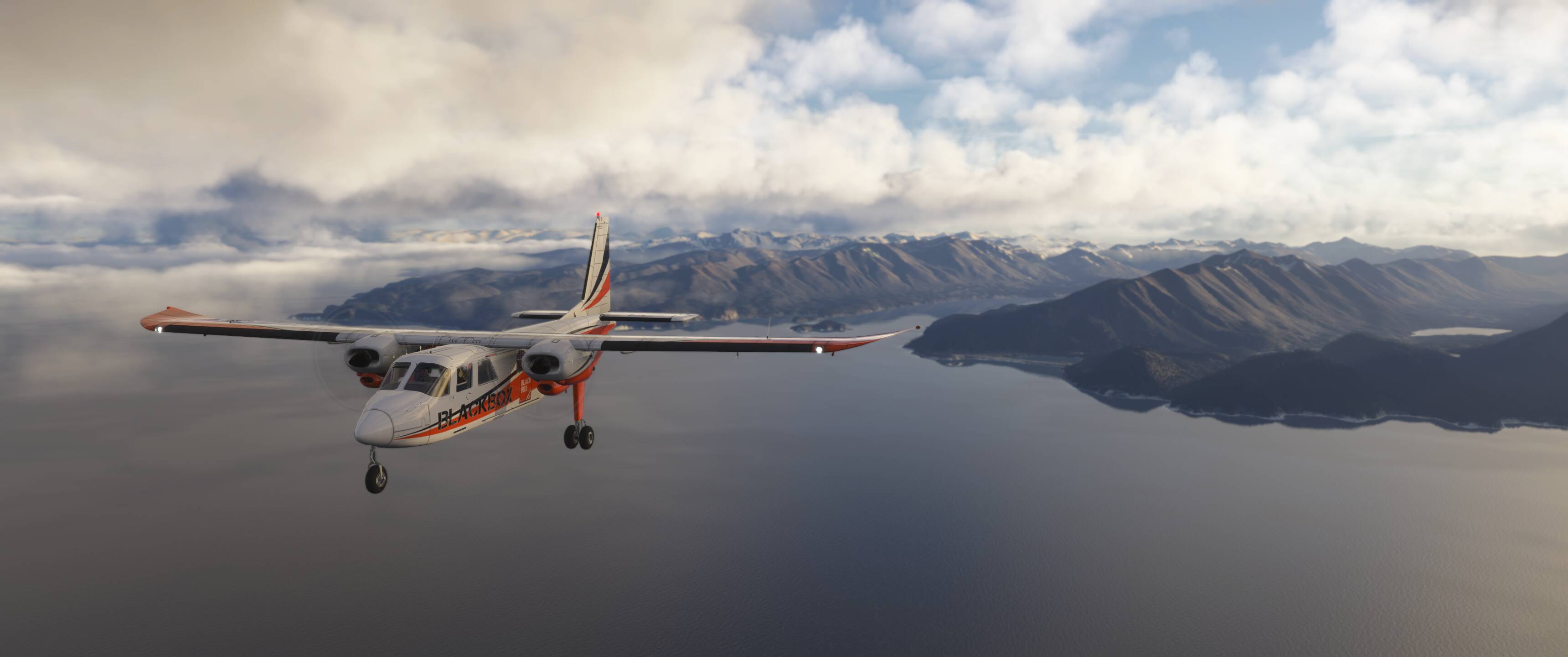
Starting with a Cargo Transport - Medium mission in Alaska, this one takes us from Nanwalek (KEB) to Portage Creek (PAOC) and will include a long two first legs across the Cook Inlet with Augustine Island as our guide, then following some small rivers, valleys, and lakes beginning with McNeil Cove to Kulik Lake, Nonvianuk Lake to Kvichak Bay, and then onto our final destination at Portage Creek.
Several waypoints will have visual references (namely the above island and bodies of water) and a few are airports between our dotted line path to PAOC.
The larger point is that creating a custom flight plan (I used planner.flightsimulator.com) and then importing it into Career mode is relatively easy and works well with the mode provided you have properly filed the flight plan, and it delivers you to the planned destination. Additionally, I’ve filed this flight plan as VFR to avoid any mandatory ATC communications other than on departure and arrival.
The flight plan can be found here (though only useful in practice if/when this specific mission is active, which it will not always be).
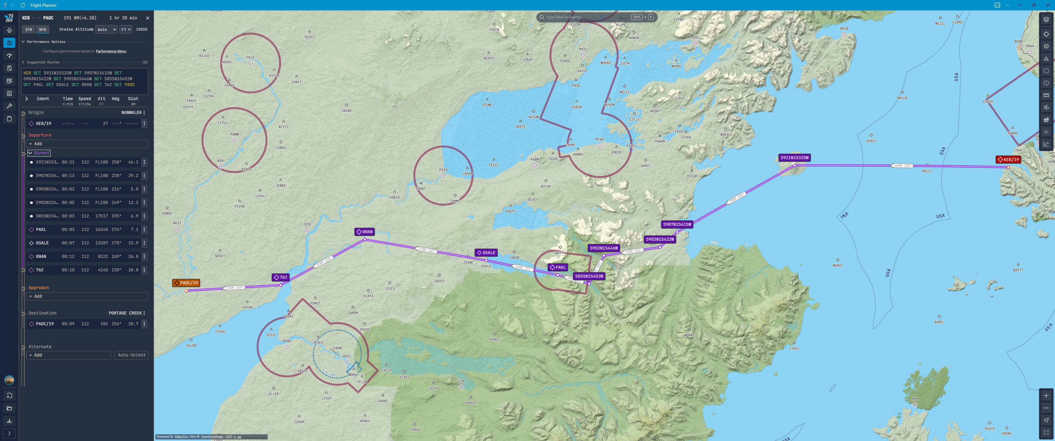
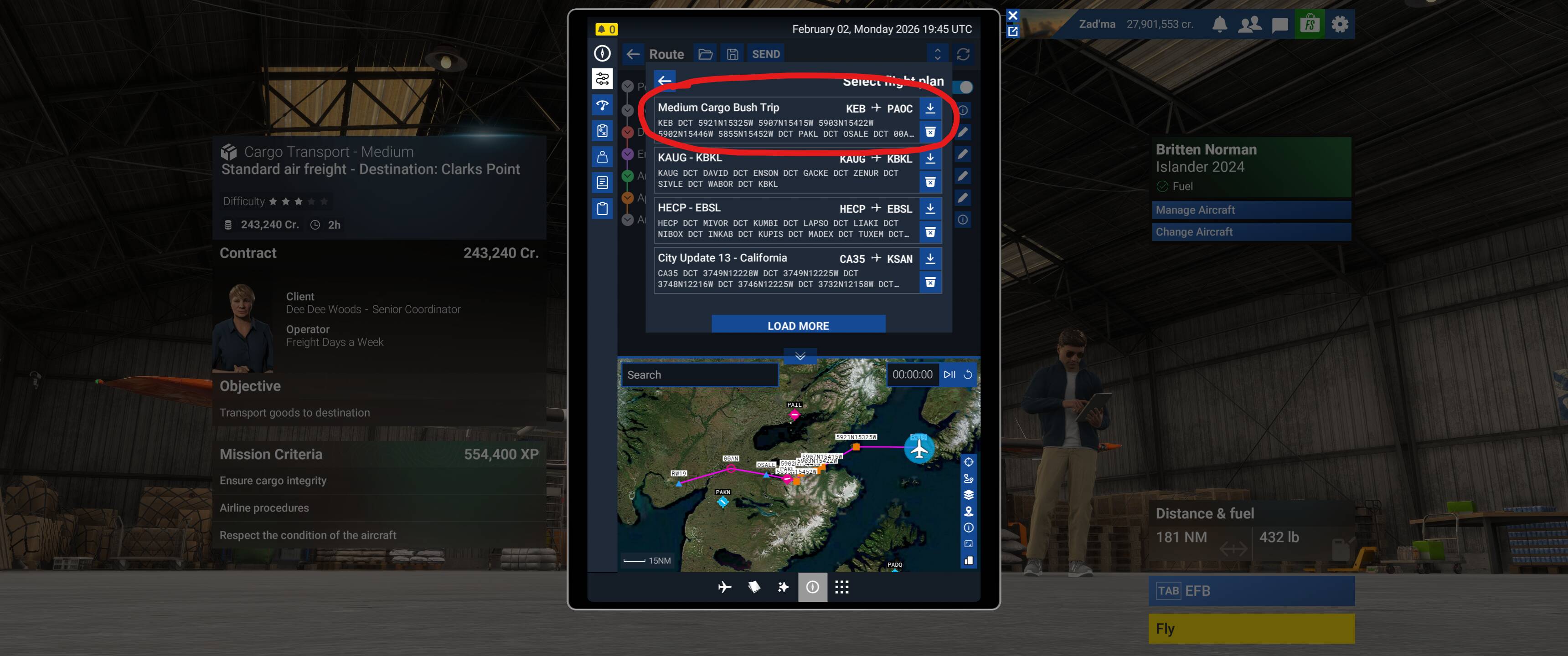
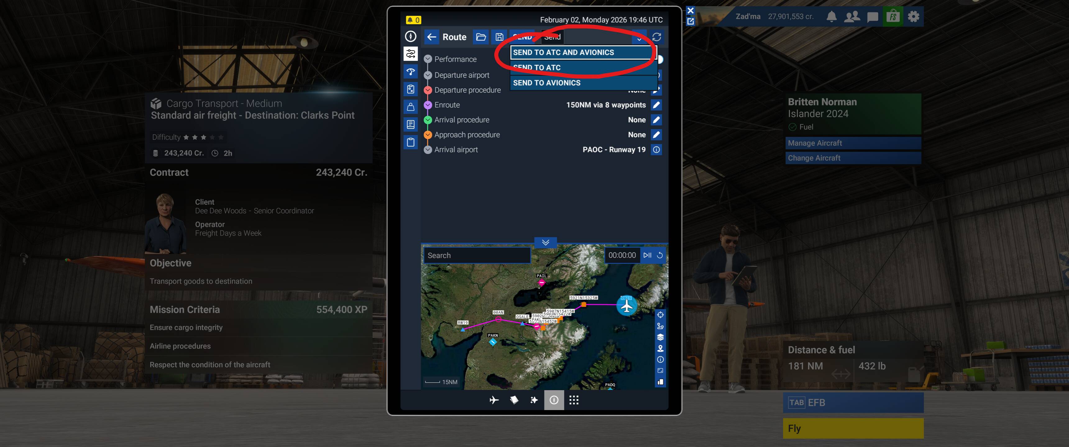
One unfortunate caveat in this planning phase is that not all airports you are sent from/to in Career mode exist in the AIP data used by planner.flightsimulator.com. This will generally make this process impossible to do exactly right as you wouldn’t be able to plan on the web, save, and then load into the EFB - but the same kind of planning can happen directly in the EFB, it’s just a little less intuitive.

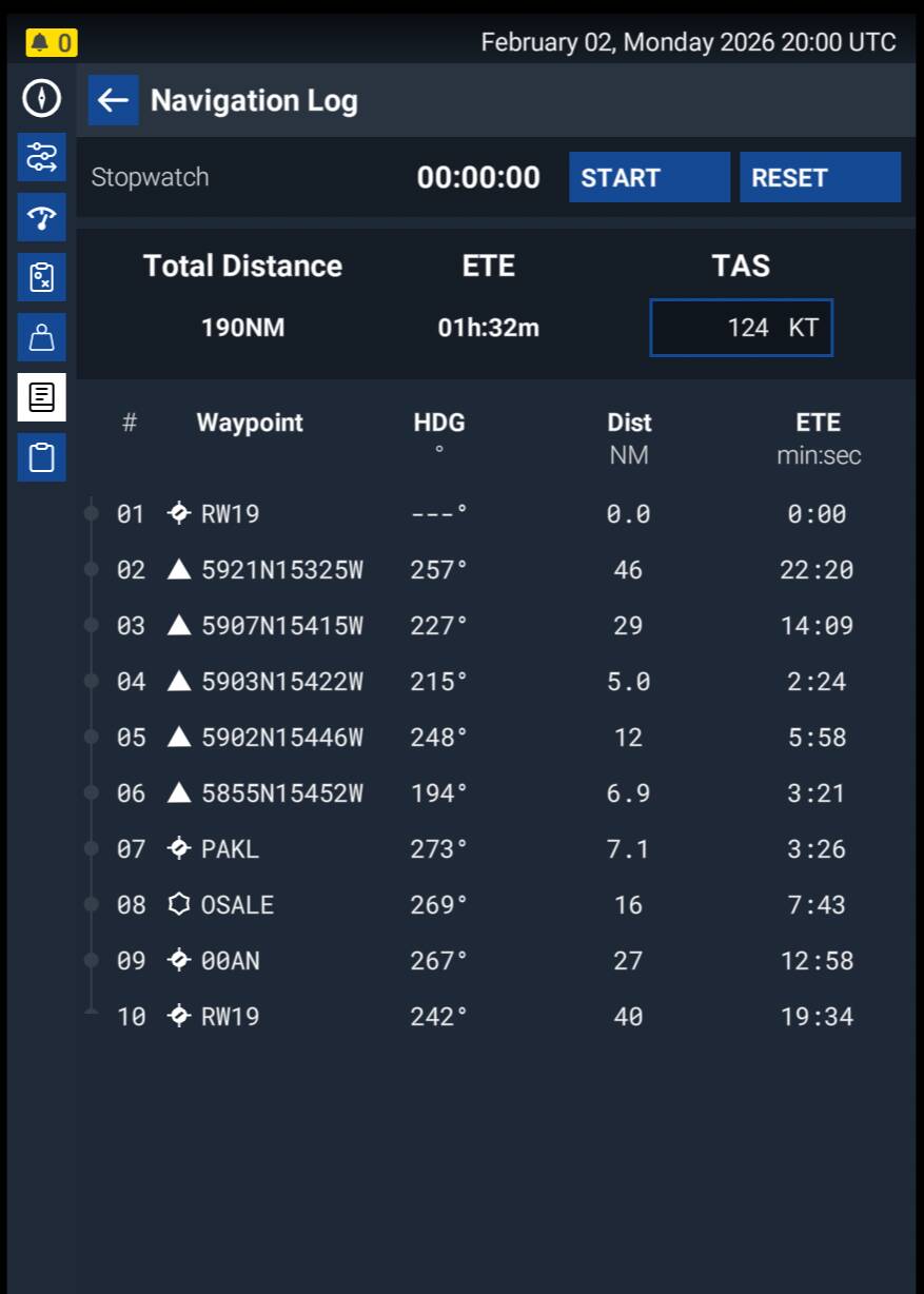
For the Dead Reckoning purists out there, the planner will also output a great navlog with multiple formatting options:
”IFR”
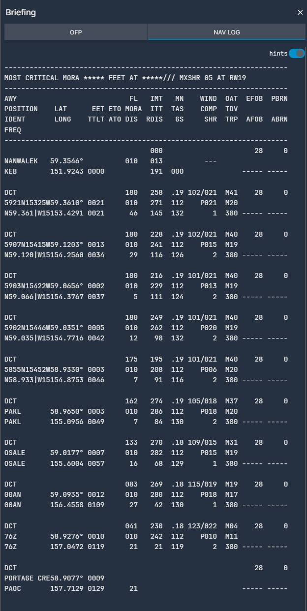
“VFR”
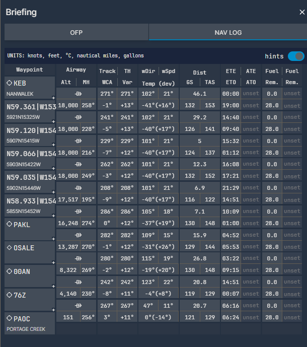
“Modern”
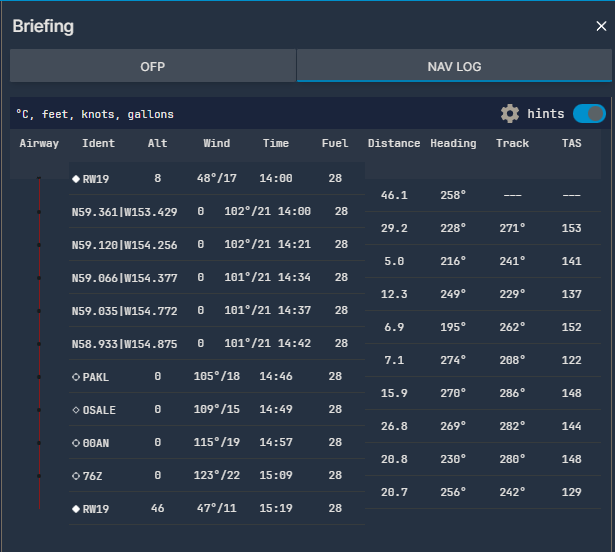
Or the version on the EFB:
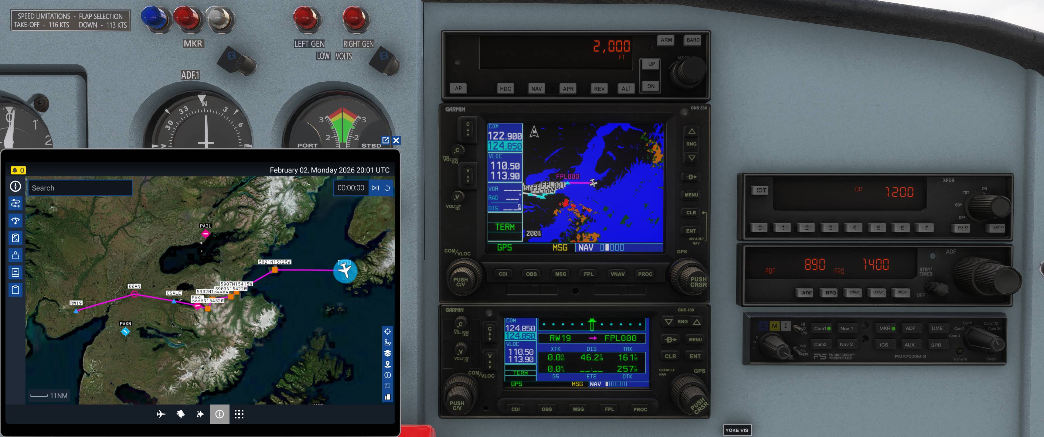
In addition to the above, the EFB map and Garmin stack will have your custom route and be there should you need or prefer it.
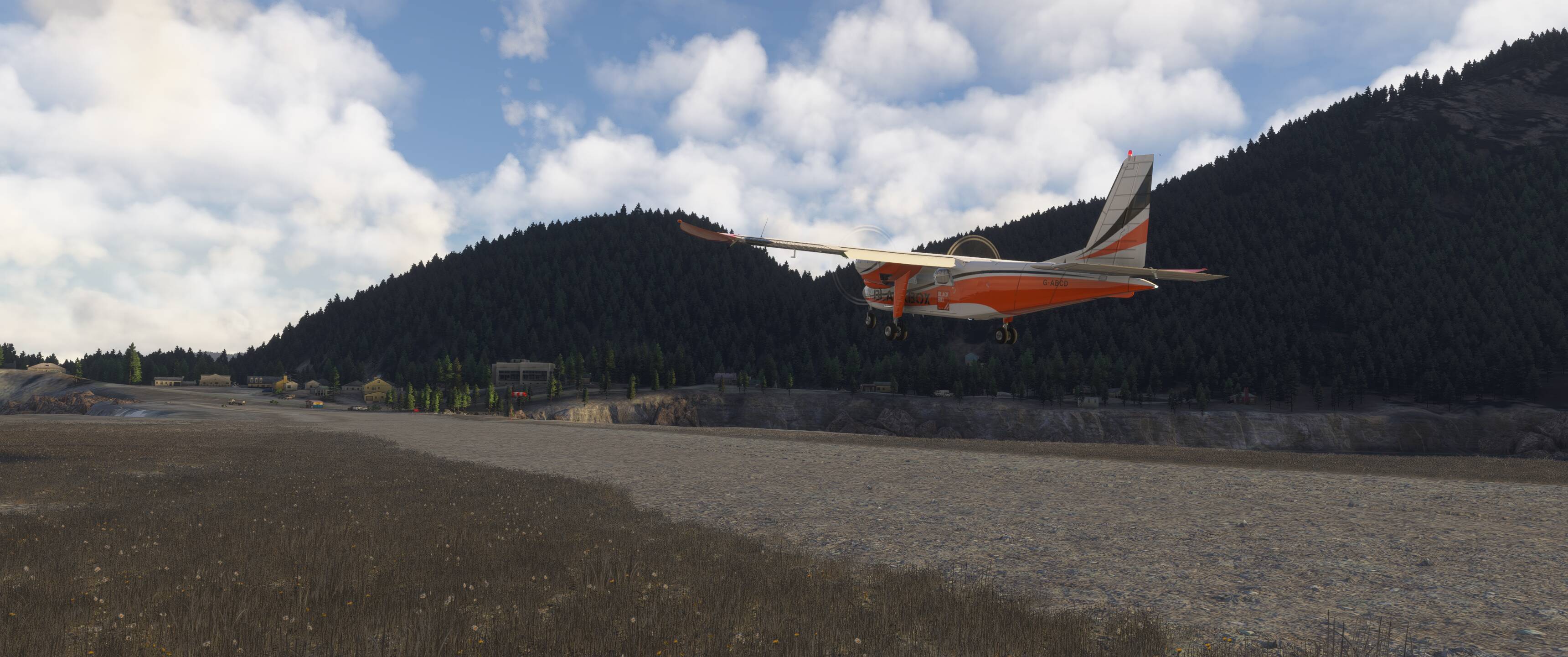
Big orange guy says “go that way” for runway selection, so I’m obliged to listen.
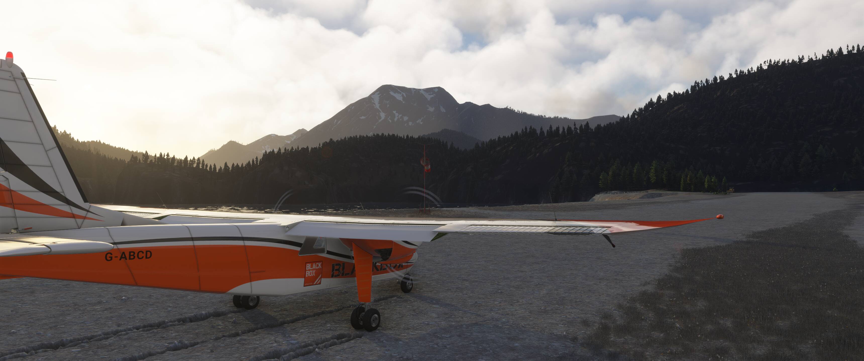
Thankfully the Islander can get us off the ground in a very short distance.
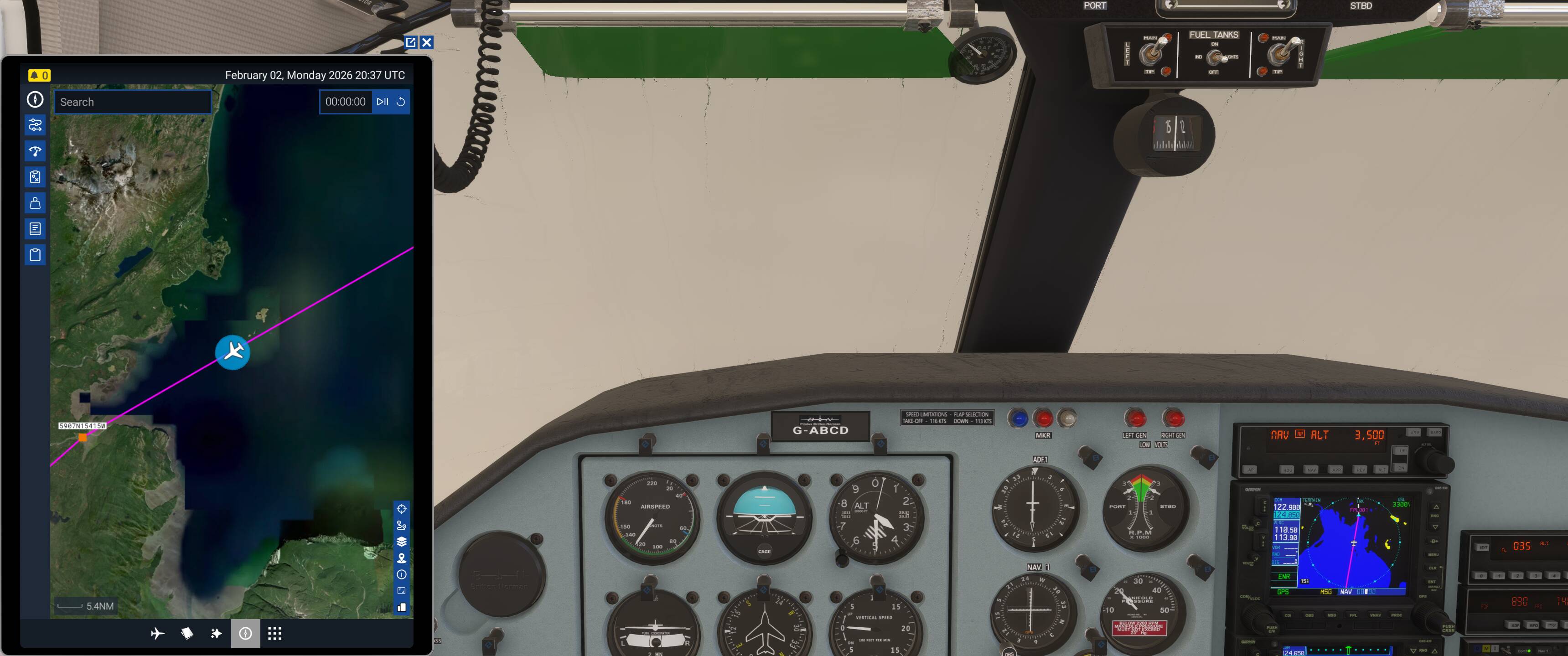
Never quite sure where the missions get their altitudes from on VFR flights, but it would like us at 3,500ft so that’s where we’ll go (note, 2,000ft was the filed cruise altitude - the route is generally westerly and VFR, so it should technically be an even number + 500, but I won’t be picky).
Our first obstacle to clear (because why go around it when you can go over it) is Augustine Island, home to the Augustine Volcano which last erupted in 2006. A quick Google search tells us it has an elevation of 4,134ft, so we’ll climb to 4,500ft just to be safe. As we’re flying VFR and have had no contact with any ATC to speak of, we can do this all on our own.
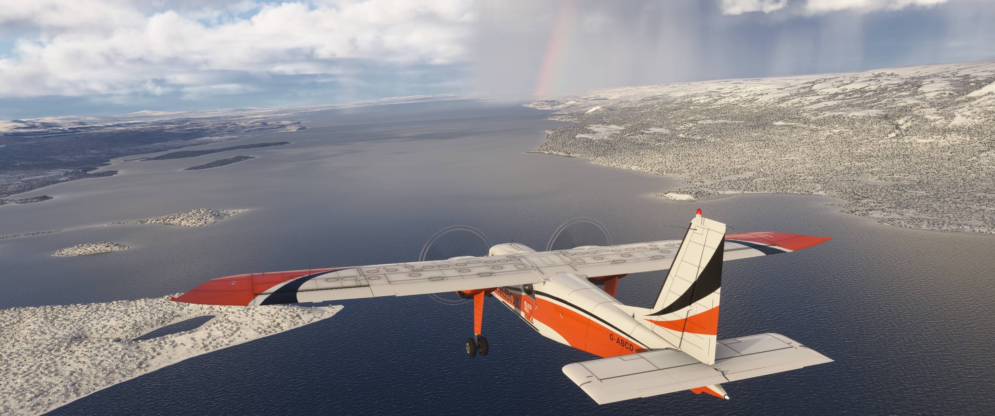
A bit of rain to go with our rainbow on the way over Cook Inlet.
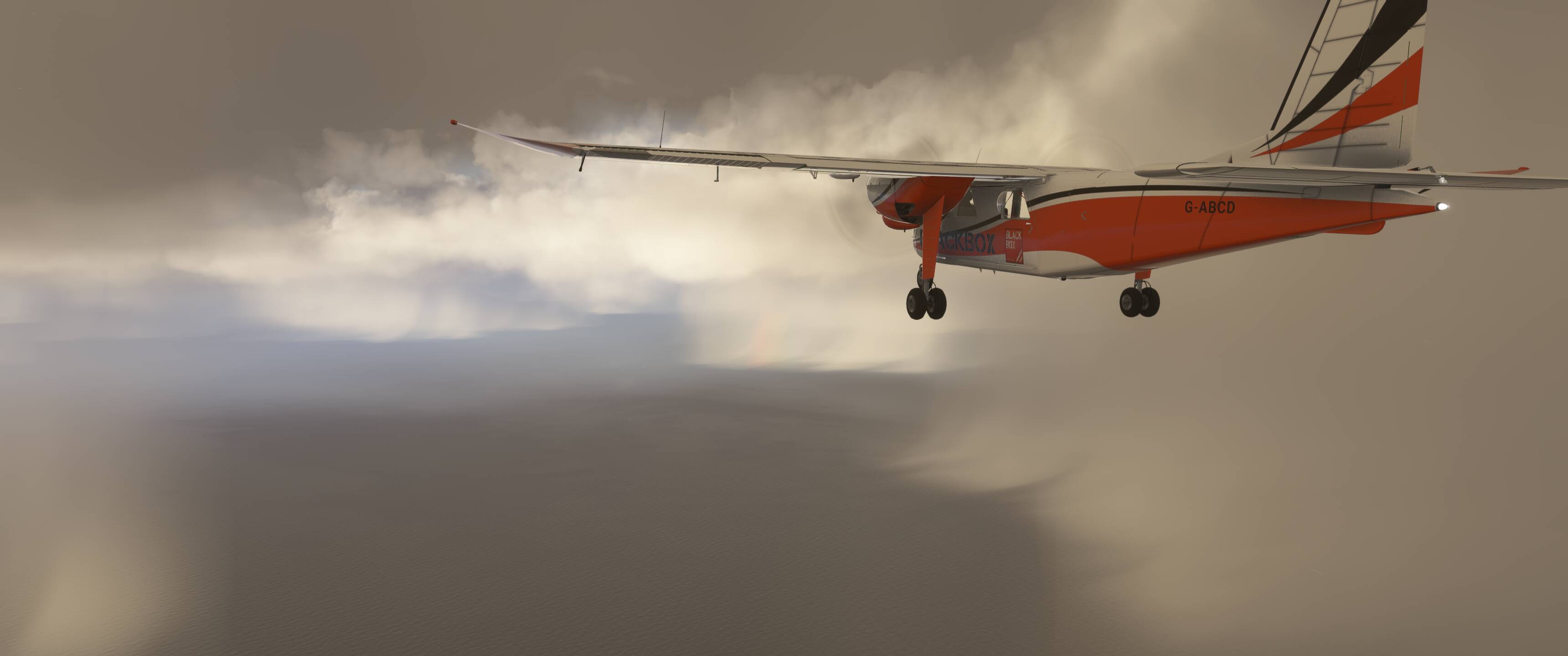
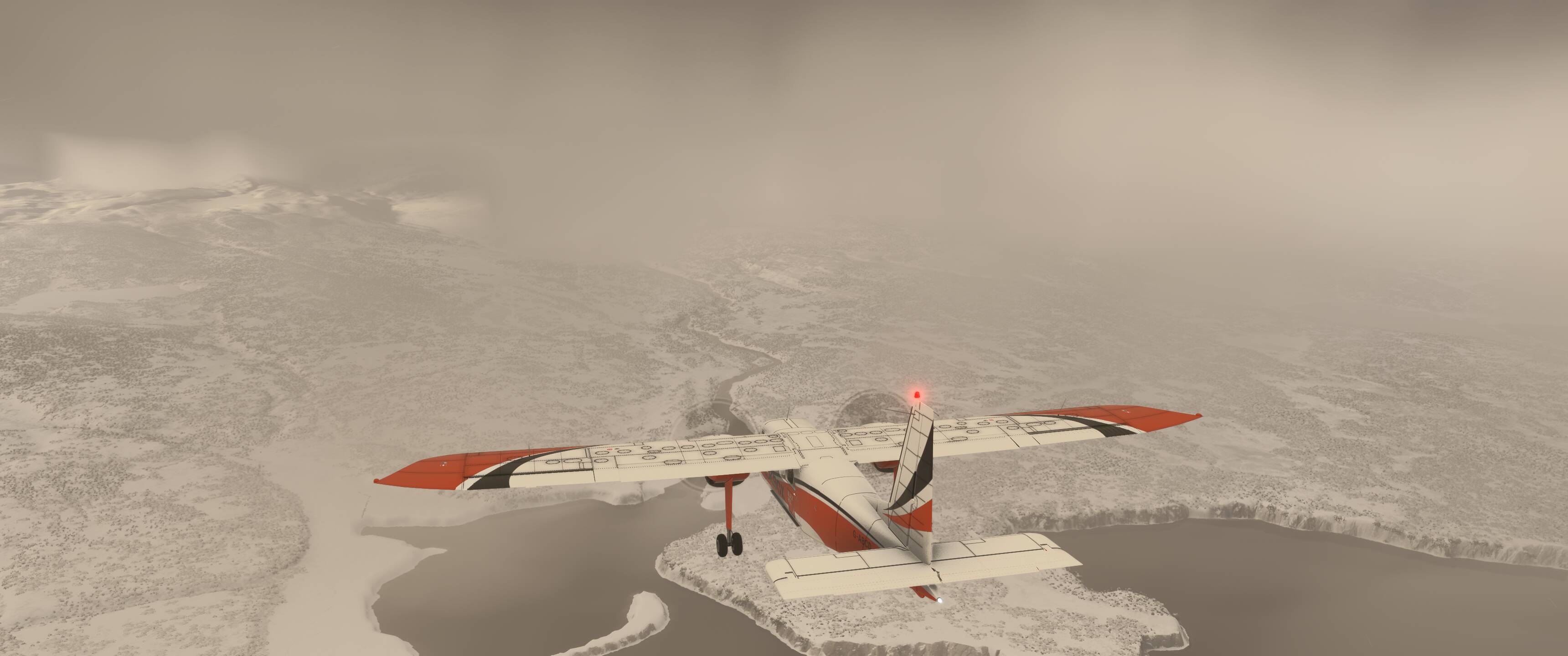
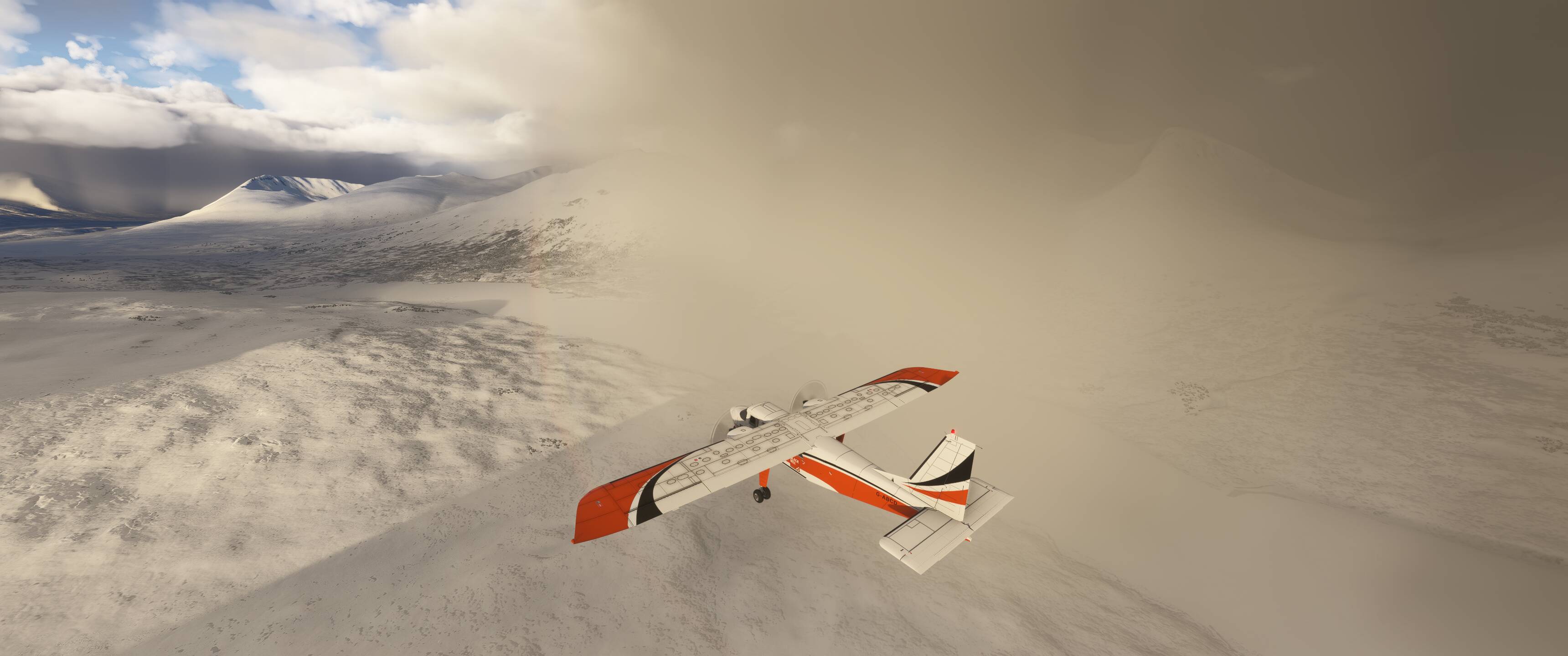
Quite an intimidating sight when breaking through the clouds. Seems like we won’t clear it at 4,500ft but we will……….. I think.

After putting all our faith in Asobo for getting these elevations correctly and crossing over the peak of the volcano we’ll head a little more south bearing 227 towards McNeil Cove and try to spot the river from our map to guide us inland. Crossing the volcano was quite an experience, with a massive downdraft pushing us down at about 1,500fpm just seconds after crossing the summit. That’s alright, no need to be up at 4,500ft anymore, anyway.

It’s at this point of approaching the mainland that I’m realizing our VFR plans might be a bit tougher to achieve than hoped with live weather, but we’ll press on anyway. After all, the weather in Alaska seems to turn on a dime, so who knows what we might get in another couple miles.
Taking this final long leg over water as an opportunity to check in on our precious freight - which appear to be parts for Wonder Woman’s aircraft which is sitting at PAOC waiting for repairs.
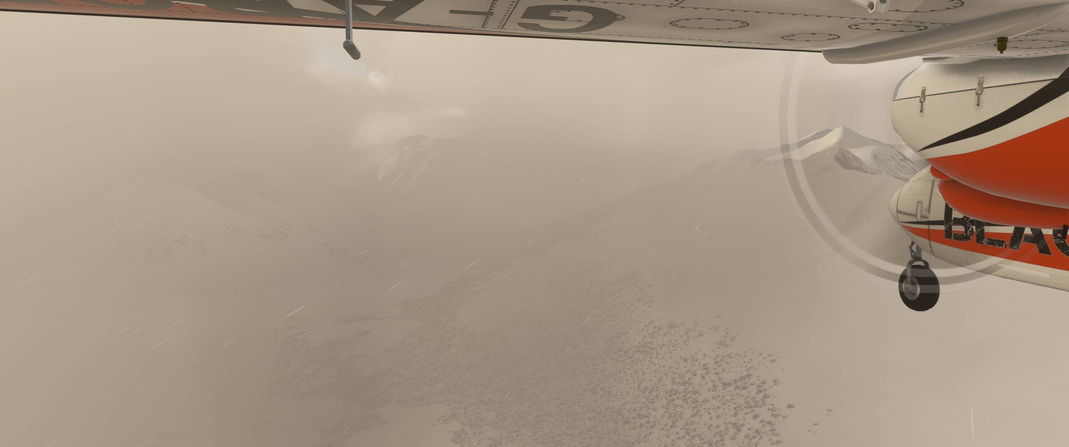
As we approach land and are in pretty significant IMC I’m going to make sure the 530 is all set up with the terrain display ![]() .
.
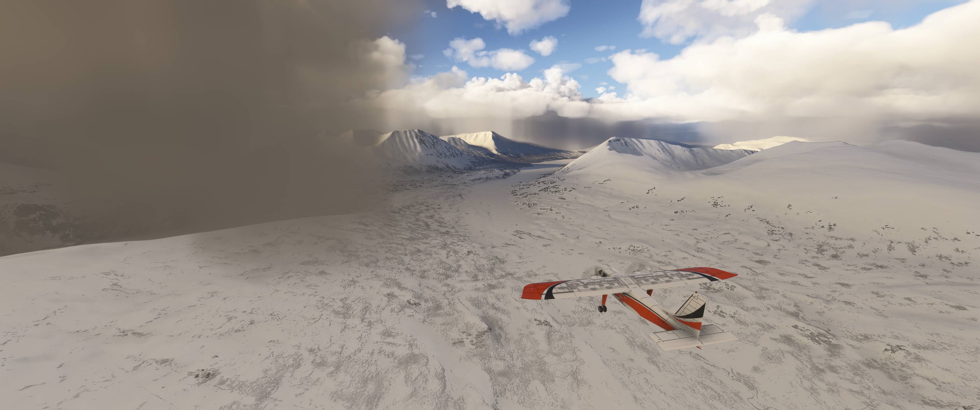
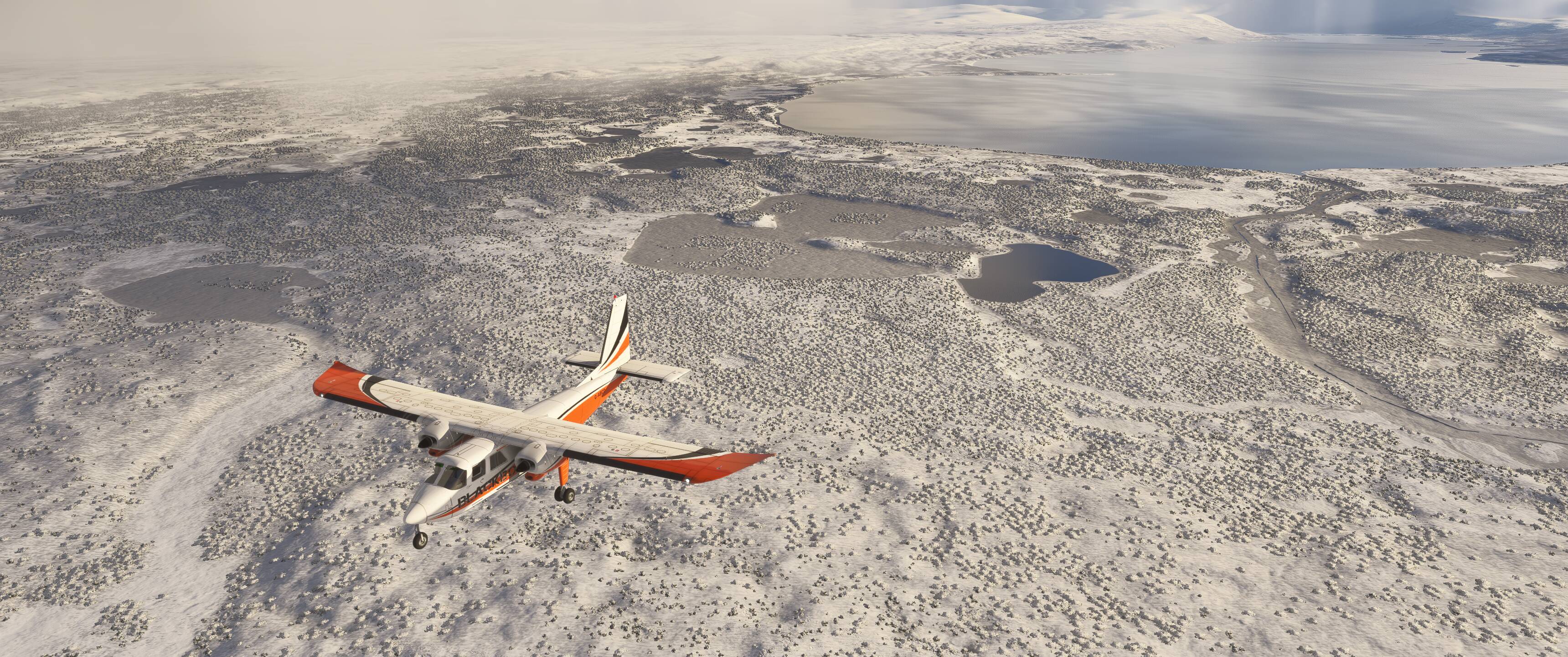
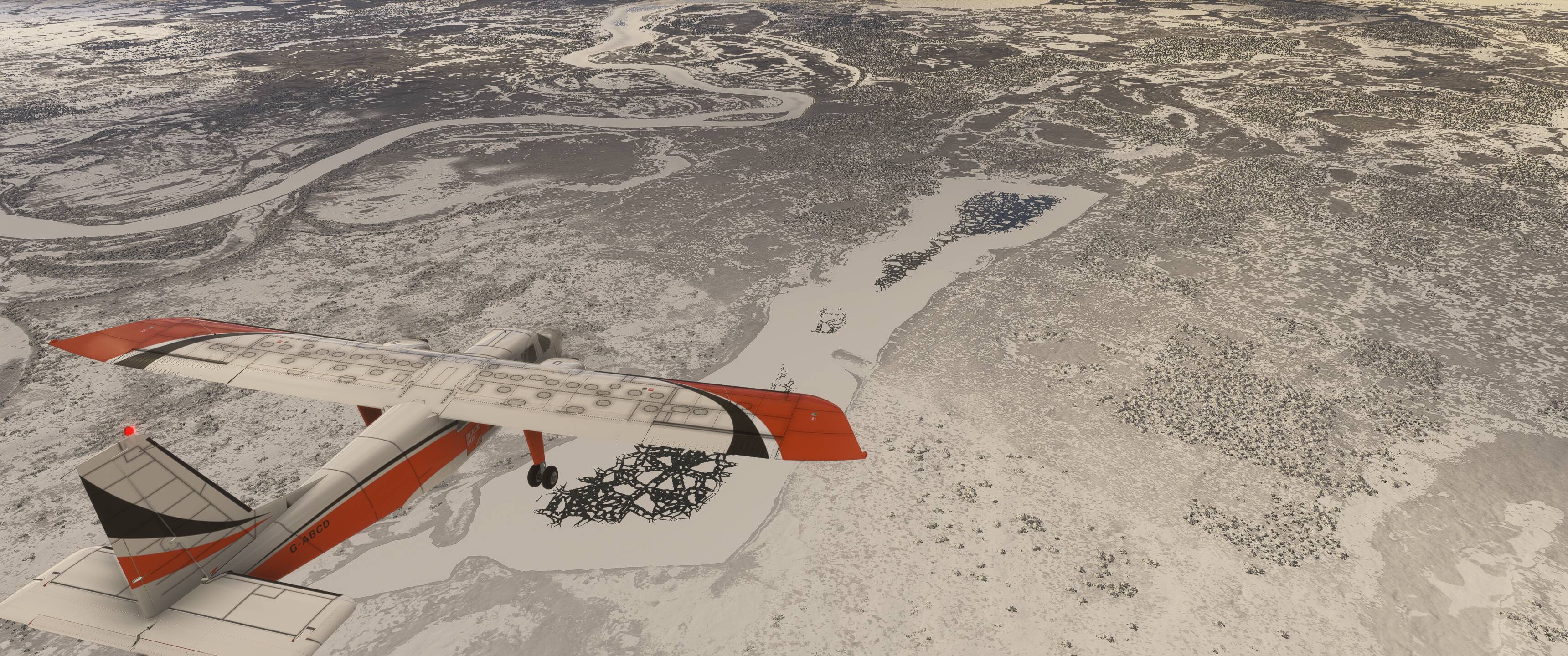
Cloud coverage does break up a bit as we go “feet dry” - just enough to catch the river we saw on our map during the planning phase.
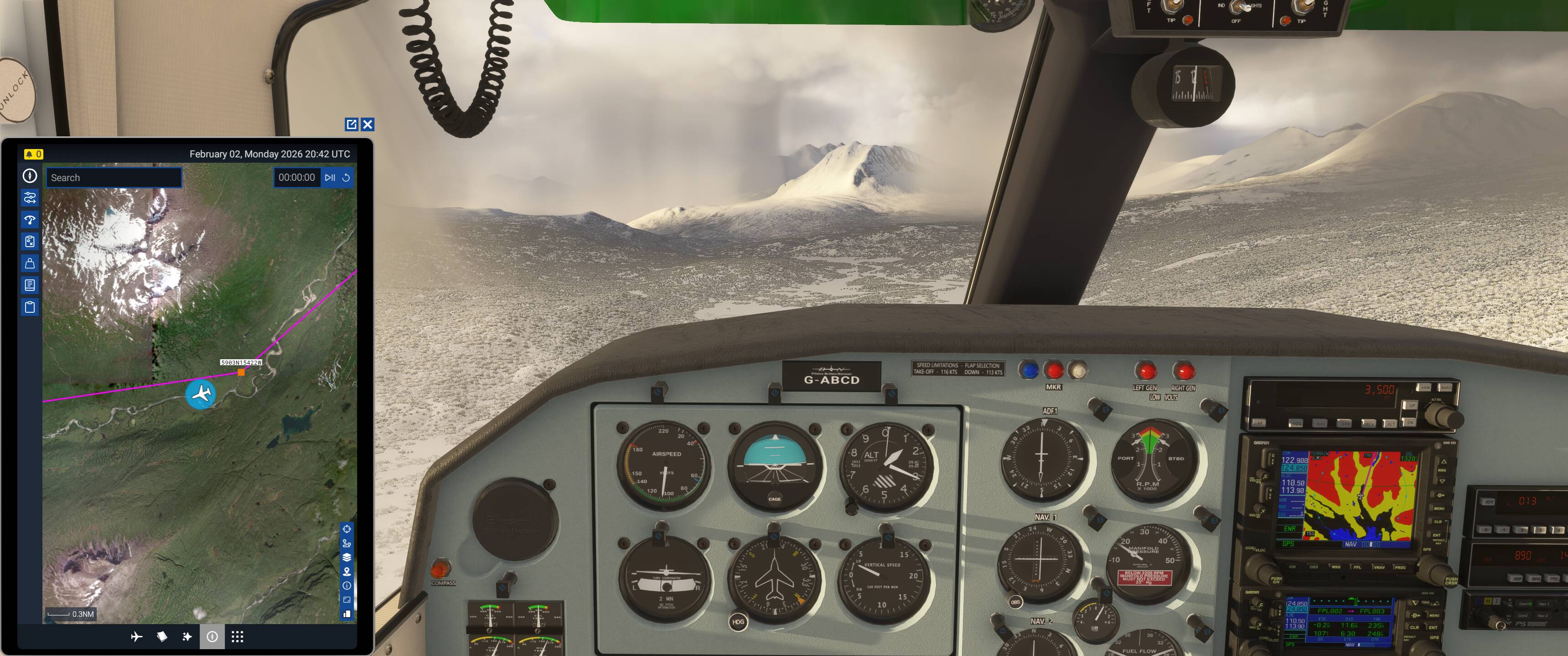
With that in mind, we’ll kick off the AP and drop down to track the river through the valley ahead. A bit tougher when the river is frozen and covered in snow ![]() but we can cheat it a bit with the satellite view on our EFB map. And no need to feel too committed to the magenta line - “more like guidelines, really” - and as long as we’re close-ish, the mission will have no issues with it.
but we can cheat it a bit with the satellite view on our EFB map. And no need to feel too committed to the magenta line - “more like guidelines, really” - and as long as we’re close-ish, the mission will have no issues with it.
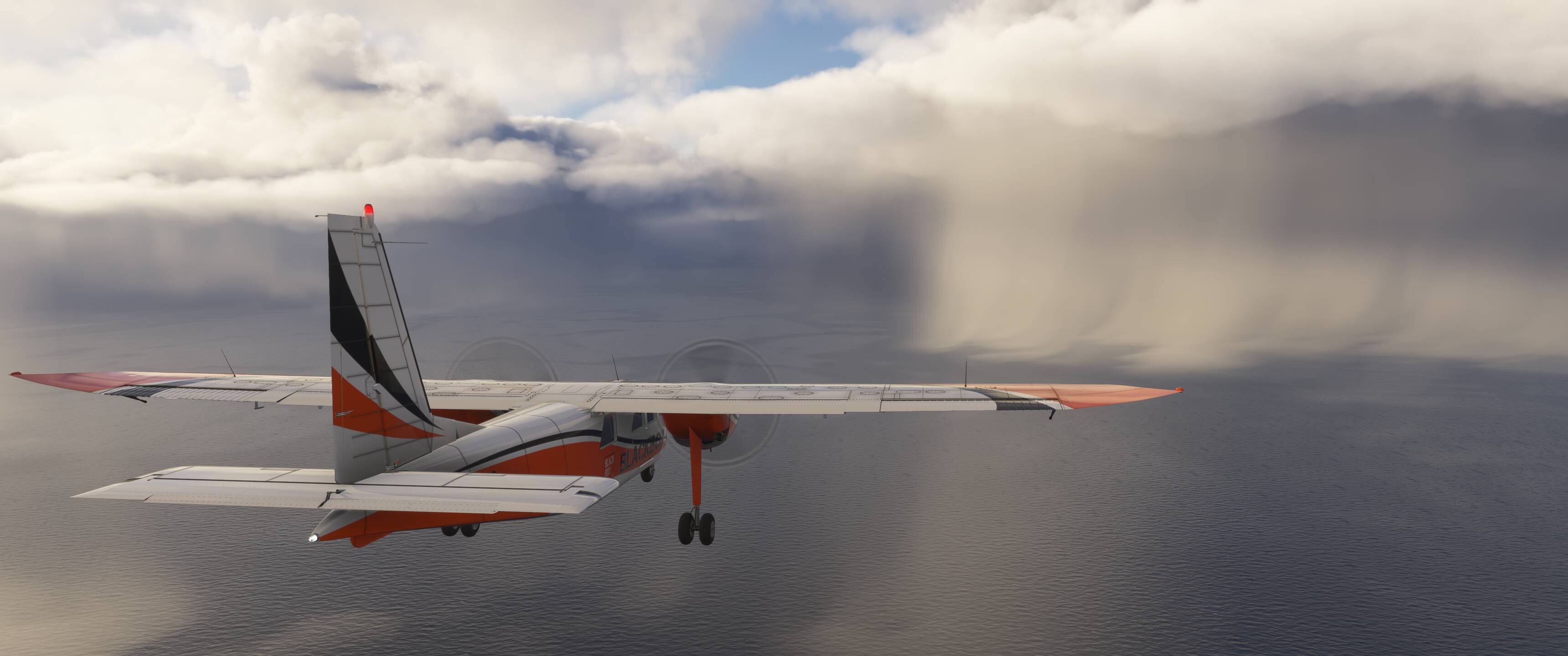
Some more rainbow action as we cross the very-frozen McNeil Lake.
As we approach the larger-but-still-frozen Pirate Lake at our 1:00 our route instead turns left, into the soup and through a valley towards Kulik Lake.
Catching some major updrafts in this valley - rather up than down, at least!
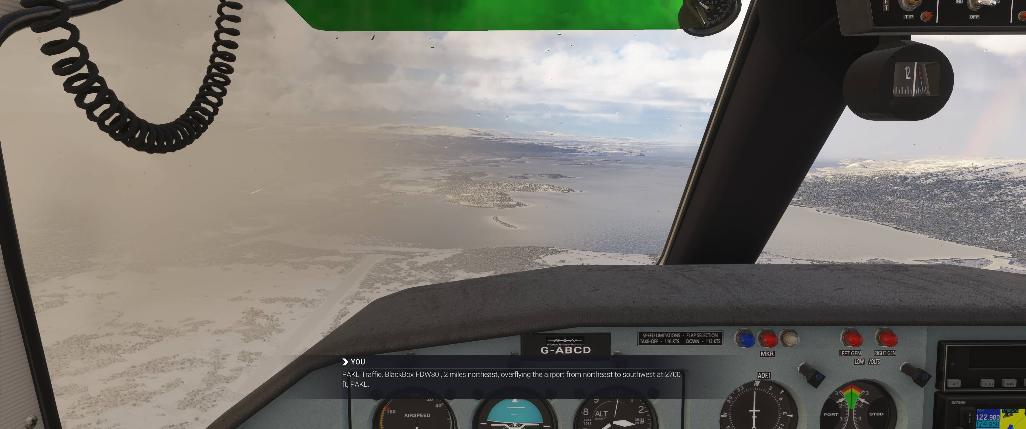
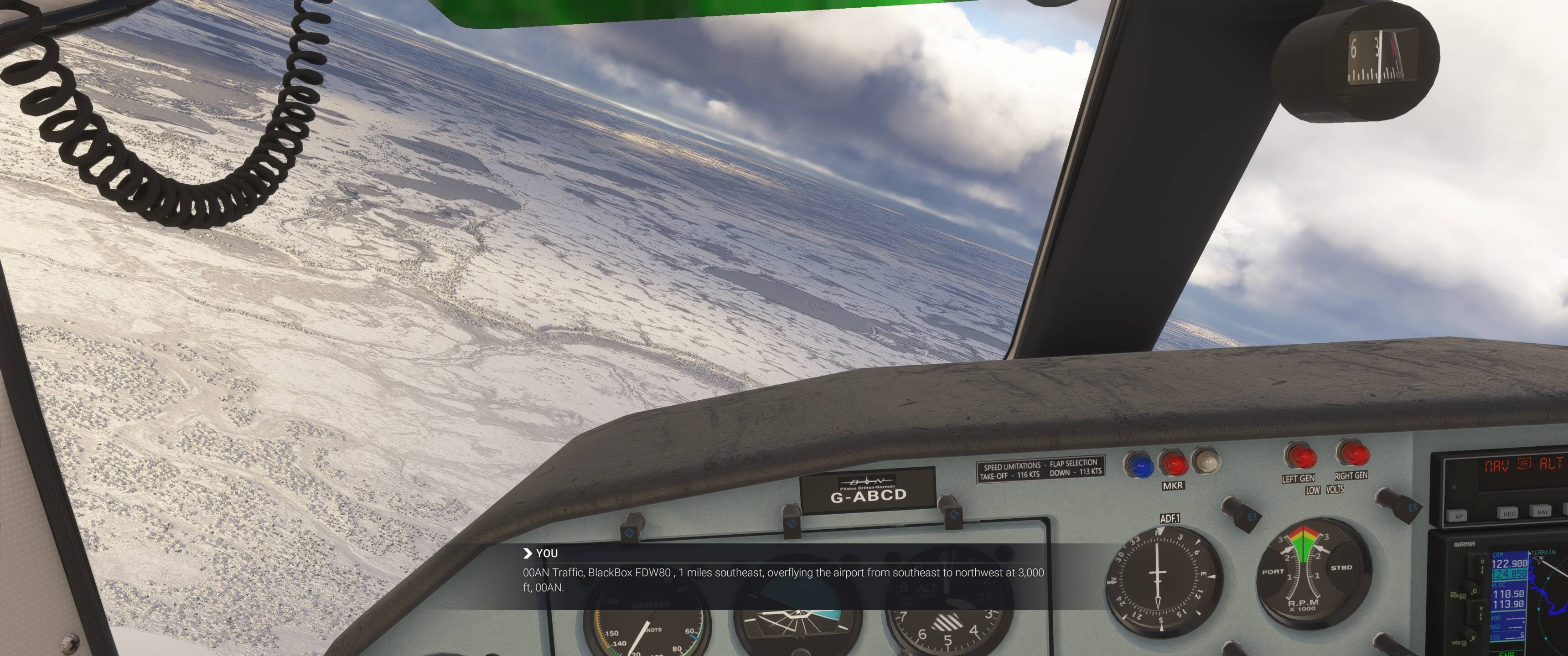
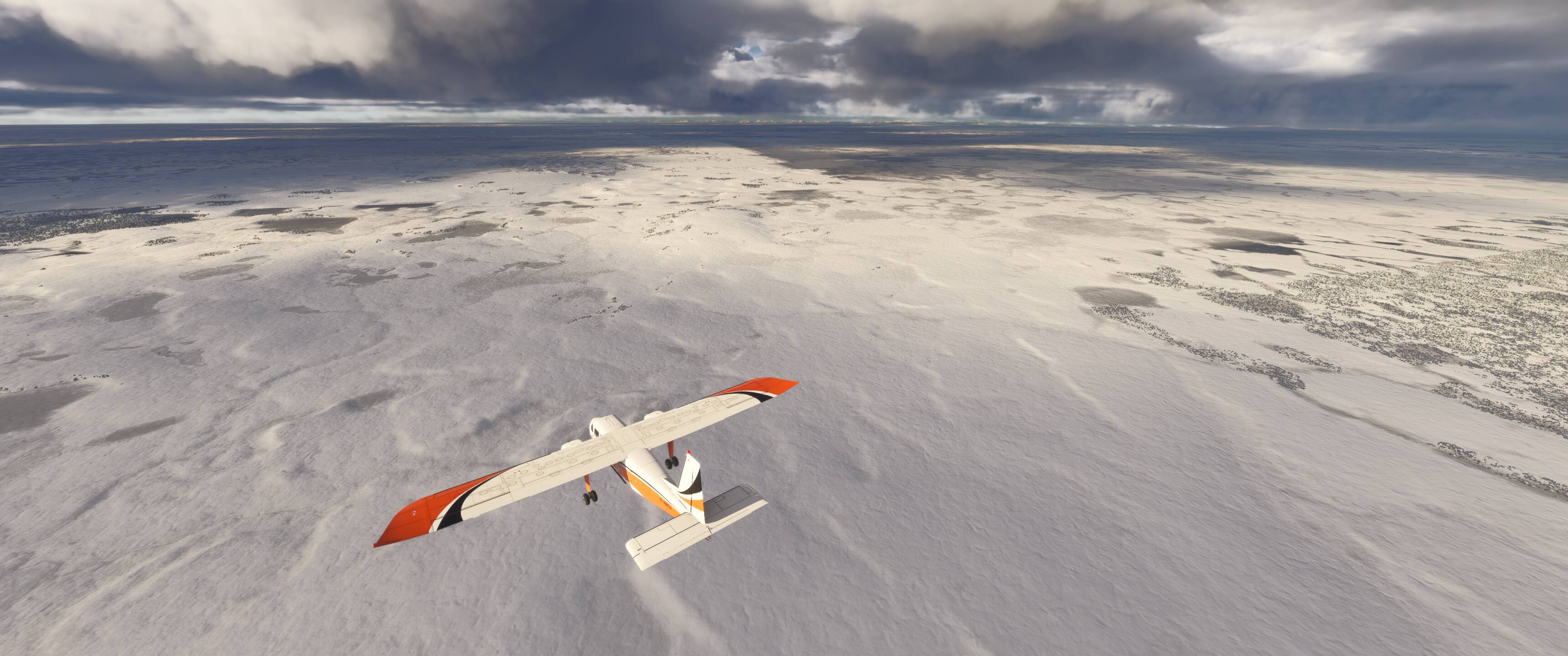
Once we reach yet another frozen lake (in Alaska? in February? shocking) we’ll turn to head west towards our first airport flyover - Kulik Lake (PAKL). The flyover call on CTAF is wholly unnecessary, but why not.
Weather conditions are improved on the other side of PAKL, even permitting us a lake that isn’t frozen over - and look, another rainbow.
At the eastern end of Kulik Lake we’ll pass over what Google Maps tells us is the Royal Wolf Lodge (17 x 5.0 star ratings!) and catch a tributary of the Alagnak Wild River on our way to our next airstrip flyover - Katamai Lodge (00AN).
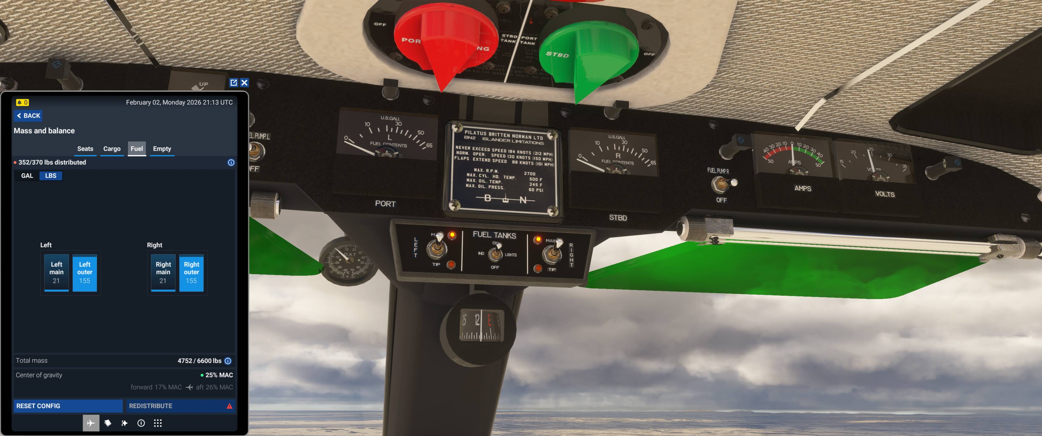
Well, that’s not the amount of gas one hopes to see - but it seems like just a bug of the aircraft that doesn’t account for fuel in the tip tanks. Hopefully the remaining ~55 gallons the two tip tanks combined have in them is enough to get us to our destination.

Upon further review, it seems that the main tanks don’t actually burn any fuel at all and I have been flying thus far on faith, trust, and pixie dust - something to report to the team at Blackbox, it seems. Actually, as I typed this the engines started to sputter, despite the EFB showing 42 pounds of combined fuel in the in-use main tanks… definitely something strange happening with fuel consumption here, but that’s for another thread entirely.
Again, callouts for no one but myself - but no one’s stopping me.
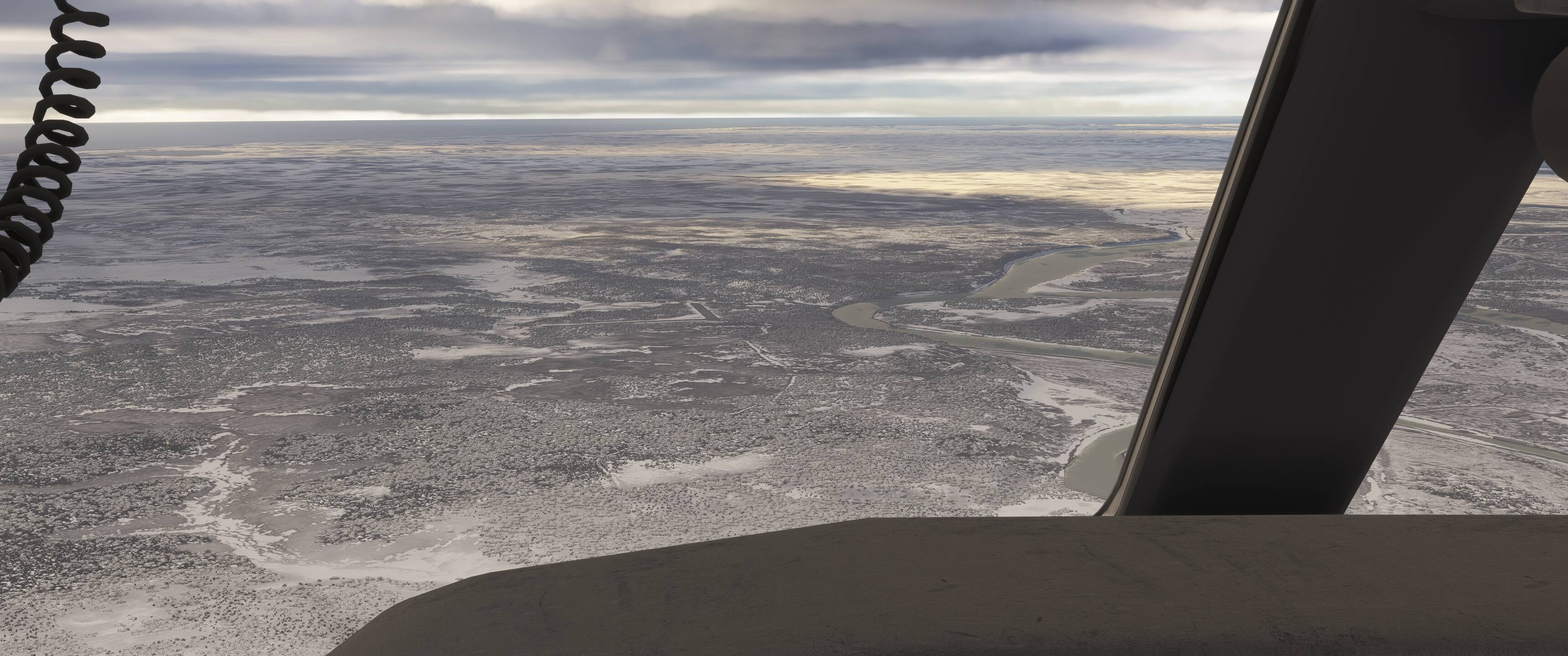
As we pass over Katamai Lodge we head towards our last major body of water - Kwichak Bay.
As we approach the northeastern corner of Kwichak Bay, we’ll look for Nakeen airfield (76Z) from which we can head 21nm bearing 249 to arrive at our destination, Portage Creek (PAOC). Actually, looks like 76A doesn’t exist in the sim’s navdata - neither EFB nor Garmin have picked it up from our web planning, so we’ll just be Children of the Magenta Line![]() for this final leg.
for this final leg.
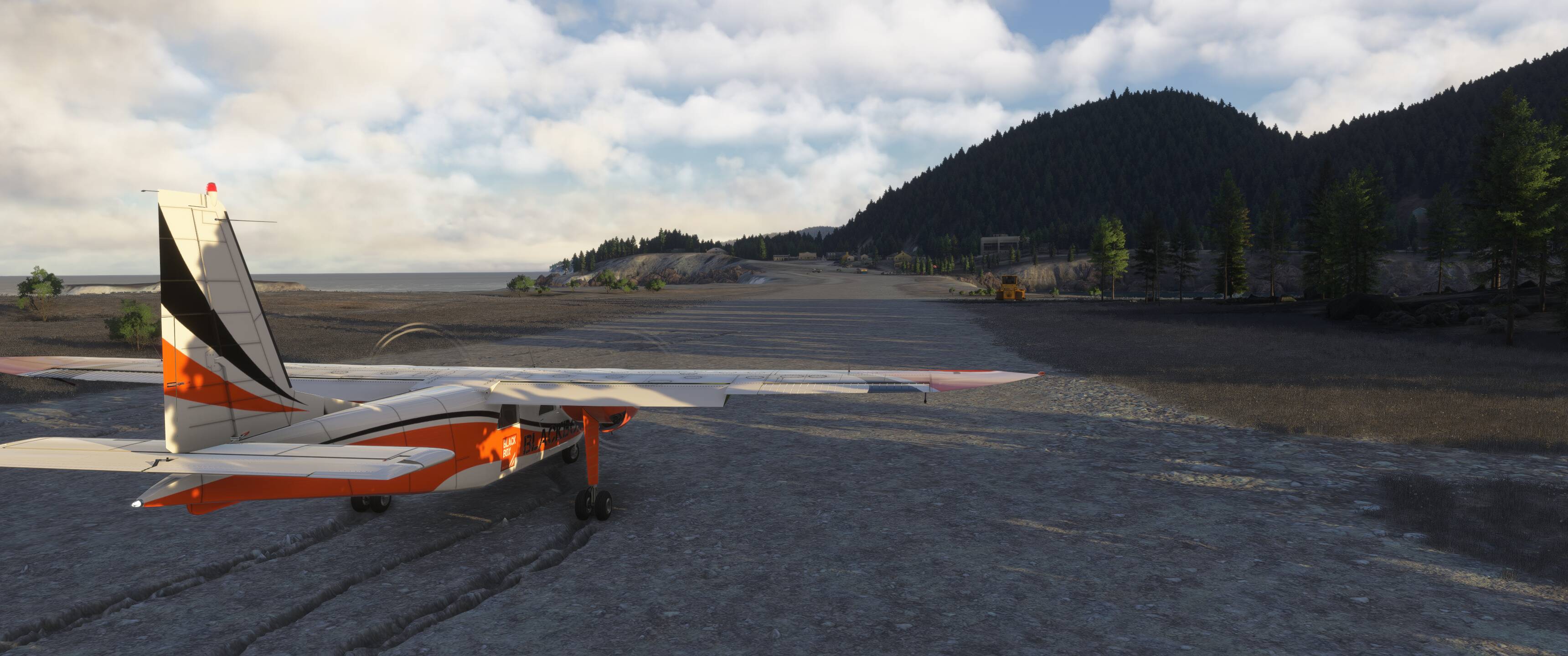
Original flight plan called for runway 19 at PAOC, however current conditions have wind from 360 at 13kts, so we’ll re-file with runway 01 just to ensure the mission progress isn’t interrupted.
Runway 01 has a heading of 15-degrees so we’ll start to set up OBS on the 530 to reach PAOC on that heading. Conditions are good enough to just fly it visually, but it never hurts to have some redundancy. We’ll keep it simple and join a very long right downwind here in a moment.

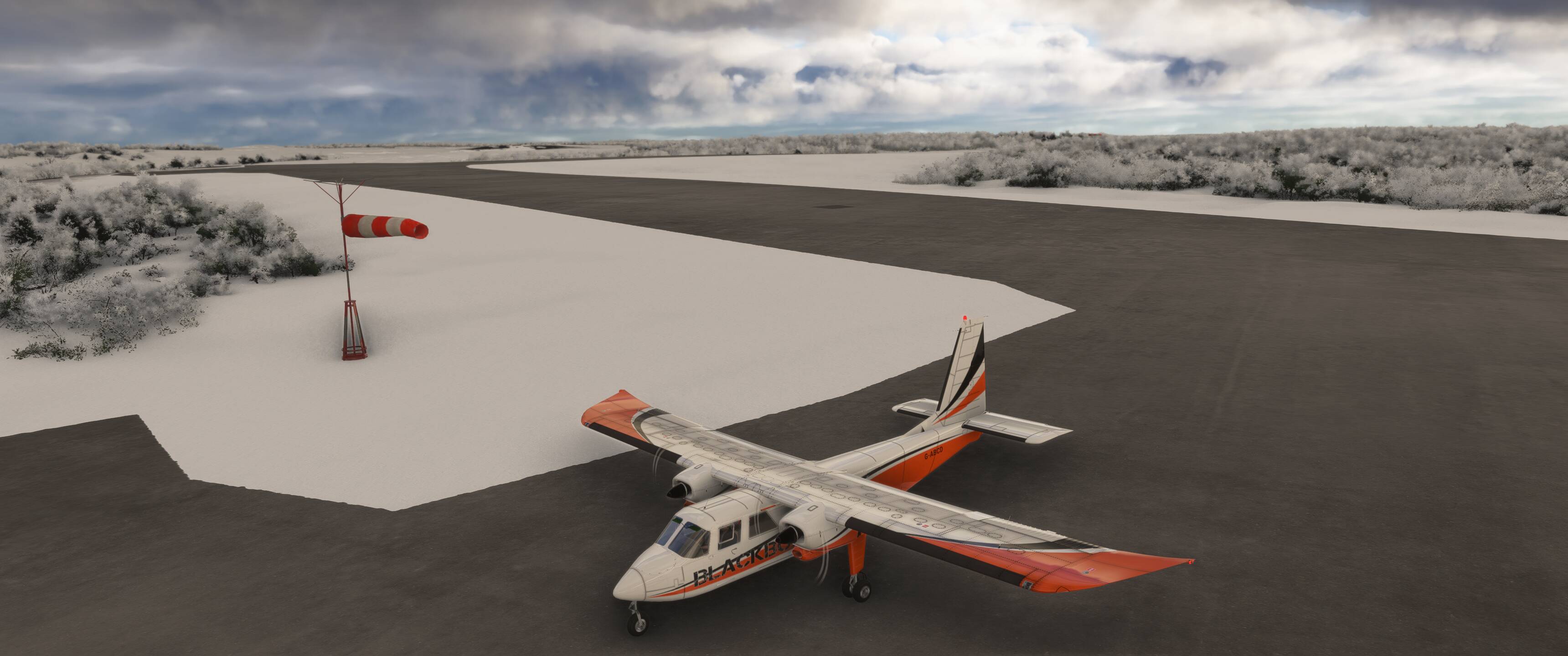
Approaching from the downwind side with the field in sight - will probably just end up circling to land.
This big orange guy confirms we chose wisely on that runway selection ![]()
What I failed to mention were several “aircraft entered runway without announcement” ‘dings’ on departure despite everything being followed correctly - it happens. This is likely the cause for the decreased “Airline procedures” score (though we have no exact idea what influences this score, it can’t really be much else as flying VFR meant we had barely any required interaction with ATC to begin with).
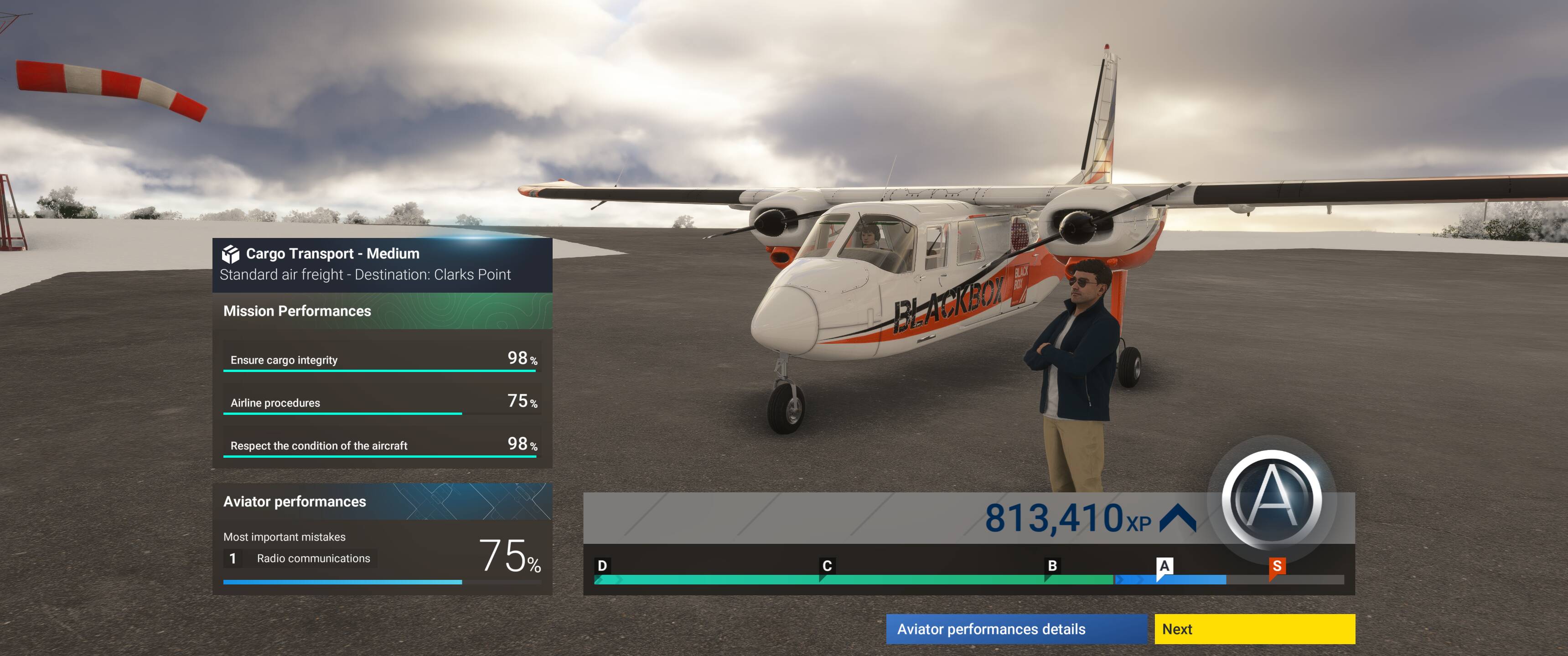
For those of you who stayed with me throughout, thanks! Hopefully this is a bit of inspiration for some to experience A-to-B career missions in a way that haven’t thought of, or possible did but didn’t think it was possible within the perceived rigid structure of the missions. As long as it’s filed correctly, it seems that you really can pave your own way, and of course that it gets you to the prescribed destination without abusing the aircraft or its payload!
Happy flying! ![]()
EDIT: And for anyone who wishes to see the flight after the fact, here’s the Volanta link with most of the above screenshots visible in context along the route.