Refer to this post for information about release:
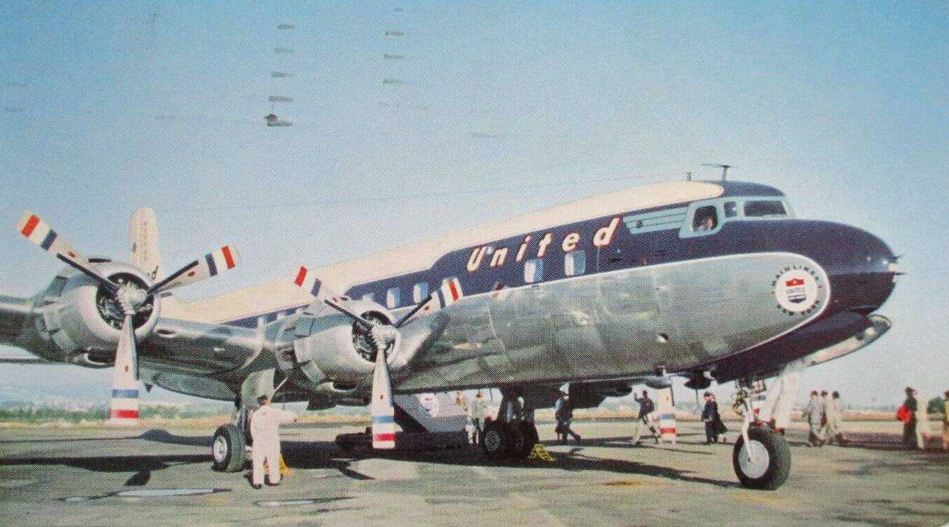
Are you a fan of Classic Propliners making their way through the skies in the late 1950s?
Are you worried where all the classic navaids (VORs & NDBs) go with every AIRAC cycle update?
Then you may have just stumbled over a right thread for you!
Why
Recently, when crossing the U.S. following the 1953 United Airlines timetable westbound, I wondered on a couple of occasions how great it would be to replicate such flight with historically correct navaids following historical aeronautical charts.
Even though one can use today’s navaids and work around the fact that many VORs and NDBs are gone, the immersion sure would be on a different level.
And that’s when I decided to kick off my new MSFS project to replicate the navaids (VORs, NDBs and LFR / RRN) as they were installed in the contiguous (lower 48) U.S. in 1958.
The main idea was to be able to:
- take the period charts (challenge: find relevant source)
- fly correct period radials and headings (challenge: re-define magnetic variation in MSFS as of late 1950s)
- use period approach charts, where possible (challenge: bring in the terminal navaids from these charts)
Sources
With the help of people over at CalClassic forum, I was able to find some approach charts from 1950s and 1960s and get ideas where to look.
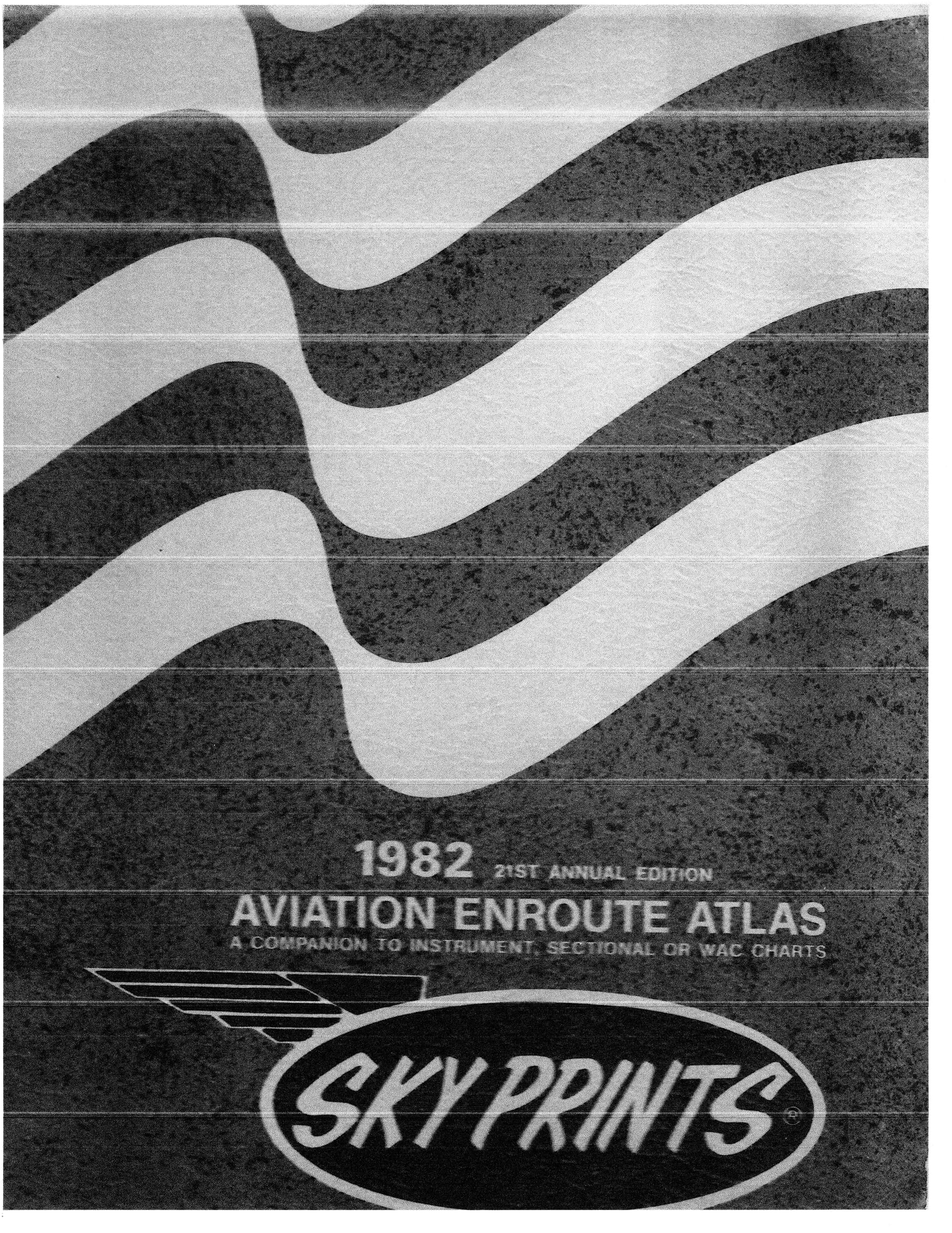
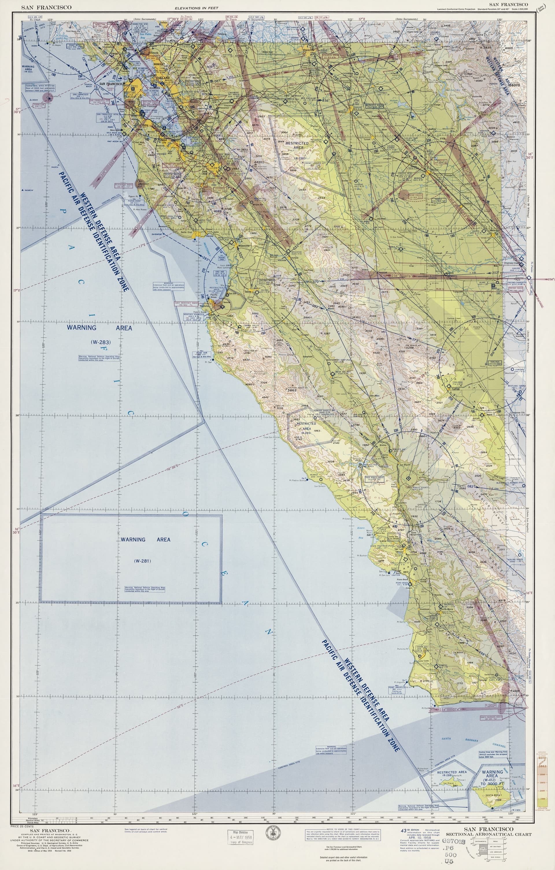
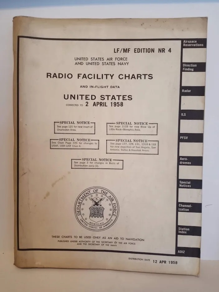
That’s how I found scans of US Sectional Charts hosted by the Library of Congress. This is a sample of a map covering San Francisco area from April 1958 (downscaled):
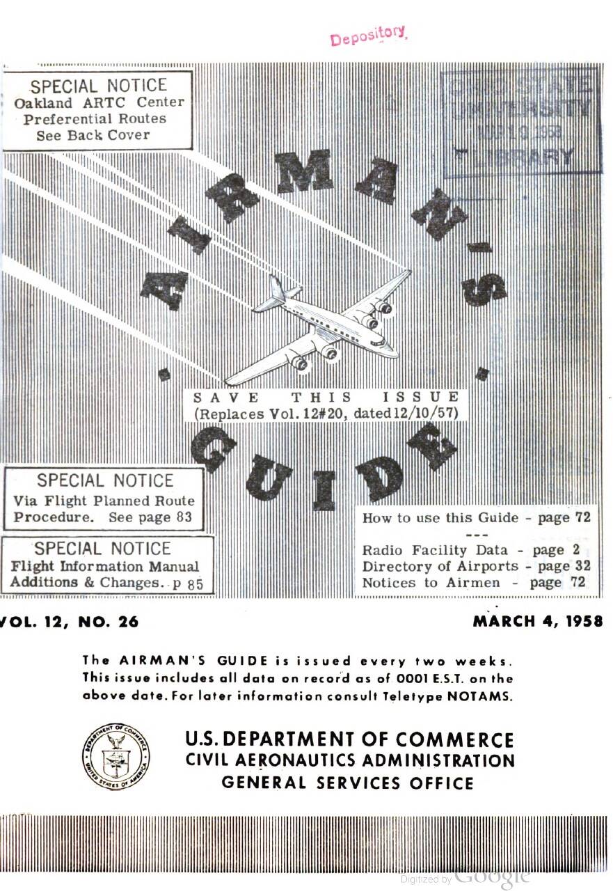
And on Google Books I found Airman’s Guide listing various airport and navaids related information.
I also bought US Radio Facility Charts from April 1958 from ebay to complement the above (still on its way).
How
With the sectionals georeferenced in qgis, I was able to georeference the depicted navaids and create a navaid database as of April 1958 (approximately) enriched with the data coming from the Airman’s Guide (ranges, ILS data, LOMs, LMMs, markers…).

It is a time consuming work and for the moment I created a test area seen in the qgis screenshot above - California, Nevada, Oregon and Washington (+ Hawaiian Islands and two smaller test areas around Boston and Miami).
As for historical magnetic variation, Hervé Sors from aero.sors.fr was kind enough to generate magdec.bgl which brings the MSFS magnetic variation model to 1950s. This is crucial of course in this kind of a project as the magnetic pole moves constantly thus changing the magnetic headings flown. It works pretty well I have to say and I also found that there is not much difference between magnetic variation for the U.S. as of 1950 and 1960 (feel free to check for yourself).
So what
At the moment, I have a MSFS scenery introducing almost 300 navaids as of April 1958 over the territory mentioned above. The scenery includes correct historical magnetic variation which allows to prepare a flight with the 1958 sectionals and actually fly the route with correct historical VOR radials, magnetic headings and ILS inbound headings.
Currently I am conducting test flights to see whether everything works as intended (it does so far).
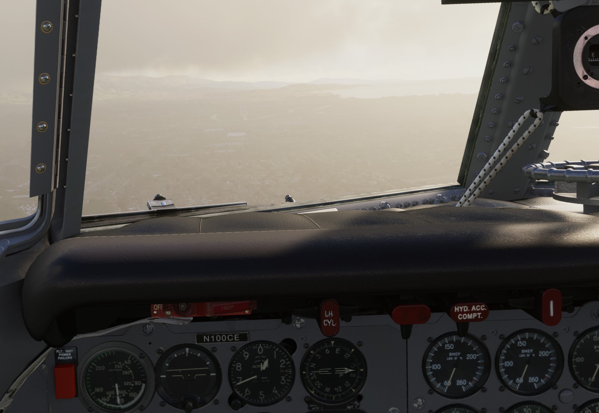
Here I am on finals to rwy 07 in Santa Barbara. If you can make out the runway ![]()
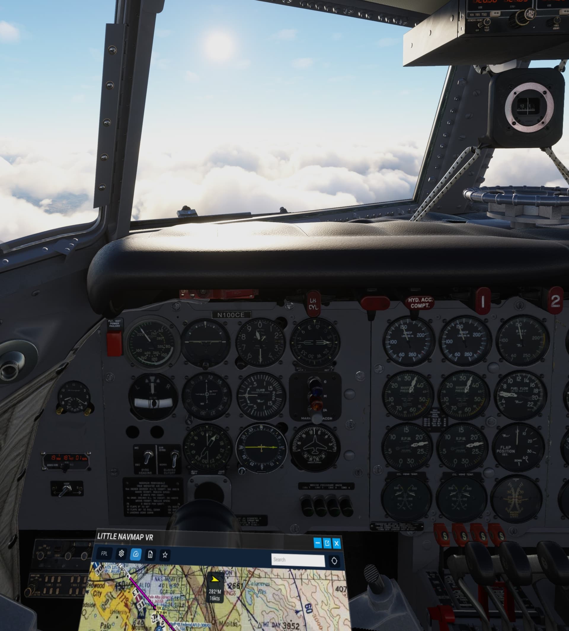
A fun fact: As you can see in the screenshot above, I was able to make a custom map for LittleNavMap. Not really necessary but maybe useful for planning and in-flight. The blue line shows a part of one of my test flights.
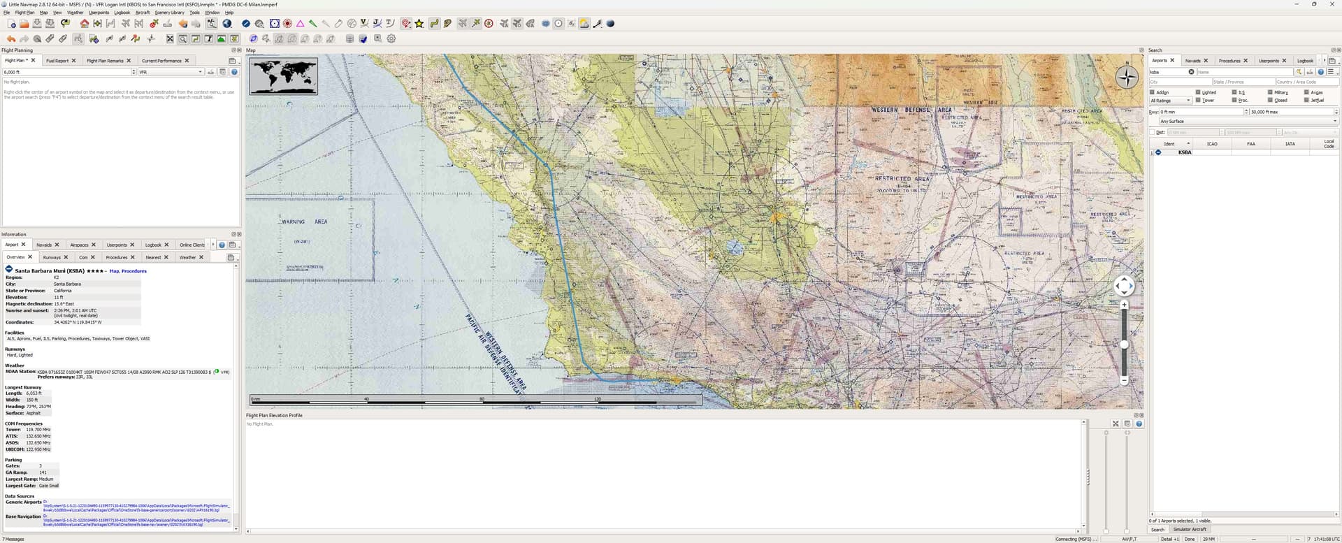
So far, I was able to plan the flight with the historical sectionals, use the depicted radials to follow the airways, fly corresponding magnetic headings and in the end land in KSBA with the help of period ILS (got a 1958 middle marker signal too; only forgotten to tune the LMM frequency to ADF radio).
Limitations
This is experimental stuff and perhaps it remains such. Why?
A 1958 navaids cannot easily co-exist with the stock MSFS navaids (many may have been moved but still share the same frequency, many share frequency with a different navaid in close vicinity, same for ILSs…).
So, unless I find a different solution, I resorted to using a DeleteNavigation element described in the SDK as “only meant to be used for debugging your own projects and should never be published as part of a public package”. Here we go. It contains commands to delete all navaids around the World.
So while the 1958 navaids scenery works as intended, outside of the scenery area there are no navaids. As the SDK does not allow for deleting navaids from specific regions only, this is the only way I can make it work in MSFS.
Another limitation is related to the fact that some historical approaches may no longer be possible to fly in the sim. The landscape and structures on it are unchanged. So while a hill probably has not moved (much) over the last 60 years, there may be new antennas and man-made structures in the way of some historical approaches. I personally yet have to see such approach (I suppose the minima were higher in 1950s when compared to those of today). Nevertheless, for sure some runways are gone making corresponding approaches obsolete.
Is it worth it?
It is of course possible to fly classic propliners with the current AIRAC cycles. This is also demonstrated by my 1953-style crossing of the U.S. linked above.
So for some, the effort may not be worth it in the end.
However for others, using the historical materials to prepare a flight and eventually fly it might add yet another level of immersion not experienced so far.
I personally fall in the second basket, so to speak. Moreover, I enjoy very much researching this subject and finding a way how to implement it in the sim. So for me, the path is the destination as the saying goes…
This is a personal choice which comes down to preferences. One can always decide not to use it ![]()
Besides, many classic navaids are disappearing with every AIRAC cycle.
Just to illustrate: In California in 1958, there were some 58 NDBs (incl. LMMs and LOMs). Nowadays this number goes down to 23. This impacts also NDB approaches of course. According to data available, there were almost 700 NDB approaches in the U.S. in 2014 but in 2024, according to official data not even 200 of them remain.
Plans
With the test area working as intended, I am thinking what next?
If the time and enthusiasm allows, I will progress with other sectionals. With 19 already done, I am about 20% through the entire lower 48.

One untouched topic is the Low-frequency Radio Range Navigation beacons. This tech, very much still in use in 1950s, was brought to MSFS by @ElectronVolt714 and his Radio Range Navigation addon. ElectronVolt replicated the RRN network with data coming from 1944. The 1958 sectionals reveal that many beacons changed place or frequency (or both) or beams or disappeared altogether. With the data I have, I can (and most likely will) update the RRN database used by ElectronVolt’s RRN addon to reflect the network as of 1958.
Where to get it?
Nowhere for the moment. I will release it in the proverbial two weeks on fs.to once I package it appropriately. Probably with a big EXPERIMENTAL and USE ON YOUR OWN RISK all over the place.
Thoughts?
I am happy to hear your thoughts about this undertaking. Please feel free to express yourself.
Thank you!