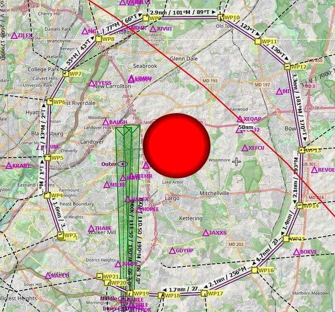
Two years ago there was a similar issue near Andrews AFB (KADW).
It was pinned down by conducting multiple flight towards the area from different direction, at the same altitude, while plotting the tracks with LNM.
After sufficient CTD points were found (end of LNM tracks), it was then possible to construct a circle, passing through all points, ad the center of the circle was the location of the scenery object that was causing the CTD, and the use of ProcMon identified the exact file that was being loaded at the point of CTD.
see
