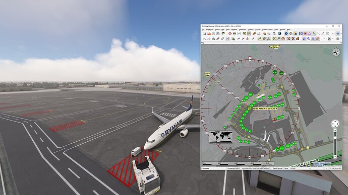
Hello everyone. I wanted to know if there exists something like this. I searched all over but personally couldn’t find anything.
I personally don’t want to pay for the recent AIRAC cycle in Navigraph so the airports might not be up to date. Also, the scenery might change the taxi signs and the names of taxiways. What I am looking for is a window (like the VFR map) but it would take the ingested taxiways already in the sim and display them over the map so when I get instructions to taxi I can reference to in-game signs, not AIP maps or similar.
Many thanks to anyone who can help.
Although worth adding that LNM will show what the taxiway and parking assignments are as in the SIM, so whatever nav database the SIM is using or custom scenery.
If you want to know IRL assignments then for mount countries you will get is for free via their national AIP.
Chartfox is an app that collates most of these charts from the various source (it is external to the SIM - not a panel or anything like that).
US FAA charts can be accessed via Sky vector website easily.
This is exactly what OP is after.
2 Likes
Thank you all for the help and for the suggestion. It is exactly what I wanted!
1 Like
