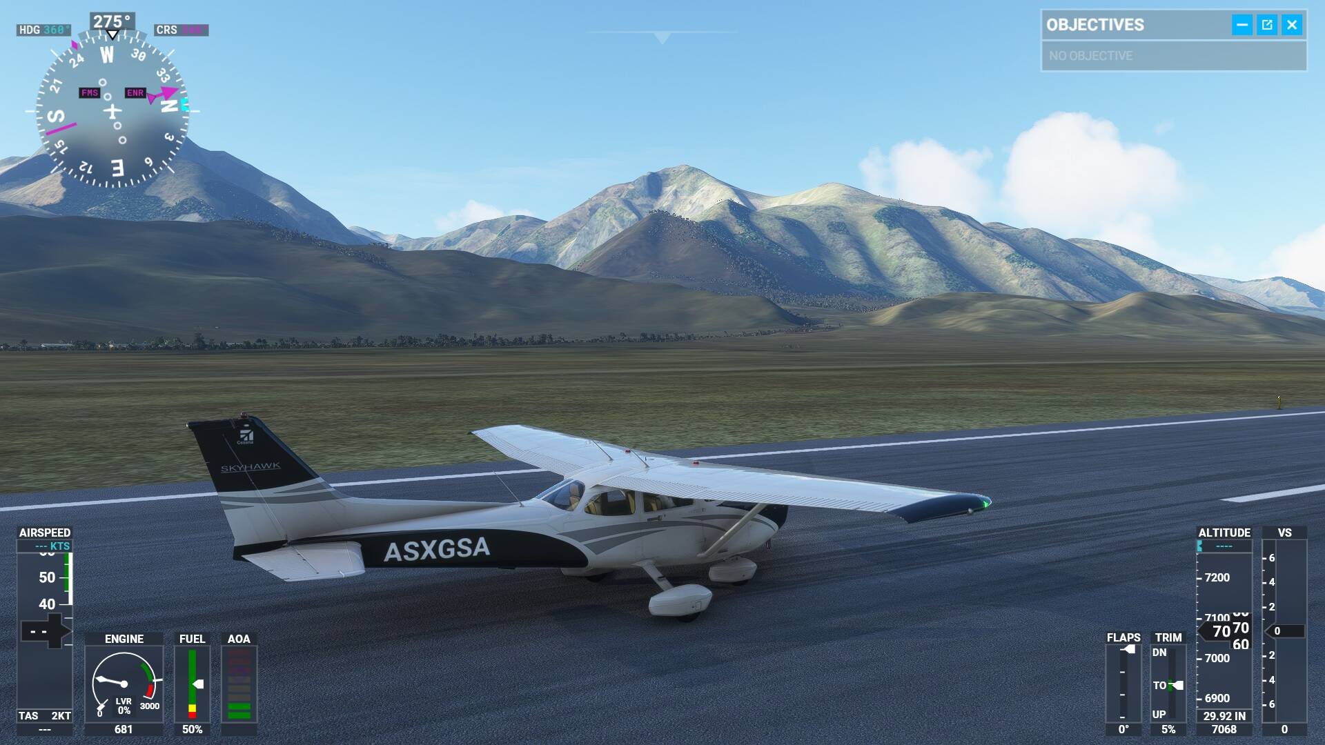
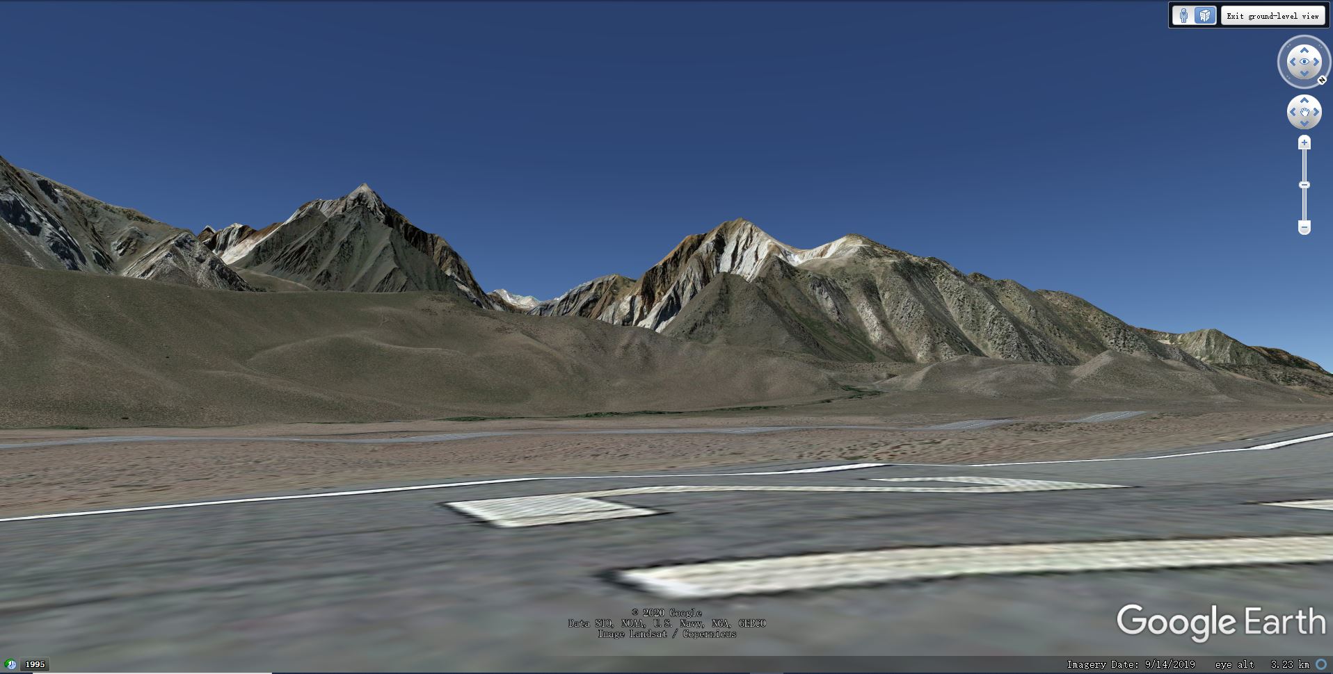
High resolution Elevation data is my most anticipated update as I really wish the smooth and rounded mountains of MSFS can get some serious facelift. After the update I took several flights to some mountain areas, and to my disappointment I can find no perceivable improvement anywhere. For verification I took a comparison picture from Google Earth. The location is Mammoth Yosemite airport runway 27 facing southwest. According to the updated elevation data map it’s 1m or 2m elevation data, but it does not look like that high resolution at all. It looks like 100m! My computer is 9900K + RTX 3090 with every graphic option set to ultra, and I cleared the rolling cache. I used to fly a lot from this airport on FSX with FS Global Ultimate terrain mesh which is 32m and it’s much better than this. I don’t know why but I really wish you can take a look at this and I really wish I had done something wrong.
The developers mentioned in the latest Q&A that they are working on an optimisation to terrain import that will improve the “verticality” of mountains. A similar request is also on the high on the bugs and issues snapshot and being investigated.
Thank you for the information. Can you show me the latest Q&A about the optimization of terrain import? I have fear that he is addressing a different problem.
Thank you so much for the Q&A link! At 17:10 Neumann was addressing precisely to this problem of the roundness and smoothness of mountains where they should look more rugged with folds and creases. So it’s not just increasing the resolution of the elevation, but how to inject it into the terrain to make it look “vertical”. No wonder even the seemingly very high resolution updated elevation data doesn’t work so obviously. I am bit confused why this has not happened in other sims including the dated FSX. Anyway I am relieved that they are aware of this problem and I am sure they will get it ironed out.
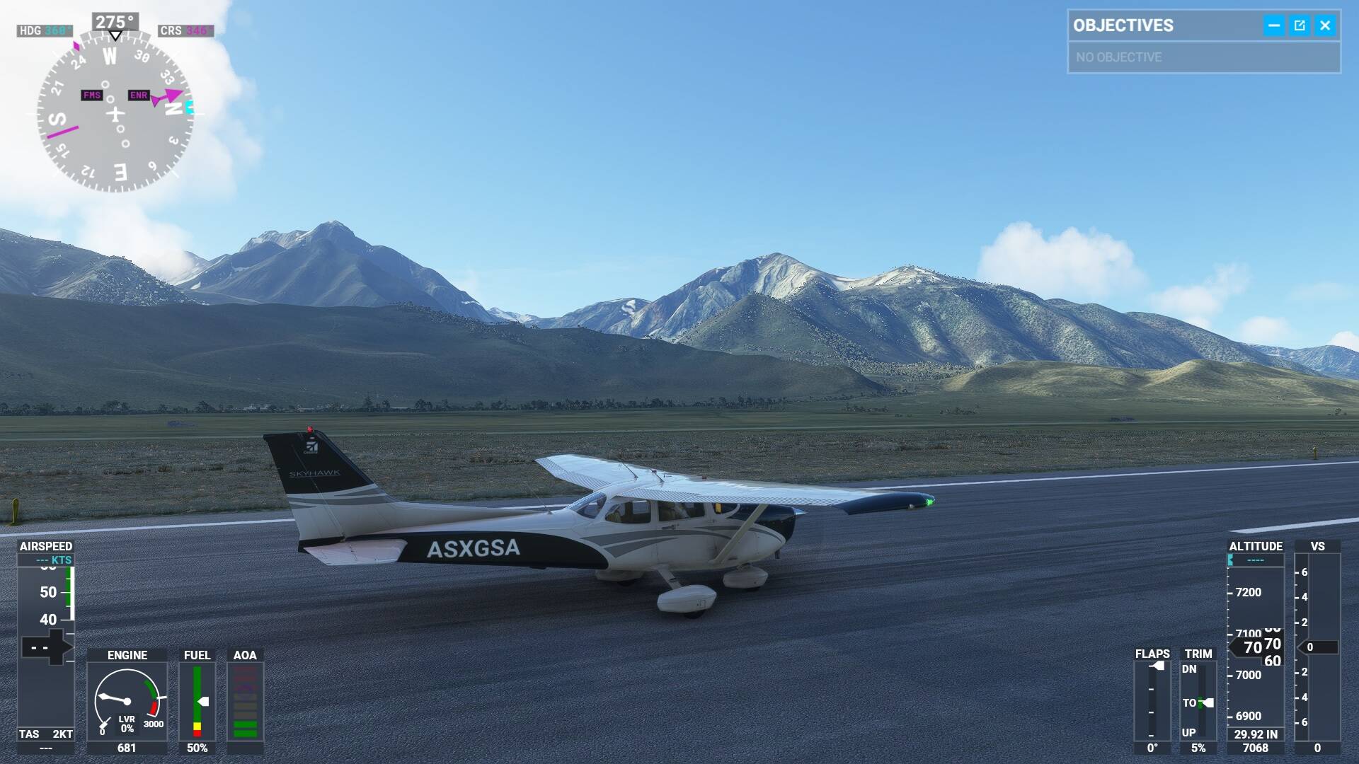
Update: I found an option in “data” - “use Bing map imagery” has been turned off, and I turned it on. Now it’s using the Bing satellite imagery as texture, and it adds much more sense of “roughness” of the mountains. So my previous comparison is not fair. Yet Google still looks much better:
There is a softening coming from the particle effects in the sim which makes the google imagery look sharper but I agree Google imagery is far superior to Bing in general.
After Japan or USA UpDates I see an " ! Elevation Data Updates" during FS loading
What’s Exclamation Point meaning ?
So the rounded and smooth moutains come not only from low elevation data, but the softening effect of MSFS as well. That’s the reason why it still looks rounded and smooth after the Japan and US world elevation update. Why don’t other sims have this softening effect?
The softening I refer to is to the image crispness, not the sharpness of the terrain.
Ok. In Google Earth there is an option to adjust the roughness of the terrain, so there must be some algorithms besides terrain mesh resolution. I wish Asobo can make mountains look more rough and rugged as in Google Earth and other sims in similar ways.
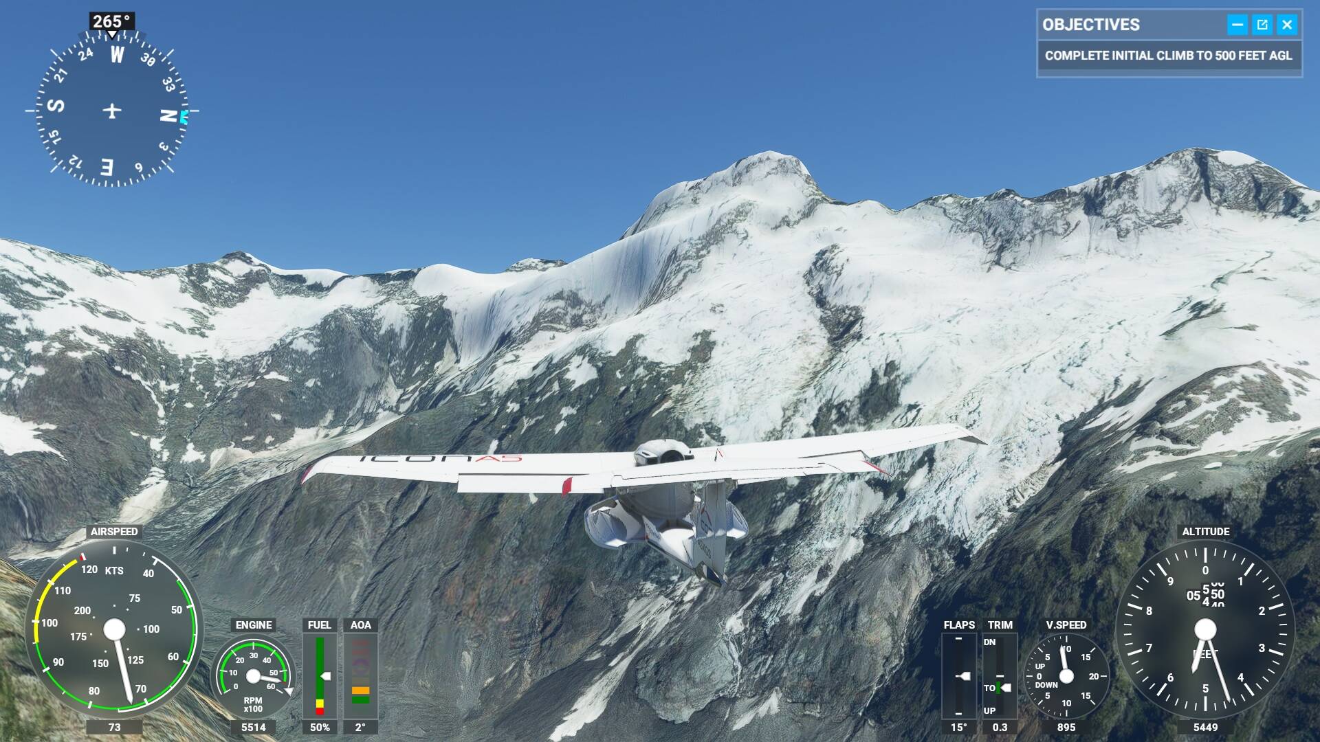
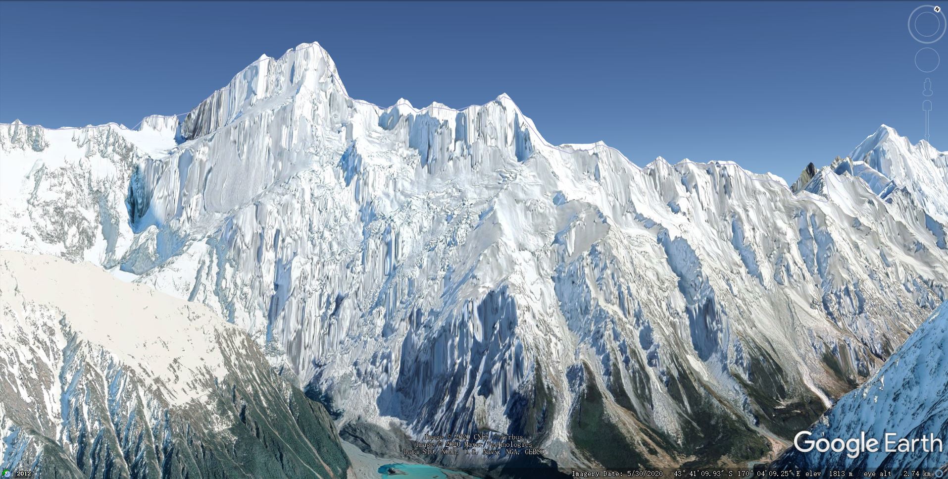
Have you flown over Aoraki Mount Cook New Zealand? roughness of the terrain is there. its going to take time for Asobo and Microsoft to impliment the mesh for the world but i trust we will get there one day - these things take time.
I will give Mount Cook a ride. I began to see the smooth and rounded mountais are not only caused by low resolution terrain mesh, but algorithm as well. There are mountains that have very high terrain mesh after the US update, but they still look rounded and smooth compared with other sims of even lower mesh resolution. MSFS might have flattened and softened the terrain surface too much.
@CDRMaz I compared Mount Cook of MSFS and Google Earth at the same location north of the airport. MSFS still has the typical smooth and rounded look. There are some areas in MSFS that do have rugged look and it’s the effect of the texture, and they are mostly not covered with snow. The snow mountains of MSFS look particularly false.
Comparing Switzerland Lugano Airport MSFS with 20m mesh mod and Aerofly FS 2 version (about 30m mesh), we can see the higher mesh MSFS version still looks more smooth and rounded. Another proof of the terrain surface algorithm problem.
Yes rounded mountains and edges is one of the big problems of FS mesh. But there is hope :
- you don’t necessarily have to wait for an update to get better looking mountains : accurate mesh is part of the online data, and there are places in the world which already dramatically improved (without dedicated update)
Mountains definitely looking better (Pokhara - Jomsom Nepal) - Flying / World Discovery - Microsoft Flight Simulator Forums - the problem is acknowledged in the roadmap and planned to be solved in 2021… Wait and see.
Also the alps (or parts of them I don‘t know) look better than a few months ago (but there‘s still room for improvement, a lot of room).
Yes that’s a good sign. I think they are actively working to improve the terrain mesh. What I am emphasizing here is that not only the mesh resolution needs enhancement, but also the algorithm of the terrain surface to make the mountains look more ragged. As we can see from the above comparison pics, the Aerofly FS 2 version has even the lower mesh resolution, but it looks more real with more ragged mountain terrain surface.
I can’t agree more. I expect the next improvement to be a better detection of ridges and edges (and maybe coastlines, to prevent the creeping high tides). Wait & see…
Could it be, that it also has to do with bandwith? Srteaming a 1 meter mesh in realtime seems not possible as of now. I remember downloading highres-mesh for x-plane took days and loadingtimes went up a tenfold.