My intention here is to journal day to day a trip I am planning from Anchorage, across the entire state of Alaska, to the northenmost tip at Barrow. I will use live weather only, which makes this adventure especially difficult in a Cessna 172, since it’s late February right now. In reality, a real pilot would never fly in the conditions I will fly, in such a plane. But I want to use live weather, and I am not waiting until June to do this.
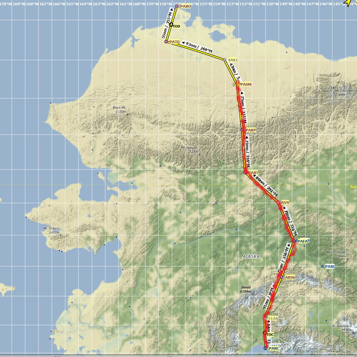
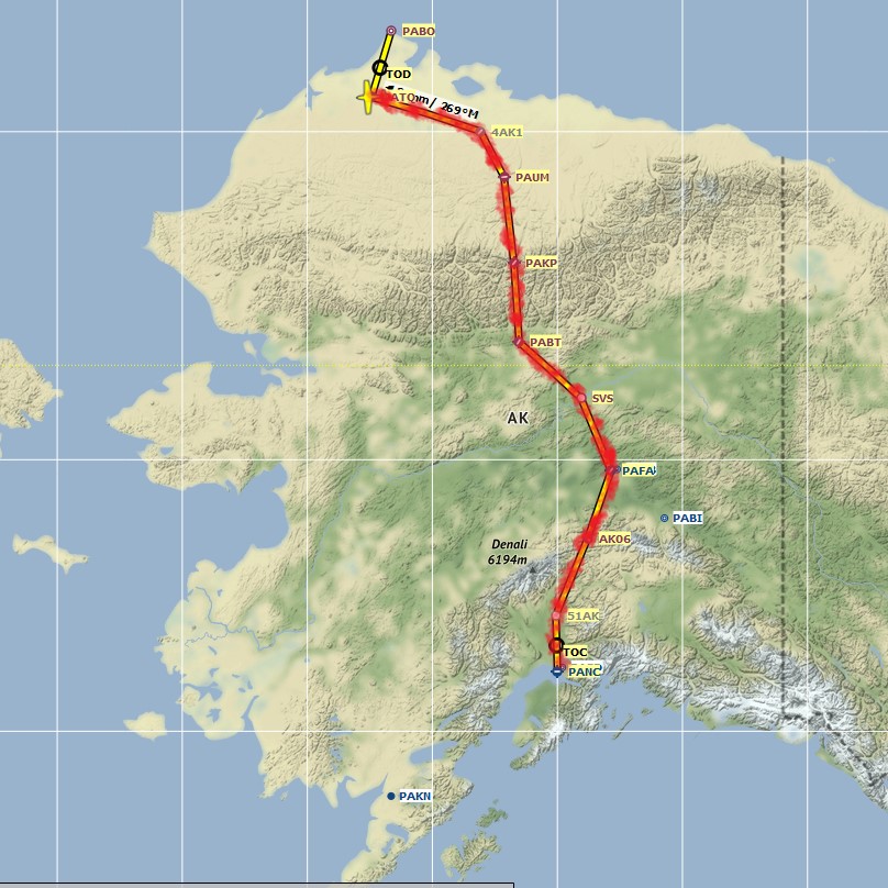
A straight arrow from Anchorage to Barrow is 630 nautical miles, but I will break this trip up into pieces of maybe 100 nm or so.
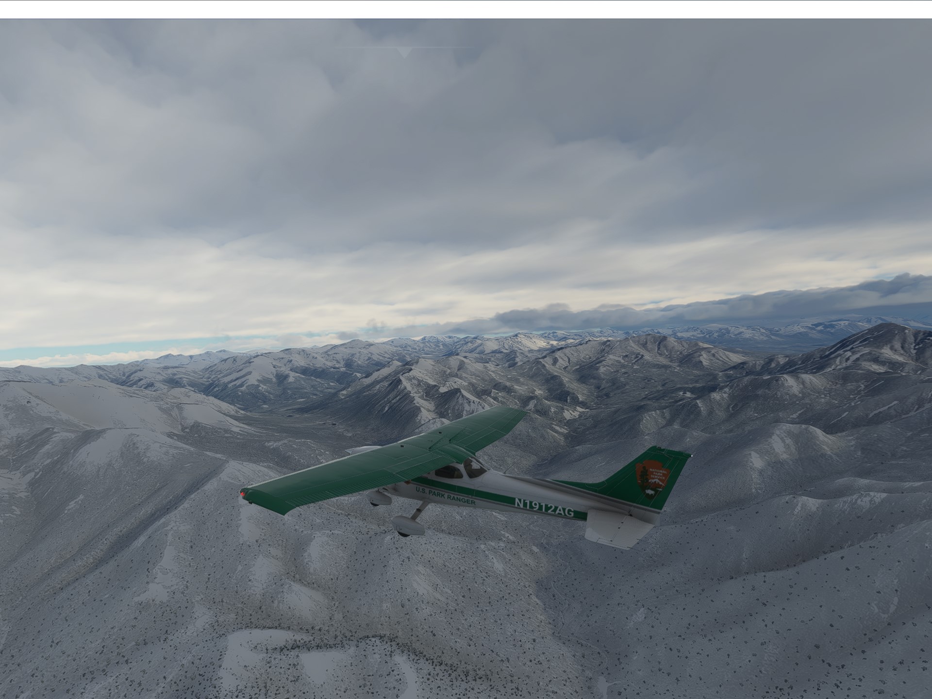
I took off today from Anchorage for a small air strip called Birch Creek, with poor visibility, low clouds, icing, but no wind. It was rough going. Icing prevented me from getting any higher than about 1,500 feet.
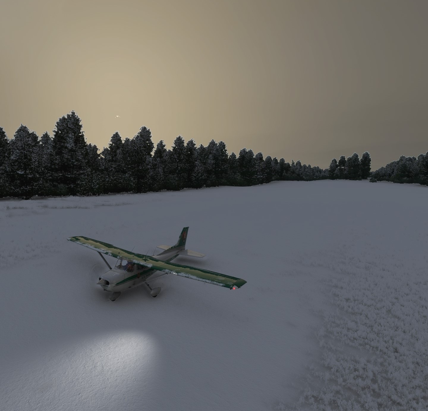
But I made it:
6 Likes
Checked the real-time weather and saw that it had considerably improved by 12pm local time. Sure enough, the skies had cleared up in my area. My intended destination of Denali (the air strip, not the mountain) was showing rough conditions but surely with the beautiful sun out nothing could go wrong, right? So off I went, from Birch Creek to Denali with a beautiful blue sky:
![aka3|666x500]
Some cloud cover, so I cruised at about 10,500 feet to stay on top of it.
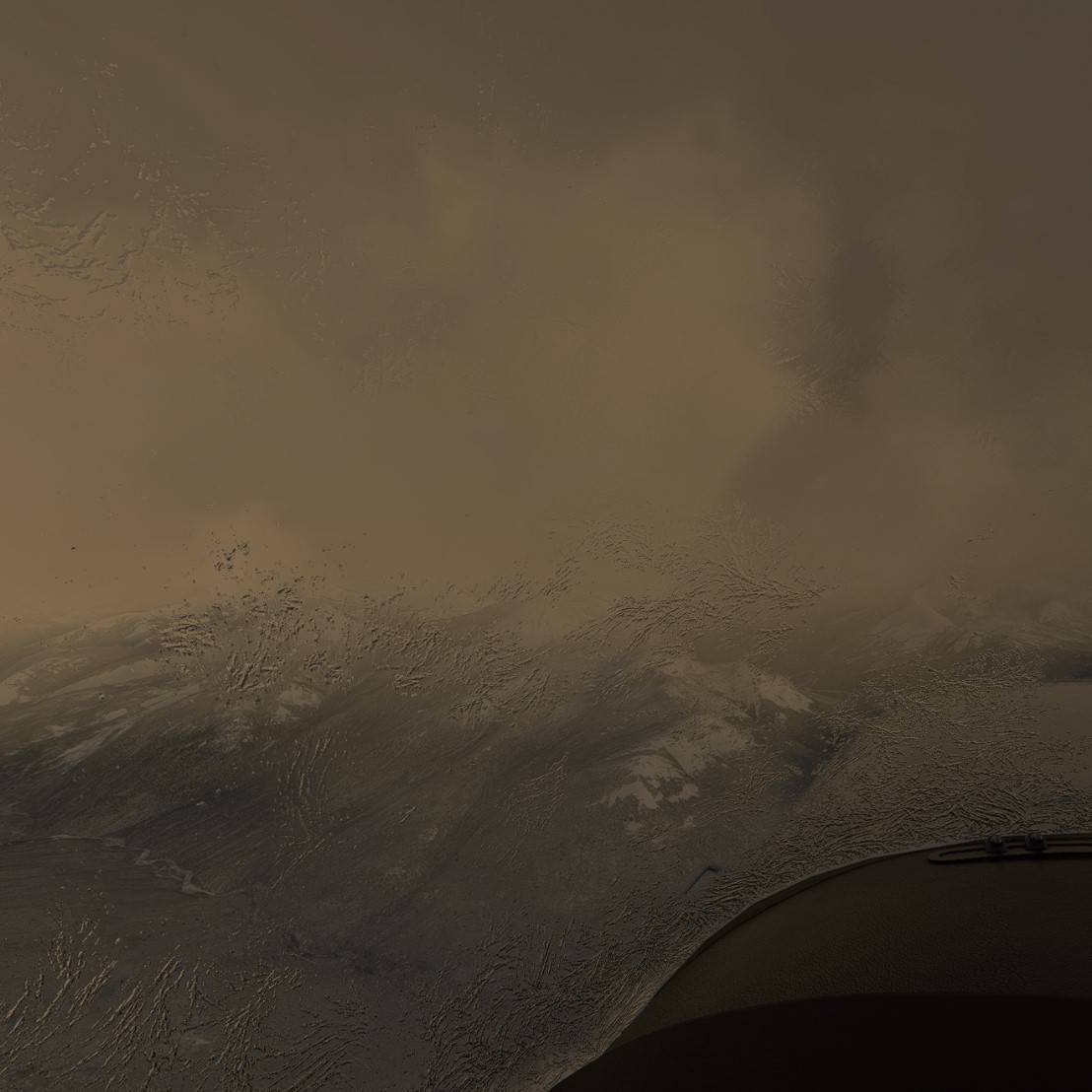
On my final turn for Denali strip, things looked a bit ominous below, but still no problems at my level…
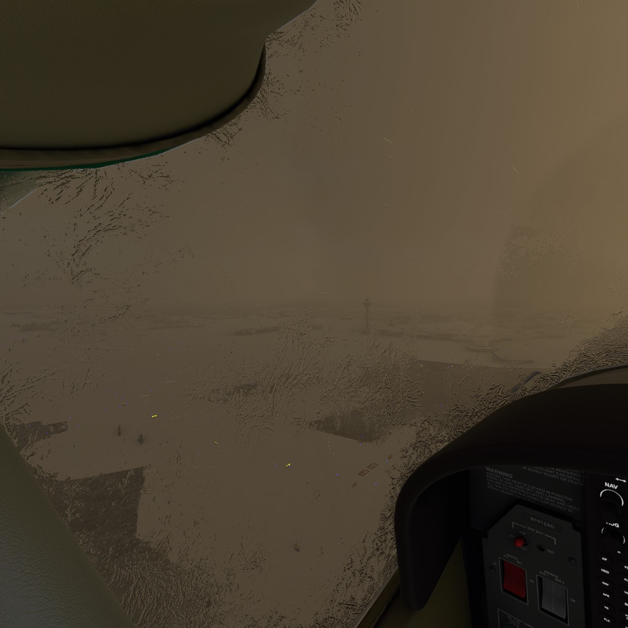
I would offer pictures of exactly what happened next but I had to choose between taking screenshots or crashing and dying. Visibility was absolute zero, even from 200 feet above the ground, which I therefore could not see. Without the expensive G1000 flight display that magically popped the runway into my visual, I had no chance. Somehow managed to stick the plane onto the ground, at which time a photo was safe:
Leg #2 completed:
3 Likes
Leg #3: distance 75 nm, flight time 45 minutes, conditions slight haze on take-off but encountered zero visibility and icing on landing. Flew on instruments and used ILS approach to land. Cruising altitude 9,500 feet.
The route from Denali airstrip to Fairbanks is a sentimental one for me, having driven it by car and from many personal memories of both Denali and Fairbanks. I checked the real-life weather in Fairbanks and there was significant cloud cover, and severe cold, but it seemed doable for a simmer whose life is not actually at stake. Take-off weather was pretty nice:
The Garmin was warning me about ominous signs at Fairbanks but at least Fairbanks is a lighted, towered airport with ILS:
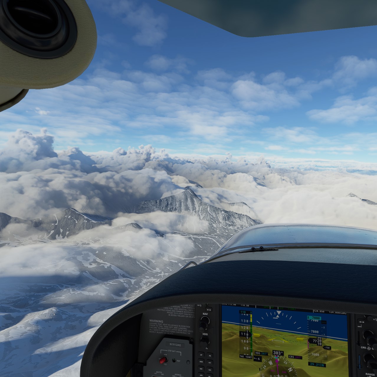
Anyway, the flight was gorgeous as per Alaska standards:
Visibility did drop to close to zero as I approached Fairbanks, but ATC was pretty good and ILS had me locked in…
By my count, I’ve knocked out 3 short legs and have about 7 more to go to reach Barrow.
1 Like
Leg #4: Fairbanks to Stevens Village, a tiny village on the Yukon River. Distance 78 nm, flight time 51 minutes. Conditions barely VFR. Strong tailwind of up to 24 knots. Temps -18 celsius at cruising altitude of 6,500 feet. Some icing encountered when I chose to go above the cloud layer temporarily.
I’m getting close to the Arctic Circle.
I took off today with some trepidation, which means I would never do so in real life. Fairbanks was showing overcast with overcast clouds at 1,100, but otherwise technically permissible for VFR. The route to Stevens Village was similarly looking okay, in terms of weather, but I’ve already had two landings in zero visibility and didn’t want a third. I would prefer to complete this journey without sim-crashing.
Cruising at 6,500 I was able to stay just below a thick soup of clouds. I experimented with trying to climb above the soup but this quickly resulted in icing of the windshield, which stayed there for the rest of the flight.
As I reached the Yukon River, visibility dropped considerably due to fog, but skimming along the iced river’s surface made it possible to maintain a visual of the air strip. A strong wind of up to 24 knots was a bit of a challenge but I landed straight into it–no crosswind–so not too much of a problem. Smooth landing.
1 Like
Leg #5: Stevens Village to Bettles, just north of the Arctic Circle. Distance 81 nm, flight time 39 minutes. Conditions VFR with overcast clouds, strong winds. Temps -23 celsius at cruising altitude of 5,000 feet. Very little icing.
On checking the weather this afternoon I saw that conditions were VFR in Bettles, so I decided to go for another leg today. The Garmin looked a little iffy:
But most of the flight was uneventful other than some strong winds, which weren’t problematic.
This was the point at which I officially passed the Arctic Circle. I have driven past the actual Arctic Circle near here and this looks like an accurate depiction:
Bettles is a a lighted airport and landing was not a problem.
I’m at about the halfway point, with my next leg flying me through the Gates of the Arctic National Park. My next destination of Anaktuvuk Pass is located within park boundaries.
1 Like
Leg #6: Bettles to Anaktuvuk Pass, through the Gates of the Arctic National Park. Distance 73 nm, flight time 46 minutes. Conditions: death-defying. Temps -26 celsius. Cruising altitude: none, because the entire route was a manual effort to keep from crashing into mountains.
The Cessna 172 has no anti-ice equipment. Given that plus the horrendous weather I’ve flown in to get this far, it’s basically miraculous that I haven’t crashed. About 20 nm from destination, the plane began suffering quite a bit from icing problems, forcing it at first to fly no higher than 5,000 feet (5,000 feet was the lowest safe altitude for this route), and then as low as 4,000 feet. I really thought I was doomed and would crash and have to start over another day. I survived partly by luck, and partly by my old mountain-simming strategy of finding river valleys to navigate my way home. In this case, this route, the river valley happened to lead to the airport.
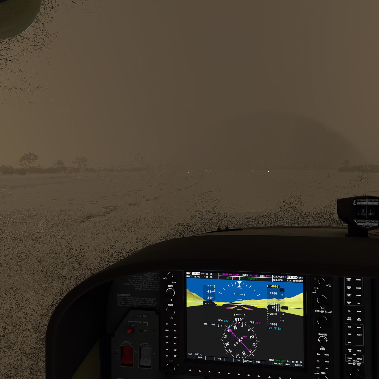
This is the atrocious visual I took off with:
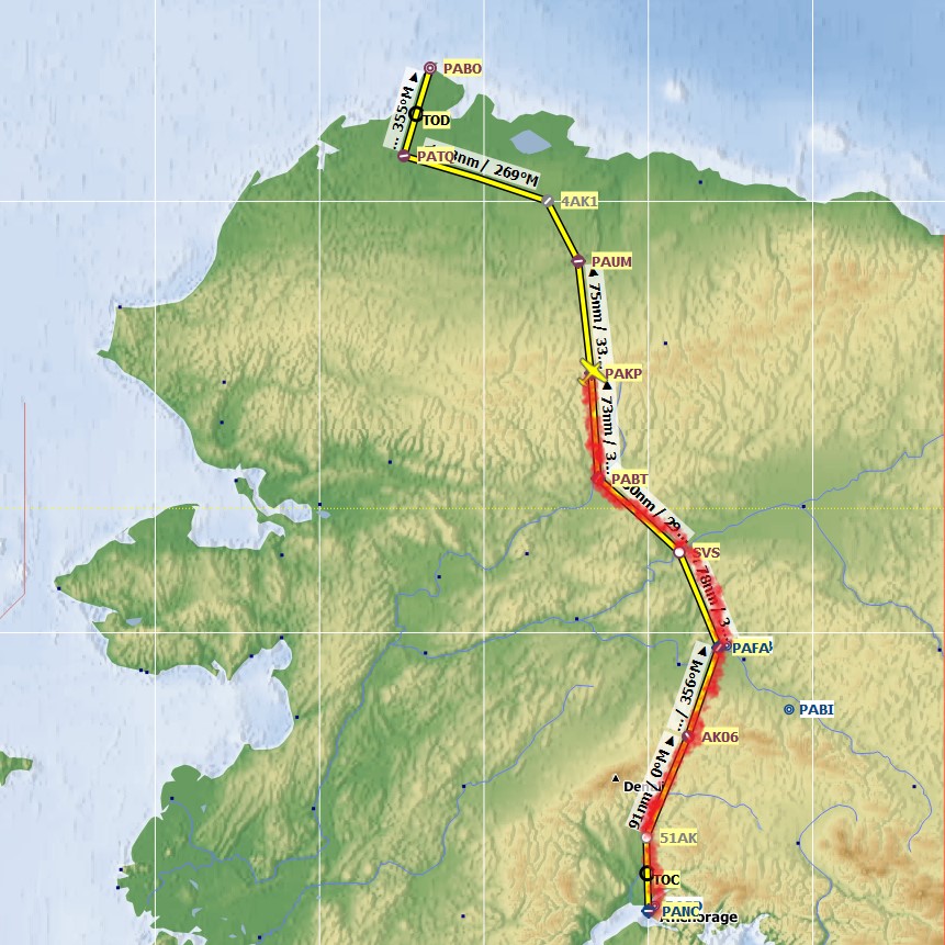
Maybe the best illustration of how tough this segment was is my planned route direction versus the actual flight path:
The Garmin was also essentially screaming at me to turn around, stop, land, try another day, etc.
Flying over a national park in clear skies in summer would obviously be unbeatable. But doing so in death-defying conditions has its own beauty…
Anaktuvuk Pass pleasantly surprised me with a lighted runway, but I still almost died trying to find it in the fog and barely landed.
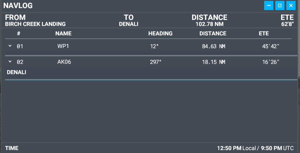
Distance remaining to Barrow is about 265 nm. Although my current plotted route is below, I’m considering changing it to a different route such that I reach the Arctic Ocean earlier and fly along its coast to reach Barrow. It may depend on weather conditions.
1 Like
Leg #6: Anaktuvuk Pass to Umiat. Distance 84 nm, flight time 66 minutes. Conditions: zero visibility unless climbing to 10,000 feet. Temps -35 celsius. Cruising altitude: 10,000 feet.
I accepted the risk of bad weather and low scenery opportunities by flying in Alaska in February/March, but I regret not sitting out the weather today especially. The ground was only visible if I was about 300 feet above it, both on take-off and landing:
A real pilot in these conditions would be at high risk of death due to spatial disorientation alone, if not expertly trained. But I have the luxury of taking cues only from instruments and not from my body, eyes, and ear drums, so I managed to navigate the steep mountains of Anaktuvuk while relying on the Garmin’s radar topography. I could not simply depart straight out either. I had to actually turn around within the narrow canyon I was in, to gain sufficient altitude, all with zero visibility.
I broke free of the clouds at around 10,000 feet:
Umiat is a lighted runway. I am also getting decent at landing with zero visibility with the aid of the radar and at least a few hundred feet of visibility, so landing here was again fine. I now have to choose between taking my currently-posted route below, or heading straight up north so I can fly along the Arctic Ocean until I reach Barrow.
Leg #7: Umiat to Inigok to Atqasuk. Distance 135 nm, flight time 78 minutes. Conditions: VFR with scattered clouds, some overcast near destination. Temps -35 celsius. Cruising altitude: 4,000 feet.
At last, the weather broke and I was able to see Alaska’s Arctic landscape unobscured. Obviously, it’s magnificent:
Taking off from Umiat, MSFS has put a gigantic windmill right next to the runway. Seems like an odd place for one. After searches online I am unable to find photos or video of such a windmill existing.
I am now just 55 nm from Point Barrow. I may practice my VOR navigation skills by using VOR only to reach it, and its nearby airport. A few interesting points about Barrow:
-
It isn’t called Barrow anymore in homage to its Native land. It is now known as Utqiagvik. MSFS has not updated this.
-
The airport at Utqiagvik is called the Wiley Post–Will Rogers Memorial Airport, after Wiley Post and Will Rogers who died in a plane crash 9 miles from the airport, in 1935.
-
The airport, PABR, is the furthest north airport in the United States.
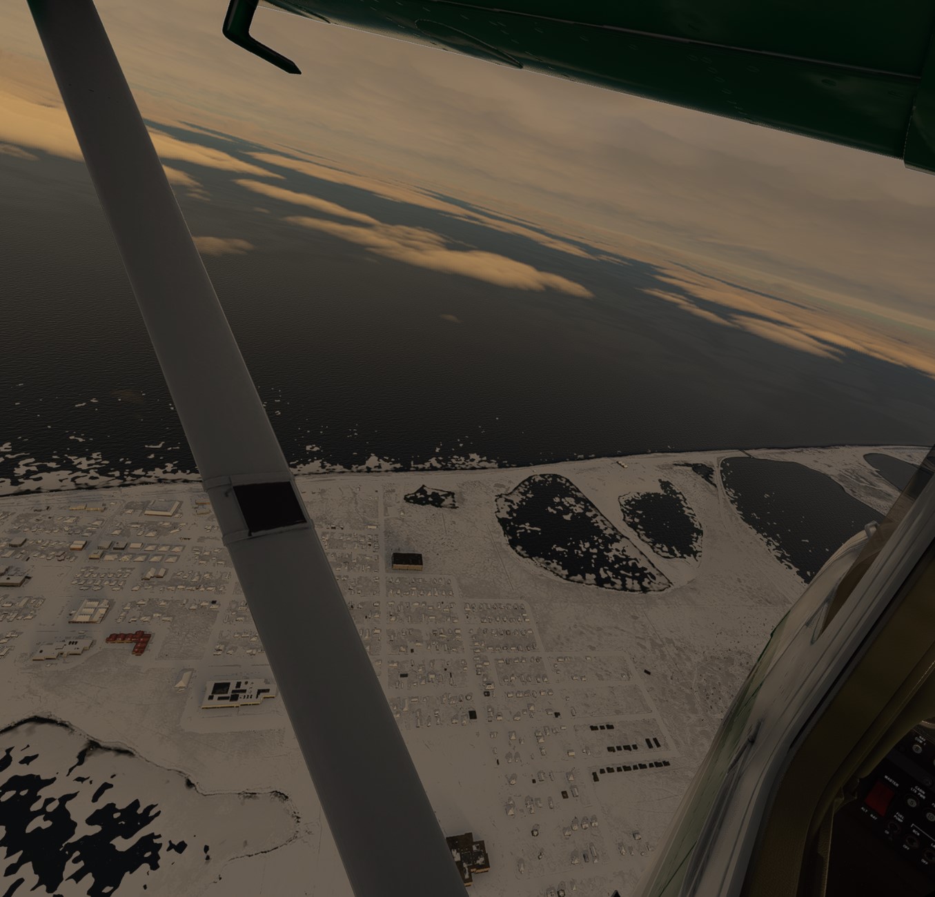
Final Leg, #8: Atqasuk to Utqiagvik. Distance 55 nm, flight time 78 minutes. Conditions: VFR with some overcast clouds. Temps -35 celsius. Cruising altitude: 3,000 feet.
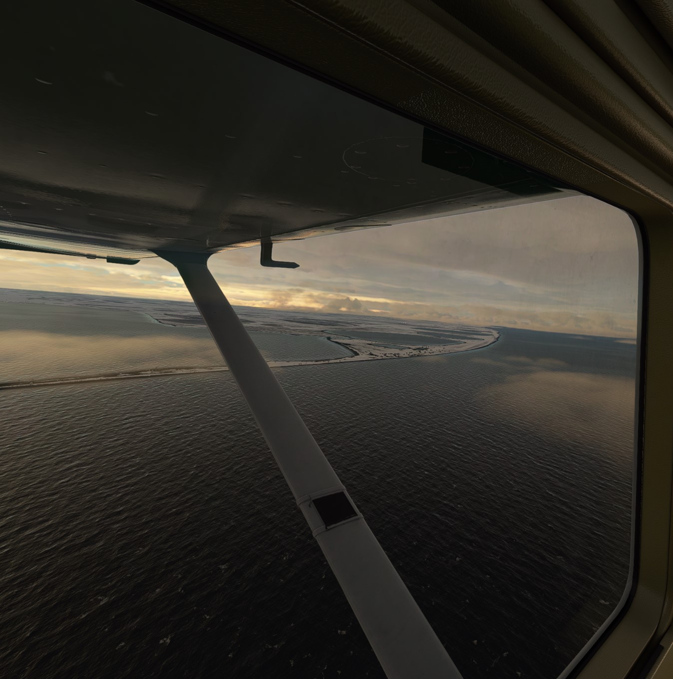
The weather and visibility were reasonably good so I decided to head up to the Arctic Ocean for the final leg. I used exclusively VOR navigation to do so, aided by a VOR station located directly adjacent to the Utqiagvik airport. Upon reaching Utqiagvik, I flew past the airport and found the small strip at Point Barrow that MSFS has recognized. I then looped around Point Barrow, which is the northernmost point of the United States, and used visuals to land at the Post/Rogers Airport. Winds were quite strong and there was a crosswind.
View of Utqiagvik on first reaching it:
View toward Point Barrow (this is where the Wiley-Rogers plane crash in 1935 occurred, approximately):
After looping around and heading back in to Wiley/Rogers: