I’m going to post here a day to day journal of a trip from the southern tip of India all the way up north to Srinagar, and maybe further if the 172 can survive the Himalayas that far. I will use live weather and live time only. The goal will be to break the journey up into legs of about 100 nms each. By my calculations the total distance from Kanyakumari in the southern tip of the state of Tamil Nadu to Srinagar, Kashmir, is about 1,500 nms.
My first leg will start in Colombo, Sri Lanka, as I wanted to experience of seeing the tip of India appear in the horizon for the first time, and fly over Kanyakumari, well-known for being India’s beautiful “land’s end” at its southern tip.
5 Likes
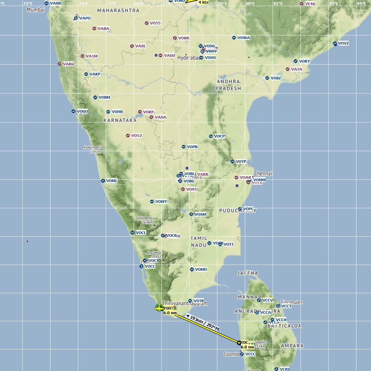
Leg #1: Sri Lanka (Colombo) to Thiruvananthapuram, Kerala. Distance 193 nm, flight time 1 hour, 58 minutes. Conditions clear, blue skies, few clouds, VFR. Cruising altitude 3,000 feet.
Though my first leg was longer than my preference for a flight session, it was inevitable due to the distance between Sri Lanka and India. Though the two nations have closer points for crossing the Indian Ocean, I wanted to both depart from Colombo in particular, and also pass over Kanyakumari. This required an almost 150 nm ocean crossing in order to land in Thiruvananthapuram, formerly known as Trivandrum.
The weather was as perfect while departing Colombo as it was the entire trip:
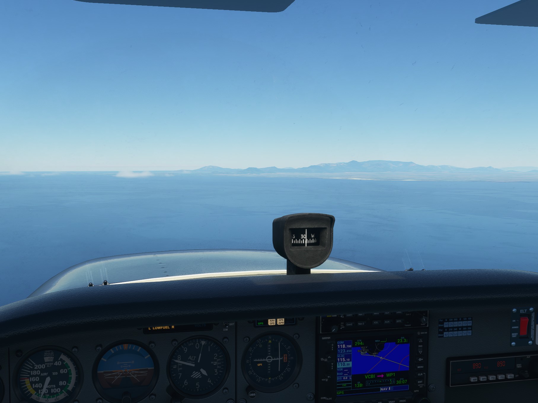
Uneventful ocean crossing. First spotting of Indian land:
Kanyakumari, Tamil Nadu:
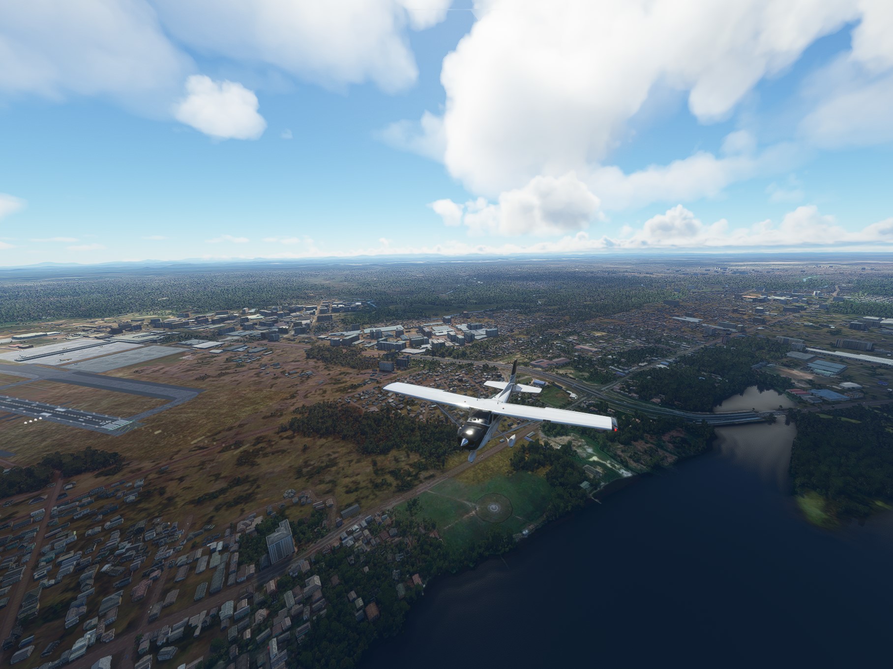
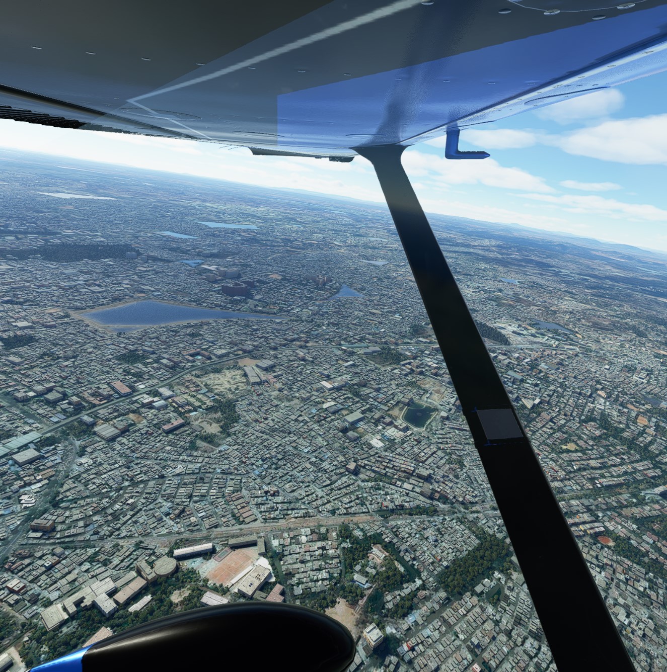
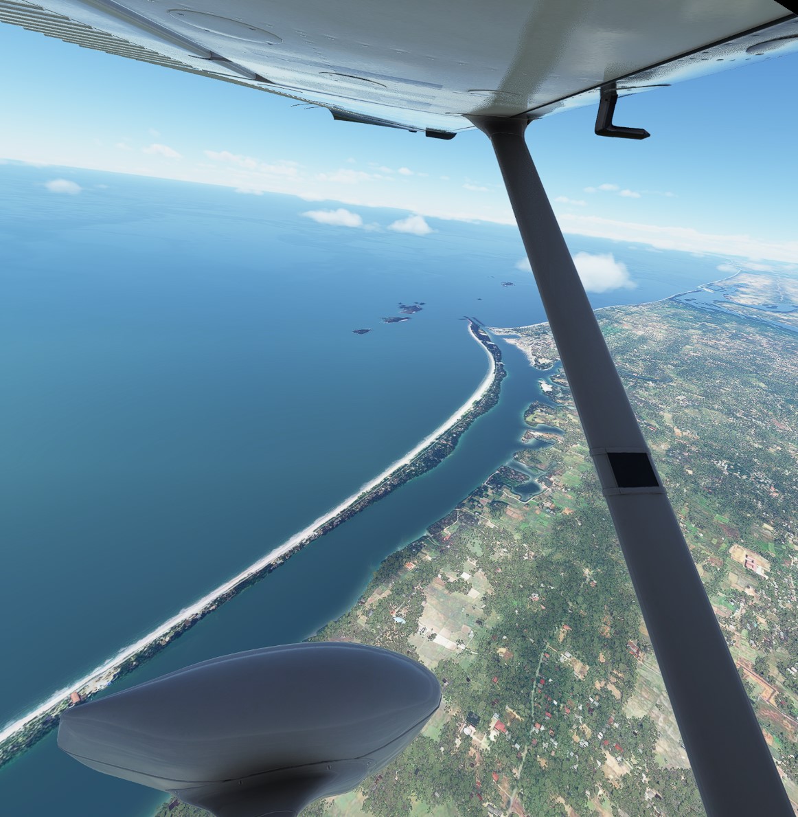
Crossing into Kerala for landing at Thiruvananthapuram.
This airport offers ILS approaches but I made the mistake of starting this trip in a 172 Skyhawk that did not have the G1000 system installed in it. I could not figure out how to trigger the ILS using the older model, so I used a visual approach and had no problems. I might switch to the newer model for future legs, unless I find the time to learn how to use the older equipment.
Meanwhile, looking forward to having some sambar and dosa in Kerala before planning my next leg.
4 Likes
Great start - tik ahe!
Please could you share your flight plan here, so we pilots can go for it!
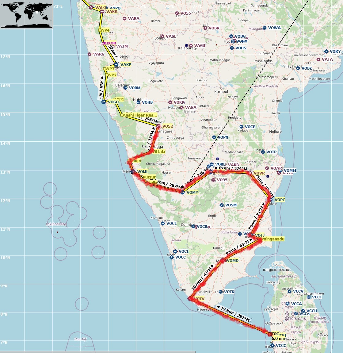
Sure, here you go. Nothing too complicated other than WP1 to make sure I passed over Kanyakumari. Speaking of which, MSFS may have included a temple or statue at Kanyakumari which I did not realize when I flew over it. If you do, you may want to get lower to try and catch a view!
VFR Bandaranaike Intl Colombo (VCBI) to Thiruvananthapuram (VOTV).pln (1.7 KB)
1 Like
Leg #2: Thiruvananthapuram, Kerala to Madurai, Tamil Nadu. Distance 107 nm, flight time 53 minutes. Conditions clear, blue skies, VFR, but very strong winds at high altitudes. Cruising altitude 10,000 feet.
Beautiful flying conditions this morning in India, taking off from Trivandrum.
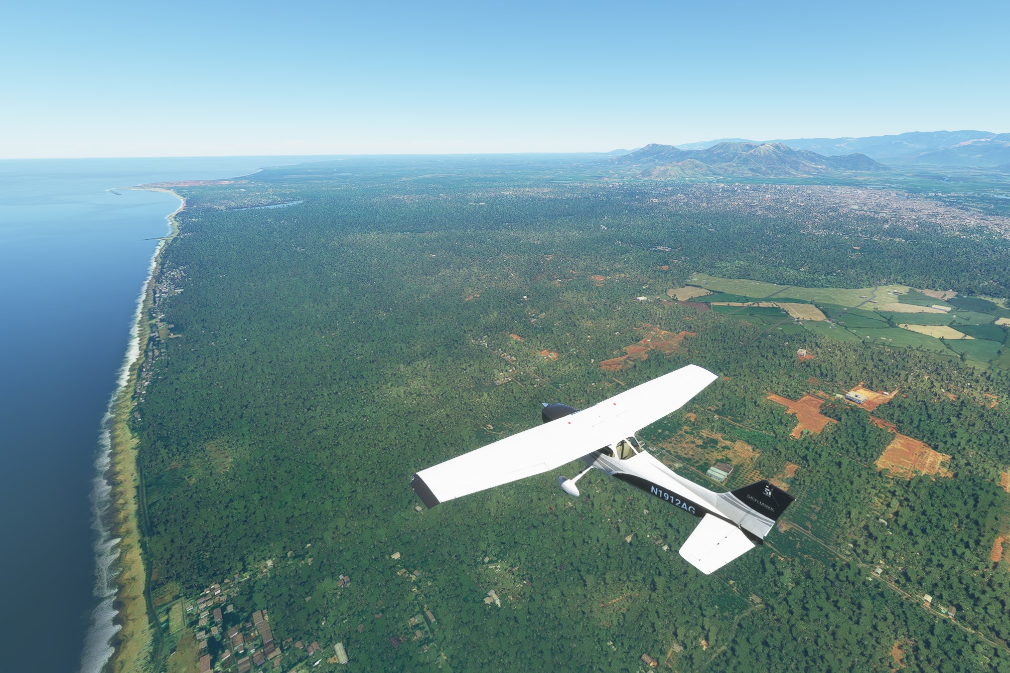
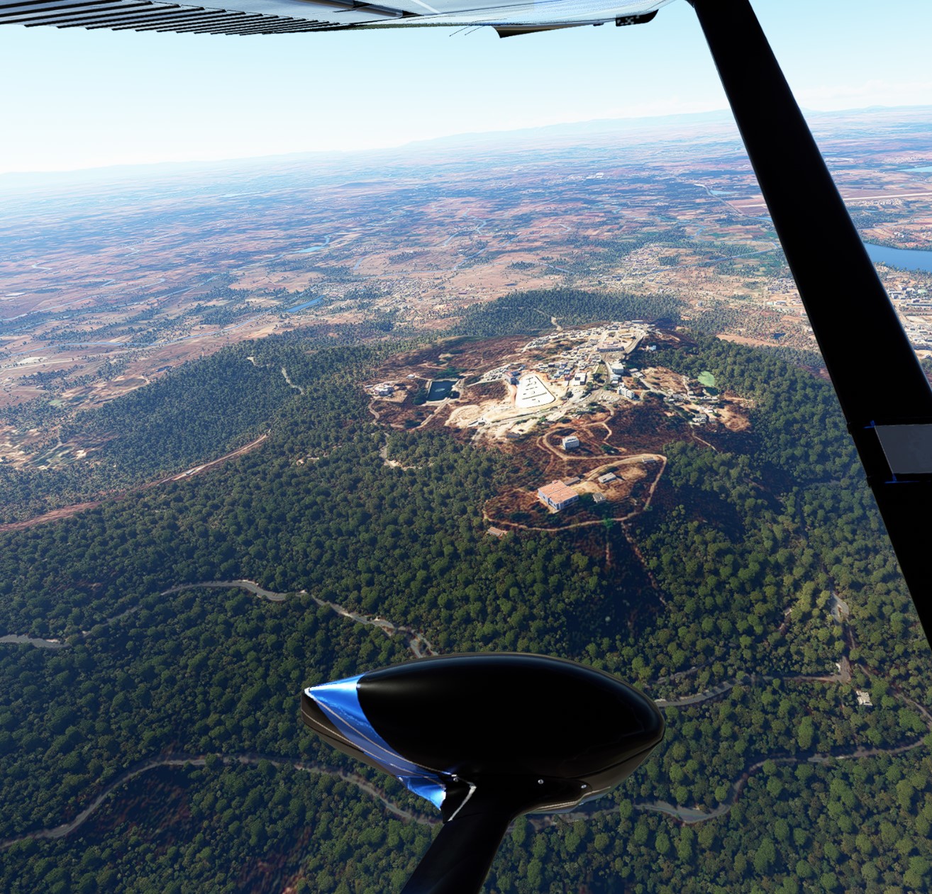
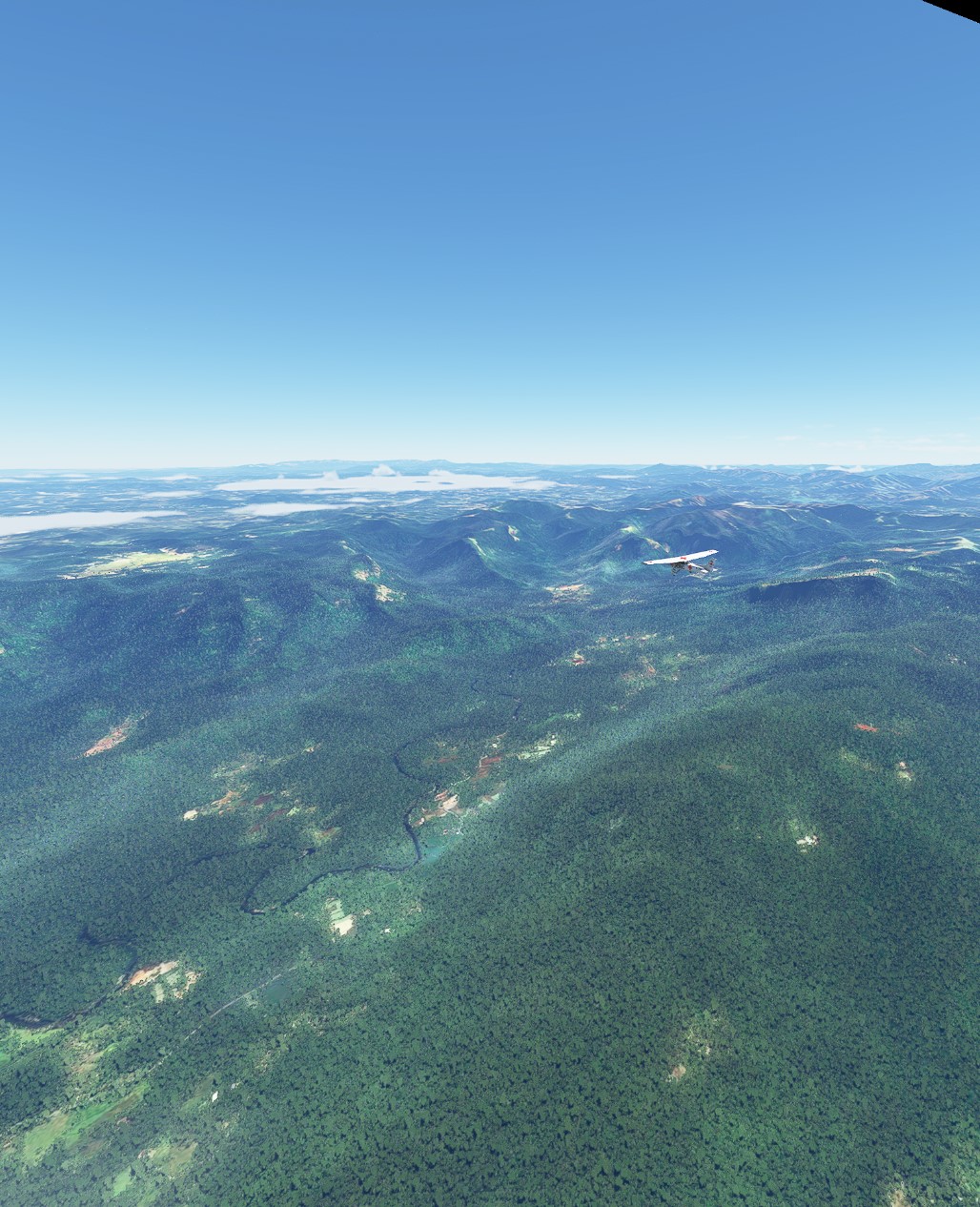
Rather than fly up the western coast, I decided to aim for a city I’ve never visited but have always wanted to on the east coast of South India: the former French colony of Pondicherry, now known as Puduchery. The route today took me over the Mundanthurai Tiger Reserve, which features some beautiful and lush mountains:
Windmill park in Tamil Nadu:
Madurai is an ILS and towered airport. Smooth landing. For now, my trip up north will experience a bit of zigzagging due to my desire to fly to Puduchery (and also Chennai).
2 Likes
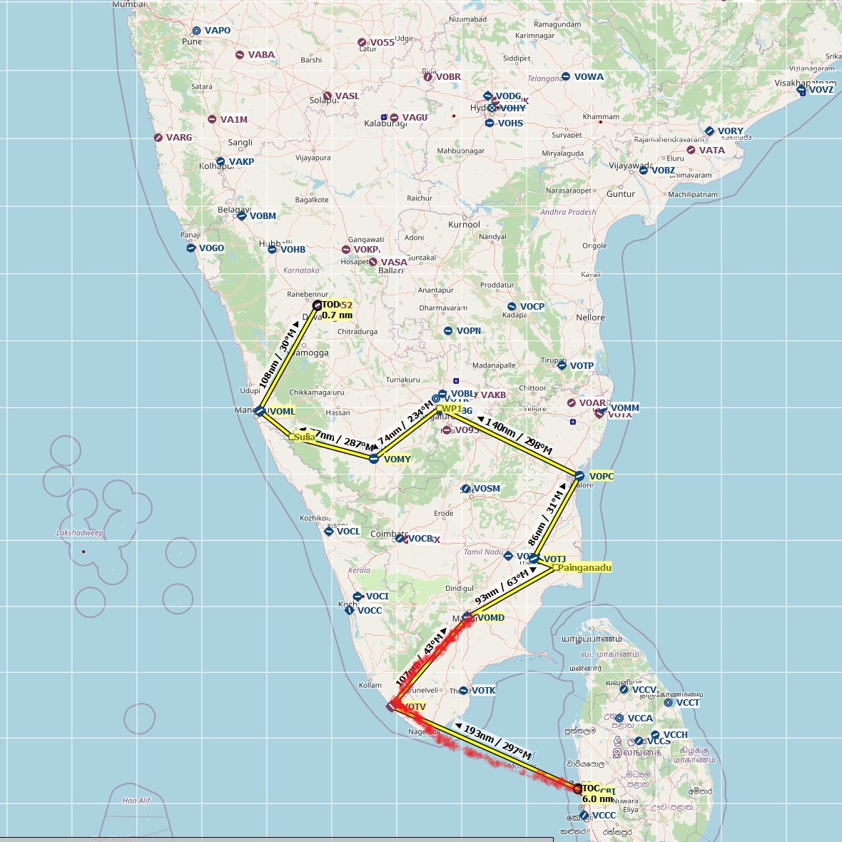
I’m not sure what is worth uploading or not at this point, but here it is either way to the extent I have routed one. There is one unique waypoint I’ve marked here for the village of Painganadu, Tamil Nadu. Painganadu is the village where Vice President Kamala Harris’s family is from.
VFR Thiruvananthapuram (VOTV) to Harihar (VO52).pln (3.5 KB)
Leg #3: Madurai to Tanjore to Puduchery, Tamil Nadu. Distance 201 nm, flight time 2 hours. Conditions clear, blue skies, some strong winds but VFR. Cruising altitude 6,000 feet.
Used GPS to depart from Madurai and fly over the village of Vice President Harris’s Indian family:
I then landed briefly at Tanjore (which is actually now known as Thanjavur; MSFS has the old name), and decided to take off for Puduchery, on the eastern coast of Tamil Nadu. Approaching the city here…
Haven’t decided yet whether to head next straight to India’s Silicon Valley, Bengaluru, or divert my route a little bit to stop by the megapolis of Chennai first. We’ll see.
2 Likes
Leg #4: Puduchery to Vellore, Tamil Nadu. Distance 71 nm, flight time 51 minutes. Conditions clear, blue skies, VFR. Cruising altitude 4,000 feet.
Vellore was much more scenic than I had expected, with rolling hills and the nearby Palar River part of the landscape. Before landing I took a quick tour of the area. There is an ancient fort in the area but I assume MSFS does not depict it, and I didn’t know to look for it at the time. My wife, who is of South Indian origin (Karnataka), informed me while I was in flight that she actually has cousins who live in Vellore and she has been there herself.
As for the mechanics of the flight, I decided against using the high-tech Garmin 1000 available in the MSFS Cessna 172 standard model. I used the “classic” Cessna 172 instead with the older Garmin equipment, as I am a student pilot in real life and would like to become familiar with equipment I am more realistically going to actually use one day.
I’m heading to Bangalore next.
1 Like
Leg #5: Vellore, Tamil Nadu to Bangalore, Karnataka . Distance 82 nm, flight time 50 minutes. Conditions clear, blue skies, VFR. Cruising altitude 6,000 feet.
Bangalore, which is now known as Bengaluru, has multiple airports. I chose not to land at the major international one, choosing instead VOBG, which I assume is a domestic airport anyway. The route from Vellore is pretty flat and uneventful, so I practiced my navigation skills by trying to find VOBG using VOR and DME instead of GPS. I was impressed that Microsoft has even matched up the morse code tones of VOBG with the real-life aviation charts of India.
Unfortunately I failed to realize that VOBG has an ILS runway in time. By the time I did I was lined up for the opposite runway. I was too impatient to start the approach all over.
Mysore will be next.
2 Likes
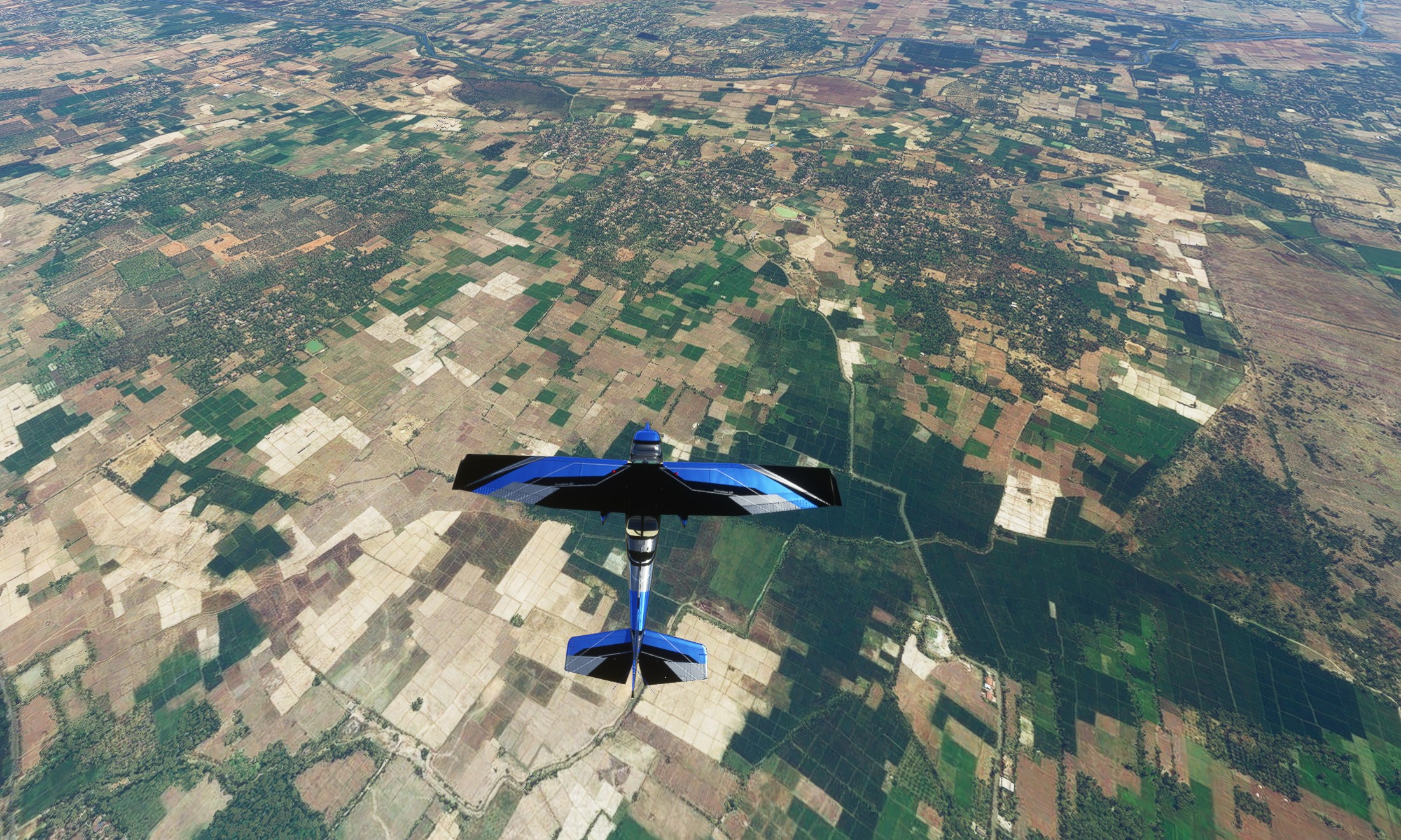
Leg #6: Bangalore to Mysore, Karnataka . Distance 60 nm, flight time 34 minutes. Conditions VFR but some clouds, strong gusts. Cruising altitude 10,000 feet.
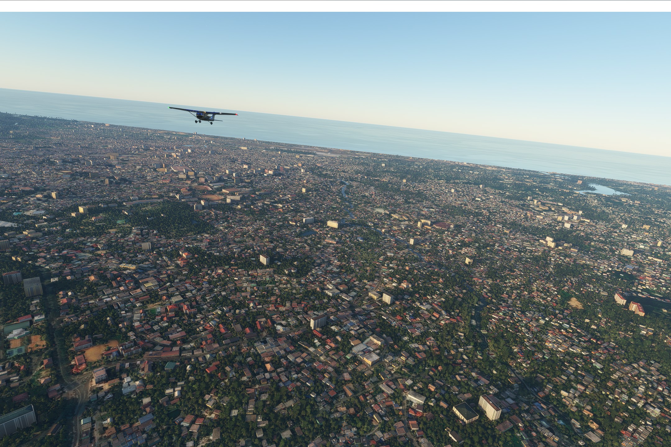
I flew today between two cities I have visited in person. Bangalore (Bengaluru) is India’s tech capital and the hub of its promise of a strong economic future. Mysore is the ancient capital of a region of India that fiercely rebelled against British colonialism, giving the Brits hell for many years and winning many battles.
The MSFS rendering of Bangalore’s urban density was so-so:
Mysore was a little better. I was pleased to see that the Sri Nandi Temple, though not terribly accurate, was roughly depicted on top of Mysore’s Chamundi Hill:
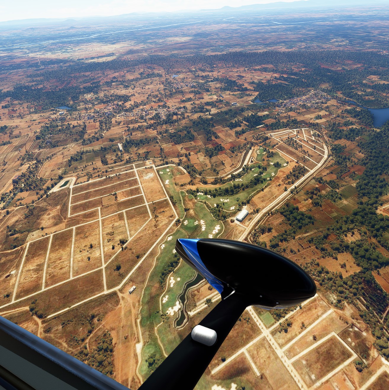
I was impressed to see a Mysore golf course too:
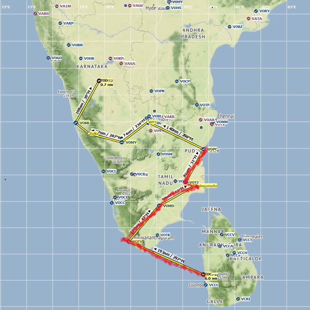
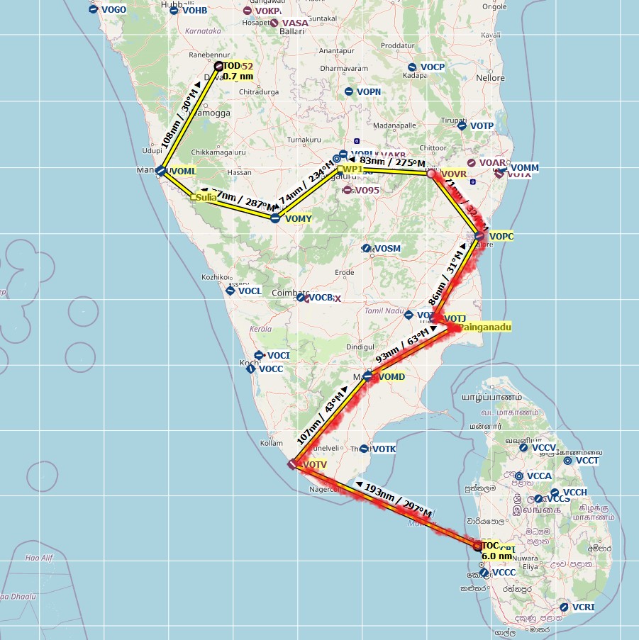
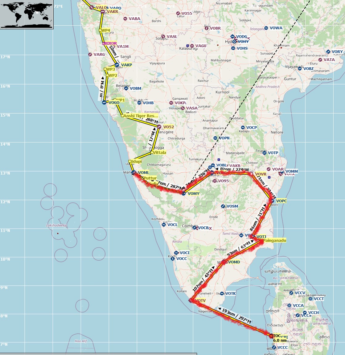
I zigzagged a little bit in this southern leg of my journey, mainly because I wanted to fly through Puducherry in the east but also Mysore and Mangalore in the west. That’s not a sustainable plan for making it to the top of India though, so I will probably stick to the west coast going forward. My plan so far is as follows, with Mysore circled in red:
3 Likes
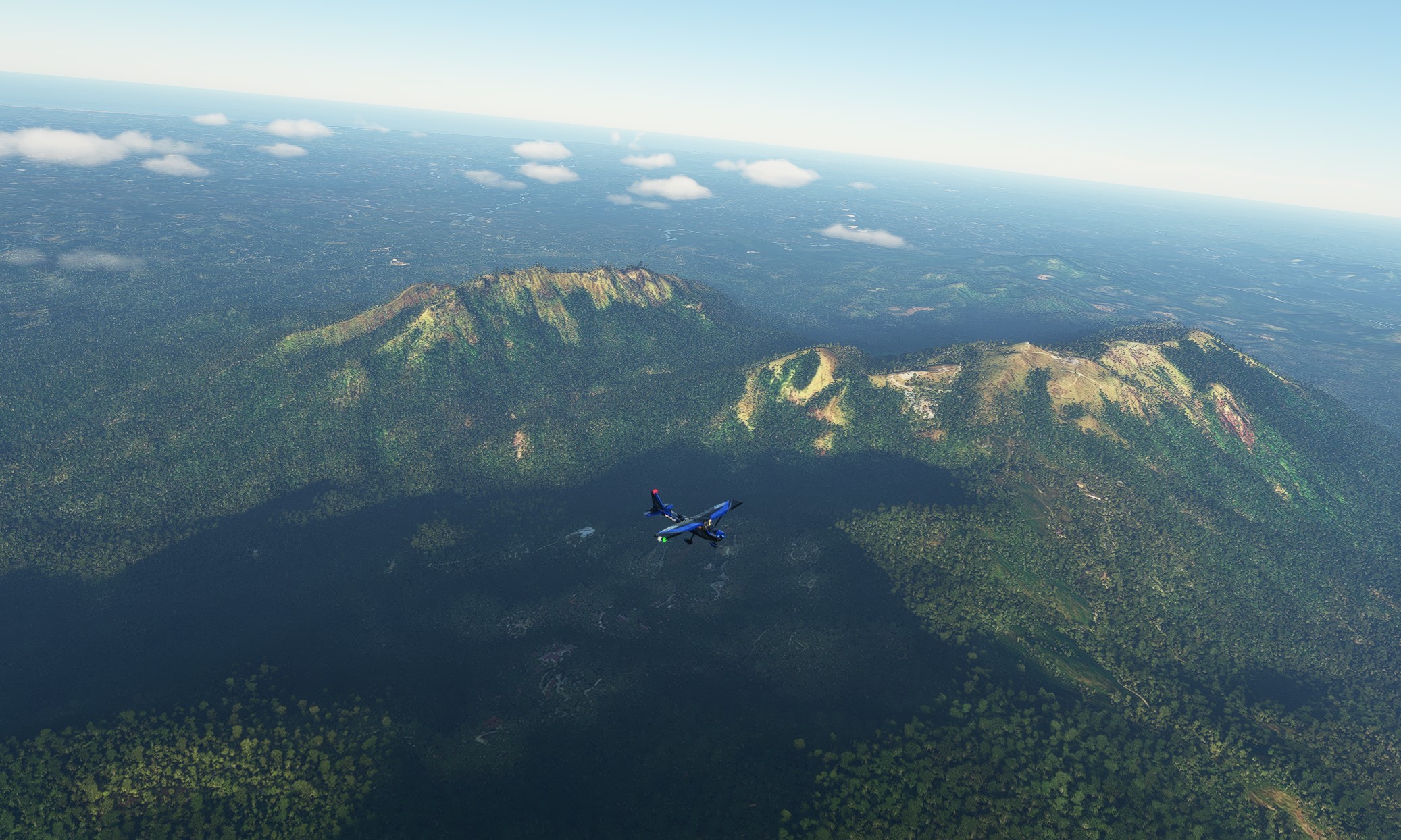
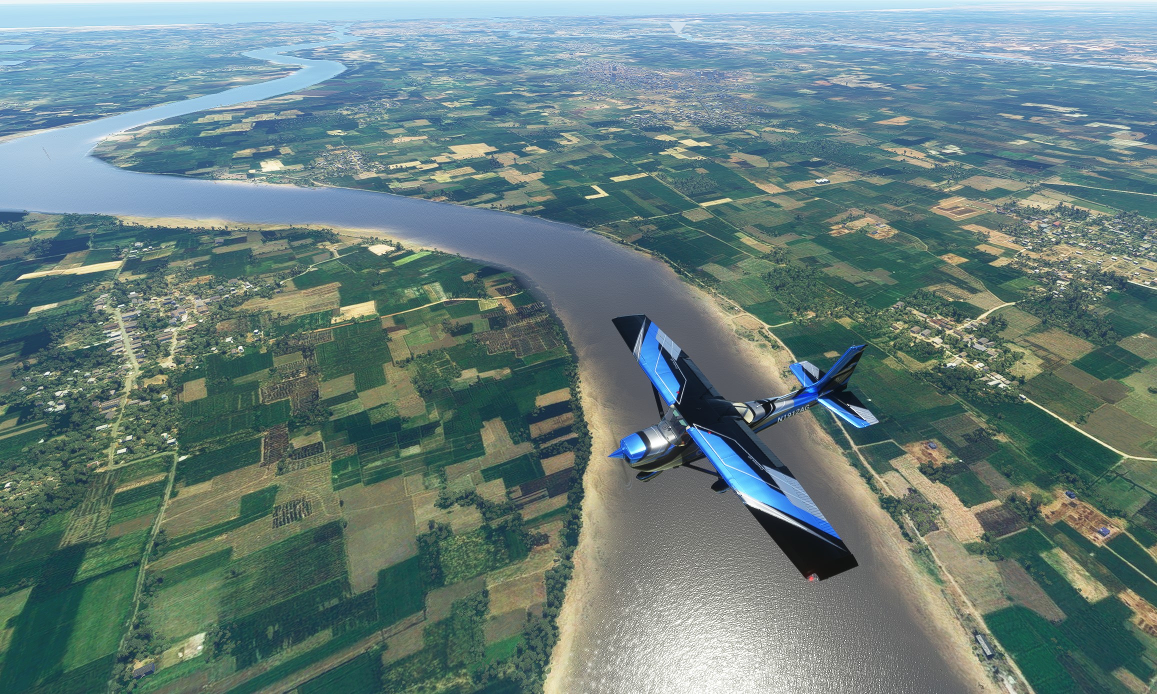
Leg #7: Mysore to Mangalore, Karnataka. Distance 115 nm, flight time 58 minutes. Conditions some clouds but VFR. Cruising altitude 5,000 feet.
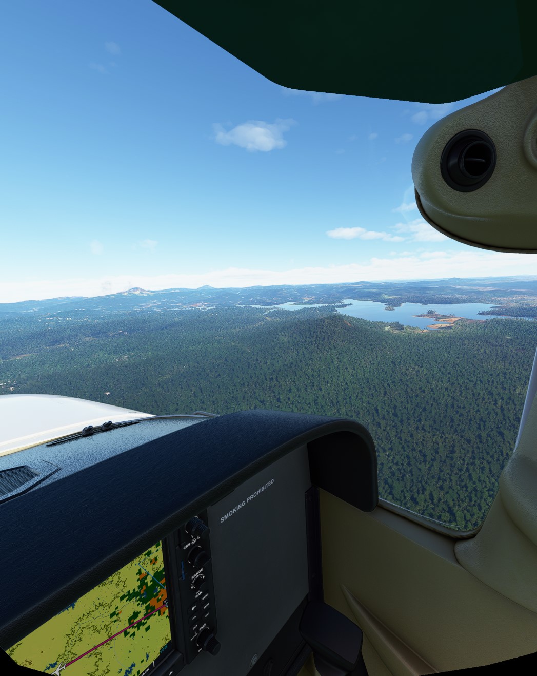
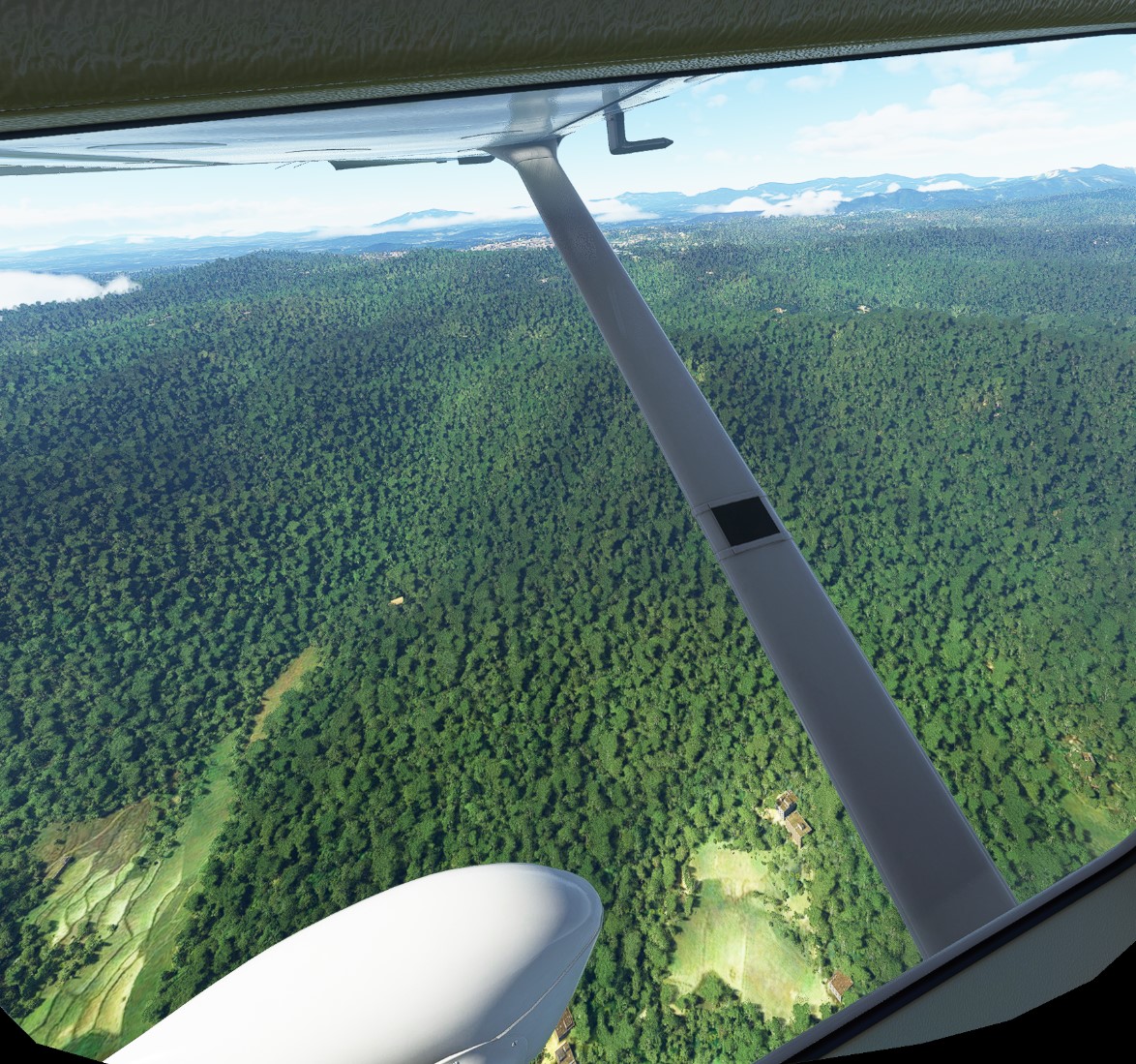
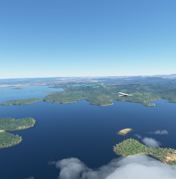
This segment took me through a few villages where my wife’s family originated, so I opted for GPS technology this time. Southern Karnataka is lush with untouched forests, lakes and mountains:
Mangalore is a coastal city with a towered airport that had ILS. ATC wanted me to enter from the west, however, and ILS was only available for the eastern runway. This is presumably due to wind patterns. Though the game gives me the option of defying ATC and landing wherever I want, I opted to obey the rules of realism and landed dutifully from the western approach.
Runway in sight:
My next 1 or 2 segments take me through some of Karnataka’s tiger preserves, in addition to a few more family-related villages and towns. After landing at Harihar I will leave the State of Karnataka and head for Goa.
4 Likes
@Sudburian Loving the legs! Also great Idea just building up your LNM flightplan! I currently have my legs split, and have the full route on Google Maps.
1 Like
Thanks! No strong feelings on my part on how to visualize the legs and progress. LMN gives you some good options on however you choose to do it. I use the standard Windows Paint editor to color things in.
1 Like
Great thread.
I’ve nearly completed my round Europe flight by prop visiting every capital city and your posts are giving me a good idea for my next expedition. Thanks.
3 Likes
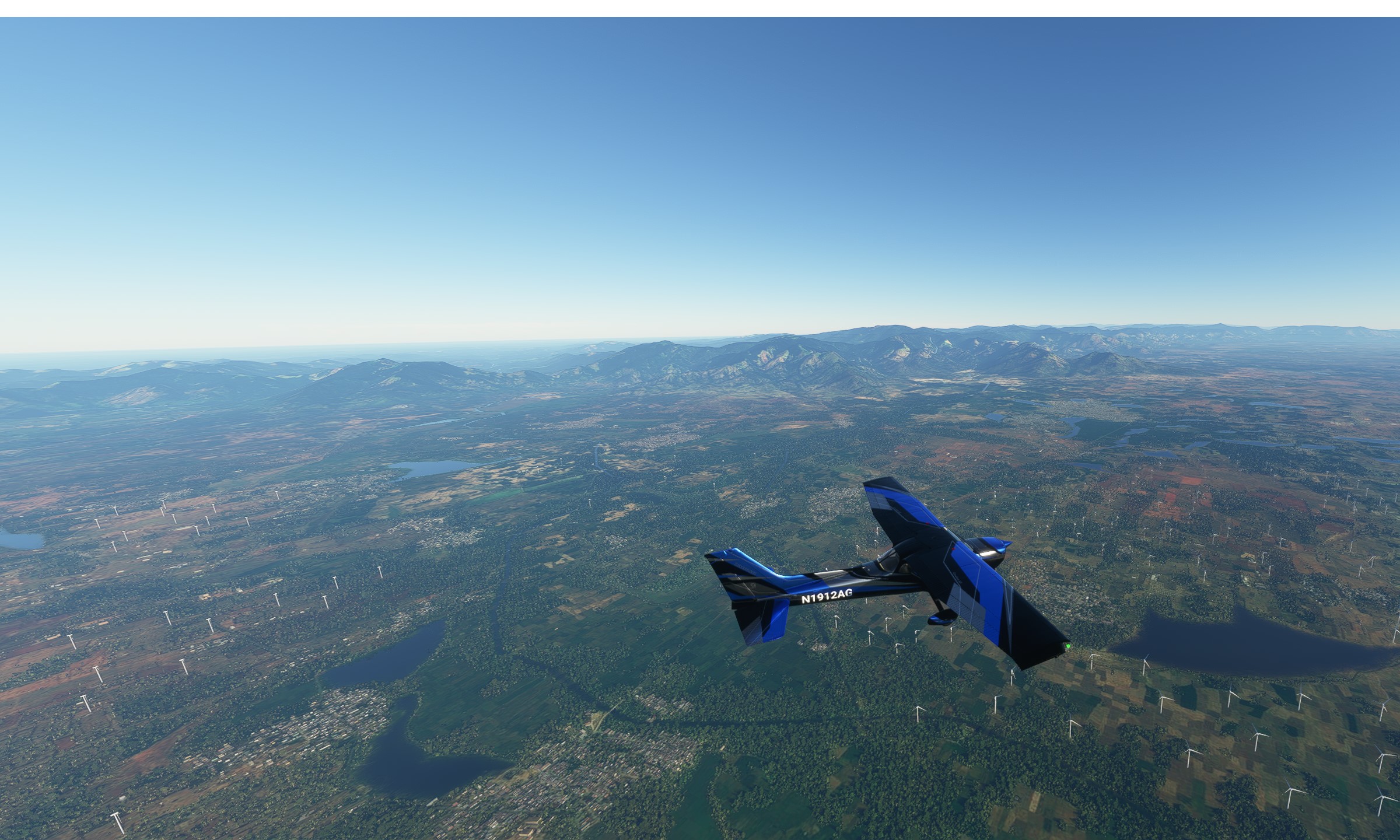
Leg #8: Mangalore to Harihar, Karnataka. Distance 128 nm, flight time 67 minutes. Conditions VFR but heavy turbulence. Cruising altitude 6,000 feet.
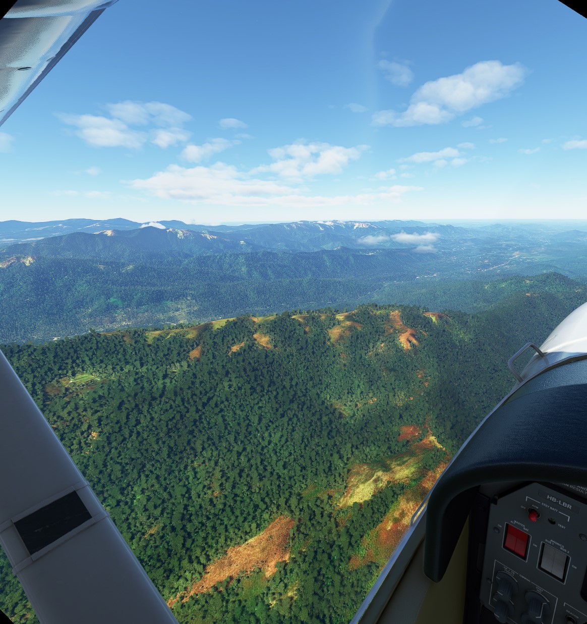
The Indian state of Karnataka is spectacularly beautiful. I don’t say that just to please my in-laws, who are not reading this journal anyway. There are vast forest preserves, coastal cities, lush mountains, lakes, and from having visited there in real life I can attest to the rich cultural history and amazing food as well. My trip took me up the coast of the Indian Ocean toward Udupi (many “vegetarian and Indian” restaurants in North America and Europe are called “Udupi” because of its famous cuisine):
I then turned inland to a small area of villages known as Vittala, which coasts over some mountains and took me to a gigantic lake:
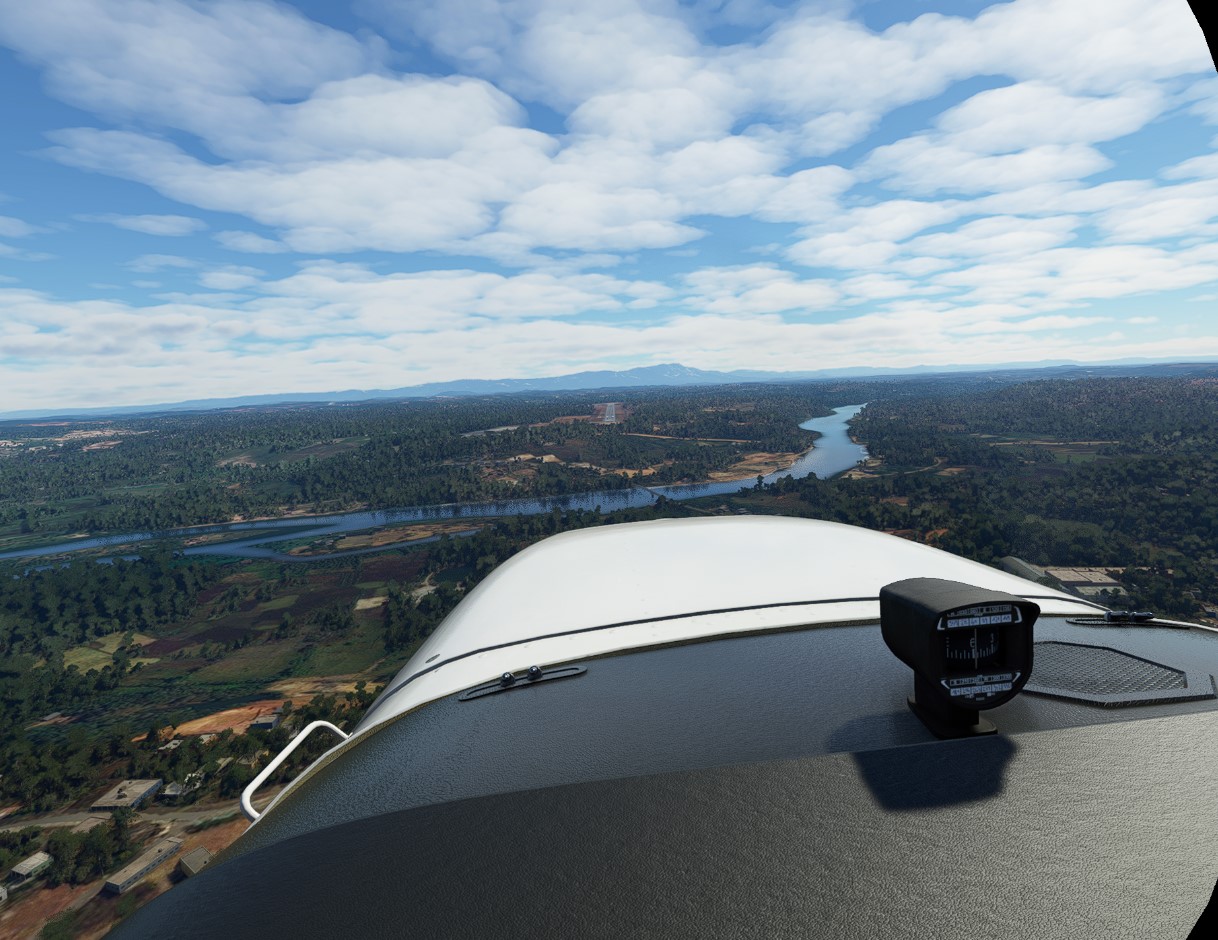
Harihar is a city of about 85,000 people, located on the shores of a river. Landing was smooth despite the high winds throughout the flight. This is my last stop in Karnataka as I head to Goa next.
3 Likes
Leg #9: Reversing course from Harihar to Mangalore. Distance 108 nm, flight time 70 minutes. Conditions nighttime flight, used VFR anyway. Cruising altitude 10,000 feet.
Two things persuaded me to take a night flight back to Mangalore today. First, after talking to family I was reminded that the Lakshwadeep Islands are located off the coast of Karnataka and Kerala in this part of India. For that, I would need to return back to Mangalore for a sensible departure point. Second, I purchased a Piper Arrow add-on plane and wanted to give it a shot, even though it was nighttime in India.
It being a new plane I was not sure how to properly navigate. I managed to set one of the VORs properly so that pointed the way for me most of the way. In the darkness of the plane I could not find autopilot or other AP settings, so I manually flew the entire way using VOR, just like in the good ol’ days. I am now back in Mangalore and will set course for Lakshwadeep at the next opportunity. Total distance to the islands is a lengthy 200 nm or so, so I will plan on a one-way flight for each leg. The Piper Arrow is a bit more powerful than the 172 so I will cheat a little bit by using the Piper for this side trip.
2 Likes
Hope it was a fun one! How did the piper fly?
Monty
1 Like
I really enjoyed the Piper. There are a few problems in flying it with a VR headset at the moment, especially at night. But overall it was great and I think they did a good job. Since I have never flown a real-life Piper, I can’t really comment on any nuanced differences or gaps in details.
1 Like