Small update of the upcoming route section of CAM 18. Salt Lake City to Omaha.
Route, arrows, beacons are in place, but still need testing and some finetuning.
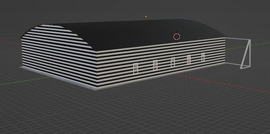
Next is working on ILF’s, and new models to match (still very much WIP).
Rock Springs
Medicine Bow
Also existing models had a few makeovers.
10 Likes
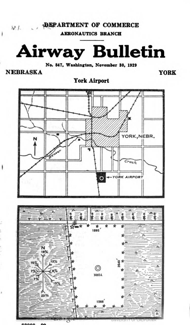
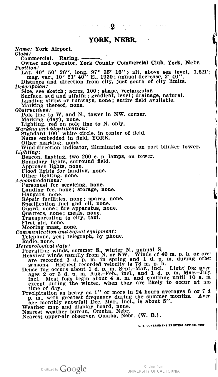
Curious If can ask, what does York Nebraska’s stuff look like specifically ?
2 Likes
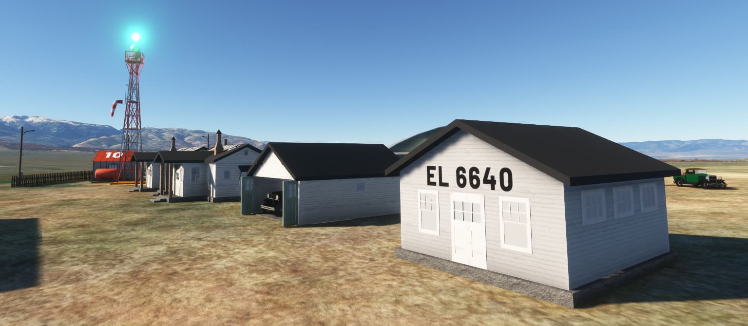
This is how Dave goes about getting info on the DOCILF:
Quote from our dev. Discord:
“80B York DOCILF 40.843272 -97.594483 - There’s a modern airfield a few miles to the north west of here. It has a beacon but probably moved later I reckon. Anyway this site is to the south of the town. The railway line is gone but you can still see the route of it so managed to plop down the beacon where it should be.”
After that we try to find pictures.
This field seems to have little additional features, as can be read in the bulletin.
4 Likes
Amazing thank you all for the hard work. I love flying these routes.
1 Like
By the way, out of curiousity, is this your ‘home’ airport?
No, But go to a Summer Camp every year since 2015 I think ( except 2020 )
Guess just curious of local history wherever am.
3 Likes
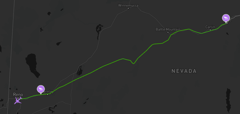
Week Ago, Flew Reno to Elko
( Pardon the 1st landing, I skimmed too close to top of a hill )

Week later ( Today the 9th)
Flew from Elko to Salt Lake City
3 Likes
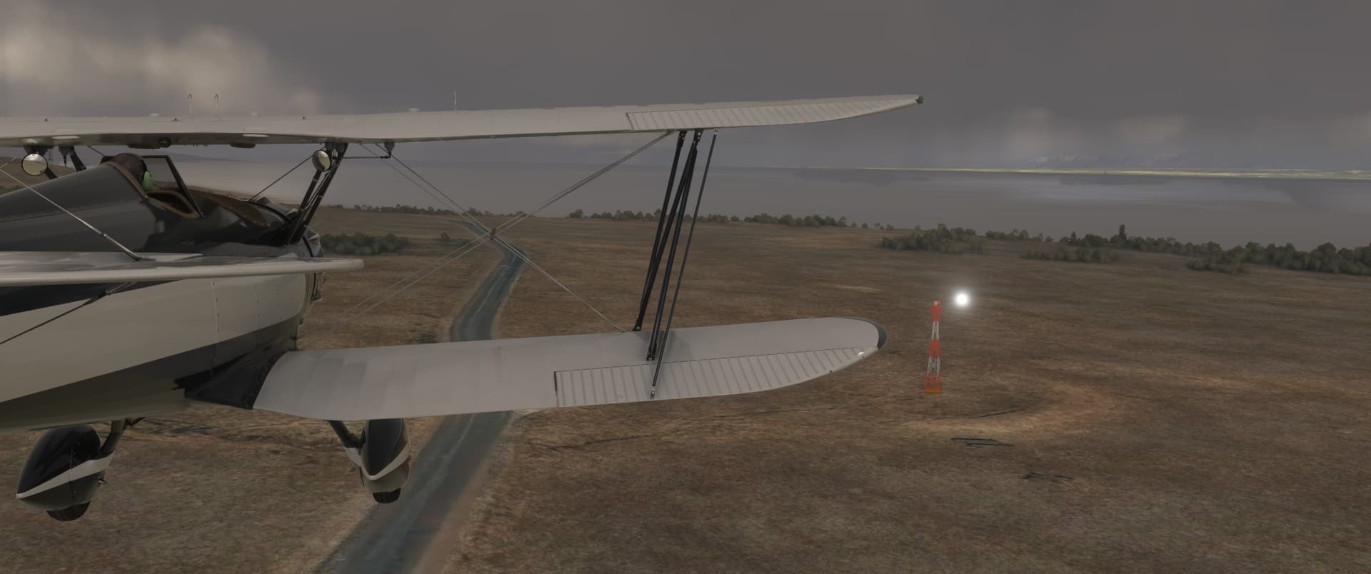
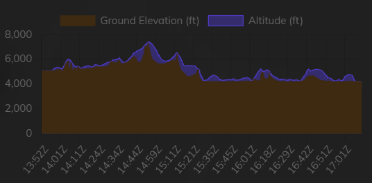
The Salt Lake Desert - what an empty vastness to fly over. I can imagine it was not without some risk in those days of less reliable engines. At least, there are a lot of landign fields and sheds at the arrows where they probably could call for some help.
2 Likes
Just seen your post now.
Apologies for my reply.
I have it all figured out for Arrows Across America, the beacon locstats, the files provided etc.
But I have no idea how the pilots of 1926 - 1934 could see the beacon lights in bright sunlight and on a fullu a clear and cloudless day.
I find that impossible.
Unless you ‘cheat’ with GPS - that they did not have ‘back in the day’.
So I make the day fully overcast with fairly high density.
Then the beacon lights show up as much as 3 beacons ahead!
No GPS!
1 Like
Nice! Any more screenshots?
How did you like the hangar at Reno, or the ILF at Salt Lake? (asking for a friend… )
)
3 Likes
Ow, right. Remember, we use the stock beacon effects from the sim. I cannot recreate your remark in full. Indeed, sometimes some beacons don’t show against bright sunlight, we think this is a changed with SU14 where they changed the simulation of some athmospheric conditions.
But most are visible.
And also, those guys did use strip maps for guidance between beacons, so don’t feel troubeled to use Little Nav Map every now and then 
1 Like
Yes, also using the old style IFR (I follow road) mostly is an option. So getting lost sure IS possible (after one landing on an intermediate airfield I managed to fly into the backward direction until the landscape told me I was there some minutes ago  ), but probably most so withing soggy weather.
2 Likes
Loving your mod, guys, very well done!
Flying over the great Salt lakes, i was looking at my fuel usage, forgot to look at the horizon, tried to find the blinking marker, but lost track of it… hadn’t flown this aircraft for such a long time, i failed to either look at the height nor compass… and got spacially disoriented and crashed into the very flat water… i am so lucky to be a virtual pilot… i can only imagine what those guys went through on a daily basis.
Awsome mod guys, thank you very much.
Hi there Robcap, loved our discord conversation about that new b/w hangar… still hope to see that colourful flag on that hangar though, or on the flagpole? hinthint Love what you do, admired all you guys’ work… and hope you put your names into that manual ASAP!
Have a great flight and thank you.
Take 2… and i landed and parked at Idahome for the night, as i had some pressing matters (the release of the XF-11 by Flying Fries) to attend with… Will continue the route soon, as i figure i’ve only just barely touched the surface and i love it already so soooo much! Again, this feeling of going where the pioneers went, in adverse conditions, sometimes a cloudbank rolling down as the floor is about 5000 feet high… amazing.
And yes… i am quite late to the party, as i just crossed paths with Robcap this last week… hahaha Reading back i didn’t realise you were already working on this for nearly 2 years…even though i roam around the forum quite frequently, this mod definately stayd below the radar… I guess i wasn’t ready yet, now i am! 
See you in the virtual skies, i’ll wag my wings!
Woof ~ Woof & Salute!
Steiny
3 Likes
As well as the strip maps @RobCap1966 has mentioned, the air mail guys stayed low (between 50’ & 500’ AGL) so that they could stay orientated using the arrows and shed reference numbers at each site, plus any other landmarks they had memorised for the route.

3 Likes
Besides the strip maps I have also used google maps.
E. G. I broke Portland to Spokane CAM run into 3 legs. Then using the lat/long coordinates provided by AAA - I did multiple pin drops of the coordinates on to the zoomed google map. Coloured the pins bright red - google maps provides that option - so the pins show up very clearly.
Then printed the maps.
Easy to follow.
3 Likes
That lake looks like a T-Rex, well, you know, “doing” a camel from behind 
6 Likes
Will see what I can do with that US postal flag. Great find, Steiny.
1 Like