The image says it all – eminent death.
1 Like
I know it’s massively bugged but that’s just harsh
Oh- you mean the ATC
1 Like
California is a lovely place to die.
3 Likes
Unfortunately in this model the switch for the door jettisons fuel ![]()
1 Like
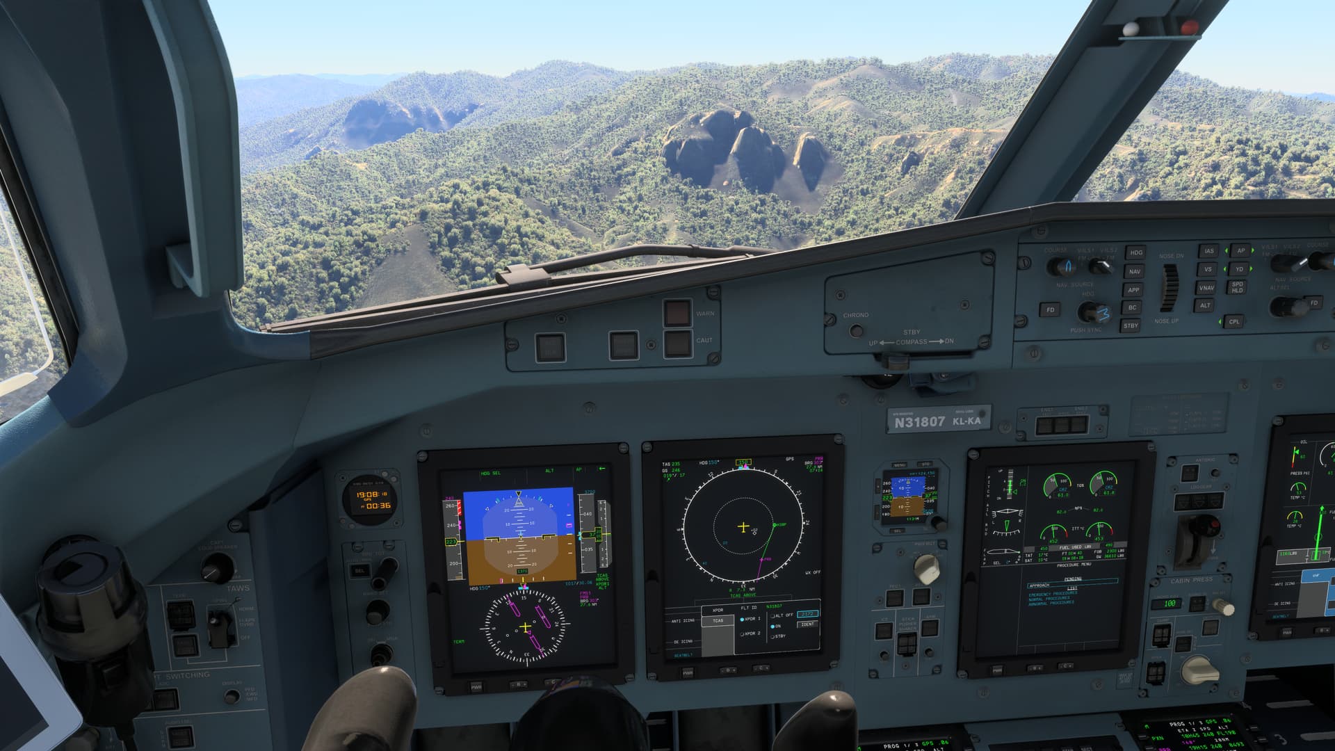
Boy that is a bad vector! ![]()
1 Like
vectors to “the” final
of your life
1 Like
So just to clarify, this was the first day you had off in 3 weeks from your night shifts at the animal shelter (in between fixing Asobo) and you thought to yourself “I know what I’ll do, I’ll fly the ATR and use the default ATC”
Makes sense
3 Likes
You’re close!
3 solid months of managing a major remodel of my house (1+ months without a kitchen!) and I finally had a moment (with pause breaks to deal with the contractors here) to fly the “updated” ATR.
I usually do use the default ATC (no VATSIM support in these parts) and vectors to final has been ATC’s go-to for nearly every IFR approach since Asobo added that switch to force the ATC to follow your prescribed flight plan rather than assign any changes based on weather.
In the past, prior to that added switch, ATC would nearly always assign a procedural approach, so RNAV or ILS, when available.
I dunno what they altered on the ATC code that is now having it favor Visuals, but I have tried so very hard to work with them and they still want to fly me into mountains. California’s terrain only exacerbates the issue.
May I should relocate to Kansas.
4 Likes
Oh, those flatlanders! I’m a little puzzled myself with all the talent they have that things aren’t a little more polished. I went for a spin in the new airbus in AFS4, and my fuel was loaded, my vspeeds were loaded, imagine that. And I could read the labels in VR. Remind me why we try so hard again?
1 Like
The skuttlebutt is that some internal team is working on the ATC for 2024 but it will be an update after release. I’m banking on working title since they have been handling the plane navigation insturments and the flight planning software. It speculated a NDA might be in place that is keeping them from openly talking about it.
Been thinking of getting one of the external ATC programs but trying to hold out to see what may happen.
1 Like
I’ve heard the same scuttlebutt and have the same notion it’s WT, too.
I have no problem holding out for a future update.
In the meantime, I’m continuing to get to know the tops of trees and sides of mountains really well.
Yeah, been there as well. If it doesn’t look like they will go the predicted route I’m thinking of getting FSHud. Will depend on if its mentioned in the road map eventually.
Surely if 2024 is a “new sim” it should also have new ATC ![]()
Or are we being upgraded in disguise….
The more I think about it with existing ATC and existing aircraft still being able to work the more I think it’s the latter.
Do you ask for new vector or do you wait for them to give you one? Request a new vector every 60sec or so and they will direct you just fine. ATC will probably send you unnecessarily 20nm from the airport but you will get there sooner or later.
Yes, I request frequently and no, they will not direct me just fine. I don’t know where you primarily fly, but ATC just cannot seem to account for the constant variation in terrain elevation that is a reality of the coastal range and Sierra Nevadas in California.
I very, very, very rarely experience ATC assigning an MSA that isn’t either scraping the belly of the aircraft over the trees where I need to switch to 3rd person view to see if I am really going to clear them or, as in this case, flying me straight into the side of a mountain. Both of my last flights I experienced the same issue — an assigned altitude that is unsafe and a request to turn into a mountain. They were two totally different flights into two different airports in California.
Similarly to the change they made to ATC a few SUs ago, where ATC now assigns your next altitude during a step climb ~2000’ before you reach your assigned altitude, they need to make that same change for the descent, and for vectors. While this may not cure their love of assigning a dangerously low altitude during the vectored approach, it would allow them to assign a change in altitude well before crashing into terrain or being asked to climb when it is already too late to do so — provided, of course, they are actually monitoring my altitude. Given they sometimes do make a request for me to climb to a safer altitude, it seems they do, but their timing for issuing that request is not coming soon enough.
Again, maybe I should try these sorts of approaches in a place that is entirely flat or where there is one simple terrain elevation change that makes this sort of approach far simpler for ATC to manage and the risk of a collision with terrain is not an issue to see it work smoothly. I’m not entirely sure how an improved ATC would put together a safe set of vectors with a safe MSA. Whatever algorithm they are using for calculating the vector path seems to be sort of okay (having to ask for updates notwithstanding), but they need to also be looking at the terrain elevations along that route and determining a way to assign an altitude that is safe until reaching a point determined as an Intermediate Fix prior to being handed off to ATC.
1 Like
It’s not just California Sierra Nevada nountains. I experience the same problem descending into KASE in the Colorado Rockies as well as KJAC.
1 Like
There are small changes in ATC from what I can see. I would have thought it would be included in the sim at launch but sadly that isn’t the case.
However, seeing as Asobo has given so many free upgrades over the life of 2020 and will be continuing that even after 2024’s launch I have some faith they will deliver.
Maybe I’m missing something here, but it looks like you are off course and should be making basically a right u-turn to intercept. So why does it look like you are still flying towards the mountain?
I’ve had ATC quirks, but never anything like this.
That and some other things is the reason why I do not use ATC.
I plan route for GA and take online route finder for commercial flights.
Use charts for SID/STAR and takte those values from charts. For minimum safe altitudes.
What approach is this on your picture? Airport, runway etc.