This is intended to be a general purpose topic where people can ask what a [something] is, or if you know what the [something] is, (you can describe it), but don’t know what to call it - this is the place.
I’ll start off with the first question in what I hope is many:
Given:
I bought a subscription to Navigraph and I can find all kinds of charts and stuff about airports, (landing, takeoff, patterns, etc.), everything you need to know about the airport - especially if flying IFR. Additionally they have larger scale maps that show waypoint-to-waypoint flight-paths that are useful for IFR flight planning - but they show little if any surrounding detail.
Question:
What I am looking for is more like a “visual” road-map. IOW, a larger scale map that describes a larger area that is useful for VFR flying - showing landmarks, things to avoid, and general information for someone flying by “looking out the window”, instead of a waypoint-to-waypoint flight plan.
What do you call that? (I think they’re called “sectionals” - but the ones I remember seeing were pretty useless for VFR flying as they didn’t describe the surrounding area, just waypoints and beacons.)
And, if you know how, how do you find one in Navigraph for a specific location?
I understand that Navigraph has promised to include VFR Sectional maps as a feature in a future update. (They have been promising this for a very long time.)
I found the on-line charts and, (doh!), found the VFR selection.
I noticed two important things:
First:
Not unlike electronic schematics and mechanical drawing blueprints, aeronautical charts are a skill unto themselves, using their own kind of hieroglyphics and symbology to describe important details.
Second:
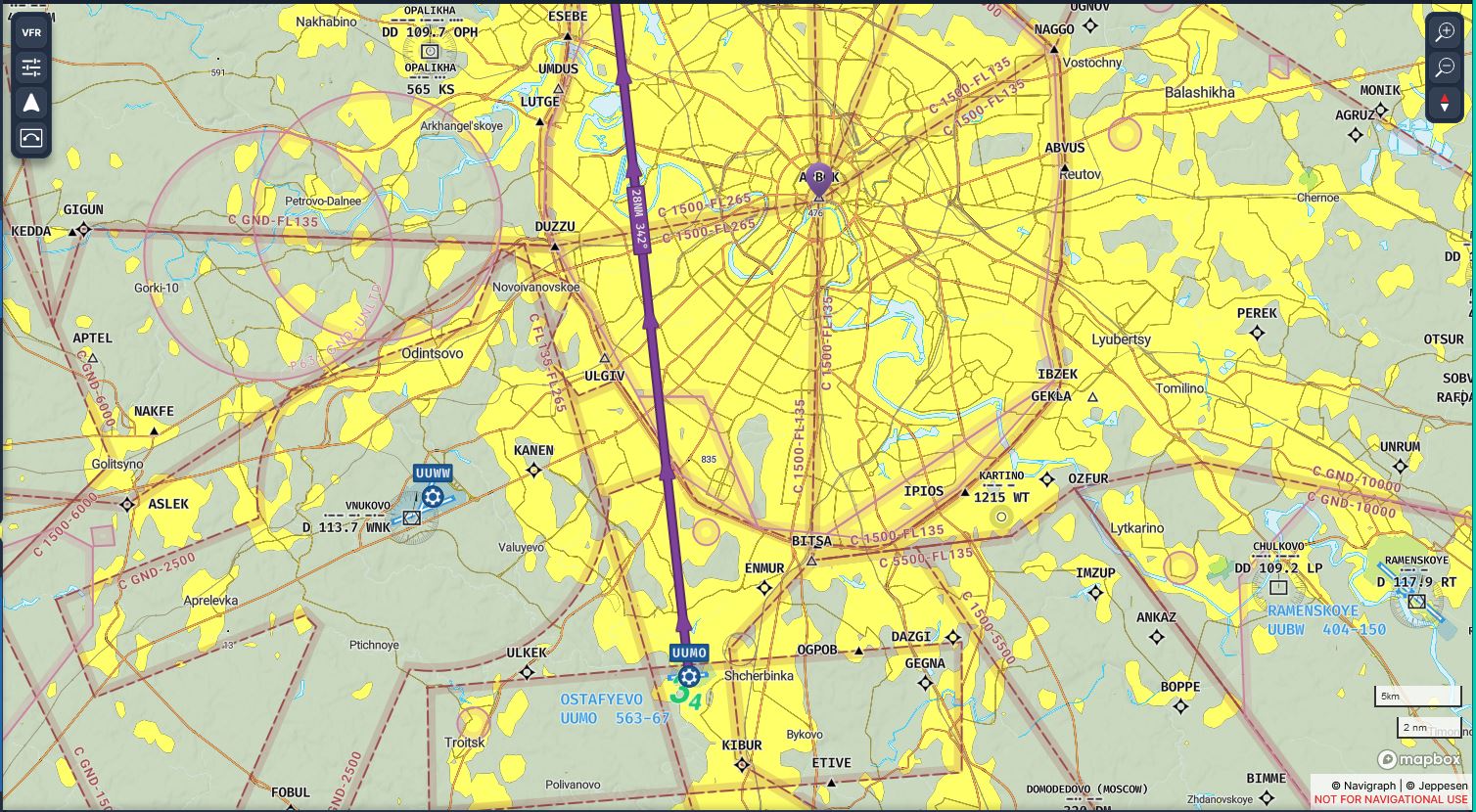
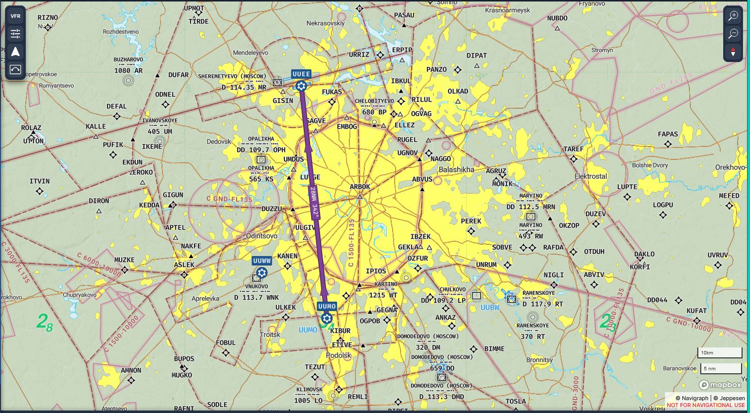
“Legally” there’s no such thing as “casual VFR flying around sightseeing” around Moscow as it appears that just about everything possible is classified as class-C airspace! Which makes sense when you note the large number of airports, (and places like the Kremlin), in the Moscow region - it probably looks a lot like Washington DC, NYC, Chicago, or any other major city. Can you say “ATC clearance”? Ahh! I KNEW you could!
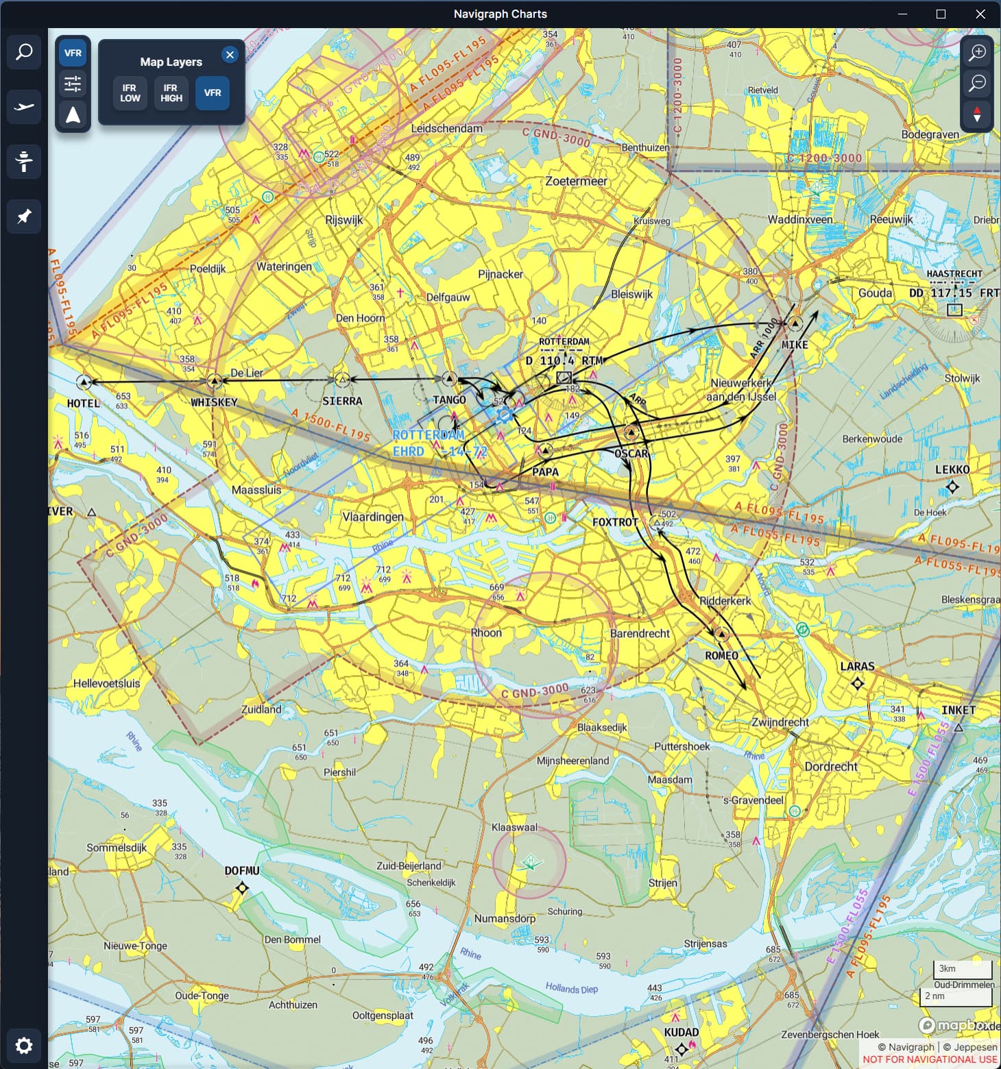
The same goes for Rotterdam actually (as depicted by my picture in the message above), but usually ATC is quite relaxed and if you have a reasonable request, it is allowed 9 out of 10 times. (Back to the field via the river, exit via the north, couple of 360s over the city, etc. As long as you don’t hinder IFR traffic (you do need to fly 1000-1500 ft usually) it’s not really a problem.
The VFR routes are there for when it’s busy, you’re lazy or you’re unknown to the area
I think you might be looking for something like a VFR Flyway planning chart.
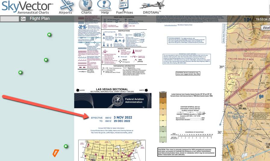
If you go to Skyvector.com, and zoom in on for instance, the Los Angeles area, you’ll see among the buttons in the upper righthand corner “LosAngeles FLY”.
Many high traffic areas in the U.S. have these on the back of the Terminal Area Charts. The idea is to help a VFR pilot navigate sophisticated IFR areas with a minimum of fuss, and maybe even not having to talk to ATC at all.
They have large arrows, and diagrams, and even the shapes of the landmarks are often drawn on there to help you identify them.
They have markings for suggested VFR routings, and they show markings for the common IFR routes and altitudes which helps you know where NOT to be, or at least where to be very careful.
Sky Vector has various “levels of charts” for viewing. If you go to the little search box on the left side, and put in a code, it will take you to that point. On the right side of that page are various “flight levels” you can view or have as a default if I understand it correctly. Navigraph Charts 8 to me is mind boggling and yes, I need to watch a video on it, but I should know what I am trying to accomplish first otherwise I get information I do not want at that time. It must be my old brain cells just refusing to put anything else inside them, as more and more it just goes over my head.
Indeed, VFR flights over Moscow are not legal but Matthias Rust ignored that restriction back in 1987 in a rental C172. Could not manage to land on the red square due to many pedestrians but toched down on a nearby bridge or parking lot.
Comparable situation in Washington DC where Frank Corder landed on the south lawn of the white house.
He died on impact after he crashed the stolen C150
I should have touched on this directly in my first response…
Sectional charts are the standard for VFR Navigation. The U.S. ones are all on SkyVector, but other countries are less well represented. It can be difficult to get VFR Charts for a lot of the world in a inexpensive online format. And of course the content varies.
Navigraph’s VFR maps don’t look really like the U.S. sectionals I’m used to, but they are better than the IFR route charts for sure (if you’re flying VFR). And they have good world wide coverage.
Anyhow, my knowledge is all U.S. And I can tell you that skyvectors U.S. sectionals are exactly the charts used here. They do show navaids, and intersections etc that are used by both IFR and VFR pilots, but what they have that IFR do not is topographical shading, markings showing urbanized areas (yellow), major highways, large electrical transmission lines etc that would be useful when navigating by visual reference.
If you have skyvector showing ‘World VFR’ (with all the maps seamlessly connected) you will not see the map legends and notes… So if you’re not familiar with what these charts contain, click the button at the top right corner that just has the chart name. It’ll be up there near the buttons for ‘world vfr’ ‘IFR High’ ‘IFR Low’ etc.. you should see one with (for U.S. at least) a major city name, such as Los Angeles.
Once you have the sectional chart displayed with that button, you will be able to see all of the notes on how to use the charts, what the symbology is, etc, and even the back side of the chart which often has a LOT of helpful additional information.
You will notices that the Navigraph map includes more detail than the SkyVector map for the same area, but neither includes any obvious topographical detail
I really don’t know where to get current Russian “sectionals” for VFR flying - or even out-of-date ones for my own purposes for that matter.[1] Supposedly Navigraph is the “flight simmer’s outlet” for Jeppson charts which, (AFAIK), is what The Big Dogs, (i.e. real pilots), use.
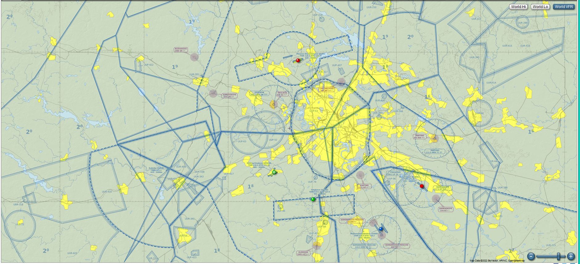
Also, if I am guessing correctly, the areas surrounded by what looks like pink picket-fence facing inward are “You really don’t want to be here now, do you?” airspace. Actually, if the US chart notation is used here, it would be “restricted” but not “prohibited” airspace - which VFR pilots try to avoid anyway.
[1] If anyone knows where I can get new or even used Russian sectional charts, that knowledge would be appreciated.
Years ago I went to a GA hangar office at Worcester Regional, (pre-9/11), and asked about “maps” that pilots use, and the guy there gave me an out-of-date sectional for me to look at and it was interesting!
Yep, also important to remember that in some countries (I don’t know if Russia is one), VFR private avation is a pretty rare unicorn. So there might not be conventional charts.
I know in some parts of the world the charts are still controlled by agencies that will not make them freely available. They are a revenue source. So getting them for hobby purposes isn’t reasonable.
You are correct if you apply the U.S. style rules to that marking it would indicate restricted airspace. Even in the U.S., ‘Restricted’ is sometimes actually ‘Prohibited’. A great example of this being the area around Groom Lake Nevada, more popularly “Area 51”. This airspace is R 4808 N, a restricted airspace.
But I can guarantee you that airspace operates as if it is 'Prohibited" and you will never get permission to overfly that area. I suspect the reason it was done this way was when that base was actually still secret, they didn’t want to show a Prohibited space out there that would attract attention.
Typically a ‘restricted’ space is available to fly over sometimes. Normally the restriction is military, but if nothing is going on in the area, the area may be deactivated.. And you can get permission to enter. But, places like Groom Lake, that never happens. It is prohibited even tho not marked that way. Kind of next down the list in that regard would be Military Operations Areas (MOA), these are often available to fly through, but will be activated when military activity is going on, and during those times will require special procedures, or may not allow you to enter. Those are all over the place in the U.S. Notes are on the charts as far as what agency to contact for information.
Anyhow, sorry with your difficulty finding decent world vfr coverage. You’re not alone!
Based on the few articles I have found on the subject, GA flying is a growing hobby, especially in more remote areas, and I hear that there are airports and aero-clubs that are just ITCHING to get you behind the wheel, (yoke ), of an airplane.
If I remember rightly, getting real, current, sectionals in the US isn’t free either. Just so long as the cost isn’t prohibitive, I don’t mind.
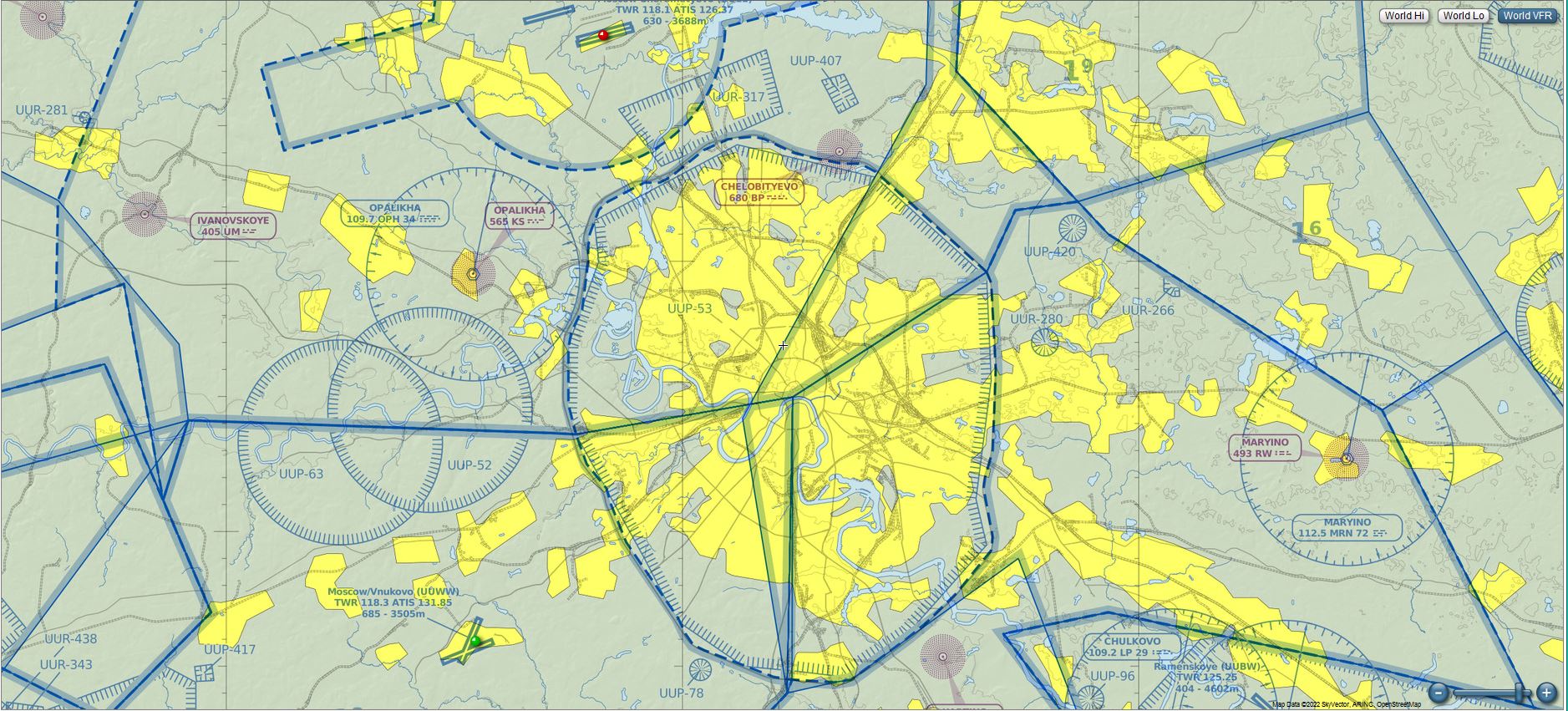
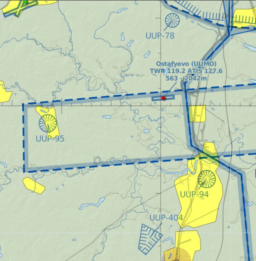
Here’s a close-up of Moscow. AFAIK “UUP” = prohibited and “UUR” = restricted.
The area near top center, marked UUP-78 is the training and administrative area for what used to be the KGB - kind of like Langley Virginia.
UUP-95 is, (AFAIK), the administrative and training facilities for the Russian army intelligence.
UUP-94 is a facility in Podolsk that is used both by the police and the government for certain administrative functions. I can’t imagine why it would be restricted, people go there all the time to get driver’s licenses, accident reports, and such-like. Maybe the restriction is left over from Soviet times?
UUP-404 is, if I remember rightly, a training area of some kind.
Most of this stuff is visible via Google/Yandex maps so it can’t be that secret.
I’m still trying to find out what the blue-dotted-lines represent.
Correct. But they are revised frequently, so even ‘old’ ones are accurate enough for sim. Sky Vector’s charts are very recent. Just now I looked at their Las Vegas sectional and it is marked as valid through tomorrow!
I don’t know how the rules work for their website exactly, but that chart is 100% current even if it might be marked as not for real world use.
It doesn’t always indicate anything is secret, they just don’t want anyone flying near it for some reason.. Those markings are such small areas you could easily see into that area without flying in the restriction.
In the U.S. restrictions like that are common around tall antenna farms, or tethered radar or camera balloons. If you look along the mexico border with California and Arizona you will see some of these where they have surveillance balloons tethered to 15000ft. Those tethers are hard to see, so they just don’t want you flying there as it is a danger.