Okay. As it seems to be the most appropriate of all the post concerning OpenStreetMap usage, I’d like to share and summarize what we know.
Autogen is definitely capable of utilizing OSM data, it’s confirmed by a funny cases like this.
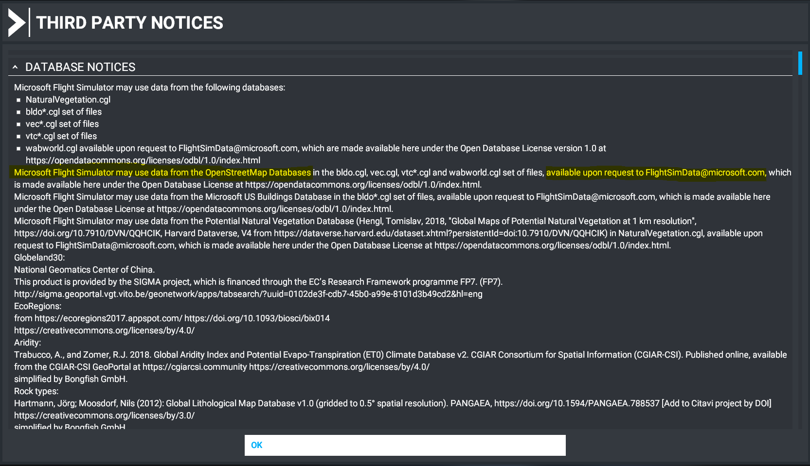
But here are hard proofs in licencing/database notices:
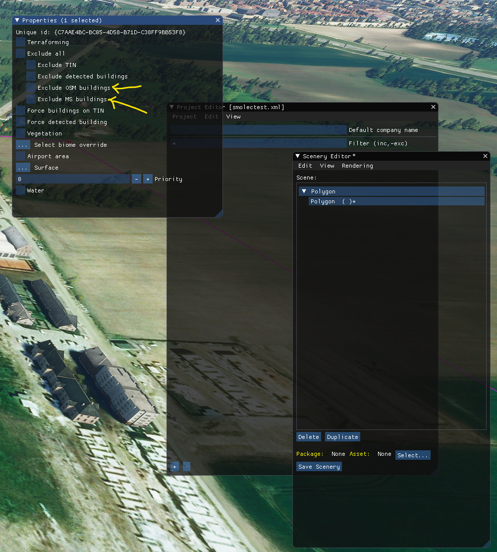
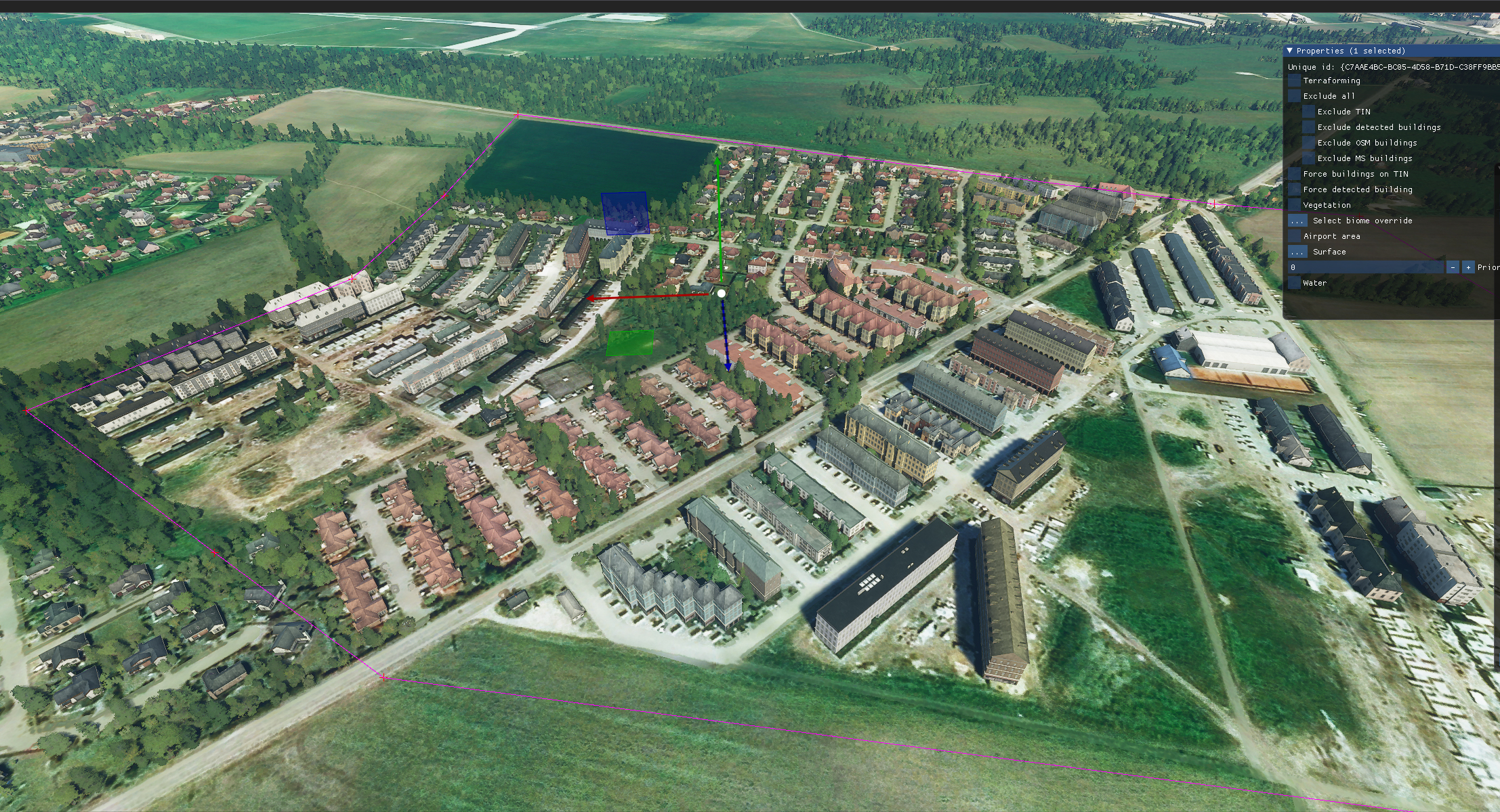
and SDK tools in which we’re able to exclude OSM buildings or MS buildings:
We know what specific tags are being used by the autogen, as @AlphaMutyoro shared info:
‘height’ tag is not work
‘building:part’ is seems like ignore
‘building:level’ is effecting
roof shape tag is not concerning.
SOURCE: Community Driven World Builder in SDK Discussion
However, OSM data in many regions seems to be outdated. Examples:
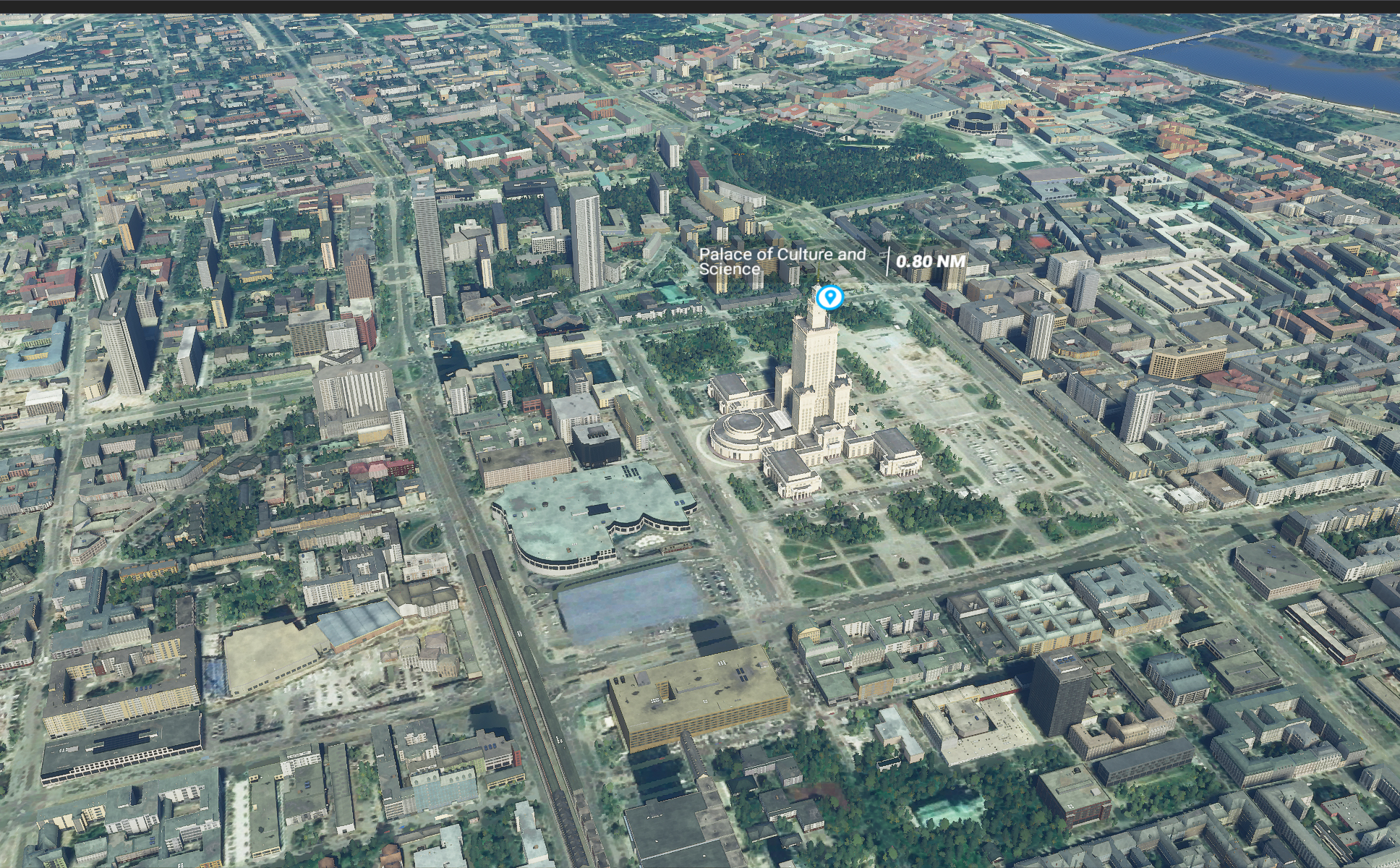
Many skyscrapers in Warsaw (Poland, EU) (which even got itself custom 3d model from Asobo team) have correct 3d models in OSM:
same view in MFS using OSM data (checked with DevTools to be sure) looks like this:
we can see many ignored buildings or interpreted in confusing way.
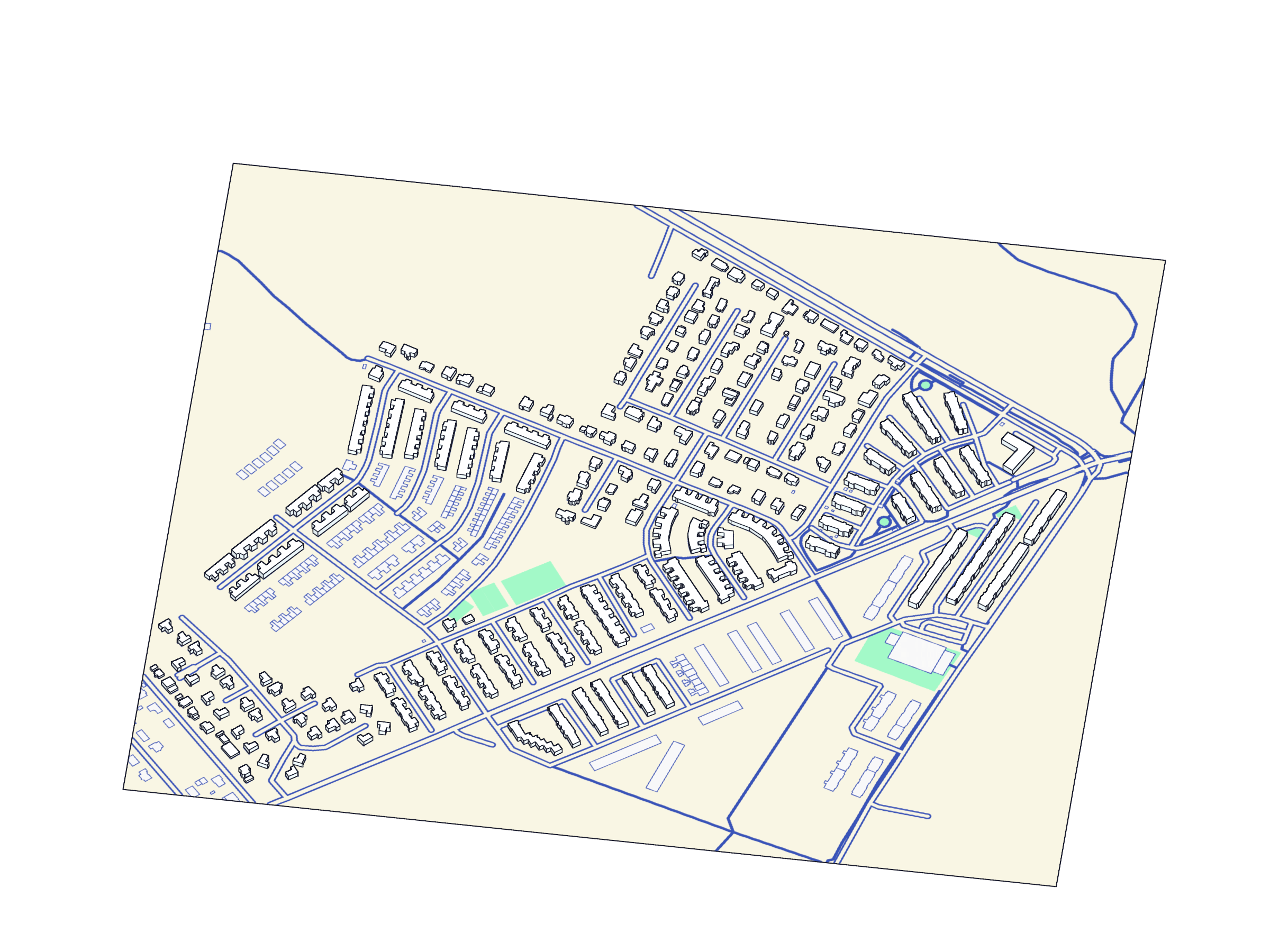
There’s also small neighbourhood near my home airport EPWR with OSM data which I updated, so it’s accurate:
same view in FS:
The last example has the right to be outdated, as I’ve submitted the changes like 3 days ago.
From that all it seems to me, that FS autogen is definitely not streaming OSM data directly from OSM, but probably relies on OSM data stored on FS servers. Because of that Warsaw example I bet either that OSM data is old, or it’s old AND further processed and misinterpreted by autogen algorithms.
It would be super nice to get official info from the Dev Team on how this process actually works, especially how frequent are the updates and will we be able to improve FS experience through updating OSM data without messing with publishing scenery packages.
quick update:
I’ve sent an email to FlightSimData@microsoft.com and  tweeted a question regarding OSM data update frequency, and looking forward for them to reply so I can share the official info