where does the live weather data in msfs come from?
is it possible to find the same data without beeing airborne (ore using the sim)
Lets say you want to do old school manual flight planning, using wind and temp data along a planned route, to plan for a certain course, wind correction angle excpected GS and TAS etc. for an alltidude of eg 20000 feet, and to do this anywhere in the world, and when airborne at cruise leve in the sim, the winds will be the same along the route.
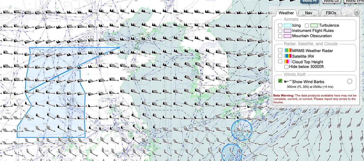
Each barb shows direction and strength. A single line (“feather”) is 10 knots, half a feather is 5 knots and a triangle is 50 knots. Altitude is selectable from the settings icon. The screen shot is showing winds at FL300.