Hello everybody
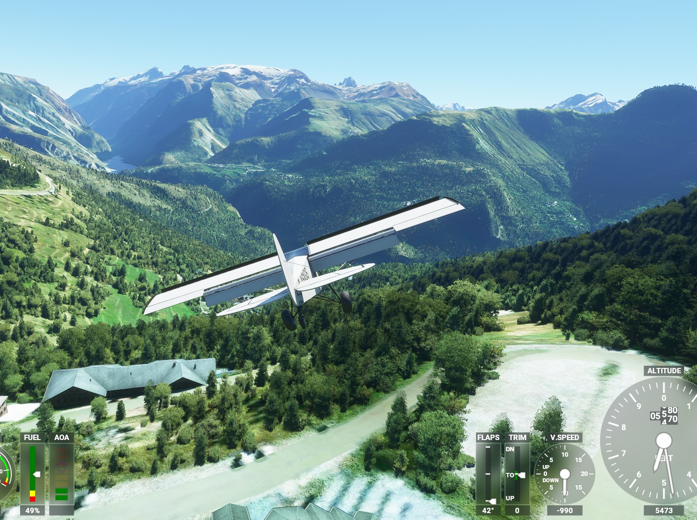
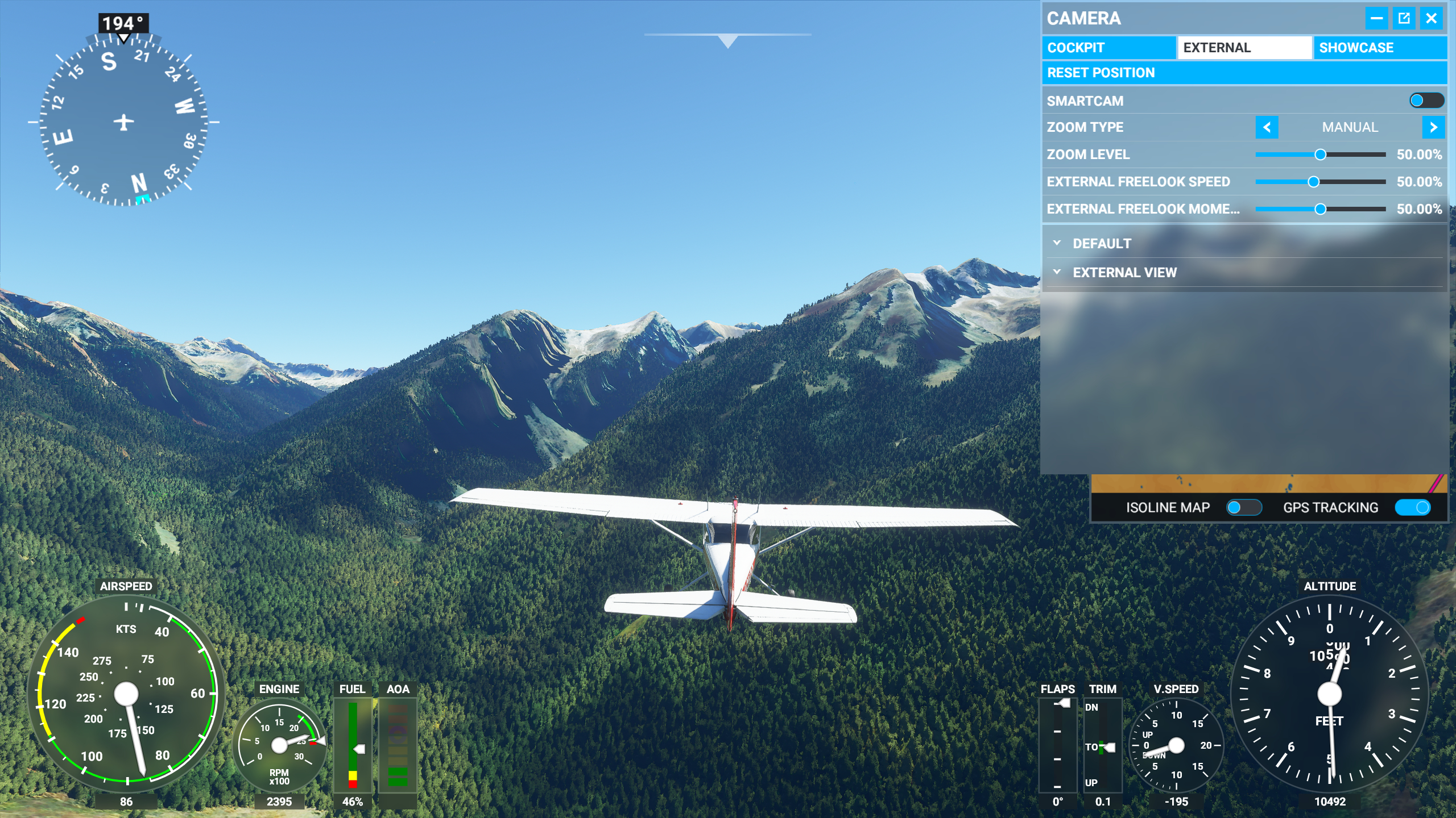
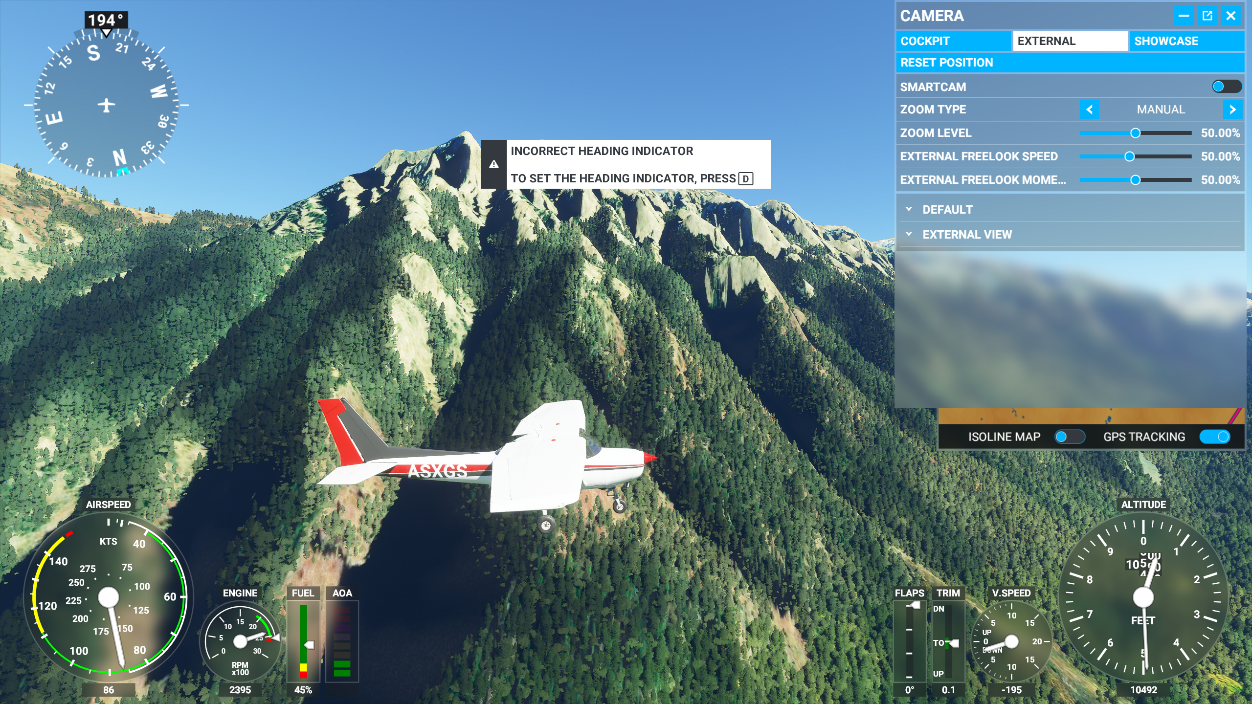
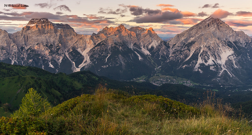
I’m pretty sure I’m not the only one who finds the geometry data of mountain areas in the Swiss, French and Austrian alps very underwhelming.
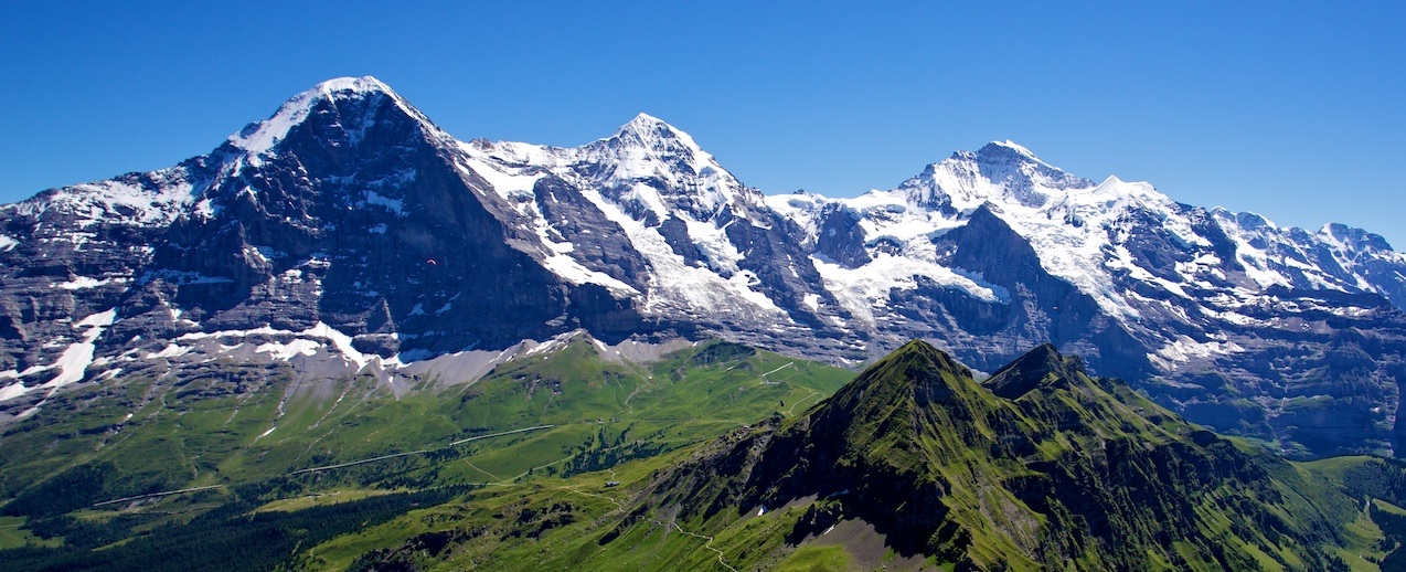
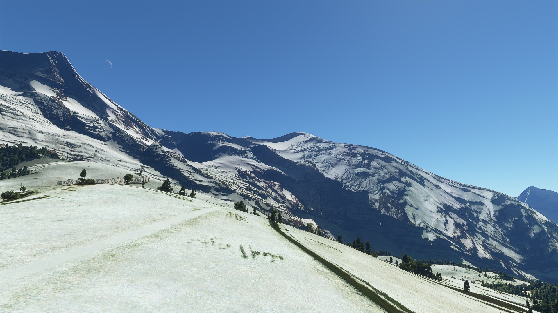
I just flew over the famous Matterhorn, the Jungfraujoch, Eiger, and all thouse world wide famous mountains… and: It’s just sad.
The geometry of the terrain is so low resolution (tested on “ultra” settings of course) that is simply almost impossible to enjoy the area.
Is it still fun to fly? yes, sure.
But overall I’m a bit shocked how poor the data is.
The terrain data and detail on Google Earth (on my PHONE!) has about 100x (not exagerating) more geometry and details.
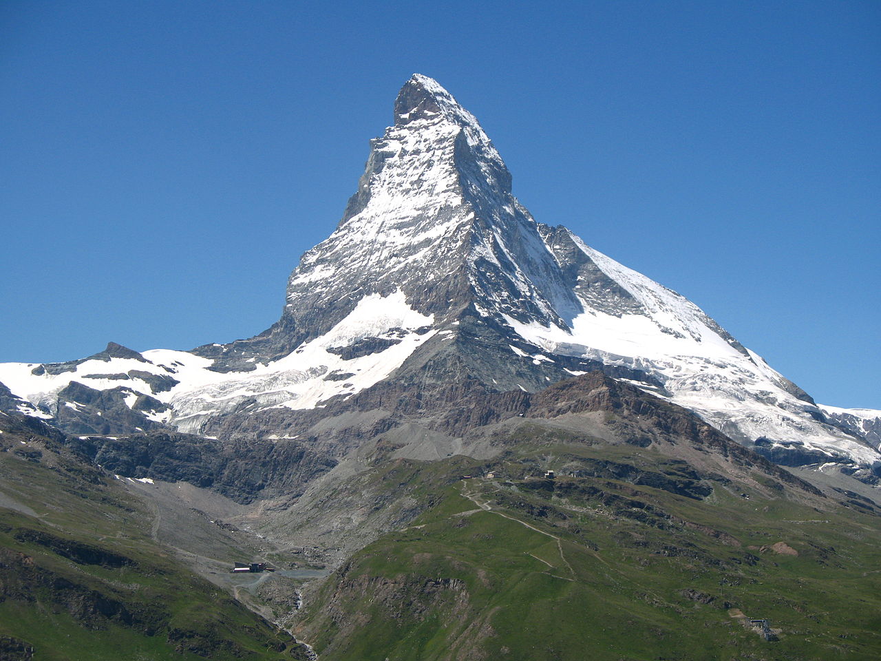
Compare the “Matterhorn” mountin in the sim and on Google Earth. In the sim, it’s barly more than a 3D triangle. In Google Earth, it actually looks like the real mountain in all it’s glory.
Now I know, they might have to make compromises because of performance, but I really think that they simply use very poor low res terrain 3d data.
And that’s just said because better data exists! Google has it, and Asobo could even get super highres data of the alps from Swisstopo, Switzerlands landscape topography agency.
I urge everyone who feels the same to write the team via https://flightsimulator.zendesk.com/ and tell them to please use better 3d terrain data, especially in the alps and mountain areas in generall.
Because mountains are really a weakness of the Sim at this point.
Water, weather, coulds, planes… I love it. But the mountains? Embarrasing 
IMPORTANT ADDITION @Asobo: From today, March 1st 2021, all of Switzerlands 3D-terrain data, geo data, maps, etc. of the government (Swisstopo) is available for free.
PLEASE make use of this incredible dataset to give us a very detailed mountain terrain and a very accurate representation of Switzerland in general.
kind regards
Oliver