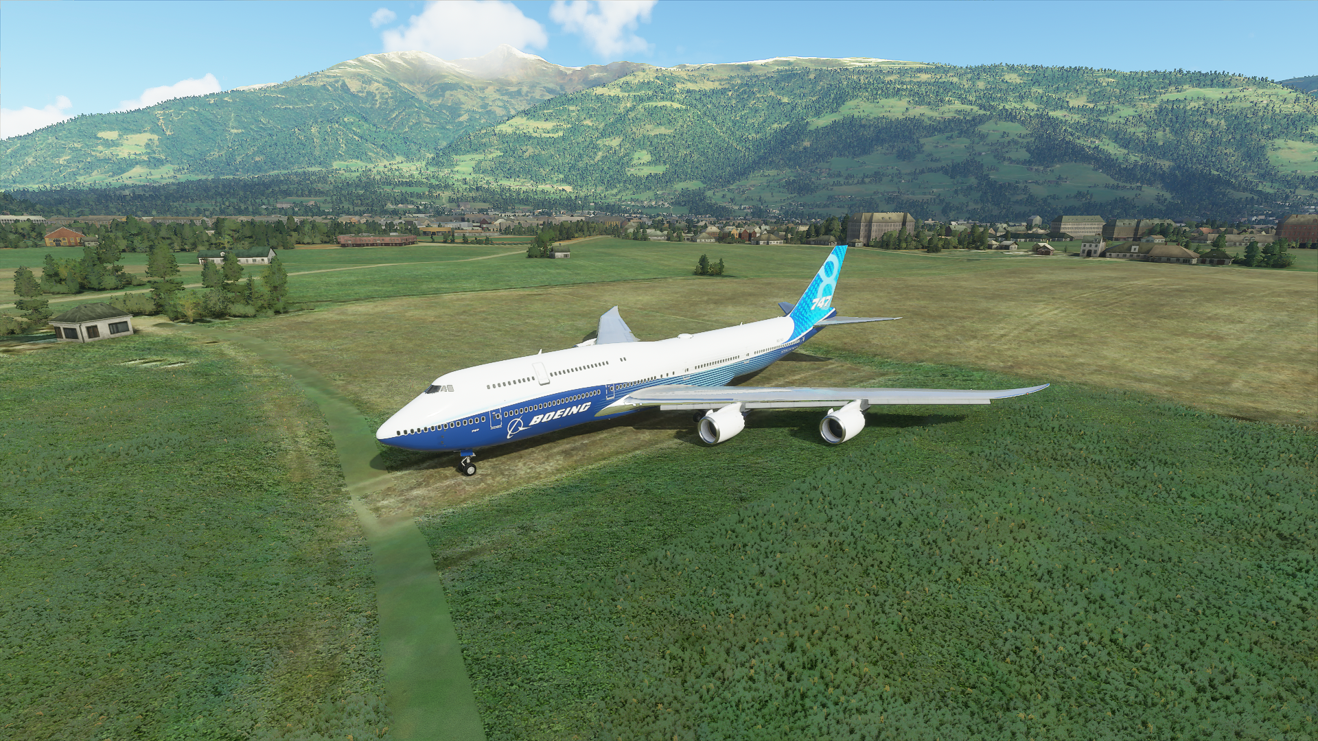
Really? 'E.g. the FS Genesis 19m mesh for the Alps was sufficient to depict the mountains quite realistically, especially considering the performance impact and morphing problems.
The Cerros in Argentina were one of the first places that I visited in this game and they were so disappointing.
How can Asobo claim to have a realistic world when they can’t even get the general shape of an object measured in units of kilometers right?
I’m all for better resolution especially on roads but I wonder if you could say that if you blew up the image on your phone to a full-sized large monitor. Put another way, shrink your large monitor down to phone size and I bet it would look incredibly crisp and detailed. Also, I’m often blown away on how much better all mountains are at least pretty much all of the US mountain ranges compared to anything Orbx regionals put out. But sure, bring on more resolution this is one of the main things that keeps MSFS from passing the FS Turing Test. Just need major increases in hardware as well presumably to cope with big increases in resolution.
I think you missed my point regarding my comparisson to Google Earth on my phone:
I was simply making a point there, and that is: A normal phone running Google Earth can show more and better 3D landscape geometry than an expensive highend computer with FS2020.
Not because the phone is more powerful, but because Google Earth simply has much much better 3D data than FS2020.
The resolution of the phone display is rather irrelevant. Compare it on the PC if you like, does not matter.
They point is the resolution of the terrain. NOT the display who shows the content.
Sure, a 1080p display needs less “power” than a 4k display, but that’s completelly off topic.
We are talking about terrain resolution and also accuracy here. Not about display resolution.
I’m sure you have seem all the examples above in this thread.
We don’t talk about display resolution or display size, we talk about the detail of the terrain. Or actually: The lack thereof.
(And yes, I know: Google Earth of course does not have cloud simulation, sky illumination, etc. I’m aware of that. But terms of raw geometry and satellite textures, at least in the alps, it’s WAY ahead of FS2020 and that is a real disappointement)
I guess the Japan worldupdate that is going to be released in a few days will give us a glimpse into what “better DEM” will mean… Hopefully…
1 Like
I know the point you were trying to make, and my point is when you look at a given image’s native resolution on a big screen detail will be obscured/spreadout compared to that same image on a tiny screen. Those low resolution pixelated details tighten up and so become more visible on the tiny screen. The only thing that really takes this to objectivity is: what is the difference in the image capture resolution of GE v B date that is used in MSFS. Also, there will be a point after which utilizing higher resolution capture will translate to more data than can be processed by current hardware.
Another example are the cliffs of Faroe Islands that were such a disappointment. I recently flew over the Zion National Park area in Utah and even those mountains were a disappointment ![]()
All the northern coast of western Europe looks totally bland too, no steep sand dunes behind the beaches. It is just flat with randomly generated buildings sticking out. Steep coastlines seem to be a rarity in general.
Where’s Slartibartfast when you need him?
4 Likes
Jorg said in the latest Q&A that Japan is 5m resolution
The low mesh problem is all the more prominent when the ortho resolution is much more detailed than the other sims.
1 Like
Is the ortho resolution really that good though?
In many areas of the new Japan, the satellite images of the landscape are rather low res.
They cover it well because often you have a lot of 3D trees and they cover the bad low res satellite imagery, but especially at beaches you can see that, even in the “new” Japan, texture resolution is not that high in many areas.
2 Likes
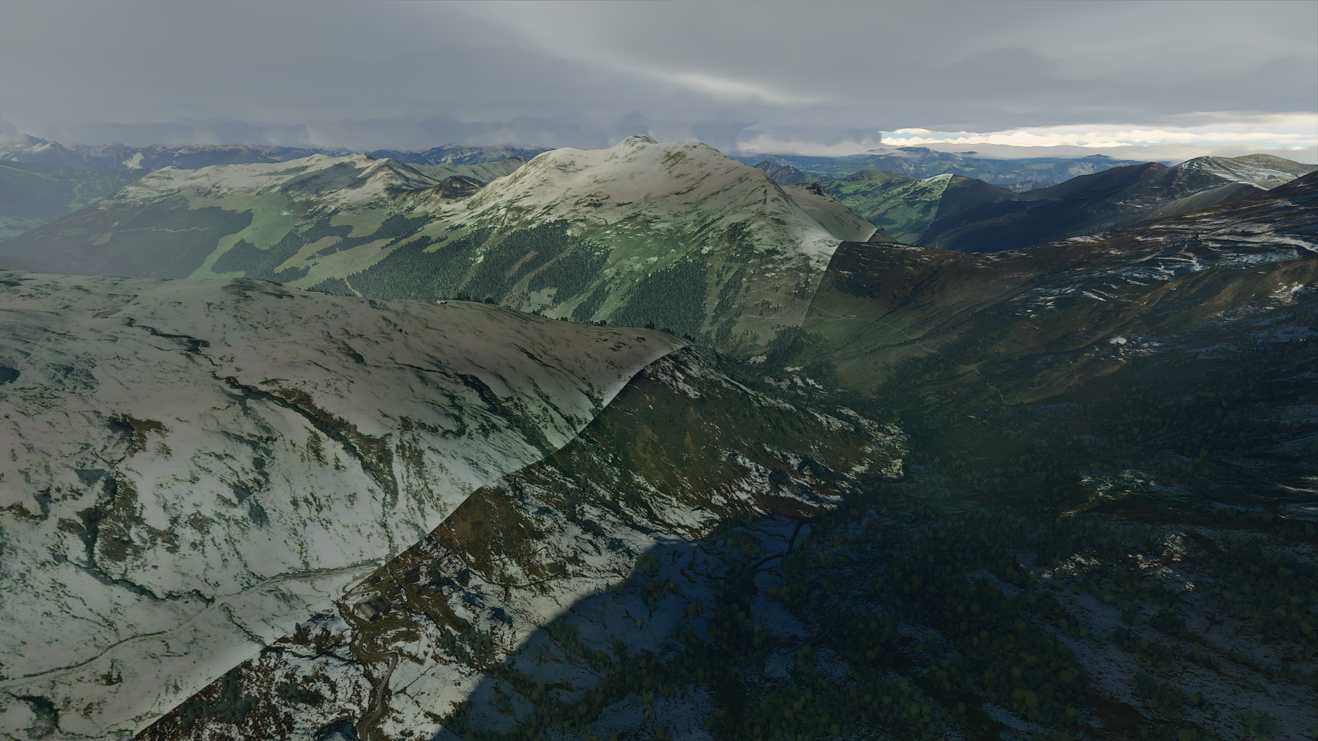
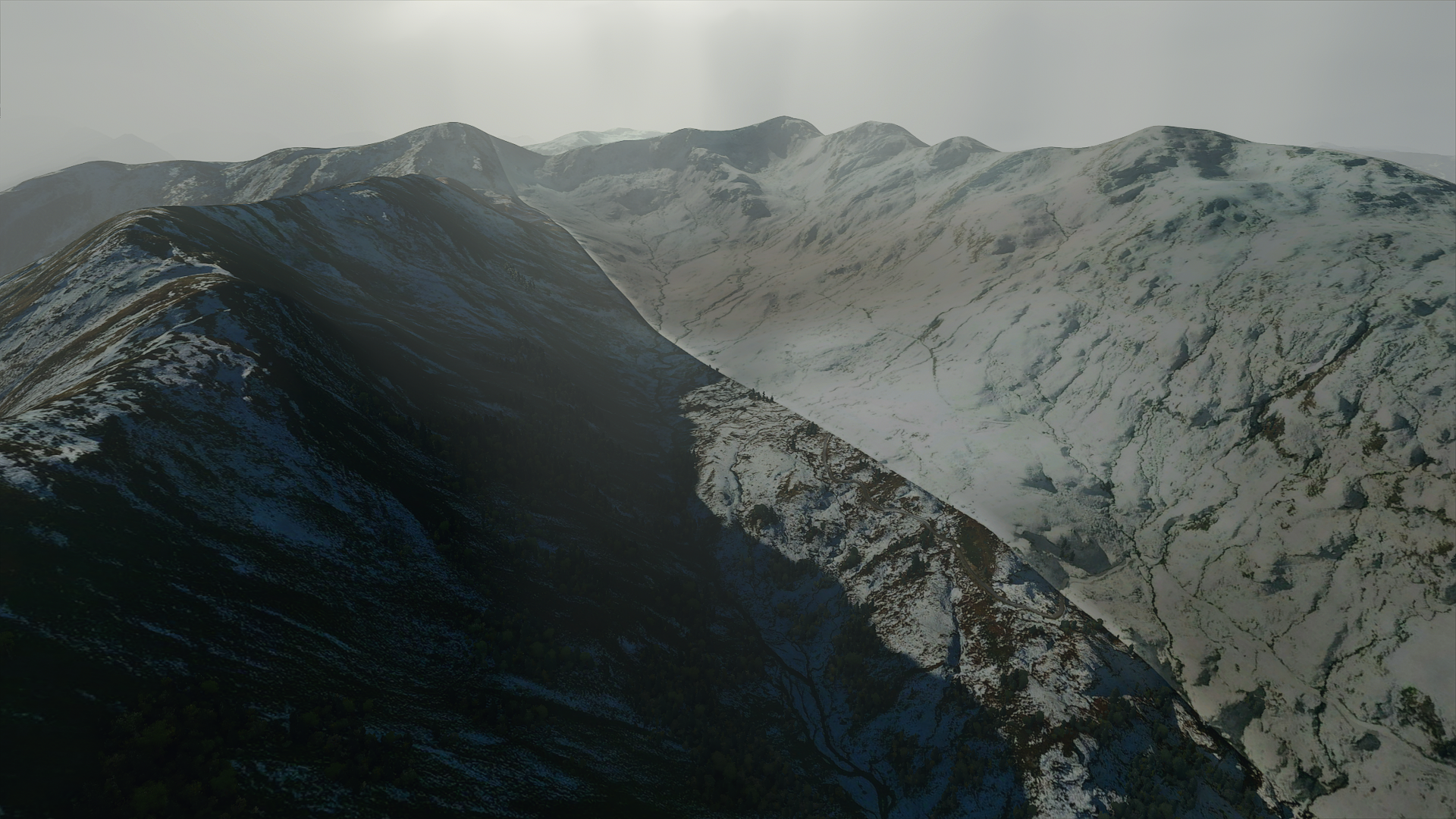
The “new” Japan world update shows that there is still a loooong way to go for proper mountains.
Did you fly over the new mountain areas of Japan? In most areas, there are very harsch transitions between winter and summer satellite imagery. Some areas are covered in snow, and then, in the middle of the mountains, you have hard lines into summer textures.
And the colour tint of the satellite images is a mess too. Very often in the new Japan, but also in the “old” alps we currently have, mountain satellite images have this ugly green tint.
Everything is slightly greenish. Snow, rock, everything.
It looks very realistic. And in many of the new Japan mountain areas, this changes all the time… you have squares of greenish tinted textures, then right next to it braunish tinted ones, blueish tinted ones as well… often combined with ugly hard lines between winter and summer satellite imagery as well.
3 Likes
i prepared to write comment as situation about elephant in the room, but before - start searching, and found this thread… yes it’s most annoyed for me, even more than ctd, when i see snow wherever it is when +15*c i feel very big discomfort
The mesh is disappointing, the seasonal switches are just as annoying
And what is this?
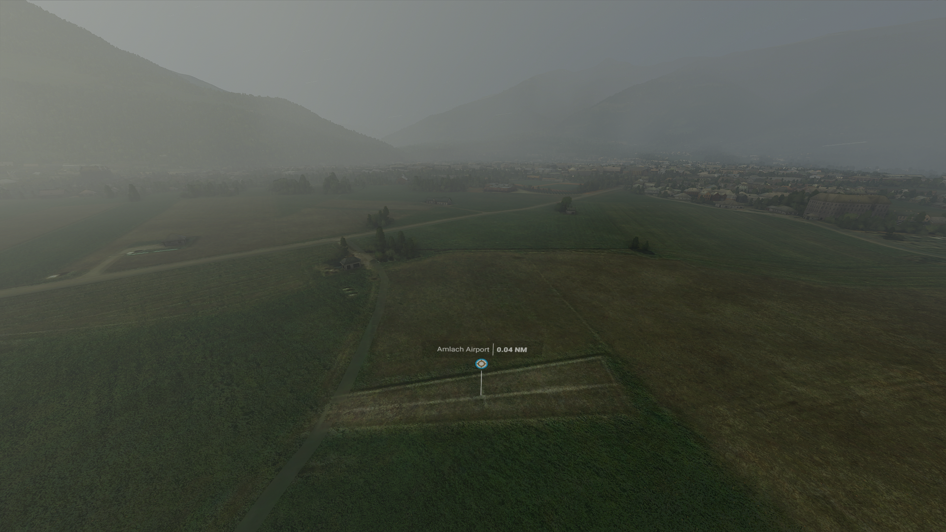
Apparenly an airport with 246ft grass strip!
Challenge accepted
There are worse places, Santorini, *Best Island in Europe ” title for the sixth consecutive year.

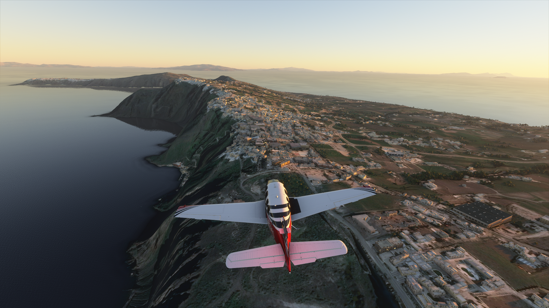
That’s the best angle I could get
I don’t get why the USA gets an update next, although Bryce canyon needs it.
I guess it only looks good where photogrammetry is available, like Naples (despite weird trees)

(Mount Etna is a mess, detail switch right across the top, Vesuvius not much better)
3 Likes
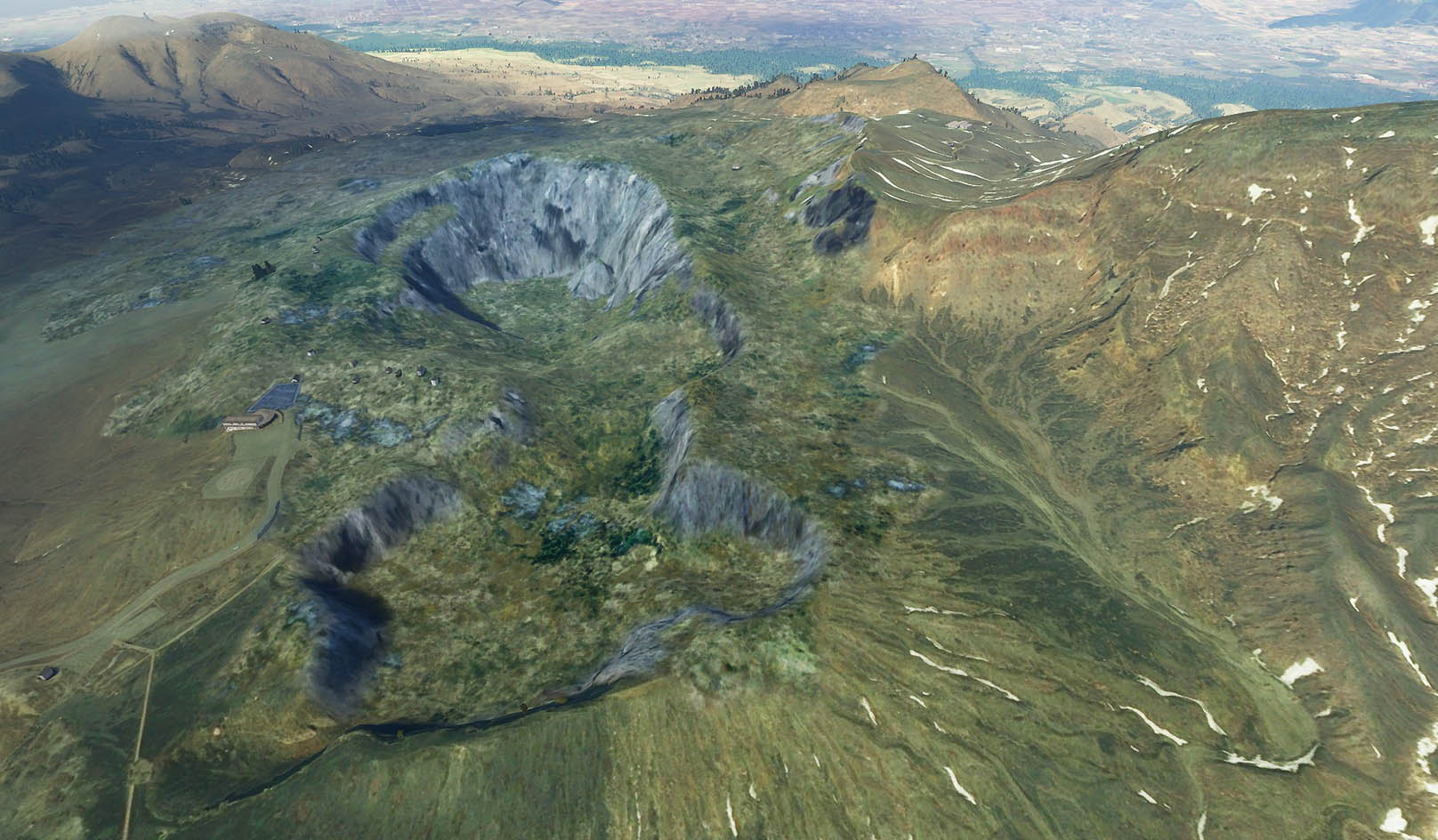
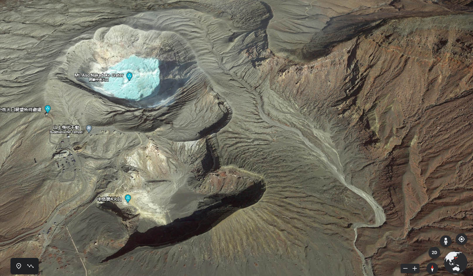
I just checked out “Mount Aso” in the new Japan update.
Attached a screenshot from the (new) DEM of FS2020… and how the area looks in Google Earth (in 3D mode of course).
Gosh I wish we would have Google Earth satellite imagery and terrain quality in FS2020. Or at least something in the middle ![]()
6 Likes
This is clearly not matching the 5m resolution mesh which was claimed with the Japan DLC.
5 meters ^^
1 Like
Do you mean this looks like 5 meters or it was claimed Japan ships with 5 meters? Just let me know so that I correct my post.
It was claimed by MS that Japan world update shipped with a 5 meters DEM
thank you, post updated.
I wonder if the ortophoto in MSFS is not deceiving. I was near Fukuoka last December but the railway I think was still closed.