Cool  Was slewing around there!
That’s amazing, well done!
While I can land using ILS (thanks youtube), the whole setting this up seems to be a lot of work using the XML files.
I’ll have a look and see what I’ll do with my buildings.
Not really sure if I want to make them freeware yet or ask a few euro for them somehow (my 3ds max license runs out in 15 days…)
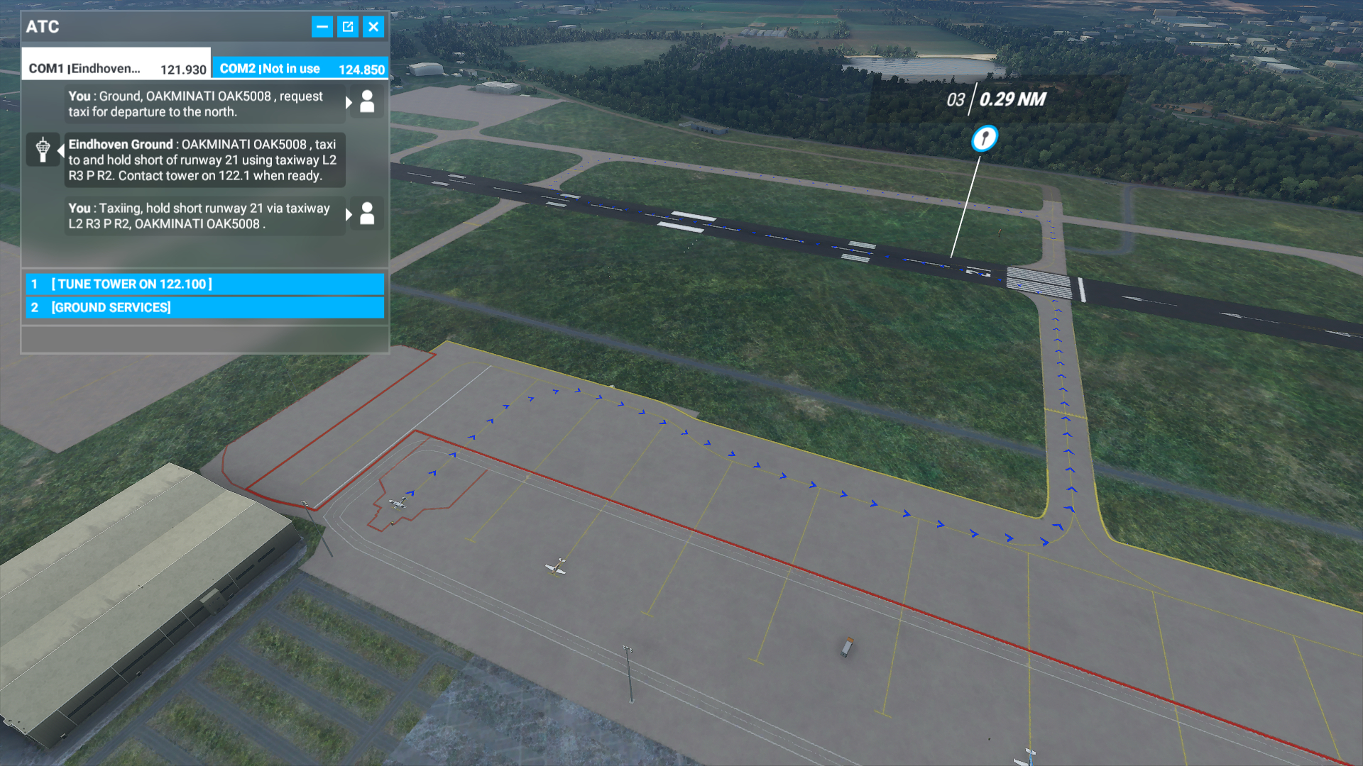
Some progress on the taxi routing;
Just need to see if I can get ATC to tell you to cross the runway from L2 -> R3. Also, I probably need to “close” R2 so it routes you to R1 to enter the runway ([Freeware] Eindhoven Airport - EHEH (WIP)).
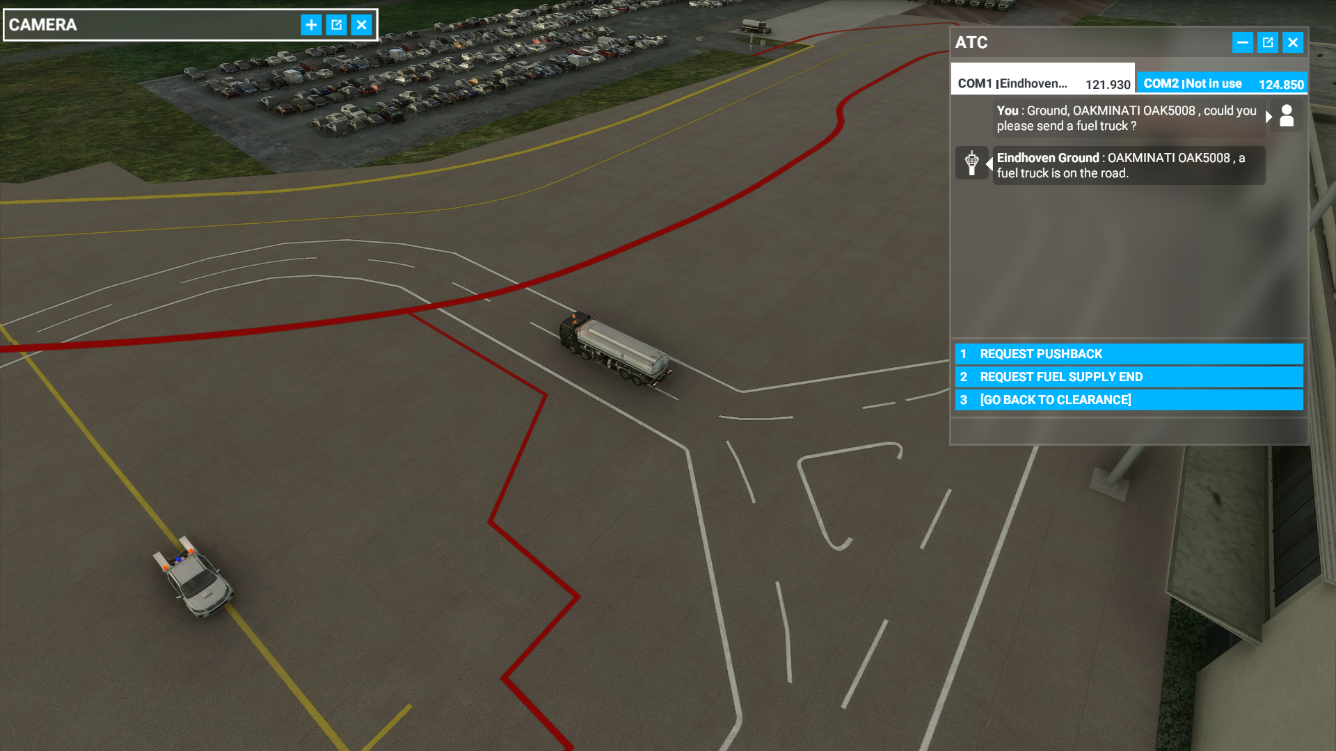
As a bonus I have added a vehicle route around the parking spots and a vehicle spawn so requesting fuel is also possible already in the next update!
2 Likes
Thank you for this! I will install it in a hit and try out the ILS for you. Looks amazing!
ILS not working. There is no GS information, and LOC signal works as a VOR, meaning the plane doesn’t follow automatically when engaging approach. The EHZ/EHO are at the right runway and recognized depending which way you are approaching
Right, no glide scope, I saw the ILS icon on the map already indicating it didn’t have GS but now we are sure, will be looking further into this, I hope I don’t have to set up waypoints, SID, and STAR routes first for this 
If you want to, I can take a look for you to figure out the ILS. Thought I saw a glideslope somewhere when I was spitting through the SDK when I tried to make my own EHEH
If you could that would be appreciated, always handy to have a second pair of eyes.
At the moment I have this defined under airport
<Airport region="Eindhoven" country="Netherlands" state="Noord-Brabant" city="Eindhoven" name="Eindhoven Airport" ident="EHEH" lat="51.45118066342770" lon="5.37920478382411" alt="23.25191453751177" magvar="0.000000" trafficScalar="1.000000" airportTestRadius="2100.00000000000000" applyFlatten="TRUE" isOnTIN="FALSE" starAirport="TRUE">
<Com frequency="124.530" type="APPROACH" name="Eindhoven Arrival"/>
<Com frequency="122.100" type="APPROACH" name="Eindhoven Arrival"/>
<Com frequency="131.005" type="TOWER" name="Eindhoven Tower"/>
<Com frequency="122.100" type="TOWER" name="Eindhoven Tower"/>
<Com frequency="121.930" type="GROUND" name="Eindhoven Ground"/>
<Com frequency="126.030" type="ATIS" name="Eindhoven Information"/>
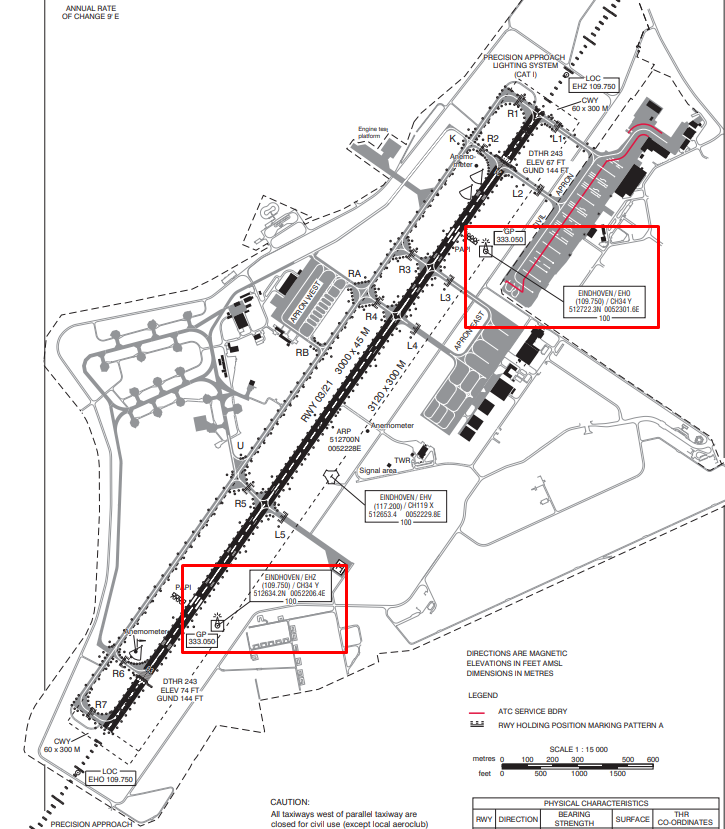
<Ils lat="51.462503" lon="5.388386" alt="73.3F" heading="34.99" frequency="109.750" magvar="0.0" ident="EHZ" width="5.0" name="ILS RWY 21"/>
<Ils lat="51.437525" lon="5.360386" alt="66.6F" heading="215.01" frequency="109.750" magvar="0.0" ident="EHO" width="5.0" name="ILS RWY 03"/>
</Airport>
So no waypoints to SID/STAR routes defined.
SID/STAR shouldn’t be a prerequisite for a ILS. Did some forum search, seems like you have to add in a glideslope somewhere within the ILS code. I’ll take a closer look and test some things out after I got some sleep. Tired and code searching don’t mix
1 Like
Hmm, went through the SimpleNavData.xml in the SDK documentation and the documantation itself, couldnt find anything related to ILS Localizer/Glideslope. The code you have is exactly like described in the SDK, so its really weird that it doesnt work. But i found in the BGL that both ILS are missing their glideslope flag, and nav.
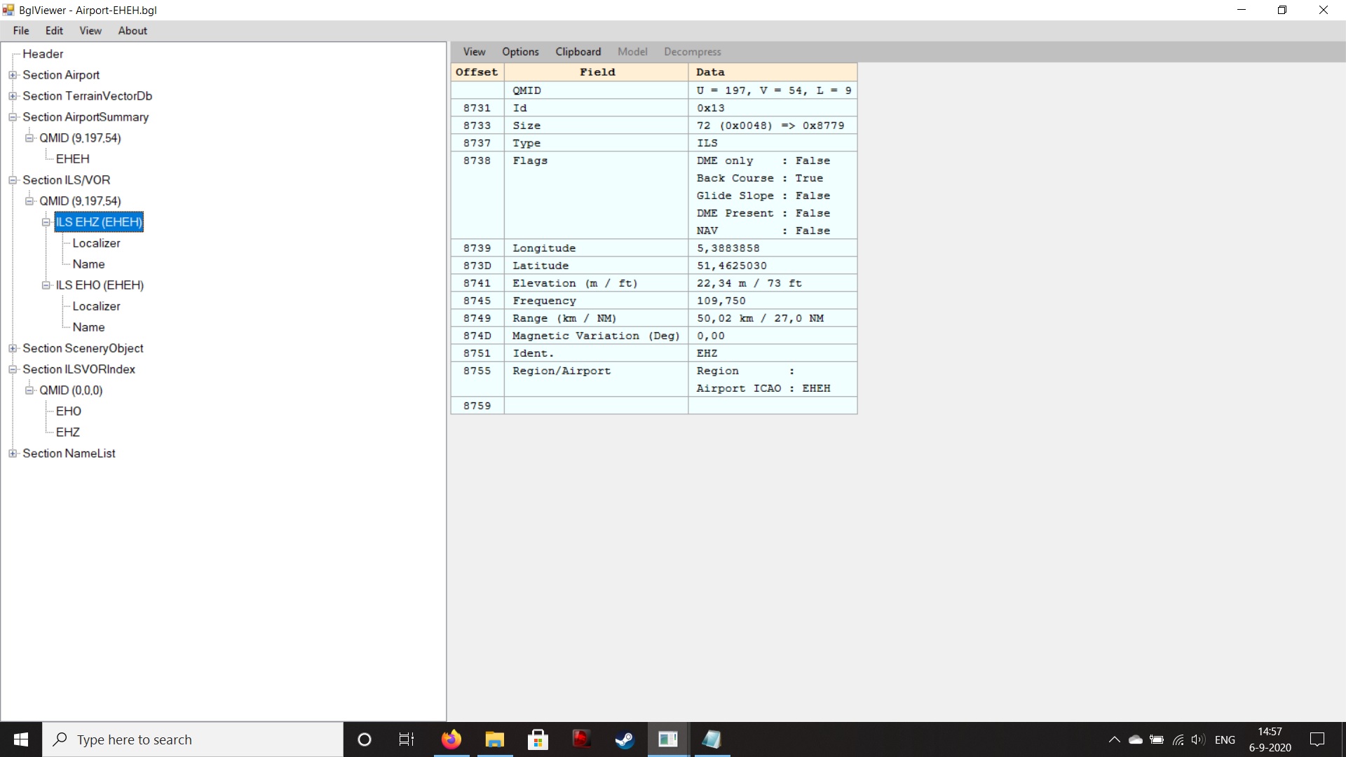
Which makes me suspicious that the ILS are recognized as VOR instead of Loc/GS, which support my previous point mentioning the plane doesnt follow APP when testing.
I’ll try to find out some more and ask on the Discord, but evert post i read regarding ILS so far is that we’ll probably be bette roff waiting for the SDK update 
Hmm yeh, same with taxi navigation, there seem to be some issues with as well, especially having ATC tell you to cross the runway and in some cases it might even override your set start positions of the runway so it’s all bit fiddely. Question is how long would it be for a SDK or just even a documentation update xD
Also, there seems to be more info missing that cannot be set but is listed in the bgl, like the magnetic variation of the airfield and the Localizer is not linked to any runway as it is set to 0, so that is something as well.
I wasn’t able to get ILS to work either
When I try to set it up it crashes the game.
RNAV does seem to work, see picture

Ye documentation is currently lacking for proper ISL/GS landings, seems indeed the added frequency is only the RNAV. As stated above, when inspecting the BGL i saw that the localizers were not even “linked” to a specific runway and there is no further info at the moment how to do so, so we just have to put that in the back burner.
In the meantime, testing some waypoints and at least the fuel truck is moving towards to the plane and back again to the fuel depot!
Seems that live traffic is also properly working now! Though it is only in a small generic 1 prop plane, hmm, maybe I need ramp_extra instead of ramp_large, I hope I don’t need Gate for this as it needs a jetway and EHEH doesn’t have those!

Hi there,
I am struggling making my own packages with the SDK. It seems to difficult for me. The best I knew was the ADE for FSX and P3D. That was an easy job.
Now on point:
Thank you for this package and keep up the good work! I tested the ILS and I saw that landing is not accurate on ILS freq. 109.75 the airplane steers at the hangar.
Next thing there is unfortunately no G/S. Only the LOC works. Thank you! Again, keep up the good work. Now we have an airport on that missing spot!
Kind regards,
Peter
“Living near EHEH”
version 0.7;
- Adjusted approach lights offset from 30.48 (default) to 10 meters.
- Connected parking spots to the taxiway routes.
- Changed parking spots from medium to large with a radius of 22.
- Added a vehicle spawn point and connected a route to parking spots, for the fuel trucks.
- Expanded the apron a bit to have a fuel truck area with some props.
- Corrected some waypoints and paths.
- Physically disconnected L1 from path so ATC doesn’t use it (temp solution).
- Corrected some taxiway signs.
- Added some extra painted lines on the civilian apron.
- Added Eindhovense Aero Club apron and 3 small parking spots.
- Removed freq 122.100 (tower/approach) as these are emergency freq.
- Removed the runway edge line as EHEH 03-21 does not have this.
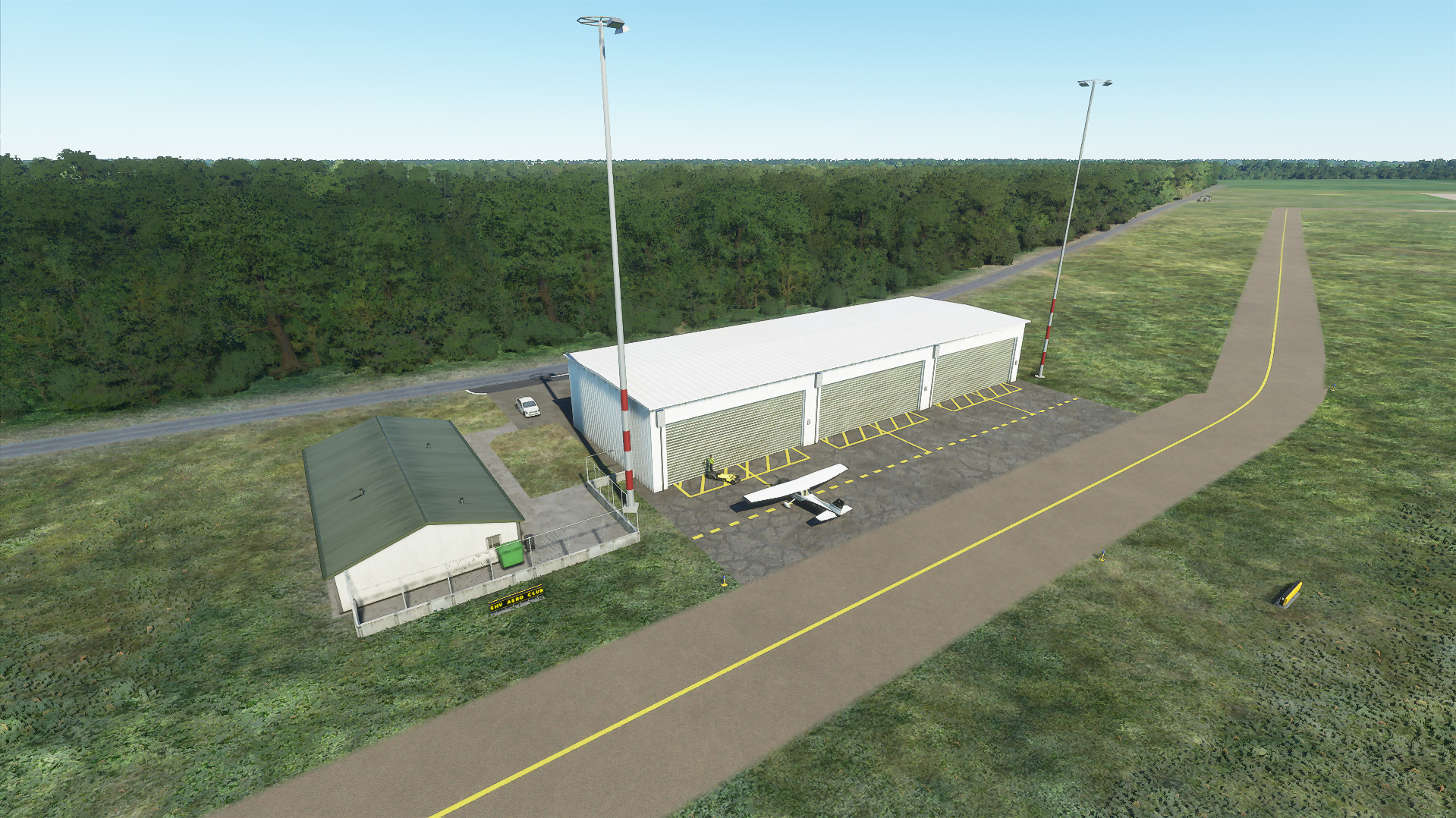
On request from someone of the Eindhovense Aero Club I have added an apron at their club’s hangar and have added 3 small parking spots for a single prop airplane. These spots are on the N general parking place.
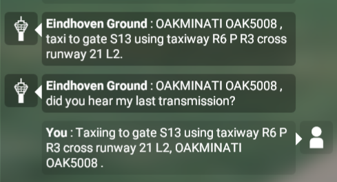
After fiddling around I have decided to disconnect L1 path from the civilan apron so ATC won’t use it as a temporary solution as “closed” taxiway didn’t seem to be honored at the moment. On the other hand, routing is now correct, though it doesn’t say to cross or use the runway from L2 > R3 unfortunately.
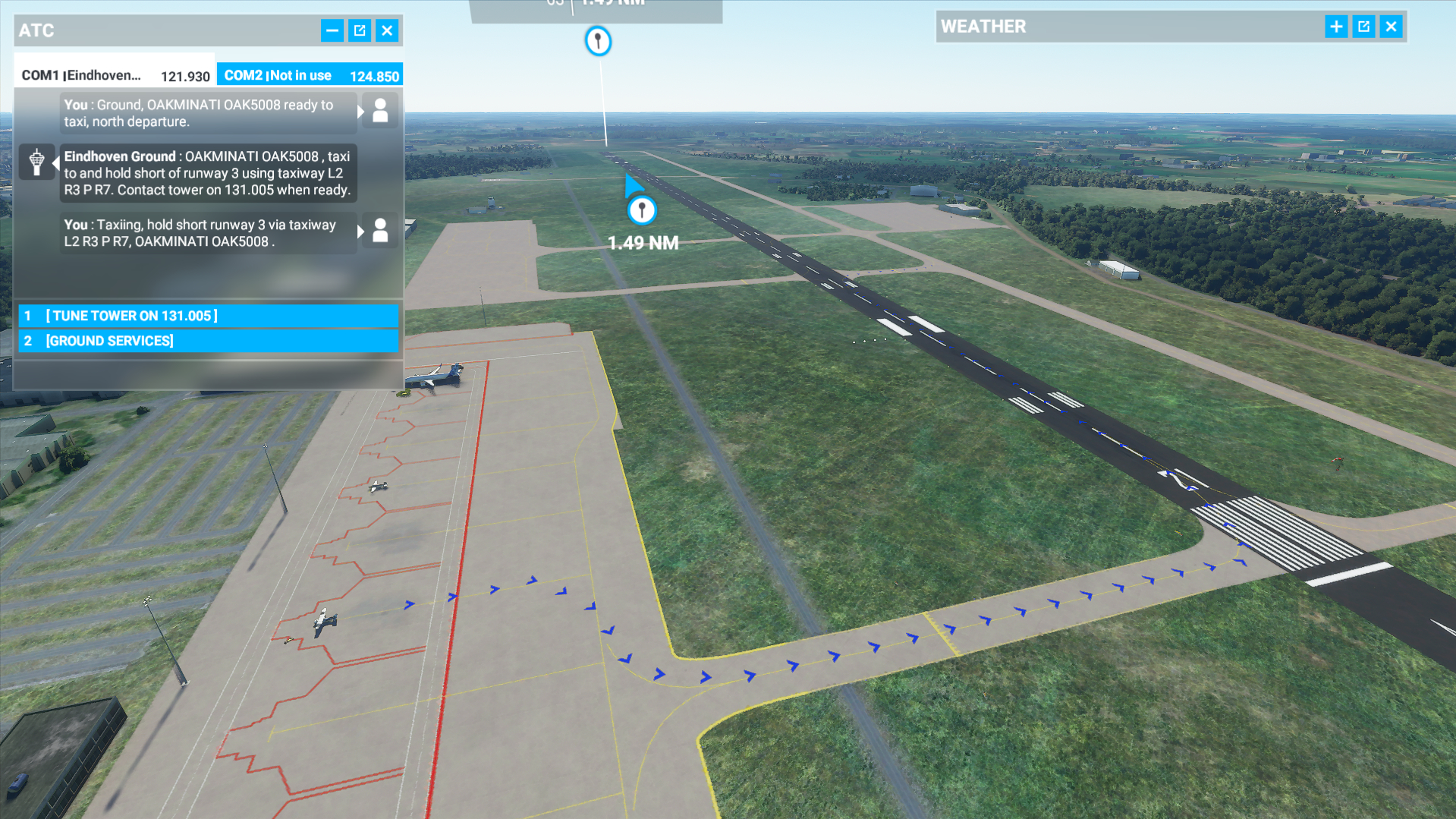
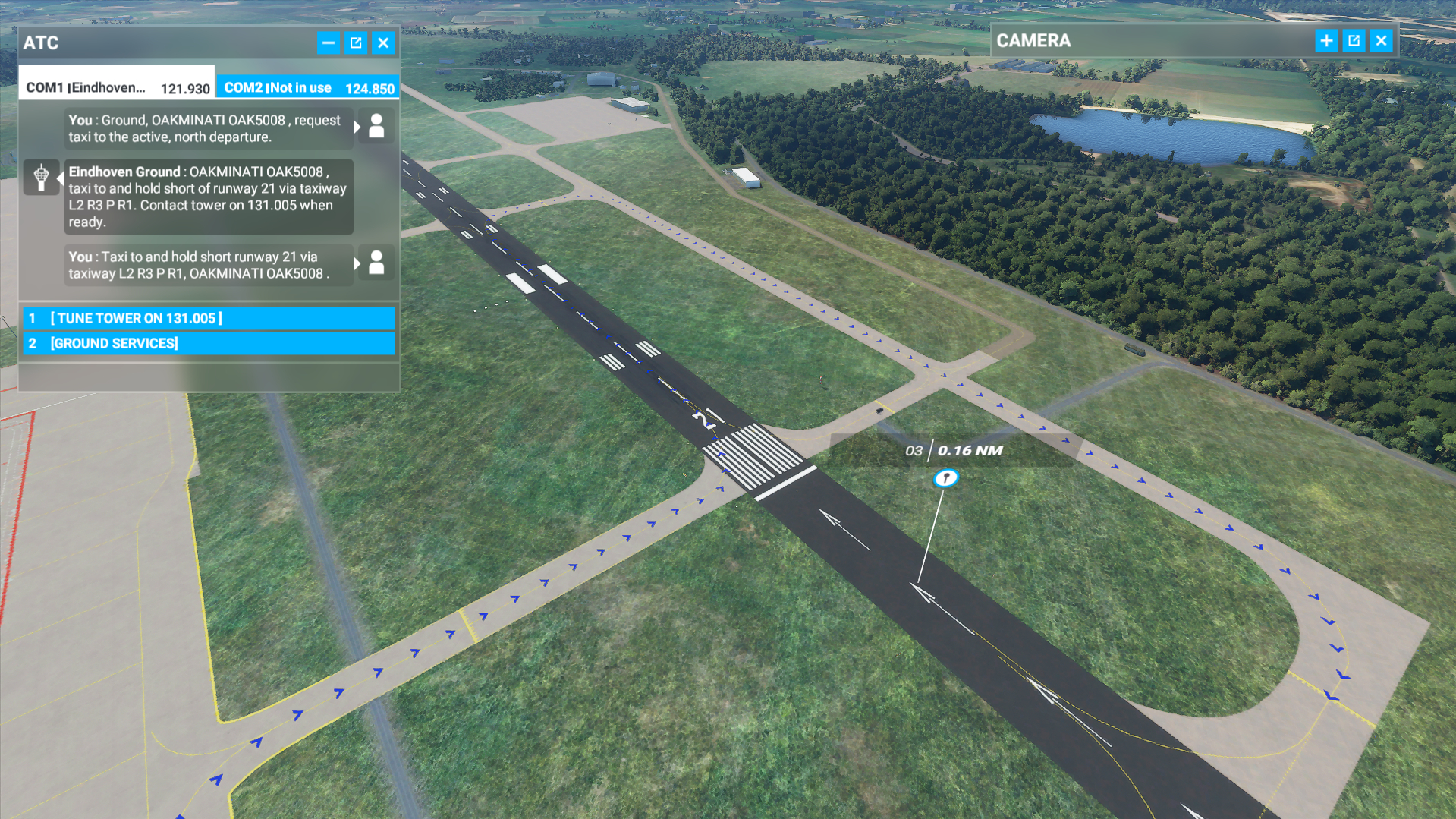
*Don’t ask me why runway 21 is shown as 03 in the POI marker, everything is set correctly…
Edit; It does seem to mention “cross runway” when navigating back to the gates after landing low, ATC is being picky now, wasted so much time trying to figure this out.
5 Likes
amazing work! and yeah, live traffic is working. was coming in with my Cessna, had to hurry up because there was a TRA737 almost biting my tail
Could you show a screenshot of what you mean that it steers to the hanger? GS is not implemented but LOC should be navigatable via NAV and bring you correctly in line with the runway.
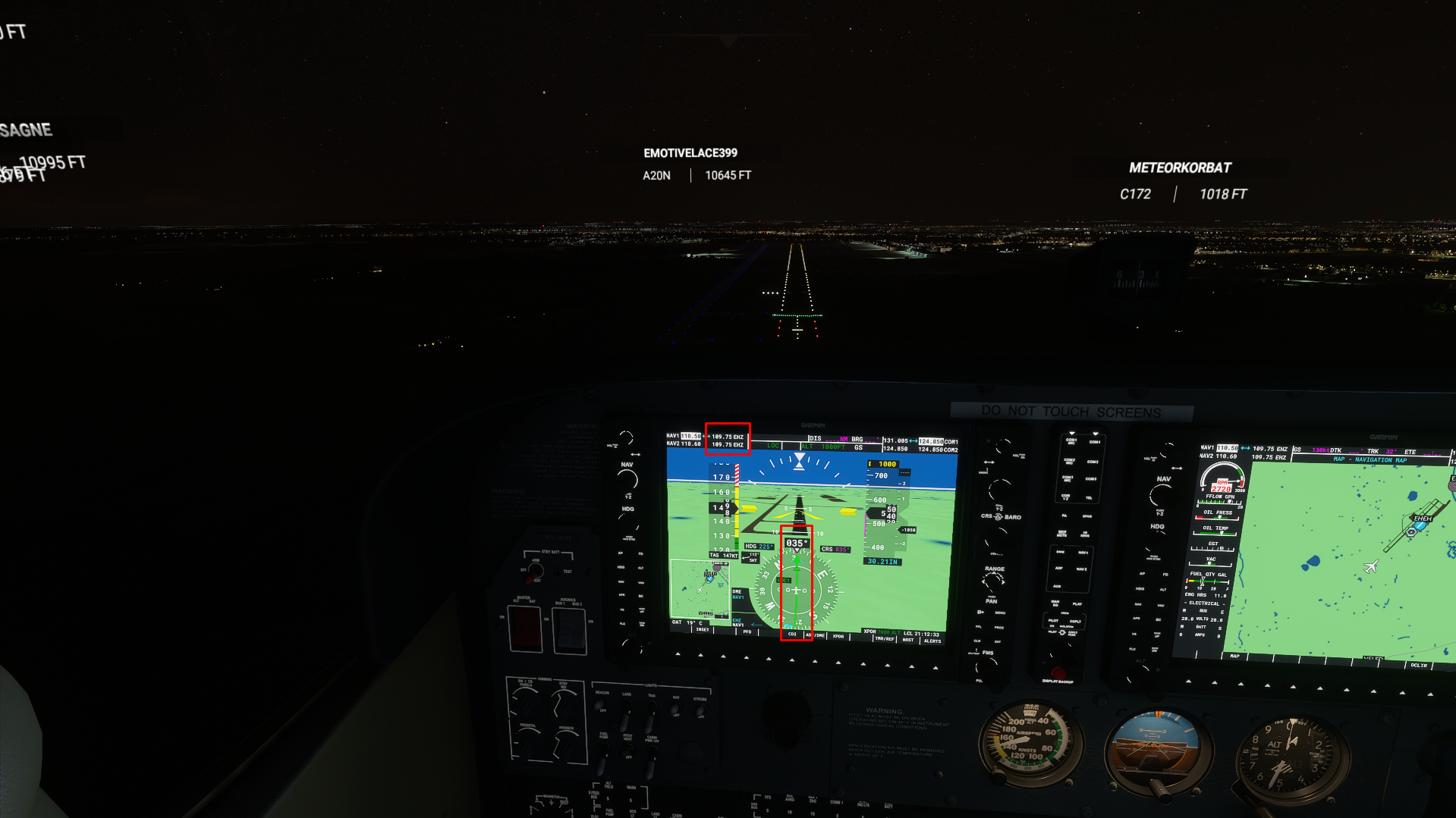
Approaching 03 in the screenshot, when approaching from the north, localizer ID will show EHO correctly.
@Ocgineer got feedback on glideslope. Try in this format! This is example, correct for both ILS EHZ and EHO
 <Ils lat="52.41818882524967" lon="0.5820612609386444" alt="8.229M" heading="56.711998" frequency="109.900" end="PRIMARY" magvar="1.1" ident="ILAK" width="3.94" name="ILS RW06 " backCourse="True">
<GlideSlope lat="52.40490552037954" lon="0.5470526218414307" alt="8.229M" pitch="3" />

Thanks!
I will have a look and make a test version quickly later tonight/tomorrow. Looking at the coordinates of the glide scope in the example with Google Maps it seems it is an antenna just to the side of the runway. For EHEH this would be then “51.442842 5.368486” for 03 and “51.456172 5.383775” for 21, seeing antenna’s there.
The antenna at 51.448177 5.374945 is Eindhoven TACAN (EHV)
Edit, Yup those are the antenna’s for the Glide Scope.