GS antennas are usually located in line with the PAPI, as both are aiming you to the touchdown zone not the Treshhold. So use those coordinates as starting point I suggest
Edit: you got them on the chart. Even better!
GS antennas are usually located in line with the PAPI, as both are aiming you to the touchdown zone not the Treshhold. So use those coordinates as starting point I suggest
Edit: you got them on the chart. Even better!
Noticed, you are correct, looking at the plan of EHEH those locations are roughly in line with the PAPI. I’m planning to use the coordinates listed in this document so both ILS LOC and GL locations are positioned and having a heading as documented, not relying on Google Maps “what is here” ^^;
Shouldn’t be to much difference between the chart location and Google maps location I recon. Although I noticed when I was trying to make EHEH for myself that some distances were different. But should be a good starting point yeah! Can’t wait to try some circuits here :slight_smil😄
I might even try to start on procedures for you 
Goodday,
Does VOR work? I tried to get it work, but I get no connection.
Yours,
Marius.
Unless you got a military jet you won’t get information. It’s listed as VOR/DME in the sim, but it’s a TACAN in real life. So the commercial and GA can’t get a bearing from it. It’s used as a GPS fix
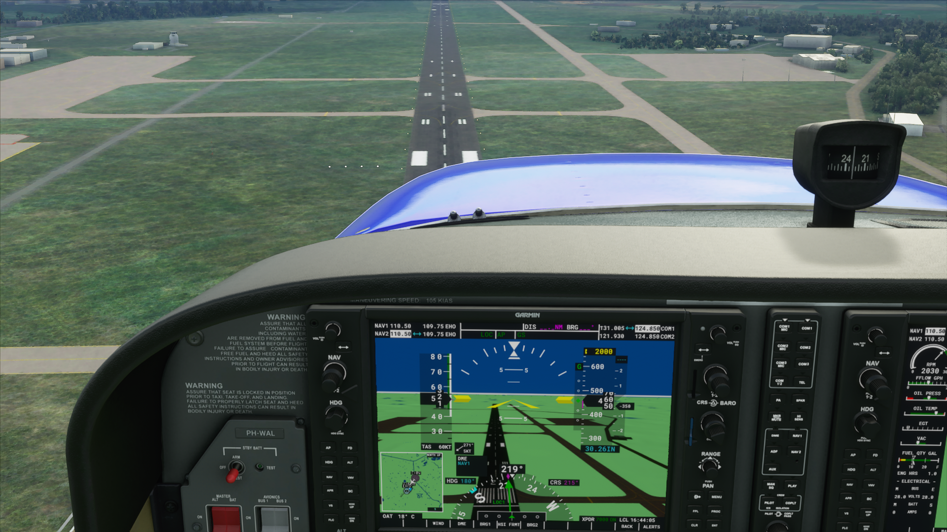
Whoohoo, it just auto navigated to the runway and aligned itself and GS indicator showed up.
Let see when I hit approach!
Edit, well I got the Stay on Target achievement finally lol.
Awesome! Glad it worked!
Version 0.7.1;
And of course, gotta thank @AwesomeBlack533 for the glide slope info!
Version 0.7.2;
Just leaving this here as well, sharing is caring;
<Airport>
    <Ils lat="51.462503" lon="5.388386" alt="73.3F" heading="34.99" frequency="109.750" magvar="0.0" ident="EHZ" width="5.0" name="LOC 03">
        <GlideSlope lat="51.442828" lon="5.368433" alt="8.229M" pitch="3"/>
    </Ils>
    <Ils lat="51.437525" lon="5.360386" alt="66.6F" heading="215.01" frequency="109.750" magvar="0.0" ident="EHO" width="5.0" name="LOC 21">
        <GlideSlope lat="51.456194" lon="5.383767" alt="8.229M" pitch="3"/>
    </Ils>
</Airport>
The geolocations and runway bearings are from;
https://www.lvnl.nl/eaip/2020-08-27-AIRAC/html/eAIP/EH-AD-2.EHEH-en-GB.html#eheh-ad-2.24
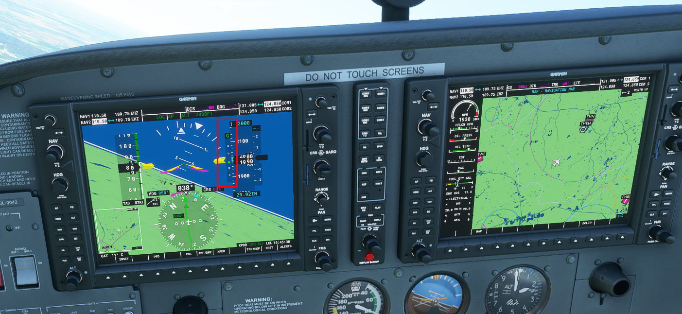
One thing I noticed is that 21 is getting the wrong GS signal. As you can see in picture, I’m on track and GS, but touch down point is the marker at 03
Going to test for 03 if it’s the same now
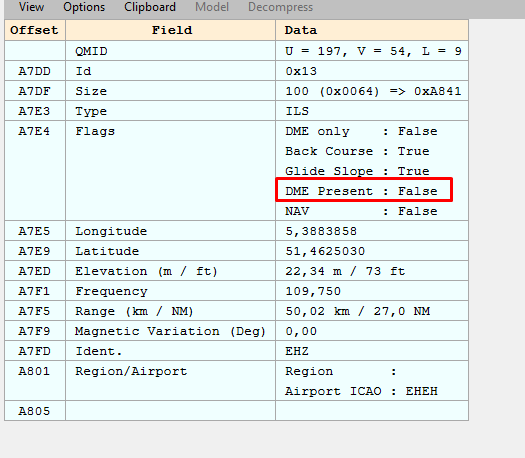
Hmm, could be the height of 8.229 meter set in the Glide Slope definition. Also, can you check if you get a DME reading for the runway (or is this not available for ILS/GS)? As when inspecting the BLG i saw that the ILS did had “Has DME” marked as false.
Other than that, if the height doesn’t matter, I think its time to add the approach waypoints?
PS, when I tried it out, it was like my first ever ILS landing so I didn’t know what to expect 
First of all, great work you’ve been doing here!
Looks like everytime you’re 2 steps ahead of me 
In your code you mentioned:
<Ils lat="51.462503" lon="5.388386" alt="73.3F" heading="34.99" frequency="109.750" magvar="0.0" ident="EHZ" width="5.0" name="ILS RWY 21">
Now by all means, I have no experience with airplanes or flightsims.
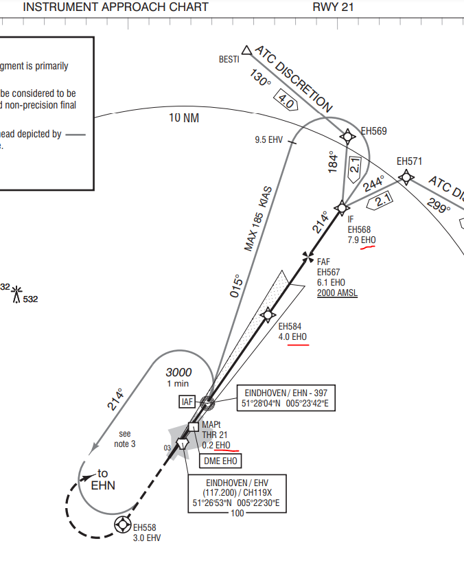
But I was looking at the EHEH charts and it shows for Runway 21 it uses EHO
Though your identifier in the code mentions EHZ.
Shouldn’t this be the other way around and thus show EHO? (and EHZ for 03?)
Same thing at 03. It’s aiming ai the wrong point. And both have no DME, what should be happening with ILS
@MJetten it shows up correct in the sim, look at my pics
Right, the name="ILS RWY 21" & name="ILS RWY 03" seem to be swapped around which is an error on my part, but it seems that the game does not use this and only uses the identifier luckely. Will correct this in the next version but as far we saw it does not impact the LOC and GS.
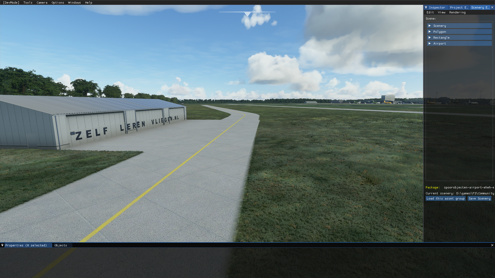
Hah, the Aero Club hangar xD
But now that I look at it again, the heading would be incorrect then as well, as I assume I have to give it a heading that is opposite of the approach heading, but tuning NAV seems to give the right ID 
Yeah strange  wouldn’t change it if it works. Another thing I noticed is both headings are off by 1 degree in reference with charts (035/034 and 215/214)
Actually, scratch that, I shouldn’t try to do this in the middle of the night, seems I even swapped the two glideslope locations, wth have I been thinking…
This might be the reason the plane is still so high when following the GS as the touchdown point is at the wrong end of the runway then. Will make an update asap to test. Thanks for actually catching this @MJetten lol.
EHEH has a variation of 1°E a year I believe.
I got the info from https://www.lvnl.nl/eaip/2020-08-27-AIRAC/html/eAIP/EH-AD-2.EHEH-en-GB.html which shows 2020-08-27 in the weblink and all further linked PDF’s seem from 2020 as well.
I saw another custom airfield with the magnetic variation field set;
That explains. Last jepessen for EHEH chart was Nov 29 2019. So scrap that haha
Ok, you got me interested, loading FS now with your ILS code and swapped the Glideslope codes.
Seeing if this works on my version