Here is my take on Eindhoven Airport - EHEH - in Eindhoven, Netherlands. Will be updating when I have some more time and figure out more stuff so you can subscribe to this thread.
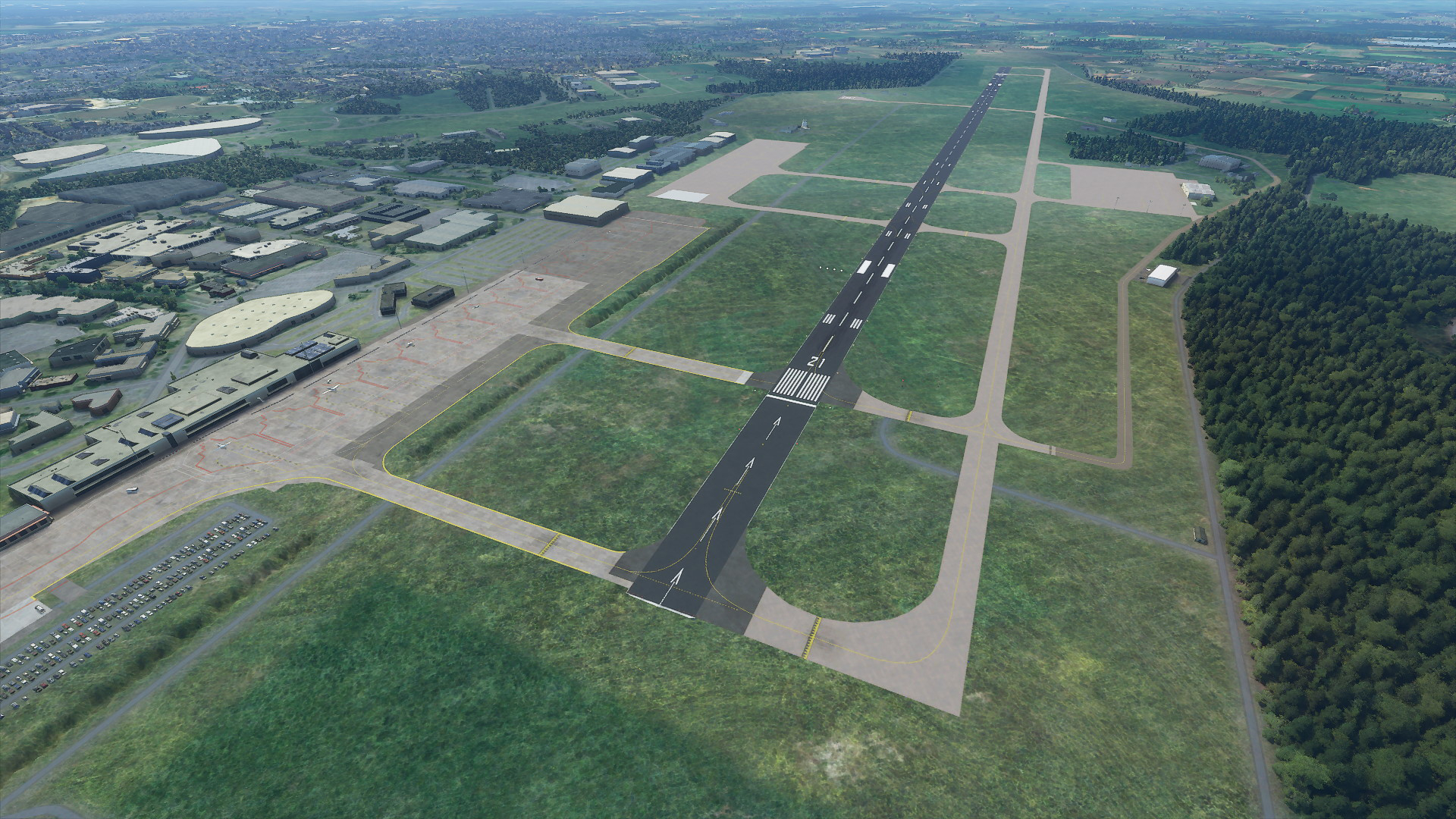
Accurately placed runway with a very slight slope.
– The threshold of runway 03 is 74 feet high.
– The threshold of runway 21 is 67 feet high.
Accurately placed approach lights (CALVERT) and PAPI (3°) indicators.
Accurately placed ILS localizers for both runways and GS/DME positions.
– ILS GS antenna height is calculated based on position and the runway slope.
– Both runways use 109.750 MHz localizer frequency (21 Ident: EHO, 03 Ident: EHZ).
– Enabled DME for the ILS approach.
– Enabled ILS back course for missed approach handling.
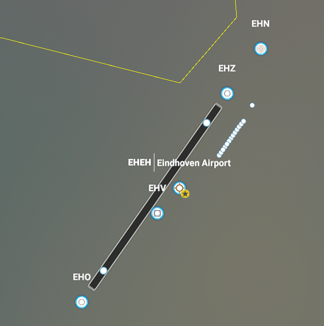
This airport adds 43 new waypoints to the game.
– 38 EH waypoints in the range of EH550 - EH599.
– 5 named waypoints; BESTI, GEMTI, MITSA, RUSAL, and TILVU.
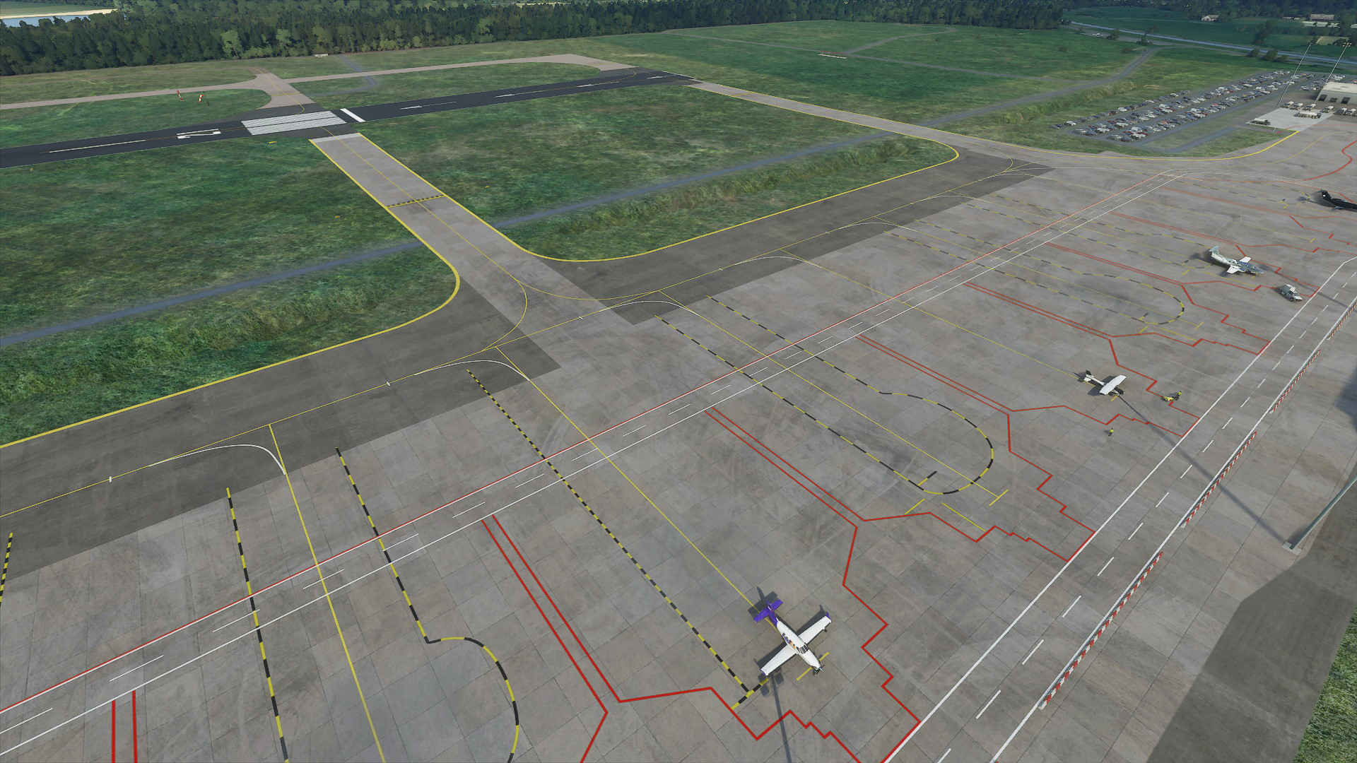
The civil apron is the updated version with 14+2 ramp parking spots.
– 14 large ramp parking spots, S1 up to and including S14.
– 3 small ramp parking spots, G1 and G2 at the end of the apron.
– Fuel truck request from ground control is available.
– Some visuals and lines are added based on aerial photos.
The “Eindhovense Aero Club Motorvliegen” apron is added.
– 3 small ramp parking spots at their own hangar; N1, N2, and N3.
The two military aprons are added.
– Taxiways are available, but no parking spots yet.
Taxiways with Taxi signboards around for guidance.
Added vegetation patches around and in the perimeter to hide the default “censor” smudge.
Eindhoven Airport is a Starred Airport, as it is a major airstrip for the southern Netherlands.
Navigraph compatible, this will remove the added runway and ILS from Navigraph if used.
Issues / TODO:
No SID or STAR’s are implemented yet.
Custom buildings for EHEH.
Update/Clean aerial imagery for nicer looking terrain.
Coming from The Netherlands myself I can say it already looks great but is there anyway you can enable snow on the runway and taxiways ? When its snowing they stay completely free of snow as if they have magic build in heating lol
Interesting will take a look if I can find something regarding this, I just added a runway with the in-game tools and documentation is still very sparse. I’ll fly around some airports with snow as up till now I’ve always used live weather or just clear skies when using the editor.
OK so I have seen the Apron and left taxiways were covered with snow, where the runway and right taxiways were not. I believe this is due to the added coloration to make them darker (according to the satellite images), though the apron and left taxiways also have this but much lighter.
I checked Schiphol (premium) and it had the same issue on the runways and a few other concrete places, I believe this is then a bug in the game engine and will file a ticket when I did some more testing.
Found a little bug, floating light above the control tower even during the day. maybe lower it or attach a pole to it or something so it doesnt appear to be floating in the sky. Other then that great update again, cant wait to see the finished product
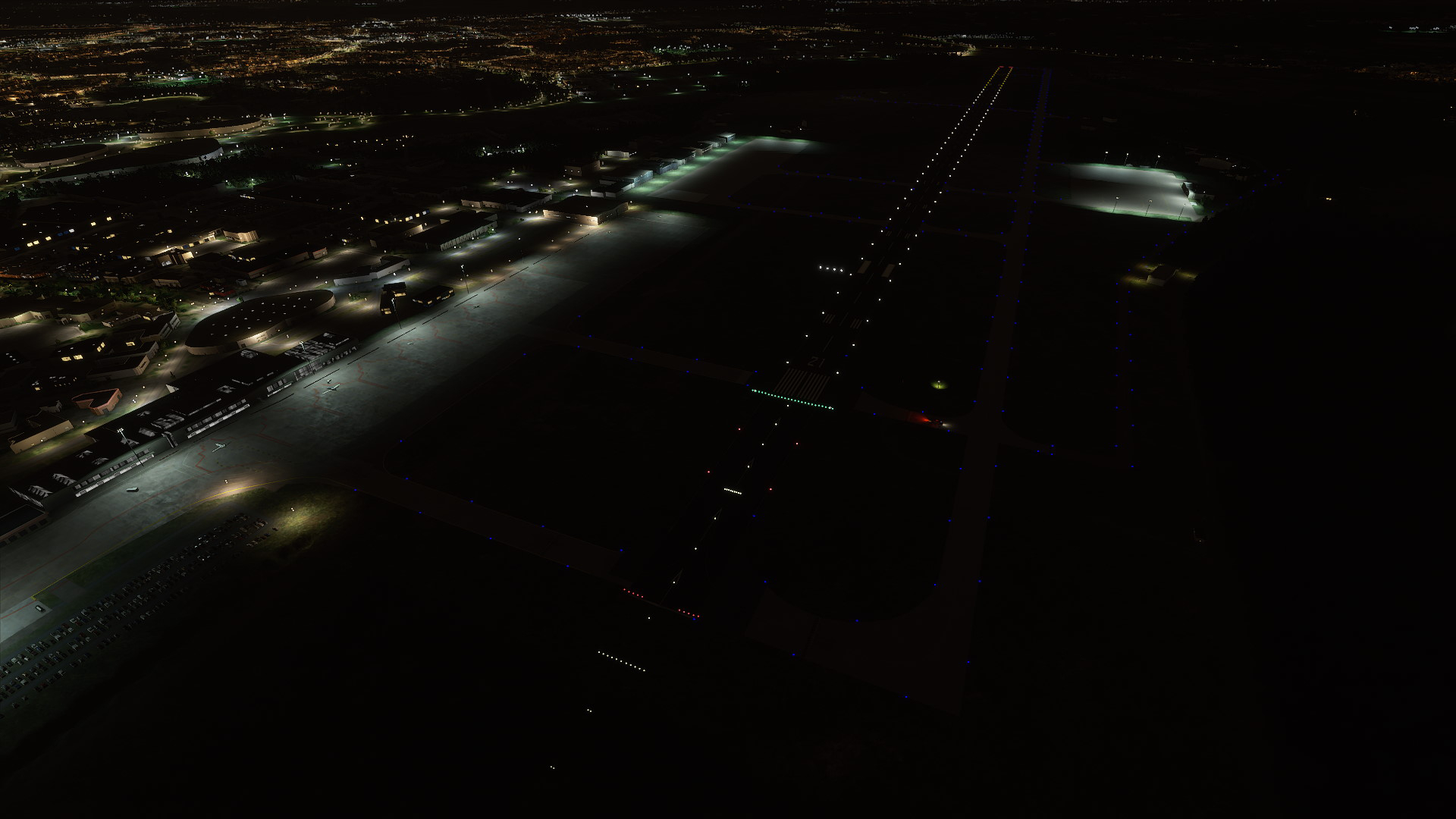
Manually added (roughly) the taxi lights around the taxiways.
Added bright lights around the apron, locations are based on the satellite coordinates.
*I just need someone that can create a model of the terminal and figure myself out how to create and added some ground textures for the civil apron. Other than that I only need to create some taxiways around the military hangars between the trees in top-right (from picture).
@patrickb1973 I have disabled the beacon (floating light) as I was unable to adjust the position of it and as you said it was way higher than the actual tower so was kinda pointless at this moment.
Well at least he has models which I am lacking, currently, I am in the process of manually drawing the taxiways and have them exactly like the satellite images (and what he did apparently as well) and I am working on importing the Google Maps images as ground textures to get some more accurate positioning and uncensored area’s so I could finalise the civil apron lines as well. Not sure if I want to do that now and just leave this as-is for now and wait for that mod or somehow collaborate, not really using Reddit so that went completely past me.
Aight, I will fiddle around with importing Google Maps air images to use as ground texture to uncensor and see how that works out, hopefully that fixes the deformed open-air parking areas. Just that I rather collaborate than doing stuff that someone might be do better job at, I am furthermore completely new to all this in-game modding and modelling and the lack of documentation doesn’t help either
Of course I don’t remove this thread so people at least are able to use EHEH in-game as for now. Just a question for you did you manually drew the taxiways with a apron in segments or …?
Great job! I tried it myself when the SDK was just released and did a pretty good job (if I say so myself), but your version is definitely more accurate. Hope you’ll find someone to do the terminal.
Calculated the midpoint of the runway: 51.450129 5.374512 for exact documented positioning
Added ILS LOC frequencies and locations as documented.
– ILS LOC 03: FREQ: 109.750, ID: EHZ
– ILS LOC 21: FREQ: 109.750, ID: EHO
– Have not tried to land with ILS yet, never been able to complete an IFR route in MSFS yet.
Set Tower, Approach, and Ground frequencies so there is some communication with ATC.
– trying to figure out taxi routing and routing to parking, making progress with that.
TACAN ID: EHV Is already present in-game on the correct location, will not adjust/override this.
Version 0.6 Aerial;
I have also a test version of 0.6 with Google Aerial images to unblur the area. Keep in mind that this is a quick test/preview as I have not done anything to the image sources such as clean up. What also might be noticeable is that the runway is slightly off than what is documented/calculated so I am not sure if I want to shift the runway to match the aerial images. Will work on this version as well to clean up and make sure to cover all the censored parts and that it connects nicely with the original bing imagery, like fields not cut in half due to different seasons the imagery was taken.
Before I focus on either updating the visuals around the taxiways/runways -like the aerial imagery shows like by making use of multiple layers- or by cleaning up the Google aerial images, I will focus on taxiway navigation/routing and parking first. Would like someone to test the ILS LOC approach, there might not be a glide scope available.
Well I have stated my intentions that I wanted to work together, we will see, in the meantime I’ll focus on getting navigation, frequencies, routing, and taxiways correct so the other can focus on modeling which is also good.