De Kooy Airfield Or Vliegveld De Kooy EHKD is an airfield 2.9 NM south of Den Helder, Netherlands named after the nearby hamlet. It serves as both a civilian airport under the name Den Helder Airport and a naval airport under the name Maritiem Vliegkamp De Kooy
Most movements on the De Kooy are made by helicopters, bringing workers to and from offshore oilrigs and naval helicopters such as the NH90. But fixed-wing aircraft visit and operate from the airport as well.
The project is the first attempt to work with the SDK and will improve over time.
Its all made out of stock objects and hopefully will be ready for a first version in a couple of days.
!
19 Likes
Great stuff! I miss EHKD being there.
1 Like
Progress.
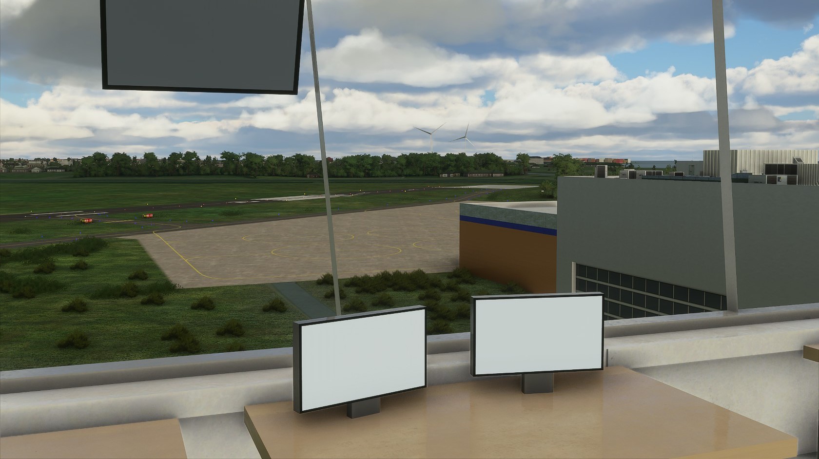
All taxiways have manually blue edge lights.
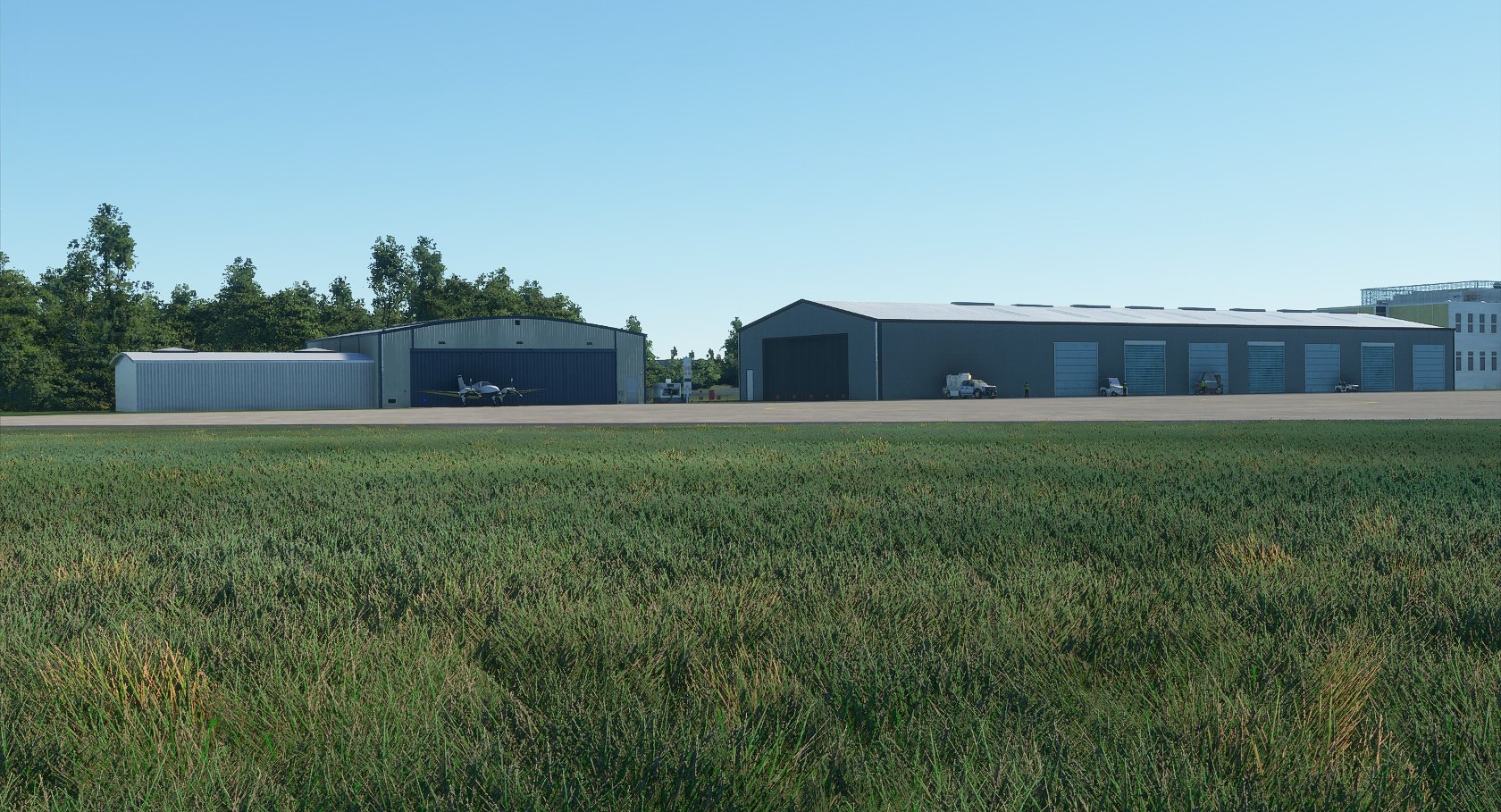
Military apron is almost finished.
Grass details added.
Runway details and complete lighting placed.
7 Likes
Great stuff! Eagerly following and if I can help by testing or whatever then
Let me know!
1 Like
I downloaded Eindhoven Airport i am happy that more airports for the Netherlands are coming…
I want to download your port when you are ready!

1 Like
That grass looks nice! Nice seeing more smaller Dutch airports being made as well!
Let me know if you need some info that I might have already. Currently, on EHEH I have the ILS LOC and GlideSlope (with DME) implemented and working on approach and depart routes now. Not sure if EHKD has any ILS approach systems though!
2 Likes
Nice to see a Dutch airport/strip is in the work, when i flew over airbase Deelen, there is nothing there, just a photoshopped green mess. Hope someone will try to recreate that one as well, i for the life of me, can’t figure out how the SDK works.
2 Likes
Keep up the good work! Eagerly following your project.
1 Like
Looking forward, very nice!
1 Like
How is this coming along?
Good almost everything is finished but the public apron. Because of no available ingame overlay and the special shape of the public apron its a lot of trial and error with google earth on the other screen to create the apron. To be continued.. !
1 Like
What I do for the Apron (and taxiways) is place a few points roughly the shape I want and then check those points on Google Maps with “whats here” to get the geo-coordinates. Then I edit the XML scenery file directly for those points, which might be a slow process, but creates a better copy of what you see on Google Maps. You can then just save the XML file in any text editor (e.g. Microsoft Code) and then press “load asset” button to instantly see the changes made, without restarting or reloading!
I think it is also possible to use Google Maps Aerial Images (CLG asset group) to replace the Bing Maps Aerial images and then use that to trace over, but I am not sure about if it shows up when you are working on the project [https://forums.flightsimulator.com/t/guide-how-to-create-custom-aerial-photo-scenery/231783].
2 Likes
Thanks to the tip i managed to get the aprons on the right location. Ground markings being placed.
Nice! And dang those circles seem perfect round, I have such a hard time forming painted lines.
Also, would you be willing to share how you added the grass, for some reason I haven’t been able to successfully do this 
1 Like
I will pm you because i have no idea what you mean haha.
Progress on the public apron. Work is coming along nicely!  Hope some of you recognize the place.
3 Likes
Yep drive past it quite often!
Good progress! Groudlayout mostly finished.
Most of the nightlights have been placed.
Starting with the airport scenery around the public apron.
3 Likes
Awesome! Finally a decent rendition of my third favourite airport in NL!
Nice work!
How is the project going? Looking forward to fly from Ameland to De Kooy 
1 Like