Maybe I am saying it wrong or need to reinstall the game, but the map scroll function do not wrong nor does the navigation though the legs in the flights plan.
Haven’t worked since I started playing again a few months ago. Use to work with the default g1000 and da62.
But the da62x flights model is too good to return to default. And g1000 nix is the new g1000 default, so can online hope for a fix.
When I say I cannot scroll though the FP, I mean I can see the vnav data when the list is longer than one screen.
Have you tried the steps I outlined above? Those two functions are very much working.
If when you hover the mouse cursor over a knob and the knob turns blue, it means you are in the sim’s Lock interaction mode and you need to do this:
If when you hover the mouse cursor over a knob and the knob does not turn blue, it means you are in the sim’s Legacy interaction mode and you need to do this:
- Press the left mouse button to push the knob in.
When you are looking at a flight plan, you will know instantly if you have pushed the FMS knob in because one of the waypoints in the flight plan will be selected, appearing as black letters on a magenta background. If you are trying to see waypoints in a flight plan that is after the lowest waypoint visible in the MFD, then, with one of the waypoints selected as described above, turn the larger FMS knob clockwise to move the selection down the screen until those hidden waypoints start to scroll up into view.
I fly the DA62X and do this scrolling any time I have both a departure and an approach set up or o long list of waypoints I have added to the flight plan.
Yes, the selection was the issue. I figured it out now, I have to right click the mouse to push, then it works.
The same with map scroll, right click and a mouse appear on screen, then the map scrolls.
I was not aware, big help and bit embarrassing, but thx really makes a difference 
Just for future reference it’s referred to as map panning not map scrolling.
Check, obviously English is not my native language 
Most of us understood anyway 
Yeah it definitely does weird things. I tried the same waypoint and hold again last night and it worked properly, it stayed in the hold until I pressed SUSP 
Wild, right? Something you never want to hear a pilot say: “alright, what’s this thing doing now?” Same goes for the sim! 
Glad it finally did the thing for you!
Noted in the engineering maintenance log and flagged for subsequent crews, and hopefully not the air crash scene investigators at some point 
Apologies if this has been covered already: I find that the traffic in the G1000 Nxi does not match what I am seeing everywhere else (looking out the window, in LittleNavMap, etc). I fly using Vatsim and have vatsim inject the live traffic (which is what I see out the window - but the G1000 seems to be on its own mission).
I don’t use Vatsim but I do use AIG Traffic Controller to inject traffic and the same thing happens. I see other aircraft at around my altitude and hear ATC talking to them but they do not appear on the MFD. I have the setting to Unrestricted. I do see traffic on the MFD at departure quite often but not usually after that.
For example I can be on approach and clearly see an aircraft ahead of me on finals and hear it getting landing clearance and I get instructions to follow the aircraft on finals etc. but nothing on the MFD. Same thing when I get traffic advisories from ATC on route, I see the traffic but nothing on the MFD.
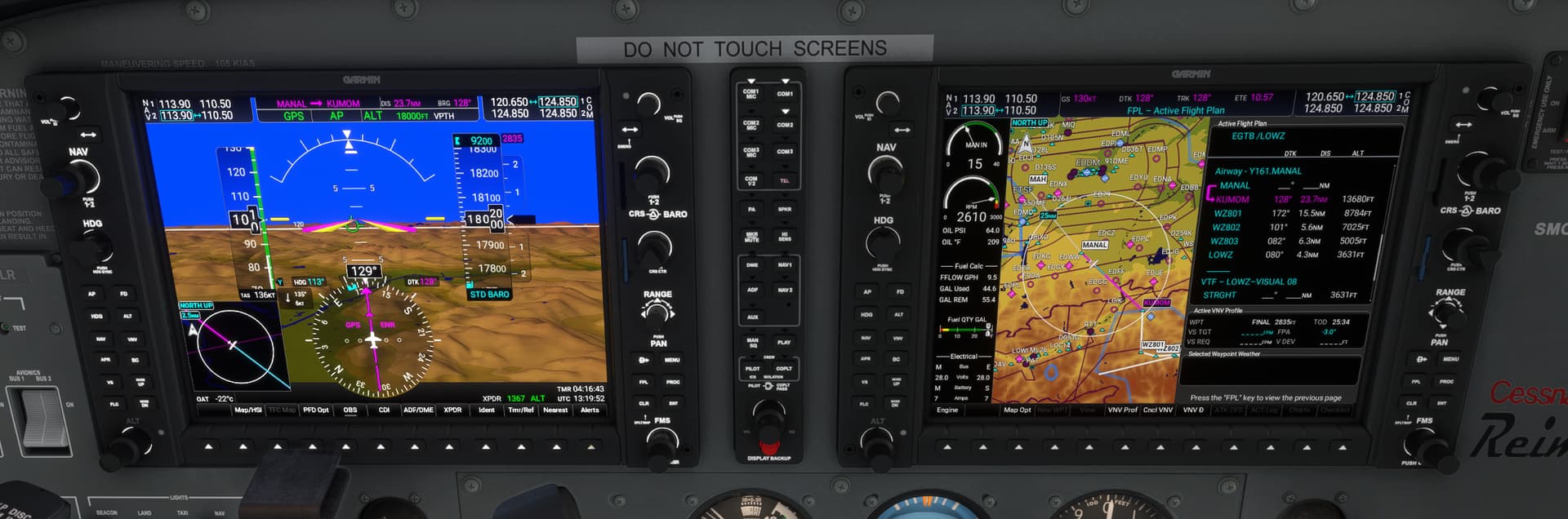
Why is VNV not engaging at the correct time (or at all) on this setup?
I have a flightplan set up which is working fine for the whole flight, right up to the VNV descent. The TOD should be just after MANAL to get the required 3deg descent.
The MFD shows the calculated altitudes at the remaining waypoints on the route, and they look fine.
But they don’t engage at the correct time. Indeed the TOD is shown as being 25 minutes away. By that time I will be over the airport at 18,000ft!!
To make it engage at the correct time and maintain the correct descent to the start of approach I had to manually edit each height constraint by changing them slightly and saving them (so they go cyan with a pencil). As soon as I do that, the VNV comes to life and starts the descent.
But why do I have to do that. What is the value of calculated contraints if they are not usable?
And why is the unit showing the TOD as being 25 mins in the future, when in fact it is already overdue?
This is not a lone case. I have seen this many times. Am I doing something wrong, or is the system bugged?
This is what I do and it always works:
- As soon as I have reached cruise altitude,! set the altitude bug below the lowest waypoint altitude in the MFD, in this case, 3600.
- Once I am on the heading to MANAL, I activate the approach or do a DIrect To MANAL.
- I immediately thereafter press both the VNV and APR buttons to get both the pending white VPTH and the white GP (or GS with ILS) indicators at the top of the PFD.
After doing that, I do not have to touch the Garmin until disengaging autopilot just before landing.
You have selected a VTF (vectors-to-final) approach, which by definition has a discontinuity between the rest of your flight plan and the final approach fix. The altitudes shown are white, which are advisory altitudes only. VNAV does not really operate through a VTF discontinuity (though it does calculate advisory altitudes through one, just to give you an idea of what a path would look like).
If you want to hit a particular constraint prior to the start of the approach you will need to set an altitude constraint manually where desired. Or, you can go direct to a fix in the approach, and then VNAV will compute a path from that fix.
Lots of folks choose VECTORS thinking it just means “no transition” but it has a number of navigational guidance caveats and actually means “I’m going to receive vectors to get to the final approach fix”, i.e. ATC is going to get you to the right course and altitude.
I dream of MSFS ATC having that VTF capability.
Thanks for the detailed explanation.
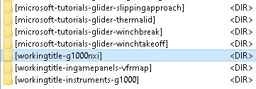
@Bishop398
Hi Matt,
pls one question to not have some chaos, can you be kind say if my directory about your products are ok? I see there also some G1000 with also G1000NxI, is this correct? I understand that maybe this is some base package or? thnx for clarification.