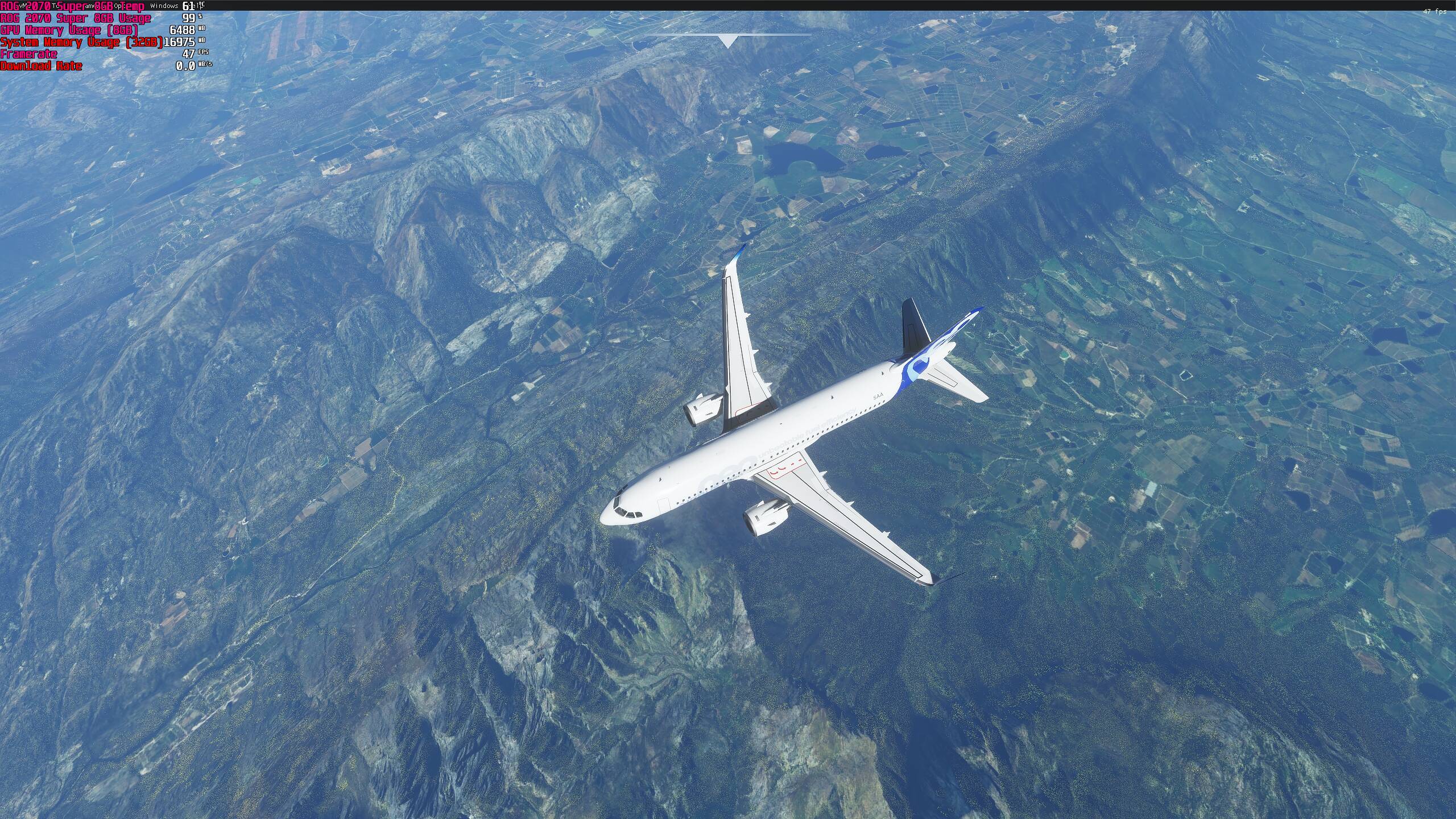
18 GB VRAM thats insane.
I wonder where lies the problem when “the other” sim can manage to load much more sharper ortho textures (ZL17-ZL19) without using so much vram
18 GB VRAM thats insane.
I wonder where lies the problem when “the other” sim can manage to load much more sharper ortho textures (ZL17-ZL19) without using so much vram
Less detailed I guess om the other game, plus that it 4k and way above the max lod for the game in UI?
I had the full UK textures from orbx in the 11.5 game and it didn’t look anywhere near as detailed in 3d
Just tried dropping to 200 LOD on both, Res at 100 and then only 9500-11500 vram  but can’t see as far ahead detail, hopefully this will improve over time
After every restart of the sim, address responsible for Terrain LOD setting changes.
Only thing i found in common is that current address always ends with 0160
XP Orthos unfortunately look far better than this (at higher altitudes that is…at low altitudes, FS2020 becomes much better). I wish Asobo would at least address this so we could know why it occurs, as none of the settings seem to affect the poor quality of these textures at high altitudes. Perhaps it’s some limitation of the scenery streaming
If you manually set Terrain LOD parameter higher than 2.0 (ingame 200). I think max is 10 (then you will see ground textures the same resolution from FL200+ like if you were flying at 2000 ft AG
Be warned though - your GPU and RAM will scream
there is a mod around that vastly improves the tree draw distance called “fsblog-trees-draw-distance-fix”
makes a big difference, then if you increase the LOD in the .ini file you will see big improvements
the trees doesnt impact on fps but the LOD will take up fps, vram and sys ram though
Could you send the link for the download and an explanation on where to put it after I downloaded would be appreciated.
Here you go:
https://www.flightsimulator.blog/2021/01/05/increase-trees-draw-distance/
Drop the extracted files into your MSFS “Community” folder
I must say that resolution (ZL) got worse again.
The old known trick increasing Terrain LOD (manully up to 10 max) works now differently. Higher ZL textures are no longer loaded and affected by this setting 
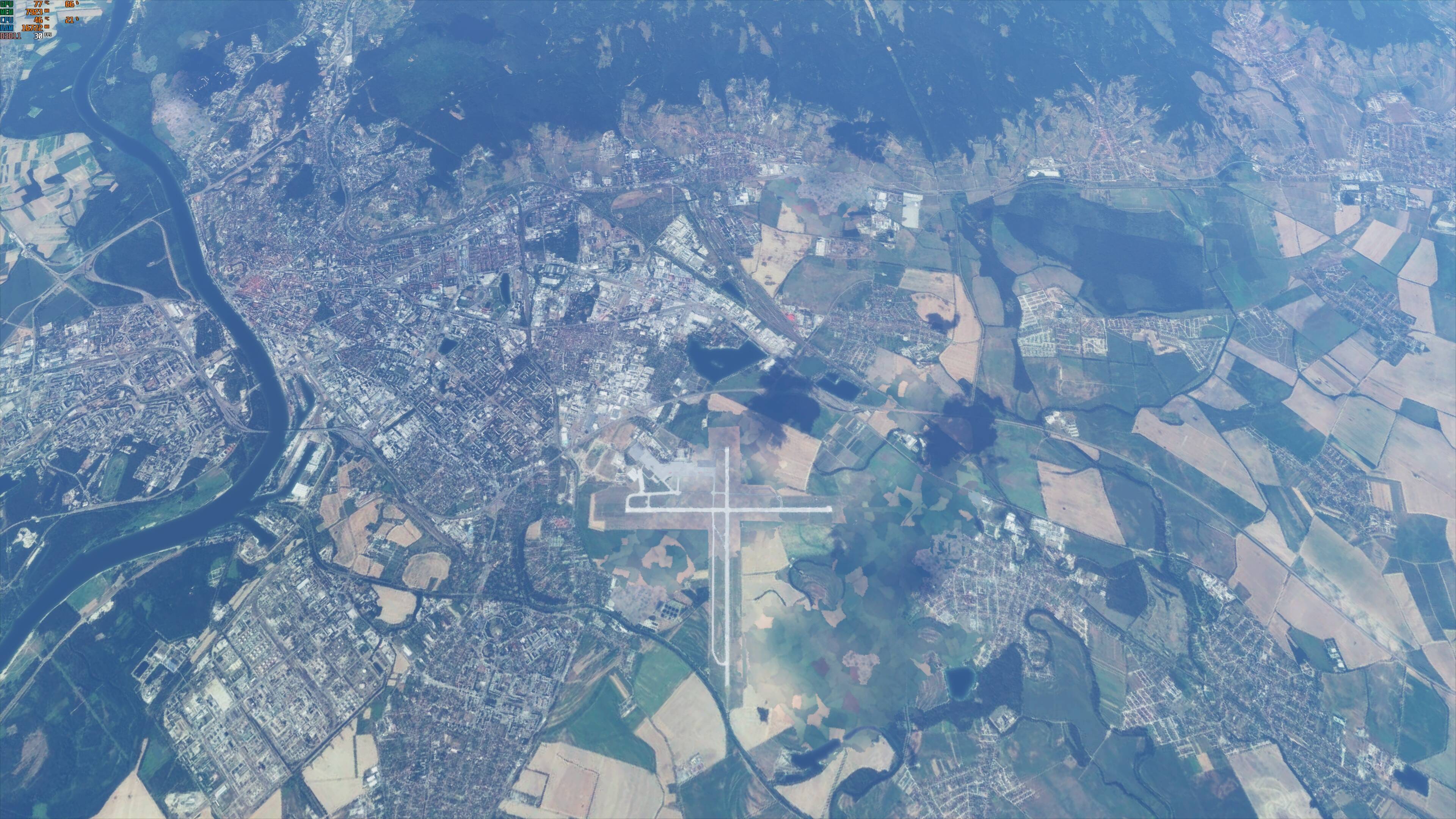
Screenshot with Terrain LOD10 - FL320
It happens above FL290
Something doesn’t seem quite right there, I have my LOD set to 3.75 for most scenarios and the difference between 200 and 375 per say is quite significant. I will do some more testing tonight and post some screens of 200 vs 375 and greater.
yes, try FL300+ . there is difference, but not in different ZL
LOD edit still works for me, at 31000Ft you can see the LOD of 375 has sharper ground textures. I’ve tried 400 and 450 and the results are the same.
200
375
Yes, but loaded textures are at HORRIBLE quality (thats ZL14 tops)
As soon as you go below 290 its a huge difference
I hope you understand what im trying to say.
EDIT: I did testing where i had comparison screenshots from September, result is 1:1 - did not change
I will try again near KATL, where i spotted this and thought theres an issue
So i found my problem, ortho is at subpar quality in the location where i flown yesterday, (Asberry, Atlanta), so no big deal. Not a sims fault
When you get up above 30,000+ feet the sim displays the base satellite imagery with no autogen buildings, not the high-resolution aerial imagery you see at lower altitudes. The satellite imagery is lower resolution, and you can’t make it any sharper than it already is by cranking up LOD or texture detail sliders.
The switch-over between high resolution aerial to low resolution satellite scenery used to happen at a much lower altitude.
Personally, I have no problem with the way they do this now. It was a problem when the switch-over in terrain resolution happened at only 8000 or 10,000 feet. From a technical standpoint, Asobo would have to make this resolution switch at some point as altitude increases. At high altitude you can see thousands more square miles of terrain than at low altitude. If they tried to cover all of that with ZL19 resolution imagery, the streaming bandwidth required, and increased memory footprint would bring even the very best system to its knees.
Even in real world flying, at high altitude, horizontal visibility and the ability to make out detail on the ground is often limited by atmospheric haze or cloud cover. Here is an actual photo I took on an airline flight from DTW to IAH. The airport is KCMI in Champaign, IL - one of the featured airports in the original Microsoft Flight Simulator from the early 1980s, and the home base of Sublogic, who developed it for MS. This photo was from 32.000 feet, and though the airport runways stand out, there was not a lot of detail to be seen in surrounding fields and terrain, either to the camera, or to the naked eye.
I agree that if you modify config files you can crank LOD to levels the stock sim won’t allow through the graphics UI, and you might get a bit more detail by doing that, but at what cost in performance?
The imagery you see at high aircraft altitudes comes from satellite photos taken at 150 miles up, while the imagery seen at lower altitudes in many (but not all) parts of the MSFS world comes from photos taken from aircraft aerial surveys at typically 8000 feet AGL, which is why that imagery has much higher base resolution and detail.
Everyone has their own way of using the sim of course, but if I want to do sightseeing, I will do it from a much lower altitude than the flight levels. When I am flying at 34,000 feet, I am typically using an airliner or biz jet, emulating an IFR flight between city pairs, and while it may be nice to observe the passing terrain (if weather allows it to be seen at all), my main focus is on navigation and procedures.
good for you, at least you are satisfied. Thanks for explanation
This issue has gone on for too long. It needs to be acknowledged and hopefully addressed. This is my number two issue right now, second only to poor VR optimization.
They probably never will at this point I’ve watched majority of the Q&A and I haven’t heard them even talked about it nor mentioned it.
though solution would be so simple !!! adjusting slider past 200
but no, now you have to edit cfg (not a good solution) or manually edit memory every time you want to adjust the setting
I mean , okay, despite my ultimate wish to see the ground clear from FL300, its painful to see ground getting blurier and blurier as you pass certain altitudes and lets be honest, even 2000ft is enough to see those runway numbers already fade away